Download Agreement, Release, and Acknowledgement of Risk:
You (the person requesting this file download) fully understand mountain climbing ("Activity") involves risks and dangers of serious bodily injury, including permanent disability, paralysis, and death ("Risks") and you fully accept and assume all such risks and all responsibility for losses, costs, and damages you incur as a result of your participation in this Activity.
You acknowledge that information in the file you have chosen to download may not be accurate and may contain errors. You agree to assume all risks when using this information and agree to release and discharge 14ers.com, 14ers Inc. and the author(s) of such information (collectively, the "Released Parties").
You hereby discharge the Released Parties from all damages, actions, claims and liabilities of any nature, specifically including, but not limited to, damages, actions, claims and liabilities arising from or related to the negligence of the Released Parties. You further agree to indemnify, hold harmless and defend 14ers.com, 14ers Inc. and each of the other Released Parties from and against any loss, damage, liability and expense, including costs and attorney fees, incurred by 14ers.com, 14ers Inc. or any of the other Released Parties as a result of you using information provided on the 14ers.com or 14ers Inc. websites.
You have read this agreement, fully understand its terms and intend it to be a complete and unconditional release of all liability to the greatest extent allowed by law and agree that if any portion of this agreement is held to be invalid the balance, notwithstanding, shall continue in full force and effect.
By clicking "OK" you agree to these terms. If you DO NOT agree, click "Cancel"...
It’s mid-June and most of the snow has melted from the high country so it was time for our first 14er of 2021. I picked La Plata Peak as our objective for the day. Why La Plata? Well, my favorite parts of the 14ers we have climbed so far were the class 2 rock scrambles at the tops of Mt. Shavano and Mt. Yale. La Plata, via the Southwest Ridge route has significantly more class 2, like a mile and a half, so it was a logical next step in our mountain climbing progression. And if a half mile rock scramble is fun, a mile and a half scramble should be downright electrifying, right? Well, no. As we discovered, a mile and a half of rock scrambling is tedious, painfully slow and exhausting. But we still needed to learn that.
We picked La Plata’s non-standard Southwest ridge route because even though the recent warm days have melted most of the snow in the Sawatch we can look out our windows in Salida and see there are still quite a few large snow patches, particularly on north-facing slopes. We figured the Southwest Ridge would be clearer than the standard Northwest route. My wife and I were joined on our adventure by one of our new Salida friends.
We started just short of the 4WD trailhead about 1.5 miles past the town of Winfield on Chaffee County Rd. 390A where, according to Mr. Roach, we were to “leave the main road and follow another 4WD road northwest (right) for 300 yards to a gate at the end of the road”. I didn’t like the look of that second 4WD road. The roughness and steepness made driving another 300 yards seem unnecessarily risky, and besides there was already a Toyota 4-Runner parked in the meadow at the intersection of the two roads when we arrived, so we decided that was close enough.
We started hiking at 7:00 a.m. when the meadow was still in the shadows but the sun was shining off the tops of the surrounding east-facing peaks.
Sure enough, about 300 yards up that second 4WD road there was a gate to the right and the South La Plata trailhead straight ahead.
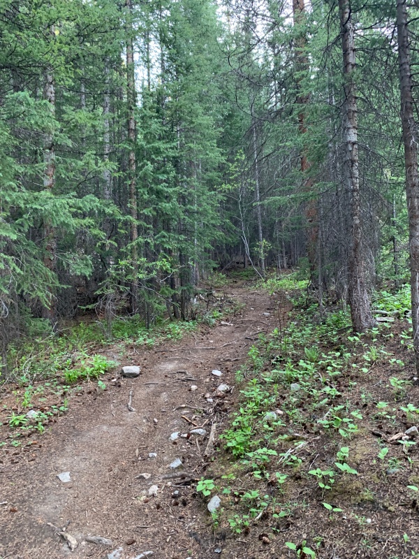
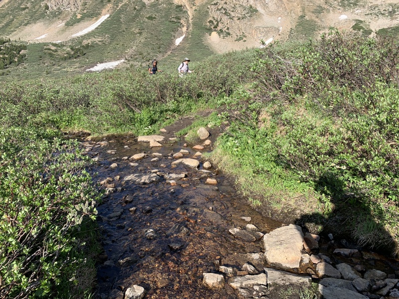
The hike starts with a well-defined, moderately steep trail through dense forest. We crossed a creek on a sturdy log and continued up and over a ridge to a second drainage, which we followed the rest of the way up.
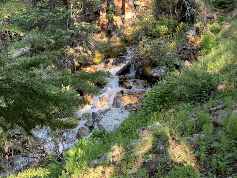
Most of the way, we were accompanied by the sound of a cascading creek, full from spring snow melt, to our left.
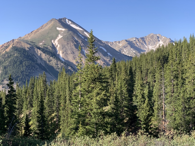
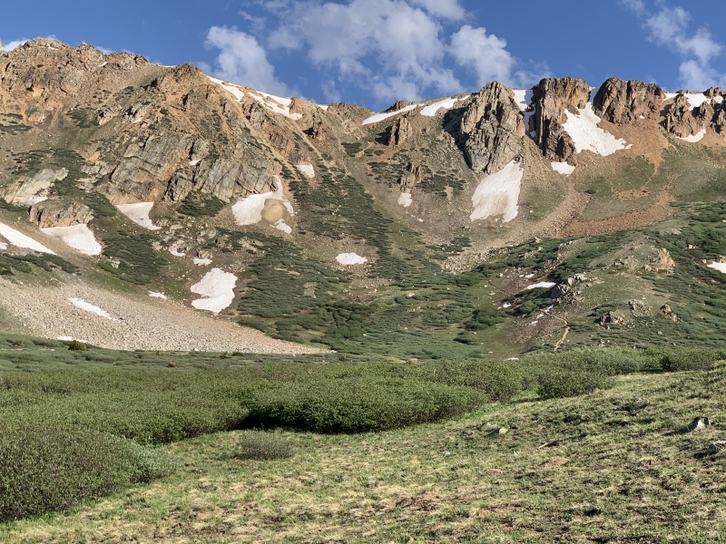
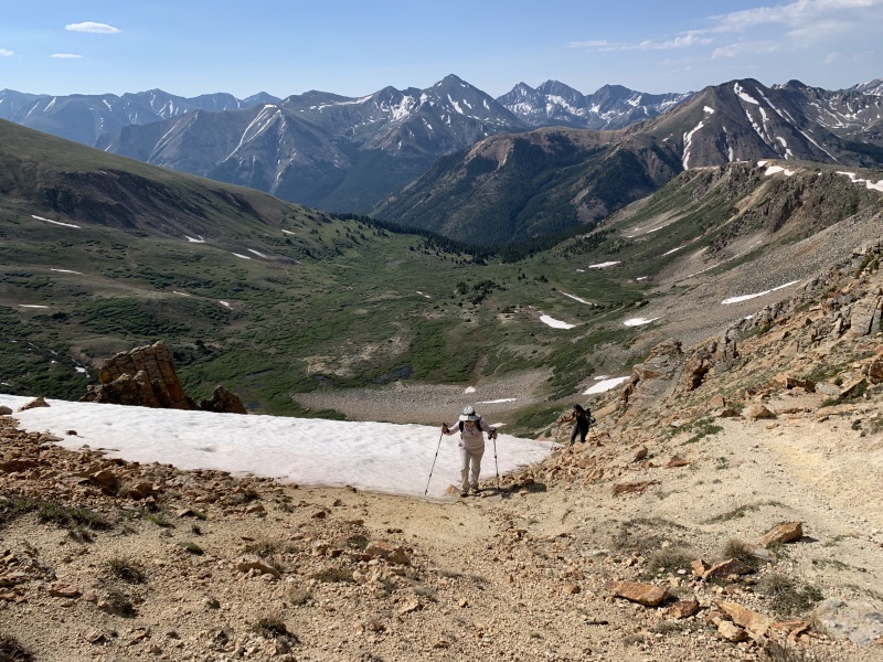
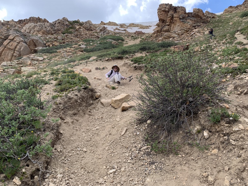
At about 11,800 feet the trail starts to break timberline and the view opens up into one of the most beautiful basins I’ve seen. From there it’s a gentle climb across the basin through meadows thick with willows and wildflowers. There are numerous creek crossings and sections of the trail are muddy but the views in every direction are stunning.
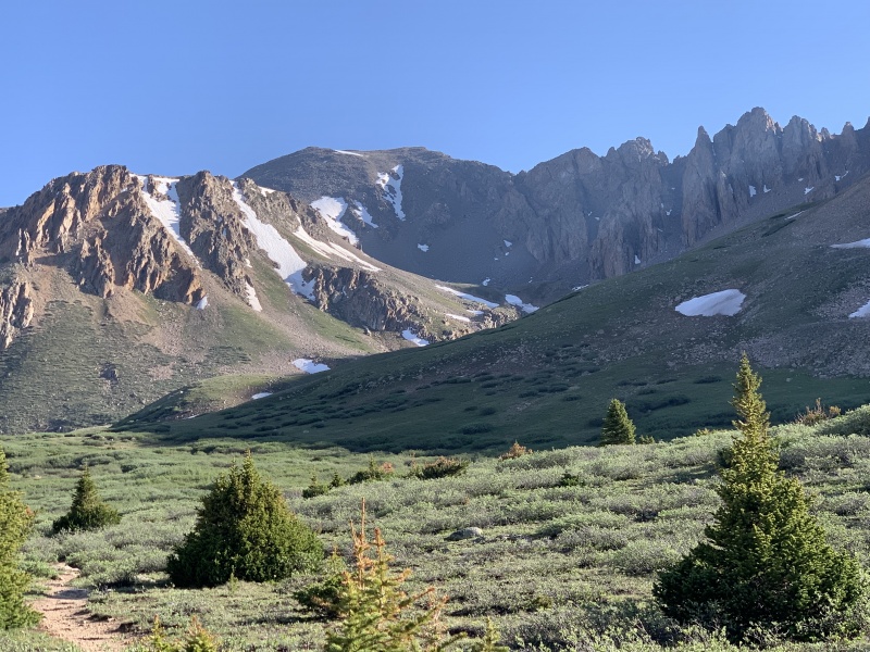
We called these the Dolomites, because, well, they look like pictures I’ve seen of those mountains in Italy.
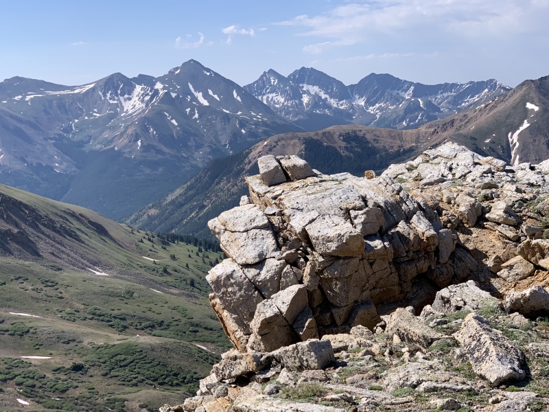
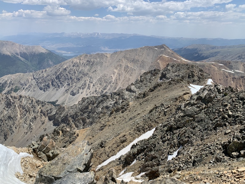
Mt. Huron and the three Apostles from the basin.
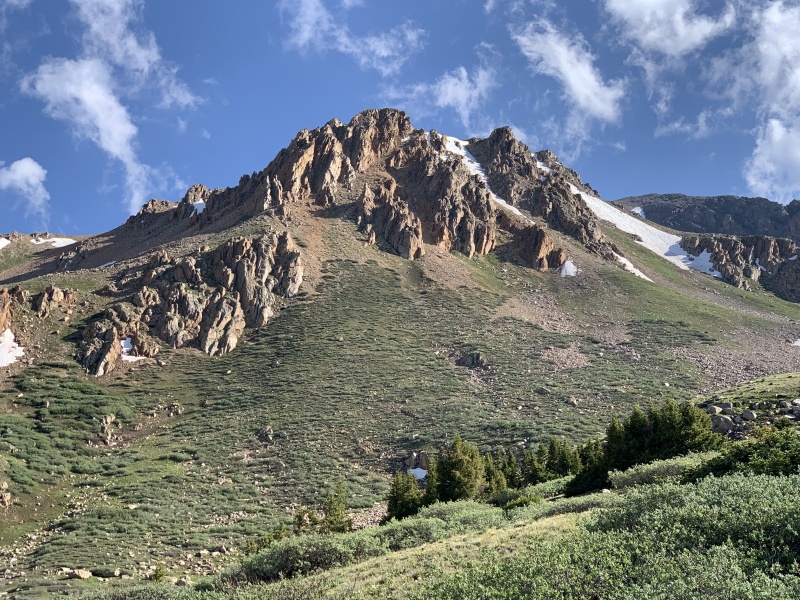
Hiking through the basin was great until we realized the only opening to the basin is the one we just came through and that all other sides are guarded by cliffs and steep headwalls. We knew this was the case, we’d seen the pictures and read the descriptions but in real life, the size of that headwall makes you sort of re-assess how badly you want to climb La Plata.
As you approach the middle of the headwall you realize it’s not just its size or the steepness that makes it the crux of the climb, it’s how loose it is. Ball-bearing gravel on hardpack. Because of the looseness and the almost unclimbable surface of the official trail, people have cut numerous shortcuts between the switchbacks resulting in even more loose rocks and a hillside that is basically destroyed by foot traffic. It’s a twisted ankle or busted knee waiting to happen. And the thing is, it doesn’t need to be that way. There’s plenty of room on that face to cut proper switchbacks. The addition of four or five sharp switchbacks with moderately steep ramps in between would go a long way to eliminate the short-cutting, loose gravel and intrinsic hazard of this section. But I digress.
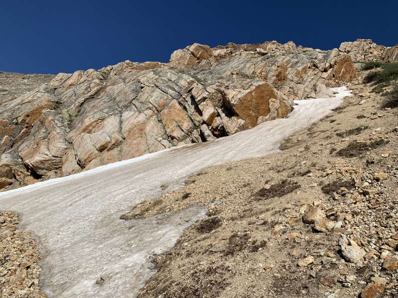
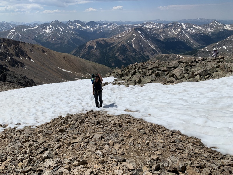
Approaching the upper snowfield.
Almost to the top.
View of Mt. Huron and the Three Apostles from the top of the headwall.
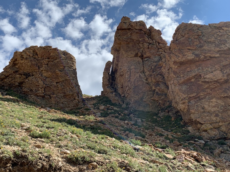
We called this the Sound of Music section and if Julie Andrews had come twirling over the ridge singing, we wouldn’t have been surprised at all. Sayers Benchmark in the background.
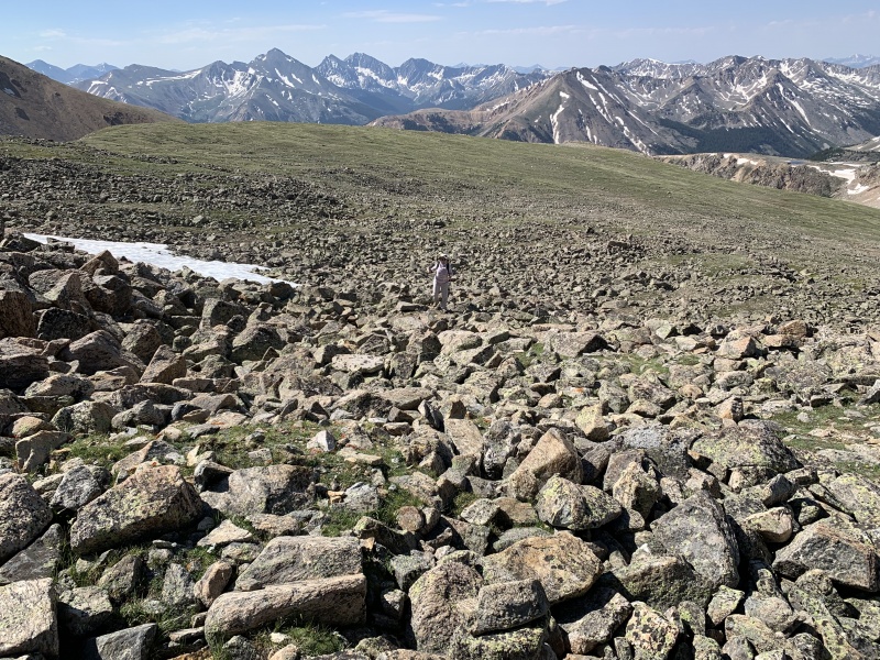
The Rockpile from Hell (RFH). From reading reports, we knew this wasn’t the summit, we knew it was where the class 2 scrambling really begins but we were mentally unprepared for just how big, steep and rocky it really was. The vast majority of the time spent on this route was climbing and descending the RFH.
Eye to eye with Sayers Benchmark.
Small snowfield at the top of the RFH.
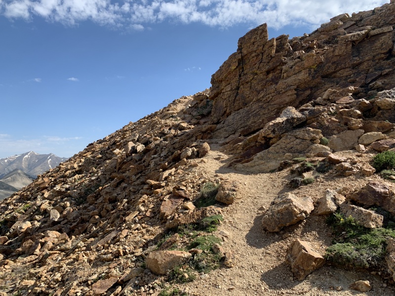
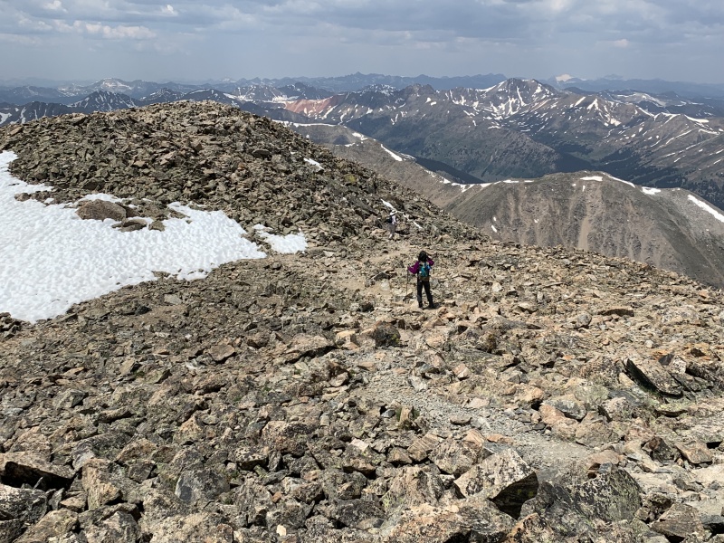
From the top of the RFH, La Plata’s summit ridge comes into view. See the person standing on top? More rock scrambling to go but at this point we were warmed up.
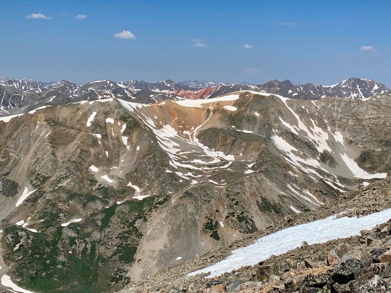
The route finding in these rock fields is challenging. There are plenty of cairns set by previous hikers but I’m not sure I always agree with the cairn setter’s idea of a trail. For the most part it doesn’t matter because it’s all equally rugged, just keep going up. One place where it did matter was coming over the last hump before La Plata’s summit. I finished too high on the hump and came over the top only to face a large surprise snowfield tucked under the north side. This required a few additional minutes of down climbing to detour around the snow. The photo below was taken looking back on the snowfield from the final section of the summit ridge. The standard route on La Plata meets the Southwest ridge route on the right in this photo. As the faint trail indicates, the correct way around the snowfield is to cross the narrow section of snow to the left.
Our crew summiting. Check out the snow covered peak in the distance, upper left, I believe that’s Snowmass?
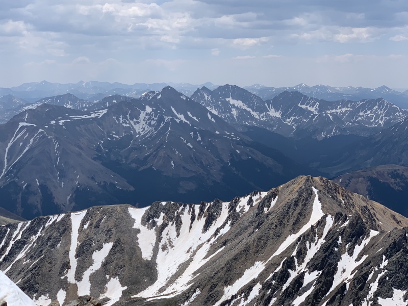
Summit view of Mt. Huron and the Apostles.
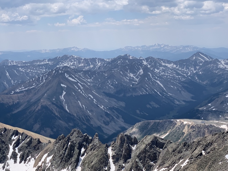
Summit view southwest.
Summit view north towards Independence pass.
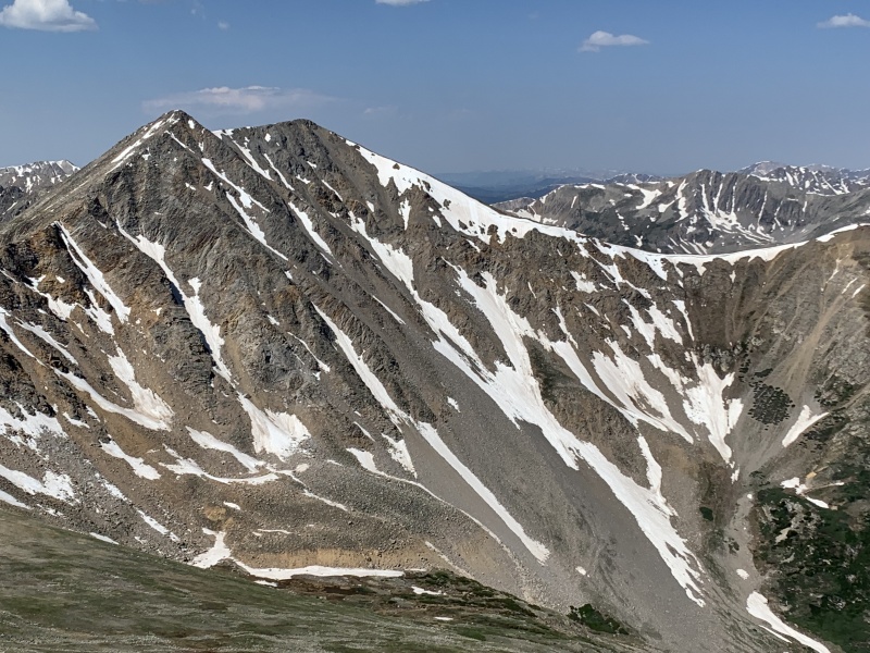
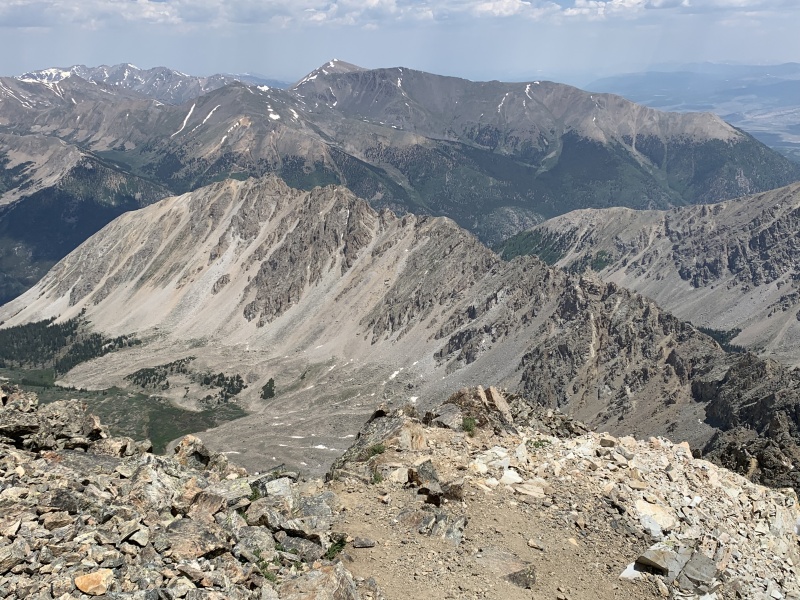
Looking northeast with Ellingwood Ridge in the foreground. Mt. Massive and Mt. Elbert behind.
The view east showing the top of Ellingwood with Rinker Peak in the background.
It was a beautiful day on the summit of La Plata. I was a little concerned due to the strong wind when we topped the headwall but it became calmer the higher we got, like we climbed out of the wind. By the time we reached the summit there was just a gentle breeze. We had the summit to ourselves and stopped for lunch for a few minutes to enjoy the sunshine and the views before heading back down.
We were all worried about how we were going to get back down the headwall section. Going up is difficult, coming down would be downright dangerous. In our party of three, all of us slipped and fell at least twice. My wife’s solution was the rarely seen gravel glissade, also known as the butt scoot.
I’d say La Plata was the most difficult 14er we’ve climbed so far. The miles of rock scrambling and treacherous headwall made for a long day but it felt good to be up high again and to get the first 14er of 2021 under our belts.
Thumbnails for uploaded photos (click to open slideshow):
It was a grind for us as well yesterday... that headwall, with tired legs on the way down, was a bit of a struggle, we each slid on our butts for much of the upper section. But the summit was great, the views spectacular, and no weather to deal with!
I echo your sentiments re the headwall. It's steep, gravely, nasty, and some (including me) might say, dangerous. Going up, it's mostly just steep but hey, it's a hike to a 14er so it has to go up at one point or another! It's somewhat exposed to rockfalls if other hikers are above, so please do your part and watch for potential hikers below when hiking up! But going down was by far the most difficult section of the entire hike (last week -trip report in progress). It's just plain nasty, despite the shortness of the nastiest section. However, I did not find the "RFH" that hellish at all. It's a textbook class 2 & the rock piles are stable and again, one has to get their butt up 14000 ft one way or another... the issue is that it is so steep that it is hard to keep the head up and look ahead for the better marked trail. Which means losing the trail again and again and having to do more off-trail class 2. But going down the RFH, it is easy to follow the trail for 90% of the section. One of my favorite 14er hikes to date despite my wtf moments down the headwall.
Caution: The information contained in this report may not be accurate and should not be the only resource used in preparation for your climb. Failure to have the necessary experience, physical conditioning, supplies or equipment can result in injury or death. 14ers.com and the author(s) of this report provide no warranties, either express or implied, that the information provided is accurate or reliable. By using the information provided, you agree to indemnify and hold harmless 14ers.com and the report author(s) with respect to any claims and demands against them, including any attorney fees and expenses. Please read the 14ers.com Safety and Disclaimer pages for more information.
Please respect private property: 14ers.com supports the rights of private landowners to determine how and by whom their land will be used. In Colorado, it is your responsibility to determine if land is private and to obtain the appropriate permission before entering the property.


")
")
")
")
")
")
")
")
")
")
")
")
")
")
")
")
")
")
")
")
")
")
")
")
")
")
")
")
")
")
")
")
")
")
")
")
")
")
")
")
")
")
")
")
")
")
")
")
")
")


