Download Agreement, Release, and Acknowledgement of Risk:
You (the person requesting this file download) fully understand mountain climbing ("Activity") involves risks and dangers of serious bodily injury, including permanent disability, paralysis, and death ("Risks") and you fully accept and assume all such risks and all responsibility for losses, costs, and damages you incur as a result of your participation in this Activity.
You acknowledge that information in the file you have chosen to download may not be accurate and may contain errors. You agree to assume all risks when using this information and agree to release and discharge 14ers.com, 14ers Inc. and the author(s) of such information (collectively, the "Released Parties").
You hereby discharge the Released Parties from all damages, actions, claims and liabilities of any nature, specifically including, but not limited to, damages, actions, claims and liabilities arising from or related to the negligence of the Released Parties. You further agree to indemnify, hold harmless and defend 14ers.com, 14ers Inc. and each of the other Released Parties from and against any loss, damage, liability and expense, including costs and attorney fees, incurred by 14ers.com, 14ers Inc. or any of the other Released Parties as a result of you using information provided on the 14ers.com or 14ers Inc. websites.
You have read this agreement, fully understand its terms and intend it to be a complete and unconditional release of all liability to the greatest extent allowed by law and agree that if any portion of this agreement is held to be invalid the balance, notwithstanding, shall continue in full force and effect.
By clicking "OK" you agree to these terms. If you DO NOT agree, click "Cancel"...
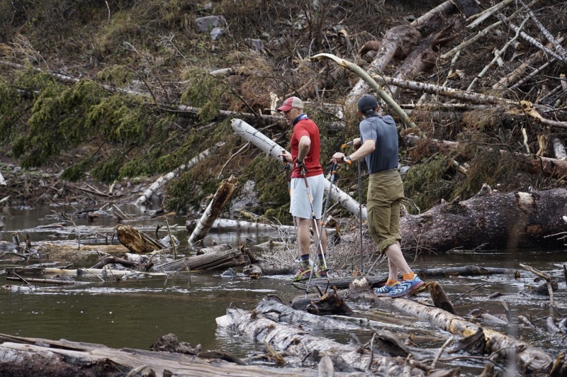
There always seems to be a backstory to these big days, and this one is no different. Last May, John, Terrence, and myself all drove out with the intent to camp at Snowmass Lake to do Snowmass Mountain as an overnighter. We hiked in six and a half miles carrying our skis and overnight gear, made it to the snowmelt-swollen “logjam” creek crossing (which had been successfully crossed by other parties a few days prior), spent 45 minutes failing to find a safe way across (after getting 80% of the way through it), and then spent the next few hours on our six and a half mile out discussing how to do this peak without getting shut down by the logjam.
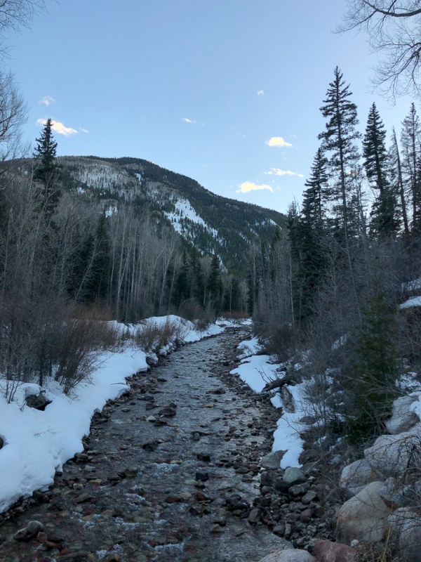
The obvious solution was to come early – when the creek would still be deeply covered in snow – and while we were at it, just to do the 23 mile, 6000′ day as a daytrip and save the hassle of overnighting it. I’d talked to Andy about daytripping Snowmass and, being the type to do things like the Grand Traverse, was excited to come for the adventure. With that the plan was set, and we all started planning. We settled on sometime around Easter, figuring the snowpack would stabilize in time but still have good snow coverage all the way to the car. John, Terrence, and myself drove out together on Friday afternoon with Andy coming a little later in the evening. It was beautiful, as expected.
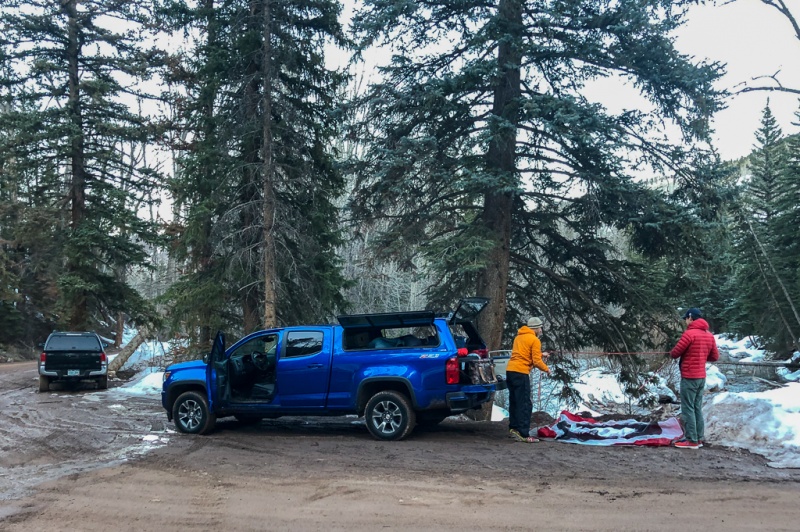
The road was plowed to about half a mile from the summer trailhead, with deep snow beyond that. So we set up camp there, with me sleeping in the truck and John and Terrence opting for a tent.
We were all in bed about 8pm. The plan was to start hiking at 1:30am, and because everything always takes longer than expected we set an alarm for 12:45. Andy rolled in sometime around 11:30, I think, and slept an hour or so in his truck.
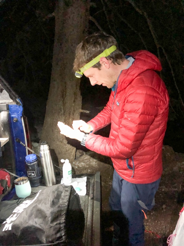
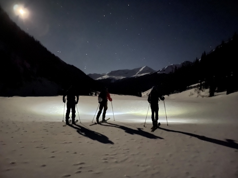
“Morning” came quickly. I fired up the jetboil for coffee, everyone ate some food and got dressed, and as could be reasonably expected, we started even later than planned at 1:50am. The first several miles are pretty flat-to-rolling which led to my toes getting pushed in to the front of my boots more than I like, and I was pretty sure the day was going to result in the loss of a toenail only a couple hours in.
The night was beautiful, and despite air temps not being that low the skies were crystal clear – alleviating any concern over a solid freeze. Once we passed the logjam – which we’d not have noticed if we didn’t know where it was, thanks to snow coverage – the terrain finally turned upwards. My toes were happy for that but I knew the damage was already done. Up to this point, we were able to follow an existing track, while unnecessary for trailbreaking reasons (the snow was rock solid) it simplified routefinding and saved a lot of mental energy.
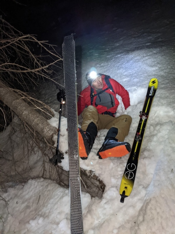
Things got a bit bushwhacky once we started up, and we were on our own track-wise. Next came a good reminder that snow in the trees may not always freeze up the same as it does out in the open in Spring.
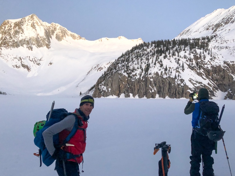
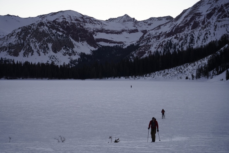
After struggling to get back on my feet for a few minutes, we were back on our way up to Snowmass Lake. We were there before sunrise, not too late but a bit behind where we expected.
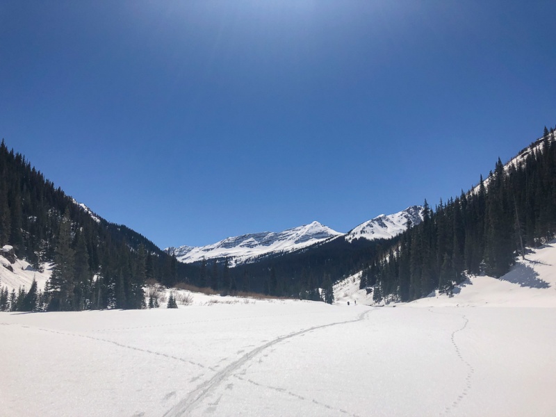
It's a big lake.
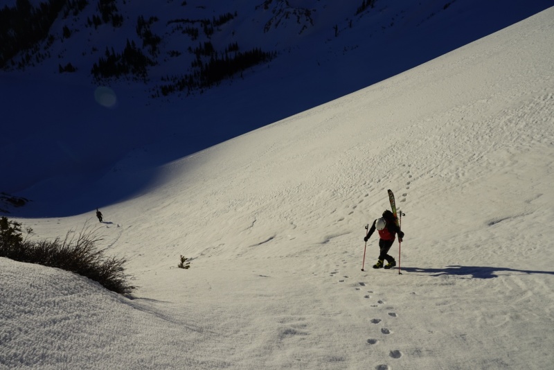
From there things pitched upward again.
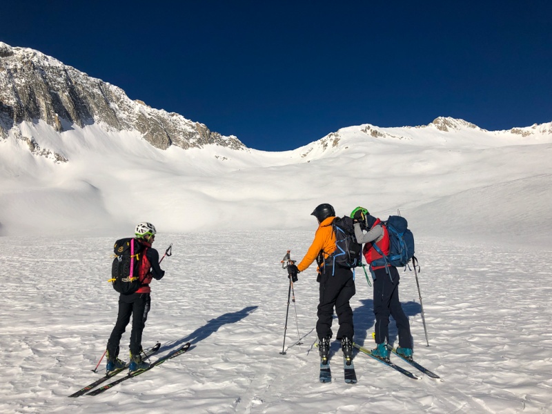
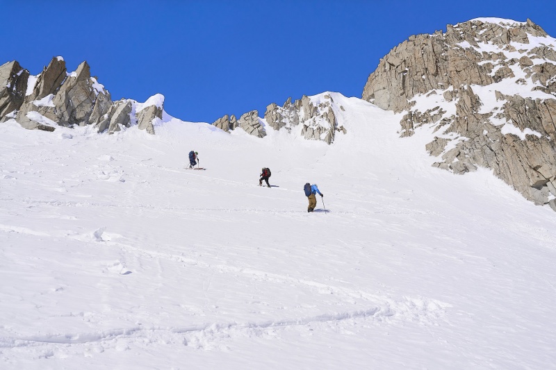
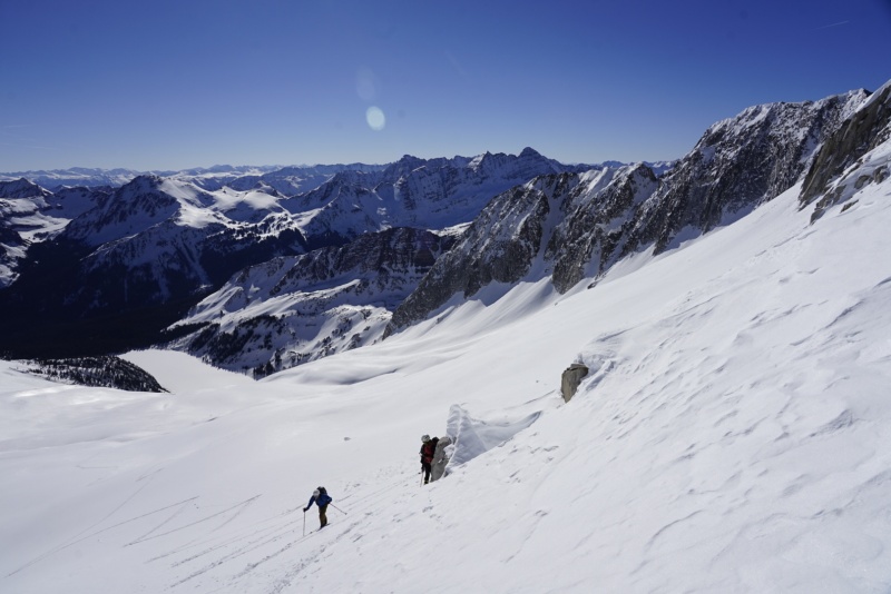
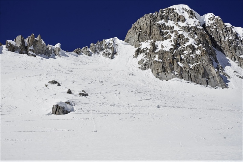
We regrouped above the headwall, a little behind schedule but again, not too bad – especially with the breeze keeping things cool.
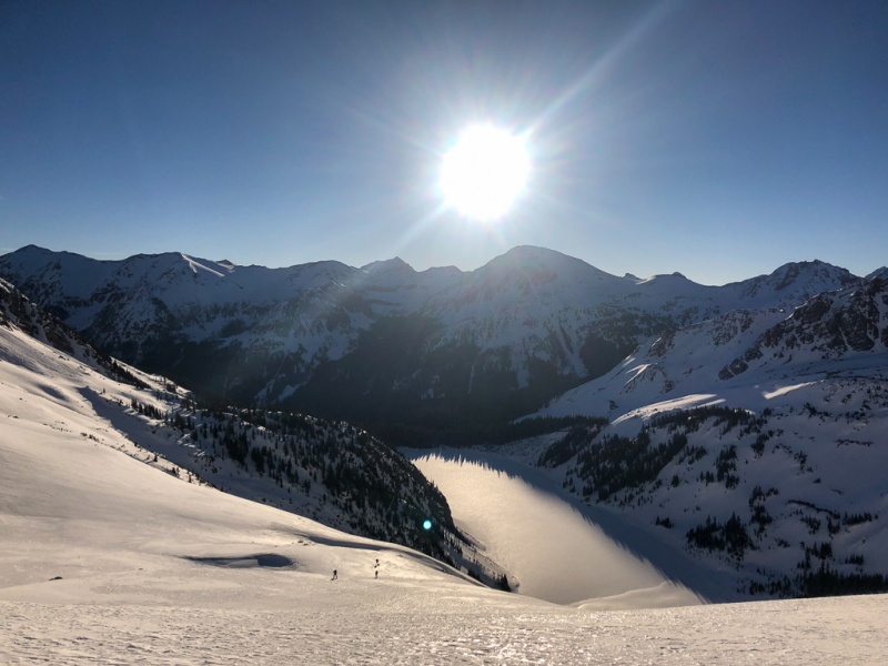
We assessed our options for gaining the summit ridge and decided on this direct route. We weren’t comfortable with the NE direct summit line as things warmed up more, and also didn’t trust it’d be fully consolidated anyway.
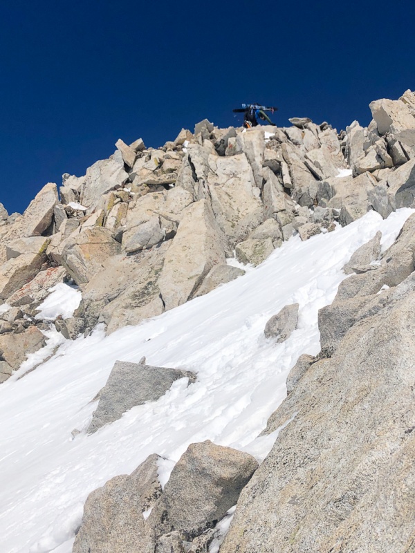
John and Andy took the lead, setting the steepest switchbacking skintrack I’ve ever been on – in the 50 degree range.
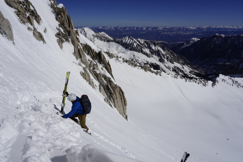
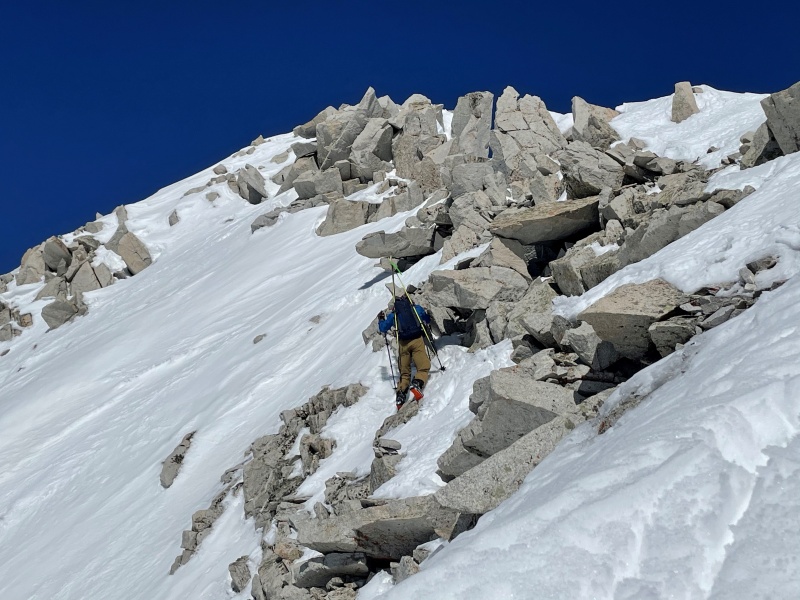
Andy and John did a great job setting the track, but it became unsupportive by the time Terrence and I got there. We had to use our skis as an anchor to aid in booting up the final couple turns to the ridge.
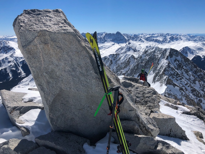
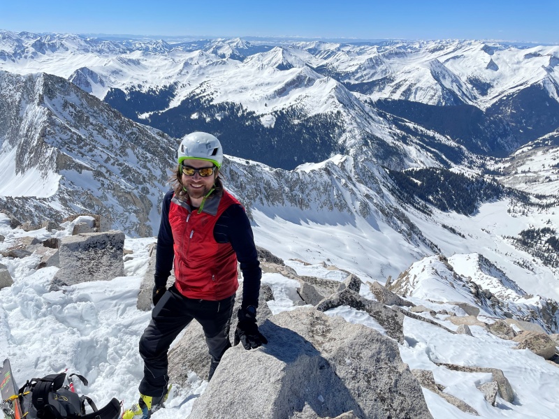
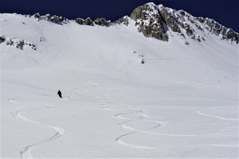
The ridge from here was a mix of snow and class 3 scrambling, with route assessment and selection taking more time than we expected – especially since we were already behind schedule. But the summit came quickly enough.
Unfortunately we were well behind schedule and worried about the snow getting too hot, so we couldn’t take any time to enjoy the views and kick back. We looked around at all our options, having to rule out a lot of choices. The preferred NE direct summit line was nearly vertical (80deg+) and had very thin cover over lots of rocks, so while it looked good from a distance it was unskiable this day. A few other lines were ruled out, and we decided the short downclimb to where we gained the ridge was our only safe option.
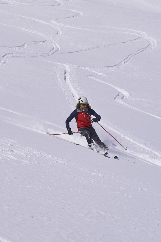
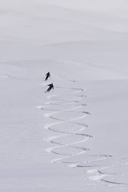
We skied off, with John going first. I went next. I was cautious on the first few turns, then opened it up once I got a feel for conditions. I then immediately crashed hard:
Conditions got a little more predictable as we got lower, but thanks to 7″ of snow a few days prior things were generally challenging and inconsistent. Terrence had bigger boots and skis than the rest of us, and it showed in his skiing.
The skiing was fairly fun overall.
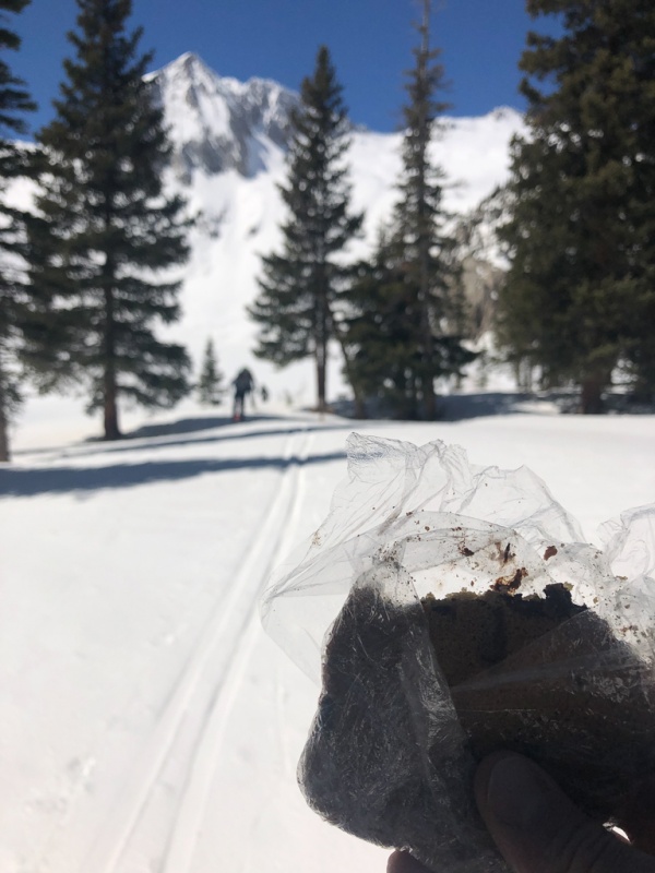
We hit the lake and started skating, which was tiring but quick. It was there I finally enjoyed the big cookie made by my family, with over 1/3 a cup of cookie dough. I've got a freezer full of these things for peak season and I'm starting to doubt I'll get through them, the way conditions are going.
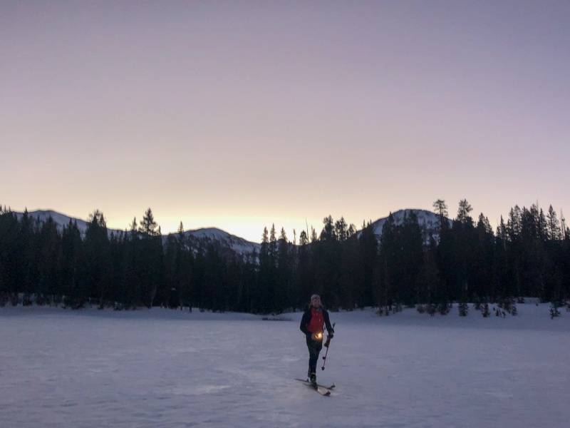
From here to the lower lake was a bit of a slog. It was difficult/impossible to stay on the summer trail due to the rolling/meandering nature of it, but we eventually picked our way through. Everyone was out or almost out of water at this point, so when we got back to open water we got some from the stream and used iodine tablets that John brought. That’s something going in my kit going forward.
It was almost 2pm at this point, and we’d hoped to be back to the cars and heading home by now. And we still had 8 low-angle miles to go. We put skins back on to get across the lake, and I feared we’d have them on all the way back to the car. Fortunately we only had them on for about a mile, and were able to pole/skate/sidestep the rest of the way to the car – though the flat/rolling terrain was exhausting and took another two and a half hours to get back down to the trailhead.
A full fourteen and a half hours after starting we were done, in more ways than one. I sat and grabbed a beer and got my boots off ASAP. I knew my toenail was coming off (and it did, four days later). Andy had to scramble to get home as he was well behind schedule to get back to his wife and two very small children. Terrence and John and I weren’t in a huge rush though didn’t waste much time as we wanted to get the three hour drive home done before it got too late.
This was too much for a daytrip. I’m glad we did it but I definitely would not make the choice to do it again.
Thumbnails for uploaded photos (click to open slideshow):
That's impressive! Great work, and thanks for sharing!
Caution: The information contained in this report may not be accurate and should not be the only resource used in preparation for your climb. Failure to have the necessary experience, physical conditioning, supplies or equipment can result in injury or death. 14ers.com and the author(s) of this report provide no warranties, either express or implied, that the information provided is accurate or reliable. By using the information provided, you agree to indemnify and hold harmless 14ers.com and the report author(s) with respect to any claims and demands against them, including any attorney fees and expenses. Please read the 14ers.com Safety and Disclaimer pages for more information.
Please respect private property: 14ers.com supports the rights of private landowners to determine how and by whom their land will be used. In Colorado, it is your responsibility to determine if land is private and to obtain the appropriate permission before entering the property.
")
")
")
")
")
")
")
")
")
")
")
")
")
")
")
")
")
")
")
")
")
")
")
")
")


