Download Agreement, Release, and Acknowledgement of Risk:
You (the person requesting this file download) fully understand mountain climbing ("Activity") involves risks and dangers of serious bodily injury, including permanent disability, paralysis, and death ("Risks") and you fully accept and assume all such risks and all responsibility for losses, costs, and damages you incur as a result of your participation in this Activity.
You acknowledge that information in the file you have chosen to download may not be accurate and may contain errors. You agree to assume all risks when using this information and agree to release and discharge 14ers.com, 14ers Inc. and the author(s) of such information (collectively, the "Released Parties").
You hereby discharge the Released Parties from all damages, actions, claims and liabilities of any nature, specifically including, but not limited to, damages, actions, claims and liabilities arising from or related to the negligence of the Released Parties. You further agree to indemnify, hold harmless and defend 14ers.com, 14ers Inc. and each of the other Released Parties from and against any loss, damage, liability and expense, including costs and attorney fees, incurred by 14ers.com, 14ers Inc. or any of the other Released Parties as a result of you using information provided on the 14ers.com or 14ers Inc. websites.
You have read this agreement, fully understand its terms and intend it to be a complete and unconditional release of all liability to the greatest extent allowed by law and agree that if any portion of this agreement is held to be invalid the balance, notwithstanding, shall continue in full force and effect.
By clicking "OK" you agree to these terms. If you DO NOT agree, click "Cancel"...
I am posting this report to add to the sparse information about the N Ridge of Mt. Antero as accessed from Cascade Campground.
First point I want to make is that the rating of Class 2 in the Gerry Roach guide is misleading. Perhaps when snow conditions are right it can be a cruise, but otherwise, be on guard! The gully leading up the the N Ridge is steep, sustained, and loose. On the descent I dislodged a boulder the size of a loveseat with a beveled edge that would have cut a person climbing under me in half. The slope is steep enough that if you were to catch a toe and stumble, you would likely cartwheel a long way with potentially catastrophic injuries. The rock is loose, but no where safe for "scree surfing". The gully has a distinction as being one of those places where it is easier to go up than to go down both for the physical effort required and time it will take. I totally understand why CoHokie chose to avoid the descent on this route in his 6-20-17 report.
Having said all that, I also have to say that by the time I reached the summit I was stoked to come down and write a report about how this route was an overlooked gem. Going up was really fun and spectacular. But the descent beat that sentiment out of me. Climb this route, yes, but meet someone with a jeep at the summit to get back down!!
OK, enough for the intro.
This day had an inauspicious start when a wild turkey flew into the side of my car just 30 miles out from Montrose at 6:30 in the morning, breaking the windshield and removing the passenger side view mirror. Undeterred by the ill omen, I pressed on, getting to the trailhead at Cascade Campground a little before 9:00 a.m. I hiked a little ways into the wood toward the gully leading to the N Ridge and decided that it was a short enough distance that snow shoes would just be dead weight. Jumping ahead in the story a bit, glad I did not take them because I would have stashed them at the bottom of the gully where I never would have found them again coming out in the dark without a headlamp. (yeah, yeah, yeah, I know)
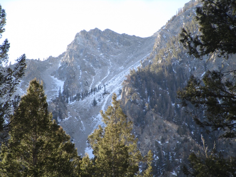
From the parking lot the gully is not evident. Only after hiking a few minutes into the campground does it come into view. Until then, everything from the road looks sort of impossible.
Westernmost of two treeless gullies
The tall tree in the center of the previous photo marks the point where the scrambling got difficult. A decision had to be made about whether to stick to the rock or don crampons and use the snow/ice. I opted for the rocks, which in retrospect might have made things more difficult, but the snow was wind slab over ice and seemed more dangerous, even with traction, than using the rocks. As it turned out, I carried the crampons all day.
Also in the previous photo, the saddle on the skyline right was my objective. I think one bit of good advice for anyone heading up that way is to avoid the temptation to head north (climbers right) up to the ridge too soon. By staying more to the left (westerly direction) I found easier ground up high and avoided the difficulties described by CoHokie in his 6-20-17 report.
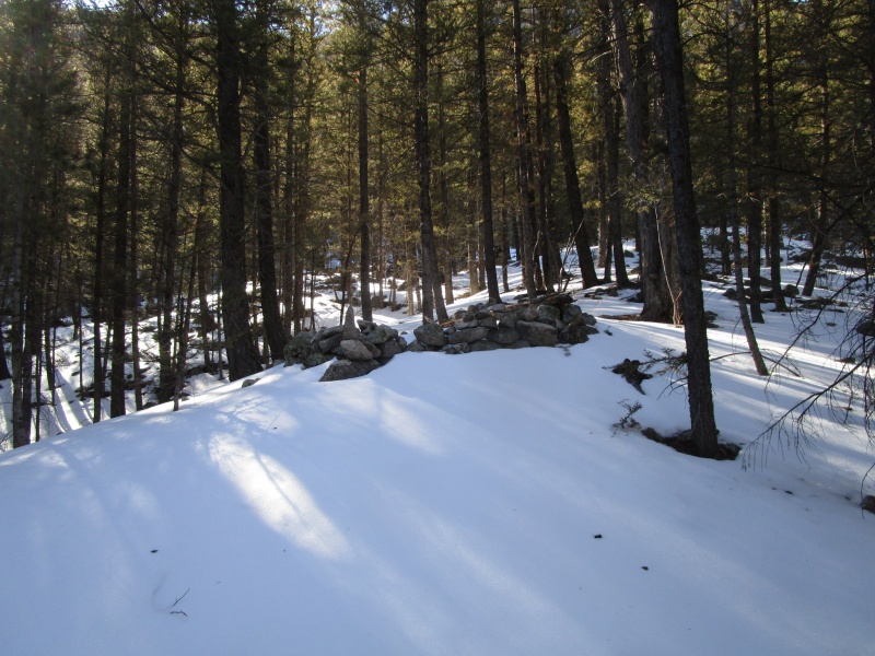
But between the car and the gully was about 30 minutes of woods to get through.
Shortly after leaving the campground road, this rock structure
There was not hint of trail, but it was straight forward to bushwhack toward the gully which was visible most of the time. The snow was never more than knee deep and given how brushy it was, snow shoes may have been more a hindrance than help.
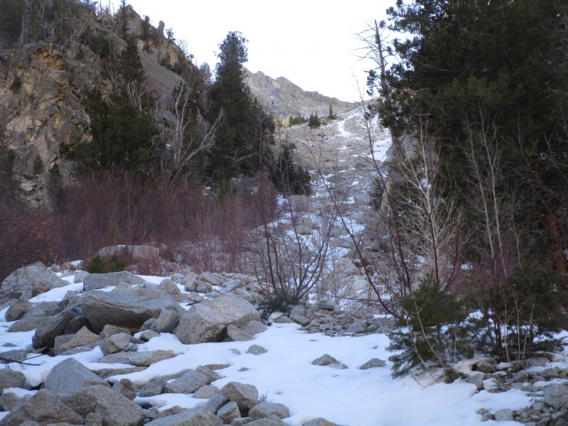
Start of the Gully
I built a cairn here to mark where to go back into the trees. Flagging tape would not be a bad idea if you are thinking of heading up. Like the snow shoes I did not bring, I never saw that cairn again either!
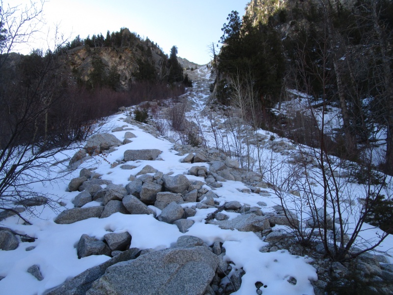
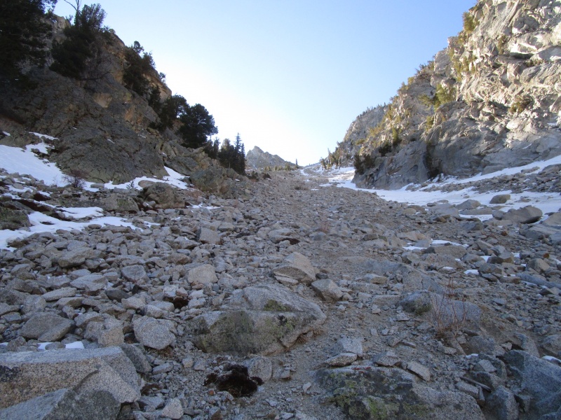
Moving up the lower section of the gully was not difficult
The tall tree from the first photo, now at center.
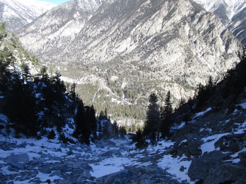
Looking back down from where the previous photo was taken; about an hour from the car.
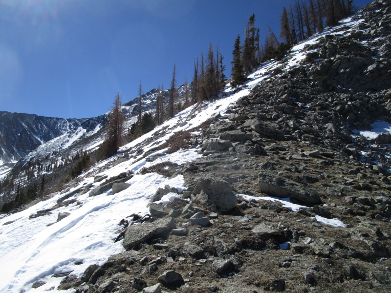
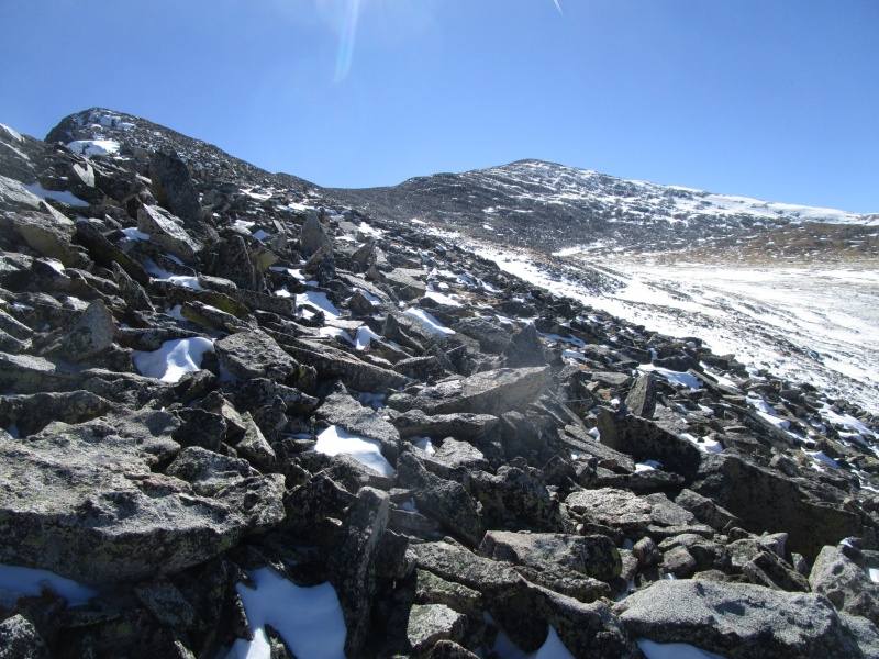
When you get up out of the initial part of the gully things open up a bit and there are several ways to proceed. The steepness of the slope increases insidiously.
Lunch spot
I stopped for a break around 11:00 and had to regroup and settle my thoughts. Did I find the best route up so far? Would it have been easier, safer with traction on my feet? Should I consider going down the standard route and walking around to my car to avoid this descent? But I settle down, calm my mind and look ahead to where it seems the worst of the slope is behind me and look forward to pushing on.
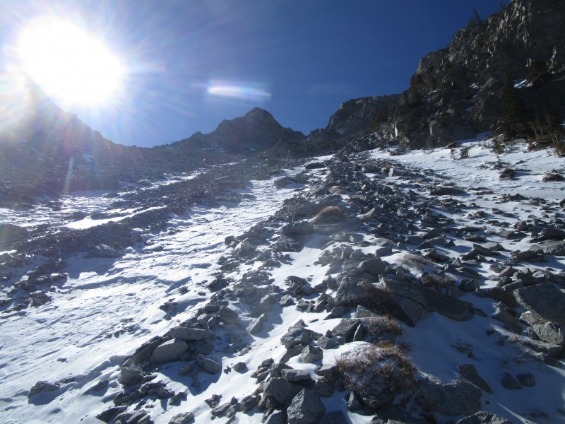
Upslope from Lunch Rock.
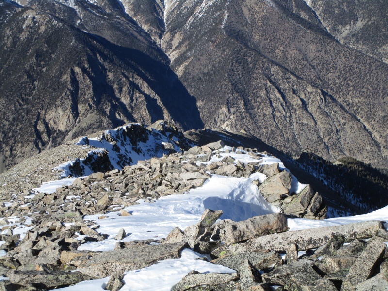
That peak in the center of the previous photo is the terminus of the North Ridge. I accessed it by going to the saddle on the left. In retrospect, it might have been easier to put the crampons on and stick to the snow and ice. Ascent88, in his 1-18-09 report makes the gully sound quite trivial in his report. But yesterday the snow was pretty rotten and big chunks of wind slab would break away and I imagined that even with crampons, the slabs would run on the ice underneath taking me with.
Gaining the Ridge
Easy ground to the N Ridge proper
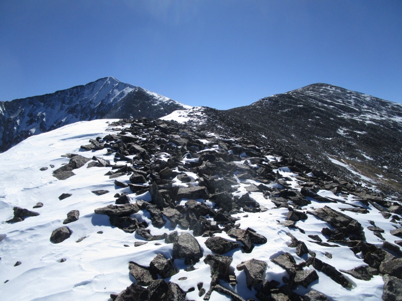
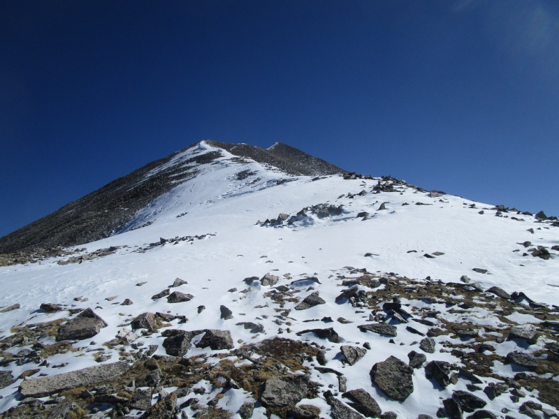
Start of the North Ridge. High Point is NOT Antero
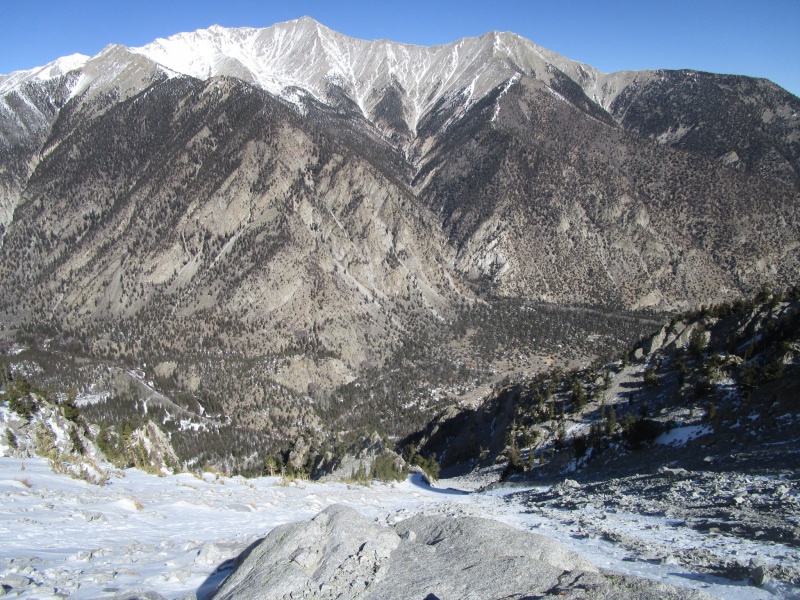
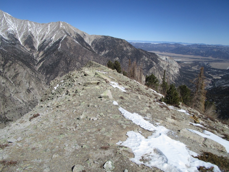
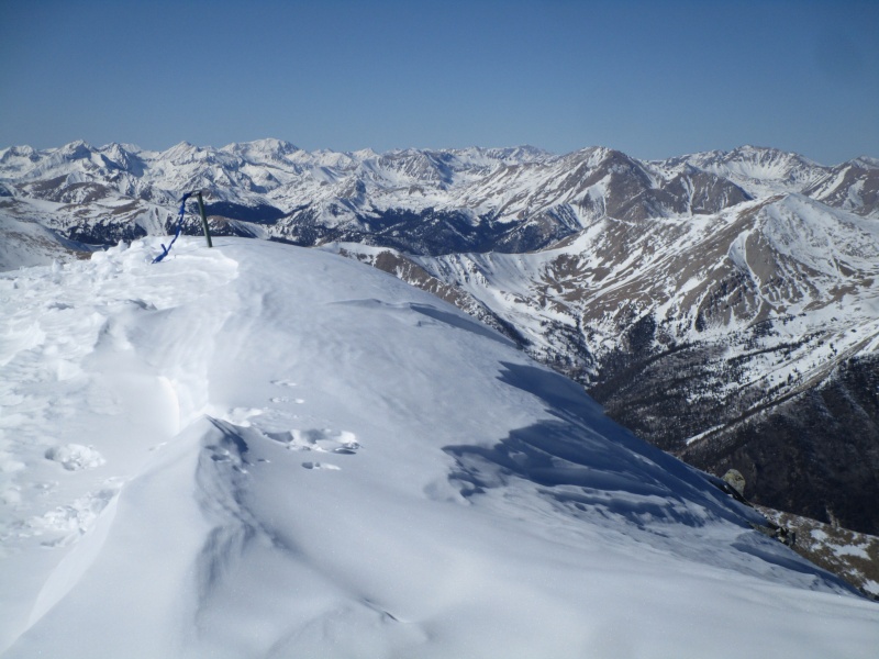
Looking back down at Cascade Campground from the Northern end of the North Ridge
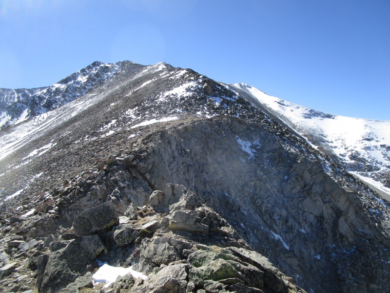
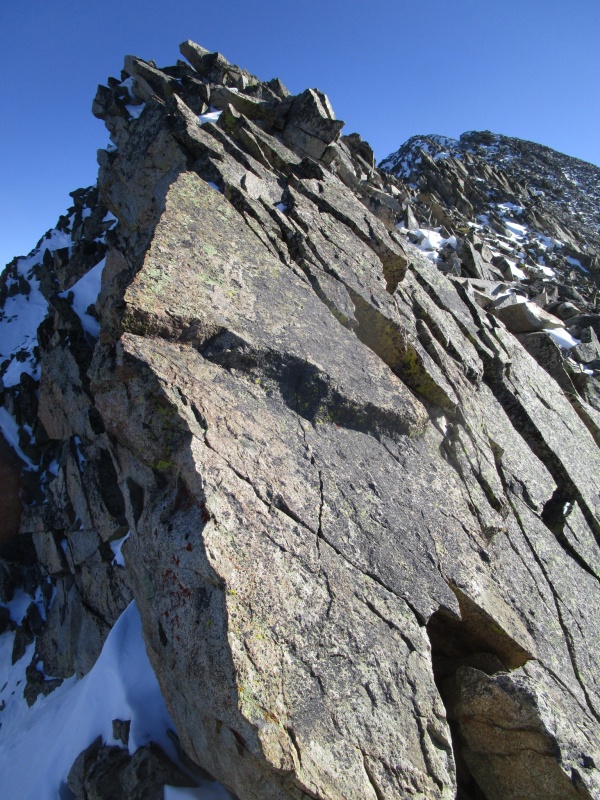
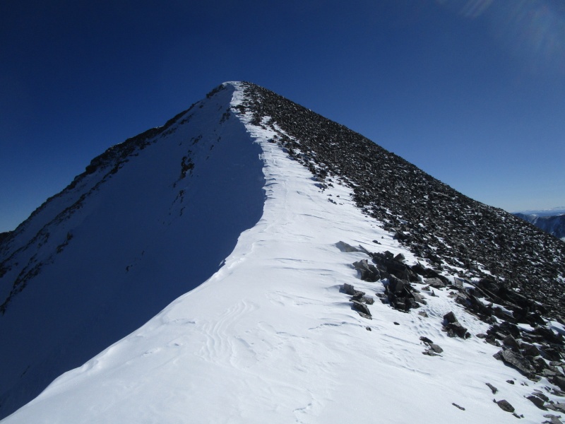
The climbing on the ridge was pleasant and straight forward. For the most part, staying right on the ridge crest was best. But it did have a few surprises. Anyone ever talk about the Knife Edge on Antero? Well here you go.
Class 2 Gerry? Really?
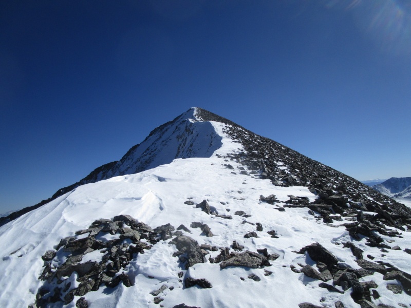
After the Knife Edge you finish the run up to the false summit along the ridge
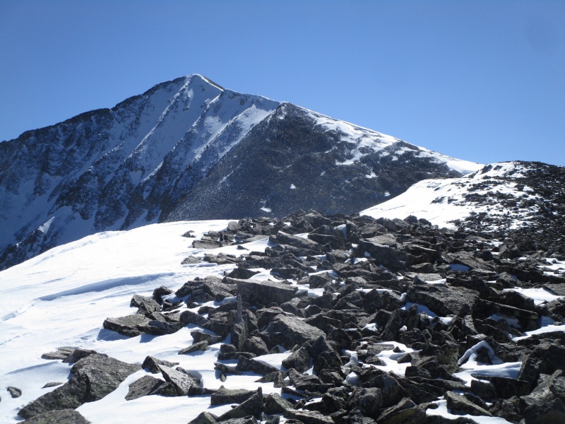
Nearing false summit; point 13,762 in the distance.
First view of Antero Summit
The North Ridge should not be underestimated. It was steeper and took more time than I anticipated. Getting my first view of Antero, I check the time and it is getting near 2:00 and I am starting to think I better pick up the pace. Fortunately, the hike around the back (east) side of Pt. 13762 is some of the easiest walking all day and I find myself looking at the final push to the summit around 2:15.
Antero
Final ridge to summit
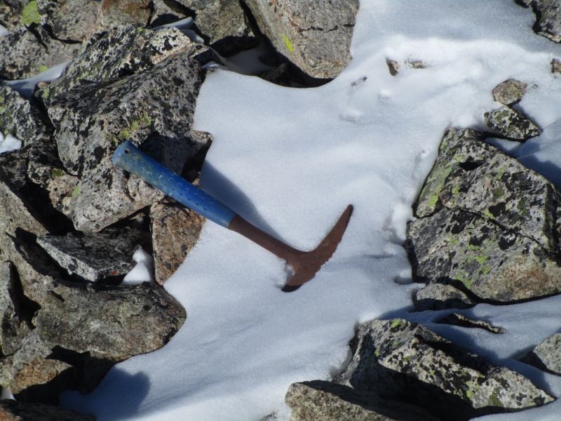
I had not seem much evidence of other human presence on this trip so far, then I spy this on the ground.
Rock Hammer
If anyone wants to claim the hammer as theirs, just let me know. I did carry it down.
Getting close
Closer still
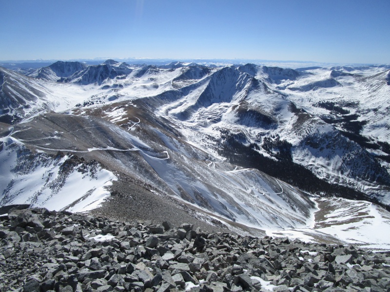
Summit View
The road to the summit
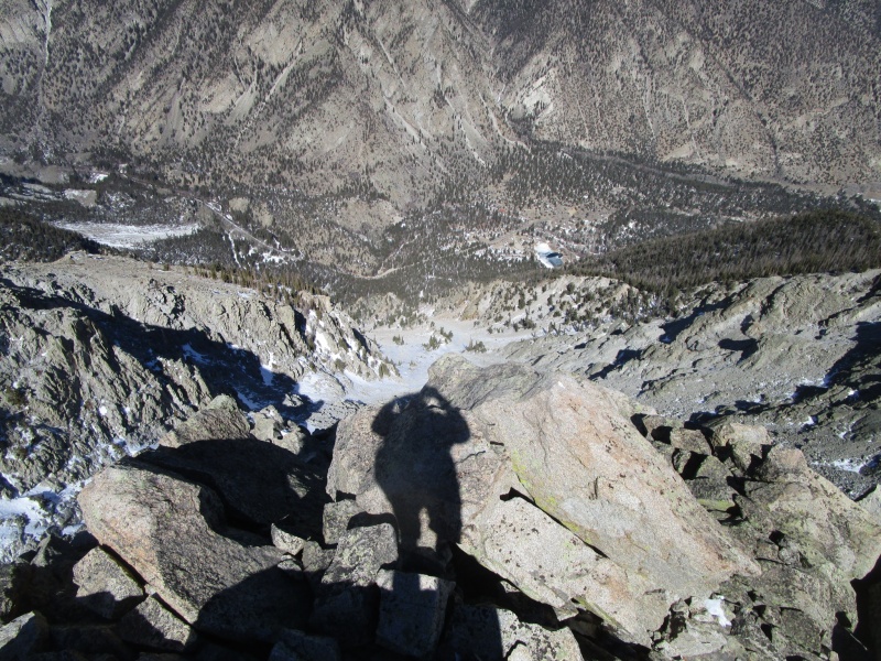
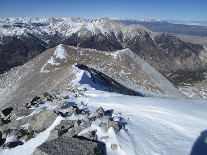
View back down to Pt. 13762 and upper end of N Ridge
Looking down most of the N Ridge
I left the summit at 2:36 and at that point, figured I would have enough daylight to cover the 3 1/2 miles back to the car. There are very few mountains where the descent time is anywhere close to the climb time. Well, this is one of them. About 5 1/2 hours up and 4 1/2 hours down. I got back to the car right around 7:00 p.m. I am pretty sure I made up time from the summit to the top of the gully, but after that it was a real crawl. Of course part of it was being exhausted and part of it was worrying about losing daylight without a headlamp, but I really think that gully will demand the respect of anyone traveling over it and the time and effort going up will be met or exceeded by the time and effort to go back down.
Thumbnails for uploaded photos (click to open slideshow):
Well I wasn't trying to describe misery, because it was an excellent day out and mostly fun. But I did want to stress that this is not what you would expect from a Class 2 climb.
Great report. I'm always interested in alternative ways to hike a mountain.
Caution: The information contained in this report may not be accurate and should not be the only resource used in preparation for your climb. Failure to have the necessary experience, physical conditioning, supplies or equipment can result in injury or death. 14ers.com and the author(s) of this report provide no warranties, either express or implied, that the information provided is accurate or reliable. By using the information provided, you agree to indemnify and hold harmless 14ers.com and the report author(s) with respect to any claims and demands against them, including any attorney fees and expenses. Please read the 14ers.com Safety and Disclaimer pages for more information.
Please respect private property: 14ers.com supports the rights of private landowners to determine how and by whom their land will be used. In Colorado, it is your responsibility to determine if land is private and to obtain the appropriate permission before entering the property.
")
")
")
")
")
")
")
")
")
")
")
")
")
")
")
")
")
")
")
")
")
")
")
")


