Download Agreement, Release, and Acknowledgement of Risk:
You (the person requesting this file download) fully understand mountain climbing ("Activity") involves risks and dangers of serious bodily injury, including permanent disability, paralysis, and death ("Risks") and you fully accept and assume all such risks and all responsibility for losses, costs, and damages you incur as a result of your participation in this Activity.
You acknowledge that information in the file you have chosen to download may not be accurate and may contain errors. You agree to assume all risks when using this information and agree to release and discharge 14ers.com, 14ers Inc. and the author(s) of such information (collectively, the "Released Parties").
You hereby discharge the Released Parties from all damages, actions, claims and liabilities of any nature, specifically including, but not limited to, damages, actions, claims and liabilities arising from or related to the negligence of the Released Parties. You further agree to indemnify, hold harmless and defend 14ers.com, 14ers Inc. and each of the other Released Parties from and against any loss, damage, liability and expense, including costs and attorney fees, incurred by 14ers.com, 14ers Inc. or any of the other Released Parties as a result of you using information provided on the 14ers.com or 14ers Inc. websites.
You have read this agreement, fully understand its terms and intend it to be a complete and unconditional release of all liability to the greatest extent allowed by law and agree that if any portion of this agreement is held to be invalid the balance, notwithstanding, shall continue in full force and effect.
By clicking "OK" you agree to these terms. If you DO NOT agree, click "Cancel"...
Endlich Echos: Little Kennedy's Granite Playground
The thirteeners of Endlich Mesa are little known. Despite being in the popular Weminuche Wilderness, they're overshadowed by their larger and oft more rugged counterparts to the north. They make up the southern wall of the Weminuche and from there south it's almost nothing but mesas and canyons all the way to New Mexico. Their unique position within the Weminuche offers great views of the rest of the wilderness area, and expansive views in all other directions. The peaks are easy, for the most part, and Endlich Mesa is an area I fell in love with on this visit, my first and thus far only visit.
Whiley and I rushed to do these peaks on a three-day weekend immediately prior to a snow storm that would likely keep us away until the next season. With so many peaks we could do in such short order, and in our favorite part of Colorado, it was a no brainer to go down there and get as much as we possibly could. The worst part of Endlich Mesa? If you said the approach, you'd be wrong. Unlike many of the other Weminuche peaks the Endlich approach is gorgeous and not brutal. What is brutal, however, is the drive to the trailhead. The road above Lemon Reservoir to the trailhead is long, rocky, and time consuming. It's not particularly difficult but it forces you to go slow or else risk a blown tire or body damage. It took Whiley and I two hours each way from Lemon Reservoir, to give an idea of how tedious the road is.
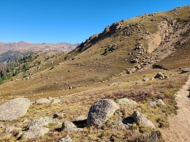
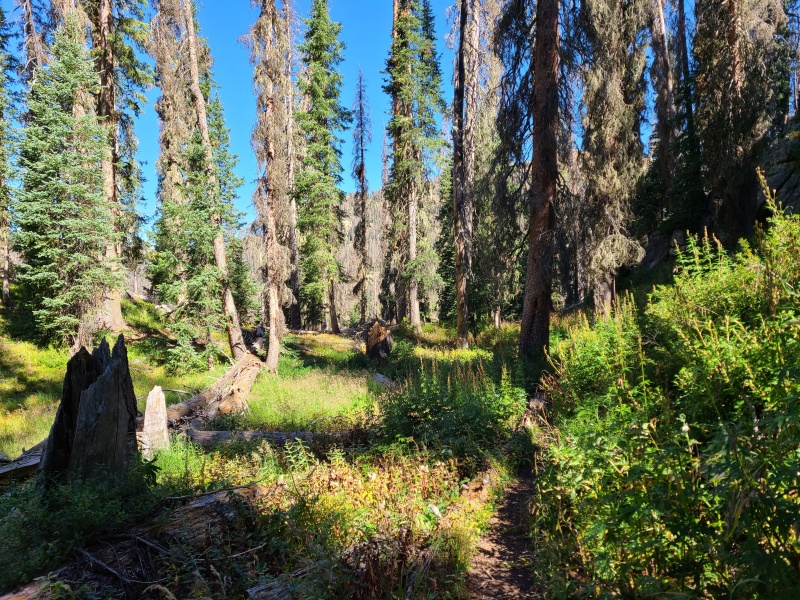
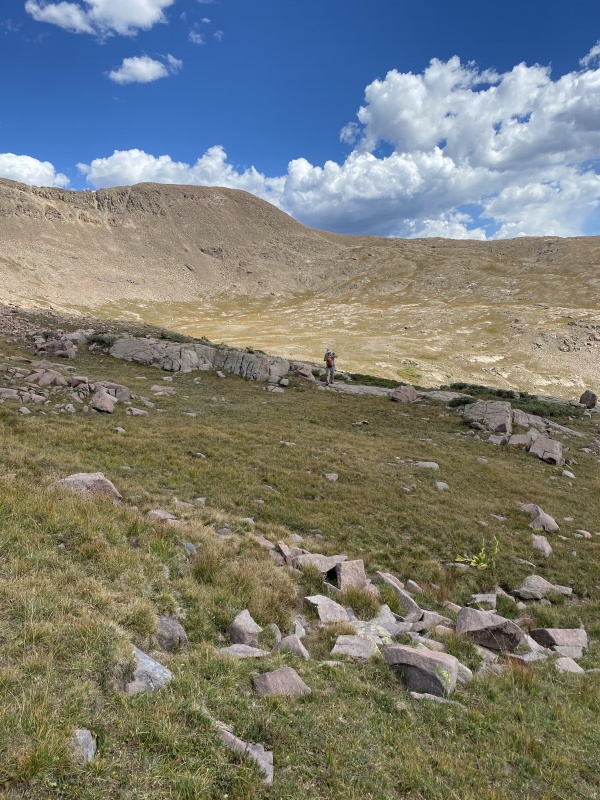
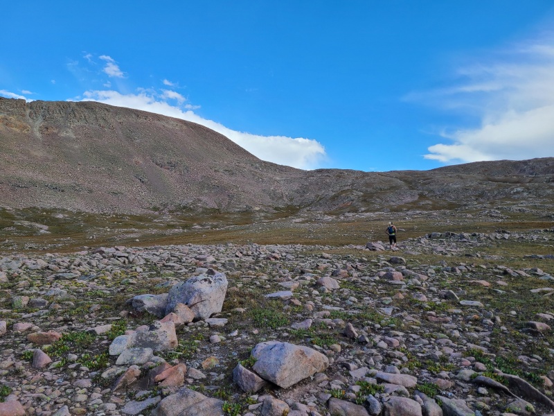
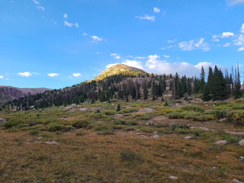
We got started the next morning at about 8:45am, a casual start for the Wemi. Our plan was to backpack in, setup camp near City Reservoir, do as many peaks as we could in the afternoon, and spend the night before finishing what we had left on day two. The Endlich Mesa trail is awesome. It's easy to follow, in great shape (little to no loose rock, braiding, etc.), and has views pretty much the entire way in both directions. It rises gently to well above 12,000 feet before dropping steeply towards City Reservoir, which is actually lower than the trailhead, meaning we'd have a fair chunk of gain on the way out.
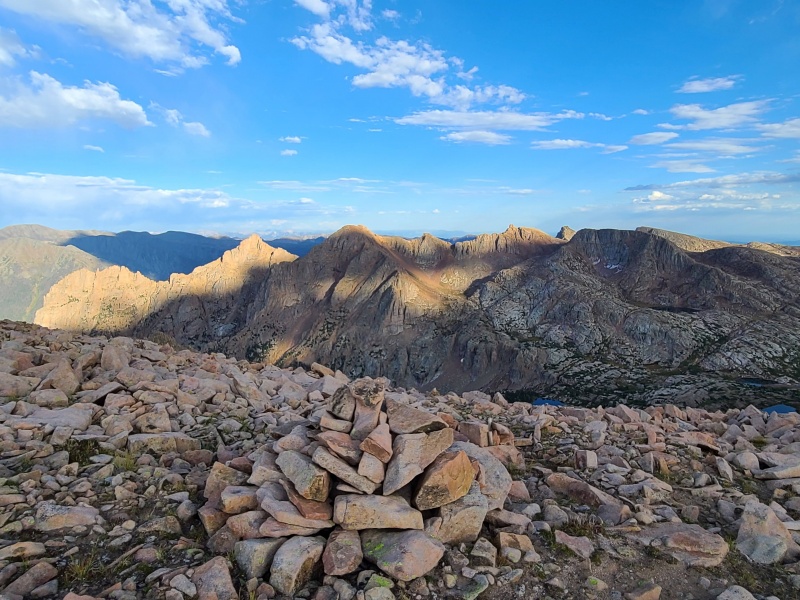
Endlich Mesa and its peaks.Great trail across the boulder-strewn slopes of the mesa.Into the forest.
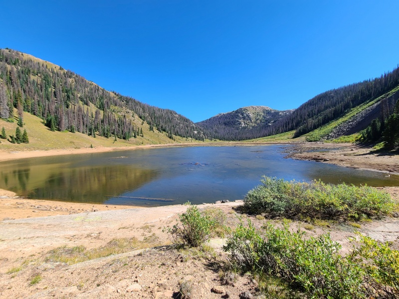
The trail only gets a bit difficult dropping into the reservoir, since it's steep and the granite pebbles of the area make footing a bit shifty in spots. Before we knew it we were at the reservoir, which was exceptionally low. So low, in fact, that it was not even draining anymore. The upper reaches were filled with green pond scum and it quite honestly smelled terrible. The trail took us around the south side and then the western side. We found good, clear water flowing into the reservoir from elsewhere, so we went off trail and setup camp several hundred feet northeast of the reservoir in a forested area near a forked creek.
City Reservoir, very low at the time. The far stretches were scummy, stinky, and disgusting.Me with Sheridan Mountain (12,795') behind. Photo: Whiley H.
We quickly setup camp and refilled on water. It was quite hot and we had started with less water than normal, knowing we'd be at camp before we ran out. Then, at the now uber-casual time of 12:15pm, we set off to do six Weminuche thirteeners. Who needs a pre-dawn start in the Wemi? Not us. Forget that noise.
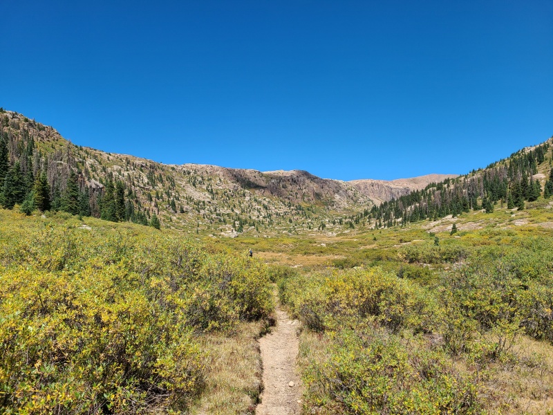
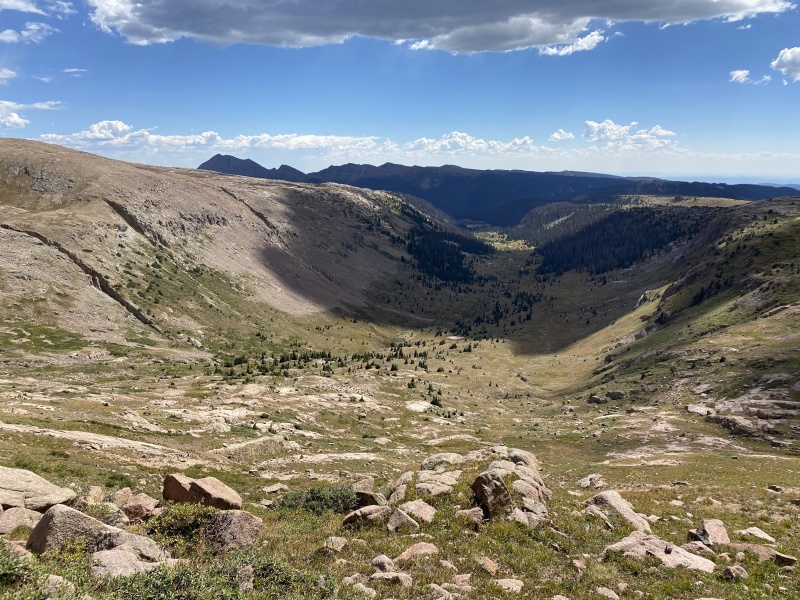
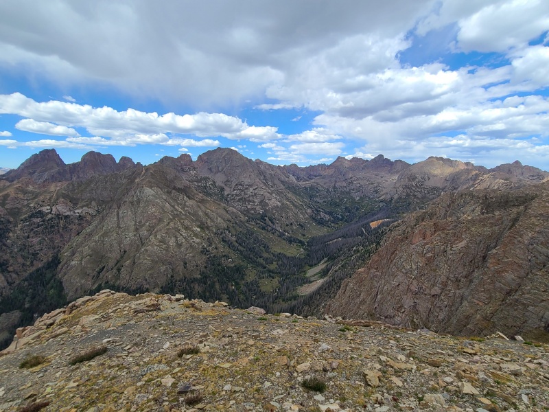
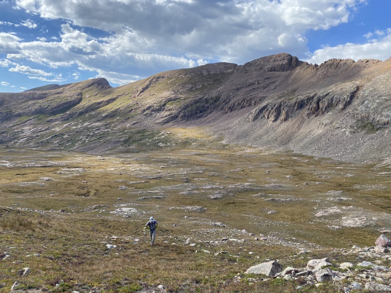
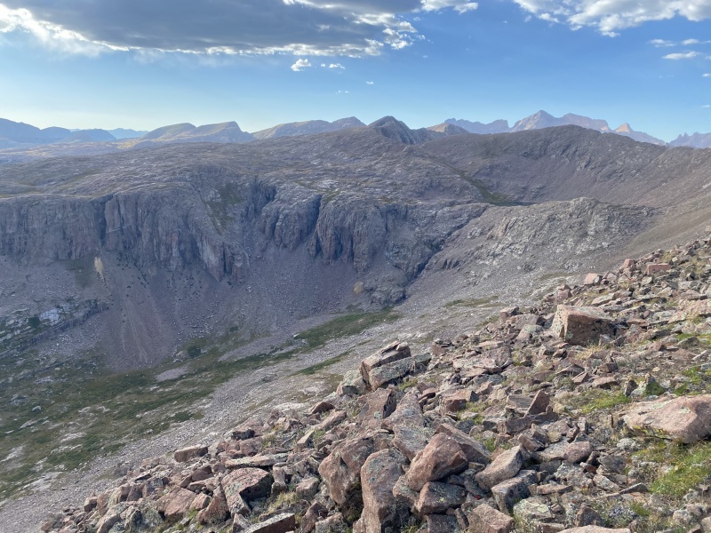
We made our way back to the trail and took it north into Crystal Valley, which separates Silver Mesa to the west and Endlich Mesa to the east, and drains Florida River. The granite walls of the valley stood in contrast to the flats, and we could tell this was going to be quite the beautiful hike.
The beautiful valley north of City Reservoir with Florida Mountain in the back on the right. Super lush for September in a drought year!
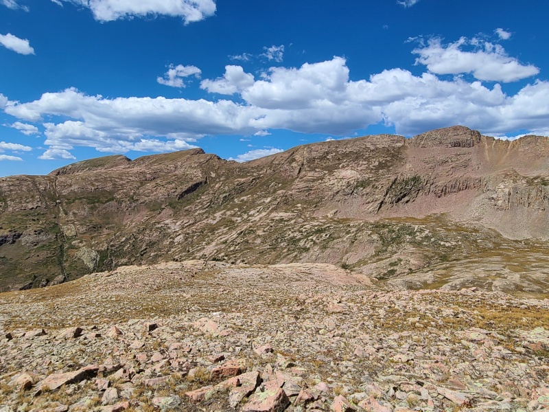
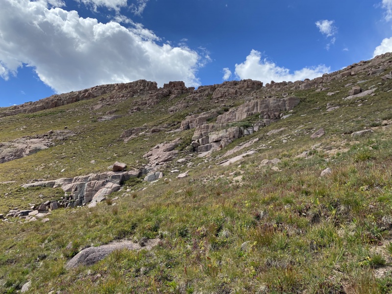
Though there were peaks at the head of the valley we wanted, we instead stayed on the trail as it headed south then west up a steep set of ledges to the top of Silver Mesa.
Pleasant trail up Silver Mesa. Photo: Whiley H.Bullion Mountain's distinctive flat summit from atop Silver Mesa. Photo: Whiley H.Crystal Valley.
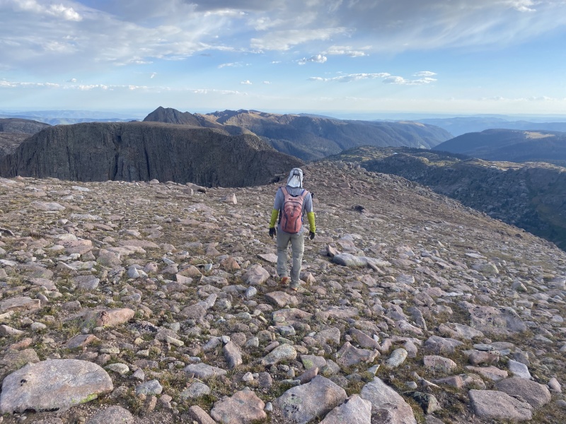
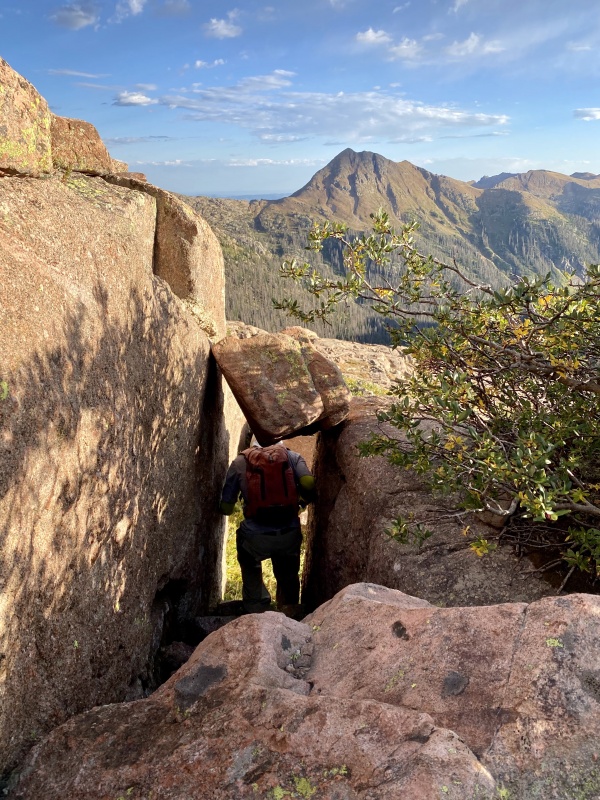
Once on top of the mesa things started to get even cooler. Massive granite slabs littered the mesa, interspersed with trees and grass. Surprisingly enough the trail remained rather good through all of the rock, though we eventually left it to head towards Mount Kennedy; the trail continued towards Trimble Pass, which drops into Vallecito Basin and eventually to Columbine Pass, which gives access to Chicago Basin. The approach via Endlich Mesa would be a long and scenic alternative to the standard Needleton approach, and one I can say would really be a total joy for those so inclined.
Endless granite slabs.Tunnel through time. Photo: Whiley H.Looking far west towards Overlook Peak (12,998'), Colorado's highest twelver.
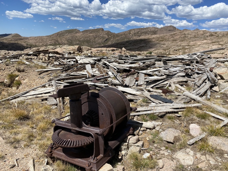
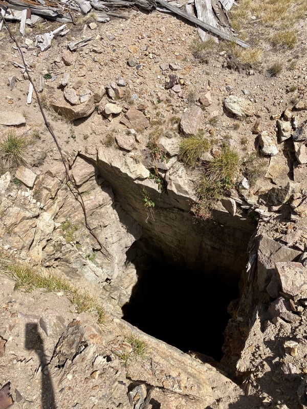
Along our way up Silver Mesa we encountered some old mining ruins, including a wide-open mine shaft. I'd heard of open shafts before but somehow had never seen one. I peered into it but it was surprisingly dark. We have no idea how deep it actually is, but it was pretty neat to see one "in the wild," so to speak.
Old mining debris. Photo: Whiley H.Don't fall in! Or drop your phone... Photo: Whiley H.
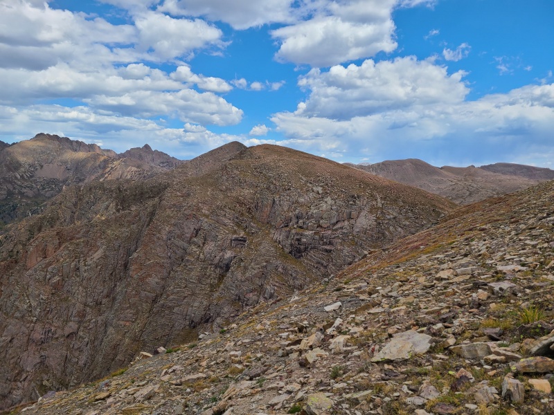
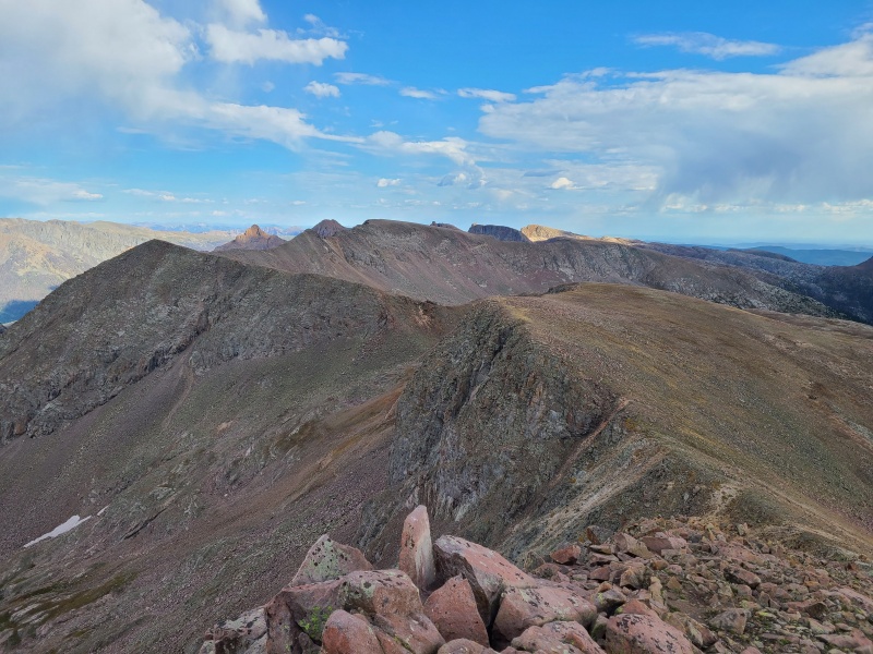
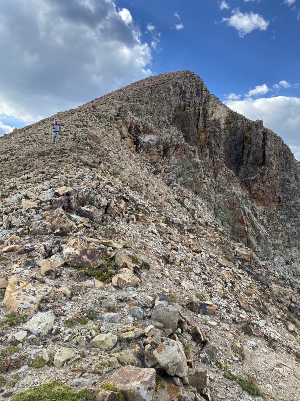
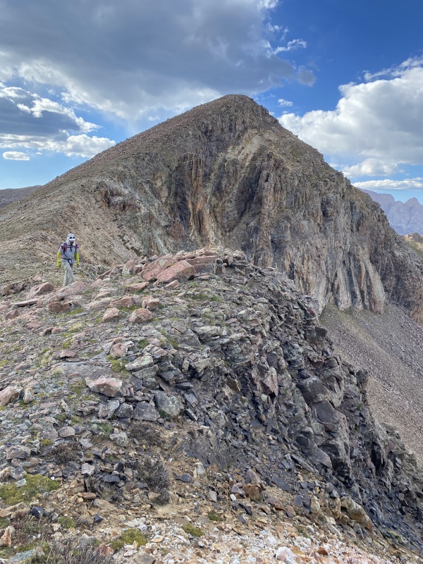
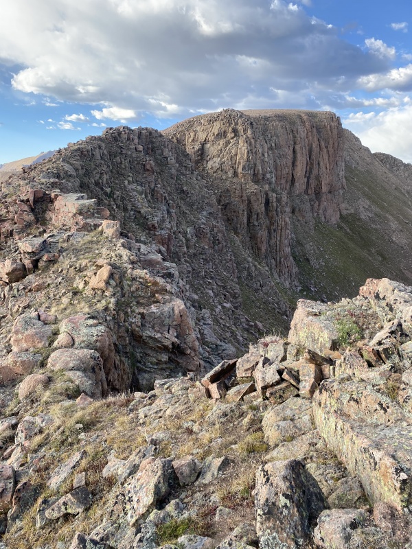
We continued our hike north up Silver Mesa, then crossed the head of Missouri Gulch (not the Missouri Gulch of Sawatch fourteener fame, obviously) under Aztec Mountain. Mount Kennedy was the farthest west peak on our trip, and we aimed to start with it and then bag Aztec Mountain, Bullion Mountain, Silver Mesa, Florida Mountain, and Mount Valois by running as much of the ridgeline as we could heading east. We figured that we could do those six before nightfall.
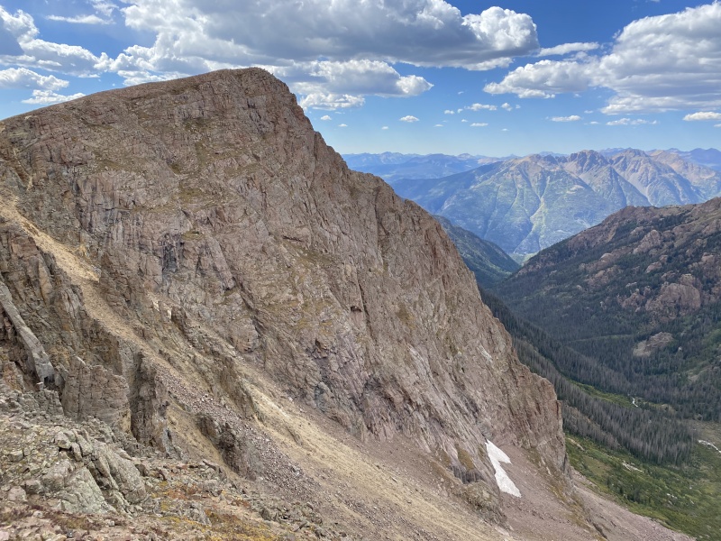
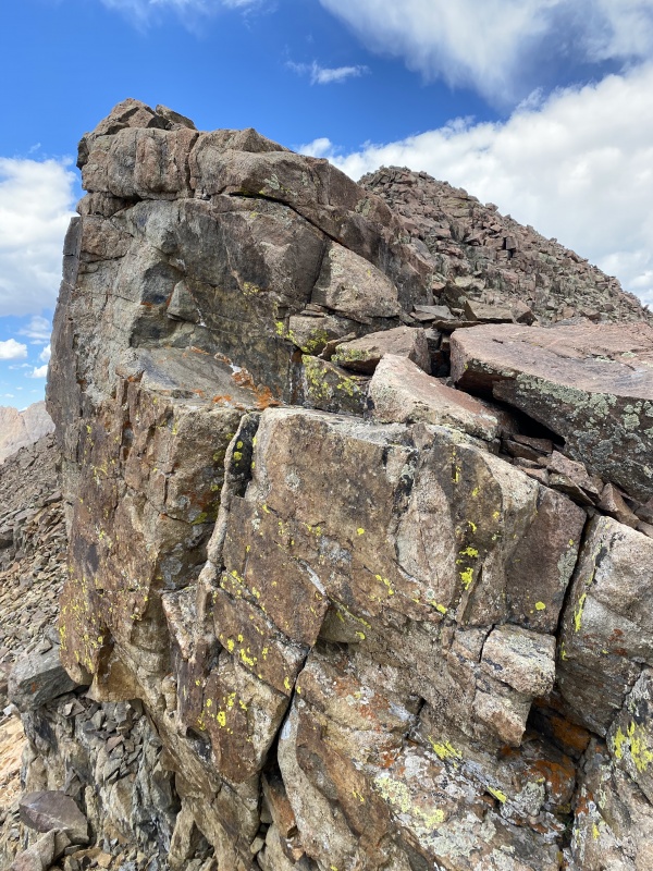
Mount Kennedy (right) and its western sub-summit (left).Quite the formidable looking wall. Mount Kennedy on the left, Aztec Mountain on the right.Bullion Mountain and vast stretches of mesa. Photo: Whiley H
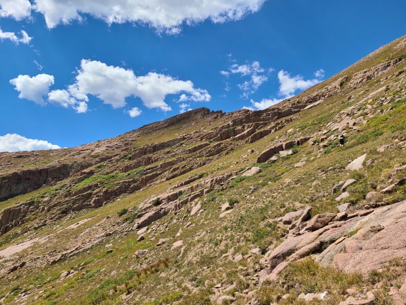
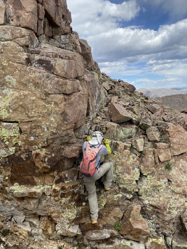
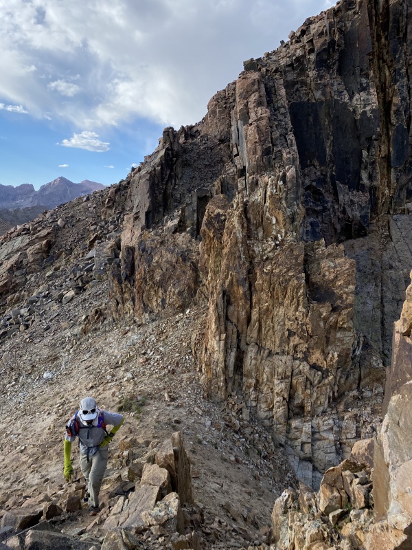
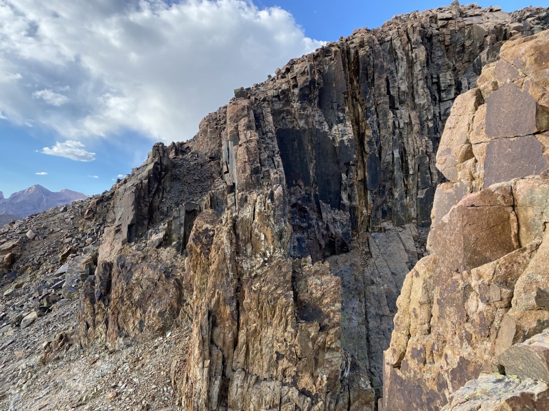
As we rounded the head of Missouri Gulch we had to begin taking our route more seriously. Aztec would be a steep and scrambly affair, and Kennedy a bob-and-weave up grass and around exposed granite blocks.
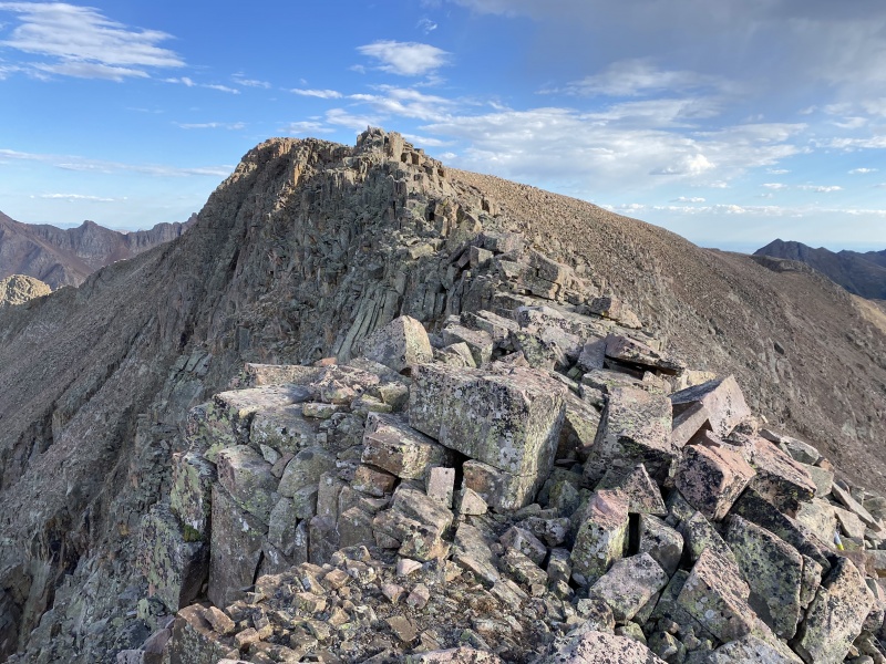
Interesting, slabby terrain up Mount Kennedy.Looking down into Missouri Gulch. Photo: Whiley H.More rock on Kennedy. Photo: Whiley H.
Kennedy's upper slopes gave way to grass and boulders instead of the giant blocks, and we decided to go to its western sub-summit since it was only a few minutes away.
Nearing Kennedy
East along the many mesas. Bullion and Valois in sunlight with Emerson, Peak Twenty One, and Sheep D on the right. Photo: Whiley H.Kennedy's western sub-summit. It ain't much to look at... Photo: Whiley H....but its views make up for it. Photo: Whiley H.West towards the West Needle Mountains group.Chicago Basin with the Pigeon/Turret group on the left. Ahh, the Weminuche.
We gawped at the peaks around us for a minute or two then headed to Kennedy's main summit.
Mighty Kennedy.
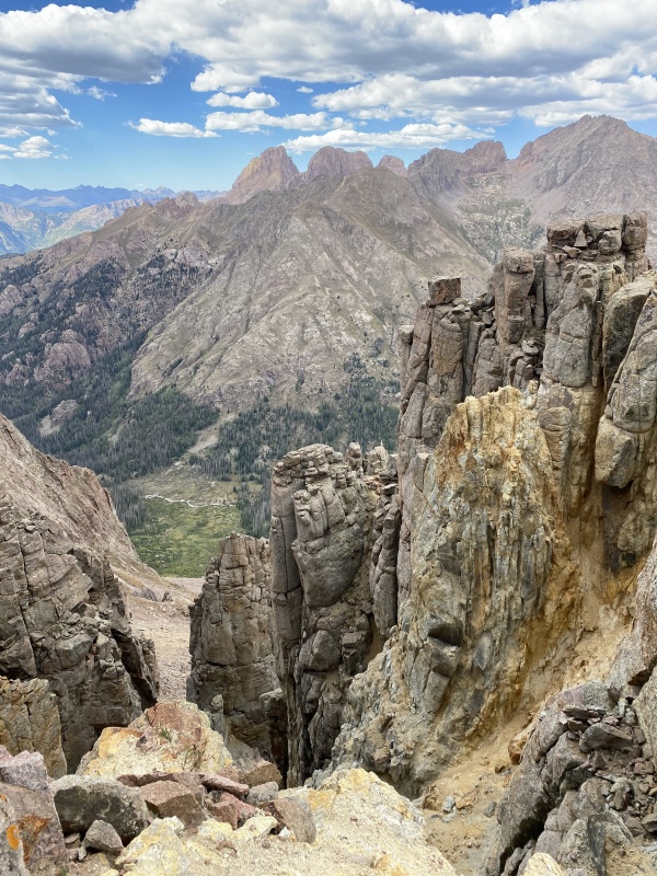
The drops north into Chicago Basin are steep, eroded and impressive. We probably took way too many pictures down the north wall, but there was some seriously cool stuff along the way.
Wanna take a trip to Chicago? Photo: Whiley H.Aztec with a side trip to Chossville. Photo: Whiley H.Lumpy towers en route to Aztec. Photo: Whiley H.Mass monsters. Photo: Whiley H.
The ridge to the saddle contained some minor scrambling, but in general it was easier to simply skirt it all. Rock quality wasn't always top notch either.
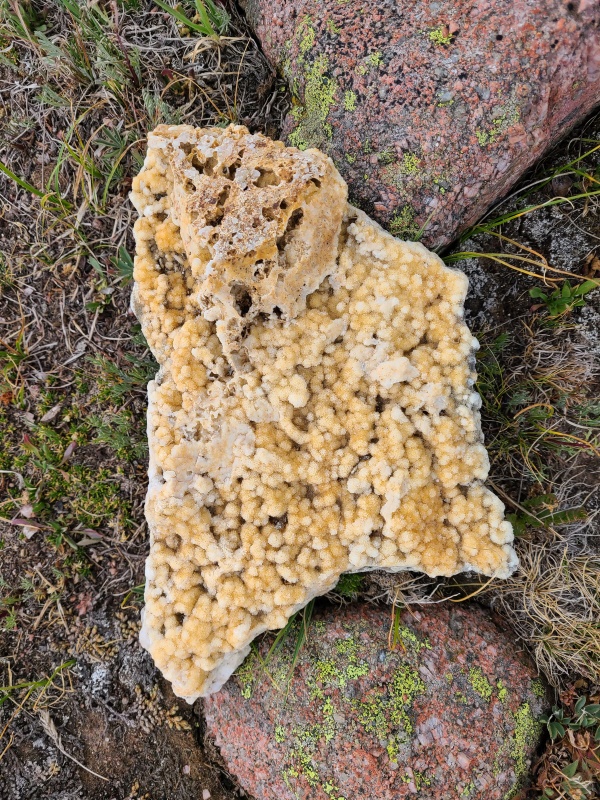
Blobs for days. Photo: Whiley H.A look back on Kennedy. It looks like it could be climbed from Chicago Basin, but it might suck. Photo: Whiley H.Neat fuzzy crystal rock along the ridge.
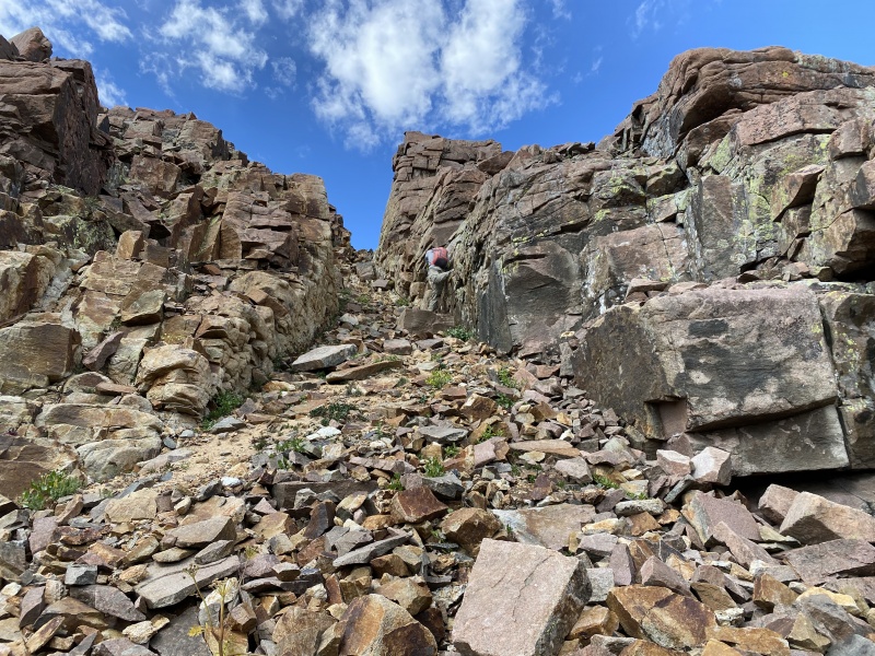
As we approached Aztec we got to do some scrambling, pretty much the only good scrambling of the day.
Steep rock up Aztec. Photo: Whiley H.Multi-colored fractures. Photo: Whiley H.Ledges to the Aztec temple. Photo: Whiley H.Gully to nowhere. Photo: Whiley H.Pinks and greens and grays, oh my!
The scrambling we encountered went at about Class 3, though from the southeast, and with better route finding, Aztec could be kept to Class 2+.
Big blocks that are more stable than they look. Photo: Whiley H.Aztec's northwest ridge into Chicago Basin. Photo: Whiley H.
We summited Aztec and quickly left for Bullion. The views were better from Kennedy anyway, especially the western summit.
Heading towards Bullion. Photo: Whiley H.
The ridge to Bullion looked rotten and time consuming. We could see its southern flank and guessed that would be easier and faster to drop back towards Missouri Gulch than try and traverse the ridge, even if it meant eating more elevation loss and re-gain.
Colorful but ultimately a chosspile.More Chi Basin. Photo: Whiley H.
We backtracked slightly to the west and dropped down steep Class 3 slabs, blocks, and gullies.
Descending Aztec. Photo: Whiley H.Some rather good scrambling. Photo: Whiley H.
I didn't think the down climb off Aztec was as good as the climb up, and it felt a little harder. Again, it probably could have been easier but we mostly just took whatever option was right in front of us. From the transition between rock and grass in the gulch we headed due east towards Bullion.
A lump known as Bullion Mountain. Bullion Mountain, also known as a lump.
Progress across the grassy flats was fast, certainly faster than the ridge would have been, and we quickly found ourselves below Bullion's hideous and smashed up southern side.
Crossing Silver Mesa again. The difficulties of the ridge are apparent. Photo: Whiley H.Oh boy! Huge piles of broken, angular talus and boulders!
At least the views back to the west were pretty dope...
Diamond necklace on Aztec. Photo: Whiley H.
We made the climb up Bullion as short and fast as possible because it was the least pleasant of our six peaks. Overall the route went at a pretty rough Class 2+ with plenty of clamoring over the mess of broken rock that makes up the entire peak.
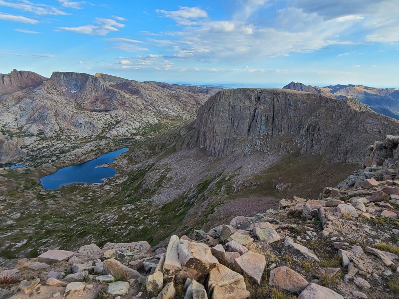
Is there such thing as too many photos of Chicago Basin? I think not. Photo: Whiley H.Easier ground towards Silver Mesa (foreground), Trimble Pass, and Florida Mountain (left).
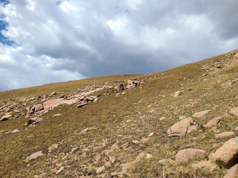
With three more peaks to go, and not much desire to remain on broken Bullion, we headed southeast towards Silver Mesa which, considering it has a whopping 120 feet of prominence, barely qualifies as a peak. That said, it's not about the peak itself - look at a topo map and Silver Mesa stretches in a north-south line for miles - this is simply the highest point of the landform.
More janky rock coming down Bullion, but it was not to last. Photo: Whiley H.Photo: Whiley H.Vallecito Basin. Photo: Whiley H.Impressive north wall of Bullion and Aztec. Photo: Whiley H.
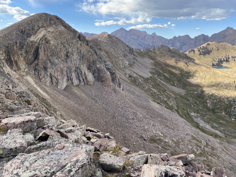
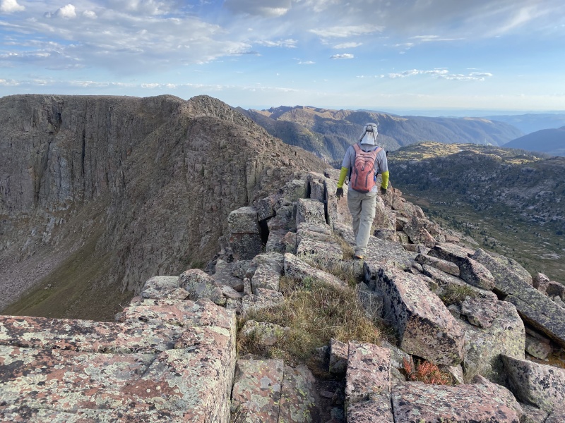
Silver Mesa was pretty much not a thing, merely a bump along the ridge, so we continued on towards Trimble Pass and Florida Mountain, also really not a thing, merely the peak at the head of Crystal Valley.
Descending Silver Mesa towards Trimble Pass, where the trail is visible into Vallecito Basin. Photo: Whiley H.Closer shot of Trimble Pass.
All of the terrain between Silver Mesa and Florida was nice and easy. From Bullion all the way to Florida took us less than 30 minutes total.
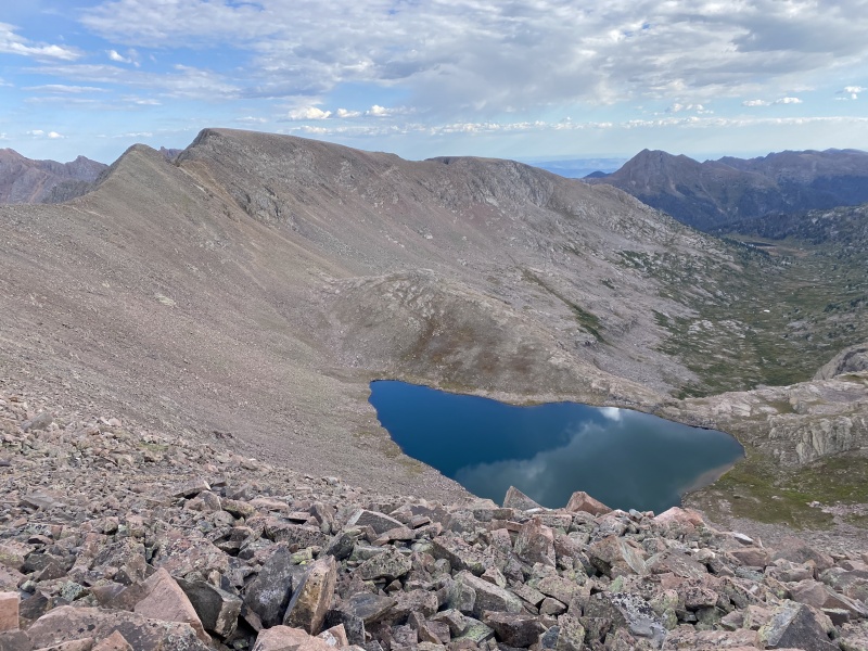
Summit of Florida Mountain. Photo: Whiley H.Johnson Creek cutting a deep channel through the basin. Hope Mountain left of center, Grizzly Peak C in center skyline, and McCauley Peak on the right.Long ridge to Mount Valois, with Lillie Lake and Sheridan Mountain along for the ride. Photo: Whiley H.
From Florida Valois looked easy, though we couldn't see the whole ridge, and near the summit it looked like some scrambling may lurk. It was entirely talus all the way across, and afternoon was clearly upon us. We had to go fast to get down before dark.
That's a lot of talus hopping, and some unknowns at the end of the ridge. Photo: Whiley H.There's enough rock for everyone here. Photo: Whiley H.Nearing the big bump prior to the unknown section of ridge. Photo: Whiley H.
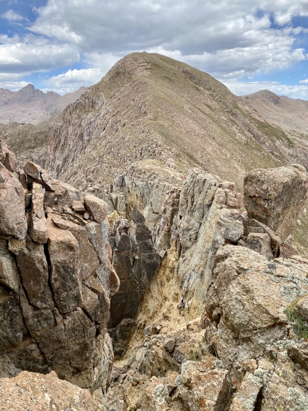
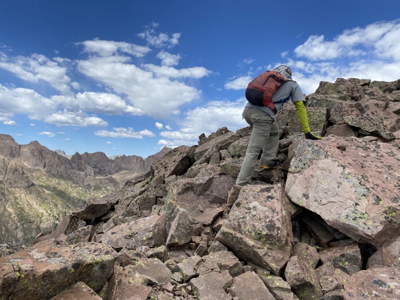
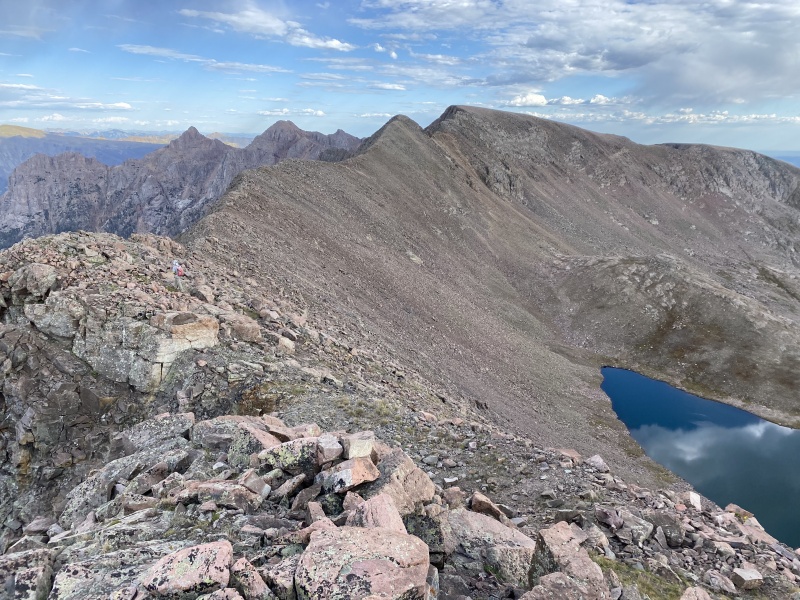
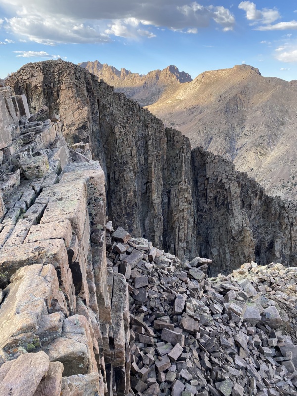
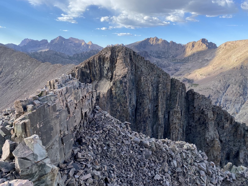
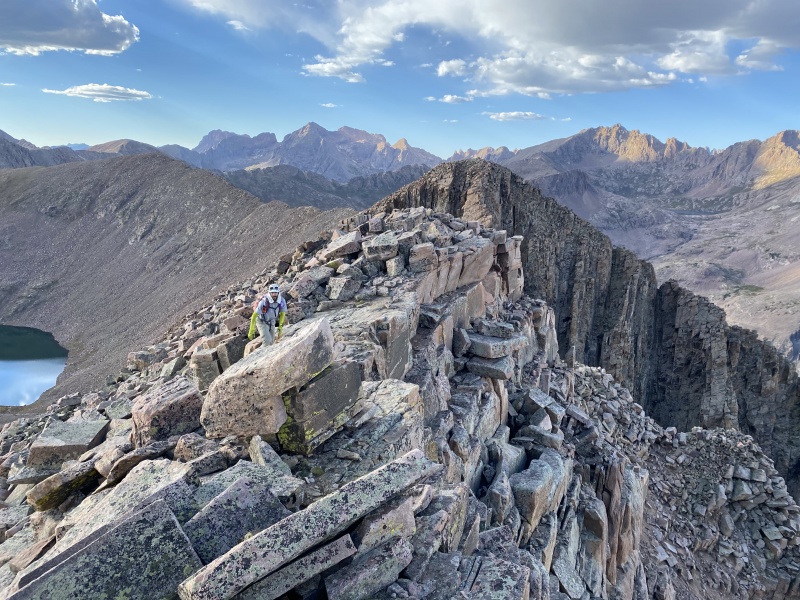
The first two thirds of the ridge was indeed humdrum talus without a whole lot of quality to it, but the last third was where the money was. There wasn't a whole lot of scrambling, some Class 2+ and even then not much, but the rock on the upper reaches was spectacular, eye-popping geology.
Rounding the corner to fun.A look back towards Lillie Lake. Photo: Whiley H.Unholy towers. Photo: Whiley H.Majesty. Photo: Whiley H.Easy walk, hard rock. Photo: Whiley H.Like a 285-layer cake. Don't eat this though. It's worse for your teeth than cake. Photo: Whiley H.Wild uplifted bedding. Photo: Whiley H.I am never disappointed in the Weminuche. Photo: Whiley H.
The closer we got to the summit the more fun the ridge became, and the more solid the rock was.
Better than good, it's great! Photo: Whiley H.
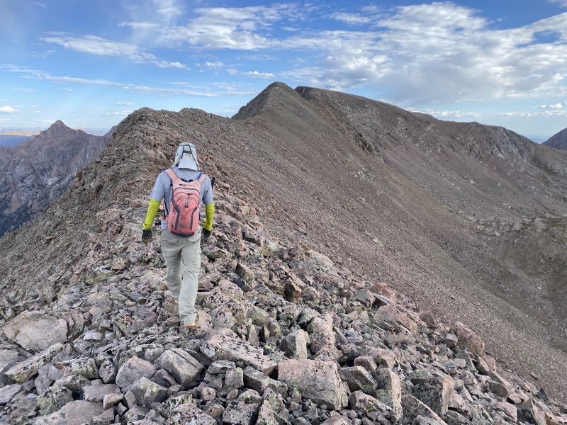
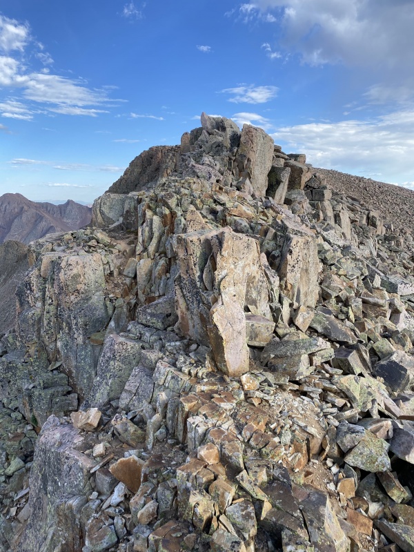
The majority of the scrambling on the ridge to Valois came right at the end.
Pearly whites. Photo: Whiley H.Dubious but enjoyable. Photo: Whiley H.The last of it. Photo: Whiley H.
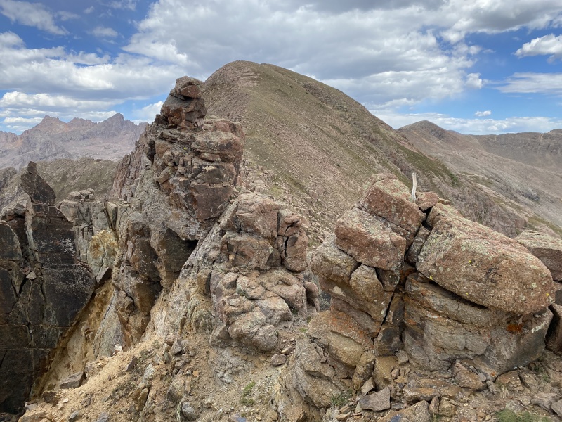
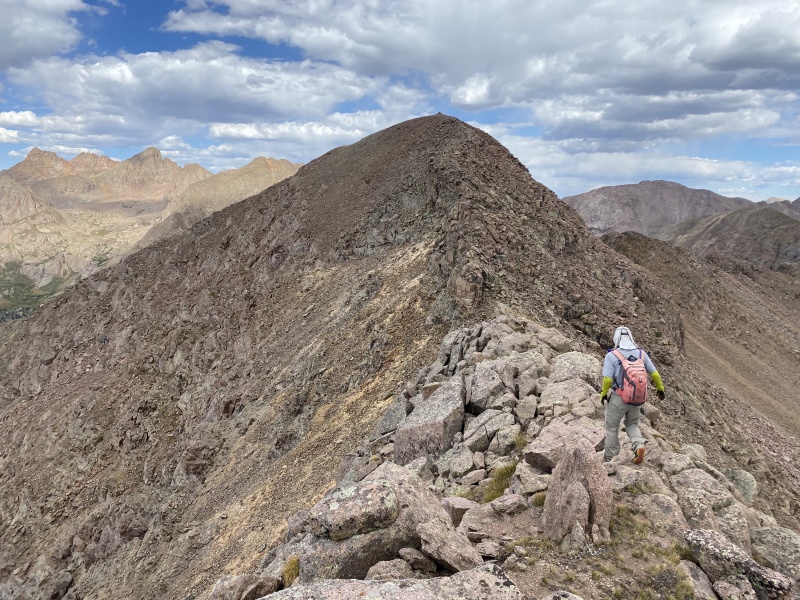
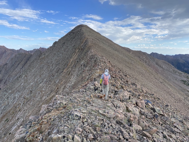
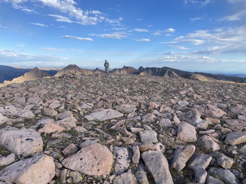
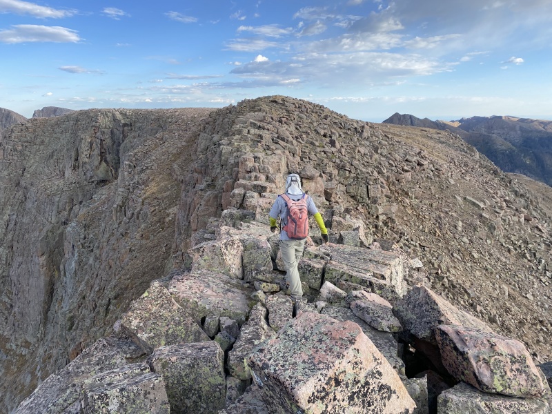
Eventually the ridge relented into a big, flat area carpeted in granite and then the pancake summit.
Almost there.The wee summit cairn of massive Valois. Photo: Whiley H.Chicago Basin and Vallecito Basin in one shot. Photo: Whiley H.Organ, Amherst, and a large chunk of tomorrow.
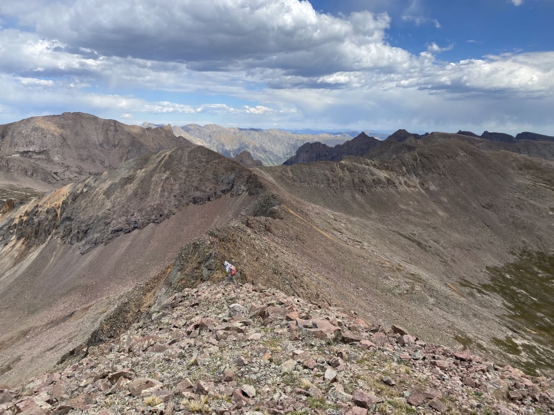
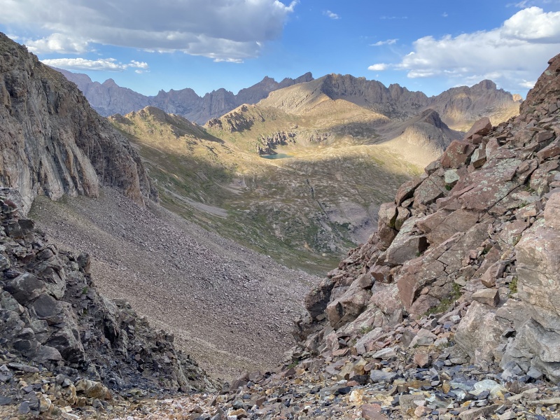
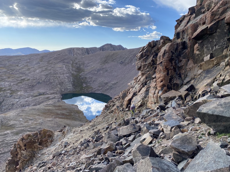
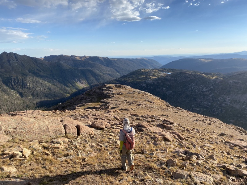
We drank in the shining views from Valois and then beat feet down its south ridge, a mix of grass and embedded granite talus. The eastern cirque was a sheer wall; the western slopes also ended in cliffs; in the middle the ridge narrowed almost to a catwalk, and re-expanded into a rounded bulb after.
Beginning down the south ridge. Photo: Whiley H.
Western cirque with Castilleja Lake below.Getting squeezed. Photo: Whiley H.The long stretch across Crystal Valley all the way to Mount Kennedy and beyond. Photo: Whiley H.Near the end of the catwalk-like section, looking towards the summit. Photo: Whiley H.In the middle of infinity. Photo: Whiley H.
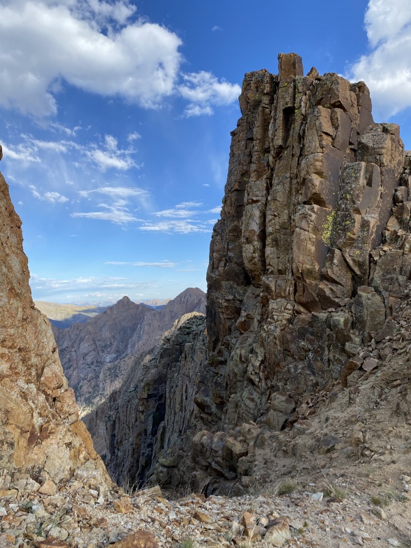
Past the catwalk the ridge opened wide and the rock shifted slightly from the good white granite to slightly friable red granite. We weren't sure exactly where to descend to get down safely, and tried to descend directly west into Crystal Valley.
Growing shadows. Photo: Whiley H.
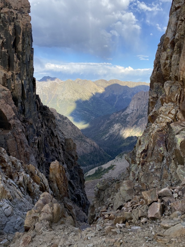
The slopes down seemed to terminate in cliffs, as best we could tell, and we didn't feel like picking our way down through them if such a thing were possible. We stuck close to the western edge of the ridge and continued south, slowly losing elevation in our search for a break to the valley. As we descended the broken rock melded into cohesive slabs and then big, exposed blocks. We never had to do any real scrambling but there was plenty of route finding to get down the ridge.
Still not a clear way down, but getting better. Photo: Whiley H.A not-really-chockstone and a midget. Photo: Whiley H.
Eventually we were simply descending among huge, open expanses of granite occasionally cut with grassy passages, but overall the lower ridge was dominated by a sea of rock. It seemed improbable at the time but we twisted our way through the maze, hoping not to get cliffed out, and suddenly found ourselves in the forest at the bottom of the ridge. We were close to the trail through the valley, so we continued to Lake Marie and then the trail to camp.
Toe of Valois' south ridge.Sheridan in evening light. Photo: Whiley H.
Valois' south ridge was easily the highlight of the day. The entire ridge basically being one continuous piece of rock was pretty neat, and is always a treat and marvel of nature. Our return to camp at this point was easy and we arrived with a fair amount of daylight remaining. We filtered water, cooked dinner, and went to bed early for a second big day of mountains. Endlich Mesa was already a favorite, something I can usually say takes time to grow, and my dreams were full of peaks.
Au revoir, Valois. Photo: Whiley H.
Statistics
Climbers: Ben Feinstein (myself), Whiley H. Trailhead: Endlich Mesa
Total distance: 6.86 miles (approach) + 12.74 miles (peaks) = 19.6 miles Total elevation gain: 1,238 feet (approach) + 4,955 feet (peaks) = 6,193 feet Total time: 2:26:24 (approach) + 7:05:08 (peaks) = 9:31:32 Peaks: Two ranked thirteeners, four unranked thirteeners
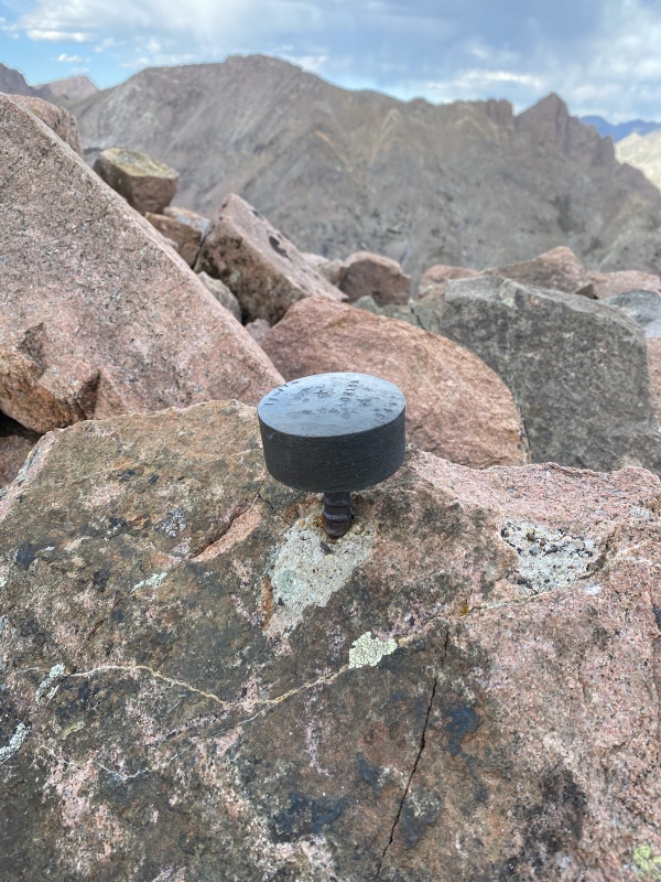
Mount Kennedy, 13,125' (unranked)
Aztec Mountain, 13,310'
Bullion Mountain, 13,182' (unranked)
Silver Mesa, 13,060' (unranked)
Florida Mountain, 13,076' (unranked)
Mount Valois, 13,185'
Splits:
Starting Location
Ending Location
Via Time (h:mm:ss)
Cumulative Time (h:mm:ss)
Rest Time (m:ss)
Endlich Mesa Trailhead
City Reservoir Camp
2:26:24
2:26:24
Segment End
City Reservoir Camp
Mount Kennedy (west summit)
2:37:47
2:37:47
0:00
Mount Kennedy (west summit)
Mount Kennedy (main summit)
0:10:41
2:48:28
0:00
Mount Kennedy (main summit)
Aztec Mountain
0:34:36
3:23:04
12:25
Aztec Mountain
Bullion Mountain
1:01:16
4:36:45
0:00
Bullion Mountain
Silver Mesa
0:13:31
4:50:13
0:00
Silver Mesa
Florida Mountain
0:14:33
5:04:47
0:00
Florida Mountain
Mount Valois
0:35:47
5:40:34
0:00
Mount Valois
City Reservoir Camp
1:24:35
7:05:08
Overnight
Version history:
Date
Notes
April 20, 2021
Initial publication.
April 21, 2021
Incorrectly called Johnson Creek Vallecito River. There is no Vallecito River, and Johnson Creek drains into Vallecito Creek.
My GPS Tracks on Google Maps (made from a .GPX file upload):
Florida is Spanish and means, variously, small flower, flowery, full of flowers, etc. There was also a small community back in the 1800s in La Plata county called Florida. I'd imagine it wasn't the state that inspired the name of the peak, but rather that Florida is a descriptor!
I loved that area when I packed in there last July. The approach from Endlich Mesa is stupendous; the views start as distant promise and end in grandeur. You captured the beauty of those mountains well. Hitting Jupiter, Grizzly and McCauley from the south was sweet. I didn't get Aztec or Valois because of weather and didn't even mind. Valois is vast and presents differing views from its various angles, and I'm looking forward to getting back there even more, after reading this!
Caution: The information contained in this report may not be accurate and should not be the only resource used in preparation for your climb. Failure to have the necessary experience, physical conditioning, supplies or equipment can result in injury or death. 14ers.com and the author(s) of this report provide no warranties, either express or implied, that the information provided is accurate or reliable. By using the information provided, you agree to indemnify and hold harmless 14ers.com and the report author(s) with respect to any claims and demands against them, including any attorney fees and expenses. Please read the 14ers.com Safety and Disclaimer pages for more information.
Please respect private property: 14ers.com supports the rights of private landowners to determine how and by whom their land will be used. In Colorado, it is your responsibility to determine if land is private and to obtain the appropriate permission before entering the property.


")
")
")
")
")
")
")
")
")
")
")
")
")
")
")
")
")
")
")
")
")
")
")
")
")
")
")
")
")
")
")
")
")
")
")
")
")
")
")
")
")
")
")
")
")
")
")
")
")
")
")
")
")
")
")
")
")
")
")
")
")
")
")
")
")
")
")
")
")
")
")
")
")
")
")
")
")
")
")
")
")
")
")
")
")
")
")
")
")
")
")
")


