Download Agreement, Release, and Acknowledgement of Risk:
You (the person requesting this file download) fully understand mountain climbing ("Activity") involves risks and dangers of serious bodily injury, including permanent disability, paralysis, and death ("Risks") and you fully accept and assume all such risks and all responsibility for losses, costs, and damages you incur as a result of your participation in this Activity.
You acknowledge that information in the file you have chosen to download may not be accurate and may contain errors. You agree to assume all risks when using this information and agree to release and discharge 14ers.com, 14ers Inc. and the author(s) of such information (collectively, the "Released Parties").
You hereby discharge the Released Parties from all damages, actions, claims and liabilities of any nature, specifically including, but not limited to, damages, actions, claims and liabilities arising from or related to the negligence of the Released Parties. You further agree to indemnify, hold harmless and defend 14ers.com, 14ers Inc. and each of the other Released Parties from and against any loss, damage, liability and expense, including costs and attorney fees, incurred by 14ers.com, 14ers Inc. or any of the other Released Parties as a result of you using information provided on the 14ers.com or 14ers Inc. websites.
You have read this agreement, fully understand its terms and intend it to be a complete and unconditional release of all liability to the greatest extent allowed by law and agree that if any portion of this agreement is held to be invalid the balance, notwithstanding, shall continue in full force and effect.
By clicking "OK" you agree to these terms. If you DO NOT agree, click "Cancel"...
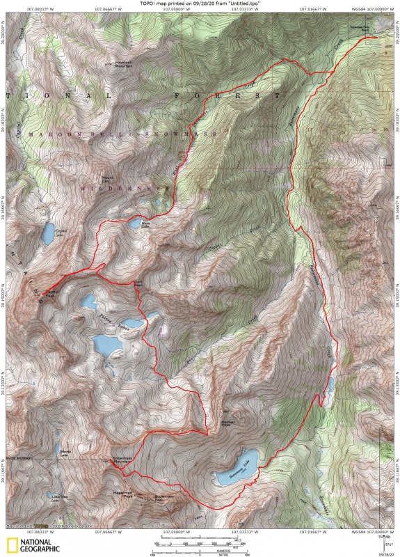
Thought I would share my recent linkup of Snowmass Mtn, Clark Peak, and Capitol Peak as I have not seen it done very often. This would be my 8th time up Capitol and 7th time up Snowmass but never have I climbed them in the month of September and never have I thought about combining them in the same outing. Looking at a map in preparation, I decided I would try to include Clark Peak as well as it was the last peak I needed for the Bicentennials outside of 17 remaining in the San Juans.
Route taken in clockwise direction.
I drove to the Snowmass Creek Trailhead Saturday night and passed many cars parked along the narrow road leading to an overflowing parking lot. My timing was perfect as I took the last remaining spot just as a car was just pulling out. I set my alarm for 4:30 and slept as well as expected in the back of my car.
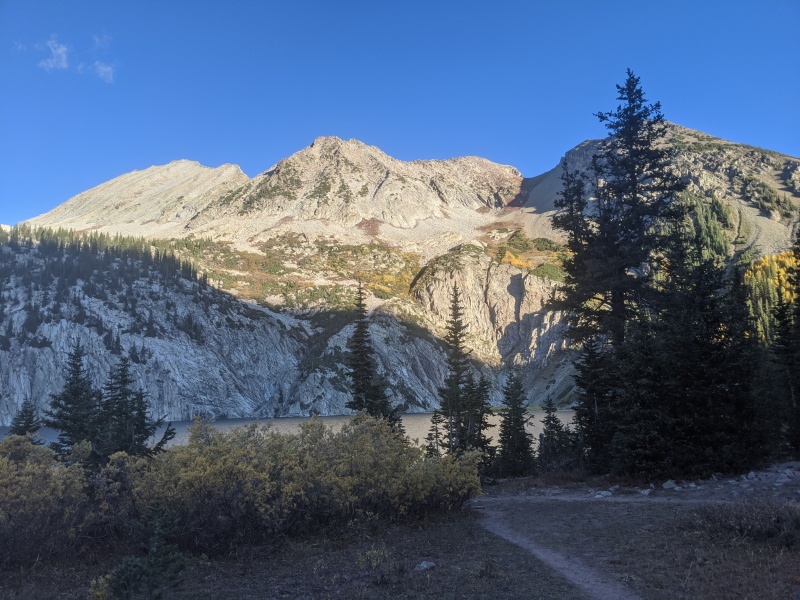
I headed out at 5:00am on the standard Snowmass Creek approach to Snowmass Lake. At the lake, I ended up taking the high trail which leads to Trail Rider pass. I was definitely getting high above the lake and just decided to keep going until I could leave the trail and traverse under Snowmass Peak and Hagerman Peak to rejoin the standard route up the East Slopes of Snowmass Mtn. I passed a number of parties heading up to the Hagerman-Snowmass ridge and then quickly scrambled to the Snowmass Summit just before 10:00am.
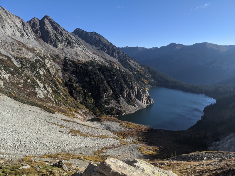
Just above Snowmass Lake, the view of Snowmass Peak on the left and Snowmass and N. Snowmass in the distance to the rightAt Snowmass Lake, this shows the ridge heading East from North Snowmass and the Saddle I will use to access Pierre Lakes BasinTraversing from Trailrider Pass trail underneath Snowmass Peak to access standard East slopes route
I then proceeded back down the way I came to the Hagerman-Snowmass ridge, but then dropped a bit to the Northeast avoiding the initial difficulties of the Ridge heading directly east from North Snowmass. Before losing too much elevation, I gained this easterly heading ridge and stayed on the ridge proper all the way to a saddle which I assumed to be Heckert pass, high above Snowmass Lake.
Heading towards Heckert PassLooking back to Snowmass Mtn and N. Snowmass
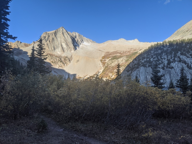
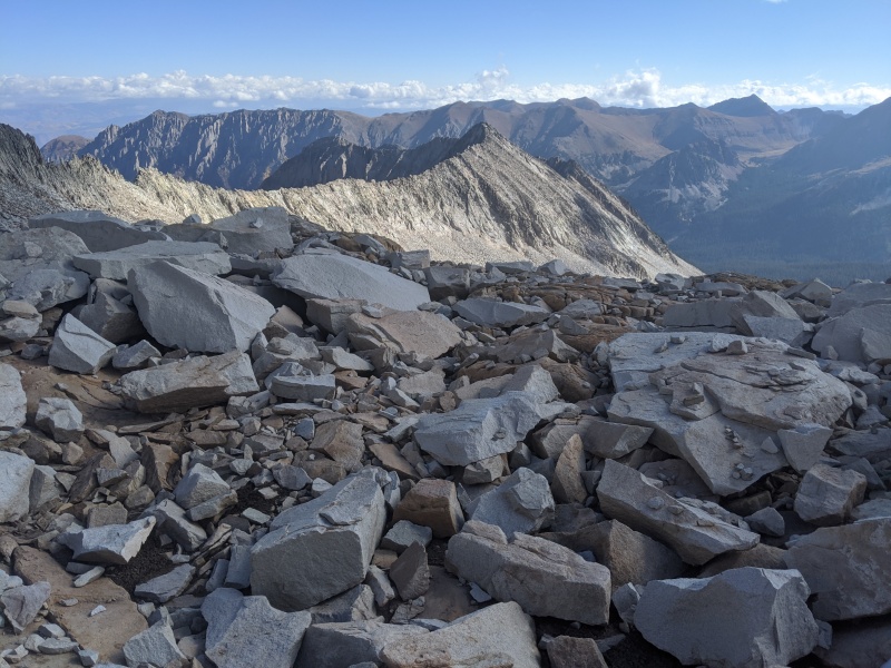
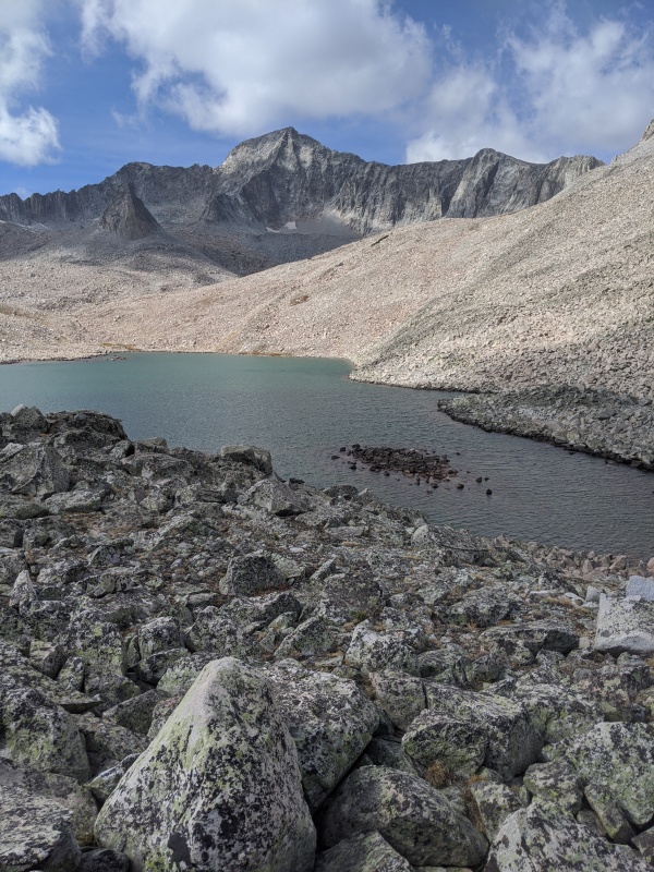
Looking Back at Northeast face of North SnowmassAlpine view of Capitol and Clark Peaks above Pierre Lakes Basin
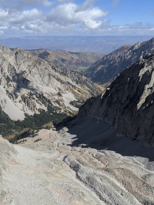
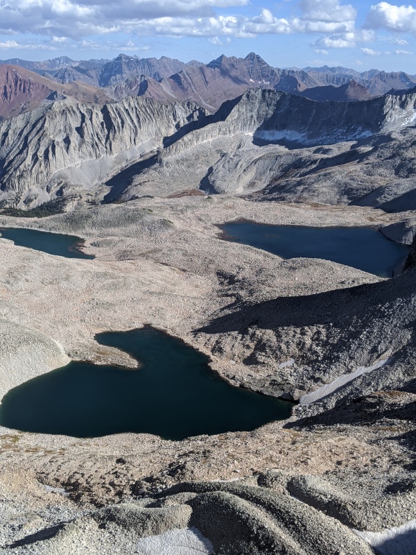
Here, I travelled down a rotten gulley to the north and traversed Northwest around a ridge to enter the Pierre Lakes Basin. I stopped at Bear Creek for a quick cold soak of the feet and to refill my two Gatorade bottles. The walk across this basin provided great views of golden aspen groves down in the valley, Capitol Peak, the Northeast Face of North Snowmass, and more importantly my next destination, Clark Peak.
Gully which will give me access to Bear Creek and the Pierre Lakes
View of Capitol Peak from the Southeast
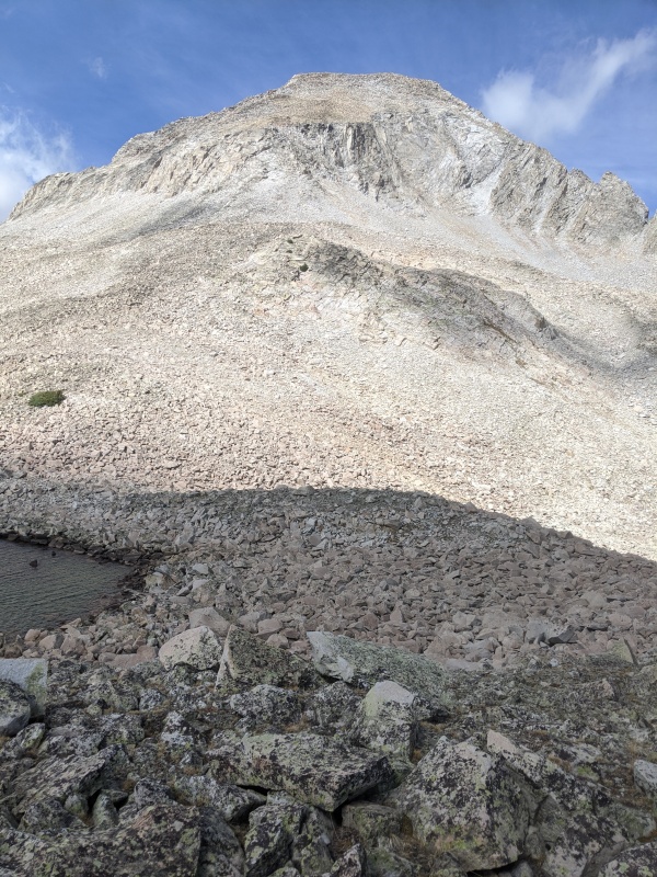
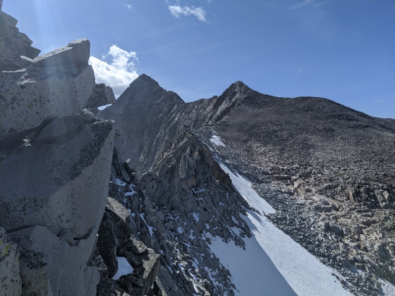
Looking at the Southern aspect of Clark Peak
The climb up the South slopes of Clark was pretty fun with some rock hopping and a little class 3 scrambling. The views from the summit were astonishing as I arrived at 2:30. After a quick signature in the summit register and a text message sent to Brad McQueen as he signed the register the day before, I was headed down to the West along a ridge that would lead me to the standard route heading to K2 and ultimately the Knife edge to Capitol.
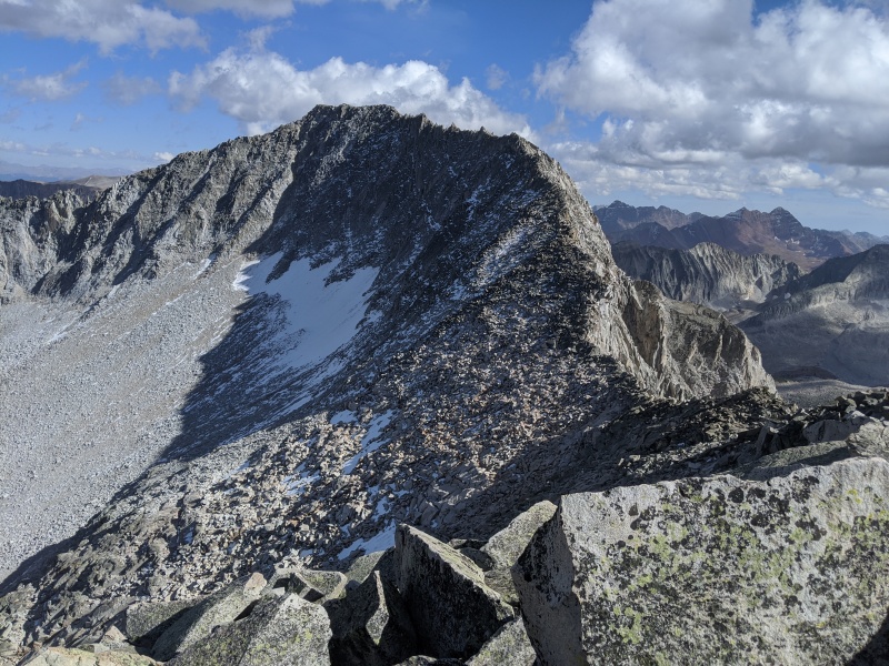
Looking back to Clark Peak while trying to get to K2Descending into basin between Daly and Clark peaks. Looking at K2 and Capitol Peak
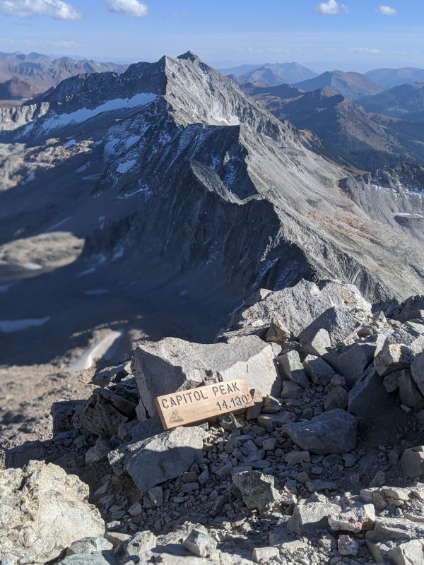
I met a couple just exiting the Knife edge and then I scampered up the ridge direct to have the Capitol summit alone at 4:45pm. After a quick bite to eat and some picture taking, I was headed down to exit via West Snowmass Creek passing by Moon Lake, where I soon lost sunlight and was required to travel through an avalanche debris field by headlamp. Up and over many downed trees was quite exhausting but I made it back to the car for a 16 and half hour adventure.
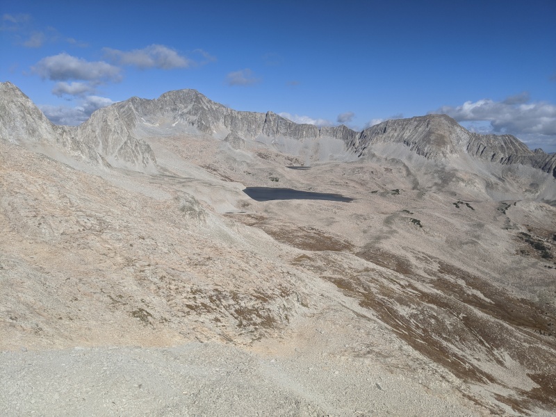
Looking back at the Bells and showing most of route from Heckert pass through Pierre Lakes Basin
On Capitol Summit looking south to Snowmass
Thumbnails for uploaded photos (click to open slideshow):
John, just how fast are you?
I didn't see that sign on the top of Cap early that day, so someone must have left it that afternoon. I did see a guy carrying a sign up, could have been him.
Did you see Brad's tent on the way out below Moon Lake?
And there is a trail in the trees that goes around the avy debris, but that would have been hard to find in the dark. GPX in my Cap TR.
Thanks hoganthepic and climbnowworklater, definitely a route worth trying! Nice thing is the technical difficulty was kept to a minimum and all the rock hopping keeps your speed up. Really fun!
Thanks Joel, I'm just end of summer fit I think. I was definitely right of your track heading down, too far south in the ravine and the downed timber. I'll try your route when I'm back there again. Congrats on your summit!
Man, that was amazing. Great shots. Was curious about doing something like this, but not familiar enough with the area. You've obviously got plenty of experience. Thanks for sharing. This will be a great reference should I ever decide to try. Great work man...BOLD!!!
Thanks Preston, tygr, Gandalf69!
Gandalf69, there is a sweet camping spot just below timber line in a group of trees near Bear Creek. Would make a great basecamp for hitting some peaks.
Any thoughts on threading the needle over the Snowmass/Cap saddle (Satan's Traverse) and going up/down the back side of Snowmass. Seems like that's the standard Elks traverse route.
Caution: The information contained in this report may not be accurate and should not be the only resource used in preparation for your climb. Failure to have the necessary experience, physical conditioning, supplies or equipment can result in injury or death. 14ers.com and the author(s) of this report provide no warranties, either express or implied, that the information provided is accurate or reliable. By using the information provided, you agree to indemnify and hold harmless 14ers.com and the report author(s) with respect to any claims and demands against them, including any attorney fees and expenses. Please read the 14ers.com Safety and Disclaimer pages for more information.
Please respect private property: 14ers.com supports the rights of private landowners to determine how and by whom their land will be used. In Colorado, it is your responsibility to determine if land is private and to obtain the appropriate permission before entering the property.


")
")
")
")
")
")
")
")
")
")
")
")
")
")
")
")
")
")
")
")
")
")
")
")