Download Agreement, Release, and Acknowledgement of Risk:
You (the person requesting this file download) fully understand mountain climbing ("Activity") involves risks and dangers of serious bodily injury, including permanent disability, paralysis, and death ("Risks") and you fully accept and assume all such risks and all responsibility for losses, costs, and damages you incur as a result of your participation in this Activity.
You acknowledge that information in the file you have chosen to download may not be accurate and may contain errors. You agree to assume all risks when using this information and agree to release and discharge 14ers.com, 14ers Inc. and the author(s) of such information (collectively, the "Released Parties").
You hereby discharge the Released Parties from all damages, actions, claims and liabilities of any nature, specifically including, but not limited to, damages, actions, claims and liabilities arising from or related to the negligence of the Released Parties. You further agree to indemnify, hold harmless and defend 14ers.com, 14ers Inc. and each of the other Released Parties from and against any loss, damage, liability and expense, including costs and attorney fees, incurred by 14ers.com, 14ers Inc. or any of the other Released Parties as a result of you using information provided on the 14ers.com or 14ers Inc. websites.
You have read this agreement, fully understand its terms and intend it to be a complete and unconditional release of all liability to the greatest extent allowed by law and agree that if any portion of this agreement is held to be invalid the balance, notwithstanding, shall continue in full force and effect.
By clicking "OK" you agree to these terms. If you DO NOT agree, click "Cancel"...
Crew: Kirsten (koffeling), Katie (kmikwilliams), Brian (BKS).
Trailhead: Beartown/Hunchback pass.
Approach: Kodiak High Route via Stormy Gulch.
Distance: It seemed much longer than the mileage and elevation stats on paper.
Gear: Overnight pack & gear, 30 m rope, BD C4 Cams: 2.0, 1.0, .75 and .5, slings, belay device, biners, etc.
Introduction:
This one meant more than most. This is the story of why that is so.
In December of 2019 Rose (Angry) started a new thread seeking partners for Centennials. The result was that a group of 5 gelled as we checked the box for Silverheels, Clinton, and Cronin that winter. I cannot say how grateful I am for such superb partners. Not to go all Jack Nickolas, but “they have made me want to be a better mountaineer.”
Four of the group on first Jagged attempt. Tom (Osprey) not pictured.
The first attempt on Jagged was in early October 2019. I had the nagging feeling that I simply was not ready for a more technical peak. I had owned a harness and climbing shoes for a mere 2 weeks, had only recently learned to tie a figure 8 knot, and had never rappelled. No, I was not ready, but the group was going, and I did not know when there would be a rope gun like Eric (yaktoleft13) willing to lead the pitches and top rope me. We had success one week earlier on Teakettle relying on Eric’s abilities. So off to the San Juan’s it was.
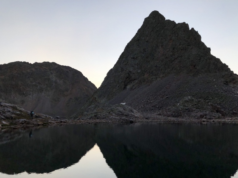
Upon reaching Jagged pass we were greeted by this snowyview... Eric set our summit chances at 35%.
Snowy Jagged October 2019.
Upon reaching crux 1 and fumbling around on snow- and ice-covered slabs over exposure for an hour, Kirsten and I decided it was best to call it. Rose and Eric were successful that day. Eric’s TR from that day is one of the best on the Jagged page. https://www.14ers.com/php14ers/tripreport.php?trip=19913
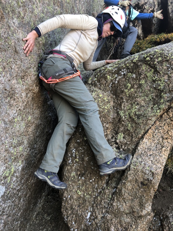
Kirsten and I calling it in the snow and ice at crux 1.
At that moment, my mind drifted to another lead climber and previous partner who is on the Centennial trek and needs Jagged. I thought, he could help me up this peak. Kirsten and I made a loose plan to try next year. Whenever I have failed on a peak, I feel the need to succeed with that partner.
A week later, I contracted Giardia. After a 2-3 month recovery I decided, I shouldn’t be relying on the mountaineering savvy of others to get me up any peak. The goal was set: I would develop the skills, knowledge, and experience to lead this myself. I joined Eric’s climbing gym (some might call it Earthtreks) and went 2x weekly. It was not so much to improve my climbing skills, but to get more comfortable in the vertical environment - for I only had a moderate tolerance for exposure. I did improve my top rope ability by two grades. I watched tons of you-tube videos on climbing, belaying, rappelling, building anchors, tying knots, and setting gear. Eric took me outdoors to climb and rappel. COVID certainly interrupted training, but I was in a much different place than a year earlier.
Kirsten embarked on a similar course of action. She started dating a guy who was a good climber. They went outside to climb quite a lot. She got competent and confident with multi-pitch climbs, rope work, rappelling, and safety checks. Along the way they got engaged and will be married in October. We wondered why we did not see Kirsten as much this summer! Congrats!
Our tentative plan for Labor Day became firm plans. I still hoped to recruit a rope gun as a backup, but no dice. I would need to lead; we would do Jagged… Yakless (without Eric or a real rope gun). As extra security, I asked to borrow some cams from Tom Pierce, the willing mentor and affable sage of 14ers.com. For those who do not know, Tom was a mentor to the all-time great 14ers.com mentor, Steve Gladbach. We also invited Katie who was my favorite partner from the 14er days and recent friend of Kirsten.
We had some planning parameters for the trip. Katie only had three days… no give there. Kirsten wanted to tack on Vestal, so she could finish the Centennials before the wedding. Based on a posted question, we decided to give it a try from Beartown and attempt a reasonably unknown route (at least to us), the Kodiak High Route. Boggy B suggested it as involving less vertical and mileage and would put us close to Vestal for the link up. I’ll provide review of route for those looking at that option.
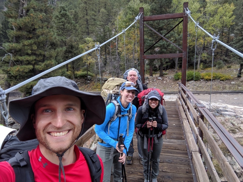
Silverton to Beartown
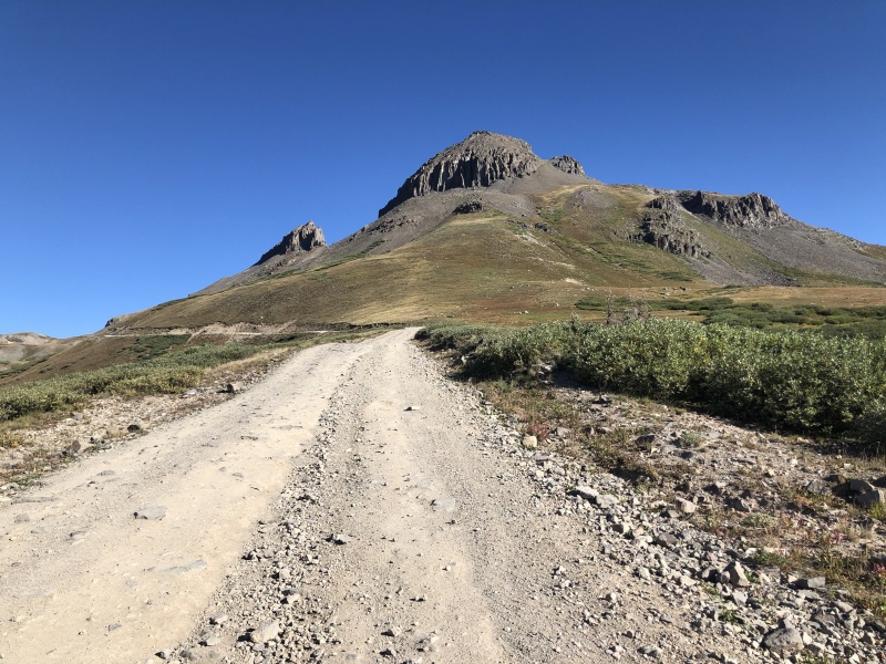
The loss of the train this year has no doubt complicated access to Jagged. The Beartown road is 50 miles roundtrip from Silverton to Hunchback pass trailhead. This is a legit 4WD road. Its up and over a major pass, Stony Pass, then a long journey through a valley to another steep rough climb leading to Hunchback TH and Kite Lake. Its 2 hours each way with what Elvis described as “a whole lot of shaking going on.”
Beartown road in an easier section. Looks like the Cimarron.
Katie’s 4 runner, Betty, went up everything “like butta”.
Katie, Betty and tire pump.
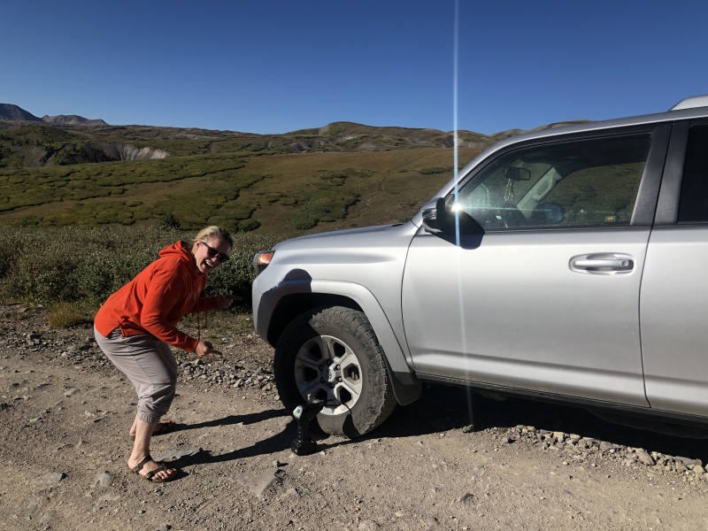
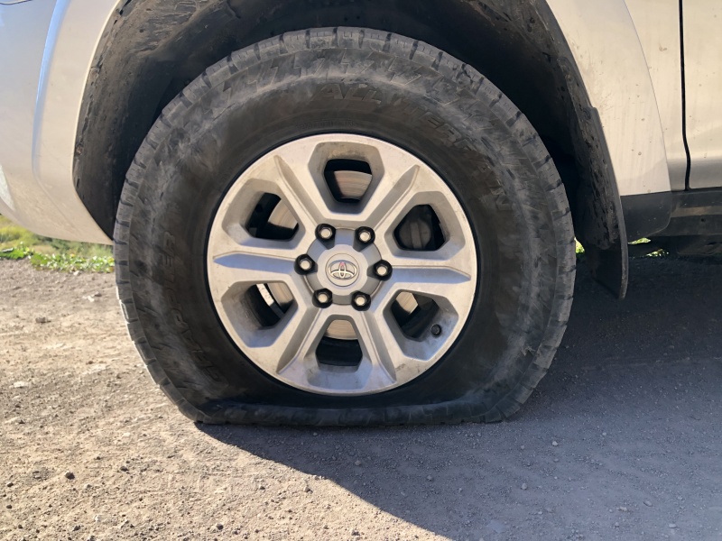
However Stony pass is well named, because one of the stones punctured a tire. Katie composed a little song on the spot. It went something like this:
Katie is a dufus…
Because she popped a tire.
Said tire.
I did a little fact checking on the song… Its only partially true.
Yes, she did “pop” a tire. Another 14er.com member can verify this.
Yes, Katie is a dufus. No question about it. Look it up:
Dufus (DO’ fus), (noun): a person possessing the positive trait of finding humor in less than ideal situations and silly stories. Example: Because Katie is a dufus, the flat tire was no big deal.
No, the blown tire had nothing to do with Katie being a dufus. This is just part of driving the Beartown road.
Some might think I am making fun of Katie here. The fact that she used the word, dufus was another positive mark for her in my mind. My family has long used the word after first seeing it in an animated kids movie, “Goofy”. Goofy told the Lester the possum to “beat it dufus”. I have been a fan of the word and regular user ever since.
Yeah, 2 hours, better have more than a Subaru, and bring a spare.
Hunchback Pass and up Stormy Gulch
Headed down from Hunchback pass into the Weminuche.
As a result of above incident, we did not get started to Hunchback pass until 11:30. We had our reservations for the Kodiak route, but given Kirsten's hope for Vestal, we committed to the route.
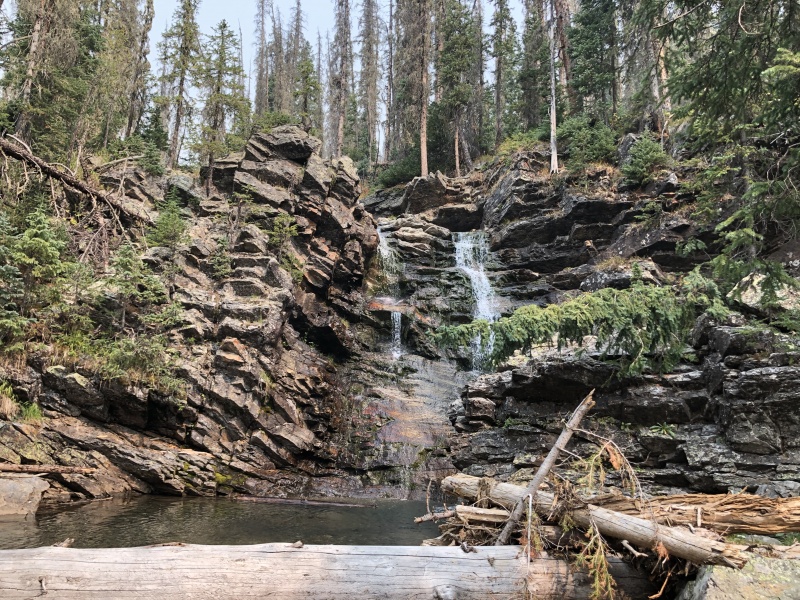
Waterfall at 10,700 on the Vallecito. We started up Stormy gulch here.
We exited the Vallecito trail at one of the last switchbacks before the Trinity creek crossing (10,700) at a very picturesque waterfall . It is about halfway between Nebo and Trinity creeks. A lightly used, but followable trail starts here. There is a fair bit of deadfall in the flat until it gets closer to Trinity Creek where the trail is quite good. There has not been enough traffic to kill all the grass, but it contains limited deadfall.
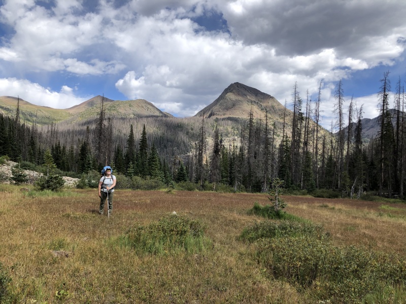
The meadow .
Trail goes through an idyllic meadow below Silex peak where another party was camped. This location has been referred to as the “dream site”. Shortly thereafter the introduction was over.
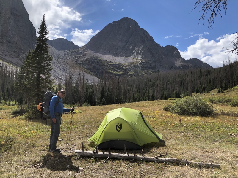
Hey look, we found Nemo.
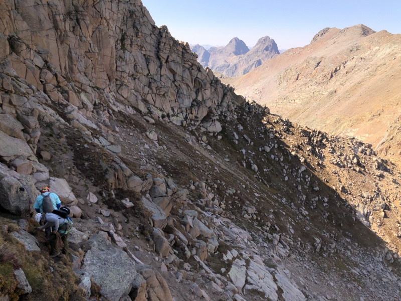
The route starts a steep loose climb up to Lake Silex.
Steep loose ascent to Lake Silex. Yeah, right through that ugly stuff. It's steep enough to make one wonder how far one would roll with a big pack.
Lake Silex is a rocky wonderland with only a couple of possibilities for a tent site in the rocks. Another steep talus field lies above the lake. It is a hard pull with a big pack to the Storm King – Peak 9 saddle at 12,800.
Storm King saddle at 12,800.
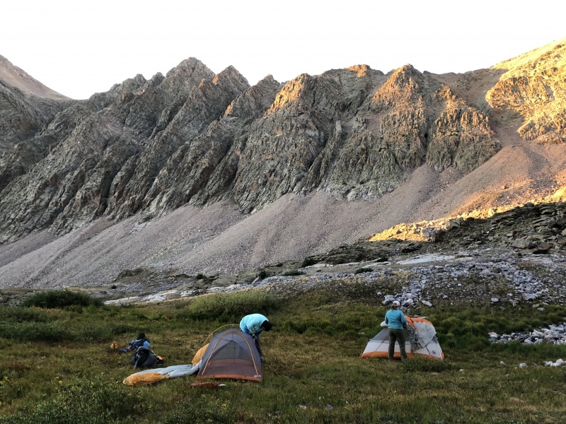
We had hoped to get further that first day, but steep, loose talus with big pack was taking a toll. We settled on a campsite in the meadow (12,400) below the pass, well above Balsam lake. The whole Grenadier group was beckoning from our camp. Here is where we picked up the Kodiak High Route. On the way back, we camped here again, talking after dark under the most spectacular sky I have ever seen.
Camp site at 12,400. Vestal and Trinities are just out of picture to the left.
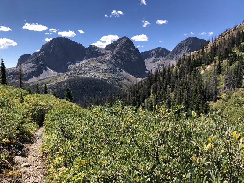
Kodiak High Route: Peak 7–8 saddle to Jagged pass.
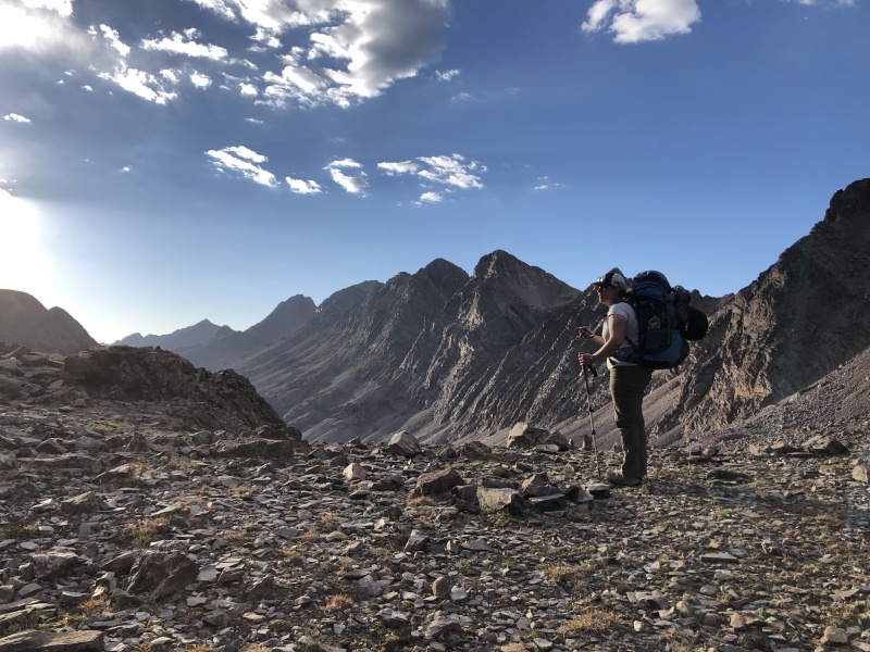
There is no question this is an utterly unique route. It connects multiple passes, basins, and lakes. We did not start until 6 am as we believed we needed daylight to navigate the initial headwall between Peaks 7–8.
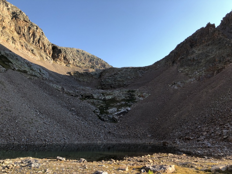
Small lake between Peaks 7 & 8 at sunrise.
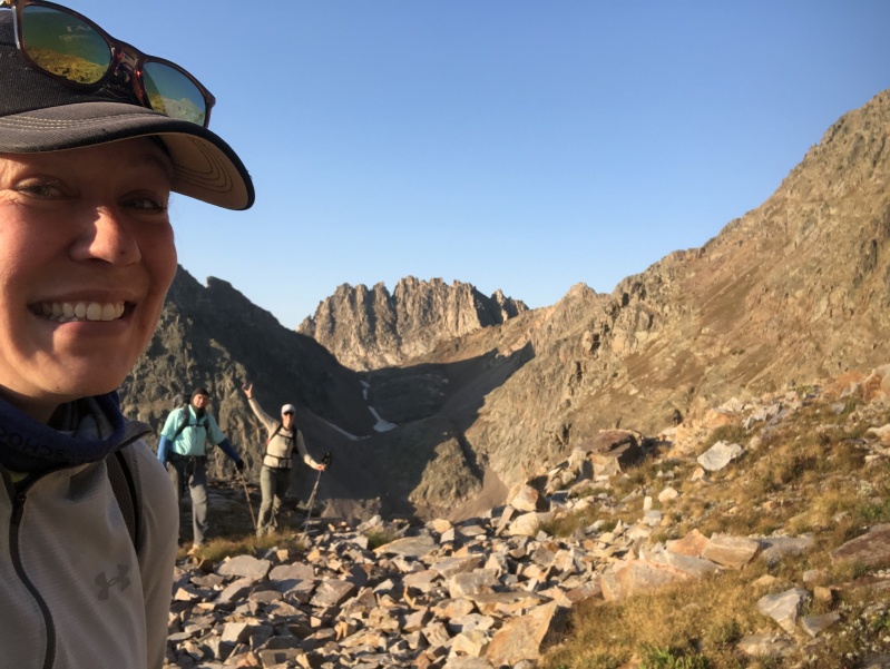
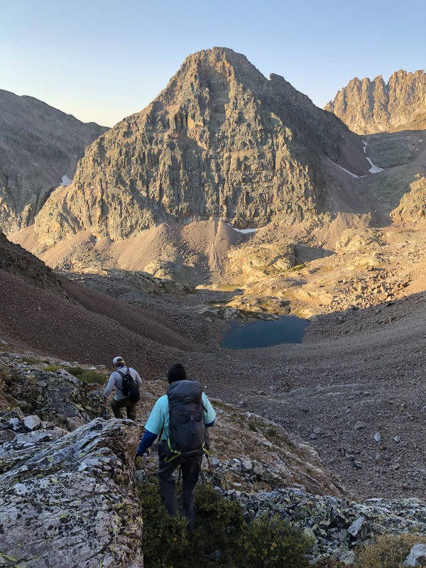
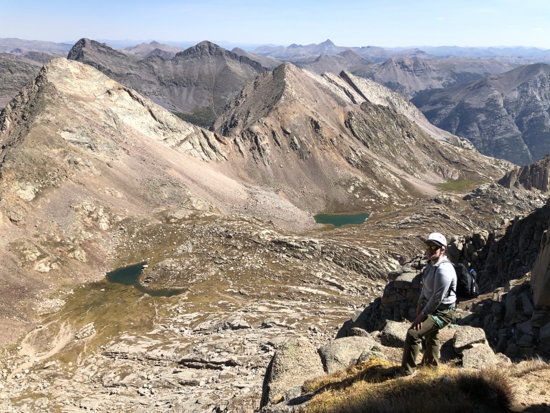
Most all the passes had ramps or headwalls requiring 400-600 ft. gain and loss. Most of these were talus, but at least by now we did not have the overnight pack. It was exciting to see our first view of Jagged...
First view of Jagged after 11 hours of hiking.
We were surprised at how many people were back in there – through backpackers mostly, not peak baggers. The landscape was spectacular. The Weminuche is simply unparalleled in remoteness and concentration of peaks and wilderness. I'm including a fair number of pictures of the Kodiak route to give others an idea of it.
Headed down a steep headwall towards the Leviathan drainage.Another picture of same place, to give an idea of terrain.The lake below the headwall.
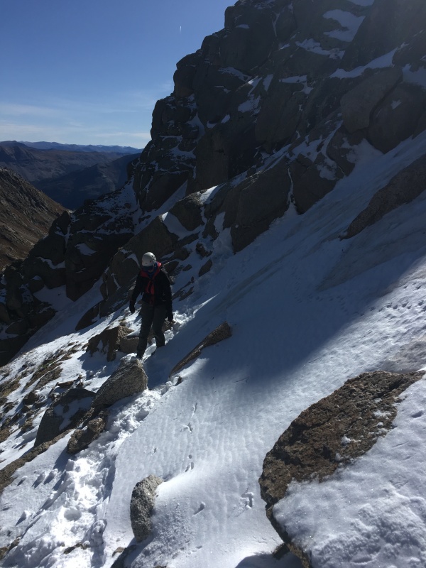
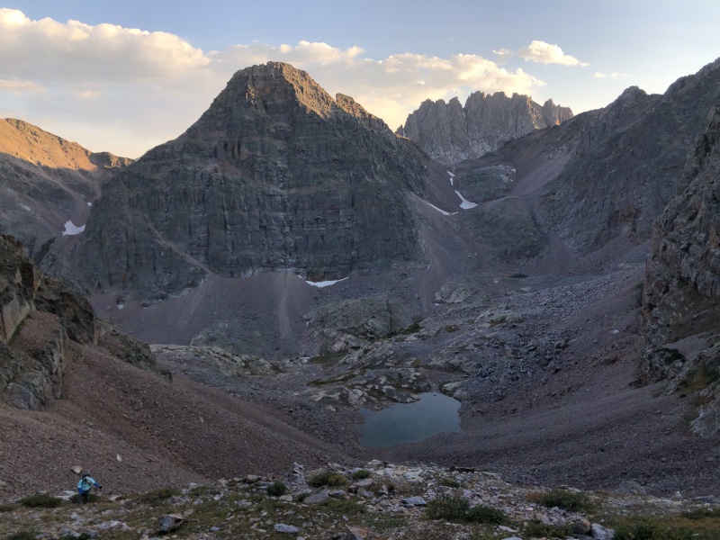
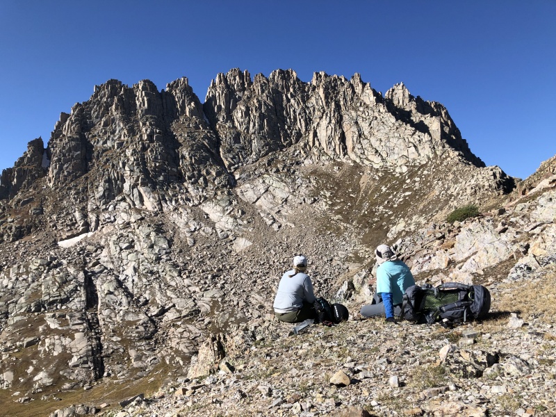
The hardest part was the slope above Leviathan Lake to get to the saddle between Leviathan and Jagged pass. It was either bullet proof snow/ice or terribly loose talus. We choose the talus. We were 3 ½ hours to this saddle where we surveyed the route ahead. Almost the entirety of route on Jagged is discernable at this point.
Katie and I looking at the route: crux 1, kitty litter ledges to notch above crux 2, traverse to crux 3, the notch and pie shaped rock. Its all there.
We contoured to jagged pass and onto the base of the climbing.
Upper Peak
After reading all trip reports both on 14ers.com and other places, the route was crystal clear. For someone who reads any of the good trip reports, route finding is easy.
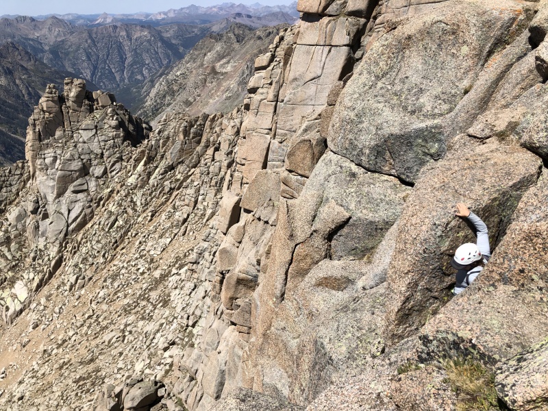
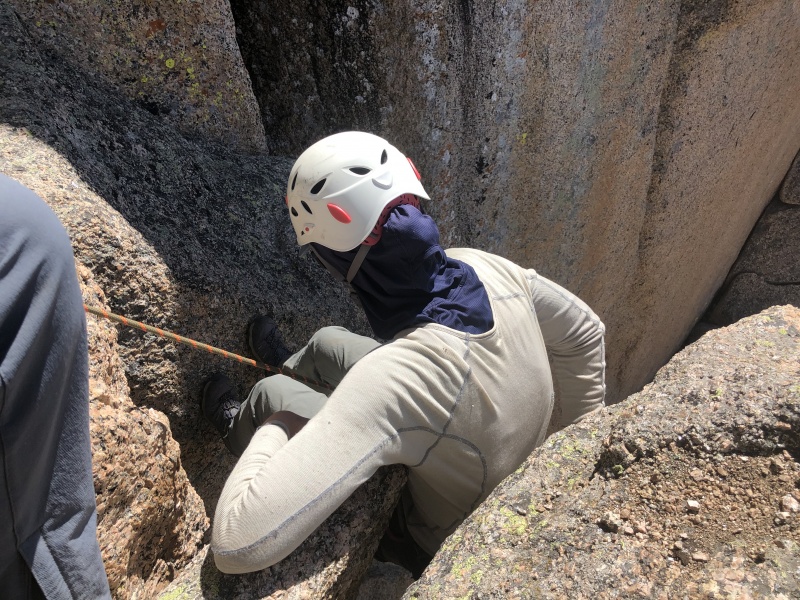
Crux 1
We found the exact spot where Kirsten and I said no a year before in the snow. On this day, we said yes.
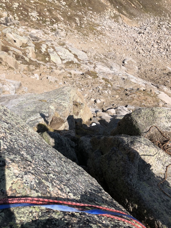
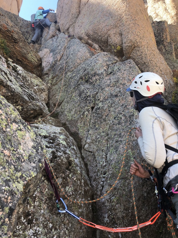
The bottom of the crux is class 3/4 in a trough-like feature. All of us free-soloed it. I had hoped to not have to set any pro for this crux, but the c4 sloping ramp-type feature to the left of the trough was damp and slick - as usual. We took a straighter branch to the right which I’d say was low c5. I went ahead and set a couple of cams. The trough was a little tight to get set up for a belay, but we managed.
The anchor at the top of crux 1 climbing. We don't have a picture of crux 1 climbing.
The anchor appeared in no time. I felt bad for how a year earlier, Eric waited here at this anchor for an hour with us merely 45 feet below. On the descent, a 30 meter rope was about 15 feet shy of reaching the start of the pitch. However, it does reach the c3/4 terrain which is easy to downclimb.
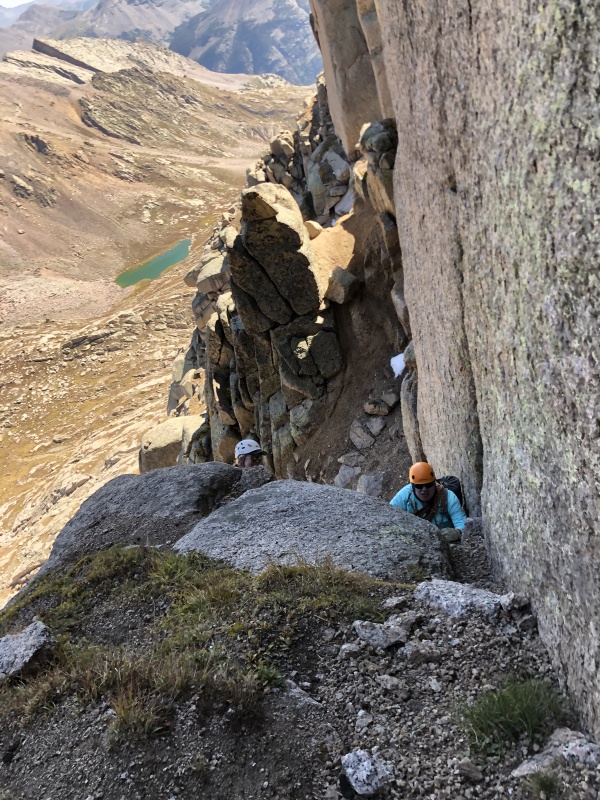
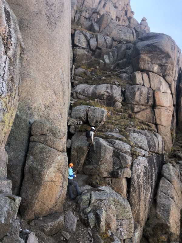
Kitty-litter ledges to Crux 2
These are appropriately named. I had read that some feel they are insecure and unnerving. I did not find them to be that. This is probably the longest section of the whole upper route. There are a couple of bolts installed on a slab which parallels the couloir at one of the sketchier sections. But, it’s really only c2+. We downclimbed most of this section on the descent. There are 2 existing anchors (not including bolts) here, placed for a 30 m rappel.
Crux 2
A good vantage of the terrain at crux 2.
There are two ways to tackle this; 1. The narrow c5 chimney/chock-stone against the cliff face on the left or 2. Traverse downward to take the c4 buried slabs/steps to the right. We choose the chimney. It is harder than it looks. The narrow width makes the stem moves awkward and the good jug hold at the top of the chock-stone is harder for those under 6 feet to reach. This section was not as exposed as expected, so we felt no need to protect it. Early season with snow/ice, some protection would be warranted. There is a broken cam in a crack that could be used to set up a clothesline type belay.
Kirsten stemming crux 2. Its a narrow stem with longer reach at back of chock-stone.
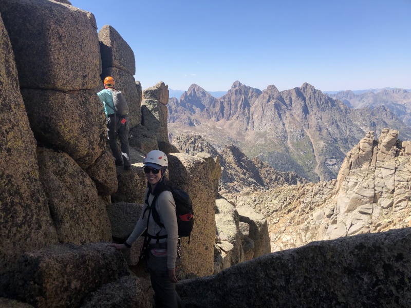
We regathered and made our way up more kitty litter ledges to crux 3. Almost all that distance can be seen in the standard pictures of this crux. It goes quickly. There is some c3 to get to crux 3.
Katie on a grass ledge between crux 2 and 3.
Crux 3
The belay ledge for this crack/chimney is sizeable (8’ x 10'?) and pretty level, but I still wanted a piece of protection for the belayer and to prevent a leader fall from going down the face. I found it satisfying each time I got a good placement, because I knew it meant I would be comfortable continuing the route.
Kirsten on lead belay, with me on lead. The exit move is shown in pic. Earthtreks belay certification tag visible.
I found this 25’ to be easier than expected. Most of it, I would call c4 with only the upper 8-10 ft low c5. I had watched a youtube video of the exit and thought it would be harder than it was. I would certainly free solo it. Neither Kirsten nor Katie found the move particularly challenging.
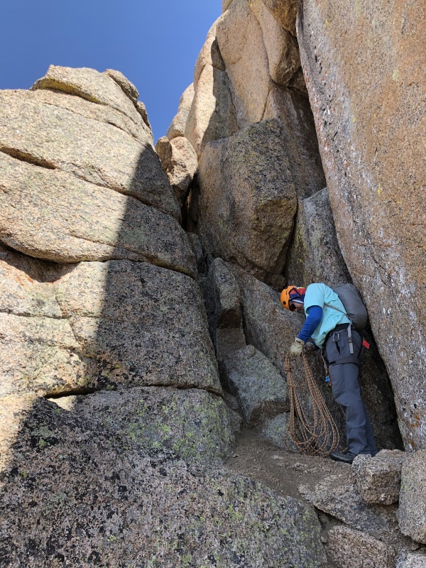
Backside and Chock-stone Chimney
After the notch, the backside is a little airy.
It now seemed like we were going to be successful, but moving through the notch to the other side felt like going into another world. I expected this side to be exposed and it was. I knew the history here and the memory of fatal accidents always weigh on my mind. The reach around move I did not think was concerning until the descent. At that point we were taking a snack break, I was anxious to keep moving and forced a cliff bar down. Because my mouth was dry, I could not swallow and was physically choking at the critical move. Eventually, I ralphed the remains of the bar over the south face (relief). Sadly, the cliff bar plummeted 600 feet to an unfortunate end. I hope some marmot finds nourishment.
Working our way to the final chimney.Setting up for last belay at final chimney. I wanted a little protection to pull the chock-stone move.
We reached the final chimney and looked up. Yep, that’s a big rock, and it’s definitely changed the difficulty here. The belay ledge is huge, so I didn’t feel the need to protect the belayer or have concern about falling past the ledge and down the face. I had planned to sling the chock-stone for protection, but couldn't get a sling all the way through from below. (I think slinging the little rock is the way to go). I went ahead and set a cam below the big stone. Feeling super confident, I pulled the move and set up on top for belay.
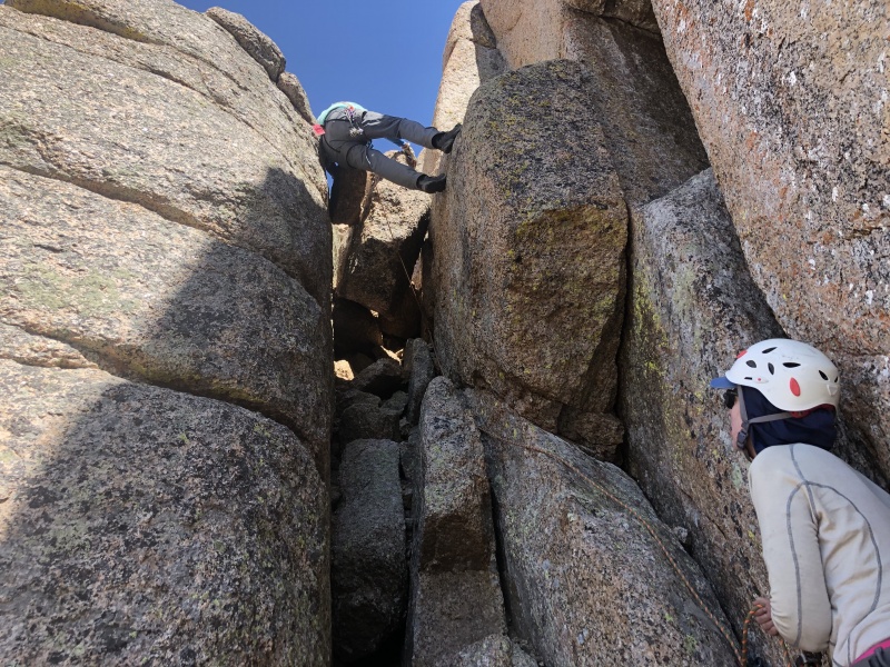
Stemming to get around the big rock.
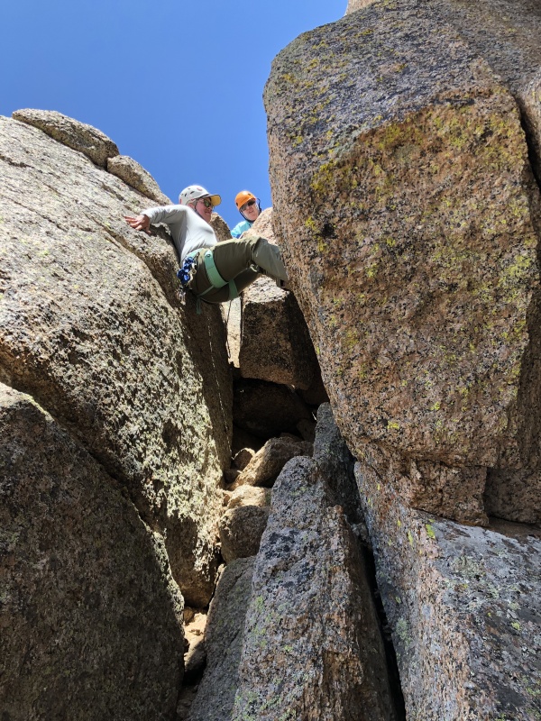
Katie moved to clean the piece but could not get it out. She worked with a nut tool for probably 5 minutes before finally getting it. Everyone pulled the move, but it is a physical one.
Katie after getting the cam unstuck.
The rock forces one to stem out 4 feet or so and again there is a big hold on the back of the small chock-stone that is harder for someone less than 6’ to reach. Since this is the hardest move IMO, I've provided various pictures to illustrate it.
Katie does it.Kirsten getting over the little the rock.
At that point, we found the alternative rap station beside the chock-stone, so as not to attempt pulling the rope on the descent through the rope eating chock-stone. However, that anchor is not all it should be. Since we didn’t have any webbing and didn’t want the hassle of dealing with the rope on the chock-stone, we used it on descent. But it’s the only thing, I didn’t feel 100% about on the whole effort.
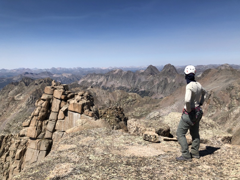
I announced the summit was in the bag, but Kirsten didn’t want to jinx the final 40’. 2 minutes later, we all stood on top. I’ve heard some mention the challenge of a crossover move in that section, but it just doesn’t deserve mentioning – its all c3.
I got to say, it felt good.
Upon reaching the summit, I felt very emotional, not as much about the personal achievement, but the amount that Eric had helped me to gain the skills to do this. Yes, this was Jagged…yakless. But in all reality, I was depending on him as much as ever (voice in my head). No way would I have attempted or succeeded at this before going out with him. He is simply the best mountaineer that I've climbed with excepting Steve Gladback, Alan Arnette, and Tom Pierce (thought I would name drop a little). Eric combines pre-trip research, gps navigation, visual route finding, endurance, climbing ability, athleticism, and solid decision making as well as anyone on the mountain. I am grateful that he has been willing to keep going out with me, when he’s as good as almost anybody on this site. He is the age of my kids, but he is the mentor, I’m the student.
Kirsten longingly looking over at Vestal. My only regret for the trip - we didn't get to tack on that summit.
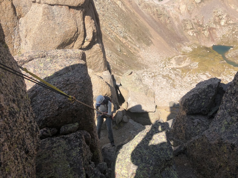
Time to get home, it was getting late in the day. There are a total of 7 rappel stations on the main route. We shamelessly used them all with Katie's 30 m rope.
Kirsten doing the rap.Cool shot of rappel at crux 2The trek back to Jagged pass after stowing gear.
Final thoughts
One of the significant things about this for me, is that mountaineering has become intertwined with my own mid-life crisis and attempt to deal with aging. It feels good to learn something new (roped climbing) and succeed at age 57. For those who have not gone through this phase of life, I hope you don’t have as much struggle as I have. I am convinced mountaineering beats other aspects of the male mid-life crisis – red corvettes, affairs, or heart attacks.
When I started training for this climb , I thought that learning roped climbing was merely a means to an end – just something necessary to help me complete the Centennials. I no longer see it that way. I plan to keep climbing, beyond completing the “list”. I would like to progress further so that climbs like Ellingwood Arete on the Needle, Kieners on Longs, and the Upper Exam on the Grand Teton are within my ability.
One final thought on goals. I’ve come to believe that the importance of goal setting is not in merely meeting the goal, but rather the personal growth and development that occurs within one to be able to meet said goal. This trip stretched me, the goal forced me to grow and I am glad – glad that I learned the skills to lead it myself.
In the end, Jagged didn't seem all that terribly difficult. I was surprised by how safe and easy it felt. The psychological challenge was greater than the difficulty of the real climb. However, I do not discount the effort in getting to the start of the climb. It is a haul that takes a lot out of one. There is simply no easy way to get 25 miles back in the heart of the Weminuche. That, I believe, is the crux of Jagged.
Thoughts for others planning a Jagged climb
Approach – The train to Needleton and a pack up No Name Basin is by far the easiest approach. No Name is gorgeous and is a good trail , if you find the way through the avy debris. It is still a very full 3 days with no room for complications with weather or anything else. I have a hunch (yes, pun) that Beartown/Hunchback will gain in popularity with the expense and uncertainty of the train.
Beartown – The approach is incredibly unique. It’s truly the middle of nowhere. It’s still doable in 3 days, but it involves bigger days than No-Name. It’s surprising how many cars were back there on Labor Day weekend.
Kodiak High Route – again, incredibly unique. For most of us, its probably slower than going Vallecito-Sunlight, due to the length of time above tree-line in loose talus with a heavy pack. But for someone who wants to spend a longer time in the central Weminuche with multiple peaks like Storm King, Peaks 7, 8 and 9, or the Trinities, then it is a viable option. I doubt I will be back.
Pro – I am glad we took some gear (4 cams). Most experienced and competent climbers will free solo everything without a second thought. But for someone like me, new to lead climbing, it offered some security. I would hate to go all the way back in there and not feel comfortable with a move. A few cams are not that heavy. I found gear placement satisfying.
Rope – I am happy with the 30 m we took. All the anchors (on the main route) are set to use with a 30 m. In each place, one can get to down-climbable terrain with this length. There are a total of 7 highly visible stations on route. I would take some webbing to backup any anchors that need it. There are a lot of other rappel stations on the mountain that require longer ropes to rappel. These look fun, more direct, and faster. But be sure to use the ones on the standard route, if you have not researched the length of rope needed for alternatives.
Climbing difficulty – There really is not that much c5 on the standard route. Crux 1 option discussed has maybe 10’ of c5. Crux 2 has 6’ of c5. Crux 3 is maybe 8-10’ of c5. The chock-stone chimney requires c5 stemming and is probably the hardest move – most physical at least. I would agree with the opinion expressed on the forum that someone who is comfortable with exposed c3+ will find this mountain doable if they have a lead climber with them. I am glad I took the time to develop lead skills to do it without depending on someone else.
Exposure – It is a steep face, but surprisingly has quite a bit of trail on the face. I can tell how exposed I felt the night after a climb. Sketchier moves over exposure I replay subconsciously in my sleep. On several of the c4 14ers I have had that experience. On Jagged there was only one move that replayed in my mind – the reach around on the backside where I barfed my cliff bar. The gear helped me feel much more secure.
Route finding – read several TR’s and its incredibly obvious. Ignore those description, and it is an extremely complicated mountain.
Thanks Kirsten and Katie for a great trip!
Thumbnails for uploaded photos (click to open slideshow):
So happy that redemption on this peak went so well for you guys. You could not have looked more solid on the cruxes either! Proud of you, Kirsten, and Katie for getting out there, getting the skills you needed to get it done, and getting it done!
Hey, I met you guys on your last day as we were both heading out---we played leapfrog that day, and you guys were kind enough to use your satellite phone to send a message through to my wife letting her know that I was ok. Nice job on the trip and trip report! I had a hard enough time just going over all those passes; I can't even imagine climbing jagged!
I very much enjoyed reading your report!. Congratulations and yes, the amount of incredible mentors and partners one can find here is another reminder that we are a close community and helping each other get better is just the beginning of a wonderful friendship.
I'm glad this all worked out for your group. After the flat tire, the delay with my partner at the TH, & the routefinding snafu going up Stormy Gulch (exited at the wrong switchback) - making the call for "Plan B" was all we could do to salvage some fun for our efforts! Camping at the "dream spot" was amazing & Storm King was a fun scramble as well. The tent you passed there is another forum member (2nd time I've bumped into him deep in the woods) who I'm sure will get his TR up at some point. I'll get Jagged at some point & now have another TR to reference! Thank you for the write up!
Brad: that was a long way back "in there". Did you see the place where we wrote your name with sticks on the trail at our turnoff point? Upon leaving we saw them disturbed, so we assumed it was you. That was a good place to exit. I'd certainly recommend Vallecito-Sunlight for another trip back there.
rdp32: it was fun see you on the exit. I was struggling worse than ever coming out of there. After sending the message to your wife, we referred to you as the "loves his wife guy".
We did not see this. We exited at the 1st switchback - as I felt I'd read that somewhere. Without the context of which direction this led us to a decent trail - which we soon realized was going to lead us to Vallecito Lake (good to know for future reference). We went along game trails and some annoying (with a large pack) rock hopping at that point until we finally found the trail. Fun times all the same!
Caution: The information contained in this report may not be accurate and should not be the only resource used in preparation for your climb. Failure to have the necessary experience, physical conditioning, supplies or equipment can result in injury or death. 14ers.com and the author(s) of this report provide no warranties, either express or implied, that the information provided is accurate or reliable. By using the information provided, you agree to indemnify and hold harmless 14ers.com and the report author(s) with respect to any claims and demands against them, including any attorney fees and expenses. Please read the 14ers.com Safety and Disclaimer pages for more information.
Please respect private property: 14ers.com supports the rights of private landowners to determine how and by whom their land will be used. In Colorado, it is your responsibility to determine if land is private and to obtain the appropriate permission before entering the property.


")
")
")
")
")
")
")
")
")
")
")
")
")
")
")
")
")
")
")
")
")
")
")
")
")
")
")
")
")
")
")
")
")
")
")
")
")
")
")
")