Download Agreement, Release, and Acknowledgement of Risk:
You (the person requesting this file download) fully understand mountain climbing ("Activity") involves risks and dangers of serious bodily injury, including permanent disability, paralysis, and death ("Risks") and you fully accept and assume all such risks and all responsibility for losses, costs, and damages you incur as a result of your participation in this Activity.
You acknowledge that information in the file you have chosen to download may not be accurate and may contain errors. You agree to assume all risks when using this information and agree to release and discharge 14ers.com, 14ers Inc. and the author(s) of such information (collectively, the "Released Parties").
You hereby discharge the Released Parties from all damages, actions, claims and liabilities of any nature, specifically including, but not limited to, damages, actions, claims and liabilities arising from or related to the negligence of the Released Parties. You further agree to indemnify, hold harmless and defend 14ers.com, 14ers Inc. and each of the other Released Parties from and against any loss, damage, liability and expense, including costs and attorney fees, incurred by 14ers.com, 14ers Inc. or any of the other Released Parties as a result of you using information provided on the 14ers.com or 14ers Inc. websites.
You have read this agreement, fully understand its terms and intend it to be a complete and unconditional release of all liability to the greatest extent allowed by law and agree that if any portion of this agreement is held to be invalid the balance, notwithstanding, shall continue in full force and effect.
By clicking "OK" you agree to these terms. If you DO NOT agree, click "Cancel"...
Milner Pass to Berthoud Pass on the true Continental Divide. On-sight.
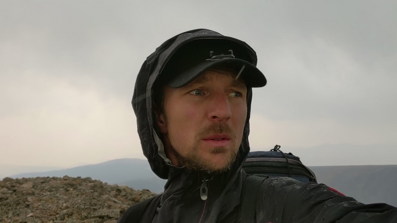
I've always loved point-to-point excursions. Living in the Denver area I've always looked at the skyline and wondered what it would be like to climb the entire thing in one go, and just stay on the Divide. I could get dropped off at Milner Pass in the North, stay the Divide all the way to the next road at Berthoud Pass. Having not climbed or researched any of the mountains on this route, I was unfamiliar with what such an adventure would entail. Finally last year, I decided to check it out. I embarked on the journey not knowing what to expect, if anyone had ever done it, or if it was even possible. I assumed there would be some scrambling involved, but by the time I got to McHenry's notch, I realized a couple of things. One, I was in for a much bigger adventure than I had anticipated, and two, there was no way I'd be able to climb every bump and gendarme that happened to be on the divide, so I settled for summitting every named peak along the way. On day two, I ran into a couple of guys doing another traverse called the "LA Freeway", who asked if I was doing Pfiffner's, but I didn't know what that was. When they understood what I was attempting, they informed me that they had in fact attempted this link-up themselves, but as far as they knew, it had never been completed. By the time I got to Paiute Peak, I was halfway done, but out of time. I had only allotted 3 days off of work, so I would have to try again.
This year, I decided to try again but now I had an idea of what I was in for. The amount of technical climbing I encountered between Powell Peak and Paiute peak alone was intimidating to think about trying to figure out again. But then beyond that lay the unknown. I also knew that I had to resist the temptation to do any research on the climbing routes I would be encountering. Even one look at Google Earth would have been problematic. Besides, I'd been feeling God inviting me into this adventure for years. What was the point of researching it? Did I not trust that he would provide for me and protect me through it? I already knew it was going to be scary, but if I knew exactly how scary, it would have stressed me out, and I would never go. I've always been more of an on-sight climber anyway. The more research and training I do for a project, the worse I perform. I lose my psyche and I can't get my heart to engage. To quote alpinist Mike Libecki, "training is training for training". For me, the allure of climbing is the exploration and adventure; to engage the creative part of my brain instead of trying to follow someone's route beta. I'd rather explore a mountain on my own terms. But if research and training is your thing, then get ready, because this one packs a punch.
My approach this year was different. Instead of an ultra-fast approach, I planned for 5 days on the trek, knowing I would be slogging it out with difficult climbing and challenging route-finding. As we approached Milner pass early Sunday morning, my heart was already looking for excuses to bail. I was afraid. I knew it was going to challenge me to the core. We were in the midst of several forest fires, and the entire drive there was smoky. I decided that if it was this smoky at the trailhead, I wouldn't go. But when we got there, it was clear.
So my wife dropped me off at 5:30 AM, and I departed into the dark forest following the Continental Divide. All day, I battled with self-doubt and fear even though I knew I wouldn't be encountering any of the technical stuff until day two. The slog up to Mt Ida was easy class 1. Still no wildfire smoke, though as I looked down-valley on either side of the Divide everything was enshrouded in a smoky haze. Easy hike to Cracktop. I had missed this one last year since it was technically just off the Divide, but I figured I'd include it. Then, Hayden Spire was next. It too was off the Divide, by a little more, and this one looked like a pretty exciting climb. I decided to see where my climbing head was at and see if I could figure this one out, but I left the pack behind. It proved to be a nice micro-sized challenge for the upcoming objectives. I was able to 4th class my way over the ridge to the overhanging headwall, considered climbing it, but then found the easier weakness on the right side of the spire clocking in around 5.4.
Hayden Spire. Technically just off the Divide, but a fun little climb. 4th class leads to the overhanging headwall, scoot right, and 5.4 to the summit.
More easy hiking took me over Sprague Mt, and Knobtop. I looked down at Notchtop and considered climbing it as well. But this one, I decided, had enough relief and distance from the Divide that I decided it wasn't worth it. I slogged through Ptarmigan Pt, Flattop, up Hallett, Otis, and a long way to Taylor, setting up camp on the summit. A pack of coyotes sounded way too close, their howls and yelps bouncing off the canyon walls nearby. I was glad to be bivvied at the summit.
Day 2, time to climb. Super nervous. After ascending Powell Peak, I headed down the other side and the class 1 terrain suddenly gave way to 5th class ridge scrambling, and down-climbing. This was the part that had shocked me last year and I found myself equally filled with fear this year. As I continued descending down cliff after cliff, I felt committed.
Descending off of Powell Peak into McHenry's Notch. These are where the technical challenges truly begin
The final cliff right before the notch itself had me stumped. I began down-climbing the huge cliff but it was too exposed. I scrambled back up and considered leaving this project altogether. I couldn't remember my beta from last year but then finally found the passageway to a descending ledge system to the left ending in a still-scary but now relatively benign 60' cliff at about 5.3. Now I was at the notch. 4th class gullies to the right led me up the south side of McHenry's to the summit. 3rd class took me down to Stone man pass, through a sea of gendarmes up to Chiefshead. Uneventful 2nd and 3rd class through Mt Alice to Tanima. The Cleaver was easy 3rd class. Then the difficulties ramped up again to climb isolation. After the Cleaver, one encounters an overhanging headwall that cliffs out in both directions. Last year I traversed right for several hundred feet down to a 3rd class gully system which led back up to the summit ridge eventually, but wasted a lot time. This year I decided to tackle the headwall straight-on.
Crux on Isolation Peak. 100' up of very exposed 5.5ish climbing, trend left to pick up the 4th class again.
There's a large cliff on the right following exposed 5.4 crack systems straight up, eventually leading out left to 4th class to a long set of false summits eventually leading to the true summit of Isolation Peak. The difficulties eased up for a while through Ouzel and Ogalalla, where I camped on the summit for night 2.
Day 3 started with easy hiking through Ooh La La, 12228, 12930, and Sawtooth. Enroute to Paiute, things took a dramatic turn again and I spent several hours navigating gendarmes and 4th/5th scrambling to arrive at the base of Paiute Peak.
The "catwalk in the clouds"
Paiute Peak. 4th class to the headwall, right, up any variation up the final cliff around mid 5th.
Handjam rest mid-crux on Paiute Peak
A 4th class scramble led to the headwall where I traversed right for 100 feet or so and climbed directly up the cliff at about 5.5 for maybe 100' before things tapered off to 4th class to the summit. There may be a way to bypass these difficulties by continuing to traverse right. More easy ridge scrambling to Mt. Toll. I traversed right up 4th class to a ledge system where one encounters a series of short 5th class cliffs broken up by ledge systems. One is the technical crux at around 5.6, but the exposure is very manageable. 4th class to summit. 2nd/3rd class to Pawnee and then Shoshoni.
Summitting Pawnee in a storm
Here things got quite challenging for me navigating the Chessmen. I managed to stay on the Divide until the last formation, but accidentally climbed the last Chessman, hoping for a ridge-connect to Apache, but there were just rap slings and an impossible cliff. So, I had to downclimb about 600' to a ledge that crossed a small snowfield left of the Chessmen and across to a gully that took me up to the Apache summit where I bivvied for night 3.
Day 4, easy scrambling to Navajo. 4th class and easy 5th took me up the right side of Navajo. From a distance I sensed that Arikaree would not be climbable up the North face in either direction, so I took a low sweep left to catch it's left flank which turned out to be an exciting 4th class scramble to the summit. From there to Deshawa, my route-finding abilities were challenged again through exposed 4th class scrambling, but was able to stay on the divide.
Challenging ridge to Deshawa
Eventually I encountered a crashed airplane on the left side of the mountain.
Left flank of Deshawa, one has to climb over this plane. 50 feet up the cliff behind it, hand and footholds are still littered with plane debris.
I had to scramble through broken plane debris up 4th class eventually leading to the summit of Deshawa. After this, the ridge became more dramatic. Around halfway to North Arapaho, I bailed from the ridge down to the Arapaho glacier, as things were beginning to look unclimbable. I climbed the bergschrund until I was forced to cross the glacier. I grabbed a couple spikes of rock and traversed the 30 degree snow slope to attain the gully and a huge slog up to the summit of North Arapaho. The 4th class ridge scramble to South Arapaho is solid and well-traveled. Heading directly down to Arapaho pass was steep and loose. It kept looking like it would cliff out, but I kept traversing right until I found a small gully down to the notch. This is where a thunderstorm hit and I hid under a cave hearing lightning crashing around me. As the storm relented a bit, I reluctantly trudged up the well traveled trail past Arapaho Pass and up to the ridge scramble to get to Neva. About halfway through the ridge, the weather turned nice. Here, for the first time, the rock felt solid and relatively safe. I camped the night at the summit of Jasper.
Day 5, I never would have expected to be able to go all the way to Berthoud pass. My progress had been slow and mentally exhausting to this point, but I began hiking through glorious class 1 terrain to Skyscraper peak, and then eventually began picking up trail systems off and on through Rollins Pass, Rogers Pass, and right up James Peak. It was only 1 pm, unbelievable. I realized for the first time that I was going to make Berthoud pass that night, so I made plans for my wife to pick me up at 6. From here a long scramble took me down and steeply up Bancroft where I encountered another storm. I was so mentally exhausted from fear but I prayed for strength and proceeded up the steep slope into the storm. But the Lord was with me all day and gave me strength, so I just kept going. I entered "animal mode", exhausted, but intensely determined, as I pounded out mile after mile through Parry, Eva, Witter, Flora, and finally School of Mines Peak where I bee-lined straight down the sunny hillside to the parking lot to the most welcome sight, Nicole had just gotten there and it seemed surreal and wonderful to enter civilization so suddenly in this way.
Some notes about the route: The section from Powell Peak to Neva requires intense navigational and climbing skills and was very engaging for 3 full days. When in doubt, I tried to stay right on the ridge, which usually was the safest place to be except where I have otherwise indicated. I also tried to approach this methodically and carefully instead of like an ultra-run like I did on my first attempt. The climbing is too loose and hazardous for that. This is more like a very adventurous backpacking trip, but I had to go light! Because I knew I would have to be doing all that climbing with that pack on my back. I took cod liver oil and glucosamine daily for a couple months preceding this trip, and my knees did great. I also wore knee-compression supports, which helped through the chimneying anyway. I brought a jetboil to melt snow which was still relatively easy to access in mid-August. I packed light with a bivvy sack and dehydrated foods. I used my phone with Gaia GPS for navigation, and brought two battery packs. Cell reception was available on a majority of the summits. I hiked for about 13 hours a day, so I wasn't in a hurry. But my conservative approach paid off as I was somehow still able to knock out 21 miles on the last day through to the end. This was one of the most intense adventures I've had in a long time due to the sheer duration I had to keep fear in check and maintain focus on climbing and navigation for those three days. But from a broad perspective, the beauty of the idea of going road to road and tackling all that came in between was the objective, and it's a cool feeling to have walked the 'catwalk in the clouds', staying right on the true Continental Divide, above treeline looking down at distant alpine lakes and snowfields going on forever, remaining on the perpetual summit for 71 miles. What an amazing journey!
First of all, rad mission. Second of all, I love the style that you did this in - no beta even though the beta is readily available, no FKT, no hubbub, just a desire for a big ole adventure. The trips with the least preparation, knowledge, and planning always end up being the most fun and memorable ones as long as you use common sense, and have some experience in the mountains. Imo the ability to "figure it out" is the best quality a mountaineer could ever have! I'd climb with you anytime! Loved this.
Hard to believe you and Justin were merely days apart on this adventure and had never even met. Great physical and mental preparation for a journey only a handful of hardcore souls will ever manage to complete.
nice onsite on Paiute while days deep into the route! That's a wild route, hard to think of doing that one sans scouting as it feels like such an unintuitive zig zag and then after all that work you just end up at the notch before the final push to the summit. Really cool stuff.
Thanks guys for the kind words! Honestly, I'll bet any of you guys could do this traverse without much of a problem. I'm just a regular dude. I'm a full-time CDL truck driver, and besides some light cragging with my kids over the weekends, I did literally zilch for training for this thing. Just ask my family, I don't have time for that. Anyone that can solo the first flatiron, with a little bit of backpacking experience, and general mountain sense, I'm sure will be able to make it through this thing (especially those of you without kids). The views are nothing short of spectacular the entire way. All the cruxes are avoidable if you want to simply take a less direct route. The zig zags pitch on Paiute was fun, but if I had traversed another hundred feet there is a 5.4 face that goes right to the summit, which is the way I took last year on my first attempt of this traverse. The main reason that this climb seemed so scary to me is that I simply didn't know what laid ahead. Now that I know, I wouldn't think twice about sauntering through this thing again at some point.
Strange that one day into my adventure, and Justin posts about having just accomplished the same route. Weird timing! I used Gaia for my traverse which came up with far fewer named peaks, around 40 that fall right on the divide. I also added a few extra credit peaks because they seemed close enough to the divide and looked fun (like Hayden spire, super fun). I also logged way less miles for some reason. I pasted the link for my GPS track so anyone can check it out if they want. Happy climbing!
Chapeau Chris! Peak list varies from source to source - if you use listofjohn and count every named peak, it gets a little crazy with the "Hell Hill"s and "Frosty Mountain"'s and all that. Even Flattop seems a little bit of a stretch to call an actual peak and just YA named point.
Similar to the mileage - it's sort of a British Coastline problem, where the more accurate you follow it, the longer it becomes, until it's of essentially infinite length! I'm not seeing your track on the Gaia map though - just other routes in Wild Basin.
Thanks Justin, and again, congrats on the FA! Thanks for letting me know about my link. It's weird, when I click on it, my whole route comes up, so sorry about this guys. I'm not the most tech savvy guy, and I'm still very new to this whole GPS thing. I'll go ahead and send you an email and try to attach the tracks there. Hopefully that works. Happy to do this for anyone else that wants to check out my track, until I figure out what the problem is. BTW, I finally found where you had posted your GPS track. Interesting to compare them. Looks like we did very similar routes, but each did some things that the other didn't do.
Caution: The information contained in this report may not be accurate and should not be the only resource used in preparation for your climb. Failure to have the necessary experience, physical conditioning, supplies or equipment can result in injury or death. 14ers.com and the author(s) of this report provide no warranties, either express or implied, that the information provided is accurate or reliable. By using the information provided, you agree to indemnify and hold harmless 14ers.com and the report author(s) with respect to any claims and demands against them, including any attorney fees and expenses. Please read the 14ers.com Safety and Disclaimer pages for more information.
Please respect private property: 14ers.com supports the rights of private landowners to determine how and by whom their land will be used. In Colorado, it is your responsibility to determine if land is private and to obtain the appropriate permission before entering the property.


")
")
")
")
")
")
")
")
")


