Download Agreement, Release, and Acknowledgement of Risk:
You (the person requesting this file download) fully understand mountain climbing ("Activity") involves risks and dangers of serious bodily injury, including permanent disability, paralysis, and death ("Risks") and you fully accept and assume all such risks and all responsibility for losses, costs, and damages you incur as a result of your participation in this Activity.
You acknowledge that information in the file you have chosen to download may not be accurate and may contain errors. You agree to assume all risks when using this information and agree to release and discharge 14ers.com, 14ers Inc. and the author(s) of such information (collectively, the "Released Parties").
You hereby discharge the Released Parties from all damages, actions, claims and liabilities of any nature, specifically including, but not limited to, damages, actions, claims and liabilities arising from or related to the negligence of the Released Parties. You further agree to indemnify, hold harmless and defend 14ers.com, 14ers Inc. and each of the other Released Parties from and against any loss, damage, liability and expense, including costs and attorney fees, incurred by 14ers.com, 14ers Inc. or any of the other Released Parties as a result of you using information provided on the 14ers.com or 14ers Inc. websites.
You have read this agreement, fully understand its terms and intend it to be a complete and unconditional release of all liability to the greatest extent allowed by law and agree that if any portion of this agreement is held to be invalid the balance, notwithstanding, shall continue in full force and effect.
By clicking "OK" you agree to these terms. If you DO NOT agree, click "Cancel"...
Thursday, Aug. 6, 2020. Randy and I left our home around 8 AM and made the long drive to the Lake City area to begin working on some of Randy's 16 remaining San Juan bicentennial (top 200) peaks. We drove up the Wager Gulch road to about 12,300', parked in the small parking area, grabbed our backpacks, and headed south and west on the Continental Divide trail toward Cataract Lake.
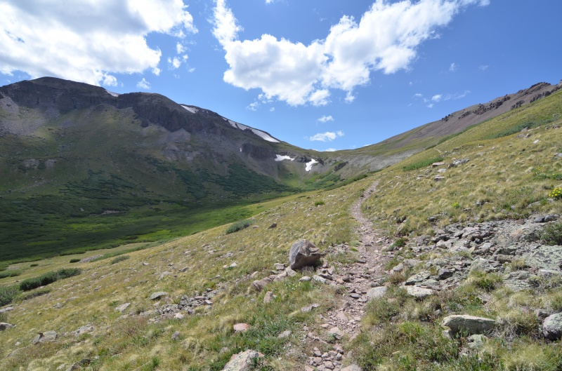
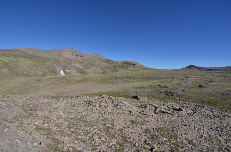
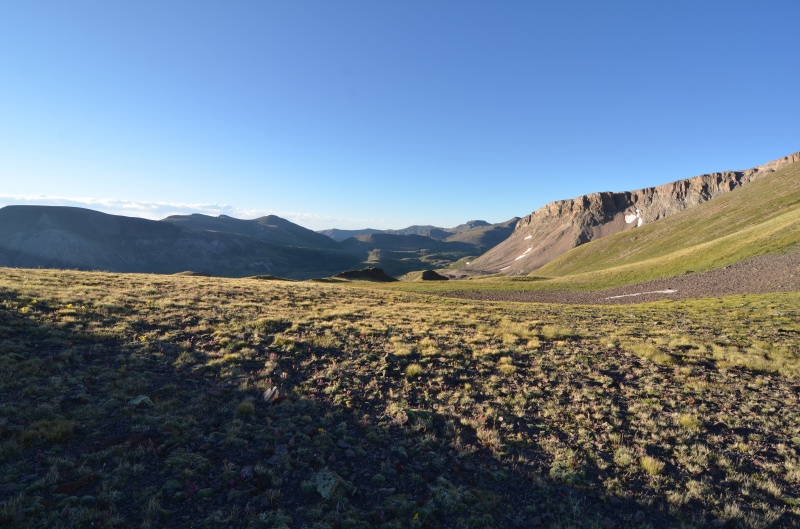
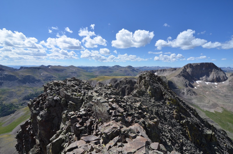
Looking west along the Continental Divide trail near Unnamed (UN) 13581
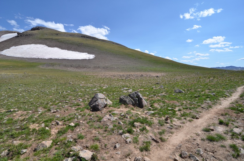
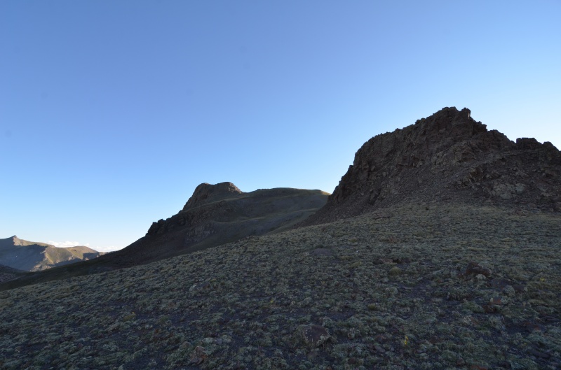
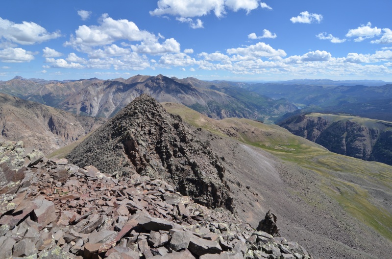
Near the saddle between UN 13580A and "Tundra Top"
The Continental Divide trail is a good one, and the miles went by quickly. Rather than camp at Cataract Lake, we chose a site at about 12,200', approximately 1/4 mile SE of Cataract Lake and about 100' higher. This was a windy location, so we anchored our tent with guylines.
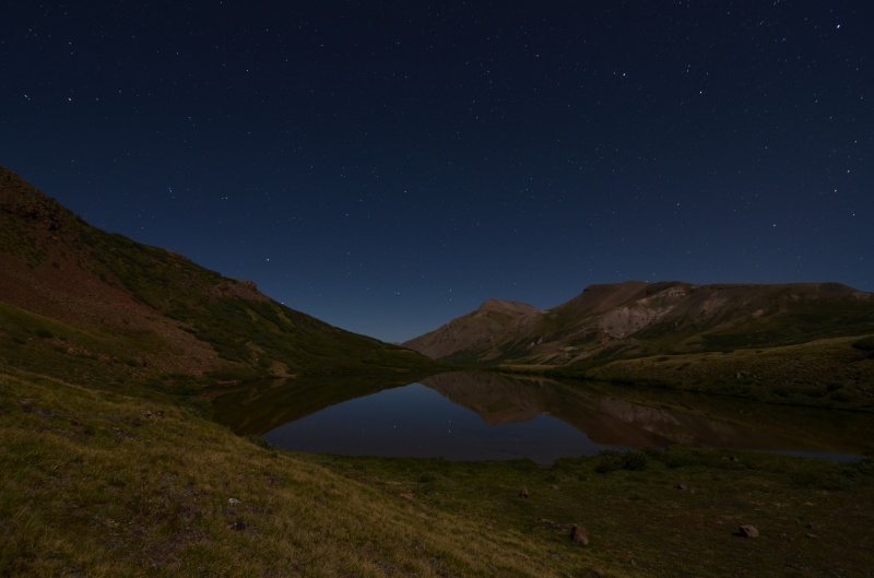
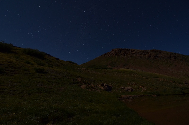
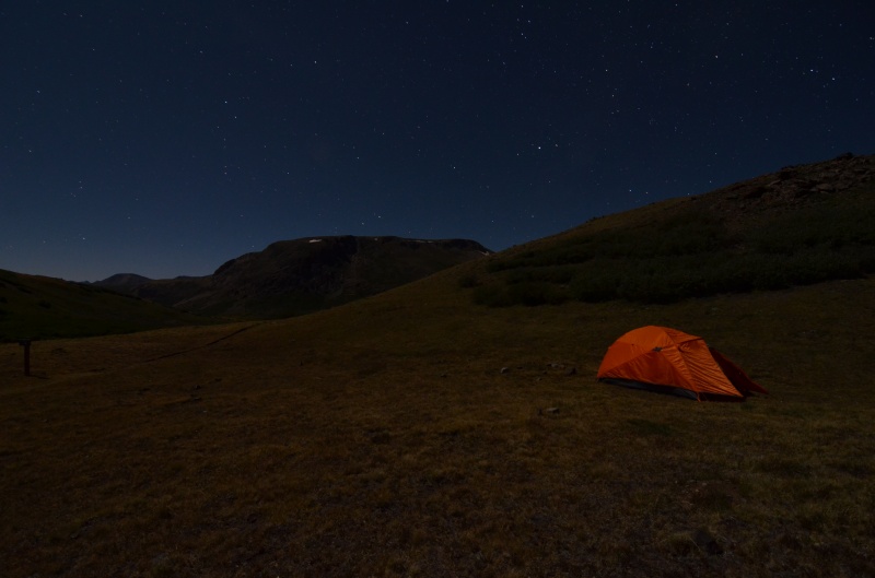
Friday, Aug. 7, 2020. Lots of stars were visible when we got up, so Randy took some photos while breakfast was cooking.
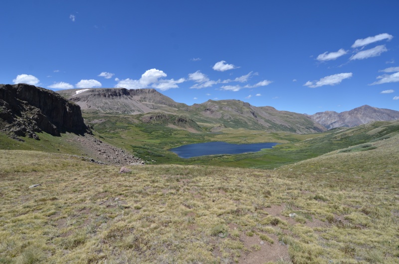
The small lake at 12,200' from our campsite
Another early morning photo from near our campsite
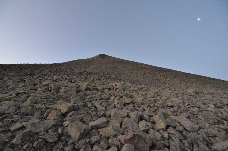
Today's goals: "Northwest Pole" (13,660') and Pole Creek Mountain (13,716'). We headed west on the trail to about 12,400' and then ascended Northwest Poles's broad north ridge.
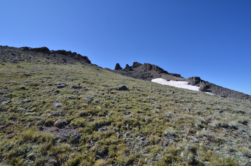
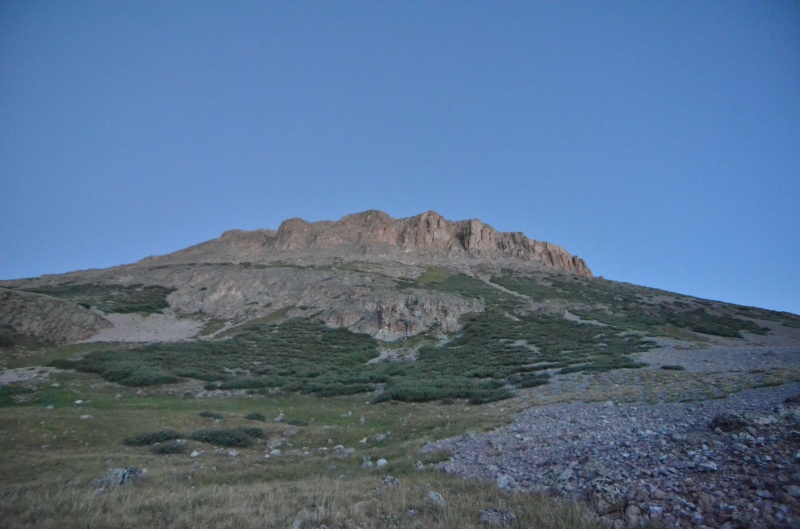
The north ridge of "Northwest Pole"
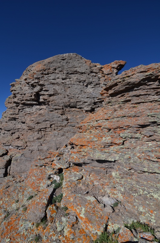
Once on the ridge, it was smooth sailing until we reached Northwest Pole's crumbling summit block. It was also quite windy on the ridge.
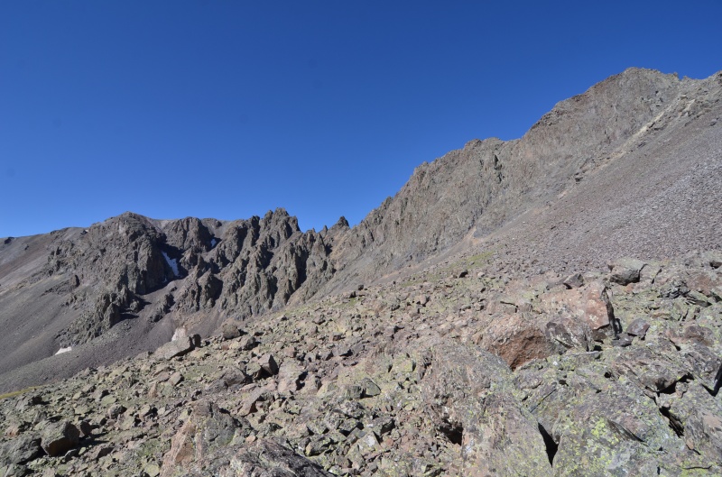
The summit block of Northwest Pole as seen from the east side of the ridge
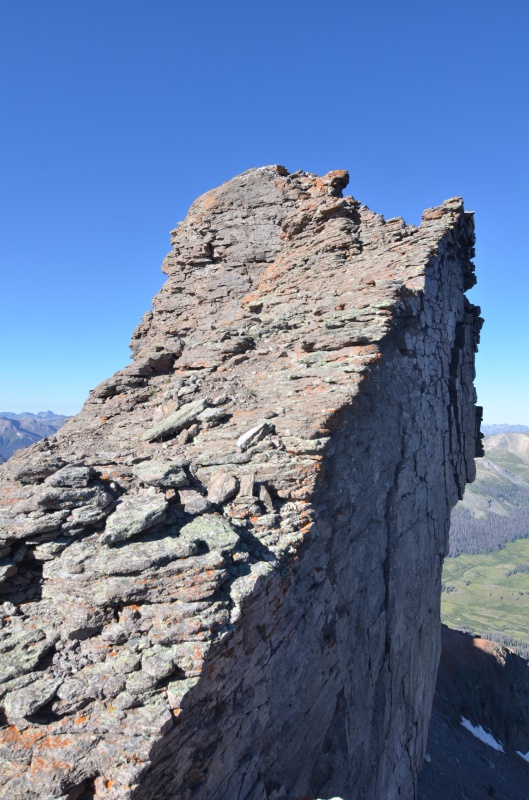
A closer look at the summit block of Northwest Pole
We scrambled up the northeast side of Northwest Pole's summit block and relaxed on the summit for a few minutes.
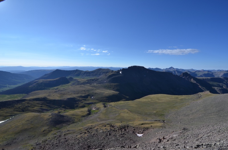
Pole Creek Mountain from Northwest Pole
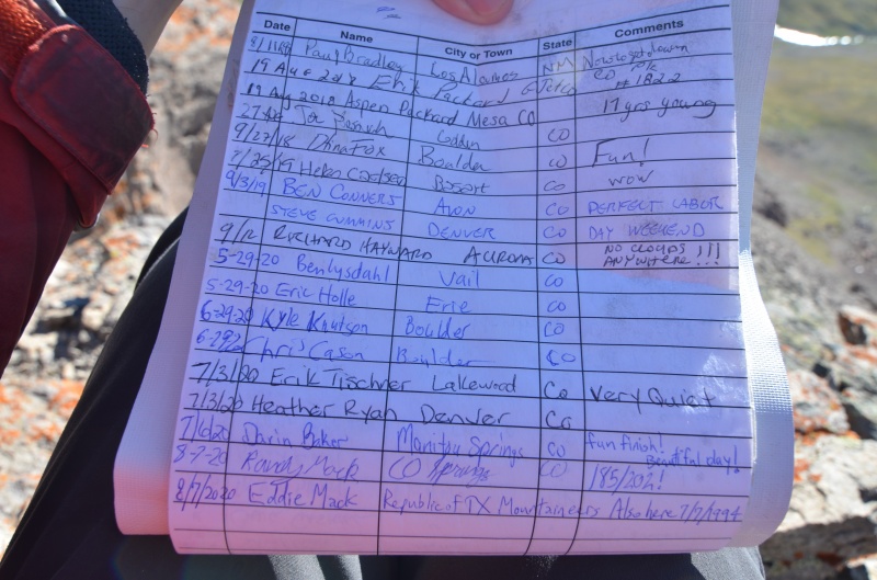
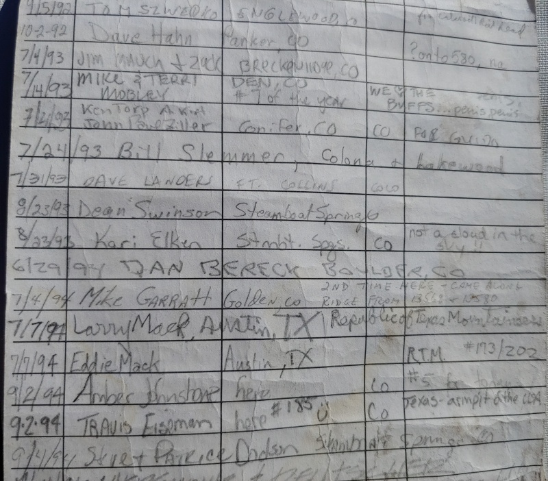
We saw some familiar names in the 1992 summit register on Northwest Pole, including Darin Baker, who had alerted me to the fact that...
...a troublemaker/troll had signed the register on 7/7/1994. Naturally, this was followed by another troublemaker/troll on 9/2/1994
My current climbing partner wasn't even born when I first climbed Northwest Pole. Who knows where the time goes?
We descended SE toward the 12,820' saddle north of Pole Creek Mountain before heading south along the ridge toward the summit. There were a few ridge obstacles that we bypassed on the right (west) side of the ridge.
Looking south at Pole Creek Mountain's north ridge
Northwest Pole from the same location as the previous photo
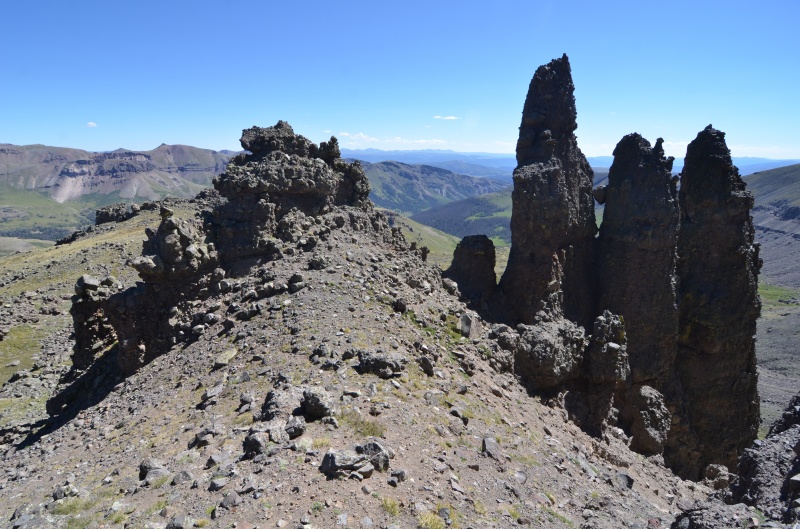
Approaching rock formations on Pole Creek Mountain
Interesting rock formations on Pole Creek Mountain's north ridge
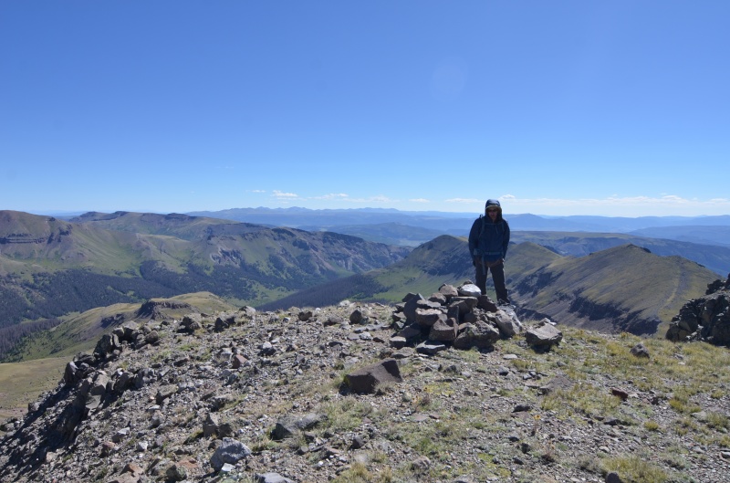
On the summit of Pole Creek Mountain
To return to camp, we bypassed Northwest Pole on its east side. We reached camp early enough to nap in our tent for a few hours before cooking dinner.
Cataract Lake with Half Peak and Quarter Peak to the northwest
Saturday, Aug. 8, 2020. Quarter Peak (13,674') and UN 13164 were today's goals. Chances of rain today were essentially zero percent, which would turn out to be a recurring theme for the next two weeks.
An early morning view of our campsite with lots of stars visible
We headed NW past two small lakes to the 12,940' Half Peak - Quarter Peak saddle. Our initial plan was to contour NE at about 13,000' to get around some ridge spires, but we ended up climbing a bit as we contoured. An ugly descent north on loose rock brought us to a point directly east of Quarter Peak's summit. From here, we climbed NW until we reached the ridge north of the summit. We went over a 13,620' false summit to the summit of Quarter Peak and in hindsight should have contoured around the false summit. Quarter Peak's makeshift summit register had been left in 2015.
Half Peak
Looking back toward our campsite (not visible)
Looking north from the Half Peak - Quarter Peak saddle
We had to descend steep scree to bypass the cliffs at left; Quarter Peak is to the right
Looking south at Half Peak (right) from Quarter Peak's summit
Looking north at Quarter Peak's false summit (with Sunshine Peak and neighboring thirteeners in the background) from Quarter Peak's summit
On the descent, we bypassed the false summit and then descended east over talus and grass to reach the Cataract Creek trail at about 11,400'. From here it was an easy hike back to our campsite. After a lunch break, we took the East Fork Middle Pole trail west to the Continental Divide before heading up the slopes to UN 13164.
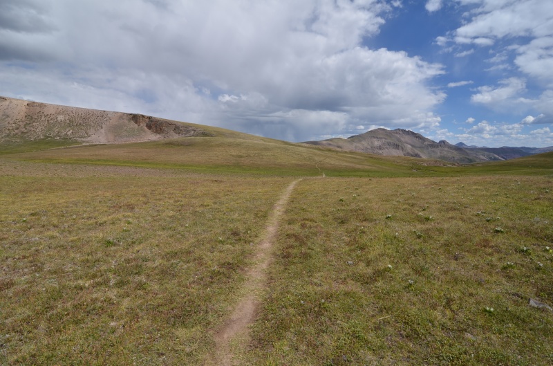
Looking east at the East Fork Middle Pole trail from near the Continental Divide
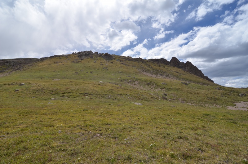
Looking west at UN 13164 from the East Fork Middle Pole trail near the Continental Divide
Mellow slopes on UN 13164
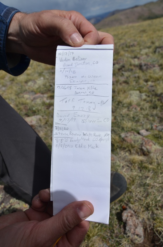
Mike Garratt had left a register, and we noticed the name of someone who likely will finish the 13ers later in 2020
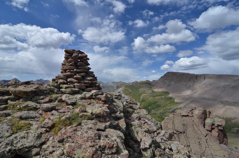
The summit cairn on UN 13164, with Half Peak in the background at right
Looking back at UN 13164 as we descended
We returned to our campsite, pleased to have completed all of the 13ers near Cataract Lake.
Sunday, Aug. 9, 2020. We slept in before backpacking to the trailhead. We were able to snag the last tent site at Woodlake Park campground near Lake City and spent the rest of the day relaxing. Hamburgers from Packer Saloon & Cannibal Grill topped off the day.
I like the night photos of your camp. That approach of the Poles from the north looks much more enjoyable. Ben and I hit them from the south, and, while shorter, the bushwhack to reach the ridge to Pole was not anything to recommend. (In fact, another 14ers.com member along for that little jaunt muttered something profane and turned back.)
Eddie, it was fun to "stalk" your summit register signature from so long ago, along with your Dad's!
I did these two as a day hike from the Cataract Gulch TH, somewhere around 19-20mi's RT and 5500'+ gain.
The miles went by pretty easy with that approach.
Caution: The information contained in this report may not be accurate and should not be the only resource used in preparation for your climb. Failure to have the necessary experience, physical conditioning, supplies or equipment can result in injury or death. 14ers.com and the author(s) of this report provide no warranties, either express or implied, that the information provided is accurate or reliable. By using the information provided, you agree to indemnify and hold harmless 14ers.com and the report author(s) with respect to any claims and demands against them, including any attorney fees and expenses. Please read the 14ers.com Safety and Disclaimer pages for more information.
Please respect private property: 14ers.com supports the rights of private landowners to determine how and by whom their land will be used. In Colorado, it is your responsibility to determine if land is private and to obtain the appropriate permission before entering the property.


")
")
")
")
")
")
")
")
")
")
")
")
")
")
")
")
")
")
")
")
")
")
")
")
")
")
")
")
")


