| Report Type | Full |
| Peak(s) |
Mt. Yale - 14,200 feet "Mascot Peak" - 13,437 feet |
| Date Posted | 07/08/2020 |
| Date Climbed | 06/28/2020 |
| Author | TaylorHolt |
| Handsome Dan Peak...and Mt. Yale |
|---|
|
RT Mileage: 9mi Elevation Gain: 5,200 ft I’ve always assumed that “Tigger Peak” is an homage to the fact Princeton University’s sports teams are called the Tigers. I actually thought that their mascot might be called “Tigger”, but I looked it up, and he’s simply known as “The Tiger”. So maybe “Mascot Peak” is some sort of bad joke that I don’t understand making fun of “Tigger Peak”, but I feel like a it needs a better name. The Yale Bulldogs do have a mascot, and he’s a dapper little fella known by the name “Handsome Dan”. Thus, I’m starting the movement to change the name of Mt. Yale’s ranked friend to “Handsome Dan Peak”. 
After researching a number of trip reports, I still wasn’t sure of the best descent route off Handsome Dan Peak. A few people descended Denny Creek, others descended The SE Ridge into Avalanche Gulch, and Mtnman200 had an interesting route where he traversed the SW Slopes of Yale and summited Handsome Dan first before heading down the standard route on Yale. I was still a little unsure about that traverse to the saddle, and after reading a comment in Roach’s book about not descending Handsome Dan into Denny Creek due to political and environmental reasons (does anyone know what he’s referring to?), I decided to do a loop from the east side of these peaks from the Avalanche Gulch Trailhead. My girlfriend Krysta and I pulled into the parking lot just as the sun was rising around 5:30am and were met by a hoard of Miller Moths who were out late partying from the night before. I’ve never seen this many moths at a trailhead before a hike, and we had to get ready in the car with the doors closed to keep them from flying into the vehicle (or into our face). Once we got started hiking, and the sun fully rose above the horizon, the moths decided it was time to go to bed, and we headed up the nice Colorado Trail towards the saddle of Yale and PT 12505. I'd done the East Ridge route on Yale before in winter, and I remembered a long slog of breaking trail in deep snow to reach the saddle followed by what seemed like endless false summits. However, in summer the route goes much quicker and was quite enjoyable. After seeing only two backpackers on the Colorado Trail, we had complete solitude on the East Ridge. The route doesn't really exceed class 2, but it's quite enjoyable and scenic; I was reminded why Roach considers it a "Classic." 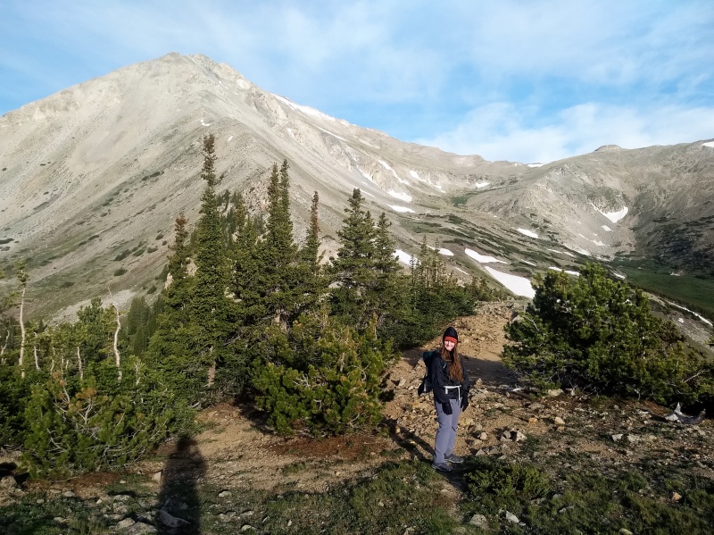
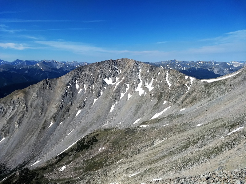
We summitted Yale around 10:00am and found a crowd of around 10-15 people on the summit (not too bad for a summer weekend). I had brought some nail polish remover and a toothbrush because there was a tip on the Facebook page that someone had written in sharpie on one of the summit rocks earlier in the week. Thankfully, I didn't see any evidence of the vandalism, so I assume someone had already taken care of it, and I went about enjoying my summit Snickers. After hanging out for 30 minutes and enjoying the views, we headed back down the east ridge for about 100 yards before dropping to the saddle with Handsome Dan Peak. 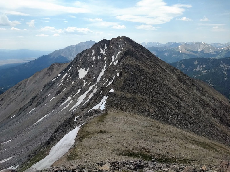
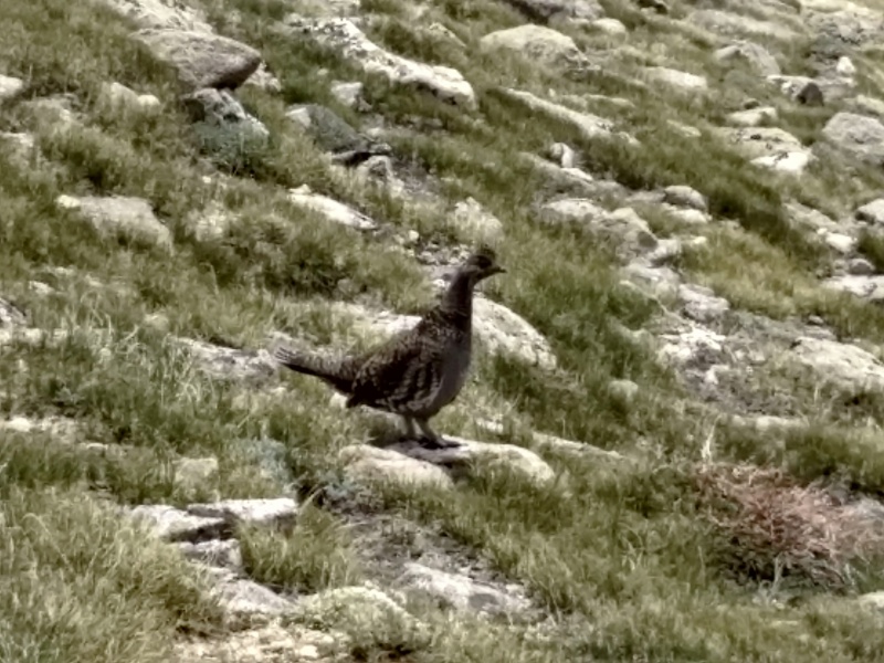
The class 2 ascent of Handsome Dan went quickly, and we were on the summit around 11:30am. After a brief break on the summit of Handsome Dan Peak enjoying the views of Yale and the Apostles, I began scouting the descent route down. It didn't look as bad as I expected as the SE ridge was visible the entire way back to the road. As we were descending the ridge above treeline, I spotted a ptarmigan and then a grouse shortly after. Of course they blend in so well that most of the time you can't see them until they start to move or you're only a few feet away from them. The grouse didn't move at all though, so I figured she had chicks nearby. I scanned the ground looking for little balls of feathers before carefully taking another step. As I took that next step, two grouse chicks flew out of the way from what seemed like right under my feet. 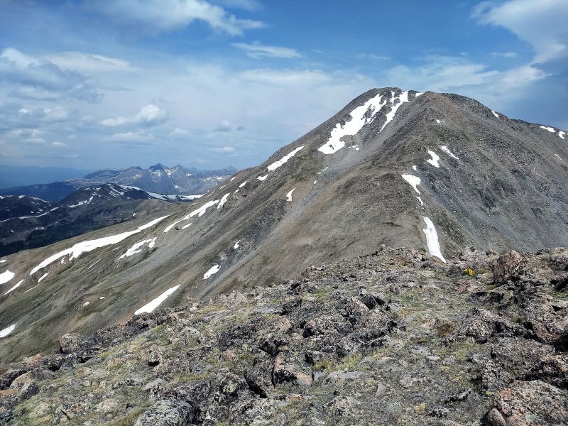
The route down the SE Ridge didn't look too bad at first as I could see the entire ridge down to the car, but the steepness from here is quite deceiving. Once you enter the trees it's 2000ft of relentlessly steep descent until you reach the bottom. The trees are at least relatively well-spaced, but it's not a pleasant descent. After about 700-800ft, I decided to try descending into the avalanche gully to the west which was free of trees. This was a mistake. Yes, it was free of trees, but the dirt in this gully was like sand, and it isn't possible to follow the drainage the entire way down without running into significant obstacles. Eventually, we worked our way slowly down, but I came to the realization that there just may not be a great was to descent Handsome Dan. If I had to do it again, I'd probably descent directly east at around 12,250 and aim for the trail, but I'm not sure if that route is significantly better. 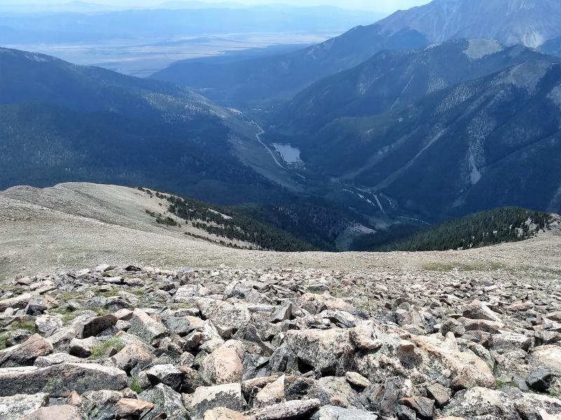
Handsome Dan Peak is a nice addition to any day on Yale, just be aware of what you're getting into on the descent. If anyone finds a better route down, please share. Here's one last picture of the real Handsome Dan... 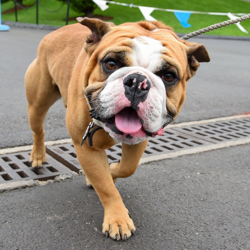 Thumbnails for uploaded photos (click to open slideshow): ")
")
")
")
")
")
")
")
|
| Comments or Questions | |||
|---|---|---|---|
|
Caution: The information contained in this report may not be accurate and should not be the only resource used in preparation for your climb. Failure to have the necessary experience, physical conditioning, supplies or equipment can result in injury or death. 14ers.com and the author(s) of this report provide no warranties, either express or implied, that the information provided is accurate or reliable. By using the information provided, you agree to indemnify and hold harmless 14ers.com and the report author(s) with respect to any claims and demands against them, including any attorney fees and expenses. Please read the 14ers.com Safety and Disclaimer pages for more information.
Please respect private property: 14ers.com supports the rights of private landowners to determine how and by whom their land will be used. In Colorado, it is your responsibility to determine if land is private and to obtain the appropriate permission before entering the property.


