Download Agreement, Release, and Acknowledgement of Risk:
You (the person requesting this file download) fully understand mountain climbing ("Activity") involves risks and dangers of serious bodily injury, including permanent disability, paralysis, and death ("Risks") and you fully accept and assume all such risks and all responsibility for losses, costs, and damages you incur as a result of your participation in this Activity.
You acknowledge that information in the file you have chosen to download may not be accurate and may contain errors. You agree to assume all risks when using this information and agree to release and discharge 14ers.com, 14ers Inc. and the author(s) of such information (collectively, the "Released Parties").
You hereby discharge the Released Parties from all damages, actions, claims and liabilities of any nature, specifically including, but not limited to, damages, actions, claims and liabilities arising from or related to the negligence of the Released Parties. You further agree to indemnify, hold harmless and defend 14ers.com, 14ers Inc. and each of the other Released Parties from and against any loss, damage, liability and expense, including costs and attorney fees, incurred by 14ers.com, 14ers Inc. or any of the other Released Parties as a result of you using information provided on the 14ers.com or 14ers Inc. websites.
You have read this agreement, fully understand its terms and intend it to be a complete and unconditional release of all liability to the greatest extent allowed by law and agree that if any portion of this agreement is held to be invalid the balance, notwithstanding, shall continue in full force and effect.
By clicking "OK" you agree to these terms. If you DO NOT agree, click "Cancel"...
Being a year round low-lander doesn't give me too many opportunities to tackle the fifty-four 14'ers besides my passion for backpacking overnights too. So, picking the next 14'er to climb takes a bit of study for me considering where we stay, things to do, and proximity to the trailhead. Mt. Yale made perfect sense this year because we had not visited Buena Vista yet, and it gave us an opportunity to be close to the Collegiate Peaks- especially only 25 minutes from the Denny Creek trailhead for Mt. Yale.
CODoT has done a great job adding new pavement, resurfacing and striping CR-306/Cottonwood Pass besides adding more parking spaces at the Denny Creek trailhead. We arrived at the trailhead parking lot at 6 a.m. on Saturday morning over the Labor Day weekend, and still had at least 15 available spots left.
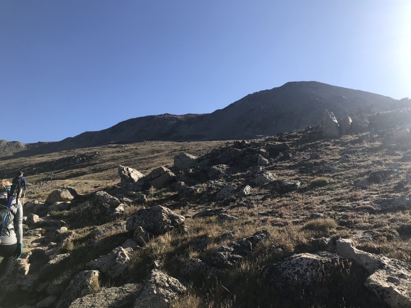
After you check out the information sign at the trailhead and start of the hike, you immediately begin an uphill ascent towards Mt. Yale and it just keeps going. I really liked this 14’er though because there are several sections that feature water falls and creeks, and bridges with either timber crossings or wooden planks. You’ll see wildflowers along different parts of the climb and the trail tracks through quite a bit of alpine tree’d areas too. The switchbacks and incline above treeline will test your endurance, but you'll be rewarded with a beautiful summit and view of the other nearby 14'ers, as well as Buena Vista below. The push to the false summit includes a fun scramble, as well as some opportunities for some Class 3 moves off-trail, and the final push to the summit will take you to 14,196' and usually meeting up with other hikers at the top since this is a popular mountain to add to your bucket list. The summit is more narrow than it is wide, and I couldn’t find the USGS marker unless it was covered up by a rock. The weather was great that day, so we lingered at the top for about 40 minutes to fuel up with some lunch and take in the altitude and sunshine and some rest. Get ready for an uphill climb from the start, but you’ll be rewarded with a beautiful summit and the ‘grand view’ of Buena Vista below.
In the early sections of the hike, you'll come across several creek crossings.Several opportunities for pictures and filtering water from the streams and waterfalls along the wayWildflowers & waterfalls...Early morning sunlight on the opposite peaks.Making our way above treeline and into the switchbacks.First look at the trail ahead and the summit of Yale.The false summit is visible here with the talus and boulder hopping and climbing ahead.Time to put away the trekking poles.
Looking down at the numerous switchbacks and approaching hikers.
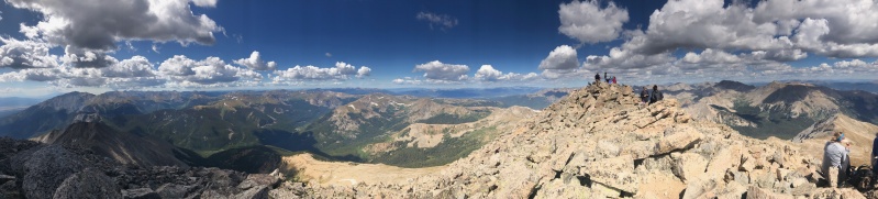
Some scrambling required, but fun.Taking in the view for a moment.This is a social mountain. Some of the summit crowd at the top.Me and my hiking team with our obligatory summit capture.Some amazing views at the top for sure.More summit views looking South.
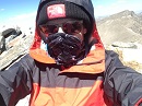
Probably a new profile picture...
More great views from Yale.
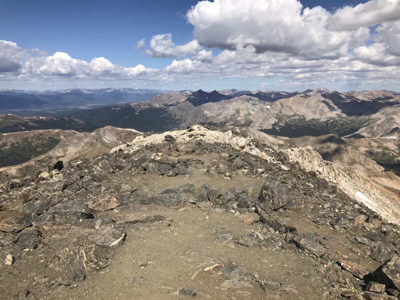
This is looking East with Buena Vista in the distance below.
Resting up before we head back down.
Following the switchbacks on the way back down, but making much better time at it.
On the way down, looking back at the accomplishment and thinking about a great summit for the day. Thanks for reading!
Thumbnails for uploaded photos (click to open slideshow):
Caution: The information contained in this report may not be accurate and should not be the only resource used in preparation for your climb. Failure to have the necessary experience, physical conditioning, supplies or equipment can result in injury or death. 14ers.com and the author(s) of this report provide no warranties, either express or implied, that the information provided is accurate or reliable. By using the information provided, you agree to indemnify and hold harmless 14ers.com and the report author(s) with respect to any claims and demands against them, including any attorney fees and expenses. Please read the 14ers.com Safety and Disclaimer pages for more information.
Please respect private property: 14ers.com supports the rights of private landowners to determine how and by whom their land will be used. In Colorado, it is your responsibility to determine if land is private and to obtain the appropriate permission before entering the property.


")
")
")
")
")
")
")
")
")
")
")
")
")
")
")
")
")
")
")
")
")