Download Agreement, Release, and Acknowledgement of Risk:
You (the person requesting this file download) fully understand mountain climbing ("Activity") involves risks and dangers of serious bodily injury, including permanent disability, paralysis, and death ("Risks") and you fully accept and assume all such risks and all responsibility for losses, costs, and damages you incur as a result of your participation in this Activity.
You acknowledge that information in the file you have chosen to download may not be accurate and may contain errors. You agree to assume all risks when using this information and agree to release and discharge 14ers.com, 14ers Inc. and the author(s) of such information (collectively, the "Released Parties").
You hereby discharge the Released Parties from all damages, actions, claims and liabilities of any nature, specifically including, but not limited to, damages, actions, claims and liabilities arising from or related to the negligence of the Released Parties. You further agree to indemnify, hold harmless and defend 14ers.com, 14ers Inc. and each of the other Released Parties from and against any loss, damage, liability and expense, including costs and attorney fees, incurred by 14ers.com, 14ers Inc. or any of the other Released Parties as a result of you using information provided on the 14ers.com or 14ers Inc. websites.
You have read this agreement, fully understand its terms and intend it to be a complete and unconditional release of all liability to the greatest extent allowed by law and agree that if any portion of this agreement is held to be invalid the balance, notwithstanding, shall continue in full force and effect.
By clicking "OK" you agree to these terms. If you DO NOT agree, click "Cancel"...
The standard route on Snowmass is 22 miles. That's long. Approximately 4 1/2 Culebras long. Too long. And probably too busy, especially on Labor Day weekend. I'd always preferred to do the S Ridge , but until recently didn't think that we had a car capable of getting us near Lead King Basin. However, a few days before we were going to leave, I saw a trailhead report indicating an AWD vehicle less capable that our Crosstrek made it to Crystal. Well damn! if they can make it, so can we!
A new plan was hatched: S Ridge (woo!) up, West Slopes (blah) down.
We set off from Denver to Marble at 8 on Saturday morning. The drive was smooth........until we hit the crux of the road: a closed women's bathroom at the Starbucks in Silverthorne, leaving all in need of relief to fight for a single restroom and creating a special circle of hell I didn't know existed. What felt like twelve hours later, we were back on I70 Marble-bound. Things went better from there, until we left Marble on the low road to Crystal. The road was not technically that hard (there was nothing we weren't sure we could make it up or down), but it is sloooooooow going. I don't think we were able to top 10 MPH at any point on it. Plus, that road is insanely busy due to the popularity of Crystal Mill and only wide enough for one car at most places, so much of the drive becomes a game of chicken with oncoming cars to see who will relent and back up to the nearest pullout, which is never really a pullout but just a small ledge and the oncoming car is a Yukon Denali driven by a tourist who usually drives a smartcar.
But we eventually made it!.....after an hour and 20 minutes to drive 5 miles. If you reach Crystal but don't have a vehicle capable of making it the last 2 miles up to LKB, then there's a parking area with room for 7 or 8 cars on Forest Service land two switchbacks past Crystal (the road in Crystal is all private property). If your car made it to Crystal, it can make it to the parking area.
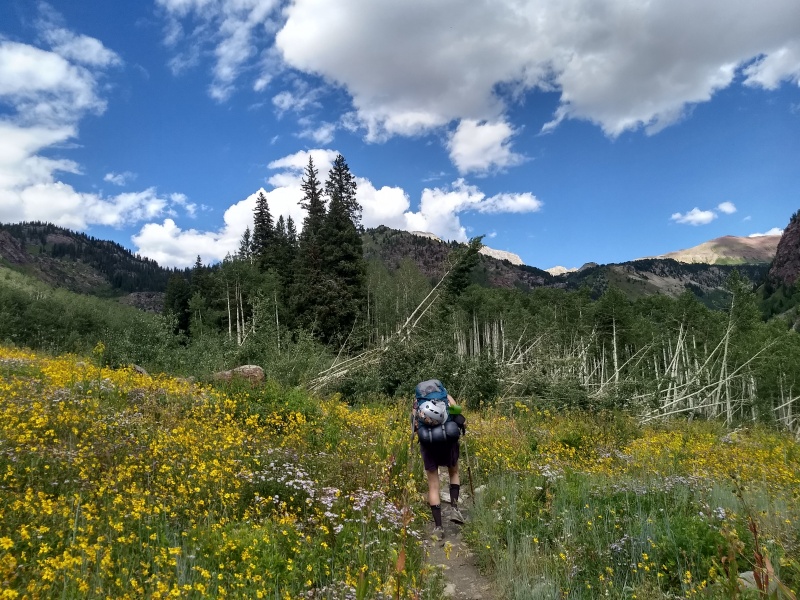
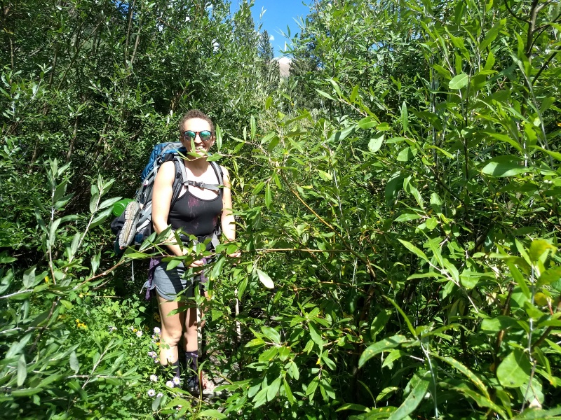
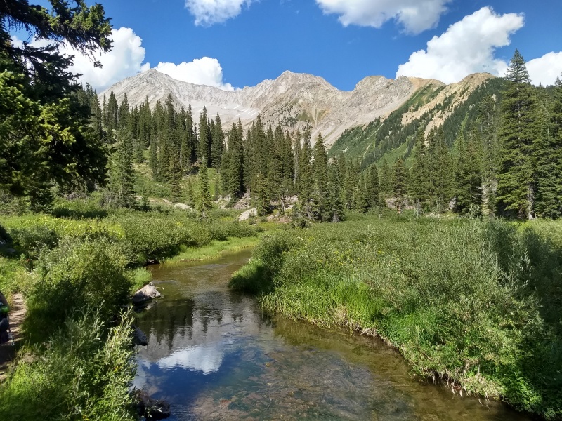
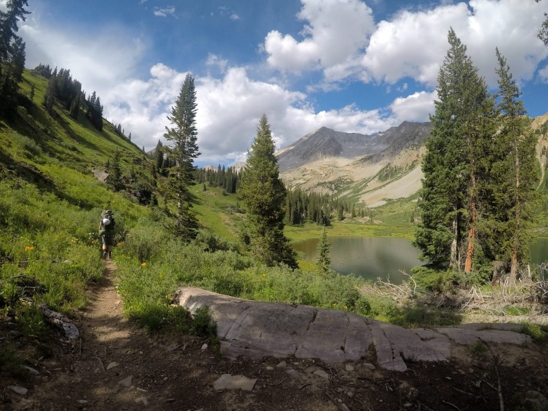
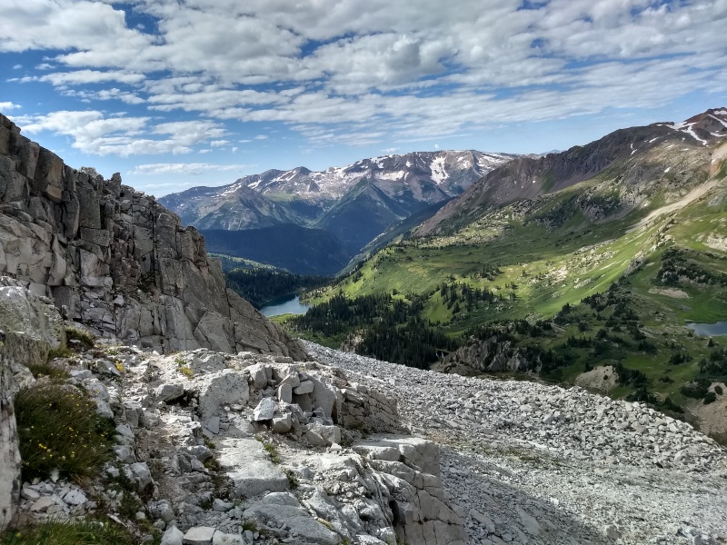
From the parking area, it was 1.7 miles up the road to the LKB trailhead, and another two or so miles to reach Geneva Lake, our camping spot for the night. The road miles went fast. Once on the trail, it was a lot like hiking through a department store if they moved all the clothing racks next to each other so there were no aisles. The trail was thiccccc with vegetation. Poles became weapons. The willows attacked back. If one accidentally got too close to the hiker in front, the reward was a trebucheted willow or aspen branch to the face. Even with the carnivorous plants, LKB and Geneva Lake was one of the most spectacular places I've been. Green, lush, wildflower-y, waterfall-y, yet rugged. Snowmass kept an eye on us as we approached, and the Bells made an appearance up Fravert Basin. We got to the lake two hours after leaving the parking area and ended up snagging spot number one at Geneva Lake, which was flat, water-adjacent, and had phenomenal views of Snowmass/Hagerman.
LKB is OK with me!
The trail is THICCCC
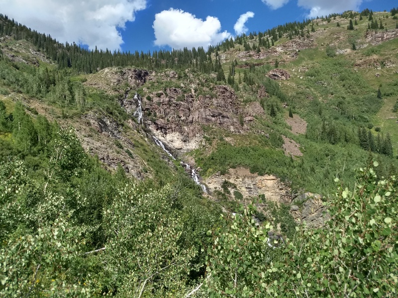
Waterfall flowing from Geneva Lake. Trail switchbacks up the headwall on the left.
Above the headwall, looking at the stream flowing from Geneva Lake, Snowmass (left), and Hagerman (center)
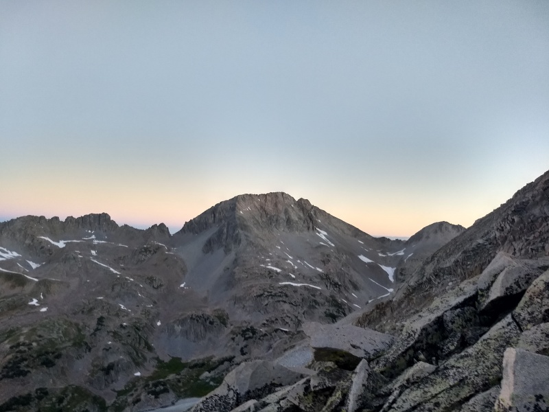
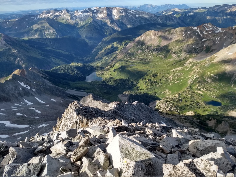
Geneva Lake with S Ridge dead ahead, camping spot up the left.
We set up camp, ate, and I beat Amanda at cards like 25 times in a row. We hit the sack just as it was getting dark. Amanda admitted later sleep was hard because she was nervous about the ascent; I was nervous about the descent.
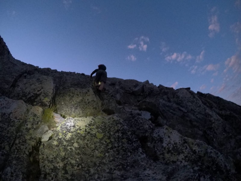
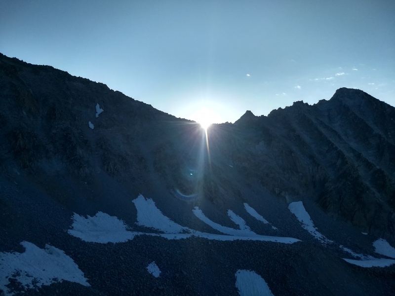
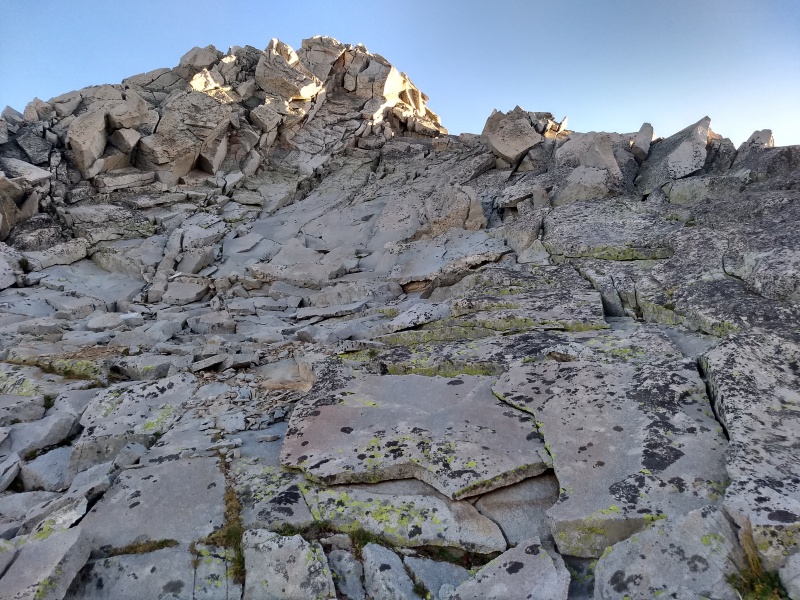
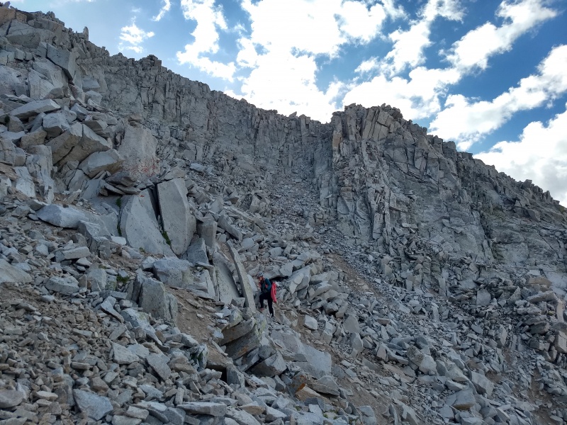
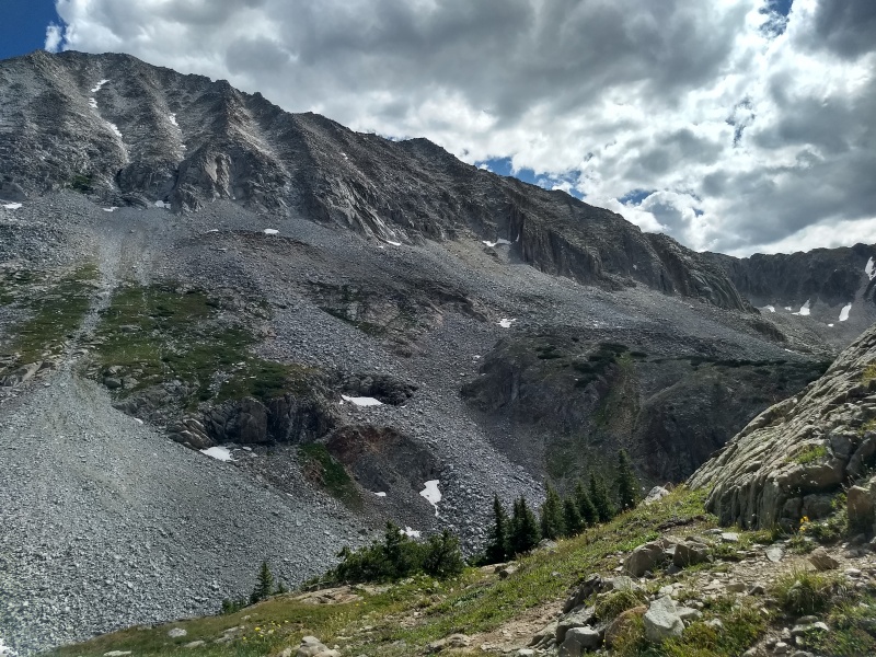
We woke up at 4 and were moving at 4:25. The trail was awesome until we reached Little Gem Lake. Then, for some reason, we left the perfectly good trail and crossed the marshy grass heading toward the creek and the talus field below the S Ridge gullies. Don't worry about finding the turnoff; it's super easy because the spot is very well marked by absolutely nothing. Just know that when you come to the most nondescript section of trail you've ever seen, that means you turn right. A GPS also helps. Cross the grass to reach a loose slope leading down to the creek crossing. I complained a lot about it at the time, but by the end of the day the West slopes had completely redefined "loose" for me so I guess this slope wasn't that bad. There are bushes and tufts of grass to help stabilize things. Once down, hop across the creek and pop out on the other side.
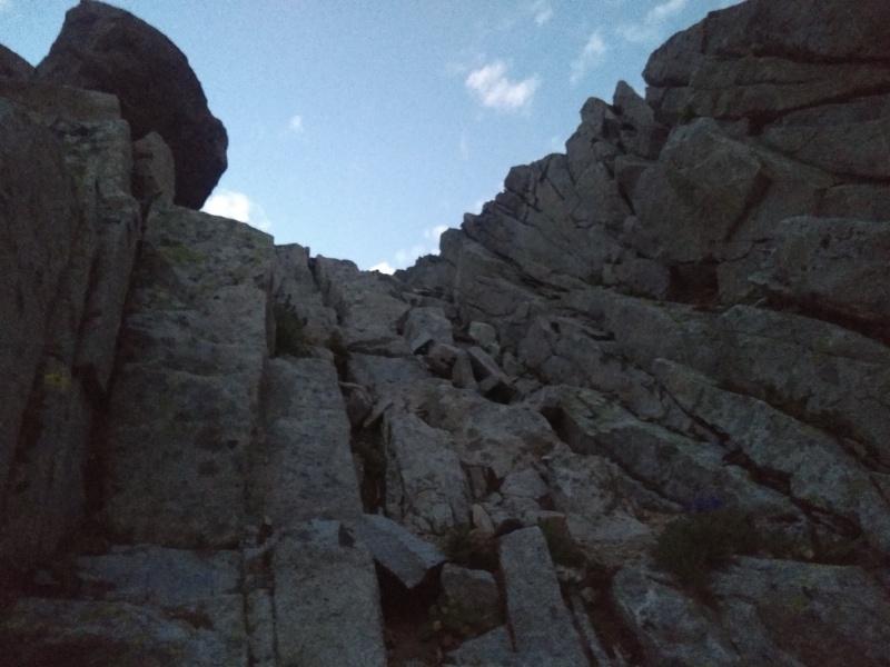
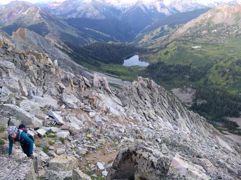
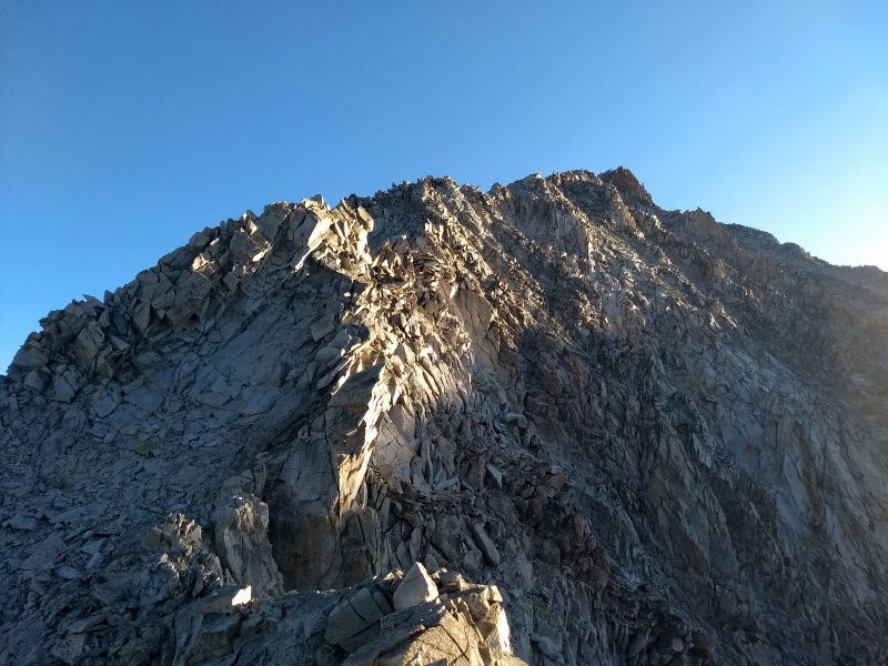
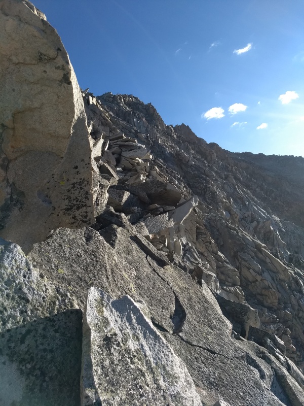
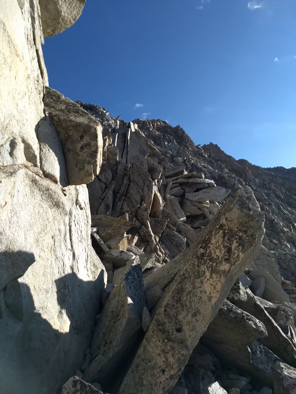
From here, ascendingly traverse around cliffs to the right. There will be a grassy, flowery gully bisecting the cliffs if you go far enough, which grants easy access to the talus field below the S Ridge gullies. Slip and slide up this, then talus hop to 12,150 and the base of the S Ridge gullies. The gullies looked loose, but the rock rib in the middle was bomber. Use a weakness at the start of the left gully to get onto the rib, then ascend bomber rock for 2000 feet to the summit. It's that easy!
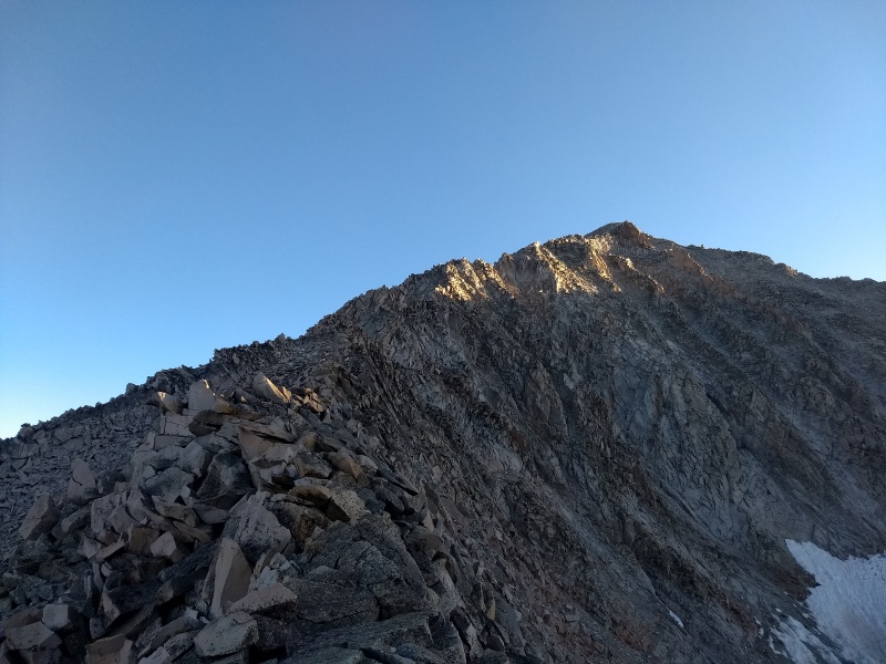
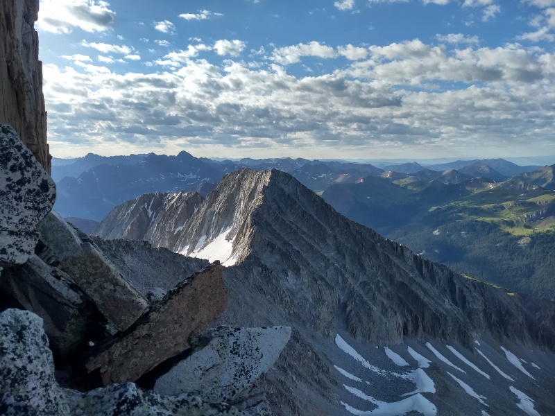
Profile of the S Ridge taken on descent from near the turnoff. Note the twin gullies used to access the S Ridge, located directly above the central patch of trees.
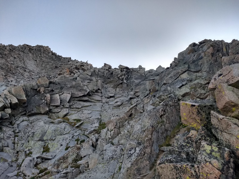
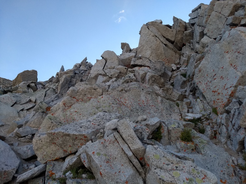
Once above the gullies, we continued climbing up while meandering slightly leftward. Going straight up would have hit the ridge proper earlier, but we found good rock absolutely everywhere on this whole ridge. So we kept going up and slightly left, crossing a series of rock ribs and gullies, on very solid rock.
My rear
Ascending up from the rock rib
I am horribly obsessed with Siberia Peak. Unfortunately, I'm the only one. No one will climb it with me :(
"Not us buddy, right? Not us!"
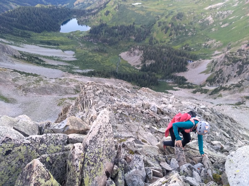
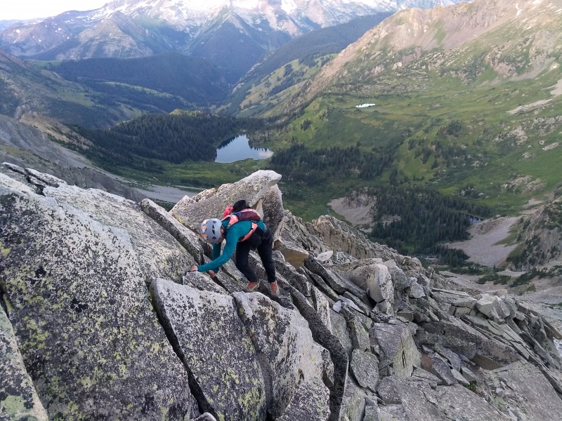
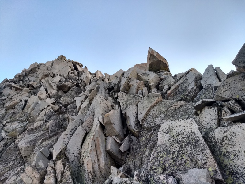
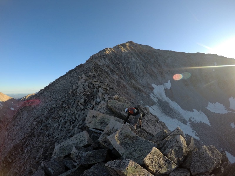
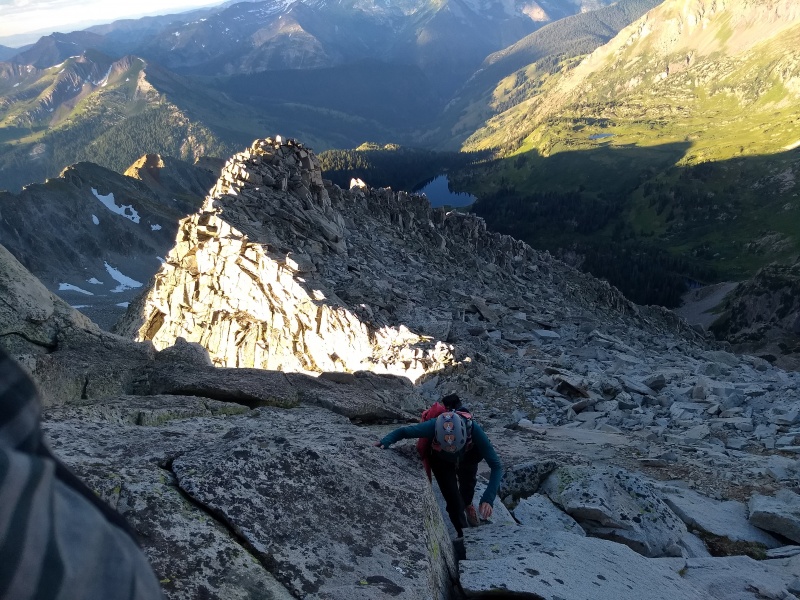
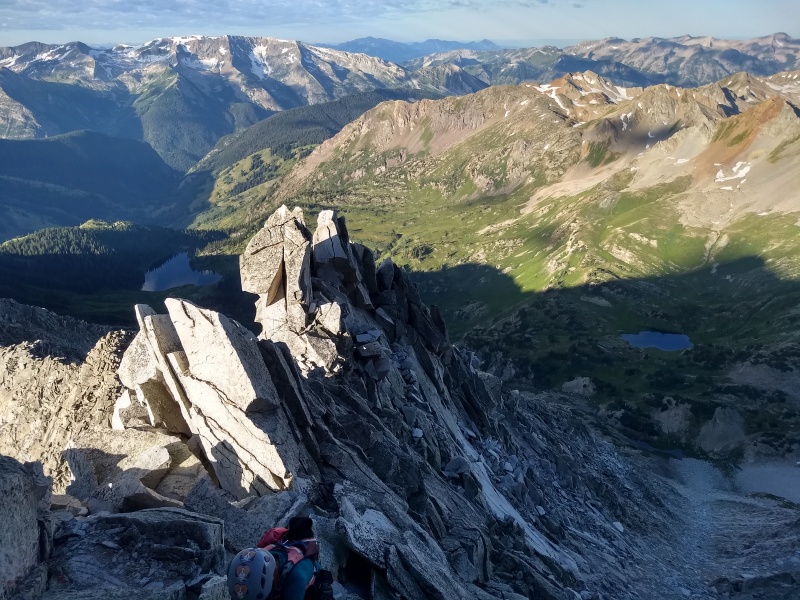
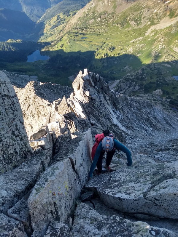
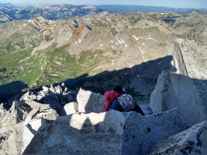
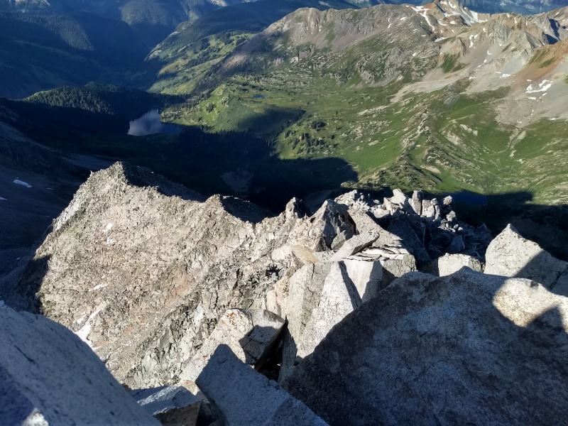
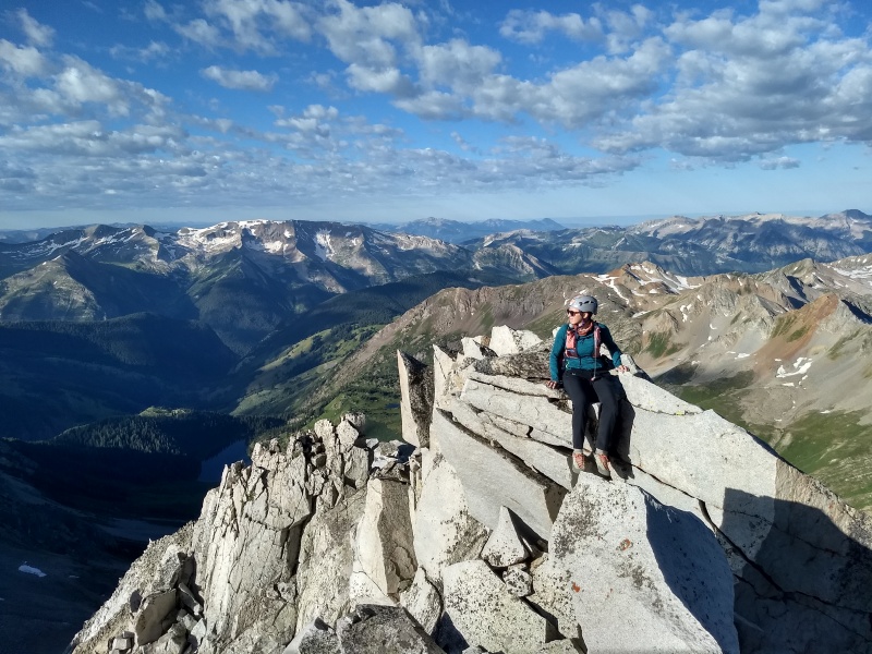
After hitting the ridge, we kept ascending to reach Pt. 13240. Scrambling was "choose your own adventure," with harder moves found on the ridge and slightly easier workarounds below the ridgecrest. For the majority of the hike, we were never more than 20 or so feet off of the ridge, as the rock was so solid we felt no need to drop down.
Amanda climbing away. Geneva Lake saying hi.
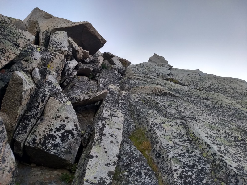
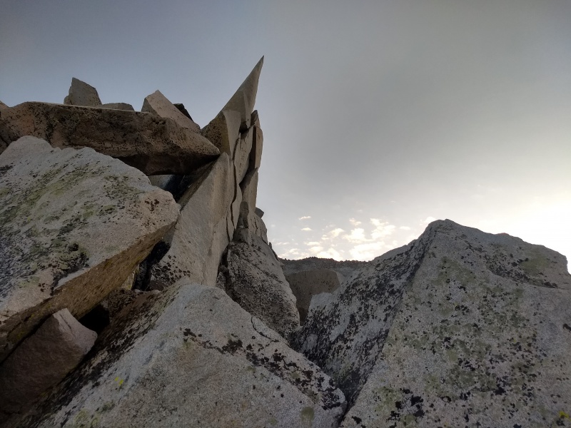
Terrain on the ridge. Believe it or not, all this rock was solid. Note blade rock pointing out from the ridge.
Makin' moves.
Still solid! Trust me. Blade rock again
Fun scrambling
Blade rock V3
Amanda bombing some fun slabs.
Okay last shot of blade rock, I promise. The point of that is actually super pointy (amazing insight, thanks)
Amanda has passed me!
Nearing Pt 13240
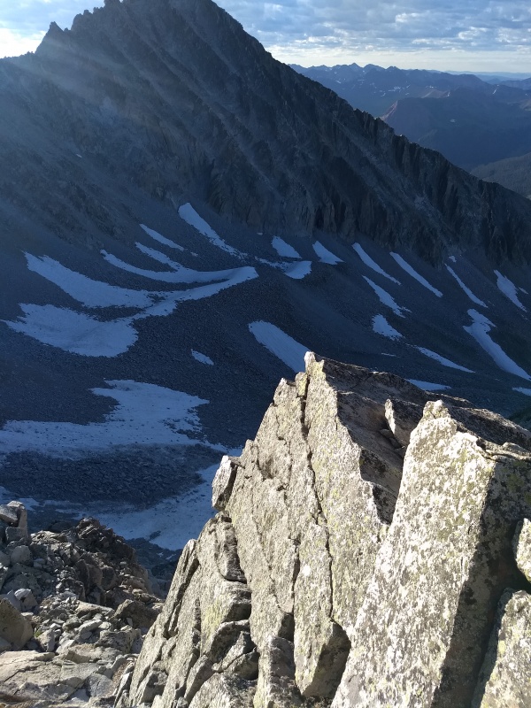
Sunkissed Snowmass
Ridge to Hagerman
We stopped for a food break on top of Pt 13240. We were moderately famished because Amanda let me do the shopping for the trip and apparently cashews, sour gummi worms, and protein bars do not constitute "breakfast food" and do not sound good at 4 AM. They sounded a little better at 7 AM, so we finally were able to get some food down to gear up for the rest of the ridge.
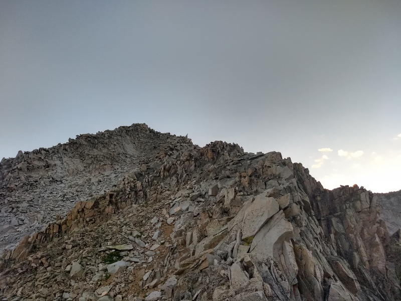
Upper ridge
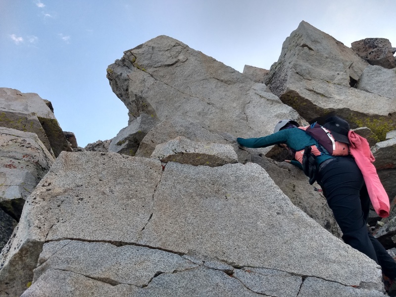
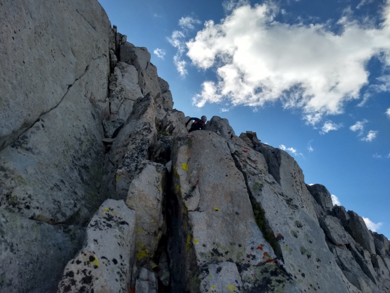
Once past Pt 13240, there's fairly easy scrambling until you hit the crux: a 40 foot slab section leading to a couple of exposed moves to the right of a large point. There's a way to skip the slabs by dropping down to the left and avoiding the point that way, but why would you want to? Solid slab/crack scrambling. I ascended the slabs via a crack system (needed one foot jam to get up, but as always, great rock), while Amanda found a way up via a small ledge system. The climbing was fantastic and we both loved the section.
Starting off on the upper ridge.
Amanda moving up, staying ridge proper.
Approaching the crux slabs
Up-close view of the slabs. Go up, then skirt the point to the right.
Amanda moving up the slabs.
Once up the slabs and to the right of the point, we dropped down 4 feet or so onto a ledge, stepped left, and traversed across a couple of slabby blocks. There were good enough hands and feet during this section, but it was certainly committing.
Drop onto the ledge at the bottom of the photo...
..traverse across these blocks, using the top rocks as handholds and a long step out to the divot in the slab as a foothold...
squeeze through this gap, then round the corner and head through a notch on the ridge....
...and you're done! Above the notch, which is center left of the photo
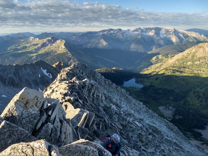
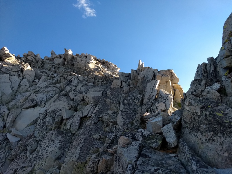
Once above the slabs, the story stays the same: scramble on the ridge crest up good rock, only dropping down if you absolutely need to. It felt like on this ridge that no matter what route we took, there was always a way to keep the scrambling at a moderate difficulty.
Onwards and upwards
Amanda deftly navigating the ridge
Cool white rocks spotted with orange lichen.
In the shadows.
LKB is a special place. So's the S Ridge
Totally candid and totally not staged...but still totally awesome
Hagerman looking fierce!
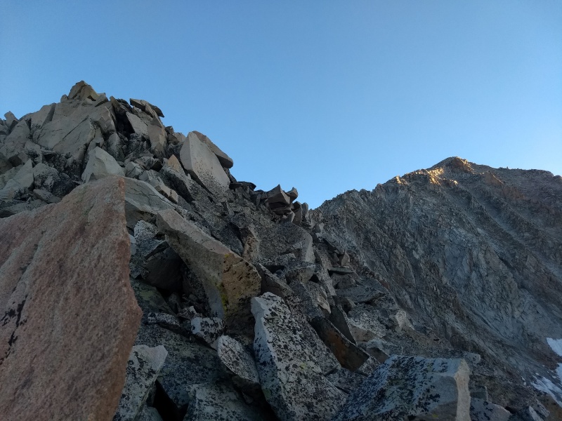
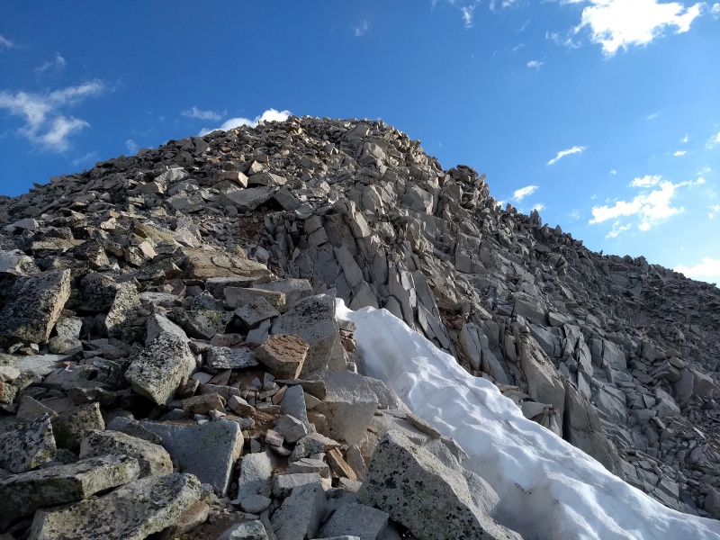
Eventually, the pitch on the ridge relented and the scrambling eased, leaving us with one short, easy push to the summit. No false summits on this ridge!. We topped out right around 8:30, making our ascent from Geneva Lake just over 4 hours (2:15 on the ridge).
Last push!
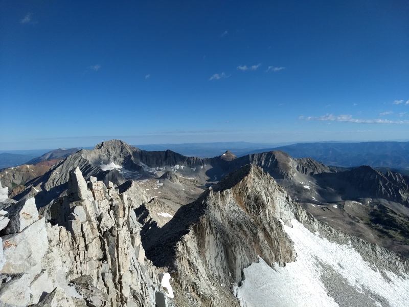
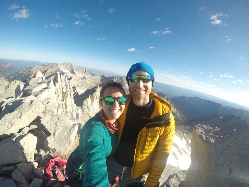
Summit! Views toward capitol and North Snowmass
Back down the upper S Ridge, looking at Geneva Lake and LKB
Success!
All too soon, it was time to come down. Head a short way toward North Snowmass, then find a weakness in the rocks, downclimb, and reach the route. I had been dreading the descent of the West Slopes, but it's never as bad as you dread, right?
Downclimb off the ridge to reach the West Slopes.
Wrong. The West Slopes are the worst.
Oh...
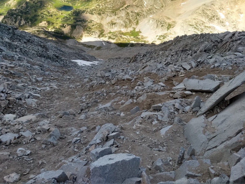
What's your least favorite type of rock? Loose talus? Scree? Hardpan? Slabs with little pebbles and loose rock on it? Well guess what? There's something here for everyone, because you can find all four at any point if you want! A veritable smorgasbord of sucky rock! We both ended up on our butts numerous times. Usually, the sound of rocks sliding out from under a hiker is cause for concern and an "are you alright?" Eventually, that noise became so commonplace that it just meant we were making downward progress. Rocks on the West Slopes never seemed to pick up enough speed to cause too much of a problem for anyone below, but almost every step sent some amount of rock headed down, though they usually stopped pretty quickly. We ran into the only other two hikers we saw all day on this section. This section never felt too dangerous rockfall-wise, but it truly could not have sucked more.
Amanda working her way down.
Oh yeah, and it went on forever. It took us as long to get from the summit to below the waterfall cliffs as it did to ascend the S Ridge.
Reaching the bottom. Crossing over to the downclimber's left of the waterfall to reach the talus field below. At least the views are nice
We finally made it down past the waterfall and onto the talus field. Cairns started to appear for the first time! We followed the path of least resistance down to the creek (which was sometimes a trail, sometimes not), where we were immediately greeted by an ascent back up to Little Gem Lake. A trail felt amazing after 6 straight hours without one.
Down and across the stream. Summit top left, West Slopes directly below summit, route down follows the rocks threading through the grassy section.
Siberia Peak and Little Gem Lake. Please someone come climb it with me
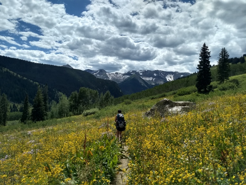
The trail back to our camp flew by, as the plants attack less angrily above the lake. We made it back right around 12, giving us a roundtrip time from our camp of about 7:40. We ate (kind of, because again, Amanda had let me do the shopping and I'd picked the nastiest dehydrated meal....bibimbap does not translate well to backpacking food), packed up, and trekked back out.
We both agreed that the S Ridge was one of, if not the best, 14er route that we've done thus far. It's hard to beat 2000 vertical feet of scrambling on solid rock. We also agreed that the West Slopes was the worst suckfest of a descent ever. But, as always happens when a hike finishes, we blocked out the bad parts and remembered nothing but the good. And there was a lot of good!
Once back at the car, we navigated the road again (only an hour and ten minutes this time!) and stopped at the barbecue place in Marble ('twas amazing). The perfect cap to a perfect weekend!
So long, LKB!
Oh, and ignore the part on the GPS track where we saddled up our Ford Anglia and flew straight to Denver.
My GPS Tracks on Google Maps (made from a .GPX file upload):
Great report. I never really gave the S ridge much thought (too entranced by the glissade descent on the glacier to think of anything else).
If you're still jonesing after Siberia next summer, hit me up. I'm bound to do Hagerman one of these days -- Siberia gives me an excuse to stay in the area another day!
Great report as usual!
Nice to see Amanda being able to get some time off to do a peak with you.
In retrospect, do you think a descent of the S. Ridge would be preferable to the descent of the West Slope route?
@zinj I will definitely take you up on that! Don't think I'll get to Hagerman this year but it'll for sure be on the agenda for next year....and Siberia's on the list too!
@angry can't wait for your report!
@osprey appreciate it! Not sure S Ridge descent would be better. It'd be a tough downclimb for sure....but at least it'd be solid.
Nice job, you two! Nice write up. I wouldn't mind doing Snowmass again via the ridge. And that write up? Sounds like it'd take as long as that hike out of Purgatory. I'll see what I can do.
Ok, so I read both tr's on this site on Siberia. Not exactly what I expected, based on what I know of your climbing preferences. Looks like it could be a similar type route to the s ridge on snowmass. Similar slabby, mostly solid, white rock on a ridge. Looks like it also has a blade rock.
For me what looks coolest, is the rarely seen view of the back side of capitol. I could be talked into doing it.
@ddedrickson Thanks! We chose not to descend the S-Ridge because it would be a tedious 2000 feet of difficult downclimbing. We also didn't realize how bad the West Slopes were going to be. If I were to do it again, I'd strongly consider downclimbing the ridge
Awesome report! Used your GPX to climb the S Ridge on 9/10 and it was spot on! Like you said rock was very solid with a few exceptions and this was a really fun climb (a bit exhausting since I did not camp at Geneva Lake and did the whole thing in a day). Because you hated on the West Slopes so hard, my friend and I decided to down climb the S Ridge which was a bit tedious but honestly took less time than ascending it. There were a few exposed moves when descending the ridge but overall I was very glad we did that as opposed to slipping and sliding down the West Slopes. Thanks again for your great report! Also of note to those who want to do this route: the road up to LKB is honestly one of the worst 4wd roads I have been on and I wouldn't attempt it without something very high clearance. Safe climbing!
@mountain_muggle_77 Great job (and great username)! Glad you found a better way down. If you made it down in less time than it took you to get up then you definitely made the right choice!
Caution: The information contained in this report may not be accurate and should not be the only resource used in preparation for your climb. Failure to have the necessary experience, physical conditioning, supplies or equipment can result in injury or death. 14ers.com and the author(s) of this report provide no warranties, either express or implied, that the information provided is accurate or reliable. By using the information provided, you agree to indemnify and hold harmless 14ers.com and the report author(s) with respect to any claims and demands against them, including any attorney fees and expenses. Please read the 14ers.com Safety and Disclaimer pages for more information.
Please respect private property: 14ers.com supports the rights of private landowners to determine how and by whom their land will be used. In Colorado, it is your responsibility to determine if land is private and to obtain the appropriate permission before entering the property.


")
")
")
")
")
")
")
")
")
")
")
")
")
")
")
")
")
")
")
")
")
")
")
")
")
")
")
")
")
")
")
")
")
")
")
")
")
")
")
")
")
")
")
")
")
")
")
")
")
")