| Report Type | Full |
| Peak(s) |
Mt. Yale - 14,200 feet |
| Date Posted | 08/31/2019 |
| Modified | 06/01/2022 |
| Date Climbed | 07/05/2019 |
| Author | ECF55 |
| Mt Yale SW - 14er Tips for East Coasters and Flatlanders |
|---|
|
Mt Yale - Southwest Slopes Trail (Denny Creek Trailhead) 5 July 2019 (Friday) Hike Times: 5:21am - 12:13pm MDT (6h 52min hike duration) Distance/Elevation: 10.56 miles / 4184 ft (MapMyRun estimates) Mountain Conditions: Patches of snow above 12,000 feet but near summer conditions. Considerable melt flow into the streams. Weather Conditions: Dry. Moderate temperatures. Clear pretty much the whole day with no chance of showers. Crowds: Poplar. Encountered only 4 people on the way up, but passed several 10s of people on my way down (on their way up). Mt Yale was my second 14er. It felt less ambitious than my first (Elbert from SE Ridge) but was still incredibly satisfying. I think Yale is a great option for 14er first timers. I did very little planning leading up the hike. We spent the majority of our trip around Telluride, but the ridiculous 2019 snow season derailed my San Juan 13er hiking plans with piles and piles of snow. Our return drive to Denver via Mt Princeton Hot Springs coincided with a stretch of glorious dry weather and my wife told me: "I got the kids. Just go climb a 14er." So I did... Tips for East Coasters and Flatlanders Before I get to the trip report (see below), I would like to stress a few points for my fellow East Coasters and Midwesterners who have ambitions of hiking up giant mountains in the Colorado Rockies but have yet to do so. I grew up in the Midwest and now currently live in Virginia, so I am proof that it can be done with proper planning and preparation. First and foremost, 14ers are foreign experiences that you just can't find east of the Rocky Mountain Front. It's hard to really describe it until you do it yourself. But basically, 14ers are an exercise of endurance on relatively long trails (10+ miles) that have significant vertical relief (4000+ feet) and reach some of the highest elevations possible in the Lower 48. On top of that, the mountain environment becomes much more rough and exposed the closer you get to your goal, quickly evolving from coniferous forest at the trailhead to frost-heaved talus and tundra at the summit. Snow will stubbornly hold at altitude much longer than down below. And weather can also quickly turn sour (especially after 12pm), so you must always be aware of the conditions and be prepared to bail if required. There are two things that you can control leading up to your hike: conditioning and altitude acclimation. Proper conditioning will ensure that you can physically endure the long process of hiking the 14er. Everyone has different training strategies. Speaking for myself, I try to find a mix of activities that build strength and stamina. Nothing beats actual hiking, so I try to get out on the trail for major hikes (12+ miles and 3000+ feet) at least once a month leading up the 14er. Appalachian Mtn trails can gain up to 3000 feet from valley to peak and if you get creative and double up, you can easily hit 4000 ft in a day. Otherwise, I biked 20-40 miles per week on rolling hills and went for 2 mile runs twice a week. This was more than sufficient. In the absence of mountains, I would recommend adding stair-climbers to you mix. Work with what you have to build strength and endurance. Altitude acclimation makes everything easier, but a lack of acclimation can derail your entire trip. I have two data points: 6 days in Colorado with 3 nights in Aspen (8000ft) before Mt Elbert (14,433ft) and 7 days in Colorado with 4 nights in Telluride Mountain Village (9500ft) before Mt Yale (14,196 ft). Elbert was challenging above 12k and I had to take frequent stops to ensure my heart rate and breathing stayed nominal. For Yale, I can honestly say that I really didn't notice the altitude until the summit push (13.5k). My limited conclusions: (1) it seems that I get about 4000ft above my hotel/campsite before I really start feeling the altitude and (2) everyone should spend more time in the San Juans before hiking 14ers... Mt Yale Trip Report Mt Yale is a great hike for 14er first-timers. The Denny Creek Trailhead is on an excellent mountain road (County Road 306) with a big paved parking lot. The Yale SW Slopes trail is very well engineered all the way up the to summit ridge. And finally, you get a taste of frost-heaved talus terrain on the final summit push, but not excessively so. Views from the summit do not disappoint. I started early so that I could get back and drive to Denver. There was no issue finding the parking lot in the dark (although it was full when I returned at noon). 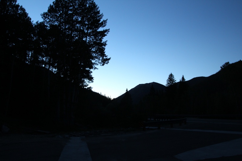
The trail was very well trodden but well engineered all the way up. 
The first two miles of the hike are in close proximity to streams and are slightly less steep than the latter half of the hike. The main Denny Creek crossing was relatively straightforward across log bundle bridges, keeping my boots dry even though the spring thaw had the stream really chugging. A second crossing just beyond the first looked a little more precarious across the makeshift bridge, but was easily passable just upstream. The trail fork to Mt Yale summit and the Delaney Gulch stream crossing were also very straightforward. 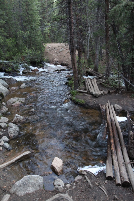
Compared to the Elbert SE Ridge hike, the Mt Yale SW Slope trail spends a lot more time in the forest. This is both good and bad. On the plus side, you hike though relatively lush Southern Rocky spruce/pine forest and get a little more exposure to local wildlife. However, the mountain is more slow to reveal the stunning mountain landscape and you don't get great views of the surrounding peaks until you hit the treeline by Mile 3. 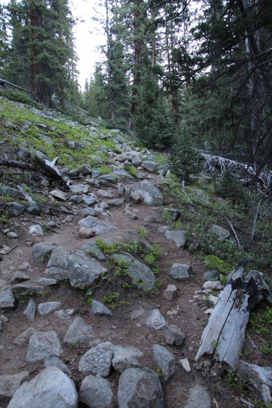
By the time that you clear the treeline, the Mt Yale summit looms over you to the east. Depending on when you start, the peak may still be blocking the sun. 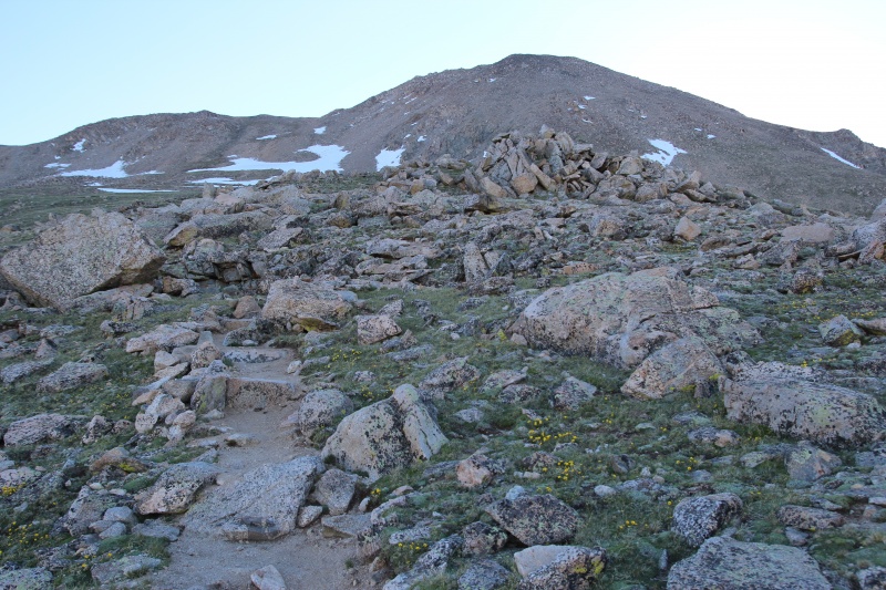
I encountered a few patches of snow holding onto the western slope, but the Southern Sawatch Range melts out much more quickly than the Nothern Sawatch, Elk and San Juan ranges. I would assess that Mt Yale was very nearly summery conditions (but the Telluride area San Juans were easily another month out). The trail continues to snake up the mountain side at a decently steep angle. I went briefly off trail after having been fooled by a "snow cut" through a large 100ft snow field, but recovered. There is a solid trail all the way up to the summit ridge. Views were really opening up to the south and west by this point.  Making progress to the summit ridge. 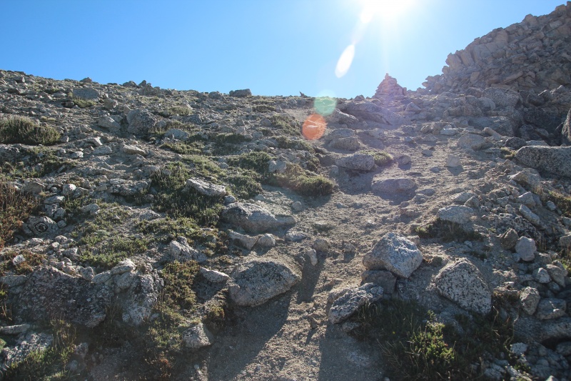
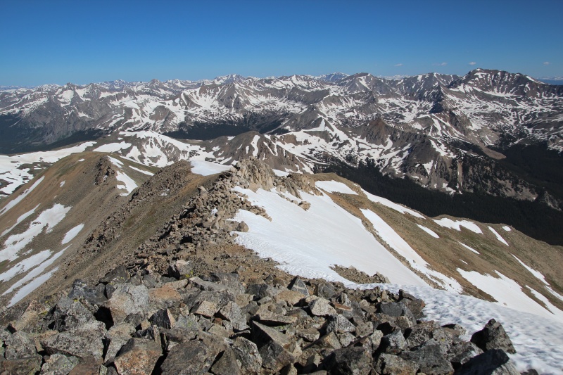
I thought the final summit scramble was great fun. By the time you get to the ridge, you only have a quarter mile and a few hundred feet of mountain left. A trail does wind up to the top, but I found myself also scrambling up along the ridge. Exposure was low-to-moderate; generally enjoyable terrain. 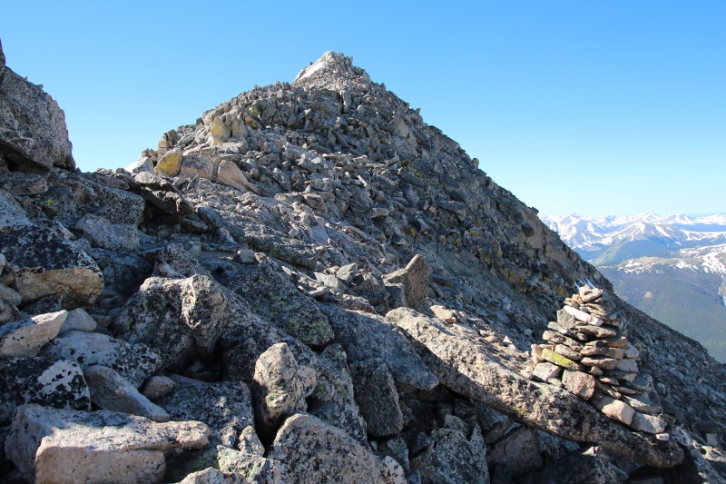
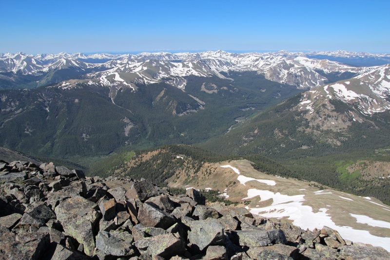
Views from the summit were really impressive. I have heard that at least thirty 14ers are visible from Mt Yale and I believe it. There are mountain peaks in almost every direction. One interesting point about Mt Yale is that the mountain dominates its stretch of the Sawatch Range. There appear to be much higher densities of peaks south of Mt Princeton and north of Mt Harvard, but the Middle Cottonwood Creek valley really opens up the area immediately around Mt Yale and enables those incredible unobstructed views. The relatively steep transition from the Collegiate Peaks to the Arkansas River Valley was also pretty dramatic. 

I couldn't find the USGS summit benchmark, but some Yalie made his mark. 14.1% average grade. 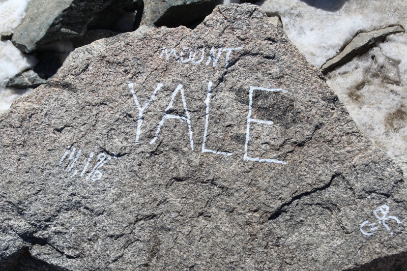
The return trip was much faster paced than the way up. I passed many more people on my way down. Yale is not a peak for solitude, but an early start will really cut down on the trail traffic as you ascend. 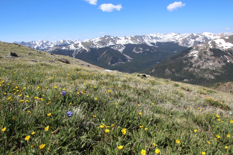
I was surprised at the density of the forest when I got back to the treeline (now in full sun). The scenery at the treeline edge was nice, but the views quickly dropped off after you get back into the forest. 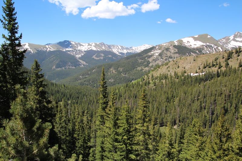
In all, a great trail and a great hiking day in Colorado. Highly recommended! Thumbnails for uploaded photos (click to open slideshow): ")
")
")
")
")
")
")
")
")
")
")
")
")
")
")
")
")
")
")
")
")
")
")
")
")
")
")
")
")
|
| Comments or Questions | |||
|---|---|---|---|
|
Caution: The information contained in this report may not be accurate and should not be the only resource used in preparation for your climb. Failure to have the necessary experience, physical conditioning, supplies or equipment can result in injury or death. 14ers.com and the author(s) of this report provide no warranties, either express or implied, that the information provided is accurate or reliable. By using the information provided, you agree to indemnify and hold harmless 14ers.com and the report author(s) with respect to any claims and demands against them, including any attorney fees and expenses. Please read the 14ers.com Safety and Disclaimer pages for more information.
Please respect private property: 14ers.com supports the rights of private landowners to determine how and by whom their land will be used. In Colorado, it is your responsibility to determine if land is private and to obtain the appropriate permission before entering the property.