Download Agreement, Release, and Acknowledgement of Risk:
You (the person requesting this file download) fully understand mountain climbing ("Activity") involves risks and dangers of serious bodily injury, including permanent disability, paralysis, and death ("Risks") and you fully accept and assume all such risks and all responsibility for losses, costs, and damages you incur as a result of your participation in this Activity.
You acknowledge that information in the file you have chosen to download may not be accurate and may contain errors. You agree to assume all risks when using this information and agree to release and discharge 14ers.com, 14ers Inc. and the author(s) of such information (collectively, the "Released Parties").
You hereby discharge the Released Parties from all damages, actions, claims and liabilities of any nature, specifically including, but not limited to, damages, actions, claims and liabilities arising from or related to the negligence of the Released Parties. You further agree to indemnify, hold harmless and defend 14ers.com, 14ers Inc. and each of the other Released Parties from and against any loss, damage, liability and expense, including costs and attorney fees, incurred by 14ers.com, 14ers Inc. or any of the other Released Parties as a result of you using information provided on the 14ers.com or 14ers Inc. websites.
You have read this agreement, fully understand its terms and intend it to be a complete and unconditional release of all liability to the greatest extent allowed by law and agree that if any portion of this agreement is held to be invalid the balance, notwithstanding, shall continue in full force and effect.
By clicking "OK" you agree to these terms. If you DO NOT agree, click "Cancel"...
Inspired by One of Our Own: The Kelso Ridge Calendar Grid
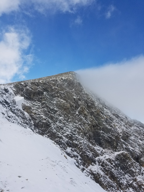
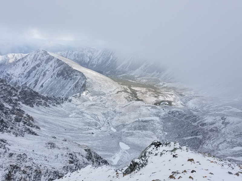
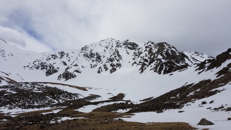
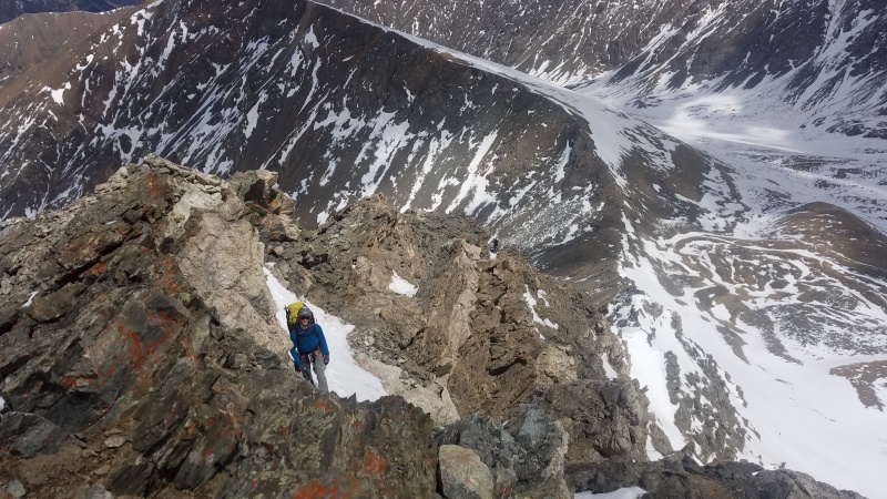
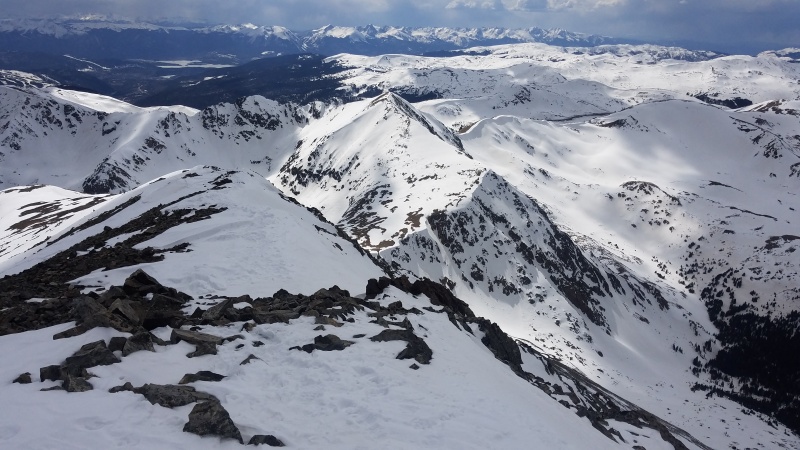
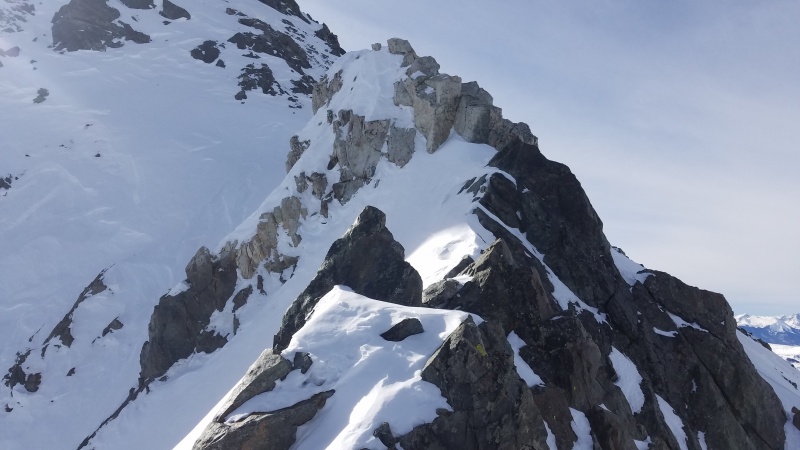
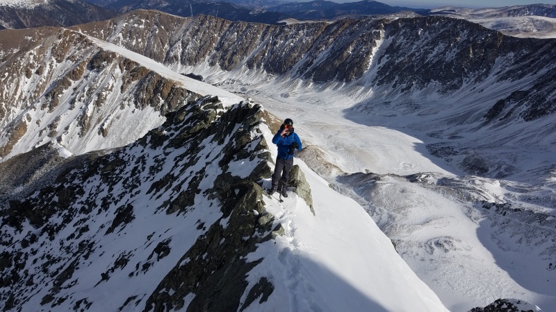
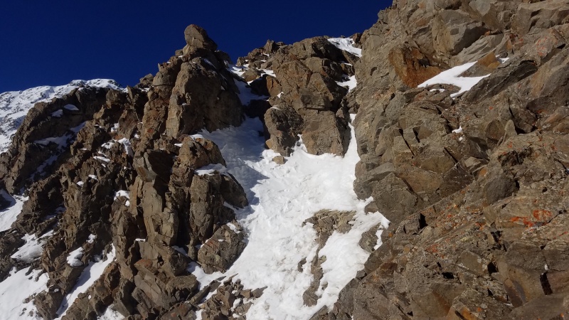
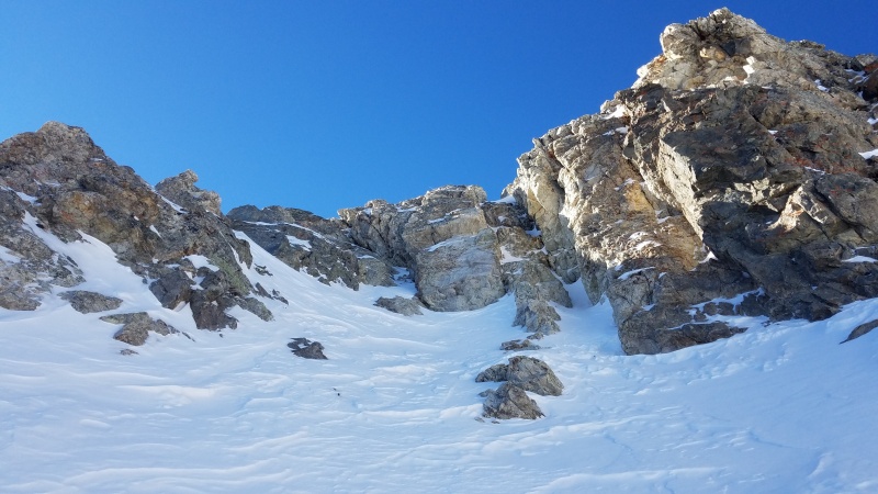
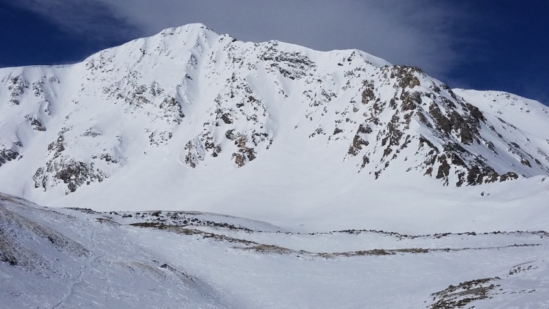
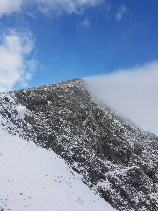
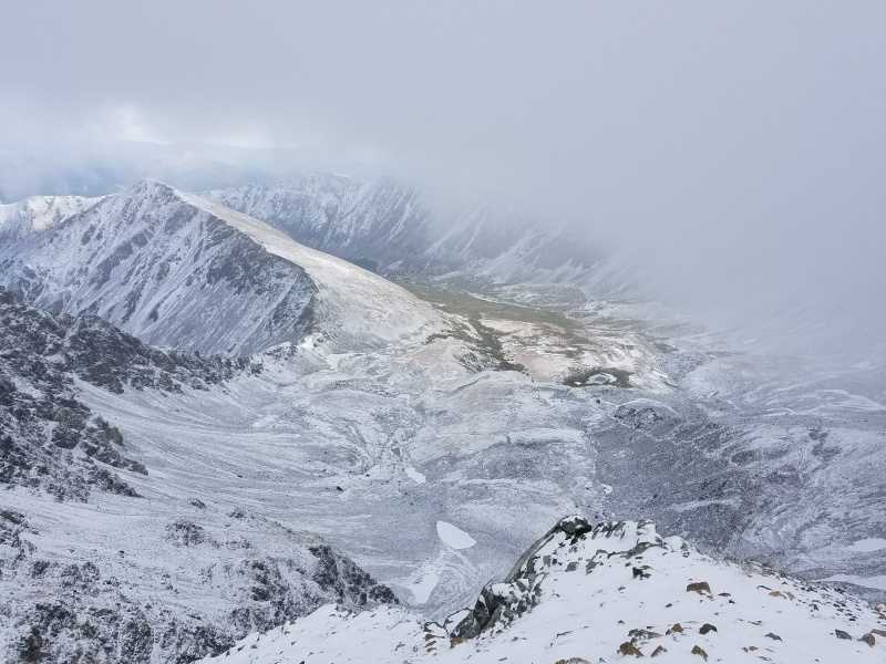
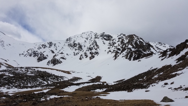
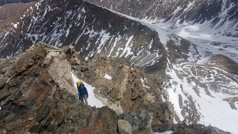
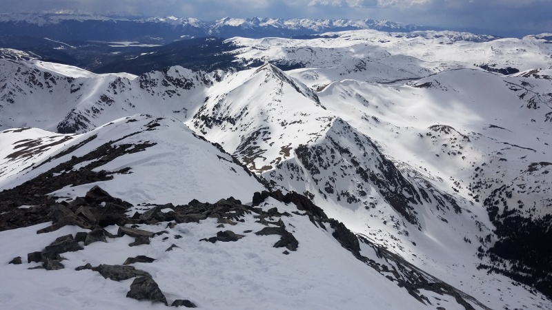
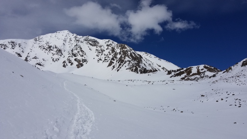
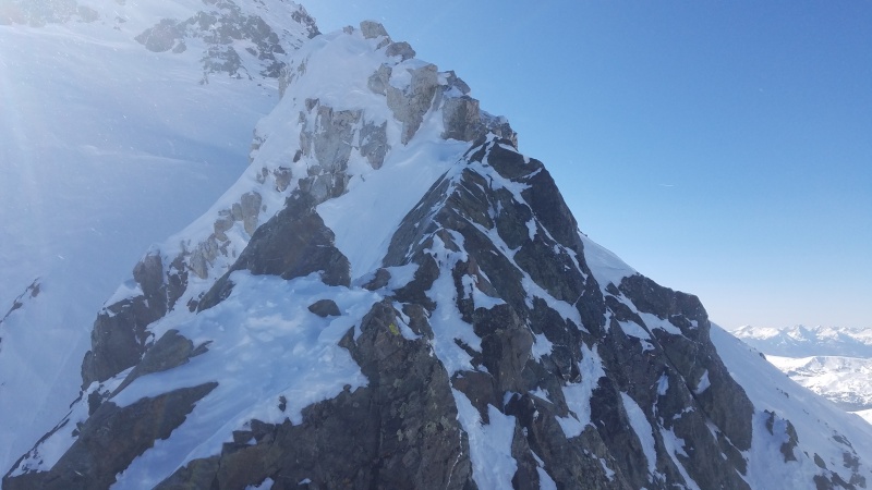
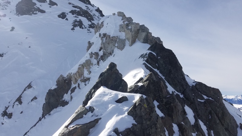
Ah, Kelso Ridge. A classic Class 3 scramble on the Front Range's second highest mountain, Torreys Peak. Though a mere three feet shorter than its neighbor to the south, Grays Peak, Torreys has a much larger stature for those who know of its treasures, which include some of the state's longest snow climbs and the subject of this trip report, Kelso Ridge. Kelso, as I affectionately call it, was the first semi-difficult route I did on a 14er, with Torreys and Grays being my 11th and 12th 14ers, respectively, and it forever had a special place in my heart from that point on. I didn't consider climbing it every month of the year on that first climb but alas, here I am, three and a half years later, having scrambled, slogged, sweat, and swore my way up that route 13 times total across each and every month of the year - the Kelso Ridge calendar grid.
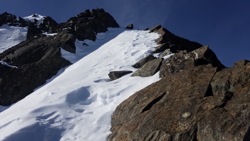
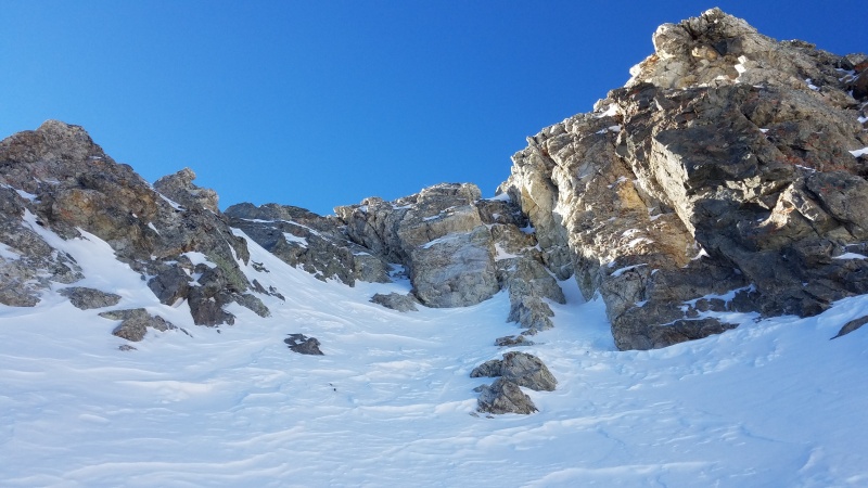
In this trip report I'll mostly share photos of the route as it changes throughout the year, along with some anecdotes and tidbits about the route. This won't be a full fledged, step-by-step trip report and it is written in the order I climbed it, NOT calendar chronology; it is half story and half informational to show the route as conditions change over the year, and to talk about various skills, skill growth, and gear. If you, like me, think Kelso Ridge is one of the finest scrambles on our lovely 14ers, then this trip report is for you.
This trip report and the underlying tomfoolery of climbing the Kelso calendar grid was inspired by 14ers.com user Brad McQueen. Brad, though we have never met, is one of my 14er heroes. For those who don't know him, he's a big name in our Colorado/14er mountain community, and his feats are nothing short of amazing. When I saw that he had completed the Kelso calendar grid - climbing the ridge in every calendar month - I was inspired to take on that challenge myself. Thank you, Brad, for the inspiration.
(Click to jump to a month of your choosing! Thanks to Bill for adding anchor functionality!)
October 17, 2015
My first climb of Kelso. Though I had rock climbed for several years I had never really scrambled anything. I always used a rope and protection. I had done the similarly graded Class 3 Bierstadt-Sawtooth-Evans combo a month earlier that felt easy and the only part that gave me pause was the heinous descent off Bierstadt. Kelso would prove to be a different beast. Roach had given Kelso the *Classic* distinction in his 14er guide book and armed with his route description and more gumption than was probably smart or healthy I chose to do it just a few short months after moving to Colorado and beginning my 14er quest.
That morning I struck off from the trailhead with my then-girlfriend and her roommate, the two of whom were to do the standard route on Grays and maybe pick up Torreys, and I was to do Kelso. I didn't really know what I was getting myself into at the time. It's unfortunate that I neglected to take literally any photos, probably because I was scared out of my damn mind on this route. There was about a quarter inch of fresh snow, I was drastically under-dressed in a base layer, light jacket, hiking pants, and ball cap, and I wore regular hiking boots which lacked the sensitivity and grip I desperately wanted on my scary first climb of the route. Needless to say, climbing the route "onsight" (I use the term very loosely for a Class 3 scramble), solo, and in poor conditions while underprepared, was an experience.
I got past the first crux, which felt stiff and scary without a rope, and though I immediately felt in over my head I also felt committed and didn't want to down climb what seemed like a scary Class 3 spot, so I continued onward. Route finding was challenging the first time up, and I remember getting vertigo at the knife edge (which was frosty and I had no gloves) and spending several minutes trying to climb down and around it to the north, on the opposite side of Dead Dog couloir. I'll save you the bated breath, I couldn't figure out an alternative path and instead straddle-scooted the knife edge since I figured it was the most stable way to cross. I won't lie, it was pretty scary. The knife edge is quite exposed but as long as you are deliberate in your movement you have no reason to worry about it. The White Tower on the far side of the knife edge took me a minute or two to figure out as well, since some down climbing is required, but once past that there are no more difficulties except the time it takes to walk back to your car and get beer. I tagged Torreys, went over to Grays, and met my crew at the trailhead.
July 7, 2017
Almost two years passed before I went back to Kelso, not because it had scared me off but because there were other mountains to climb in Colorado. Who knew?
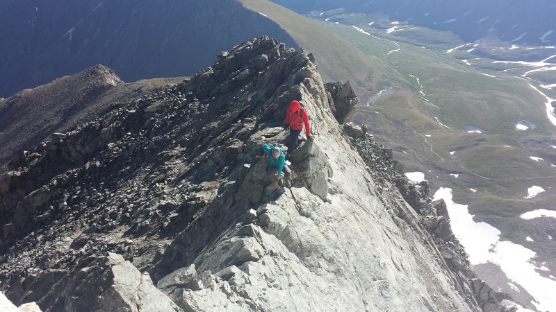
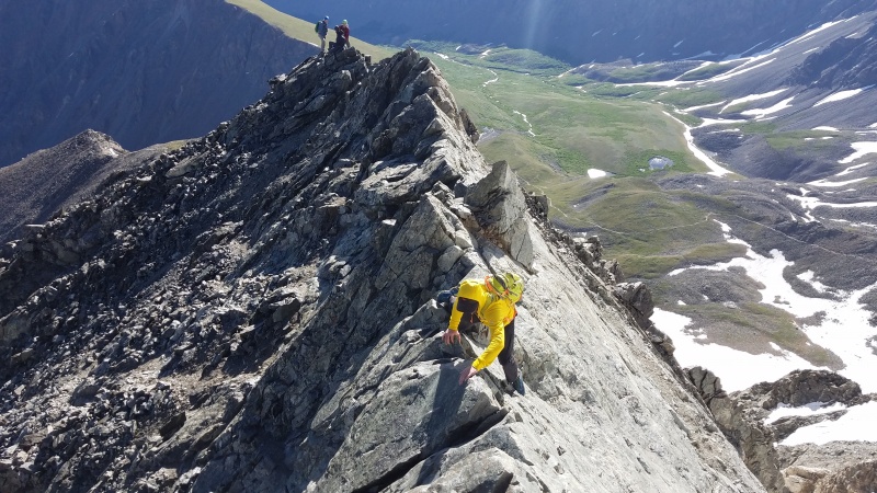
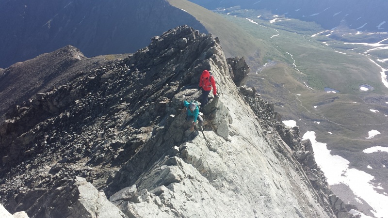
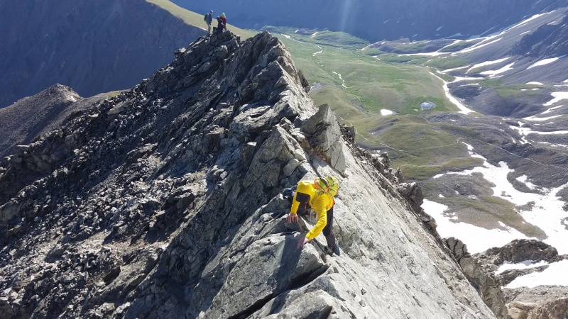
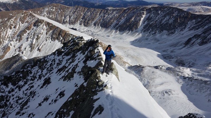
With dry conditions on the route, numerous winter and spring mountaineering classes with the Colorado Mountain Club, and plenty of scrambles in the summer of 2016 to expand my toolbox, I went back with my friends Chris and Leela so we could get a shot at a knife edge ridge before taking on Capitol later in the month. This is a picture I took of some others on the knife edge that day but gives a good sense of what it's like in dry conditions.
In dry conditions you can put both hands on the top of the knife edge, both feet along the right side of the wall, and traverse sideways. This is a little more exposed but easier.
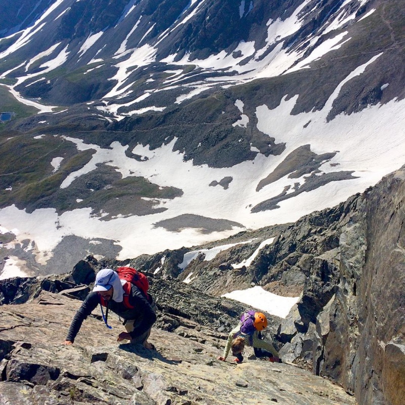
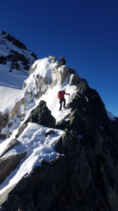
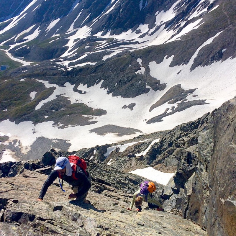
Immediately prior to the knife edge is a short Class 3 slab that Chris got a photo of Leela and I on; though a fall would of course be bad it's not quite as exposed as it looks.
You can see the trail far below. And yes, our helmets are hanging uselessly on our packs. We got to the top of the route and realized we never put them on... Oops.
August 28, 2017
Full on summer conditions by this point. I didn't take any photos this time either, opting for speed - 3 hours, 48 minutes, 44 seconds round trip for both Torreys and Grays via Kelso Ridge. I'd say that's pretty speedy! Two years of consistent training, a few dozen other 14ers (including Rainier) under my belt, and knowledge of the route meant I could go fast, and in the mountains speed is safety. The less time you're exposed to objective hazards like storms and lightning, avalanche terrain, rockfall, etc., the better. Kelso Ridge has all of those in varying quantities depending on time of year so it's to your and everyone's benefit to be prepared.
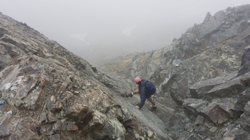
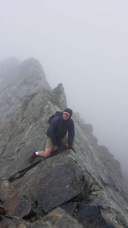
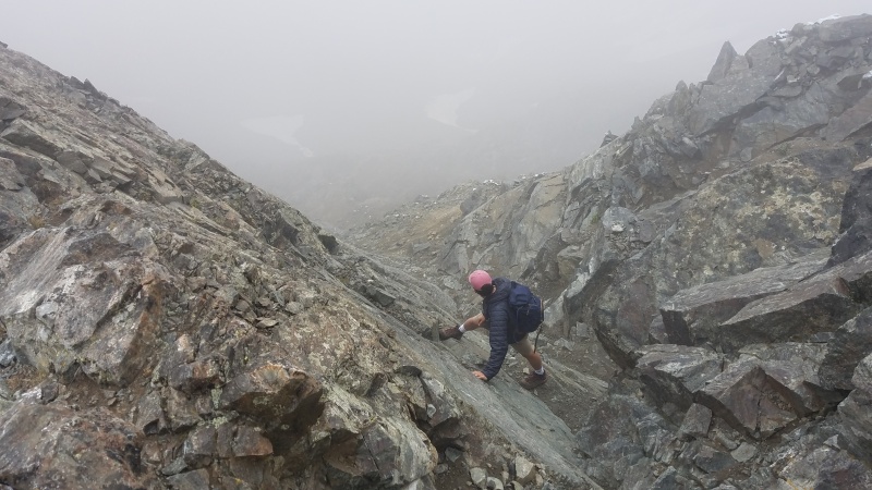
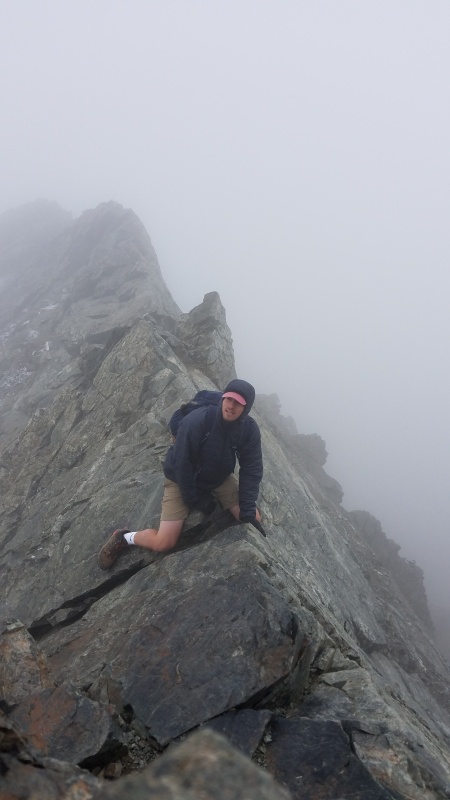
Though the photos below were taken in August of 2018 it shows the exact same spots as above, the slab prior to the knife edge and the knife edge itself, and shows that you can have almost any kind of conditions at any time of year. Be ready for it all! My roommate Mac, shown in the photo, had a great time up Kelso for his first time but was just as under prepared as I was on my first climb. Note the shorts, ball cap, lack of gloves, snow... it was cold and while everyone was OK and had fun things could have been dangerous if conditions worsened, someone got injured, whatever.
Taken in 2018. Still summer but be prepared for snow at any time of year.Also 2018. That's a look of "what the %*!# did I get myself into?"
September 19, 2017
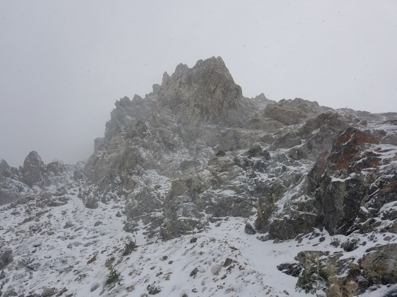
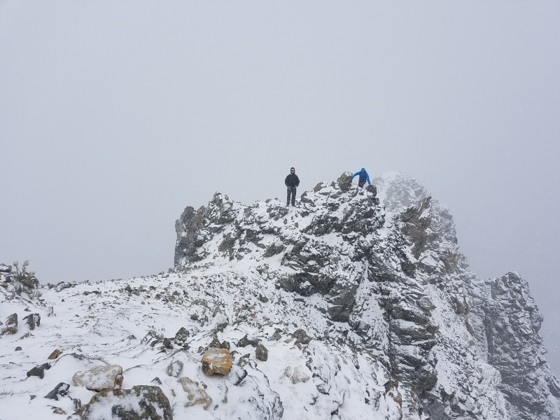
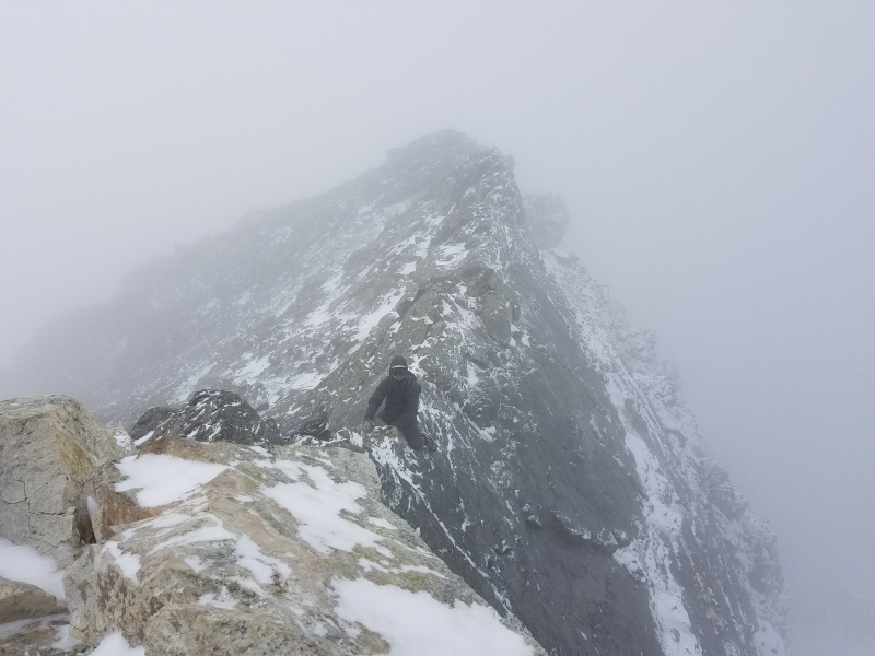
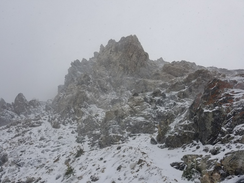
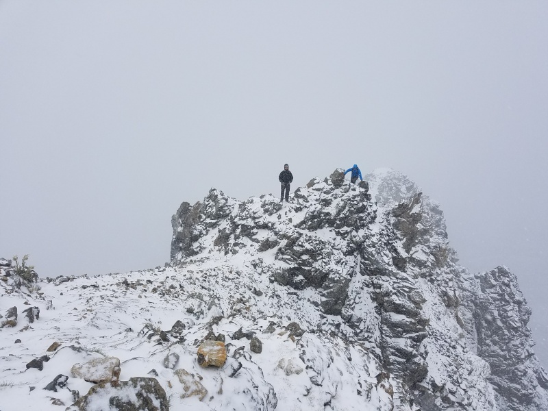
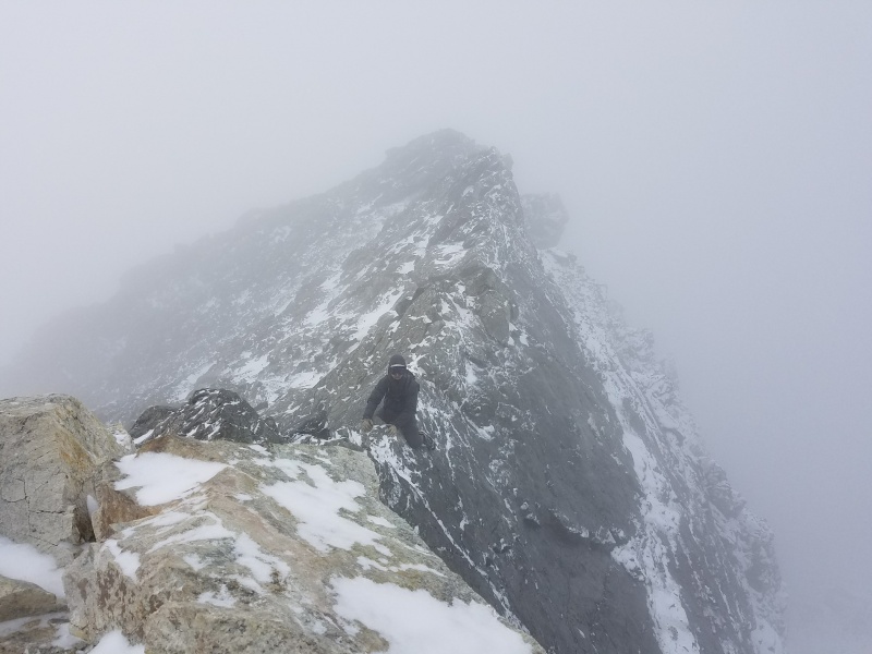
Aside from my first climb in October, September became the first month where things got real. And by real I mean sun and warm temperatures at the trailhead and a nuking blizzard by the time we hit the summit. It was just Chris and I this time (plus randos on the route, of course) and we hadn't brought ice axes because it was rather lovely at the trailhead. This turned out to be OK, we didn't need them, but it might have been nice. We were slightly under-geared here as well (I'm pretty sure I was in trail runners and didn't have microspikes), again considering unexpected conditions.
Torreys from just below the G&T saddle on the descentSnow!Tons of snow!I forget this guy's name but I remember he was pretty scared by the conditions. I believe it was his first time up the Ridge... Pretty gnarly conditions for a first time!Deceptive, no? You can see why we thought it was fine down at the trailhead...
April 28, 2018
In April and May 2018 Chris and I climbed Kelso on back-to-back weekends as training for the infamous Liberty Ridge on Rainier (spoiler alert: we got our asses kicked by LR and failed). Both weekends we had Kelso entirely to ourselves, and this was the first time either of us had climbed it with winter amounts of snow. This made the climbing quite easy, actually, and I don't believe we scrambled on rock at all either weekend. Both times snow dictated that we start at the lower trailhead on I-70.
For our April climb we packed our packs exactly like we would on Liberty Ridge; two ice tools, rope, harness and assorted climbing and crevasse rescue gear, tent, sleeping gear, and four days of food. Obviously we didn't need the vast majority of that but what better training than putting on 40 pounds of crap and scrambling it to the top of a 14er? We'd be doing the same on Liberty Ridge, albeit much harder climbing then, so we wanted to make it as realistic as possible. We did everything we'd be doing on LR, with the exception of using the rope. Not only did we do that but we carried over Torreys' west ridge to Grizzly Peak and Loveland Pass, where we camped at about 12,800' for the night before descending to the pass the next morning and hitching a ride to the lower G&T trailhead on I-70. It was a brutal day, nearly 14 miles one-way, over 6,000 vertical feet of gain, a lot of it up and down and up and down, over the course of nearly 12 hours. As mentioned the scrambling was quite easy but overall this was a beatdown of a day.
Kelso Ridge, Torreys Peak from the summer trail. Ain't she purdy? *drools*There was so much snow we were able to bypass most or all of the scrambling on snow. I believe this was taken at the knife edge, which had so much snow we were able to walk right across it (a first for both of us) as well as bypass the White Tower at its end on climber's left instead of down climbing it to climber's right.From the summit of Torreys, looking towards Grizzly Peak (in the middle).Looking down the descent. It's hard to tell just how enormous Grizzly is from here.See Chris near the middle-right? Grizzly is friggin' huge, and we'd already done 4,000+ vert with 40+ pound packs on today. No rest for the wicked!
May 5, 2018
Chris and I went back the very next weekend but this time instead of 40 pounds of gear (which we determined we didn't need, since the route was so "easy") we carried 50+ pounds of water. Yes, we are very, very stupid. Gotta get dat muscular endurance though! This time we only bagged Torreys via Kelso Ridge, then dumped the water on the summit to save our knees on the descent. We were too wiped out to get Grays. It was still a huge day with huge packs, and would be our last training climb together for Liberty Ridge.
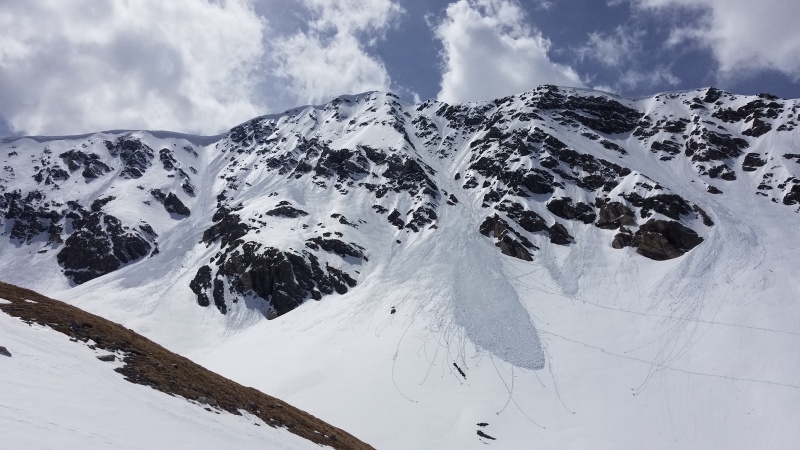
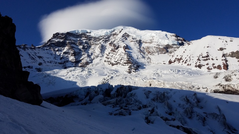
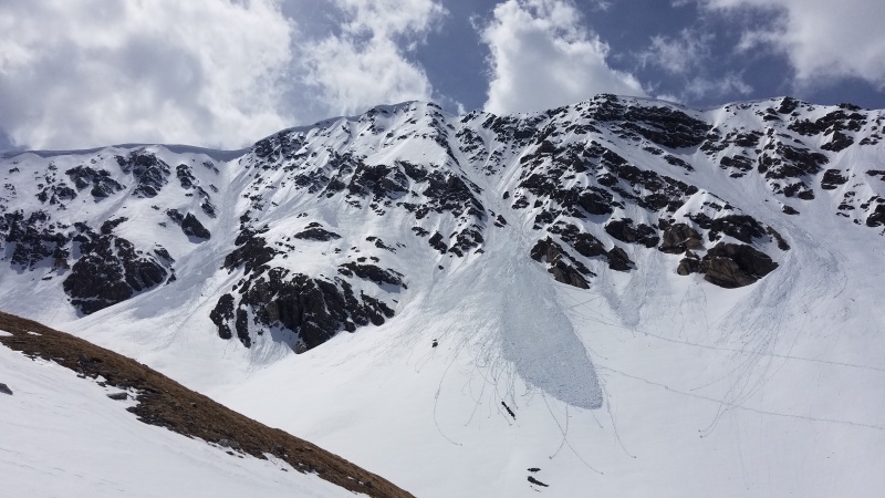
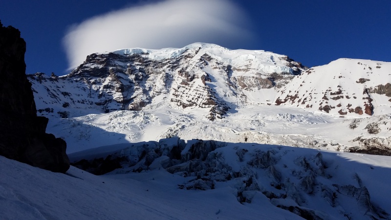
Taken near the same spot as April, there had been a major dump during the week.Yes, that's a massive avalanche that ripped out the entirety of Dead Dog.Closer look at the knife edge, White Tower, and avalanche. Scary. While we bypassed the White Tower on the left the previous week we were worried about the remainder of the snow ripping out from under us so we went around and down to the right like usual.Dead Dog's avalanche from the trail on descent. Yikes.Absolutely blanketed. This is the most snow I've seen on Kelso to this point.Thick, gloppy, deep, disgusting snow on the descent. We carried snowshoes but did we wear them? Hell no! Snowshoes are a crutch! They also make for good training weight.Bonus pic of Liberty Ridge on Rainier, since I mentioned it a few times. I took this on the morning of our second and last day of our climb (usually a four day climb). Normally the route crosses the Carbon Glacier to climber's left of the ridge then crosses the toe of the ridge and climbs up the right side. We thought the right side of the Carbon looked better and got completely cutoff from the ridge over near that crevasse field. Surrounded on three sides by multiple rings of bottomless black crevasses 50 feet wide at best, we had no choice but to turn around and abandon our climb. She calls to me still...
June 23, 2018
I think it was about this time that I realized hey, I've climbed Kelso Ridge a lot! Why not go for that calendar grid thingy? It can't be that bad, right? Well, June is a very easy month and I got one of my favorite pics of it and my buddy Antonio making the knife edge look like child's play. Both of us are strong mountain athletes and we bagged G&T in just a hair over four hours round trip.
Antonio blasting the knife edge. You can't really see it clearly in this low-res version but those three in the back were 'mirin' hard. I know I was!
November 9, 2018
Now the hard months. November through March, inclusive. Argh. I had so much work to do. Don't get me wrong here. I like winter climbing, but winter 14ers are an exercise in endurosuffering. The weather usually sucks, you have to worry about avalanche danger, the climbing is usually much harder and slower, exposing you to more bad weather and objective danger, nobody in their right mind wants to join you, and do you blame them?, you often have to start miles and miles away from trailheads and break your own trail, blah blah. A man gets to whine every now and then, OK?
So the hard months. If I had known that I'd be attempting this insanity a year ago I would have done it then, in what turned out to be a historically low snow year. It would have been complicated by a trip to Aconcagua that ate up like 28 days of January but whatever, the rest of the climbs would have been made easier and less dangerous with the lack of snow. 2017-2018 is the winter that Andrew Hamilton became the first person to bag all 58 14ers in calendar winter after all, again made easier due to lack of snow.
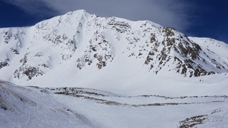
One quick addendum to this all is I find winter climbing to be kind of scary. I'm not sure if I'm a good judge of dangerous slopes or not. Yes, I've taken avy training, and have the gear, and go out and climb in the winter anyway, but I typically just avoid anything that either looks sketchy, which is subjective, or anything that fits nicely into the somewhat more scientific box of "these terrain features with these qualities slide a lot and yer gunna die!" thing. Climbing Kelso in the winter was kind of a scary thought, and it should be. I think it would be foolish to not have a healthy level of fear for a big route with numerous dangerous features on it, not to mention the multiple deaths caused by avalanches on Kelso Mountain's south slopes. I could at least avoid the latter by adding some suffering in the willows of Stevens Gulch but there's plenty of steep, crossloaded gullies on Kelso Ridge itself that, while I have never seen them slide, very well seem like they could. In the mountaineering world a lack of evidence of avalanches is not evidence that they will never slide, and all slopes are guilty until proven innocent. Caution in the winter months keeps me on my toes.
Which leads me into a kind of scary experience I had on my November tick, all caused by, of course, my own dumb self. Who else? I was up there completely alone, after all. I knew in the winter months I might only have a day or two each month to climb, so I had to take advantage of them. That's potentially dangerous thinking in that I could choose to climb literally any other year after this, but I had my nose to the grindstone at this point and I just wanted to get this over with. My November tick thus took a turn for the stupid when, after turning around a week earlier on a solo attempt due to a blizzard, I went back for another solo beating. This time I found better weather and started up the ridge without issue until I got to the second crux, the White Rocks (not to be confused with the White Tower at the end of the knife edge). Opting to climb in microspikes instead of crampons for weight savings and speed I struggled at getting up the White Rocks in a manner that I felt safe. It's much harder when glazed in ice and you're wearing quarter inch steel spikes and chains instead of crampons or sticky rubber, and I felt stuck. I ended up going around the White Rocks to climber's right up a steep snow slope that sketched me right out but proved to be safe - at least that time. I climbed close enough to the wall to always have my hands on rock at least, but that's no guarantee when the ground moves out from under you.
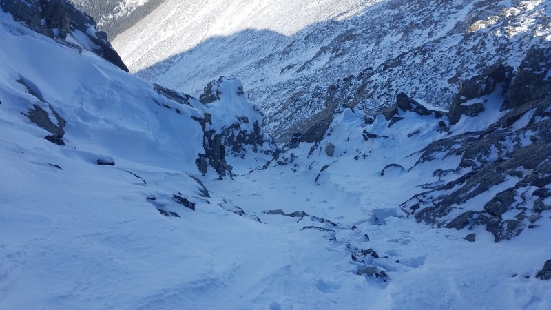
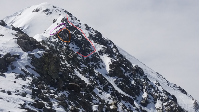
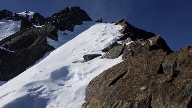
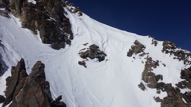
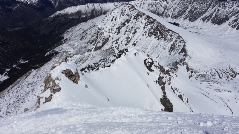
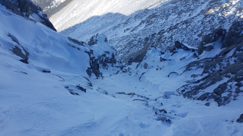
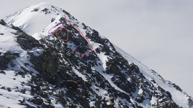
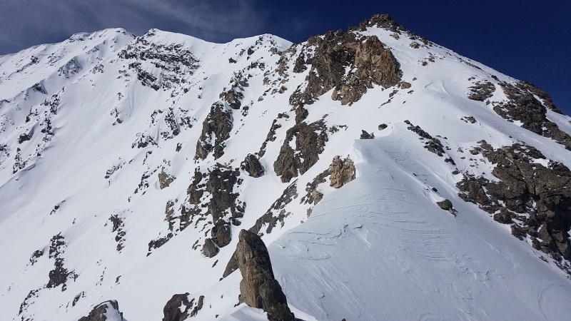
Having bypassed that I then got to the third crux, which is either the slab shown above or a Class 4 (at the very least, when covered in snow) scramble up and over to the knife edge. I was really perplexed here, and didn't want to hit the slab in microspikes with a glaze of ice, so what did I do? I once again bypassed it to climber's right, this time up a long, steep, narrow gully that was also no doubt very crossloaded. It was probably a bad idea, and while I obviously lived to tell the tale it's something that I know I shouldn't have done and did anyway because it legitimately seemed like the least bad of a bunch of bad options. I'll let the picture from near the top of the gully speak for itself.
Um... yikes. If that goes then I am a goner. Nobody else up there but me either...The gully from afar, taken on my March climb. The red line is the path I took two times up the gully (November/December). The purple circle is what I have referred to several times as "crux 3"/the slab. The orange circle is a Class 4 section of ramps and blocks directly adjacent to the slab. Either are viable options to the gully, and both are undoubtedly safer.
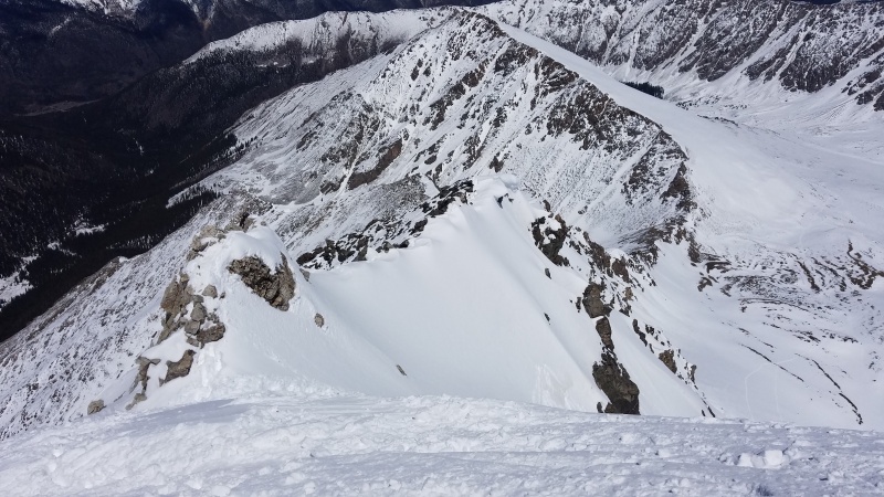
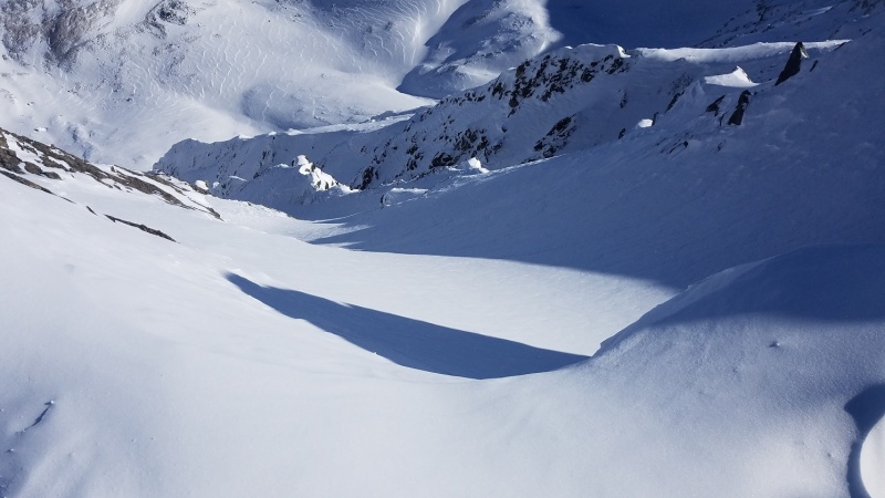
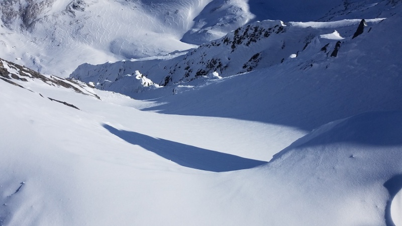
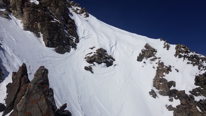
Now when I reached the top I breathed a sigh of relief for two reasons: one, I didn't die in a vicious rock pinball machine where I'm the ball. That's great! The other good news is the slope on the other side that I would have had to climb up looked like it would avalanche and destroy everything just because you looked at it funny.
The perspective on this is weird because this is looking straight down. Those ripples are on the floor of Stevens Gulch some 2,000 or so feet below, and that "ridge" near the top-middle of the photo is actually the rib separating this absolute death trap-looking gully from Dead Dog couloir to the right. This thing just looks like hell, so I'm glad I didn't climb up it instead. Cool, perspective-bending photo though!
At this point the only difficult part of the route left was the knife edge, and it was mostly dry and went by quickly and without issue. Though it wasn't true calendar winter yet the conditions very much were, and I was glad to have one of the hard ones done. Only four more to go...
I had to straddle-scoot the knife edge this time but it wasn't so bad. I stayed well away from the top of Dead Dog once I was passed the White Tower.
December 16, 2018
December was more difficult scheduling-wise. I would be going home to see my parents in Wisconsin at the end of the month and the days were getting extremely short at this point, so all of that combined with the usual storm cycle that took several days from start to relative safety meant I had very few opportunities to get my December tick.
The climbing this month, though, proved to be much easier. The weather was fantastic. I never put on more than a base layer and a fleece, and wore liner gloves all day. It was unbelievably good when I climbed, and route conditions matched. Fortuitous, mostly. I did the stupid thing with the gully prior to the knife edge again because I am an idiot and climbed in microspikes a second time (and also a last time; crampons or bust forever more) but the snow felt better, whatever that means. My friend Clay started out with me and turned around at the summer trailhead due to feeling sick, so I was solo until I ran into a couple right near the end and got a super rad photo of them crossing the knife edge, which by now was so covered in snow you could once again walk directly across it.
It's far less scary than it looks, and it is SO. MUCH. EASIER. than straddle-scooting.
January 5, 2019
Another easy month, honestly. I knew a storm was coming in on the afternoon of January 6th (which proved to be true when I got caught in a whiteout on Mount Sherman) so I had to get this one in early once again. I had spent some easy downtime in Wisconsin and was feeling nice and strong, so when Clay and I went for Kelso again I knew we had it in the bag. Yet again, somehow, another bluebird day. This time I even brought my crampons! Yay me! Instead of going up the death gully I went right up the edge of the slab on snow - exposed but not too scary or difficult. Wearing crampons this time made the climbing, both on rock and snow, significantly easier and more secure.
(Crux three.) There's a big slab here, somewhere under all of that snow.I love putting in fresh tracks on this thing!Taking a picture of you taking a picture of me taking a picture of you taking a picture of me taking a picture of you taking a picture of me taking a picture of you taking a picture of me taking a picture of you taking a picture of me taking a picture of you taking a picture of me taking a picture of you taking a picture of me taking a picture of you taking a picture of me taking a picture of you taking a picture of infinite recursion.
This time I'll include photos of what I consider to be the other cruxes as well, since I finally took pictures of the lower ones.
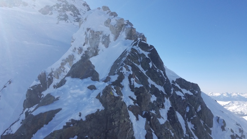
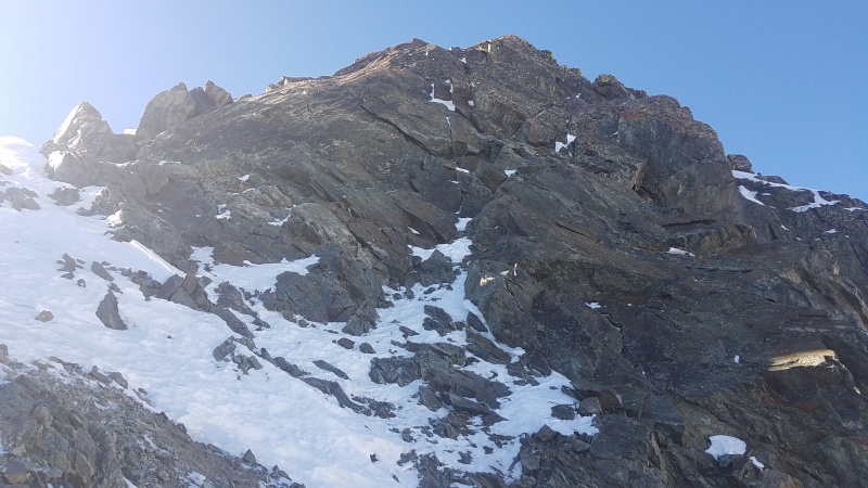
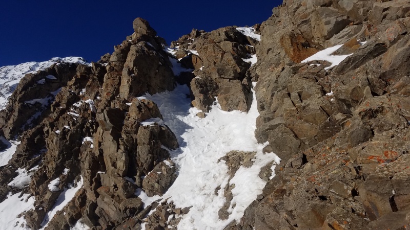
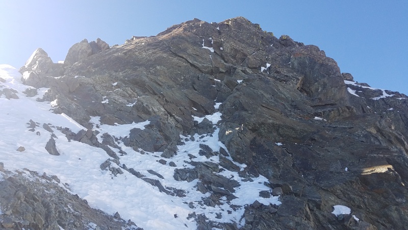
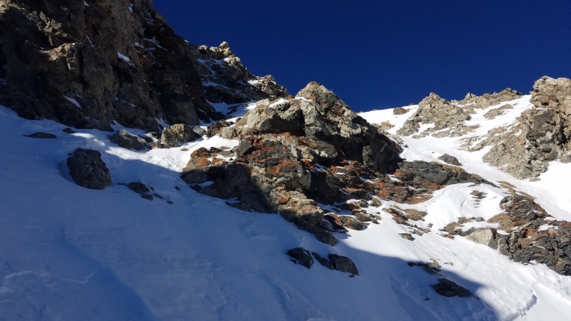
Crux number one goes up the left chimney. The more snow the easier. Early season can be kind of sketchy with ice and scrambling in boots or crampons.Crux number two, the White Rocks. You have a few options here, all of which are made much harder by wearing boots or crampons on slabby rock and climbing through narrow chimneys with a pack on. I bypassed this every time by climbing snow to the right, shown in the next photo.Immediately to the right of the White Rocks. Climb directly along the wall and you at least have plentiful handholds. It's steeper than it looks and honestly probably not all that safe, but it seemed better to me most times than attempting to slab climb in crampons where a fall would probably put me headfirst down the slope directly into a huge talus field. Pick your poison.I'd consider this to be crux three still; the slab is immediately around the left corner. The rock here is probably better than it looks but it's definitely steeper than the slab. A fall here or on the slab would have you sliding down huge, steep gullies and those gullies might avalanche. Do NOT fall. (This was taken in February, but fit better here.)
February 1, 2019
Another solo day on Kelso Ridge! Yes! And I'm getting it out of the way super, duper early! I think I'm finally getting the hang of this thing. Today felt easy and carefree. I didn't feel like I had to worry about any of the cruxes or the snow. The weather was once again bluebird. I don't know how I've managed to have multiple winter months in a row that were this easy, but I'm definitely not going to complain. This could have been a nightmare project and while there have been moments of doubt and fear I'm getting so close to being done! There's almost nothing to report for my February climb, except that apparently someone had climbed up to the knife edge and then completely evaporated. Look at the tracks, which just disappear into nothing. Where did this angel go? (I'm being facetious, come on now. I assume given that the tracks are old that they just got covered by spindrift, though it might be possible they got sketched and down climbed the entire thing. There was no evidence of a fall here, which would probably be fatal.)
Tracks to Nowhere. I mean to Torreys Peak. Easily confused.
March 26, 2019
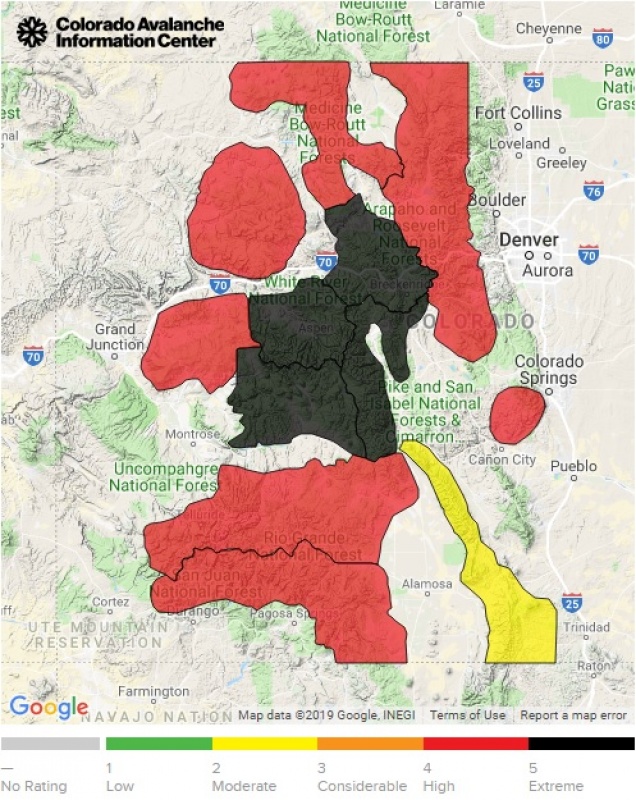
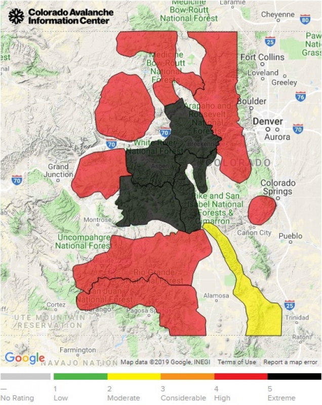
This is it. My final month on the Kelso Ridge calendar grid. 12 months, each with their own unique climb of Kelso Ridge. I'm glad it's almost over. This month has been a lot of worry since the weather has been GNAR AND A HALF. Between multiple storms we got an incredible amount of snow. Feet of it, much of it wet and heavy. We started with an average snow year and March blew it right out of the water. There were avalanches that ran across I-70. Avalanche paths that hadn't run in decades ran thousands of feet to valley floors. New avalanche paths had been created, flattening massive swathes of fully grown trees, buildings had been destroyed[1][2], and avalanches miles wide, usually rare, were relatively common.
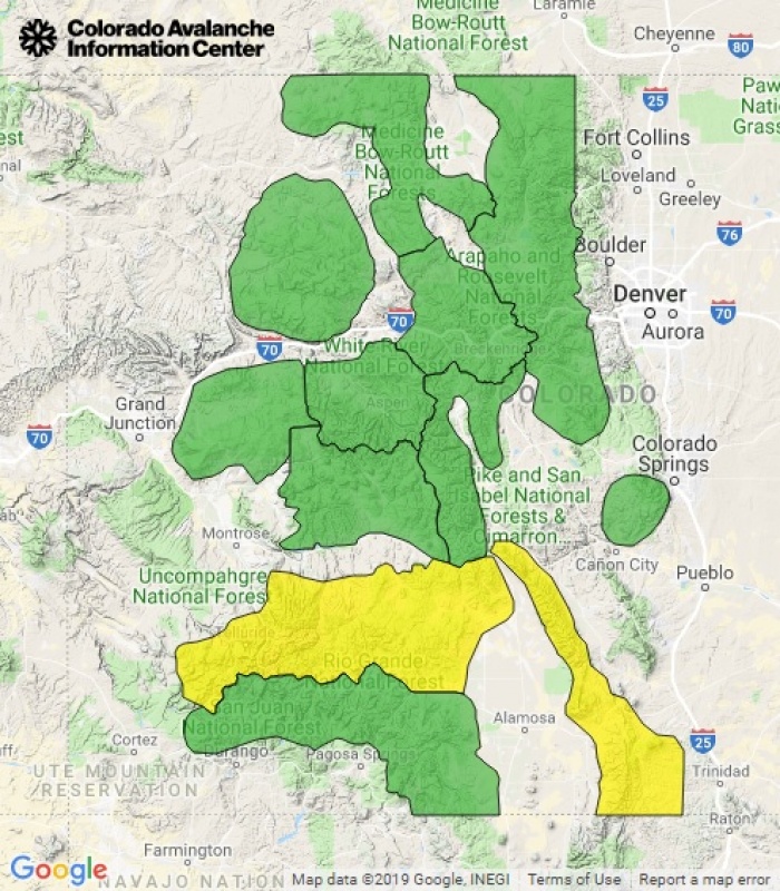
CAIC avalanche danger on March 7, 2019. Black is Extreme (5 of 5) and red is High (4 of 5) danger. I've never seen anything like this and I hope to never see this again.
To say this was a dangerous time to climb is a massive understatement. It was a historically bad time to climb, or ski, or snowshoe, or be anywhere near snow at an angle of greater than zero degrees, give or take zero degrees. Slight exaggeration. This was a couple weeks of checking CAIC every morning, telling myself I was going to die if I decided to venture out of my basement, closing the browser tab, and then planning on doing the same thing the next morning. I was getting antsy. With just one month left after so many successful back-to-back climbs I was worried that I wasn't going to get a March climb. It just wasn't looking good after getting pounded over and over like we had for the first half of March.
And finally it broke.
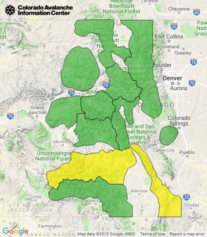
That's more like it. March 25, 2019. I'd certainly climb on a Yellow/Moderate/2 of 5 day, which so far all of my winter climbs of Kelso have been, but this was comforting after the insanity of early March. The day of my climb (3/26) did end up being a 2 of 5, but due to high temperatures and possible wet avalanche activity. I'll take that.
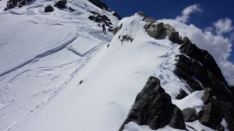
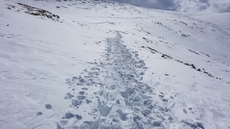
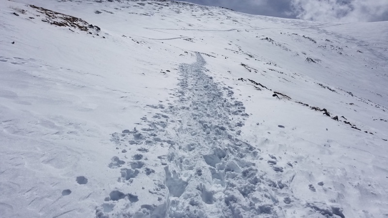
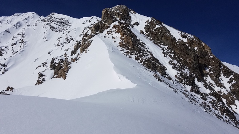
The flip side of this meant that while the snow was stable there was absolutely loads of it. I have never seen as much snow on Kelso as I did today, and considering I've climbed it every month of the year now this means it was the most extreme climb of all of them. It was kind of scary how much snow there was, and there was ample evidence of huge avalanches on the approach - two from Kelso Mountain's northeast and east sides had crossed Stevens Gulch road and obliterated trees (the road will probably have to be cleaned up with bulldozers), and the entirety of Kelso Mountain's south slopes, at least a mile wide, had slid and left huge piles of debris everywhere. I did the trek through Stevens Gulch without snowshoes, thinking that the warmth would solidify the snow some, and I regretted not having snowshoes about 100 feet past the bridge. Though I only postholed to my waist a handful of times the many miles of 3-6 inch postholing was very tiring and I arrived at the ridge much later than I wanted, at about 10:30am. By this point I was worried about wet avalanches though the snow certainly seemed very stable. I decided to launch.
A dozen plus times and I still am in love with this view.
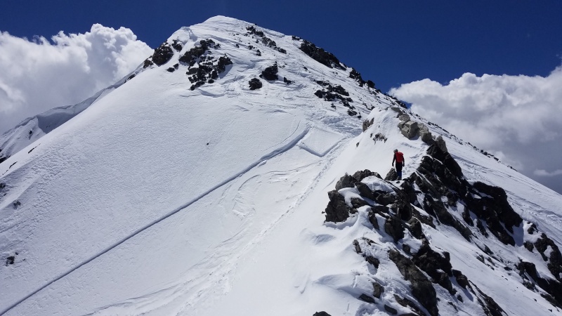
The amount of snow on the ridge also made for painfully slow progress, and the sheer volume of it was pretty scary, like it could slide at any moment. Sections that had been dry the past few months were caked in thick snow of unknown depth, making for rather hair-raising snow climbing. I tried to stay on parts that seemed like they'd break below me, if possible, but huge cornices also meant I had to avoid punching through and falling down a gully or being trapped in the fracture zone if the cornice were to fall. (For those who don't know, cornices break farther back from the edge than you'd expect. See this diagram for an example.) Tread carefully...
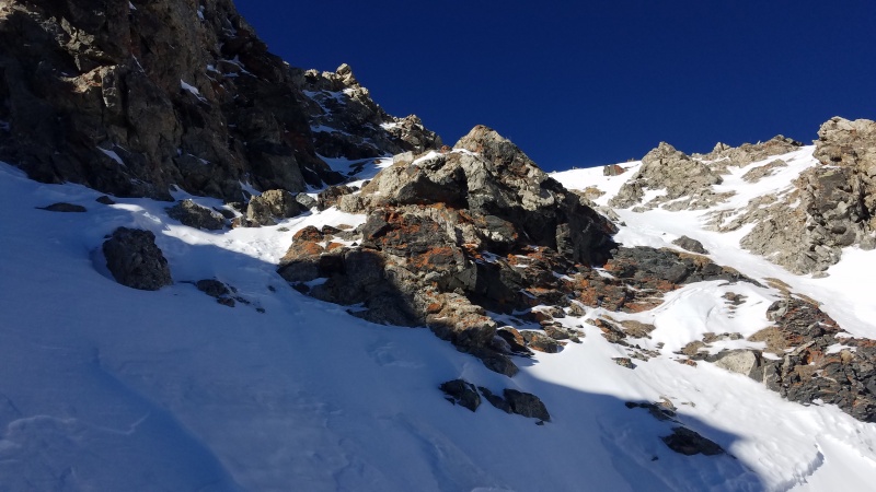
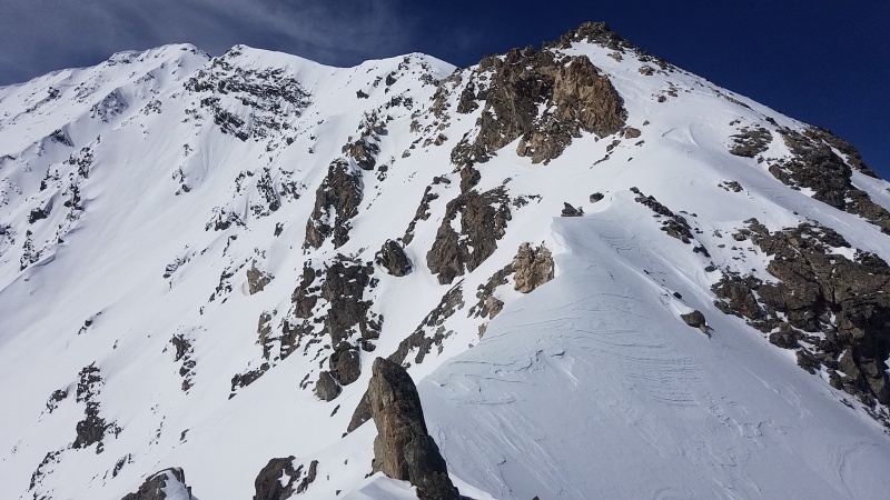
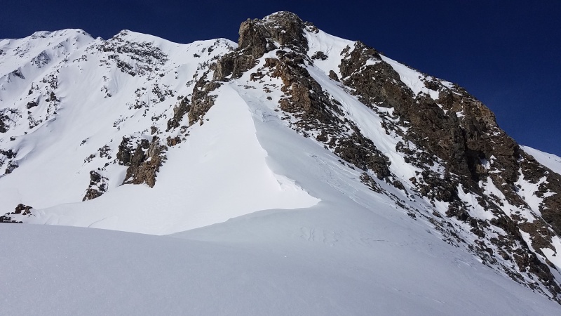
Cornices as far as the eye can see on climber's left, with potentially dangerous avalanche slopes in a lot of spots on climber's right. This is at the top of crux 2, the White Rocks.Just past the first crux. More cornices and potentially dangerous terrain. You can see the area near the second crux at the top center, including the vertical snow just to the right of the rounded bump.
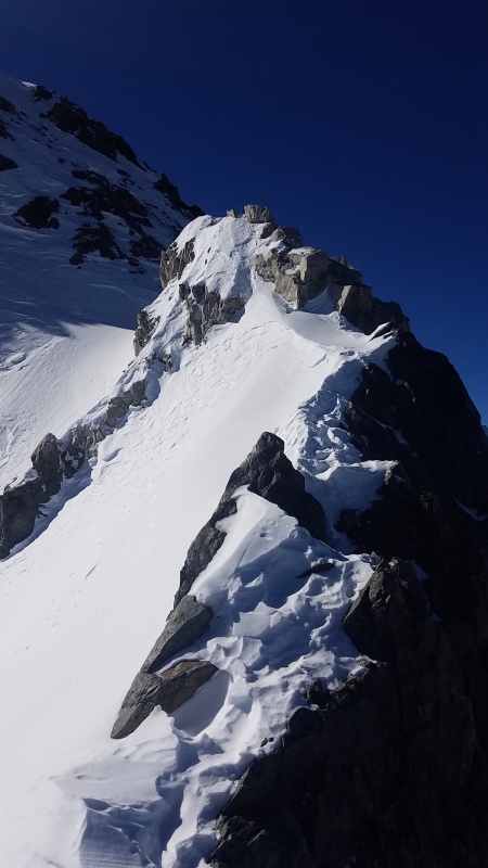
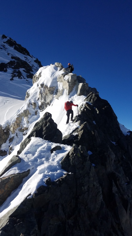
The first crux had so much snow that I did one easy move on rock to get past it. The second crux likewise had far more snow than usual, and I was able to climb it directly instead of bypassing it on snow to the right like I have every other month so far. That snow was vertical or near vertical and didn't look like it would be easy to get up. A shovel probably would have worked better than an ice axe. The scrambling on the White Rocks was somewhat difficult with hollow snow covering most of it and extreme exposure on the ridge crest itself, followed by a short section of vertical snow that I had to tunnel through to reach more moderate ground at the top, where the photo above was taken.
The snow I climbed the last four months, while usually steep, was never anywhere near this steep. A fall here would probably be unarrestable. Compare this to the photo of the same area above, in January. The White Rocks are immediately to the left off the frame.
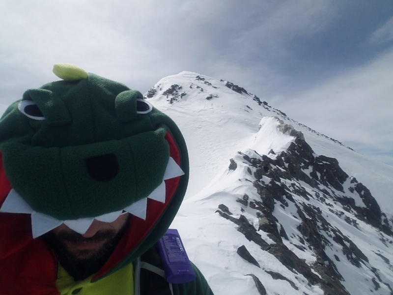
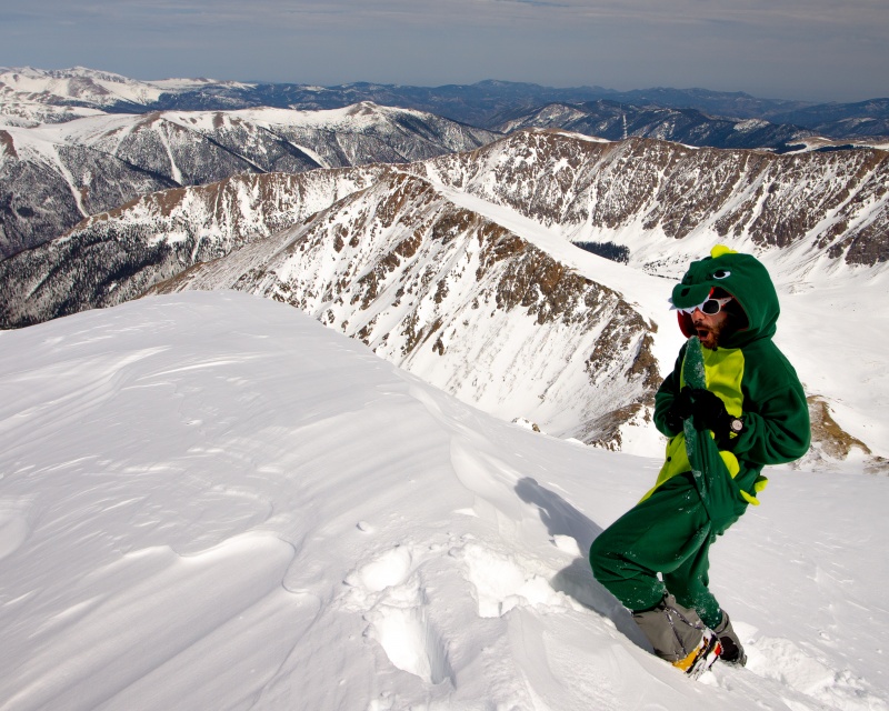
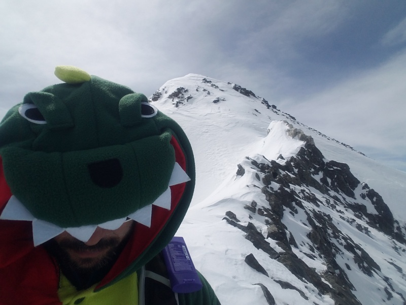
The sheer amount of snow made for slow and difficult progress. Though most of the remaining ridge, including the slab, was stable, I was sweating like, well, a dinosaur in my dinosaur onesie. Dinosaur onesie? You're damn right dinosaur onesie!
RAWR! A lad has to have some fun amongst all the suffering, right?
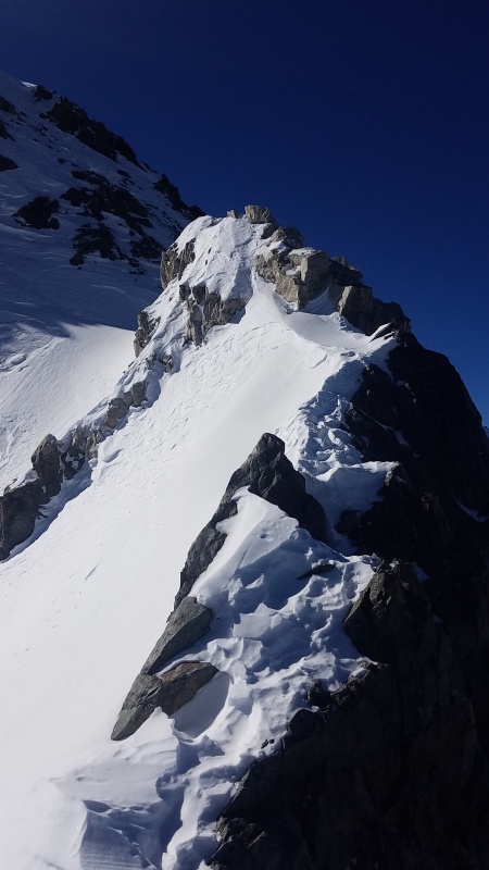
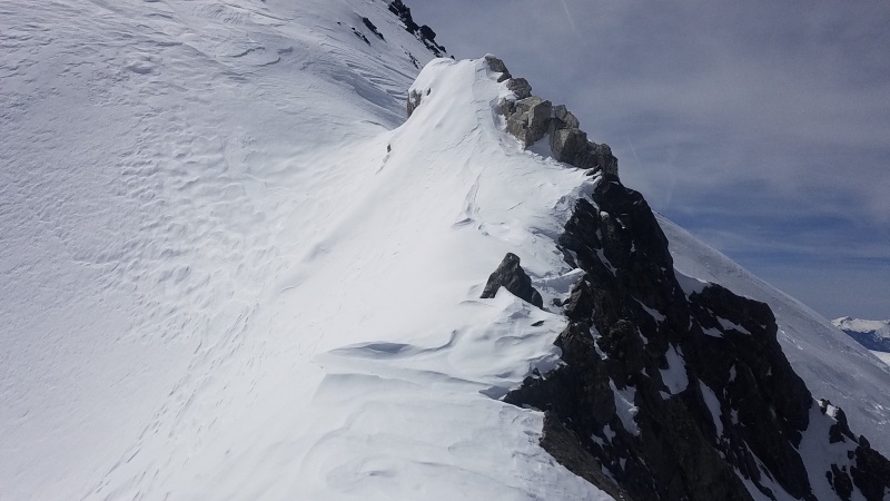
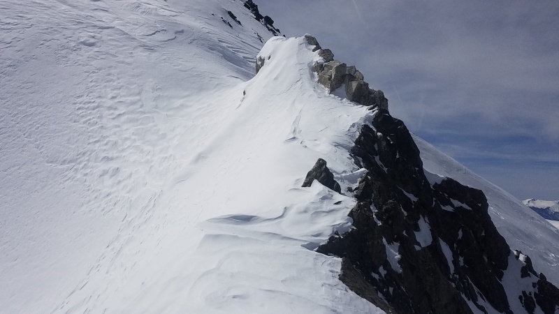
The knife edge was in spectacular shape. I probably could have laid across it entirely sideways it was so wide. Likewise the White Tower was completely covered, but I thought better than attempting to traverse around it on climber's left. I wasn't about to risk a ride down Dead Dog if it were to go, as tempting as it was to simply walk around it instead of scramble around it to the right which also proved sketchy due to the unseen, snow covered slabs that awaited.
That's not a knife edge. It's practically flat with that amount of snow.
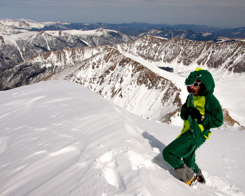
Victory poses and much celebration (more like sitting on my ass utterly exhausted) were had on the summit. I was finally done. Though it "only" took me three and a half years to finish, I feel like the last five months were the real deal. Most of the other climbs were easier and certainly had less potential to go wrong. This was a pretty incredible month to finish on, what with all the snow and decision making that goes with that, and I'm proud and quite frankly relieved to be done. It was a wild ride.
Aww yeahhhhhhhh! Photo Credit: Tyler C. (who came up Torreys' west ridge from Loveland Pass)
This dinosaur is going to go drink that beer I talked about at the very start. Thanks for reading.
Thumbnails for uploaded photos (click to open slideshow):
Congrats on finishing the Kelso Ridge grid (much more quickly than I did)! It was cool to see not only the changing conditions, but also your commentary on your changing gear and skills. I also like how you showed the other difficult areas. I'm down to just Jan and March left on Longs. Maybe you want to team up next year for one of those and start a new project? :lol:
I really enjoyed reading this, and wow...finishing this year with all the snow!?! You're a steely-eyed mountain man! Fwiw, I've been up the Stevens Gulch Road when it ran down and over the road before in a super big snow year, I think that was in the very late 90's or early 2000's. And you were right to be cautious with the cornices, I set off a slide due to a collapsed cornice back in the 90's, I think near the White Rocks. Fun times, although I didn't I didn't have a dinosaur onesie to add to the fun! :lol: It's a really fun, convenient area.
A great accomplishment, you have every right to be proud.
-Tom
@Brad: The man himself! I'd definitely be down for that, I'd be all stary-eyed, haha. I only have climbs of Longs in August and April, though I do have attempts it seems like most other months ranging from the Keyhole to Trough to Cables to Kiener's. :lol: I need a new project like I need a hole in the head but then again, I do need a new project now that I finished this off. Too bad it's cold and snowy this weekend, I'll bet Cables is in amazing shape!
@TomPierce: Thanks for the kind words! Scary stuff about the cornice collapse! I set off a small slide of my own on Yale's east ridge in 2016 and those kinds of britches-filling moments never seem far from the forefront of memory when out in similar conditions.
Congrats on reaching your Kelso Ridge Grid achievement! I really enjoyed seeing the varying conditions in all of your photos and to see how different partners and other parties handle the difficult sections of the ridge. And a nice shout out for Brad as he truly is a great ambassador to 14er climbing!
-John
Awesome awesome write-up. Congrats!
Couldn't have read this at a better time as I was hoping for a good summary of the conditions. I will be making an attempt in the ensuing week and this helps tremendously.
HOWEVER!! May I ask what happened on Liberty Ridge?! Do you have a trip report of that somewhere else? I only ask because myself and two friends will be attempting this May. Thanks!
@tomahawker_1: Way to get after it! These were some pretty amazing conditions, congrats on getting it!
@karczyn2: I didn't write a trip report for our Liberty Ridge attempt, no. But this might be helpful. I took this photo on our climb:
From left to right is Curtis Ridge, Willis Wall, Liberty Ridge, Liberty Wall, and Ptarmigan Ridge. The Carbon Glacier is the huge mess of a glacier that takes up most of the bottom of the photo. (I know you know this, but for anyone else looking at it.) Normally the route goes across climber's left side of the Carbon, towards Willis Wall and across that smooth looking area, then cuts directly right to the toe of Liberty Ridge and goes up and over the ridge then climbs up the right (western) side of it, where there's more snow.
We thought that side of the Carbon looked pretty smashed up so we decided to cross closer to the viewer, towards Ptarmigan Ridge, then cut left towards Liberty Wall and join up with Liberty Ridge. Basically the exact opposite of how it's normally done. You can see how smooth that area is, near the bottom of Liberty Wall, and we thought that looked great. Well, we did actually make it over there (it was kind of sketch, as it involved traversing over huge crevasses on sloppy 50 degree snow that had been in the sun all day), but that smooth looking area wasn't nearly as smooth as you would imagine. It actually rolls over a bit and opens up into a huge crevasse field, and we got over there and were surrounded as best we could tell. The crevasses were huge, big enough to put a small office building in in some cases, and ran from Ptarmigan Ridge left in a semi-circle all the way to the crevasse fields visible in the photo.
There may have been an option to climb down into one of the crevasses, then climb out on the other side, but we couldn't actually see the bottom of any of them and didn't want to take that risk. We spent some time investigating all the options before turning around defeated.
The climbing rangers at Mount Rainier National Park run an unofficial blog with route condition updates. An update shortly after Chris and I were on the route in early June states that "Liberty Ridge has been shutting down all recent groups due to a combination of rockfall and complicated glacier travel on the approach." Note all groups. That includes us, and I don't know if any teams summitted after our attempt. It also shows an amazing aerial photo of the area we got shutdown in, with the MASSIVE longitudinal and semi-circular crevasses we got stuck in.
So on your climb maybe go the standard way, on the left side towards Willis Wall instead. Hope that helps! Good luck!
@Chris: Thanks man, now you have to finish yours. Only what, nine months left including all of the winter ones? Easy!
Caution: The information contained in this report may not be accurate and should not be the only resource used in preparation for your climb. Failure to have the necessary experience, physical conditioning, supplies or equipment can result in injury or death. 14ers.com and the author(s) of this report provide no warranties, either express or implied, that the information provided is accurate or reliable. By using the information provided, you agree to indemnify and hold harmless 14ers.com and the report author(s) with respect to any claims and demands against them, including any attorney fees and expenses. Please read the 14ers.com Safety and Disclaimer pages for more information.
Copyright: Route information, text, risk factors, maps, GPX files, charts, photos, 14ers.com-created map imagery, flythroughs, and other content provided in this route description are copyrighted by 14ers.com and may not be copied, reproduced, republished, distributed, modified, or used to create derivative works without prior written permission.
Please respect private property: 14ers.com supports the rights of private landowners to determine how and by whom their land will be used. In Colorado, it is your responsibility to determine if land is private and to obtain the appropriate permission before entering the property.