Download Agreement, Release, and Acknowledgement of Risk:
You (the person requesting this file download) fully understand mountain climbing ("Activity") involves risks and dangers of serious bodily injury, including permanent disability, paralysis, and death ("Risks") and you fully accept and assume all such risks and all responsibility for losses, costs, and damages you incur as a result of your participation in this Activity.
You acknowledge that information in the file you have chosen to download may not be accurate and may contain errors. You agree to assume all risks when using this information and agree to release and discharge 14ers.com, 14ers Inc. and the author(s) of such information (collectively, the "Released Parties").
You hereby discharge the Released Parties from all damages, actions, claims and liabilities of any nature, specifically including, but not limited to, damages, actions, claims and liabilities arising from or related to the negligence of the Released Parties. You further agree to indemnify, hold harmless and defend 14ers.com, 14ers Inc. and each of the other Released Parties from and against any loss, damage, liability and expense, including costs and attorney fees, incurred by 14ers.com, 14ers Inc. or any of the other Released Parties as a result of you using information provided on the 14ers.com or 14ers Inc. websites.
You have read this agreement, fully understand its terms and intend it to be a complete and unconditional release of all liability to the greatest extent allowed by law and agree that if any portion of this agreement is held to be invalid the balance, notwithstanding, shall continue in full force and effect.
By clicking "OK" you agree to these terms. If you DO NOT agree, click "Cancel"...
I hiked from Summit Lake, over Mt. Spalding and the west ridge.
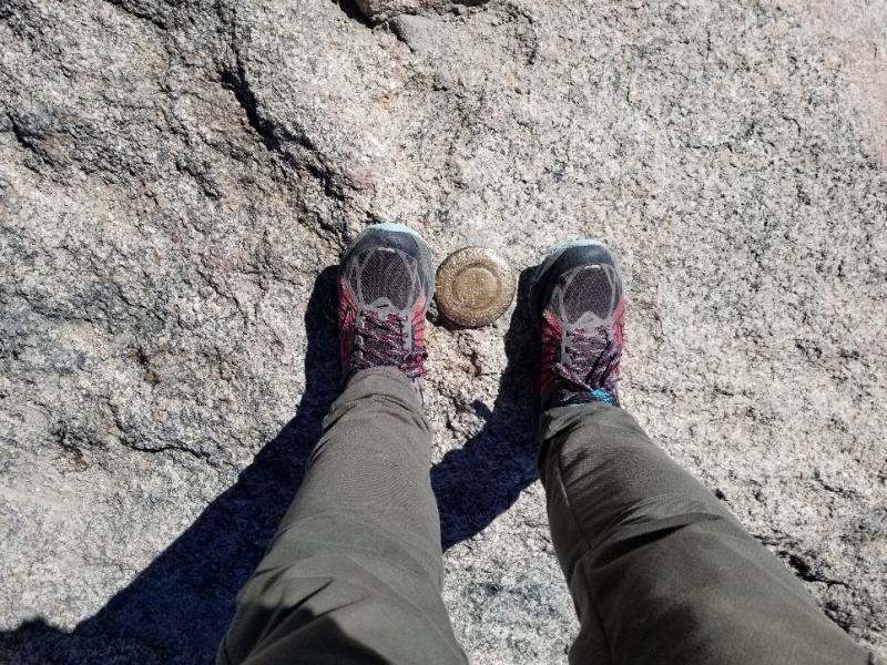
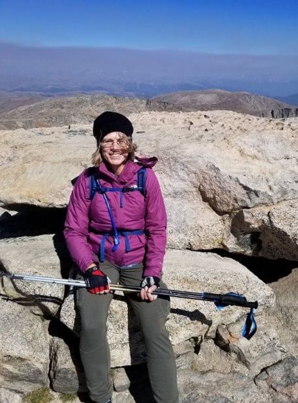
I am standing at the Mt. Evans summit marker on August 24, 2018
SUMMARY: 08/24/2018 - began at 7:00 am; summit at 10:05 am; left summit at 10:25 am; returned to car 1:00 pm.
Total time 6 hours. Hiking time, including breaks and picture taking, about 5.5 hours. Total mileage 5.8 round trip.
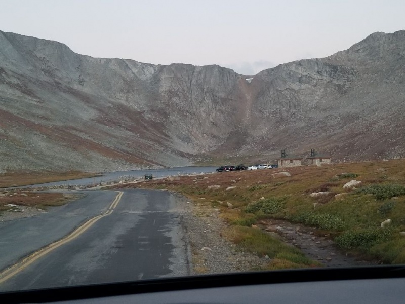
The wavy road to Summit Lake. Parking for the day costs $5.00.
Other than the chilly wind, the weather was clear and mostly sunny. I didn't notice any smoke from the summer wildfires. I didn't strip any layers off until I was only about a half mile back to the car.
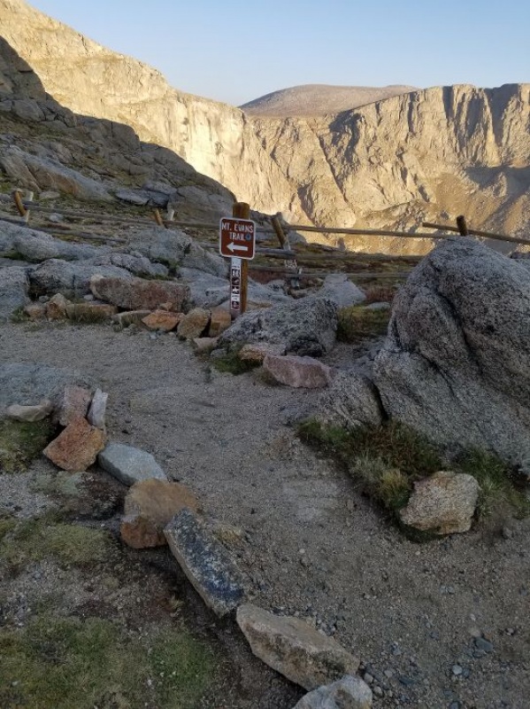
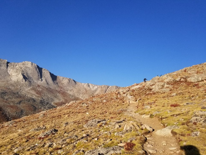
Start of the trail.
The trail is kind of steep from the beginning, but overall it does not have a lot of elevation gain. I used poles, which can be helpful much of the way, but a hindrance when you reach the scrambling parts.
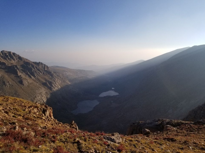
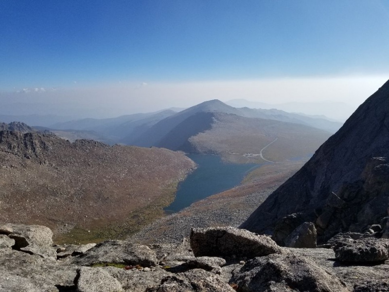
A view of the Chicago Lakes from early in the hike.
Another way to reach Mt. Evans is from Echo Lake, past the Chicago Lakes, and then up from Summit Lake. I hiked up to the lower Chicago Lake from Echo Lake this summer. I think I will hike the trail down to them from Summit Lake and back one of these days. It is very short but very steep.
The easy beginning did not last long
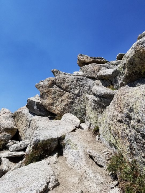
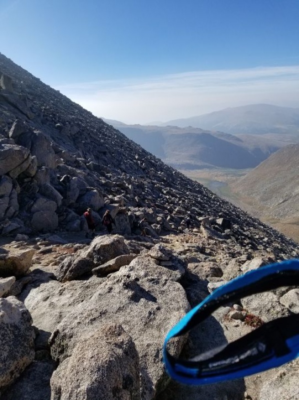
The route is ranked as class 2, but I have hiked ten other 14ers so far, and I think it's the hardest class 2 that I have ever done. There are several parts where I needed to use all fours. The upper part of the ridge, the last half mile or so of the ascent, had a lot of boulder scrambling.
Here's a section of the trail that requires all fours.
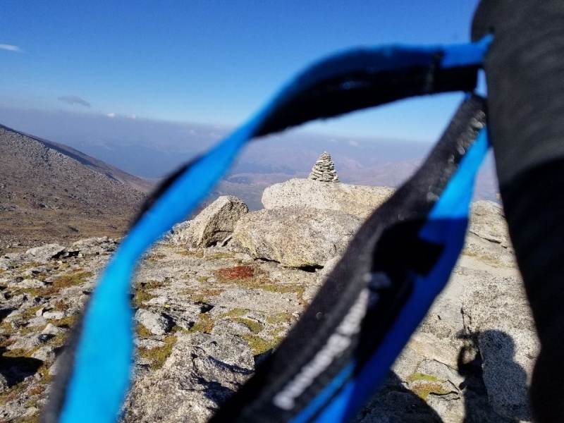
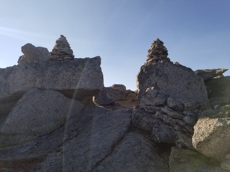
There are lots of cairns to guide the hiker. I got "off cairn" a wee bit, but found the trail easily enough.
One of the larger cairns, seen through my pole strap.
The trail clearly directs hikers over 13er Mt. Spalding. So you can easily check that one off your 13er list.
Entering Mt. Spalding
At just a little over 2 miles begins a little more intense rock climbing. I met up with a few people at a point where you can get a good look down at Summit Lake.
Viewing Summit Lake and the parking lot from a rest at about 2 miles from the start.
After that break we take a little descent to begin tackling the west ridge.
People ahead of me going down a little gravely stretch before going up the west ridge.
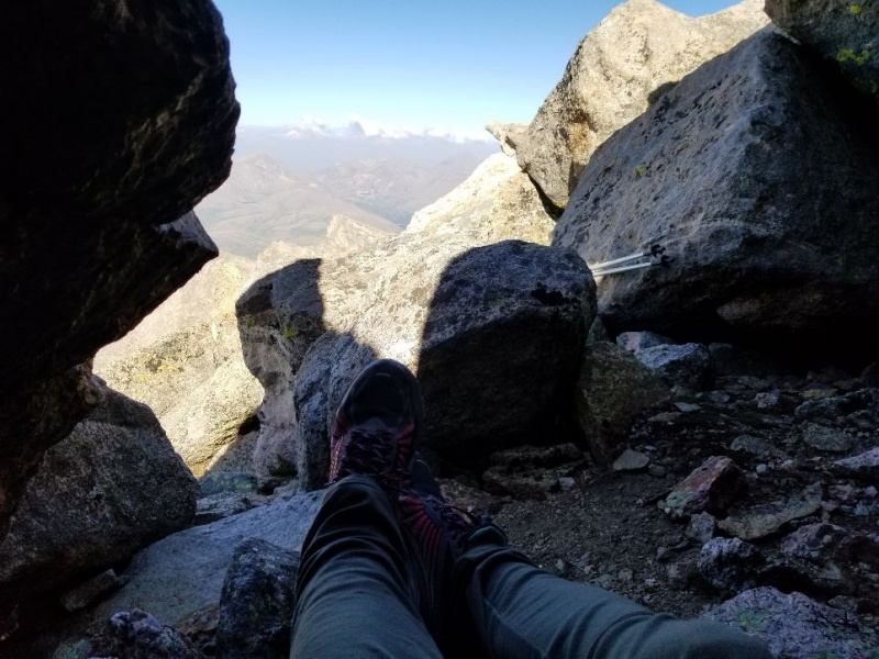
Along the way up I found a cozy cave and, after inspecting it carefully, crawled inside to get out of the wind and rest a spell. It was pretty small, but I managed to back in without taking off my pack. I didn't see the cave on the way down, but it's possible you can only see it on the way up, the way it's hidden among the boulders. I didn't think to look for it.
I am in the little cave. You might see my feet and poles.
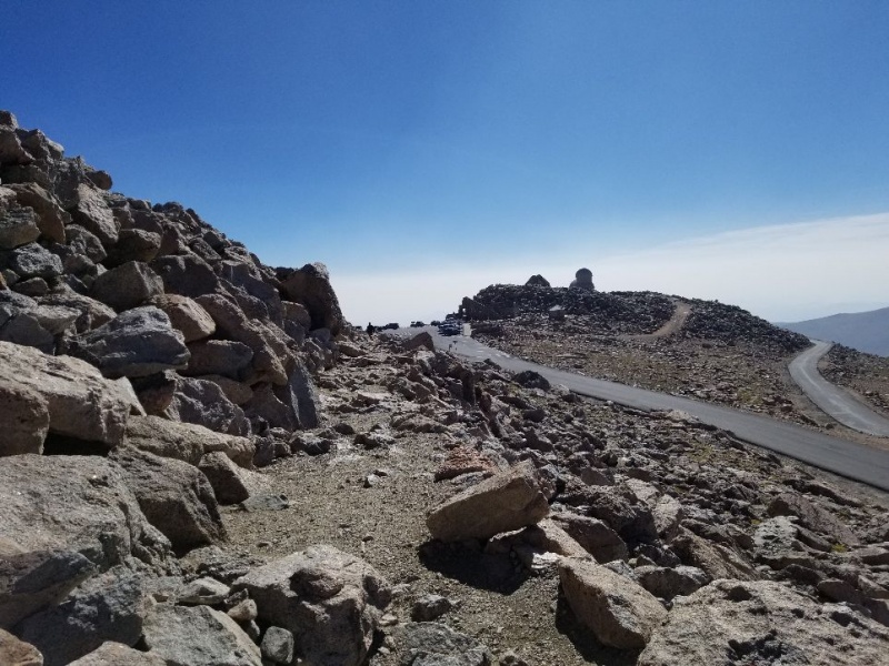
Almost to the last stretch, I came to the parking lot. I must have missed a left turn. I went all the way to the parking lot and had to backtrack. There's only a quarter mile more or so from the lot to the top of the peak.
Approaching the summit parking lot.
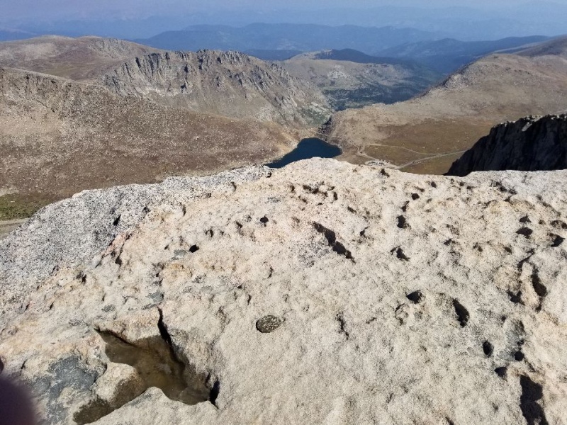
I made my way up and got my souvenir pictures. There were two markers. I stood by one (see picture #1) and got a picture of the other one on a high boulder with a view of Summit Lake and the parking lot in the background.
The higher elevation marker with Summit Lake below. You can see start and finish in the same picture!
The wind was fierce much of the time, and I was not happy with the picture of myself squinting, but it is what it is.
Windblown, but happy to have reached the summit. The higher marker is right by my cap.
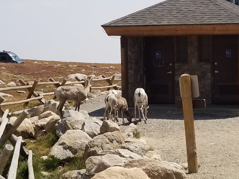
Once I returned to the start there were about 6 Bighorn Sheep hanging out near the restrooms.
Getting back to the car, I see Bighorns ahead.Another picture of the Bighorns. They leaped over the fence so gracefully and effortlessly.
Thumbnails for uploaded photos (click to open slideshow):
Caution: The information contained in this report may not be accurate and should not be the only resource used in preparation for your climb. Failure to have the necessary experience, physical conditioning, supplies or equipment can result in injury or death. 14ers.com and the author(s) of this report provide no warranties, either express or implied, that the information provided is accurate or reliable. By using the information provided, you agree to indemnify and hold harmless 14ers.com and the report author(s) with respect to any claims and demands against them, including any attorney fees and expenses. Please read the 14ers.com Safety and Disclaimer pages for more information.
Please respect private property: 14ers.com supports the rights of private landowners to determine how and by whom their land will be used. In Colorado, it is your responsibility to determine if land is private and to obtain the appropriate permission before entering the property.

")
")
")
")
")
")
")
")
")
")
")
")
")
")
")
")


