Download Agreement, Release, and Acknowledgement of Risk:
You (the person requesting this file download) fully understand mountain climbing ("Activity") involves risks and dangers of serious bodily injury, including permanent disability, paralysis, and death ("Risks") and you fully accept and assume all such risks and all responsibility for losses, costs, and damages you incur as a result of your participation in this Activity.
You acknowledge that information in the file you have chosen to download may not be accurate and may contain errors. You agree to assume all risks when using this information and agree to release and discharge 14ers.com, 14ers Inc. and the author(s) of such information (collectively, the "Released Parties").
You hereby discharge the Released Parties from all damages, actions, claims and liabilities of any nature, specifically including, but not limited to, damages, actions, claims and liabilities arising from or related to the negligence of the Released Parties. You further agree to indemnify, hold harmless and defend 14ers.com, 14ers Inc. and each of the other Released Parties from and against any loss, damage, liability and expense, including costs and attorney fees, incurred by 14ers.com, 14ers Inc. or any of the other Released Parties as a result of you using information provided on the 14ers.com or 14ers Inc. websites.
You have read this agreement, fully understand its terms and intend it to be a complete and unconditional release of all liability to the greatest extent allowed by law and agree that if any portion of this agreement is held to be invalid the balance, notwithstanding, shall continue in full force and effect.
By clicking "OK" you agree to these terms. If you DO NOT agree, click "Cancel"...
Today’s peak wasn’t much of a mystery: With 2 left and good morning weather and a finisher already selected, Maroon Peak was my only option. I left my house at 10:30pm and made it to the trail head at 3am. Note: I made it on the first try this time!!! There were several other hikers already in the parking lot getting ready to hike when I got there. I jumped out of the truck to get a head start, putting on my gloves as I walked.
Ugh! I’d brought two left gloves! No worries though, I just turned on inside out: Problem solved!
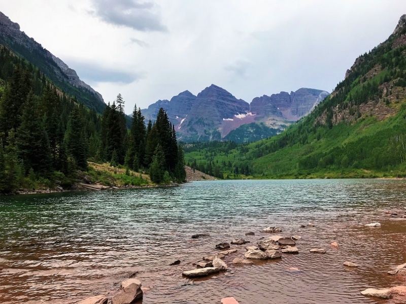
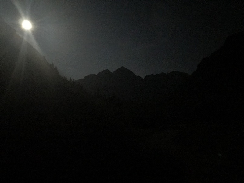
The best part about hiking this morning in the dark? The (almost) full moon! If you’ve never hiked under a full moon you should. It’s fantastic and amazing and difficult to describe. You don’t need your flashlight, as the moon lights up the trail with a glowing mist. The moonlight was reflecting off the lake and mountains. I so wished I had a better camera to take pictures of the moon and stars. Also, there was a rather loud bird on the lake, which was weird for 3am.
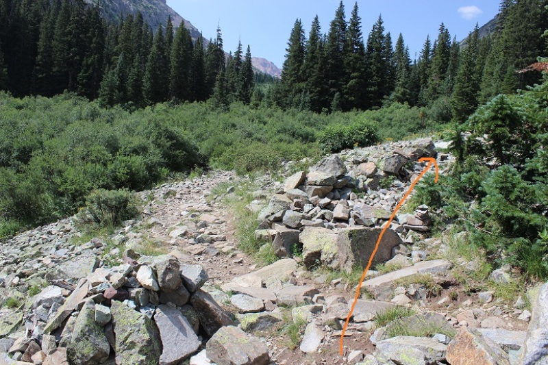
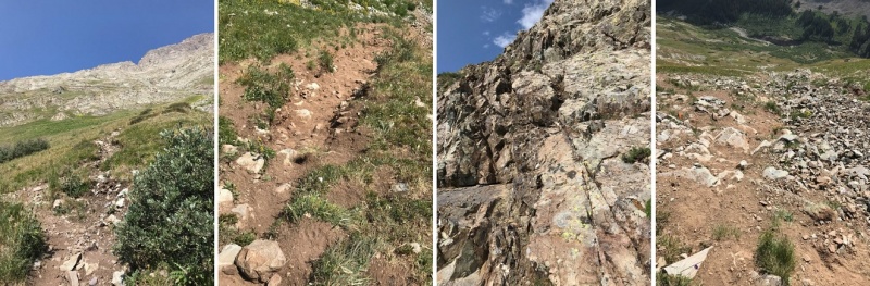
I passed crater lake and did my best to get as far ahead of the hikers behind me as possible. I was about ¼ a mile ahead of the first group of hikers when I got worried: I’d made it to a creek, which meant I’d missed the turnoff somewhere. I should have been going uphill. Drat! So I backtracked and saw a string of flashlights starting up the mountainside. Ugh! I’d lost a good half mile of distance between me and the hikers behind me! Now we were all kind of clumped together. On the way back I took a picture of the junction. Can you tell which way I should go? Let me tell you, in the dark it all looks the same….
This is the way you’re supposed to go
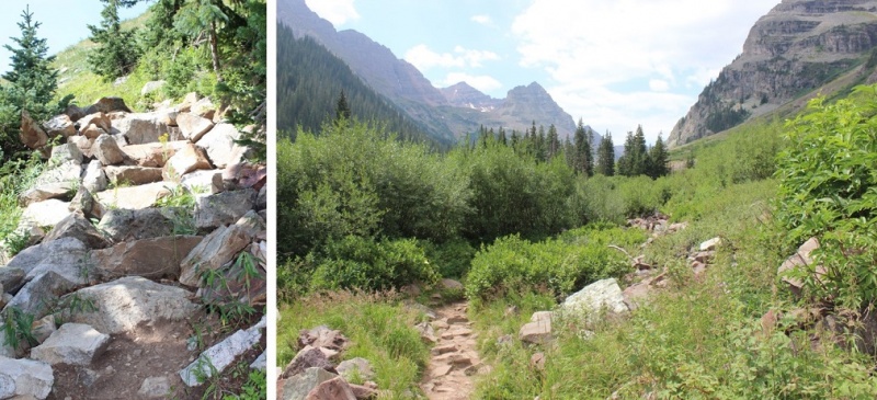
In any event, I politely rushed past them as best I could and was on my way up the mountainside. The trail up to this point was very well maintained and has great signs
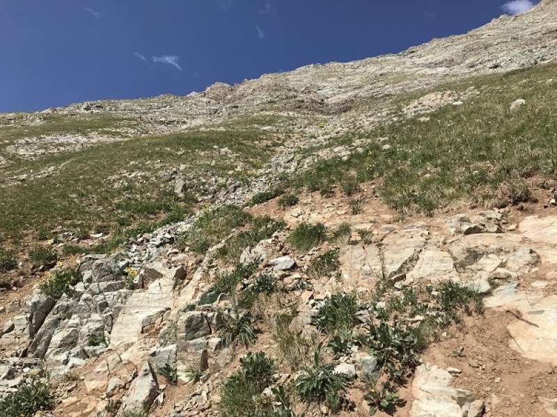
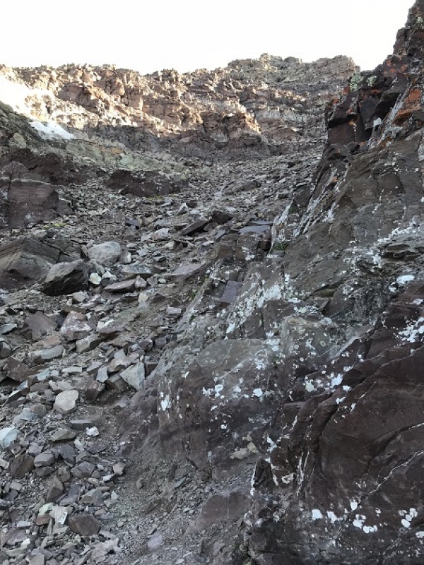
But not for long. It quickly turns into a slippery scree and gully trail that goes for 2800’ with some rocks thrown in. In the dark I noticed 3 flashlights ahead of me? Hmmm…. I hadn’t noticed them before? Maybe they’d gotten a super early start?
Your goal is to hike up this
Once you reach the top of the scree and gully trail you’re at a ridge that’s also full of scree and dirt
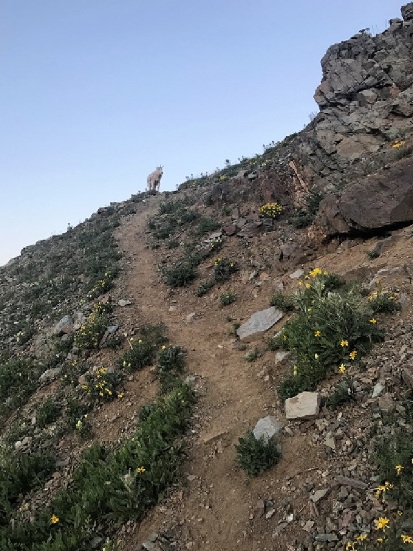
Here I saw goats. Side note: Last year I saw 1 goat. Just 1, and this year I’ve probably seen 50. Insane!
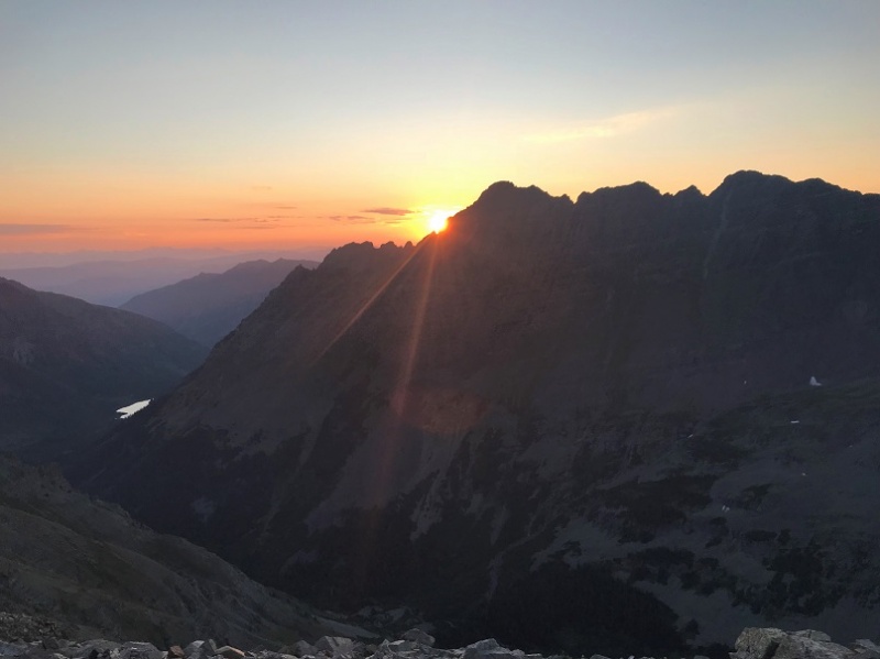
After I saw the goats the sun started to rise! I stopped for a bit just to enjoy
At the top of the ridge crest I met up with the three other hikers. They’d started at 3:45am from the junction (yes, the one I’d missed) and were impressed I’d caught up with them. We had a great chat, and I was on my way, intent on route finding alone (I like route finding… it makes me feel like I’ve “earned” the hike).
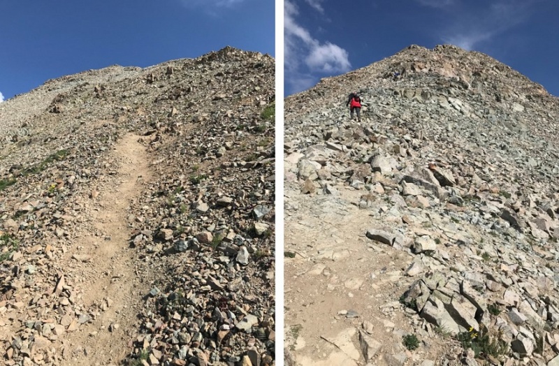
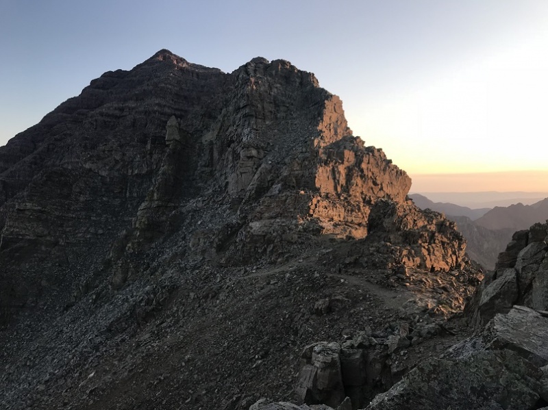
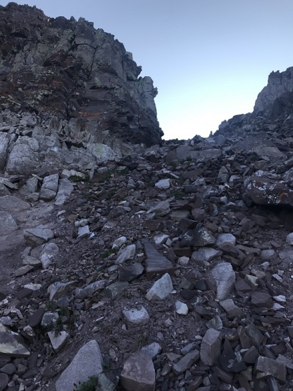
OK, so after the ridge crest this is the next obstacle…
The best way I can describe this is a lot of loose rock, and just keep going up and to the north. There are several routes to the top, but I tried to stick to the “standard” route. Several gullies are involved. But first you encounter a chimney. This was a great chimney to climb: very stable with lots of hand/foot holds
After this just follow the cairns… see them up there? Yes, those cairns.
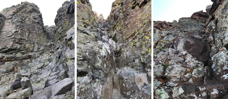
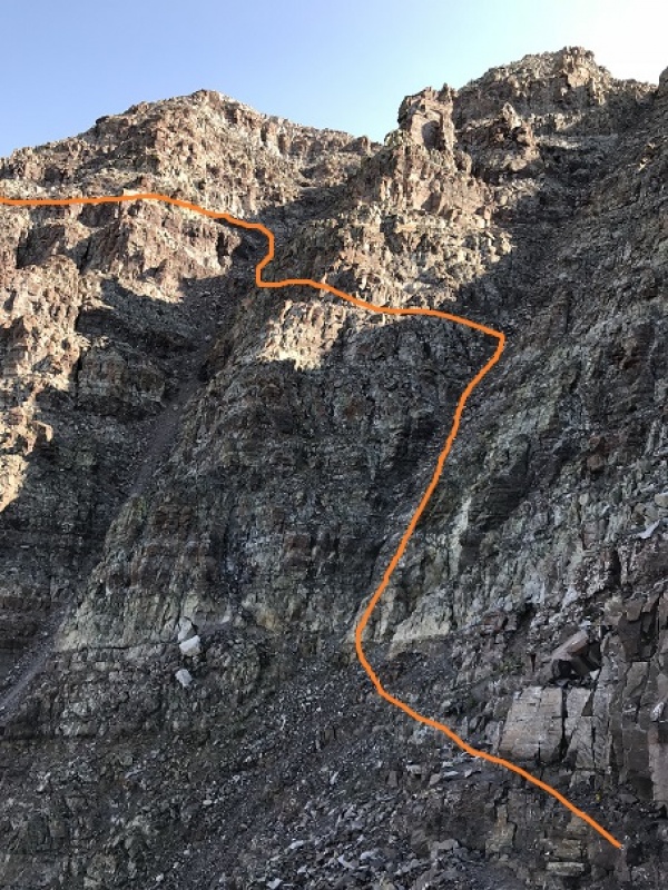
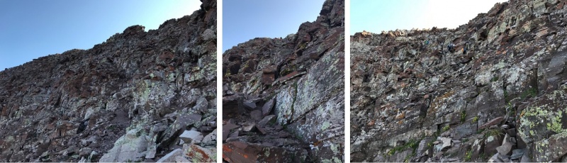
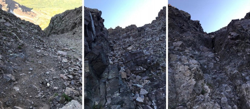
I kept following the ridge north and came upon the two gullies. I’m not a fan of gullies. Either one of these gullies is climbable, but when I looked at them the first gully looked like it had more stable rock, and the second gully had that sand/scree mixture I dread. I chose the first gully. My instructions said to get a good look at the route you want to take before doing it because once you’re in it it’s difficult to figure out. Those directions were right. Take some time to study the route you want to take before diving in. Here’s the route I took. (I was very happy with this route…)
OK, more ledges and more going north until you hit another gully (big sigh). This gully had a lot of sand and large rocks, but if you hug the right side you have stable hand holds.
At the top of the gully is a notch
Aim for this and turn left. More ledges…woohoo! Actually, I like this type of climbing! These were taken from the way down (so you can see depth with other hikers). The ledges just keep going, and going, and going. Just aim up
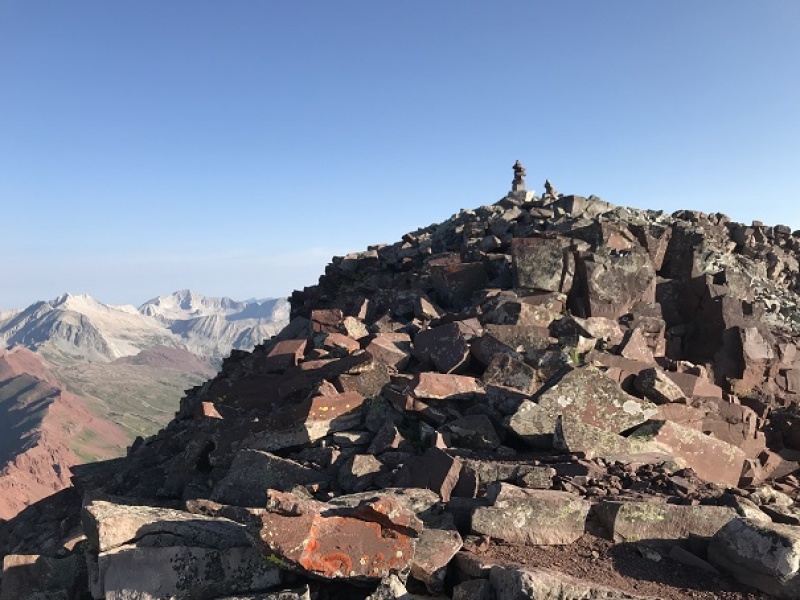
Eventually you’ll reach a ledge. Follow that ledge to the summit (it has cairns)
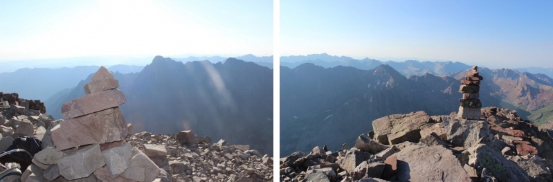
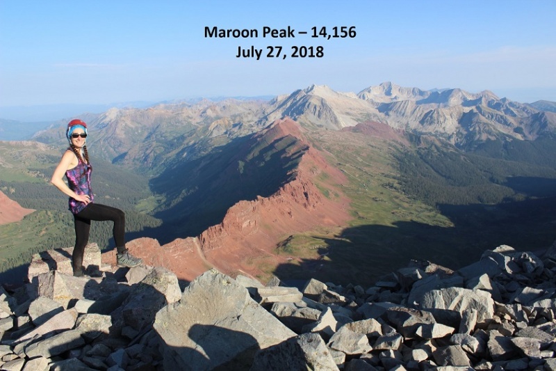
I was so excited when I reached the summit! The climb had been intense but FUN!!! From the summit I could see Snowmass and Capitol
I took a summit selfie to prove I’d summited
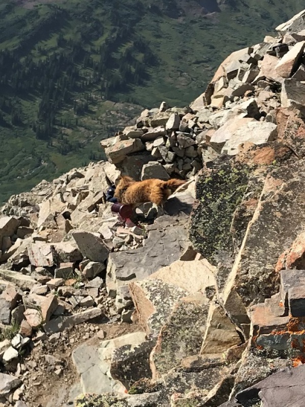
And headed back down. I saw tons of people coming up as I was coming down! All those flashlights form earlier in the day took on faces. Some people looked more than prepared for this climb, and others looked scared out of their minds. I helped several with route finding. Just for fun, here are a few of the gullies on the way back down
I talked to several more hikers, and just after taking a photo of a group on the ridge lost my phone! I spent about half an hour trying to find it (I did, but backtracking up stinks!)
I made it back to the first ridge and noticed a marmot absconding with someone’s hat and water bottle. Marmots are notorious thieves, stealing everything they can get their paws on. I was surprised someone had left these items without putting something (a rock?) on them to hold them down. It was comical to see the marmot running away with them. Sorry to the owners, the marmot was actually pretty quick and far away from me when this happened, or I would have tried to stop it
I didn’t see any more goats on the way down, but I did see a lot of late and ill prepared hikers. Most had no clue what they were getting into, as they’d just come up for a “day hike”. Water? Check. Anything else (hat, jacket, map, food, sense of direction/upcoming weather etc?) Nope. They didn’t even know climbing as involved. I guess this is how people get into trouble….
Anyway, as I hit the final ridge I put on my microspikes for the scree/dirt descent. I’ve heard too many stories of people slipping here and breaking/spraining a wrist or ankle to take a chance without them. If you don’t use microspikes on scree you totally should! It makes a world of difference: I didn’t slip once!
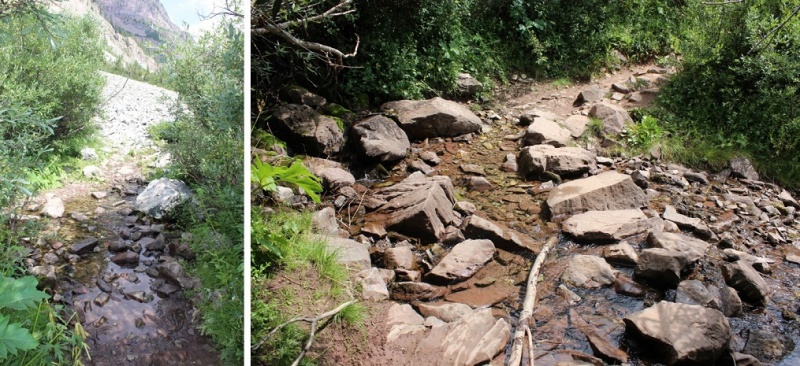
I was down the hillside in no time and got a good look in the daylight at the small creek crossings
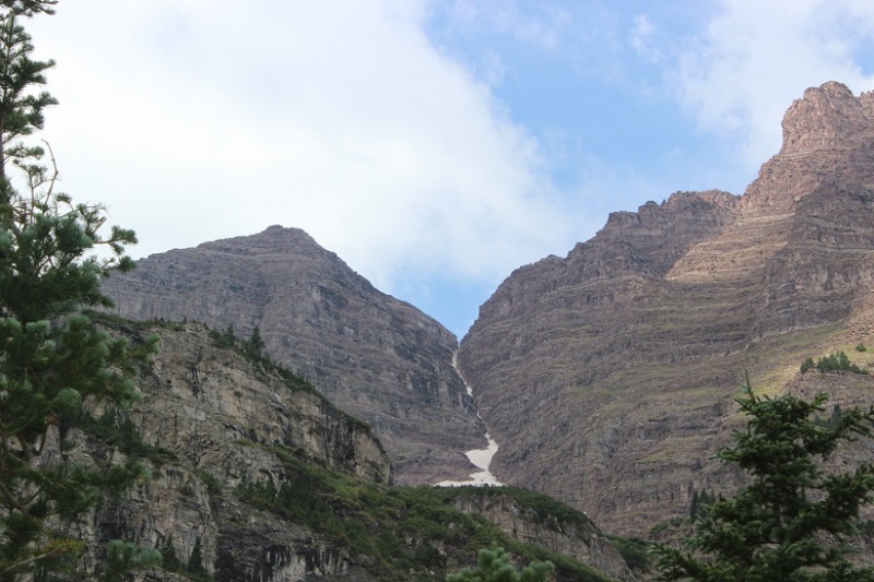
And the Bell Cord Couloir (for those interested)
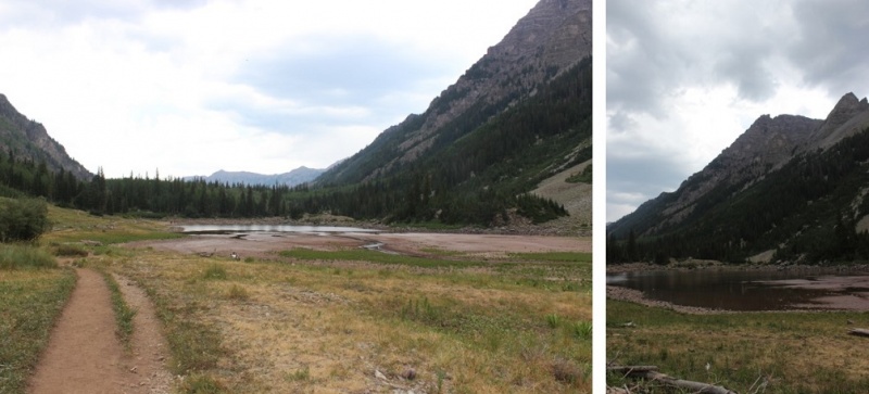
Crater Lake looked really low…
And check this out!
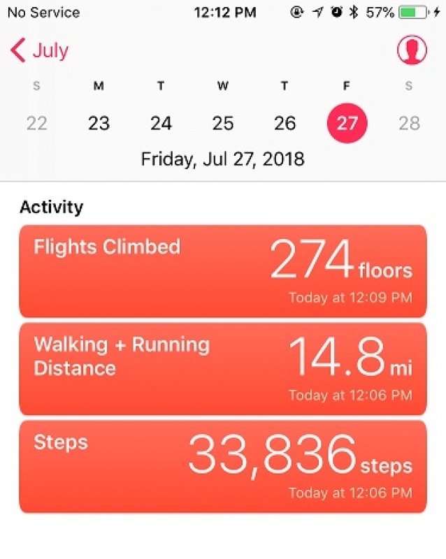
There were tons of people on the trails today! Tons! I made it back to my truck at noon, making this a 14.8 mile hike in 9 hours.
Thumbnails for uploaded photos (click to open slideshow):
Nice report! I was one of the three climbers with the early start, and that was my hat and water bottle! I realize my mistake now, and at least I know what happened.
Me and a buddy summited on 8/22/2016. Another buddy and I are going to try for the summit the first week in September. The last time we took the second gully. This time we will take your route up the first gully. Sounds like a better route. Thanks for the info.
Yes, you weren't the only one who missed the trail. We and two other groups had to back track. You were the first person I saw coming down as I hit the top on the first ridge. I was one of the two old farts on the mountain. We did summit. Just a little later that you.
Great Job
Hikers can drive in any time of day (but you should be there before 8am to get a spot). There's overnight and day parking available. Pay the $10 fee at the Rangers Station (envelopes located at the outdoor signs) and hang the receipt on your rear view mirror.
I'd never considered using microspikes on scree, but will definitely do that for Maroon, Pyramid and the Wilsons.
Caution: The information contained in this report may not be accurate and should not be the only resource used in preparation for your climb. Failure to have the necessary experience, physical conditioning, supplies or equipment can result in injury or death. 14ers.com and the author(s) of this report provide no warranties, either express or implied, that the information provided is accurate or reliable. By using the information provided, you agree to indemnify and hold harmless 14ers.com and the report author(s) with respect to any claims and demands against them, including any attorney fees and expenses. Please read the 14ers.com Safety and Disclaimer pages for more information.
Please respect private property: 14ers.com supports the rights of private landowners to determine how and by whom their land will be used. In Colorado, it is your responsibility to determine if land is private and to obtain the appropriate permission before entering the property.


")
")
")
")
")
")
")
")
")
")
")
")
")
")
")
")
")
")
")
")
")
")
")
")
")
")
")