| Report Type | Full |
| Peak(s) |
Mt. Yale - 14,200 feet |
| Date Posted | 07/18/2018 |
| Modified | 08/01/2018 |
| Date Climbed | 07/16/2018 |
| Author | Above_Treeline |
| East Ridge: Great Trail!!! |
|---|
|
I am really glad I took this trail, even though I didn't summit. Great route up the ridge! If you want to do Yale, you should consider this route, especially since the Denny Creek TH & road to Cottonwood Pass is closed past the TH for this hike, apparently for most/all the summer. Avalanche TH is supposed to be open all summer. However, this route is probably more difficult than the Denny creek TH. More vertical, route finding probably harder, etc. If you need a trail, don't take the East Ridge. The basic route is pretty easy: Take the Colorado Trail from Avalanche TH up to the top (saddle?,) hang a left, and go up the ridge. Of course, you'll need some route finding skills on the ridge. There was more trail than I expected, really quite a bit, but it was a bit difficult to stay on. And I missed it a lot going up. People were hiking from Harvard/Columbia TH area to Avalanche TH on the Colorado Trail. So you should be able to access this from that side, as well. Not sure, but I think distance might be similar or even less. It was pretty intimidating once I saw the ridge! Definitely questioned my sanity. But it was fun getting above treeline, and getting on the ridge, you really feel like you're climbing a mountain. Had some trouble below 12,900. Got too low below the ridge, I believe on the bump below 12,900, and wound up in talus. Really wasn't sure if it was steep enough to worry about or not. Very tense few minutes, but I took a few steps, and was able to grab on to a rock. Got back up to the ridge. I went left of the bump on the way down, on a cairned trail (would be right on the way up, of course) and it was MUCH easier than getting stuck. 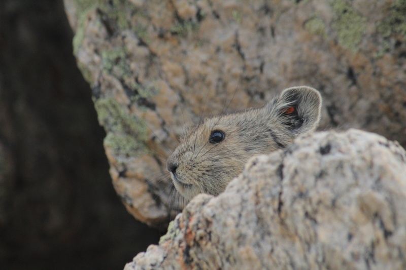 Then I hit the slick stuff at 12,900. I haven't walked on much talus lately, and I actually turned around. Didn't know how far I'd slide if I fell. Eventually, though, I went to the right of the slick stuff on the rocks. This site says class 3, but it was a lot easier, or at least less worrisome, to me. Going left at 12,900 hurt me. On the way down, I found a cairned trail that seemed a lot easier to me. I'm pretty sure I was at 12,900. I went left on the way down, I believe, on this and the lower bump. Of course, that's right on the way up. The good trail seems to be right of the ridge, on the way up, in this area. 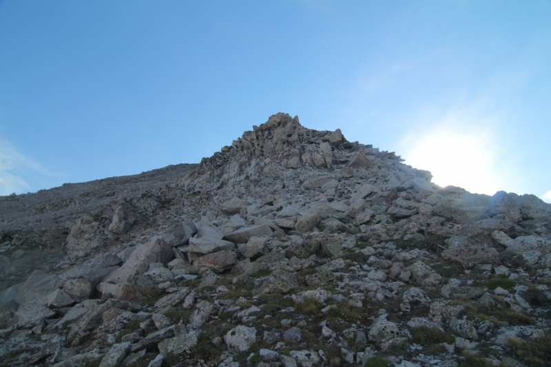 I don't like the slick stuff, not sure if the cairned trail was class 3. But it was easier, for me. Above 12,900, at the next outcropping, I stayed left following cairns. This may be class 3, but I thought I saw some slick stuff going right. So I'd do it differently than this site recommends, but if you need to keep it class 2, you might prefer to stick to the route on this site. I had good internet service up on the ridge, certainly at 12,900, and I think a bit lower. I was able to access this site, though you don't want to depend on your phone, really. It got late, weather was looking iffy, among other things, from both east and west. So I climbed a point that I would have gone around, just to get a bit higher. Possibly 13,400 or so. Not sure how close that is to the summit, but I felt really good about my effort. I believe the point a bit to the right in the photo is one of the 13,400 points, and I was standing on the other. This was as far as I got. Hopefully, I'll be able to get back up, and summit from this route.
After I started down, I realized the thunderstorms to the east were headed my way! Very dramatic, across the valley, and I enjoyed the view, although I was trying to keep moving. They didn't hit until I was maybe 1-1.5 miles from the car, and not much lightning. So not bad. 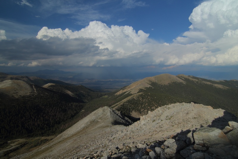 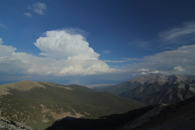 It's hard to be upset about Denny Creek being closed after taking this trail, even though I think I would have summited from the standard route. But I probably wouldn't have enjoyed it as much, or learned as much. And at this point, I probably need the education more than the peak. And the ridge was great! 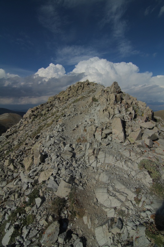 Thumbnails for uploaded photos (click to open slideshow): ")
")
")
")
")
")
|
| Comments or Questions | |||
|---|---|---|---|
|
Caution: The information contained in this report may not be accurate and should not be the only resource used in preparation for your climb. Failure to have the necessary experience, physical conditioning, supplies or equipment can result in injury or death. 14ers.com and the author(s) of this report provide no warranties, either express or implied, that the information provided is accurate or reliable. By using the information provided, you agree to indemnify and hold harmless 14ers.com and the report author(s) with respect to any claims and demands against them, including any attorney fees and expenses. Please read the 14ers.com Safety and Disclaimer pages for more information.
Please respect private property: 14ers.com supports the rights of private landowners to determine how and by whom their land will be used. In Colorado, it is your responsibility to determine if land is private and to obtain the appropriate permission before entering the property.


