Download Agreement, Release, and Acknowledgement of Risk:
You (the person requesting this file download) fully understand mountain climbing ("Activity") involves risks and dangers of serious bodily injury, including permanent disability, paralysis, and death ("Risks") and you fully accept and assume all such risks and all responsibility for losses, costs, and damages you incur as a result of your participation in this Activity.
You acknowledge that information in the file you have chosen to download may not be accurate and may contain errors. You agree to assume all risks when using this information and agree to release and discharge 14ers.com, 14ers Inc. and the author(s) of such information (collectively, the "Released Parties").
You hereby discharge the Released Parties from all damages, actions, claims and liabilities of any nature, specifically including, but not limited to, damages, actions, claims and liabilities arising from or related to the negligence of the Released Parties. You further agree to indemnify, hold harmless and defend 14ers.com, 14ers Inc. and each of the other Released Parties from and against any loss, damage, liability and expense, including costs and attorney fees, incurred by 14ers.com, 14ers Inc. or any of the other Released Parties as a result of you using information provided on the 14ers.com or 14ers Inc. websites.
You have read this agreement, fully understand its terms and intend it to be a complete and unconditional release of all liability to the greatest extent allowed by law and agree that if any portion of this agreement is held to be invalid the balance, notwithstanding, shall continue in full force and effect.
By clicking "OK" you agree to these terms. If you DO NOT agree, click "Cancel"...
Elevation Gain - 6,047' (I think this should be more because I forgot to calibrate my GPS on top and it was off by 100')
Overall Time - 8 hours 12 min (I spent at least 20-25 min talking to people on the way down the East Ridge)
Start Time - 4:53 AM from Silver Creek TH
Mount Yale Summit - 8:27 AM (3 hours 34 min) 5.97 mi 4,925' gain
15 min on Mount Yale Summit
Mascot Peak Summit - 9:35 AM (53 min) 1.20 mi 351' gain
5 min on Mascot Peak Summit
Mount Yale East Ridge - 10:36 AM (56 min) 1.10 mi 672' gain
Silver Creek Trailhead - 1:05 PM (2 hours 29 min) 5.02 mi 92' gain
CliffNotes:
Started and Finished at Silver Creek TH off CR 365 (same road as North Cottonwood Creek TH)
Took the ridge line between North Cottonwood Creek and Silver Creek to Southwest Slopes and back down East Ridge
Steep off the CO trail to the ridge
Great ridge views of Harvard and Columbia
Don't lift leg day 35 hours beforehand (rookie mistake)
Trip Description:
3 years ago I hiked Mount Yale from Denny Creek as my 4th 14er. This season I’m trying to finish the list but I’m also going back to try some repeats from different trailheads or add in 13ers. On Saturday I was able to do both. I saw a trip report from a couple years back that that described this route which combined ridge lines and making a loop which I really like doing so it lined up pretty good. After loading the proposed route on my Garmin I headed out from my buddy’s apartment in Golden.
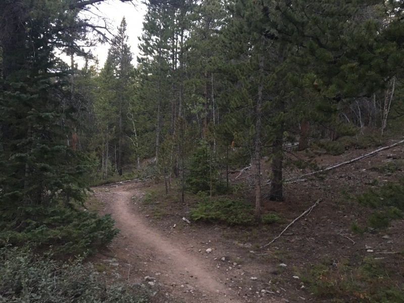
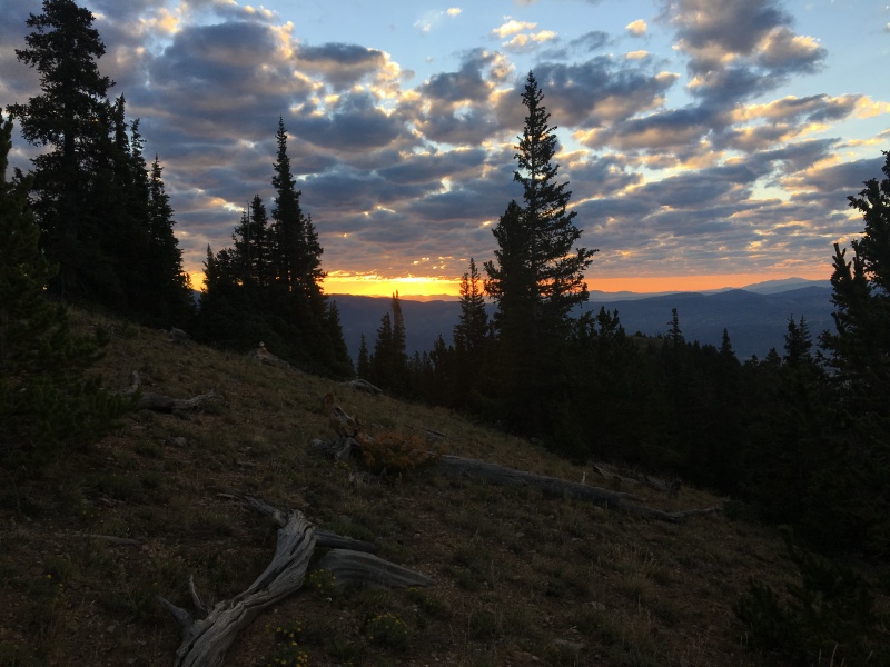
Early morning hikes never disappoint when the sun starts to rise. Maverick (my Heeler mix) and I started and the grade got steep pretty quick. We stayed on the Colorado Trail for around 1.5 miles and then picked a spot to start heading toward the ridge line. I would recommend starting up the hill sooner than I did. There aren’t really any trails through there so you just gotta your route.
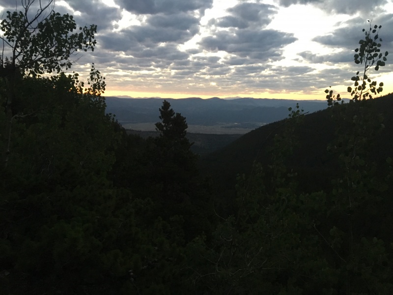
Early Morning sunrise over Buena Vista
Where we turned off the Colorado Trail
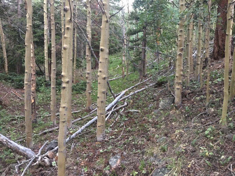
Making our own path
More off trail
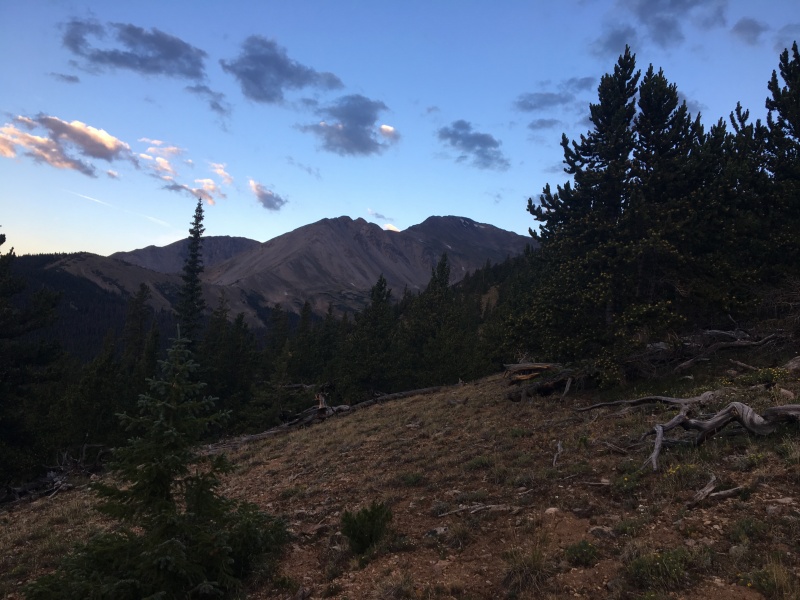
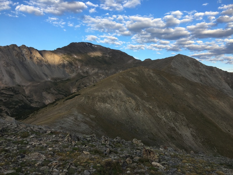
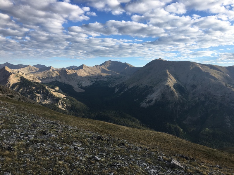
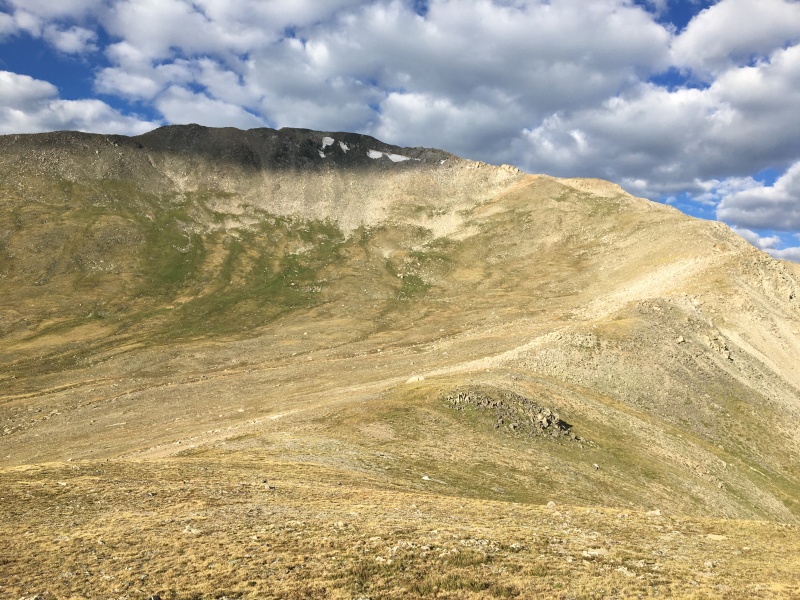
Once you get through the trees and gain the ridge, Yale comes into view. Following the ridge line is obvious over the few hills. The whole time your on the ridge you get great views of the Hork Fork Basin with Harvard and Columbia. After following the ridge the last push meets up with the standard route on Yale’s north side.
Finally Mount Yale comes into view
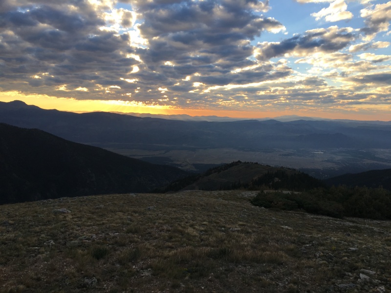
Sky over BV is on fire
Looking back at where we came out of the trees
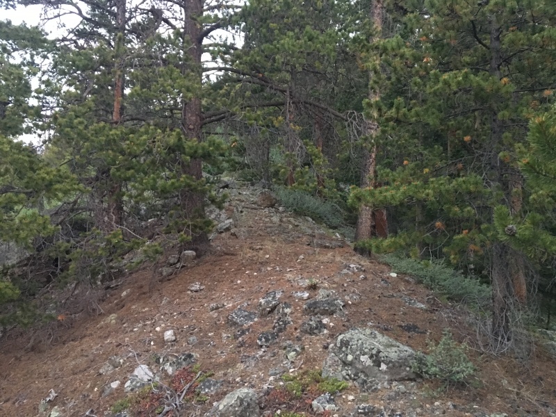
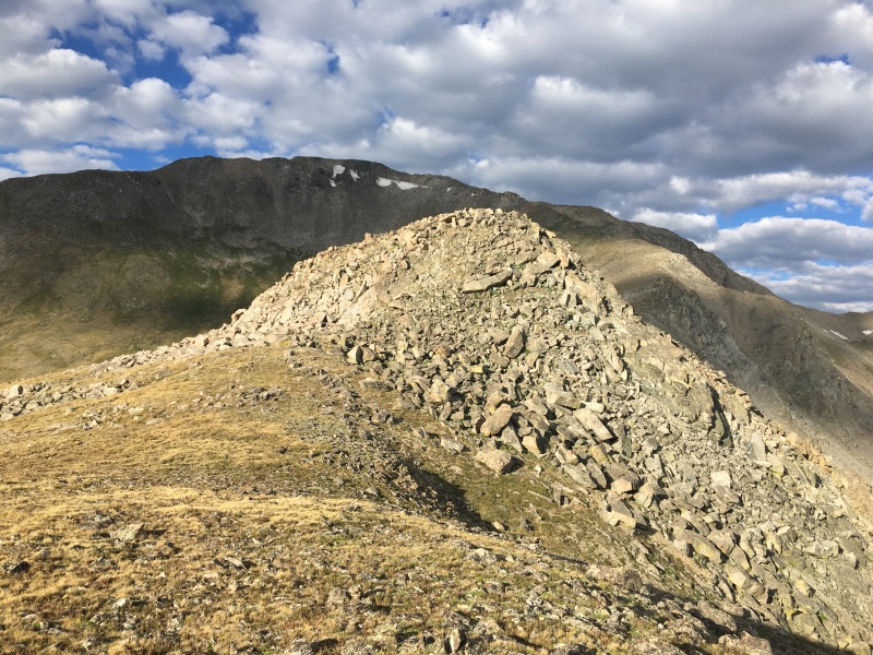
First hill actually had a cairn on it. Only one I saw on the ridge
Next hill over. Getting a little closer
Finally the sun started to come out
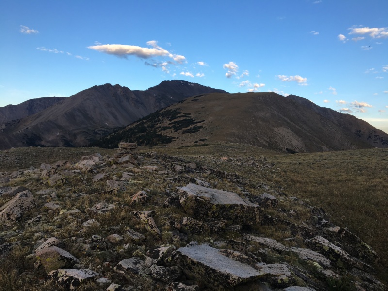
Great views of Harvard and Columbia
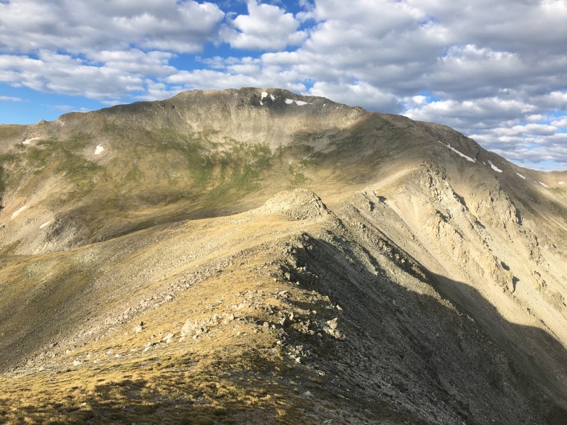
Last hill before the push to the top. This little high point on the ridge could be avoided if you wanted
I sneaked to the left of this rockpile
The ridge is obvious the whole way
At the top of this grass is where I met up with the Southwest Slopes route
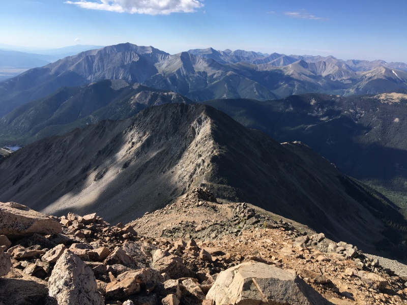
With the standard route from Denny Creek being closed and the East Ridge not the best trail, we had the summit to ourselves (couple people made it up and left before we got there). After a few snacks and dog treats we started towards the East Ridge.
Looking back at the ridge line with Mav ignoring me
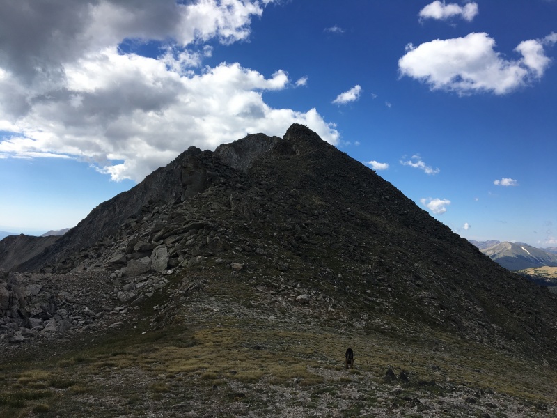
I didn’t want to orphan Mascot Peak so I read plenty about how loose it was and the spot or two to avoid. I started my descent when I was about in line with Mascot’s north ridge. The initial descent is loose but about halfway down it firms up. Stay to the left of the first boulder pile because it soon cliffs out. The rest of the way is pretty obvious. I saw one person on top of Mascot but they were gone before we got to the top.
The route down to the 13,000' saddle
From the saddle looking up at Mascot
By this time I was really regretting lifting legs on Thursday evening and I knew the slog back up to the Yale was not going to be pleasant. I made it up about halfway up and then decided to cut across the talus to meet the East Ridge a little further down staying at about 13,500’. The talus was pretty good the whole way across aside from some small loose spots.
I didn’t do any research on the East Ridge “trail” so i was surprised to find out how loose it was. Closer to treeline and the Colorado Trail it got a lot better. I passed by at least 5 or 6 people who had turned around because the route was so steep and loose.
All in all it was a another great day Sawatch, Maverick conquered his 10th 14er, and I check off another Tricentennial. Below is the GPX file of the route
My GPS Tracks on Google Maps (made from a .GPX file upload):
I'm glad my TR helped you on this alternative route up Yale. Kinda random you went for Mascot as well - a friend & I just went up there this summer via one of its southeast ridges. We then looped up to Yale (my third unique route) & down the east ridge (also a recommendable route) back to the Avalanche TH. Awesome work linking up a couple peaks in a beautiful part of the Sawatch!
Yeah I was going to just go East ridge up and down from Silver Creek and then I read your report. This was the first time I had loaded a map and went off trial so this hike opens up doors. And yeah Mascot is a little random but being so close to it I couldn't turn it down. Thanks again!
Caution: The information contained in this report may not be accurate and should not be the only resource used in preparation for your climb. Failure to have the necessary experience, physical conditioning, supplies or equipment can result in injury or death. 14ers.com and the author(s) of this report provide no warranties, either express or implied, that the information provided is accurate or reliable. By using the information provided, you agree to indemnify and hold harmless 14ers.com and the report author(s) with respect to any claims and demands against them, including any attorney fees and expenses. Please read the 14ers.com Safety and Disclaimer pages for more information.
Please respect private property: 14ers.com supports the rights of private landowners to determine how and by whom their land will be used. In Colorado, it is your responsibility to determine if land is private and to obtain the appropriate permission before entering the property.


")
")
")
")
")
")
")
")
")
")
")
")
")
")
")
")
")
")
")


