Download Agreement, Release, and Acknowledgement of Risk:
You (the person requesting this file download) fully understand mountain climbing ("Activity") involves risks and dangers of serious bodily injury, including permanent disability, paralysis, and death ("Risks") and you fully accept and assume all such risks and all responsibility for losses, costs, and damages you incur as a result of your participation in this Activity.
You acknowledge that information in the file you have chosen to download may not be accurate and may contain errors. You agree to assume all risks when using this information and agree to release and discharge 14ers.com, 14ers Inc. and the author(s) of such information (collectively, the "Released Parties").
You hereby discharge the Released Parties from all damages, actions, claims and liabilities of any nature, specifically including, but not limited to, damages, actions, claims and liabilities arising from or related to the negligence of the Released Parties. You further agree to indemnify, hold harmless and defend 14ers.com, 14ers Inc. and each of the other Released Parties from and against any loss, damage, liability and expense, including costs and attorney fees, incurred by 14ers.com, 14ers Inc. or any of the other Released Parties as a result of you using information provided on the 14ers.com or 14ers Inc. websites.
You have read this agreement, fully understand its terms and intend it to be a complete and unconditional release of all liability to the greatest extent allowed by law and agree that if any portion of this agreement is held to be invalid the balance, notwithstanding, shall continue in full force and effect.
By clicking "OK" you agree to these terms. If you DO NOT agree, click "Cancel"...
I had hoped to be climbing Longs Peak this morning for my January grid slot, but since it's finally snowing in Colorado, I thought I'd write a trip report instead. So...rather than get a conditions report for Longs today, here's a trip report from Handies from a couple weeks ago.
Date: January 3, 2018
Approach: Boulder Gulch from ~1 mile above Cataract TH
Length: ~8 miles roundtrip
Vertical: ~4,000 feet
Ascent Party: bmcqueen, ryguy, JQDivide, ScreeSurfer
Time: 5:00 hours to summit; 8:06 roundtrip.
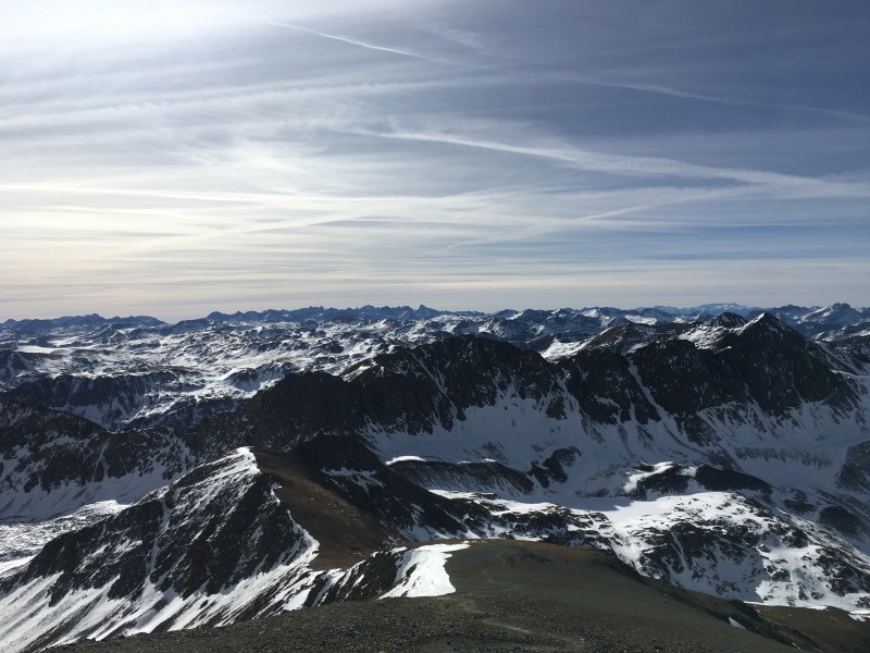
Kevin Baker's Winter Handies Peak Trip Report refers to it as "The Elusive One". In winter 2017-18, nothing seems to be elusive. The Northern San Juans have been downright welcoming this year in fact. After climbing Uncompahgre and Wetterhorn (link to JQ's TR) together on New Years Day, a 23-mile trek, without once needing the snowshoes we carried on our packs, we knew Handies, the elusive one, was well within reach.
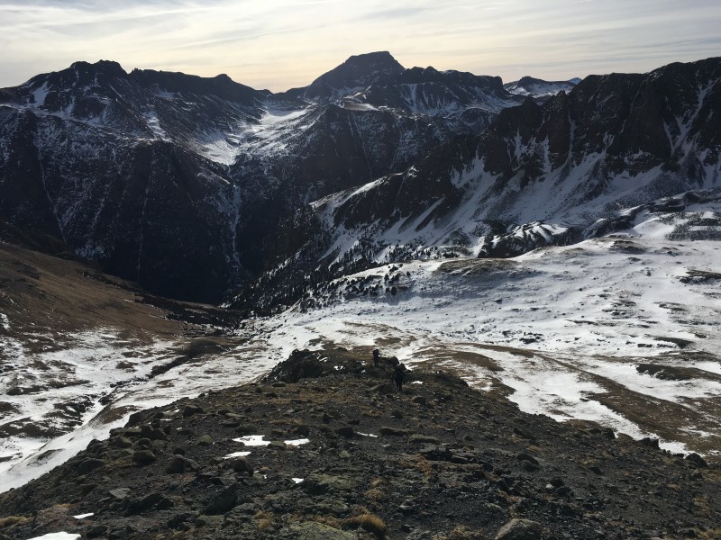
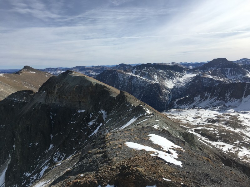
Looking back down with Half Peak in the background
On our rest day on January 2nd, we had a yummy breakfast at Confluence, then drove up the road to see how close we could get to our planned trailhead. We were able to get about a mile past the Cataract TH for Half Peak before hitting deeper snow on a steep hill that my car would no longer negotiate. Lunch and dinner were both at Packer Saloon (limited options in Lake City in winter, but Packer is good and we were happy to go back for dinner).
John Balciar drove up from Denver that night to join us at the Matterhorn Motel in Lake City. Thankfully, no children bouncing off the walls that night, but light-sleeper John didn't get much rest, describing the other three of us as "quite the symphony".
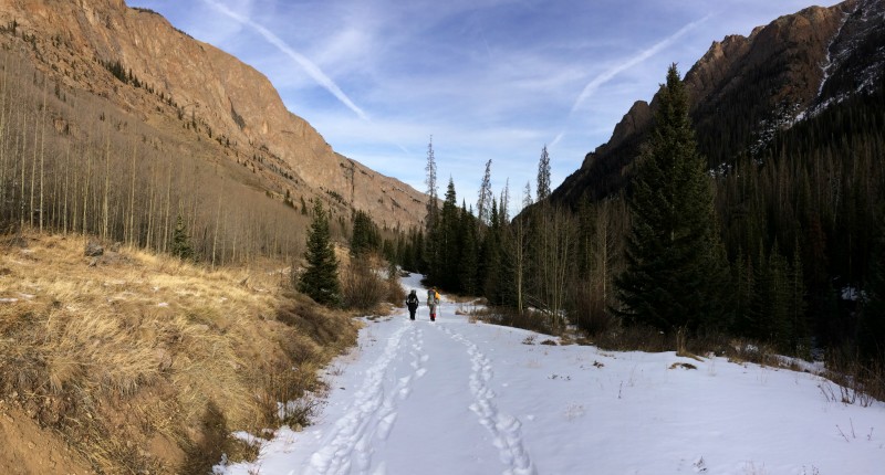
We slept in until 5:30 before launching up the road to the trailhead. We left John's car at the Cataract TH and piled into my car for the last mile before starting up the road on foot. Ryan had created a .gpx track for us up Boulder Gulch using gps coordinates from Dancesatmoonrise's old trip report. There was no sign of a trail initially, so John just led us straight up the hillside, again demonstrating that he is not normal.
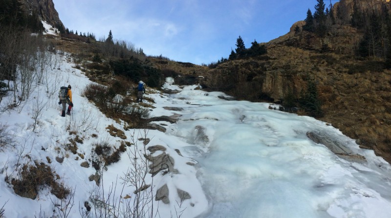
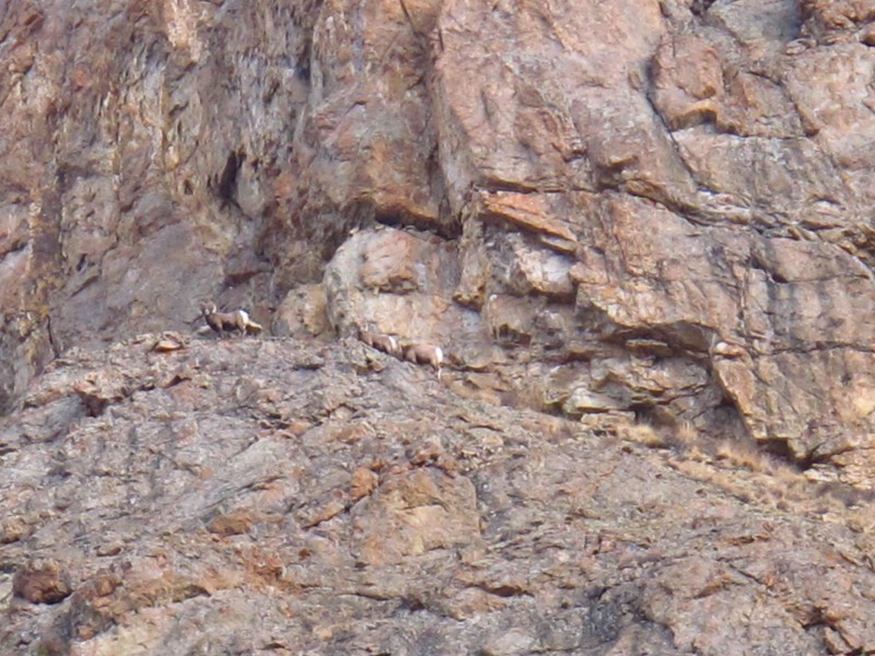
Near the frozen waterfall that we skirted on the left, John saw a few bighorn sheep that took off up the opposing hillside, nearly getting out of sight before the rest of us got there to see them. Frozen waterfall and sidehilling on a bit of snow. PC - Joel A rare photo of Scree Surfer - those bighorn sheep are up there somewhere. PC - Joel The bighorn sheep. PC - John
The snow started to get a bit deeper, but none of us had even brought snowshoes since we had just done Uncompahgre and Wetterhorn. Thankfully, John broke trail for us through that whole stretch and stopped to let us catch up just as we were almost out of the trees and to the spine of the ridge that we would follow up and out of the center of the basin. Note - in a normal snow year, this stretch of sidehilling just below treeline is a bit of a terrain trap and what I perceived to be the most likely place to slide on the whole route.
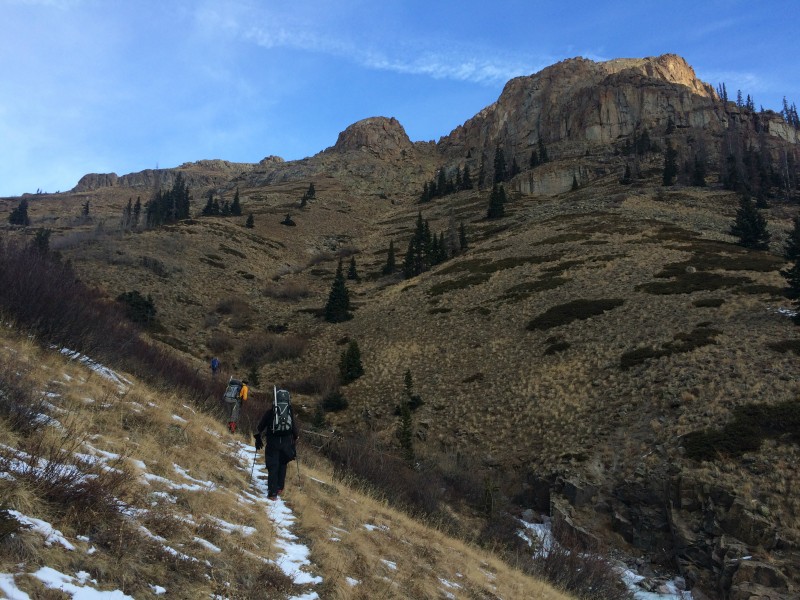
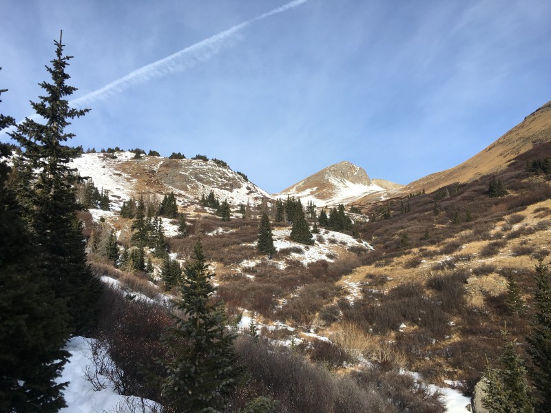
Treeline in Boulder Gulch
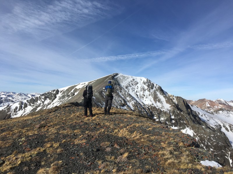
As John started off again after the break, an idea occurred to me. Since John is so much faster and I knew he needed Redcloud and Sunshine in winter, I flagged him down and offered that he could go on ahead without us, then drop down off Handies to the Silver Creek TH, then do Redcloud and Sunshine for the Lake City Triple Crown. We could move his car a couple miles down the road to the Mill Creek campground so he could descend Sunshine's winter route and end up back there. He thought about it for a minute, thanked me and took off up the hill. That's the last time we saw Scree Surfer that day!
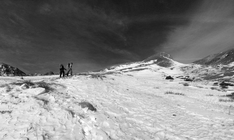
Approaching the spine. PC - Joel
Having freed John from our slower speed, Ryan, Joel and I took our time going up the ridge in the lovely January weather. It was warm enough that I went without gloves for a good stretch of the ridge. Ryan was quickly regaining red blood cells and his mountain soul now that he was back in Colorado and climbing mountains.
The reason we had chosen this route up Boulder Gulch is that it is regarded as the most avalanche safe route on Handies in winter. As you can see from the pictures and all the brown and green showing, we weren't very concerned about avalanches, but it was still fun to climb a peak from a new route.
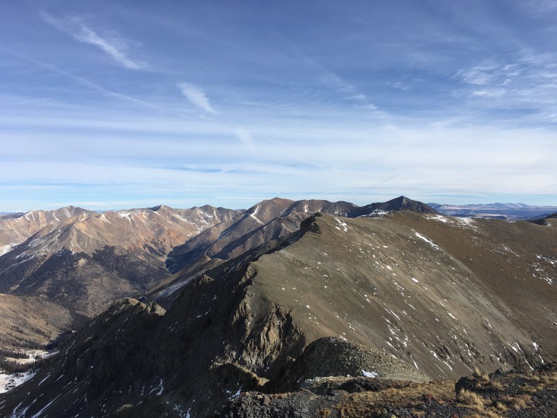
I looked over longingly at American, Jones and Niagra to the west, knowing that I needed Jones in my effort to complete the Centennials in 2018 with American and Niagra both as ranked bi-Centennials that would be high on my list before much longer. Today would just be Handies, however.
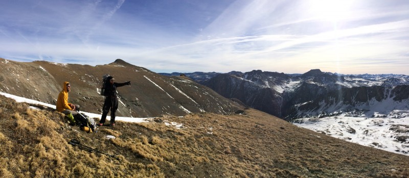
Ryan doing what Ryan does - educating Brad on what peaks we're looking at. PC - Joel Jones in the center off in the distance American, Jones & Niagra from Handies
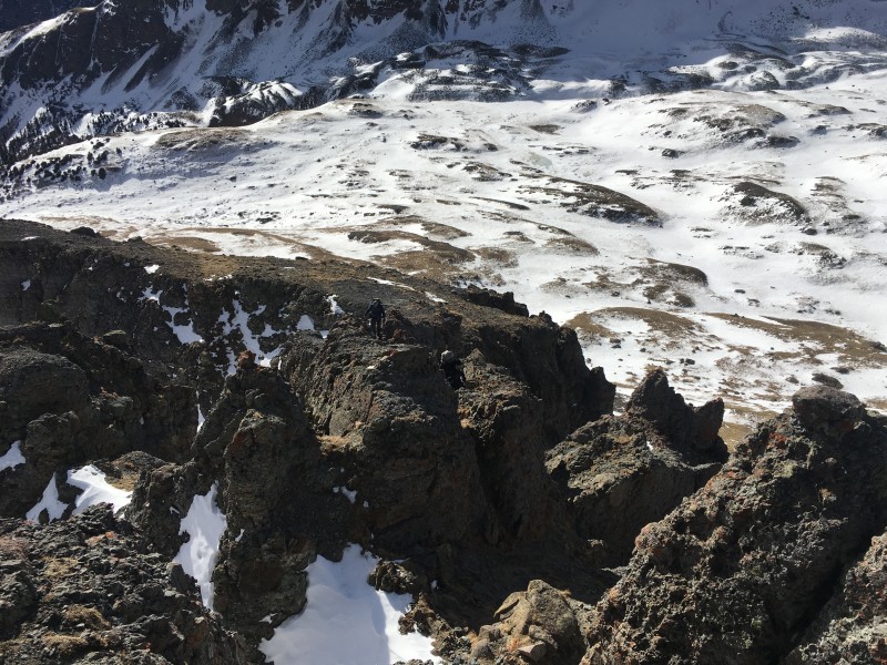
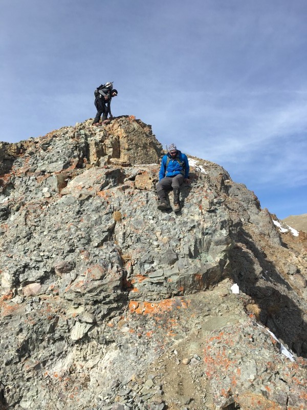
The Class 3 section of ridge is indeed short and enjoyable. The ridge is narrow in this section with steep drop-offs on the east side and loose gullies on the west side. It is a bit like a maze (albeit a short maze) weaving through, deciding whether to stay on the exposed ridge crest or follow short gullies up to regain the ridge. Given how narrow and loose it is, it reminded me of Eddie Murphy crossing to get the dagger in The Golden Child. The monk gives him parting advice and says, "Stay on the Path". Eddie Murphy replies, "What if the path doesn't stay under me?!?!"
Navigating the Class 3 section
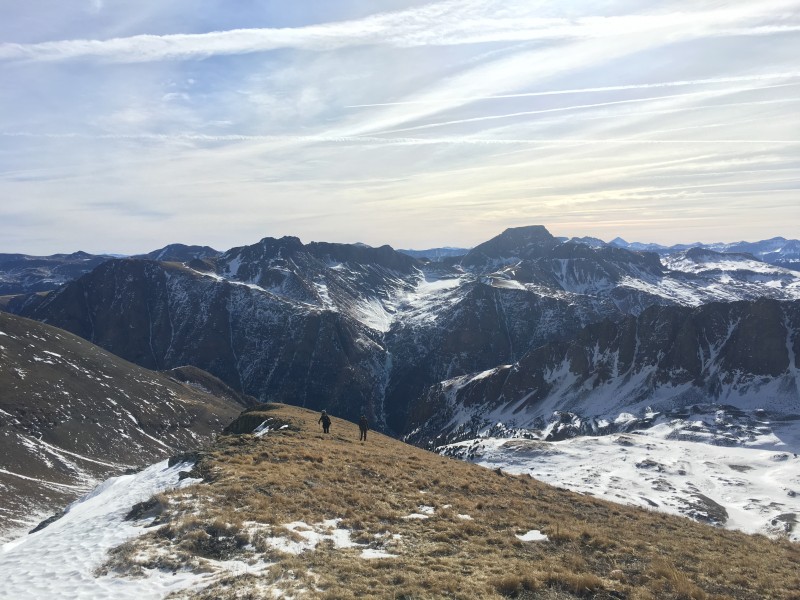
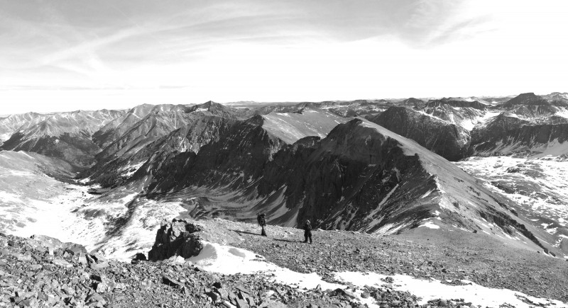
Above the Class 3 section, we continued up the gentle slope to the top of the hill just above 13,600'. We traversed a bit below the ridge crest on the left hand side going over to Handies, but it was loose enough that we chose to stay mostly ridge crest for the return trip. Handies still looks like it's a ways off, but the last bit went fairly quickly and we celebrated another early-2018 winter summit that was easier than it should have been.
Above the Class 3 - easier ground Uncompahgre peeking through Ryan & Joel checking out the remaining route to Handies' summit. Looking back on the ridge between Handies and the spine we climbed
We saw no signs of John as we ascended the last bit to Handies, so we figured he must have already dropped down into the trees towards Silver Creek on his way to Redcloud and Sunshine.
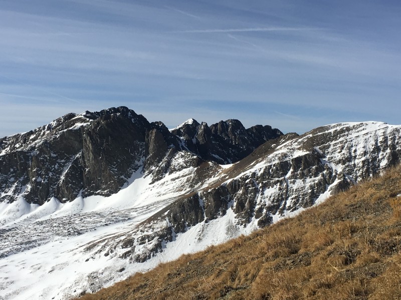
Redcloud and Sunshine Summit with Coxcomb, Wetterhorn, Matterhorn and Uncompahgre - holy smokes we need snow!
The descent was uneventful. We moved John's car down to the Mill Creek campground turn-off, thankful that we had at least completed our one peak in less time than it took him to do three.
After dinner at the Gunnisack in Gunnison, we were on our way home, happy with our New Years efforts around Lake City. Ryan added two new winter peaks while Joel & I got three.
Descending to the saddle. PC - Joel Descending a bit of Class 3 On the road out. PC - Joel
My GPS Tracks on Google Maps (made from a .GPX file upload):
I'll add that after John left us, mid way through the hike, he still beat us to the summit by 90 minutes.
And I think we only beat him down by like two hours.
MACHINE
Things have changed since your report, but the amount of snow on surrounding peaks from Handies summit looked the same as it did in early October. Cool route to the summit!
Caution: The information contained in this report may not be accurate and should not be the only resource used in preparation for your climb. Failure to have the necessary experience, physical conditioning, supplies or equipment can result in injury or death. 14ers.com and the author(s) of this report provide no warranties, either express or implied, that the information provided is accurate or reliable. By using the information provided, you agree to indemnify and hold harmless 14ers.com and the report author(s) with respect to any claims and demands against them, including any attorney fees and expenses. Please read the 14ers.com Safety and Disclaimer pages for more information.
Please respect private property: 14ers.com supports the rights of private landowners to determine how and by whom their land will be used. In Colorado, it is your responsibility to determine if land is private and to obtain the appropriate permission before entering the property.