| Report Type | Full |
| Peak(s) |
Uncompahgre Peak - 14,318 feet Wetterhorn Peak - 14,021 feet |
| Date Posted | 01/18/2018 |
| Modified | 01/21/2018 |
| Date Climbed | 01/01/2018 |
| Author | JQDivide |
| Additional Members | RyGuy, bmcqueen, BrentRichter |
| Falling into Winter |
|---|
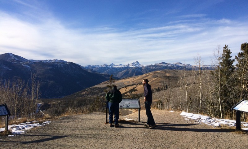 Prologue: Last winter Brad and I went for Uncompahgre on the first day of winter (Dec. 2016). Got our asses handed to us. We snowshoed for about six hours, putting in a trench starting at the main TH. We ended up setting up the tent on the road near 11,000, short of our goal of the 4wd TH. Another hour-plus the next morning and we hit the 4wd TH and decided an Uncompahgre summit wasn't going to happen. Date: January 1, 2018 Approach: Up Standard Uncompahgre 2wd TH, down Wetterhorn standard Length: ~23 miles roundtrip Vertical: ~7,000ish feet Ascent Party: Brad "bmcqueen," Ryan "ryguy," Joel "JQDivide," and Brent "BrentRichter" Start time: 4:36 a.m. Summit time: 10:46 to 11:10 a.m., groups arrival for Uncompahgre (stayed on summit for 20-30 minutes, 6 hrs, 10mins to summit) Summit time: 4:20 p.m., Summit of Wetterhorn (didn't stay long) (11 hrs, 43mins to summit) End time: 9:20 p.m. (16hrs, 43mins Car to Car) 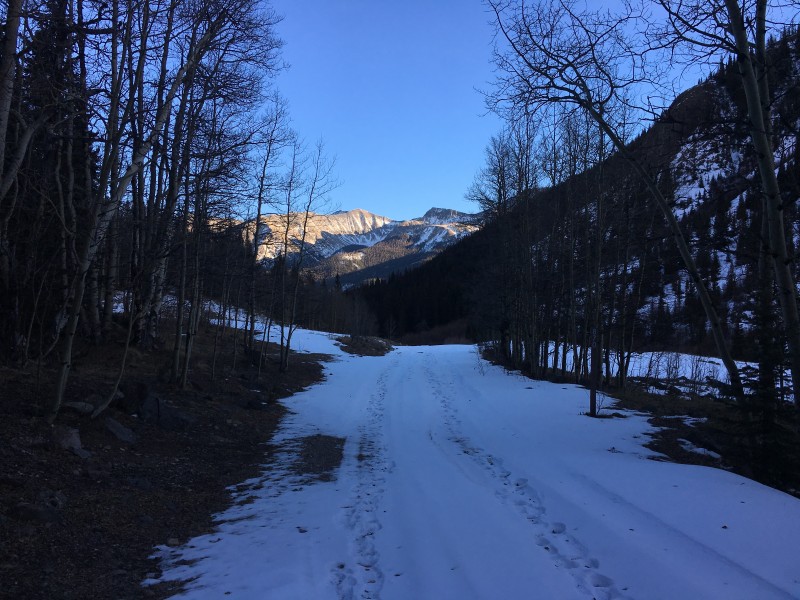 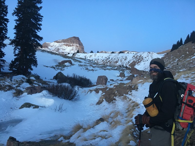 Uncompahgre Uncompahgre was automatically put on our list for this winter. The fact it's been a low snow year didn't play that much into our reason for going. Timing worked for us over the New Year's holiday and we scheduled a trip to Lake City with Ryan. 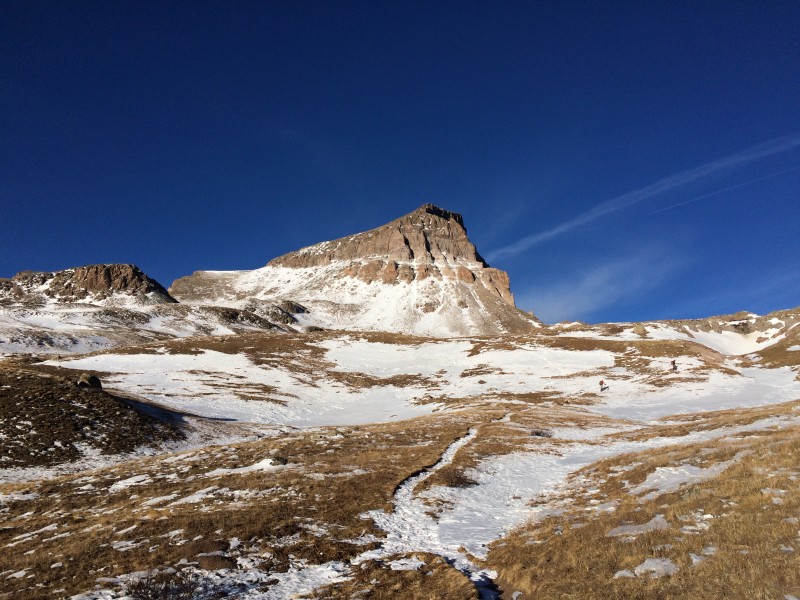 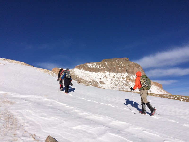 I met Ryan and Brad in BV and we loaded my gear in Brad's Highlander. On the way over we discussed summit possibilities: Uncompahgre, Wetterhorn and Handies. Which two peaks were possibilities for three days of hiking? Why not all three? If Wetterhorn was 20 miles because of the closed road, why not add on a few more and tag Uncompahgre too? Which peak first? We decided to start with Uncompahgre, because there might be a trench, which would make it easier going uphill if we didn't have to break trail. 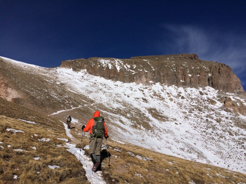 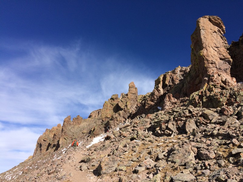 We drove up to Windy Point Overlook on Slumgullion Pass to get a view of Uncompahgre and Wetterhorn. Not much snow. Going for both was a possibility. My wife sent lasagna with us and we ate in our room at the Matterhorn Motel and turned out the lights at 7:15 p.m. The noise next store started about 8:30, young kids literally jumping on the beds, parents laughing. Ugh. We discussed options, including banging on the wall in a romantic rhythm with vocal accompaniments. Let the parents explain that. But soon they quieted down and we got back to sleep. Then the room shook us all awake at midnight. Lake City's New Year's fireworks thundered above. I've been there for the Fourth of July and they put on a good show. 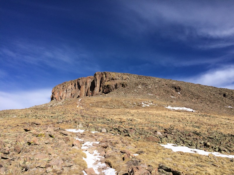 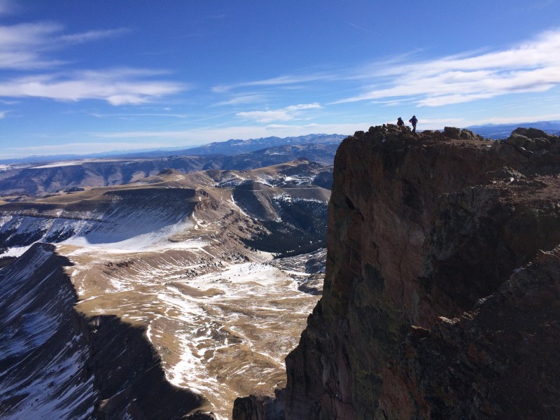 Back to sleep and up about 3:30 a.m., hit the trailhead about 4:30 a.m. We parked just a bit up the road near the gate blocking access to Wetterhorn. Brent Richter joined us. I had messaged him on the way over to LC. He drove most of the night from Denver and got about an hour of sleep in his car. Up the road we walked. A 4x4 with chains could have made it a mile or two. Ice flows were the biggest issue. One hour in, and we hit the sharp left turn near 10,200 feet. (It took us three hours to hit this spot last winter.) We were cruising. We were at the 4wd TH sooner than I expected and was very happy about it. The road was a mix of little snow, ice flows and dirt until 10,200 feet. Then it was snow all the way to the 4wd TH. 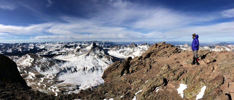  We hiked out of treeline and started up the first hill at the trail split near 12,000 feet. One of our party took a fall, sliding nearly 50 feet down the grassy/snowy slope. Freaked us out. Just saw him sliding down the hill uncontrollably. His micro spikes didn't dig into the windblown slab of snow and his feet slid out from under him. Luckily no injuries. We all adjusted our course a bit and made it to a fairly flat area for a quick snack. We later found out his spot/gps device recorded his top speed of the day at just more than 9 mph. Yes, sliding down hill goes fast. (Edit: Brad said it was OK to say he was the one that slipped. Only hurt his ego. But he also said, I had to tell everyone when I took my pizza out of my pack, it slipped down the hill just as fast. I gave Brad the sad face and though he was half way back up the hill, he graciously went down and got my pizza. I admit, I might have left it. But I surely needed the fuel to hit both peaks.) We pushed on and the sun hit the valley. Oh that feels so nice. Brad and Brent took the lead, both strong hikers. Both always faster than me. Ryan lagged behind. Unusual for him. He'd spent most of the last month and a half in L.A. for work⦠depleting his red blood cells and his mountain soul.  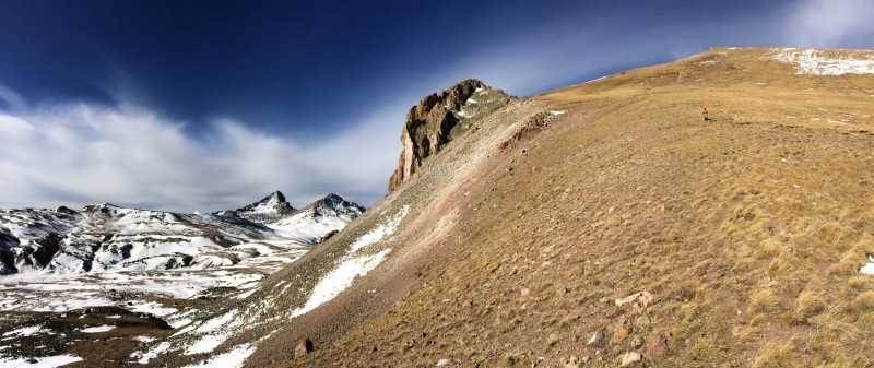 The snow in the valley wasn't very deep in the trail. Mostly windblown, sticking in depressions like the trail and near rocks. The upper portions of the Uncompahgre's trail were full of snow until the rocky areas just below the summit. These were mostly dry. 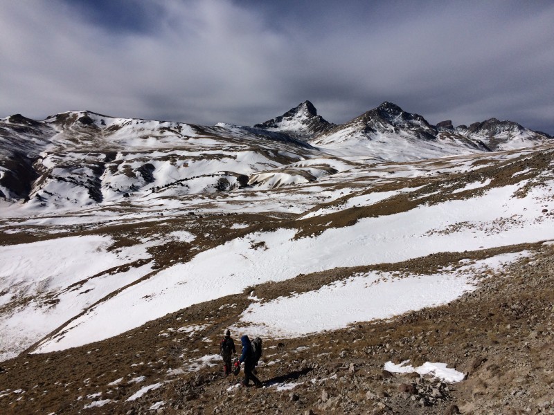 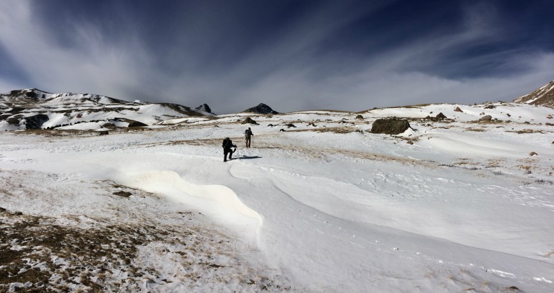 Brad said there was more snow back in November when he tagged Uncompahgre for a fall grid slot. As most of those hiking this winter have noticed⦠it is more like fall than winter. 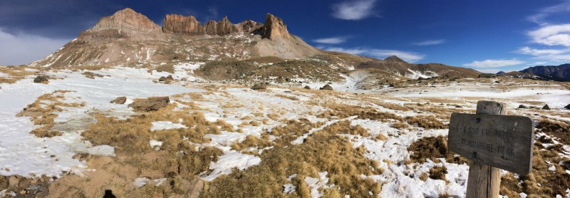 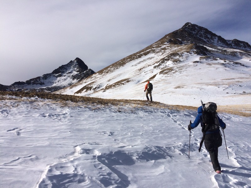 We hit Uncompahgre's summit shortly after six hours of hiking (6:10 to 6:20). We spent about 20-30 minutes at the top for photos and began our descent. We discussed going down a gully on Uncompahgre's southern ridge. Brent had previously gone up one of the gullies on another Wetterhorn/Uncompahgre combo. We took the path of caution and went down a grassy slope. 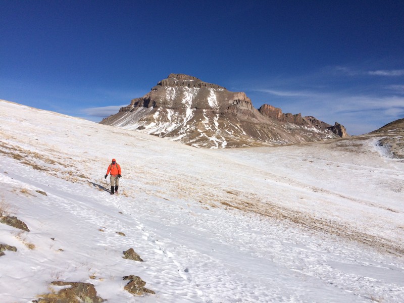 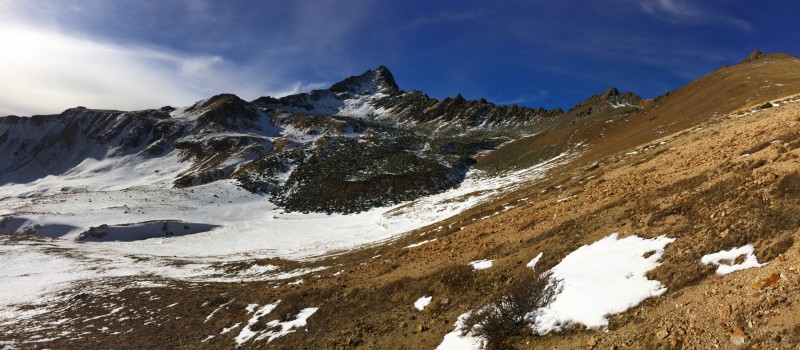 The In Between The hike between Uncompahgre and Wetterhorn was a slog. Not enough snow for snowshoes, but a few wind accumulated areas added some postholing in the low spots. It was mostly a thin layer of snow on grass or rocks.  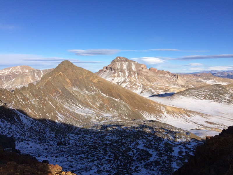 We had decided to haul snowshoes with us. We figured if by chance we had any deep snow going up Uncompahgre or in between the peaks (which was our main concern) we would need snowshoes in order to hit both peaks. We wanted to "set ourselves up for success" on this hike. The snowshoes would either be a must have, or an extra weight. Turned out to be an extra weight. 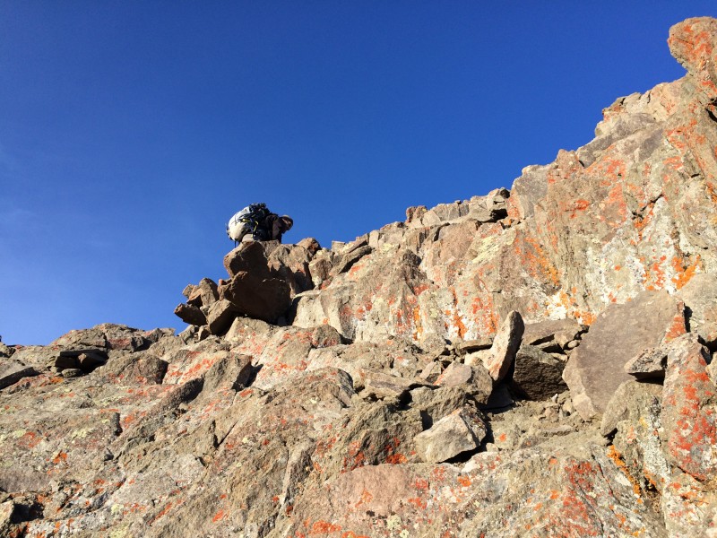 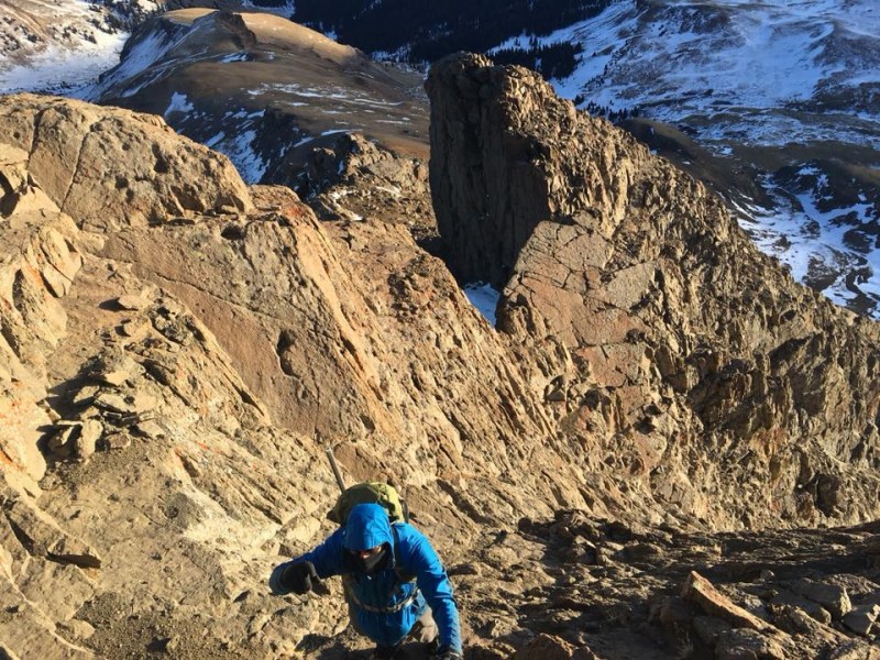 Nearing Matterhorn, Ryan decided he didn't have it in him to tag both peaks. He made the safe call to go down instead of up. Brent, Brad and I continued toward Wetterhorn. Brad broke away and climbed through the "rock garden" between Matterhorn and Wetterhorn. This 300 yards of boulders and snow sucked the energy right out of me. Tired from hiking, now I had to move up, over and around boulders without slipping into holes hidden by snow and breaking a leg. In the summer when I hiked Wetterhorn, I thought this rock garden was a cool feature on the hike, now it was more like a bad parkour course. I tripped and slipped and I bent both of my new trekking poles in this section. (My wife hates buying me trekking poles.) We lost Brad for a bit, but found him as our frustrations grew. Surprisingly, Brent called it quits after we met up with Brad on the main trail. He was exhausted and knew he had more miles to hike and drive today. 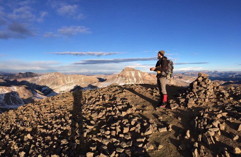  Wetterhorn I sucked down a Cliff gel and thought if I can make it to the saddle and the "yellow" dirt, I can make the summit of Wetterhorn. Just had to get through the rest of the rocks. Brad kept us on the trail and we were on our way. 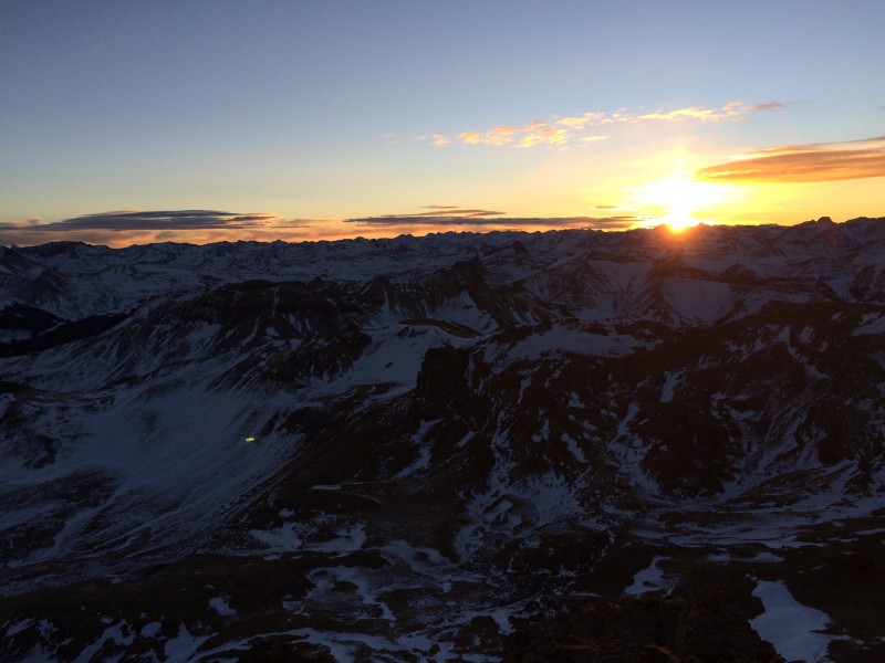 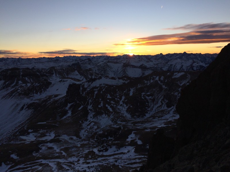 Our goal for the day was to hit Wetterhorn's summit and be back toward the saddle before dark. We were getting close, but we still had daylight. The south ridge and west face of Wetterhorn were completely dry except for a few shady spots, and near the Prow. The Class 3 section to the summit was in perfect summer conditions. We made the summit in 11 hours and 43 minutes from the time we left the TH that morning. 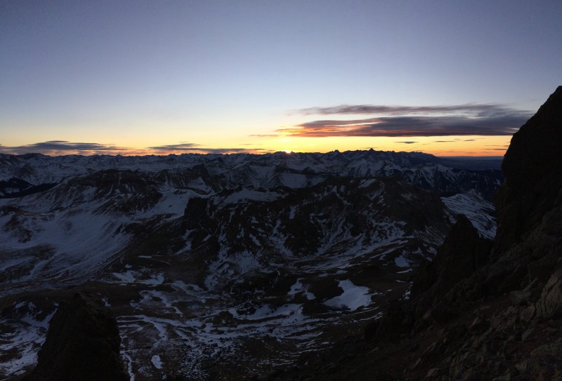 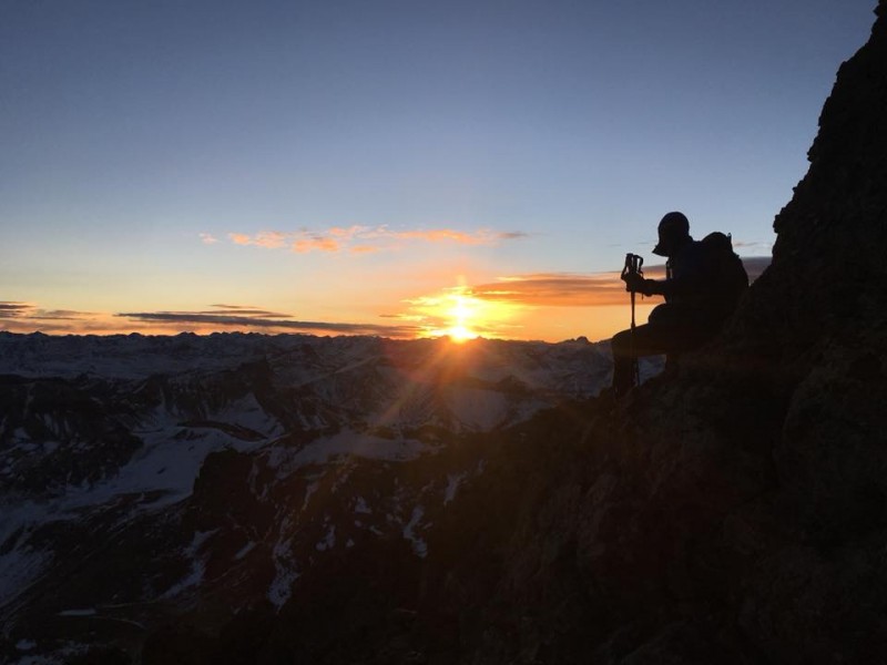 I was pumped, adrenaline fueled. We didn't stay long on the summit, just enough time for a few photos. Brad and I took our time going down. The fall earlier in the morning kept our attention on our task. We passed the Prow, ducked through the "V" notch and watched the sun drift behind the mountains to the west. Sneffels and the 13ers in that area looked awesome during the sunset. 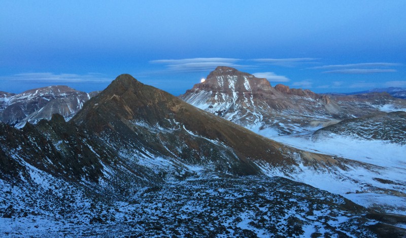 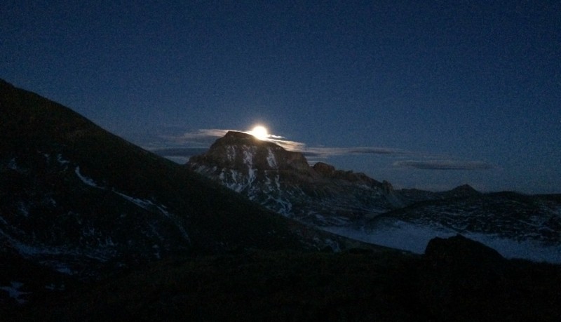 We made our way back to the saddle and realized something cool: the moon was rising over Uncompahgre. This is the second time on a peak I've witnessed a sunset and moonrise within minutes. Saw it once on Grizzly. It truly is something naturally amazing to watch. We took more photos. Grabbed a snack. Put on our headlamps. Hiked back on the trail to where we had stashed our snowshoes and a few other items. Brad asked how far back to the car. I said about 8 to 9 miles. He didn't like that answer. So we hiked about 8 to 9 miles back to the car. 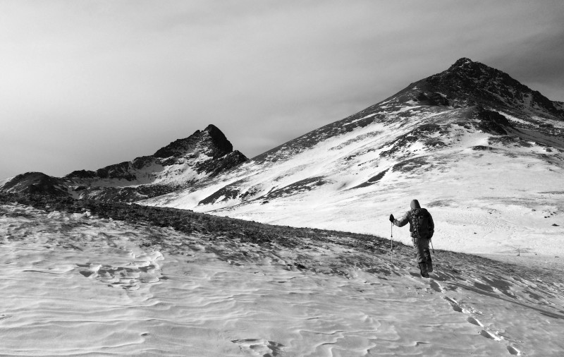 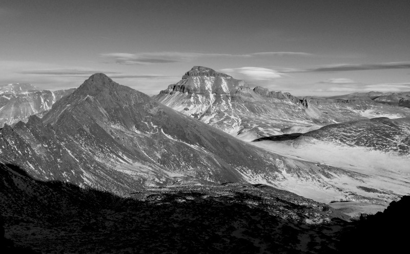 The trail back to Wetterhorn's 4wd TH was mostly ankle deep snow and few ice flows. (Edit: As we neared the one switch back just above the TH, Brad was checking the map on his phone. The trail was a mix of snow and dirt... until he took a step onto an ice flow. The scratch marks on the ice from his microspikes were pretty impressive. He once again hiked (crawled) back up to the trail. The road out was very similar a mix of snow, dirt and ice. A few large trees were down across the road, so those will need to be cut and moved before anyone can reach the 4wd TH in a vehicle this summer. The road around Capital City was completely dry. It gets lots of sun exposure. As the road dropped and wandered through the narrow canyon the snow and ice accumulation increased. Brad kept checking his clock, willing us to make it back to the car before 17 hours. We made the 23-mile trip in 16 hours and 43 minutes. 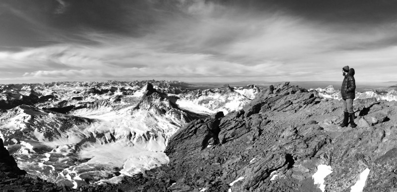  Ryan was waiting in the vehicle. He and Brent hiked the road back together. But Brent was already on his way back to Denver. Back at the hotel, we left most of the gear in the car, too tired to move it. Staci knew we'd be back late and that Lake City probably wouldn't have a restaurant open. So she sent us some homemade beef stew and soda bread. We were zombies. 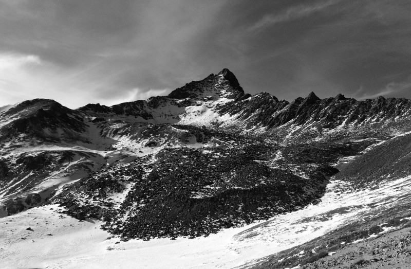 We slept well without any noise from next door. The next morning we purposely walked the few blocks to downtown Lake City to eat at a fairly new place, Confluence: part restaurant part bike shop. Lake City is nearly shut down in winter as the local population is near 800. Without tourists the restaurants and shops just can't survive. (Took us a few stops just to find a loaf of bread.) Stretching out our legs in the quiet town felt good. We then drove out to see what the TH looked like for Handies. We were able to drive just less than a mile past the Cataract Gulch trailhead. 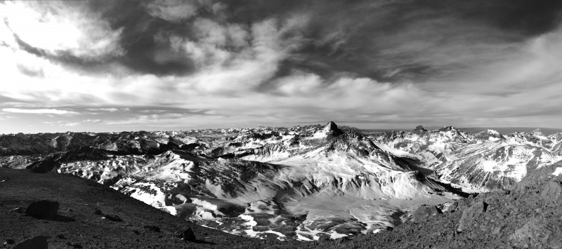 For lunch we were back at Packer Saloon to have lunch with the Hinsdale County Undersheriff. He's a friend of mine from camp days. We had a great discussion about Search & Rescue in the area and met some of his crew. Brad convinced John "ScreeSurfer" to join us for another hike and he was on his way to Lake City. Tomorrow, we'd head for Handies. See Brad's TR. Thumbnails for uploaded photos (click to open slideshow):
|
| Comments or Questions | ||||||
|---|---|---|---|---|---|---|
|
Caution: The information contained in this report may not be accurate and should not be the only resource used in preparation for your climb. Failure to have the necessary experience, physical conditioning, supplies or equipment can result in injury or death. 14ers.com and the author(s) of this report provide no warranties, either express or implied, that the information provided is accurate or reliable. By using the information provided, you agree to indemnify and hold harmless 14ers.com and the report author(s) with respect to any claims and demands against them, including any attorney fees and expenses. Please read the 14ers.com Safety and Disclaimer pages for more information.
Please respect private property: 14ers.com supports the rights of private landowners to determine how and by whom their land will be used. In Colorado, it is your responsibility to determine if land is private and to obtain the appropriate permission before entering the property.


