Download Agreement, Release, and Acknowledgement of Risk:
You (the person requesting this file download) fully understand mountain climbing ("Activity") involves risks and dangers of serious bodily injury, including permanent disability, paralysis, and death ("Risks") and you fully accept and assume all such risks and all responsibility for losses, costs, and damages you incur as a result of your participation in this Activity.
You acknowledge that information in the file you have chosen to download may not be accurate and may contain errors. You agree to assume all risks when using this information and agree to release and discharge 14ers.com, 14ers Inc. and the author(s) of such information (collectively, the "Released Parties").
You hereby discharge the Released Parties from all damages, actions, claims and liabilities of any nature, specifically including, but not limited to, damages, actions, claims and liabilities arising from or related to the negligence of the Released Parties. You further agree to indemnify, hold harmless and defend 14ers.com, 14ers Inc. and each of the other Released Parties from and against any loss, damage, liability and expense, including costs and attorney fees, incurred by 14ers.com, 14ers Inc. or any of the other Released Parties as a result of you using information provided on the 14ers.com or 14ers Inc. websites.
You have read this agreement, fully understand its terms and intend it to be a complete and unconditional release of all liability to the greatest extent allowed by law and agree that if any portion of this agreement is held to be invalid the balance, notwithstanding, shall continue in full force and effect.
By clicking "OK" you agree to these terms. If you DO NOT agree, click "Cancel"...
Peaks: Mt. Audubon (13,223') and Paiute Peak (13,088')
Trailhead: Mitchell Lake, Brainard Lake Recreation Area
Climbers: mathguy (Kevin) and MtnHub (Doug)
Introduction:
The Indian Peaks Wilderness (IPW) was first established in 1978. It lies just west of Boulder and is adjacent to the southern border of Rocky Mountain National Park. Governed by the Arapaho and Roosevelt National Forest, it is part of the Front Range and includes several peaks over 13,000 feet. Many of these highest peaks help form and connect the Continental Divide.
Because of its close proximity to the Denver metropolitan area, it is one of the most heavily utilized wilderness areas in the country. But even for its small size, its jagged, snowy skyline makes it one of the most scenic. Gerry Roach once wrote, It is smaller than Rocky Mountain National Park, but no less spectacular.
Centuries ago, the IPW was routinely visited by Native Americans. This fact prompted Ellsworth Bethel, a Denver high school botany teacher, to propose naming several of the peaks after western Native American tribes. Most of his suggestions were accepted by the U.S. Board on Geographical Names in 1914.
In recent years, I've made three trips into the IPW, two within the South St Vrain drainage and one a little farther south. Since my wife and I usually begin our CO vacations staying in the Denver area visiting family and friends, it has made sense to climb something close by for my initial hike. I've read several trip reports on the Blue Lake region, so I was anxious to experience this area first hand.
One excellent report by Derek described a massive loop, hitting nearly all the peaks along the ridge in this area in one fell swoop. That was a bit too ambitious for me. Since I have already climbed Apache and Pawnee on previous trips, I wanted to mainly concentrate on the northern peaks: Audubon, Paiute, and Toll. This would give me the opportunity to come back out through the Blue Lake drainage, which would be new to me.
Late this spring I began searching for a partner interested in joining me, and I finally found mathguy whom I've gotten to know over the course of the last couple of years. Kevin is a retired Mathematics Professor in Oklahoma. He would be vacationing in Estes Park about the same time so our vacations would overlap nicely.
The Climb:
We meet at the Mitchell Lake Parking Lot of Brainard Lake Recreation Area around 4:15am. Both of us have a National Senior Parks Pass (one of the few benefits of getting older -- and one of the best bargains ever!) so neither of us have to pay the day use fee. There were rumors going around that a few of the parking areas at Brainard were closed for maintenance but we don't find any evidence of this.
It is just before dawn when we start up the Beaver Creek Trail (#911) around 4:45 so we still require our headlamps for a little while. About a mile into the trail, the Beaver Creek Trail branches off to the right and we continue straight ahead on the Mount Audubon Trail (#913). By this time I turn off my lamp -- my favorite time of the day!
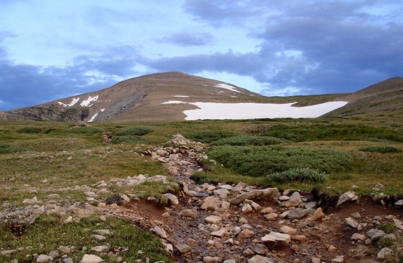
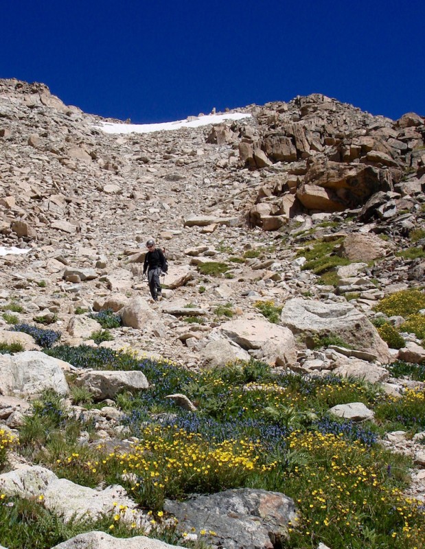
After rounding the high eastern ridge of Mt. Audubon, we finally have our first goal in full view ahead of us. Coming up the trail with Mt Audubon in view.
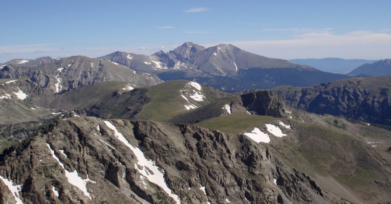
Nearing the saddle, some of the glorious and familiar peaks of Rocky Mountain National Park begin to peek over the horizon to the north. Peaks of RMNP showing above the saddle: Chiefs Head, Pagoda, Longs, and Meeker.
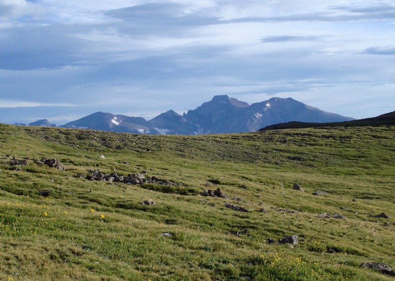
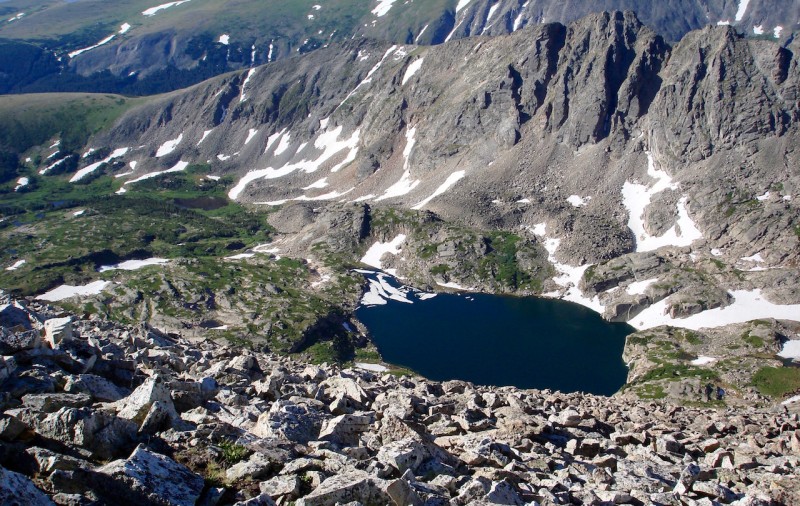
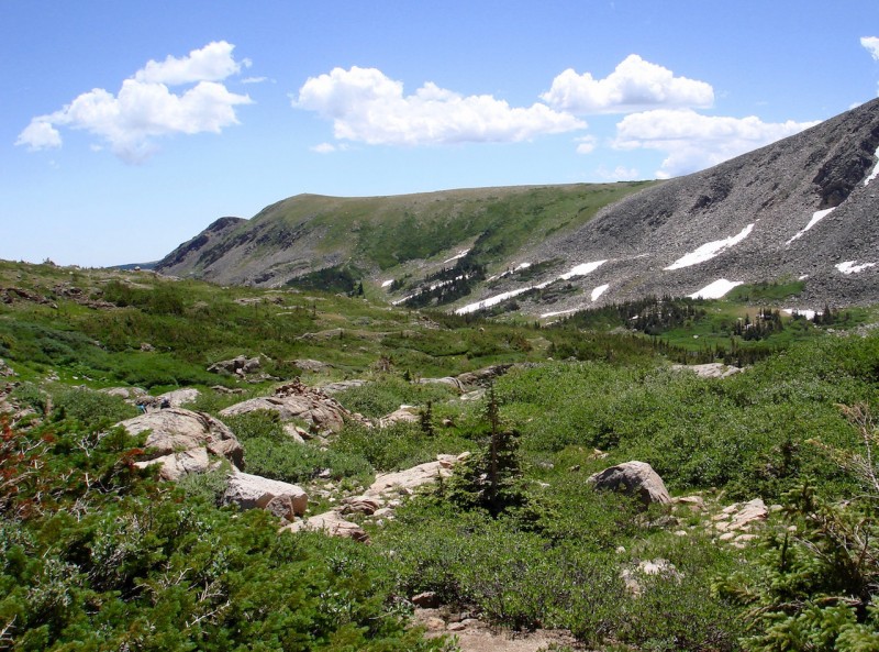
When we finally reach the saddle, the trail takes a much steeper approach, climbing up to the ridge more directly. It is mostly boulder/talus hopping now. Cairns frequently mark the route. Looking over our left shoulders, the Blue Lake valley opens up more for us to see and the hazy southern peaks of the Front Range blur in the distance. It's lovely! From Audubon's summit ridge, looking SE: Long Lake and Left Hand Reservoir.
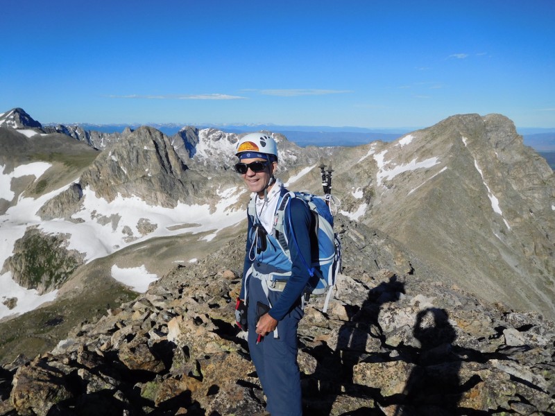
We take a short stay on Mt Audubon's summit. MtnHub on the summit of Mt Audubon. (photo by mathguy)
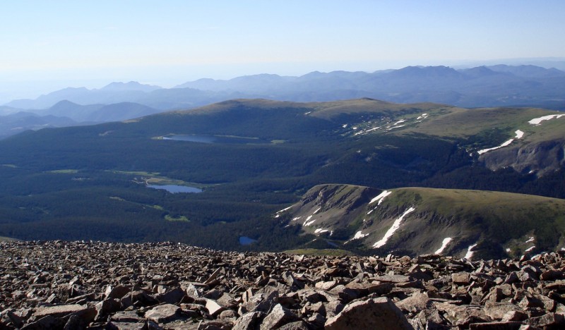
Blue Lake from Mt Audubon's summit.
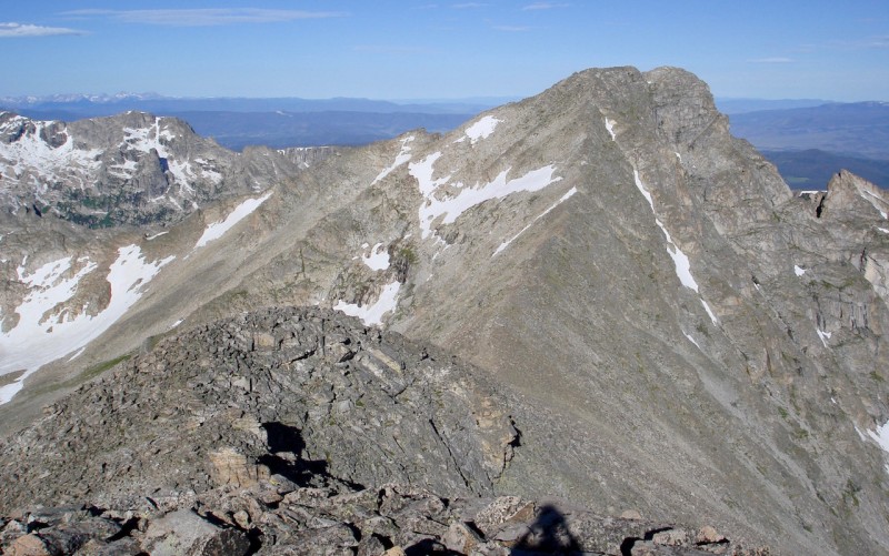
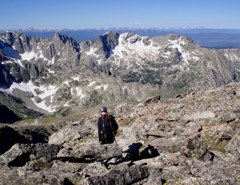
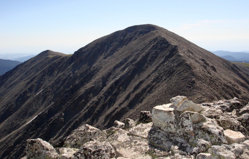
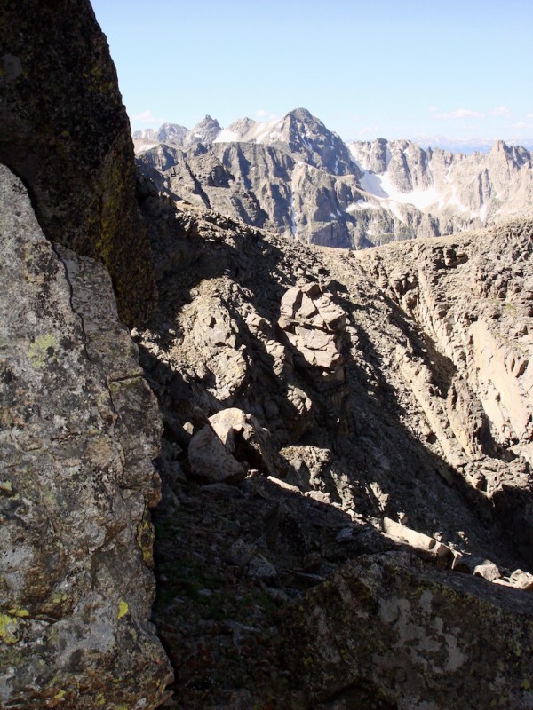
Looking ahead at our next objective, Paiute Peak, it appears to be a pretty straightforward shot of ridge walking. Looking ahead of what's to come from Audubon's summit: Paiute Pk.
On Audubon's summit we also scope out our planned descent route. Originally we had hoped to climb Mt. Toll as well and then descend down to Blue Lake from the Toll/Pawnee saddle. That route now looks quite a bit steeper with considerably more snow to deal with. There also appears to be a lot more places where it cliffs out, making safe route-finding a bit tricky.
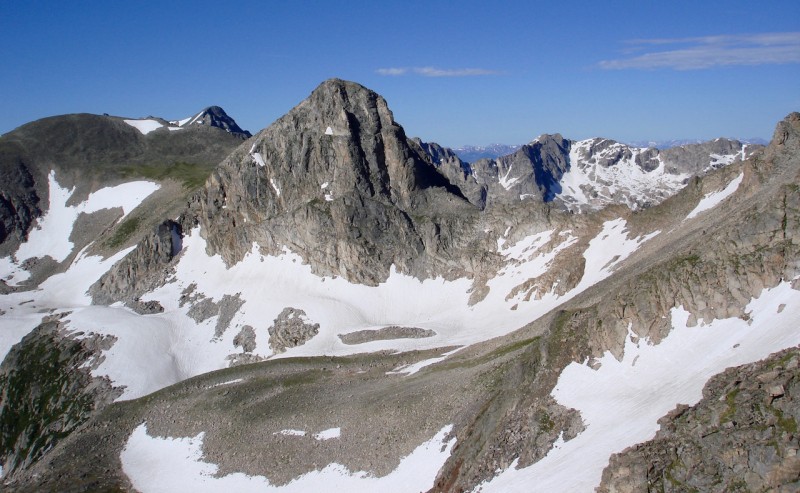
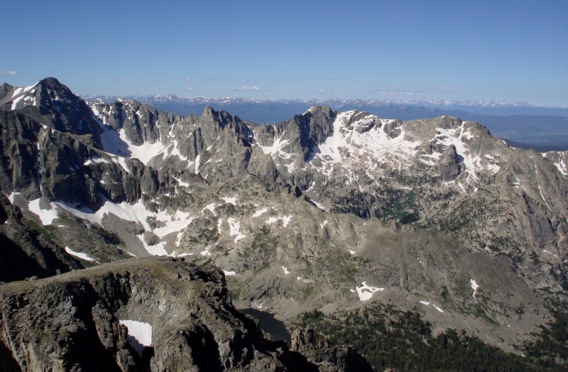
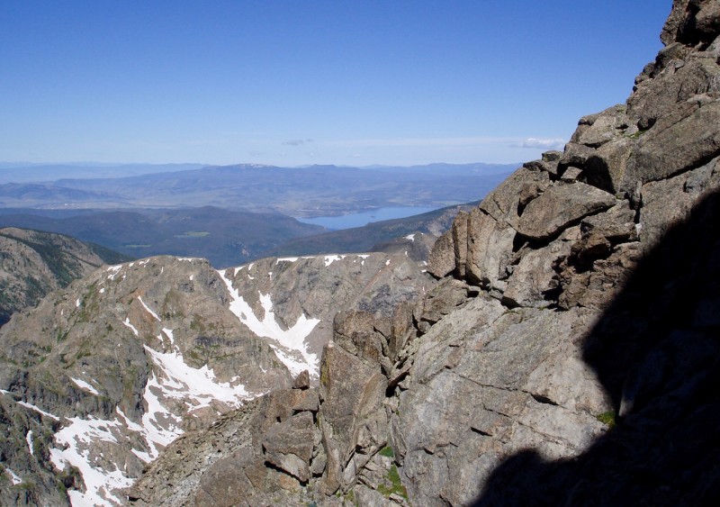
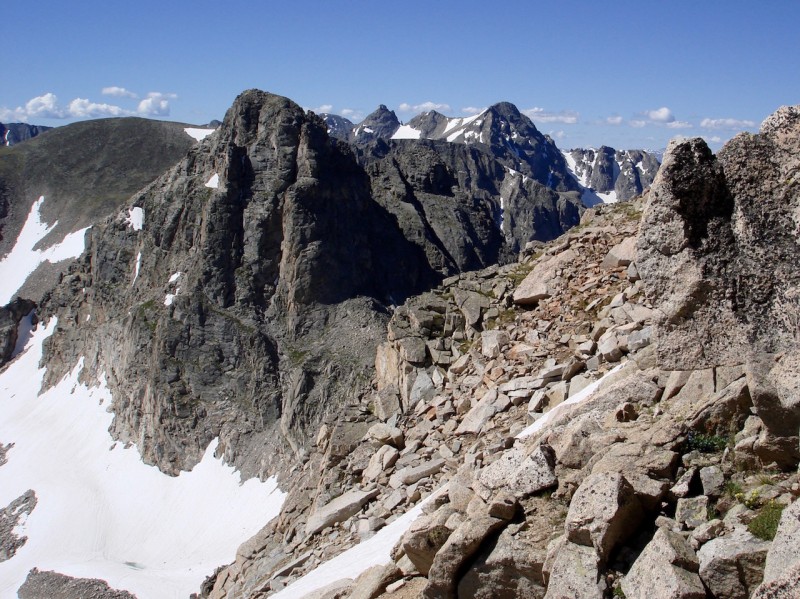
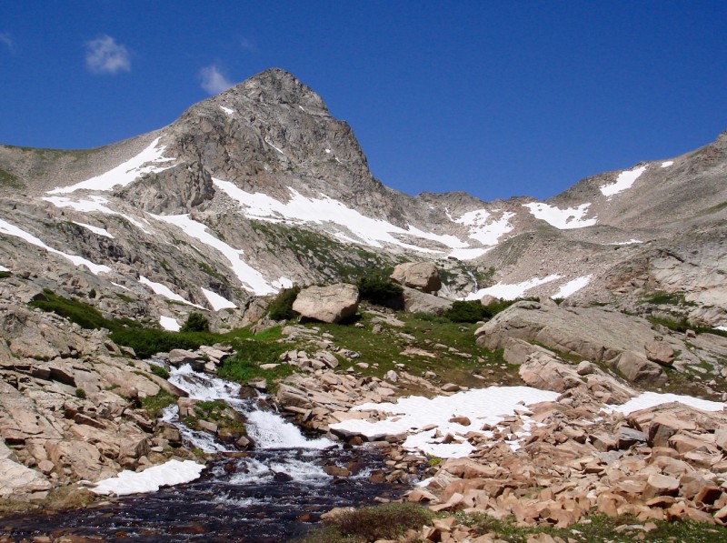
From this perspective, a descent from the Paiute/Toll saddle looks much more inviting. It is a more gradual slope down to the edge of an end moraine. It also appears that we could avoid all snow until the flattened snowfield just below the moraine, which shouldn't be a problem. Even if we end up climbing Mt. Toll, we decide we will probably come back around to the Paiute/Toll saddle for our descent. Mt Toll with Pawnee and Apache Peaks in the background (on the left).
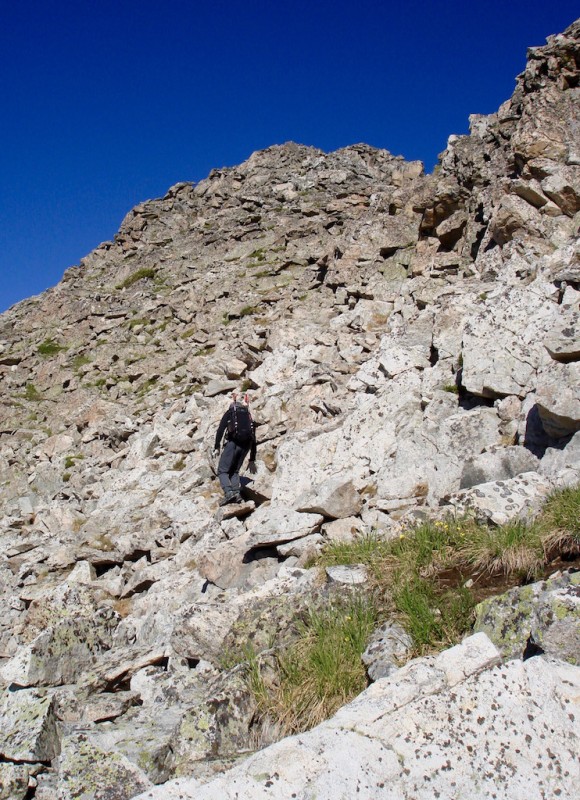
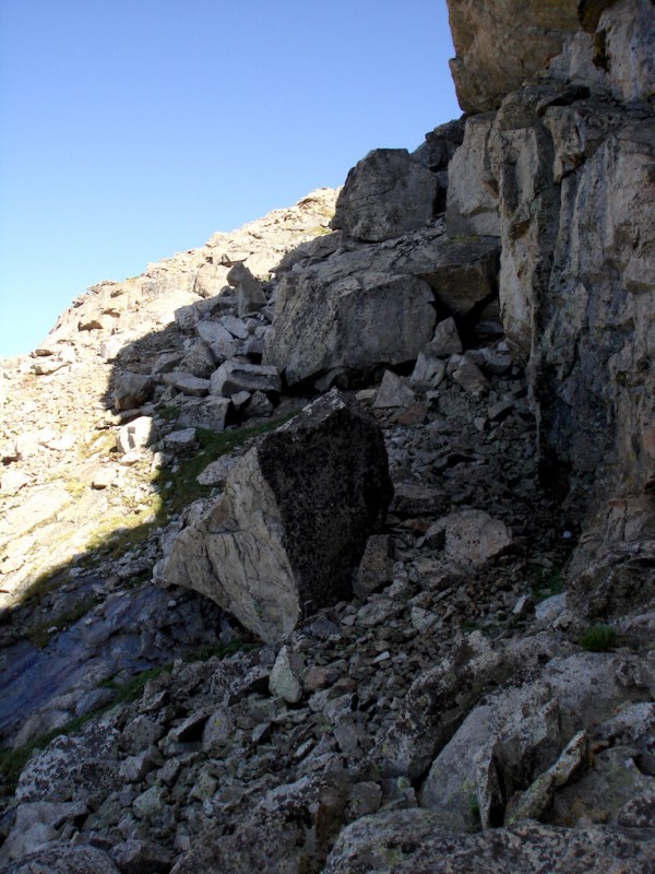
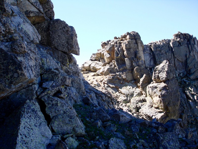
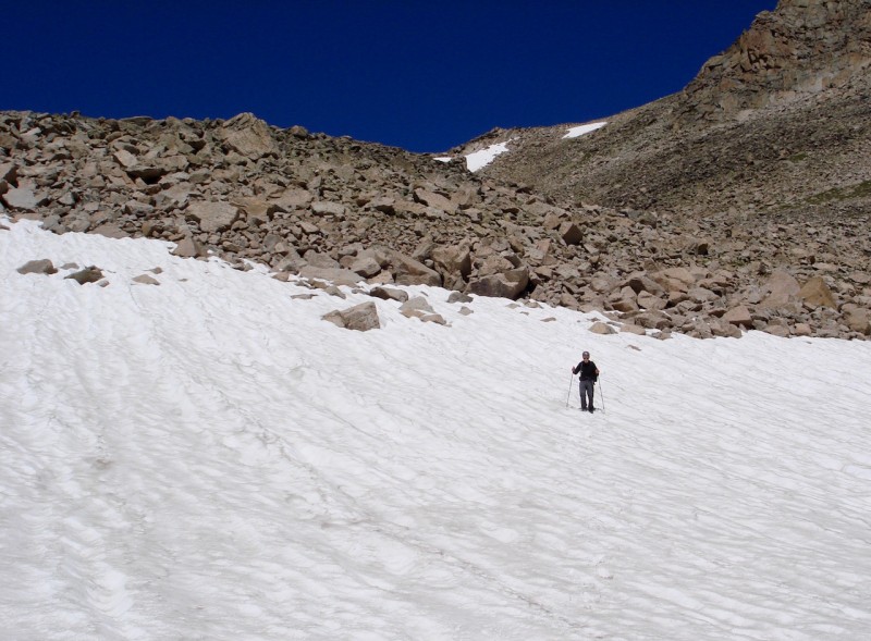
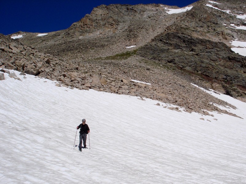
Starting down the western slope of Audubon, we soon discover the summit hid all the bumps and towers we need to traverse. There are a LOT of ups and downs over rocky terrain to reach Paiute's dual peaks and it is slow going. It is fun scrambling, but I was surprised at how much it really entailed. Looking back, the western slopes of Audubon are pretty harsh and rugged in contrast to the peaceful Coney Creek valley.
mathguy making his way up the north side of Paiute Peak.
Beautiful IPW backdrop!
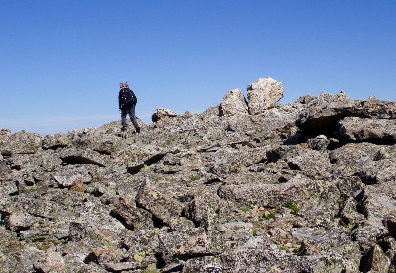
Paiute Peak has two nearly equal dual summits divided by a sharp, short ridge. Depending on the source or person describing them, it is difficult to know for sure which summit is the true highpoint. So after reaching the first one, we climb over to the second. Coming up to the first summit of Paiute.
mathguy's arrival at Paiute Peak's second summit.
Mt. Audubon from Paiute's summit.
Looking south from Paiute's summit.
RMNP to the north.
At this point, we've done more scrambling over talus and boulders than I anticipated and it has also taken longer than expected. Both of us can feel the effects of our effort in our arms and legs. Mt. Toll would be approximately another mile of similar terrain to cross, plus it would also involve a short section of Class 3 climbing to reach the ridge on Toll's SW aspect.
Looking down the side of Paiute Peak to the saddle we realize we need to drop down a substantial bit of elevation along some pretty hairy topography. We discuss our options briefly together and decide neither of us really needs to tag Mt. Toll today especially if we make our descent from this saddle. We are content with what we've done thus far.
We start down the steep side of Paiute aiming for the saddle and we're pleasantly surprised to find it not as difficult as it looked from above. It is a ledgy, rocky descent, but taken step by step we find it quite manageable. The saddle we will be aiming for on our return.
Looking back at the western face of Paiute on our way to the saddle.
Looking ahead from the same point. We first need to drop below the level of the saddle.
Still aiming for the saddle.
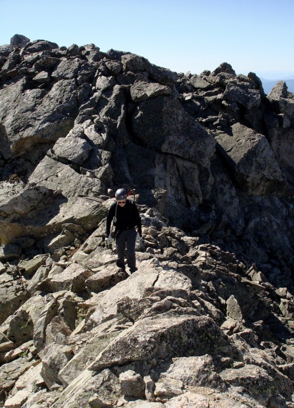
mathguy progressing along the craggy ledge system to the saddle.
Lake Granby to the west.
Almost to the saddle.
Looking back once again at the terrain we've been traversing.
mathguy reaching the Paiute/Toll saddle.
We take a short break at the saddle, looking things over closely. We both agree it would have taken quite an effort to hit Mt. Toll, and the angle of the snowfields below Pawnee and Toll would be rather dangerous without an ice axe.
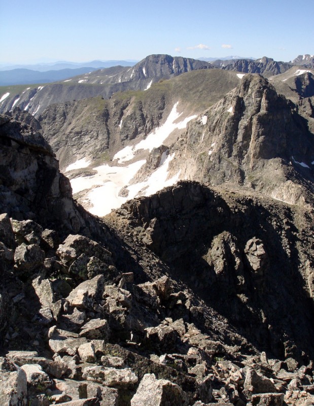
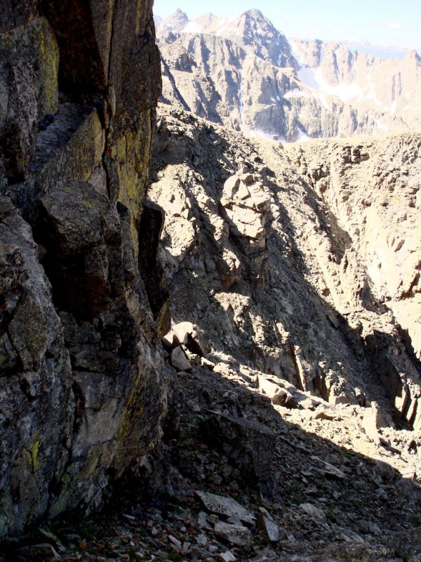
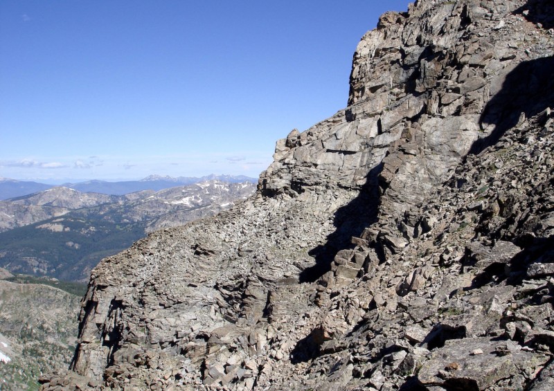
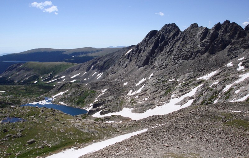
Looking down from where we are now, the descent still looks very good as it did on Audubon's summit: dry and relatively easy with few major obstacles. Mt. Toll and the jagged ridge of the Continental Divide from the saddle.
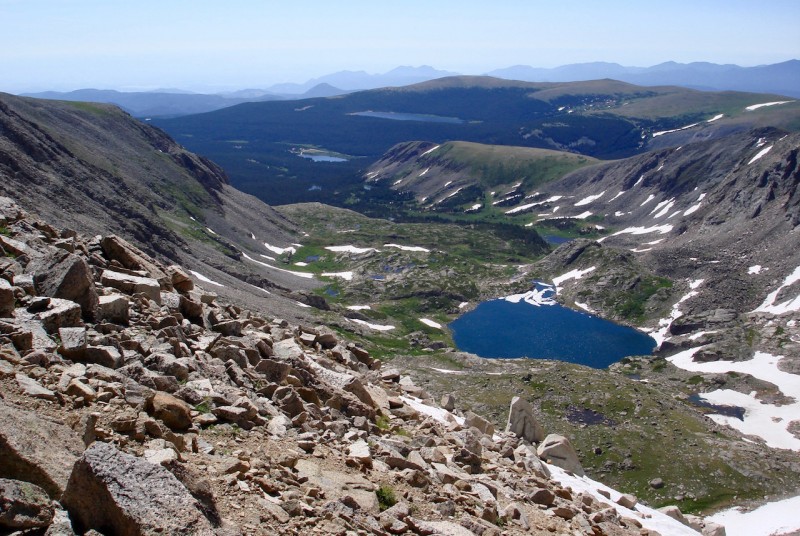
Lovely Blue Lake, the largest tarn of the paternoster lakes in this valley where we'll pick up the trail again.
The long eastern ridge of Mt. Audubon.
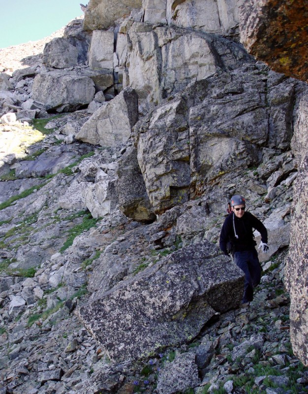
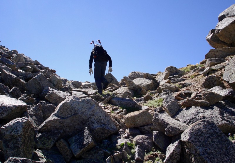
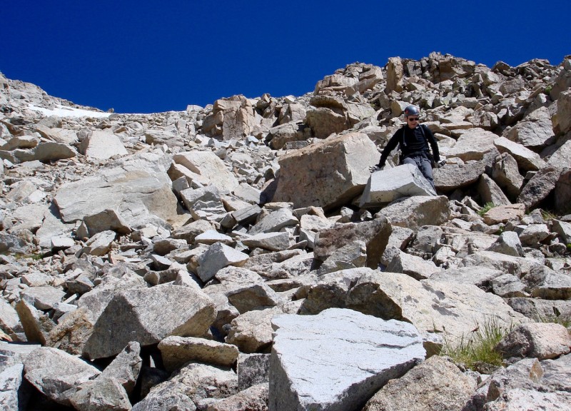
We begin our descent down through the talus and, as we had hoped and expected, find it quite typical and manageable. mathguy descending the upper talus section.
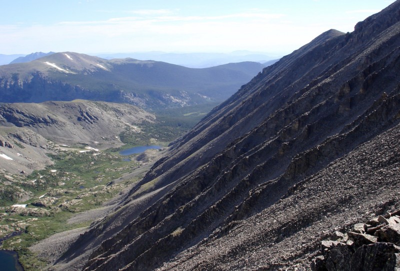
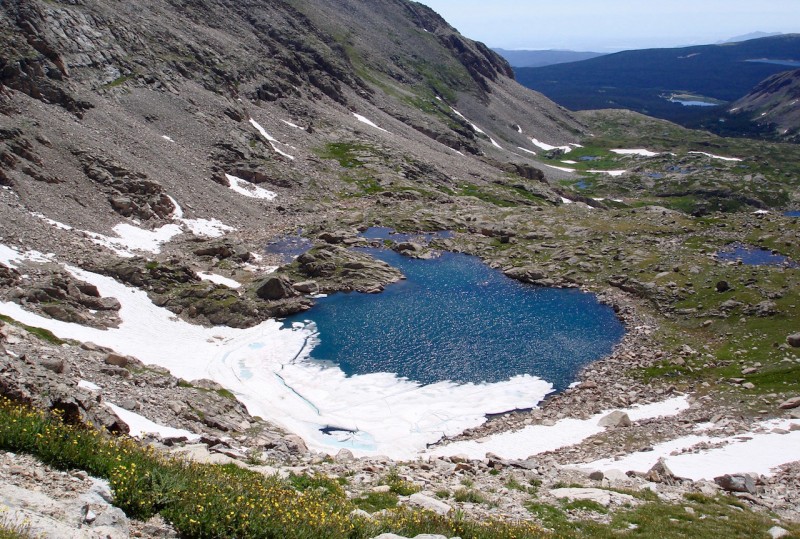
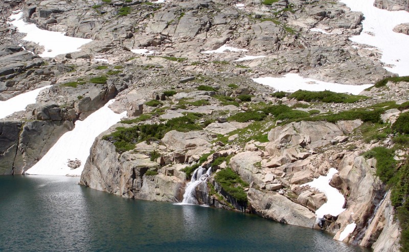
Once we reach the lip of the end moraine we get a nice view of the unnamed tarn, still not completely melted out. The high unnamed tarn above Blue Lake. (It is sometimes referred to as "Little" or "Upper Blue Lake.")
Across the way the jagged ridge of Little Pawnee Peak stands proud and tall, and acts like a sentry guarding and protecting this beautiful valley. Little Pawnee Peak towering above Blue Lake.
The headwall of the moraine is steeper and it leads us down to a large snowfield that we will need to cross in order to pass into the Blue Lake basin, a lush region of marshy terrain weaved together by streams and tributaries. Now at the level of the unnamed lake.
By this time of day the snowfield is fairly soft and it is nearly level, so crossing it is quite safe and easy. We have micro-spikes along but we don't even bother with them. Our poles and boots are sufficient. mathguy descending the snowfield.
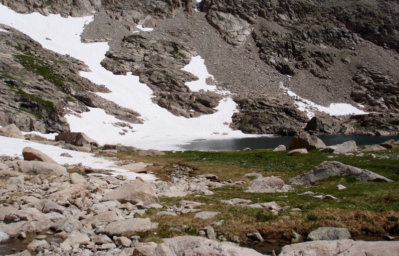
It takes us a little time to bushwhack through all the obstacles before we finally descend to the level of Blue Lake. The scrubby brush camouflages rocks and uneven ground and we come across a few short cliffs, which make for interesting route finding. Waterfall at the head of Blue Lake.
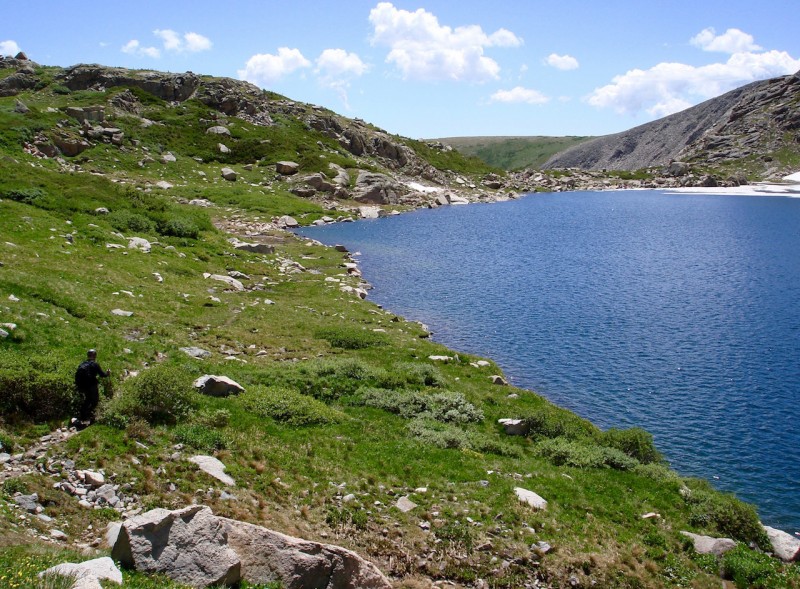
Across the water's edge we can see several day-hikers gathering at the far shore, evidence of the area's popularity. Working our way around the north side, we eventually intersect the trail. Finally catching the trail around the north side of Blue Lake.
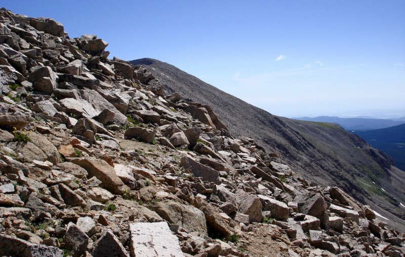
The last three miles hike back to the trailhead is on standard trail. Looking back at Mt Toll.
Along the trail back to the parking area.
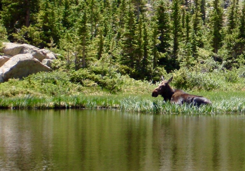
Just before reaching Mitchell Lake, we find a few other hikers congregating around a spot slightly off the trail. Looking across a small pond I see what all the hubbub is all about. A large cow moose is kneeling in the grass by the water's edge enjoying a break. A cow moose relaxing by a pond near Mitchell Lake trail.
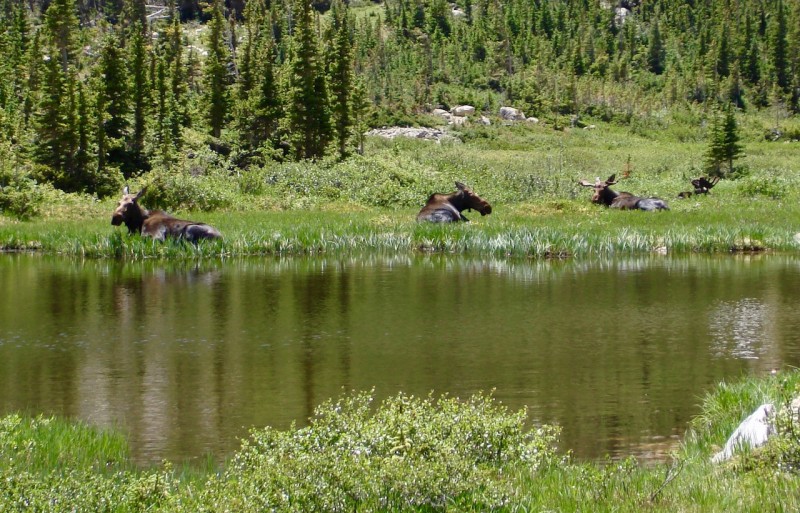
As I maneuver into a better place to take a photograph, I spy another cow as well as their mates farther in, a whole family of moose. The rest of the family.
Post Script:
This was the first of seven hikes I had planned to attempt this summer. But as I frequently have in the past, I turned an ankle on the walk out. Shortly after passing Blue Lake my left ankle flipped outward causing me to keel over into the brush. I always seem to do this at the end of a climb and always on fairly level, or mildly sloping regular trail which is very frustrating. I don't remember stepping on a loose rock or an uneven spot on the ground which makes it even more frustrating. It's almost like a hinge pin just slips out of my ankle and it completely buckles without reason or warning. Usually I can 'walk' out of it and it doesn't prevent me from continuing on to another hike a few days later.
But this time it was a doozy! If I hadn't had my poles to act as crutches, I'm not sure how I would have traversed the last three miles to the car. When I got back to the house where we were staying, my ankle was quite puffy and a little discolored. I could walk a little easier with great care, but it didn't seem wise to test or abuse it further with some serious upcoming climbs. The last thing I wanted to do was have this occur in a place much more dangerous possibly requiring evacuation.
With a heavy heart I cancelled all of our motel reservations while we still could without paying a cancelation fee. It didn't seem worthwhile to spend another 10 days of time and money just 'enjoying' the mountains from a distance. The hardest part was telling the bad news to all the fine partners I had lined up. I was really looking forward to seeing them all again and climbing together. But again, the last thing I wanted to do was ruin their trips or have them to deal with all the ramifications if I became seriously injured.
Several days later I was able to walk normally but my ankle and left foot were still quite swollen and tender to the touch. Perhaps I could have cautiously done a few more climbs, but in my heart I know I made the right decision. But I'm very thankful for the Lord's protection and for bringing us safely back home.
I will miss you all! Until next year -- climb on, but climb safe!
SDG
Thumbnails for uploaded photos (click to open slideshow):
Nice report and photos. Brings back memories of climbing Audubon and Paiute with my wife years ago. May have to head back up there soon.
One small quibble: I think shot 6 shows Pawnee and APACHE behind Toll. Compare to shot 24, which shows Navajo's distinctive summit. I could be mistaken, though. Been a while.
What is it about ankles, anyway? Poor design? Wishing you a speedy recovery!
You could be correct. But hopefully someone can verify this.
When I line up the peaks on my map it looks like Apache would either be hidden behind Toll, or it would be visible slightly to the right of it, so I think I was guessing it was Navajo which would be to the left of Toll. Then again, looking at image #6, the tiny nipple point poking through above Pawnee just left of the triangular snowfield could be Navajo.
I'm a stickler for accuracy, so if someone else can chime in with their thoughts or more information I'd appreciate it! Thanks!
I just climbed these two in the exact route, but opposite direction the following weekend. We couldn't figure out the higher summit on Paiute either. We thought the audubon trail was pretty poor condition for a $11 a day park
Doug: Thanks for doing such a comprehensive trip report and for letting me tag along on the hike. The background info you provided about IPW was really interesting and new to me (even after our hike!). I also need to commend you on your route-finding skills. I was up on Pawnee Peak last Tuesday (August 1st) and stared for a long time at the Paiute-Toll ridge wondering "how did Doug get us off that?" While it didn't look quite as steep as the descent from the Toll-Pawnee saddle (and not as snowy), it still looked pretty gnarly from the perspective on Pawnee. Sorry about the ankle, but as they say the mountains will still be there next year (hopefully we'll be there too!).
@ dillonsarnelli -- Thanks, Dill! Yeah, I'll have to talk to the wife about extending next year!
@ mathguy -- Was a real pleasure meeting you finally and getting at least one good hike in! Sorry we couldn't connect for a second one. I'm doing some PT stretching and strengthening exercises now, so hopefully I'll be ready for next year!
Audubon was the very first mountain I ever hiked - with the Boy Scouts (summer camp was at Camp Tahosa). I was prob 12 or 13 years old (a LONG time ago!). Looks like you two had a fantastic day. Sorry your ankle wiped out the rest of your trip, tho. But you made it home safe and that's the important thing. See you next summer!
Yes, fond memories are all I have right now, but it's nice to enjoy them. If you still need Pyramid by next year, I'm still game for it. Stay healthy and I'll try to do the same.
..in image 24. The dark backside of Toll really looks intimidating from the descent of Paiute. Also, I would agree that shot six looks like Apache. Has that curved blade look to it.
Minus the ankle, it sounds like a good climb. Heal up quick so you can get back out here.
Image 6 now corrected to Apache in the background. Thanks for catching the error, rrk, et. al. Maybe maps aren't always entirely accurate in that respect.
Caution: The information contained in this report may not be accurate and should not be the only resource used in preparation for your climb. Failure to have the necessary experience, physical conditioning, supplies or equipment can result in injury or death. 14ers.com and the author(s) of this report provide no warranties, either express or implied, that the information provided is accurate or reliable. By using the information provided, you agree to indemnify and hold harmless 14ers.com and the report author(s) with respect to any claims and demands against them, including any attorney fees and expenses. Please read the 14ers.com Safety and Disclaimer pages for more information.
Please respect private property: 14ers.com supports the rights of private landowners to determine how and by whom their land will be used. In Colorado, it is your responsibility to determine if land is private and to obtain the appropriate permission before entering the property.