| Report Type | Full |
| Peak(s) |
La Plata Peak - 14,344 feet |
| Date Posted | 03/25/2017 |
| Date Climbed | 03/13/2016 |
| Author | Tim A |
| Rivers of Light on La Plata-Winter Variation |
|---|
|
This information is a year old so it's worthless in terms of beta, but it may be useful for people planning on hiking La Plata's winter variation as we head into spring. There are only 5 other March TRs for La Plata so I hope this doesn't feel too redundant. The video footage of the ascent is more artistic than the prose and pics, and is set to choral music. I'm a choir director and admire beautiful poetry, so if you're too manly for the sensitivity and subtle beauty the mountains possess, feel free to pass. The poetry's subject is the Northern Lights, but it describes my experience on La Plata Peak during a winter dawn with equal grace. Rivers of Light Winter night, the sky is filled with symphony of light. The sky is flooded with rivers of light. Ah, the doors of heaven have been opened tonight. From horizon to horizon misty dragons swim through the sky. Green curtains billow and swirl. Fast moving, sky filling, the tissues of gossamer. Nothing can be heard, nothing heard! Light shakes over the vault of heaven, it's veil of glittering silver: changing now to yellow, now to green, now to red. It spreads in restless change, into waving, into many folded bands of silver. It shimmers in tongues of flame, it shimmers in tongues of flame. Over the very zenith it shoots a bright ray up, until the whole melts away, as a sigh of departing soul, as a sigh of departing soul, in the moonlight, leaving a glow in the sky like the dying embers of a great fire. My friend Brett joined me for this roadtrip from Texas and we arrived at the abandoned South Elbert TH late-afternoon on Saturday, March 12 to find a relatively dry forest but low clouds hanging over the Sawatch. The forecast gave a slight chance of snow that night and the following day (20%), but upwards of 60% from Monday-through the rest of the week, so we were going for the summit our first day in-state since it appeared to be our best chance for clear weather. Once camp was set, we could admire the sunset views of the Twin Lakes area and enjoy the complete solitude that only winter offers. Camping around South-Elbert is pretty trashy in summer with lots of gunfire, fireworks, loud music and drunk people yelling at each other. In winter, all the nonsense is refreshingly absent and it's just the sound of a cold wind whistling through the trees.  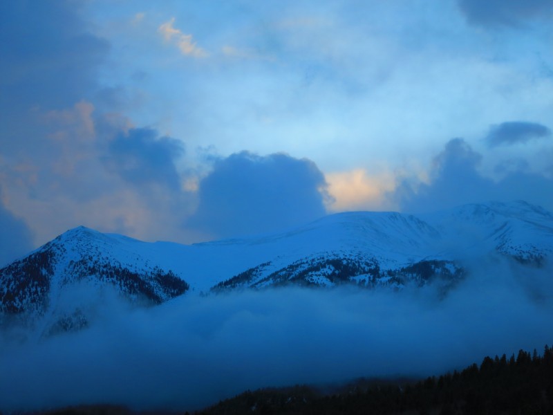 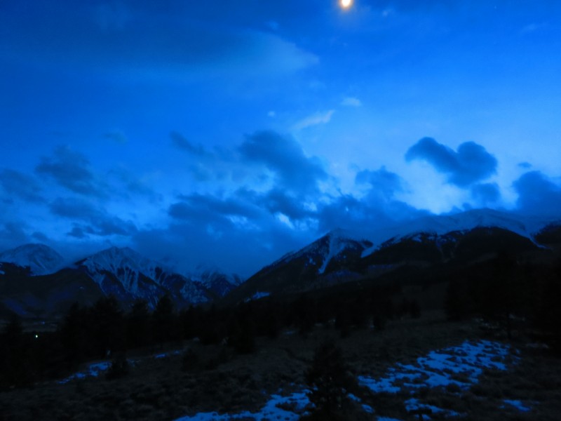 After a cold night camped near the Elbert TH, we woke up at 3am to clear skies and no wind. Always a relief. We left our tents set up in the woods there and drove the short 20 minutes to the TH and started up shortly before 4am. We were the only car at the TH but an obvious trench was in place and we followed it all the way to treeline, checking my GPS often to ensure it diverged from the standard route and made directly for the northern end of the NW ridge. Even with the trench, we opted to wear snowshoes the entire way from car to treeline, as it was still faster to wear them then risk the occasional posthole. With a trench in place, this route is a breeze. We arrived at treeline around 630, pretty out of breath having been in the mountains for only 12 hours, but completely reinvigorated to finally be able to see things in the coming dawn.  I studied the headwall of the north ridge extensively before this trip, but no picture really does justice to how intimidating it looks. It's steep and almost entirely scree. (0:12)  Brett and I decided to catch our breath and have a second breakfast before venturing out of the trees onto the ridge. We sat on our packs and enjoyed the modest view. 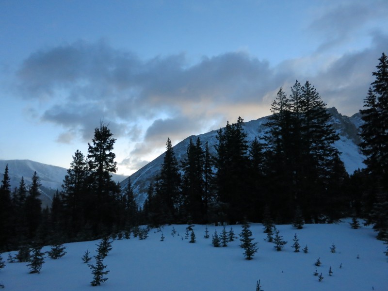 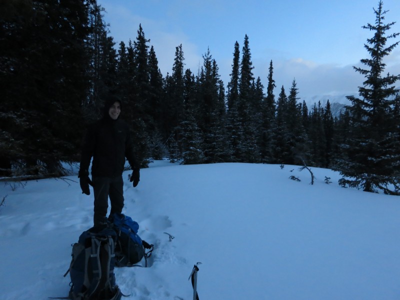  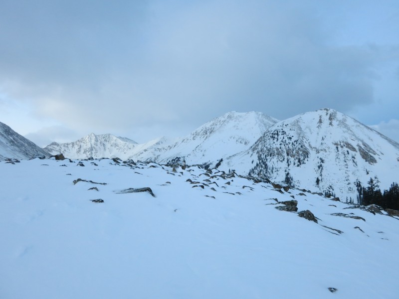 As the video shows, the slog up the headwall is unpleasant. We opted for a diagonal line up the face which topped out with some 2+ or super low class-3 moves (1:01 in the video). The lower part of the headwall just straight sucks (0:41). The scree slides under you with every step. We wore microspikes from the bottom of the headwall to the summit and I can't see how anyone could get up the wall without some kind of traction. 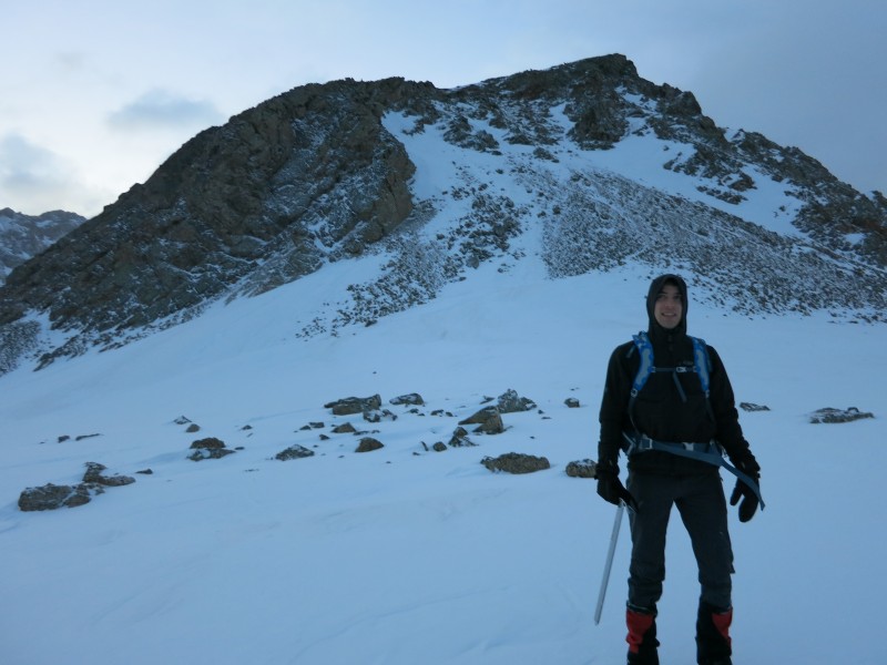 As we topped out on the ridge, the sky opened up in a spectacular lightshow to the East as the sun lit some low-hanging clouds hovering over Ellingwood ridge, turning them blood red. These cast a red glow against the surrounding peaks which were already themselves lit in the low-angle light of Alpenglow and the entire thing just conspired to create the most beautiful Sunday morning experience I've ever had. The pictures are incapable of doing justice. The panorama from the top of the headwall was better than the summit view would be a few hours later. (1:13)    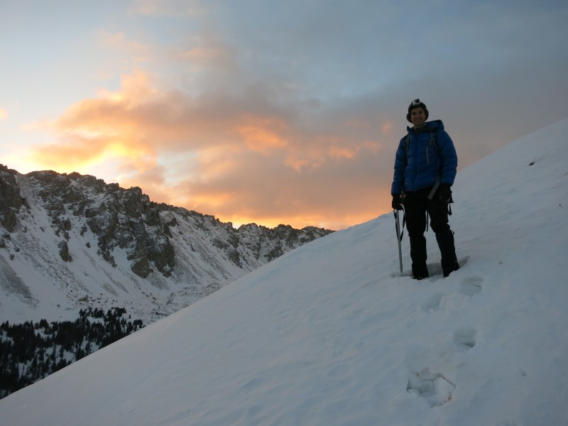    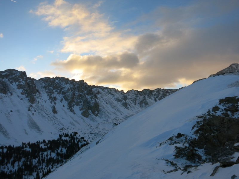   We ditched our snowshoes at the bottom of the headwall and never regretted it. Once the ridge was gained, snow coverage varied between bare frozen tundra and a few inches of wind-drifted snow which required some kind of traction to safely traverse. The lightshow continued overhead courtesy of blowing clouds. Once you've gained the ridge proper, it flattens out for a bit, so it's essentially just a stroll through the clouds at 12,500' until you near the southern end. (1:43)     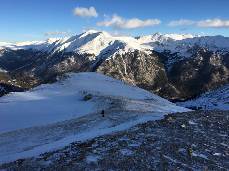  Along the ridge, there are a few rock outcroppings one must negotiate to climber's left (east), with some exposure off the west face of the ridge. This was really enjoyable terrain to hike along. (2:08) There are also a few ups and downs along the ridge, but none of the elevation loss was demoralizing as each rise that you crest offers splendid views of the route further ahead. (2:42) As Brett and I neared the end of the flat part of the ridge, we were overtaken by a fast-hiking solo climber and his dog. We stuck together to the summit. 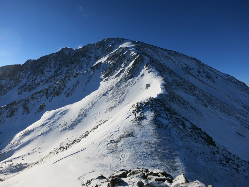    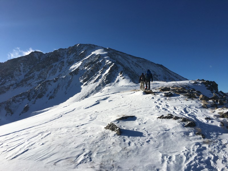 The final stretch to the summit was unpleasant, with alternating sections of talus scampering (preferable, 3:14) and open stretches of calf-destroying snowfield. (4:11) Each time I got to a steeper section with talus, I anticipated seeing the summit as I crested the slope to only see another round of scrambling or another snow field needing to be crossed. The wind picked up in this section as well, conspiring against us, but onward and upward we continued. 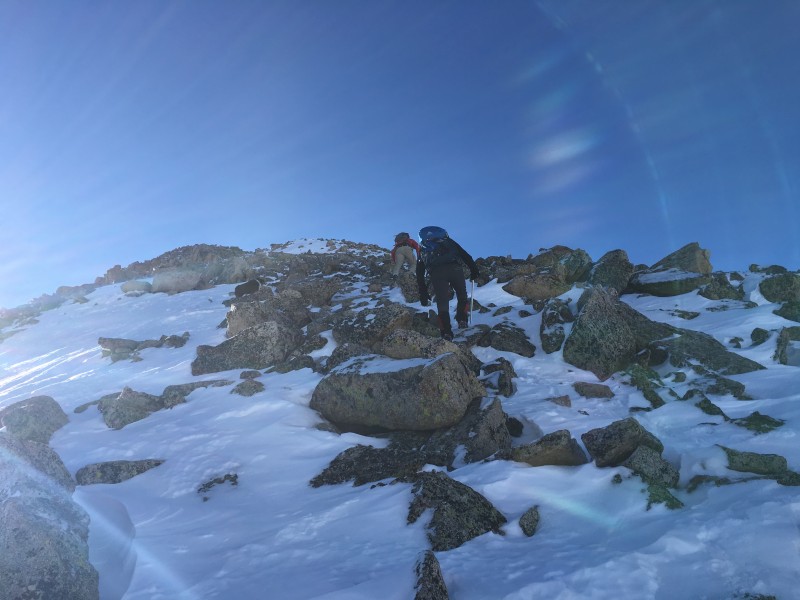     The final pitch to the summit consisted of steep talus scampering with lots of fresh powder, which was very tedious to pick through. (4:39) The summit view, like most in winter, was outstanding with a lot of snow in the Sawatch by that time. (5:15) 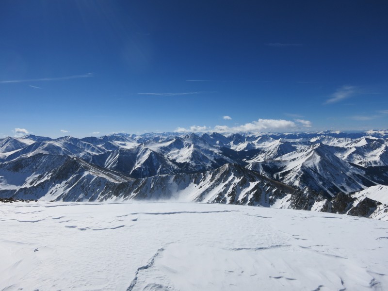    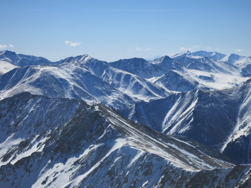   This ended up being the shortest time I've spent on a summit. After a few quick pictures, we bailed off to save our numb fingers and toes. From there, it was another long and tedious scamper down the length of the ridge.    We did have one self-inflicted addition of "interest" to our day with our descent. Because of fatigue and oversight, we bailed off the ridge down what we thought was the headwall from earlier, but it turns out we dropped down about a quarter-mile too soon, off the west side of the ridge. The area looked very familiar and it consisted of the same scree and suck we'd ascended that morning. However, once at the base of the wall, we knew we were off-route, as our track from that morning was not visible, nor were the clumps of trees that I'd looked back on several times during the climb up. I checked the GPS and sure enough, we were a ways south of where we should have been, in deep snow without snowshoes. After a few swear words, we began the postholing that would be necessary to cover the distance to the north to get back in our trench, which we gladly found after a miserable 20 minutes of suffering. Once back in the trench, it was again smooth sailing all the way back to the car, enjoying the views of the snowy forest that we missed on the way up in the dark.   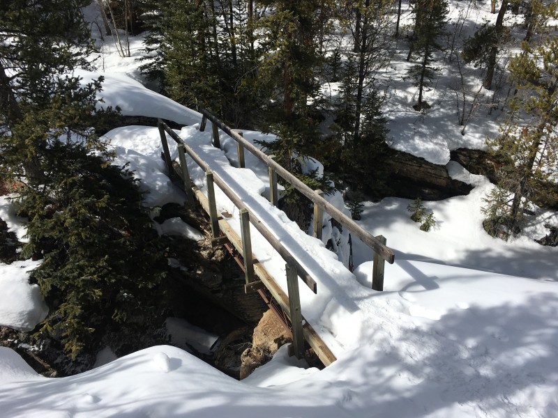 One of the (few) advantages to being from out-of-state is I never have obligations to attend to after a climb, so I can return to my campsite and just relax the rest of the day and a second night enjoying the quiet of the mountains in winter.  Thumbnails for uploaded photos (click to open slideshow):  Twin Lakes")
 Elbert wrapped in cloud.")
 A cold moon rises as the skies clear.")
 The Headwall")
 Light is such a morale booster after a long cold slog in the dark")
 Brett putting more jackets on for breakfast in the wind.")
 Breakfast with a view. Looking northeast towards the flank of Ellingwood Ridge.")
 Looking south towards Sayres Benchmark.")
 An attempt at capturing the scale of the headwall. It's much taller in person.")
")
 The sun inching over Ellingwood ridge.")
 Views of the 13ers to the north.")
 Red transitioning to orange.")
 Alpenglow fades as we work up the ridge.")
 Hovering clouds over Sayres.")
 La Plata's summit reaching into the cloud.")
 Orange transitions to gold.")
 Not a bad spot for third breakfast.")
 Brett on the ridge.")
 Sayres in the light.")
 The summit looms so seemingly close.")
 Sunburst over Ellingwood ridge.")
 Looking back at the easy terrain comprising the first half of the ridge.")
 View of the mountain from Elbert. Photo courtesy of Kiefer@SP.")
")
 Making camp feel a little homey.")
 Looking back.")
 I hang back to take pictures of the mountain for scale with the climbers in the center.")
 My three partners cresting another small rise in the ridge.")
 The west slopes and Sayres BM.")
 The giant bowl between Ellingwood ridge and the NW ridge.")
 Column of 3.")
 Scampering.")
 Terrain for scale.")
 Demoralizing snowfield.")
 The crux for me. A long stretch of calve-burning snow. My partners are about halfway across it.")
 Another wretched snowfield, close to the summit.")
 Views east.")
 Views south.")
 Views west, towards Indy Pass.")
 Familiar Sawatch peaks.")
")
 The expansive summit area.")
 Lots of snow in the Elks.")
 The ridge descent begins.")
 New views on the climb down.")
 Viewing our path through the snow along the entire ridge.")
 Trench.")
 Forest.")
 Slot canyon.")
|
| Comments or Questions | ||||||||||||
|---|---|---|---|---|---|---|---|---|---|---|---|---|
|
Caution: The information contained in this report may not be accurate and should not be the only resource used in preparation for your climb. Failure to have the necessary experience, physical conditioning, supplies or equipment can result in injury or death. 14ers.com and the author(s) of this report provide no warranties, either express or implied, that the information provided is accurate or reliable. By using the information provided, you agree to indemnify and hold harmless 14ers.com and the report author(s) with respect to any claims and demands against them, including any attorney fees and expenses. Please read the 14ers.com Safety and Disclaimer pages for more information.
Please respect private property: 14ers.com supports the rights of private landowners to determine how and by whom their land will be used. In Colorado, it is your responsibility to determine if land is private and to obtain the appropriate permission before entering the property.