| Report Type | Full |
| Peak(s) |
La Plata Peak - 14,344 feet |
| Date Posted | 12/06/2015 |
| Modified | 12/07/2015 |
| Date Climbed | 08/17/2015 |
| Author | DeTour |
| Additional Members | CharmingCatastrophe, Lucky, SikYou |
| LaPlata - Clohesy Lake approach |
|---|
|
I'm not as geographically clueless as that title implies. It took a chastising from the back-door road to Missouri to get us to climb LaPlata for the first 14er of our 2015 Colorado visit. Bear with me on this slightly convoluted introduction - or skip right to the photos, whatever you prefer ..... Because the first 14er of the trip is always a struggle for our un-acclimated flatlander bodies, we try to pick shorter, easier routes. Problem is, there are very few short standard routes in the Sawatch. We planned to take alternate routes for Missouri and LaPlata - first Missouri's west ridge via Clohesy Lake; and a day or two later, LaPlata's south ridge. That plan depended on getting Mark's Toyota Rav4, which we had driven to CO from Illinois, up the 4wd roads required for both routes. We knew it was asking a lot of that vehicle, but we had a history of getting rental vehicles up roads they really weren't designed for - with one notable exception in 2013. We checked out the stream crossings at Rockdale on Sunday afternoon, Aug. 16, the day before our planned Missouri hike. The goal was to confirm in daylight that our vehicle could handle the stream crossings and road challenges, then get a good night's sleep at a cabin near Twin Lakes before negotiating the road in the dark the next morning. As expected given the time of year, the water level was fairly low and Mark eased through the stream crossing area with little difficulty, including a tricky climb coming out of the second one which entails some serious rock-dodging. We drove a bit higher to test-crawl through another rough patch in the road. Brian (SikYou) had been up this road earlier this year and assured us that was the worst the road had to offer. 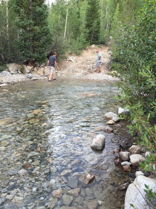 Mission accomplished for now, we thought. But on mountain roads, just like climbing mountains, getting up is only half the job. On the way down, Mark clipped one of the rocks above the stream crossing and we heard the now-too-familiar hiss of a tire going flat on a 4wd road above 10,000 feet. Having experienced a flat tire high up the Castle Creek road two years ago, Mark had made note of the spare tire on his Rav4 as we planned this trip. Unlike our 2013 rental, the Rav4 had a full spare and no locking lug nuts. We sure hadn't expected to need that spare, but here we were. My mind raced at a near-panic level wondering if we could get the truck off of that rock, move it to level ground to change the tire, and get out of there. With the vehicle wedged downhill against a boulder, it took some serious heave-ho by all of us to help free it up, but we managed that in short order and Mark crawled it to a level spot. Brian and I went to work on the tire while the others inspected the road and re-arranged some rocks to provide a better ramp for driving down. In the middle of the tire project, Brian glanced over the hood and said, "there's something big and brown moving through the trees over there." With my mind in worst-case mode, my first thought was that we had a bear visit adding to our other problems. But in fact it was only a couple deer casually strolling by. Before long we had the tire changed and crawled back down and across the streams to the relatively tame forest road. But we were obviously now without a spare late on a Sunday, and frankly questioning the wisdom of taking that vehicle back up that road the next morning. 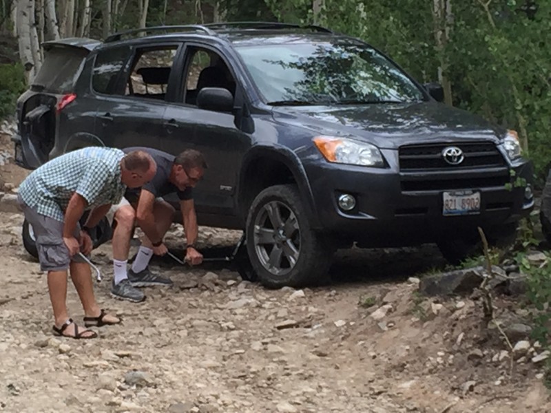 Our other planned route, LaPlata's south ridge, also had a road complication - a washout that reputedly added about two miles to the hiking distance. After much discussion we finally decided to scratch our Missouri plans for the time being and go for LaPlata's standard route. At 9+ miles and 4,500 feet of elevation gain, it was considerably longer than what we prefer for our first 14er. But the trailhead parking directly off Highway 82 sure looked appealing now. We opted for the comfortable sleep of some cabins near Twin Lakes for the night before. That sleep was notably interrupted once sometime around 2 a.m. by the loudest boom of thunder that I'd ever heard - until the next day. We awoke around 4 a.m. to weather conditions that were dry, but flashing steady lightning to the south and west - in the general direction of LaPlata. We arrived at the trailhead around 4:45 a.m. and made a consensus decision to start up the trail. It seemed a bit rash to start hiking a 14er by heading toward lightning-producing clouds. Some folks in a van parked at the trailhead opted to stay put. But it wasn't raining on us, and the radar showed a well-defined cluster of storm clouds moving northwest-to-southeast, more or less away from us, with the northerly edge skirting LaPlata's summit. With a forecast of clear morning skies, it looked like the storm clouds would be long gone by the time we approached tree line. That proved correct. Our group of five started up through the forest - brother Mark (Lucky), his son Brian (SikYou), my daughter Maryjane (CharmingCatastrophe), her boyfriend Dennis, and me. The trail crosses a nice footbridge over the South Fork of Lake Creek, which eventually forms Twin Lakes. The crossing is scenic even by headlamp, the creek roaring through a deep gash in the rock at that point. Not long after that, a slightly sketchy log bridge takes you over LaPlata Creek. 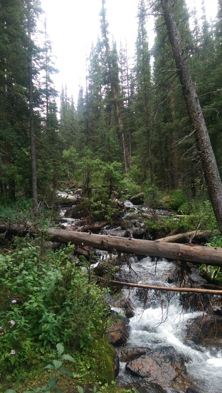 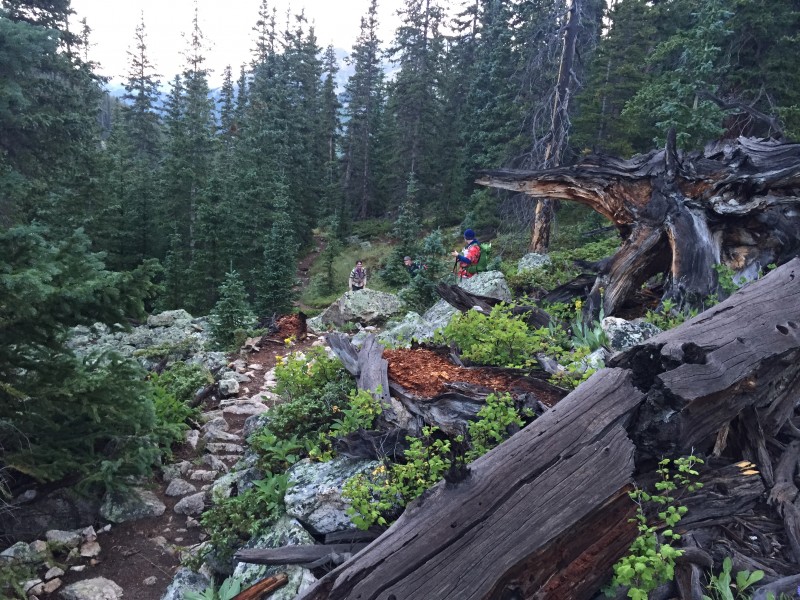 Elevation gain started in earnest after the log bridge. Some of the steep sections feature log steps that Bill Middlebrook calls "a pleasure to climb." Some in our group questioned the word "pleasure" as our flatlander lungs gasped for air already. But it was a great trail, with a variety of rocks and roots forming natural steps to compliment the manmade features taking you upward through the dark forest.  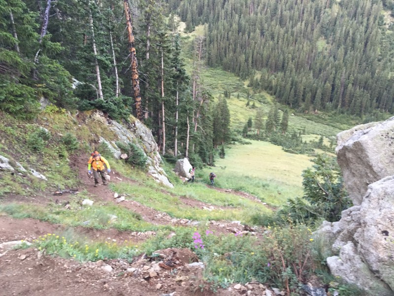 Daylight began to show through the trees as the forest thinned, which was pretty much what we had targeted. Soon we were leaving the last of the trees behind and admiring morning sun on the massif west of LaPlata which culminates in Sayres Peak. I'm not sure if we were looking at Sayres or a slightly lower unnamed 13er north of Sayres, but regardless it was a pretty sight. 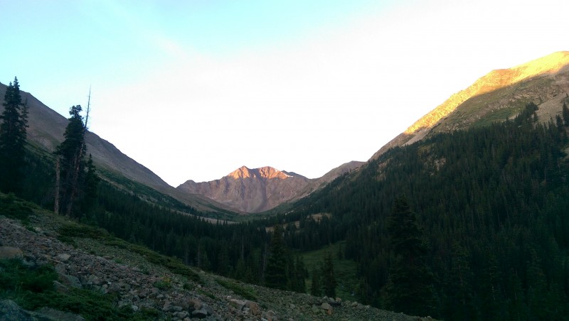 Around here the magnitude of the job before us started to come clear. It was obvious that a substantial push would be required just to reach the ridge at 12,750; and significant mileage and elevation gain awaited from there to the summit. We remembered why we had wanted to drive to Clohesy Lake for that short hike of Missouri's west ridge. But we felt we were holding up pretty well this day, and pressed on slowly but surely. 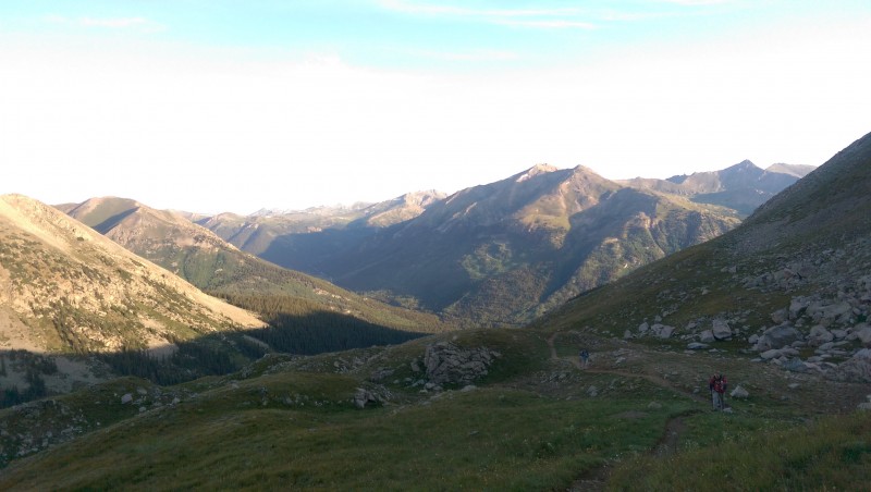  Reaching the ridge was encouraging in that we did not have that brutal wrecked feeling that we have some years by this point of our first 14er. (Castle Peak in 2013 comes to mind for that.) And, while we did our typically lousy job of tracking times again this day, it was still pretty early in the day with no further sign of ill weather. Plus there was the added bonus of getting to admire Ellingwood Ridge from across the basin, silhouetted beautifully by the morning sun. 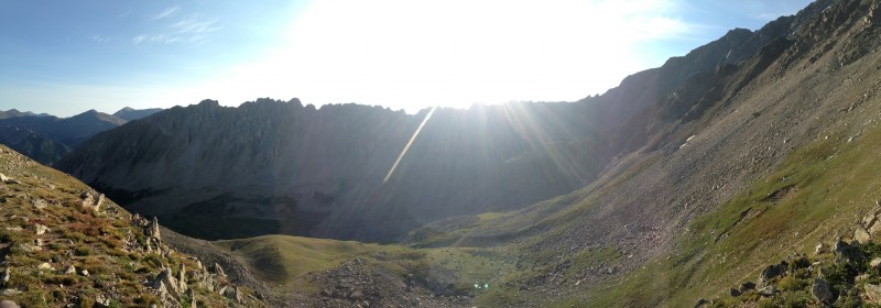  I didn't think the difficulty along the ridge was much different than what we experienced getting up to the ridge. The trail was easy to follow as it wound first to the right of the ridge crest, then returned to the middle and eventually went a bit left of the crest, following the edge of a snowfield. I briefly abandoned the trail to scramble straight up the crest of the ridge on the talus up to the next saddle, gaining a boost of energy that had been starting to wane along the trail. I was very mindful to monitor the stability of the rocks here, and they seemed quite solid to me. There's just nothing very steep on this route to put you at serious risk. But it was plenty hard enough to satisfy our longings for this first 14er of the season. 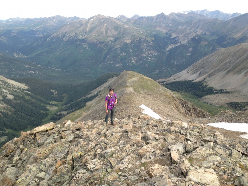 We made note of reaching 14,000 feet per Brian's GPS, mindful that we would be essentially on the summit at that elevation for Huron or Missouri. Not far past that, we could see that our path intersected the southwest ridge of LaPlata, an encouraging sign that we were nearing the top. A short while later we enjoyed the satisfaction of walking up the final steps to the summit, joining about 6-8 others who had summited before us this Monday. 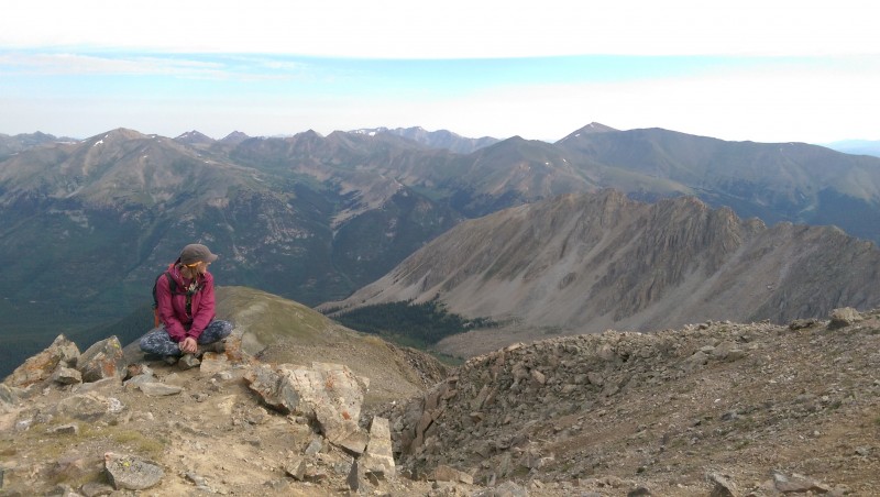 Mark and I were delighted at how good we felt at the summit. It's no big deal to the Coloradans in our group, but for us as flatlanders, reaching our first summit without a sign of headache, nausea or overwhelming lethargy is noteworthy. The true elevation of the summit remains a bit of a mystery to us. Nobody was able to find a USGS summit marker. I believe Bill Middlebrooks' 14,336 over the handpainted rock claiming one foot higher. But my National Geographic/Trails Illustrated map pegs it at 14,361, a substantial difference. Regardless of which is true, it was the highest place any of our group had ever been.   We spent about a half-hour at the summit before heading down. Our descent included a new treat for most of us - a modest bit of glissading on some small snow fields high on LaPlata's northwest ridge. Brian graced us with the use of his ice axe and some training on the basics of using it, which he had learned from a session put on by Globreal at the last fall gathering. Brian has taken to heart the advice dispensed by Britt Jones there, to bring his ice axe on every climb, even in mid-August, because you never know when you might encounter a chance for a quick slide down a snow field. Our glissades this day were really just getting a tiny taste of the experience, but Brian had a couple weeks earlier enjoyed a 500-vertical foot glissade down a snow field on Massive.  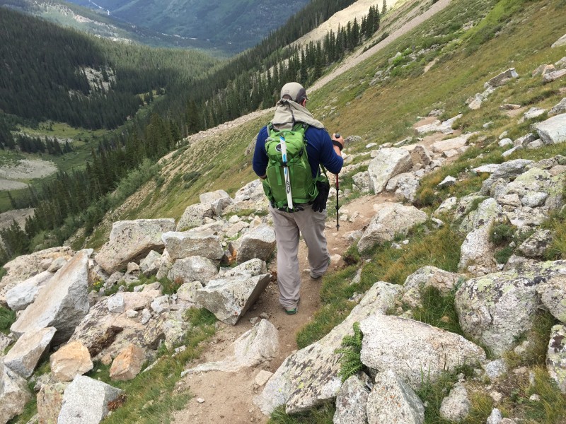 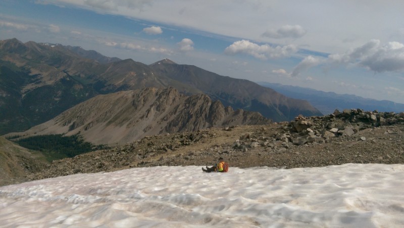 After our brief interlude of playing in the snow, our attention turned to the weather watch, which was producing mixed signals. The forecast did predict a good chance of afternoon storms, but the relatively cool day concerns over significant storms forming anytime real soon, as far as I was thinking anyway. A couple clouds presented slightly darkened bottoms, just enough to get us to step up the descent pace, to the extent we were capable - but the clouds didn't amount to much in the end. Still, we were glad to reach the saddle and begin to drop off the ridge into the LaPlata Creek basin. 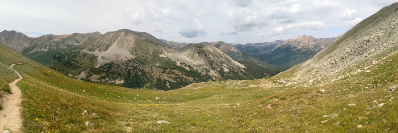  As usual, we passed on our descent others who were still going up. Some of them were high on the ridge, and moving fast enough that we figured they would summit and still pass us on the way down. And indeed, one or two fast young guys did just that. Also as usual, some simply appeared to be clueless. One lightly-clad young guy in sandals came up as we neared tree line in the basin and asked something about "how much further." Quite a ways, we told him. I made a casual comment about afternoon storms, with the assumption that "of course" he knew to be concerned about that - right? That comment probably credited him with more understanding than he really had. We took an extended break only when we felt relatively safe in the trees, when the trail returned to the vicinity of the creek. Skies were overcast but showing no sign that we could see of thunderstorms. A few minutes later, as Mark and I trudged down the trail while Brian, Maryjane and Dennis were filtering water, the loudest thunderclap I have ever heard exploded above us. Not only loud, but sharp - like the volume of artillery with the sharpness of a rifle. My instinctive reaction was to literally buckle my knees and throw my hands over my head - which of course would have done absolutely no good whatsoever had the lightning that accompanied it been anywhere nearby. There was not a hint of warning before it, and, as it turned out, nothing that followed it in the way of thunderstorm activity. There was a little rain following the thunder - just enough to get us all to stop to put on rain gear. Then the rain stopped and the sun came out, and we sweated our way down the trail, not wanting to stop again to take off the rain gear because that, of course, would guarantee that the rain returned.  Other faster descenders passed us in the woods. I didn't realize it at the time, but one of them was the lightly-equipped young guy in sandals who had passed us earlier as we descended. He told others in our group he had reached the ridge and worked his way part way up from there when a bolt of lightning - presumably the one associated with the thunderclap that freaked us out - struck behind him on the ridge. To his credit, he figured out at that point that he should turn around and head down - even though it meant walking back toward where the lightning had struck. I guess he's now a bit less clueless about 14er weather. When Mark and I finally reached the vicinity of the log bridge crossing of LaPlata Creek, I noticed in daylight what I had not seen in the dark on the ascent: the Ellingwood Ridge trail departing from the main trail, just a short distance up from the creek crossing. It was easy to see how it would be hard to pick up in the dark, being visible by crushed grass and plants only, with no tread worn through the plant cover. At the time of our passing, it was marked most distinctly by a fallen tree above the trail, hung up in other trees so it lays more or less horizontally. If you were looking for that Ellingwood Ridge trial on your ascent, you would pass under that hung-up tree, and immediately beyond it depart on that trail to climber's left. (Of course, there's no telling how long that hung-up tree will remain there to mark this spot.) The final highlight of the trip was crossing back over Lake Creek in daylight. It's a beautiful mountain stream, featuring a swirling vortex as it knifes through massive boulders a short distance from the trailhead. It was a fine place to linger a few minutes to enjoy the day's experience. 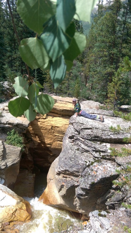 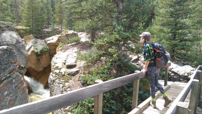 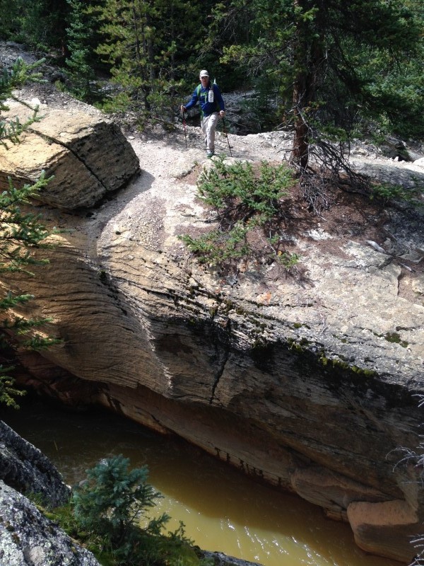 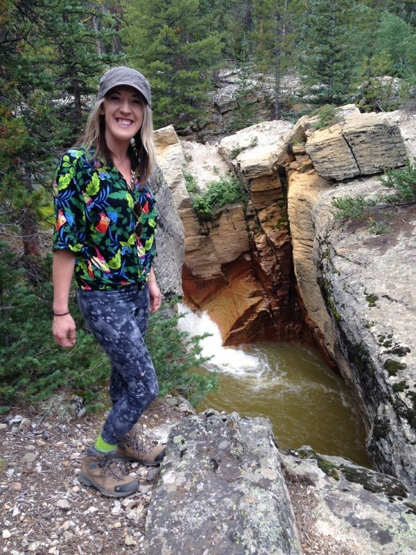 With a successful first hike under our belts, we wrestled with what to do next. Our original plan was to go for two short hikes on back-to-back days. We were still entertaining the possibliity of driving the Clohesy Lake Road to go for that west ridge Route on Missouri the following day. To even consider that, however, would require getting a new spare tire for the Rav4, to replace the one now mounted on the right front wheel of the vehicle. Anxious to keep that option open, I called All Around Tire & Wheel shop in Buena Vista, who had one used tire the right size. The proprieter, Pat Davis, graciously hung around a few minutes after his official closing time to take care of us. As he took payment, he could not help but dispense some advice. "That car isn't made for those kind of roads," he said, giving me a long steady gaze to drive his point home. "I know what you tried to do. We see it all the time. If you want to play around on those roads, rent a Jeep (from the rental store down the street) that's made for that kind of thing." In the end we took Pat's advice and spared the Rav4, and its owner, from further abuse. We found a short, casual hike up to Independence Lake from near Independence Pass to get some more acclimation time at a moderate elevation. Then it was on down to Aspen to set our focus on our main goal for the year, Pyramid Peak. 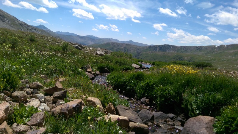   Thumbnails for uploaded photos (click to open slideshow):
|
| Comments or Questions | ||||||
|---|---|---|---|---|---|---|
|
Caution: The information contained in this report may not be accurate and should not be the only resource used in preparation for your climb. Failure to have the necessary experience, physical conditioning, supplies or equipment can result in injury or death. 14ers.com and the author(s) of this report provide no warranties, either express or implied, that the information provided is accurate or reliable. By using the information provided, you agree to indemnify and hold harmless 14ers.com and the report author(s) with respect to any claims and demands against them, including any attorney fees and expenses. Please read the 14ers.com Safety and Disclaimer pages for more information.
Please respect private property: 14ers.com supports the rights of private landowners to determine how and by whom their land will be used. In Colorado, it is your responsibility to determine if land is private and to obtain the appropriate permission before entering the property.


