Download Agreement, Release, and Acknowledgement of Risk:
You (the person requesting this file download) fully understand mountain climbing ("Activity") involves risks and dangers of serious bodily injury, including permanent disability, paralysis, and death ("Risks") and you fully accept and assume all such risks and all responsibility for losses, costs, and damages you incur as a result of your participation in this Activity.
You acknowledge that information in the file you have chosen to download may not be accurate and may contain errors. You agree to assume all risks when using this information and agree to release and discharge 14ers.com, 14ers Inc. and the author(s) of such information (collectively, the "Released Parties").
You hereby discharge the Released Parties from all damages, actions, claims and liabilities of any nature, specifically including, but not limited to, damages, actions, claims and liabilities arising from or related to the negligence of the Released Parties. You further agree to indemnify, hold harmless and defend 14ers.com, 14ers Inc. and each of the other Released Parties from and against any loss, damage, liability and expense, including costs and attorney fees, incurred by 14ers.com, 14ers Inc. or any of the other Released Parties as a result of you using information provided on the 14ers.com or 14ers Inc. websites.
You have read this agreement, fully understand its terms and intend it to be a complete and unconditional release of all liability to the greatest extent allowed by law and agree that if any portion of this agreement is held to be invalid the balance, notwithstanding, shall continue in full force and effect.
By clicking "OK" you agree to these terms. If you DO NOT agree, click "Cancel"...
Yale was my thirteenth 14er years ago. It marked my "Fall Closer" shortly before Indy Pass was closed for the season
- effectively blocking easy driving options for peaks outside the Elk Mountains. That day we had noticed a nice
ridge running northeast away from the summit ridge. After summiting Harvard & Columbia in the summer of 2014
- more ideas formed regarding this ridge as a viable option to ascend Yale.
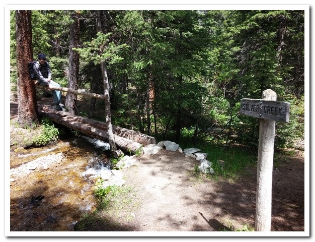
My friend Will & I gave it a go this last summer. We started at the Silver Creek Trailhead near sunrise. Anyone
who has hiked Harvard or Columbia via their standard routes has passed this TH on the way to the North
Cottonwood Creek Trailhead. We hiked the first mile and a half of the trail, angling west-southwest into the basin.
At this point you will enter a very defined "U" in the trail. Somewhere between 1/8 & 1/4 of a mile past the "U" -
we left the trail. We hiked northwest up the hill more or less across from a steep section above the creek below.
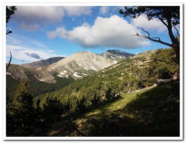
We managed to link up game trails for most of this section of the route. Looking down at the creek, near where we left the trail. Enjoying a good cruise through the woods. This view of Yale was inspiring to say the least! The views of Harvard and Columbia were quite impressive from this ridge.
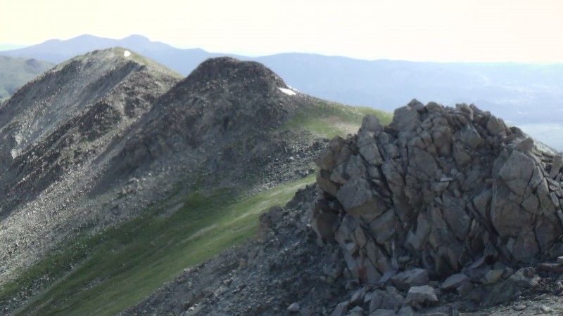
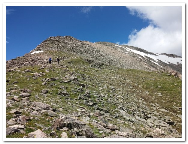
We continued along or just south of the ridge for the bulk of our remaining hike. We topped out on some of the
points and others we dodged to reduce our elevation gain. The weather was holding for the time being - we'd
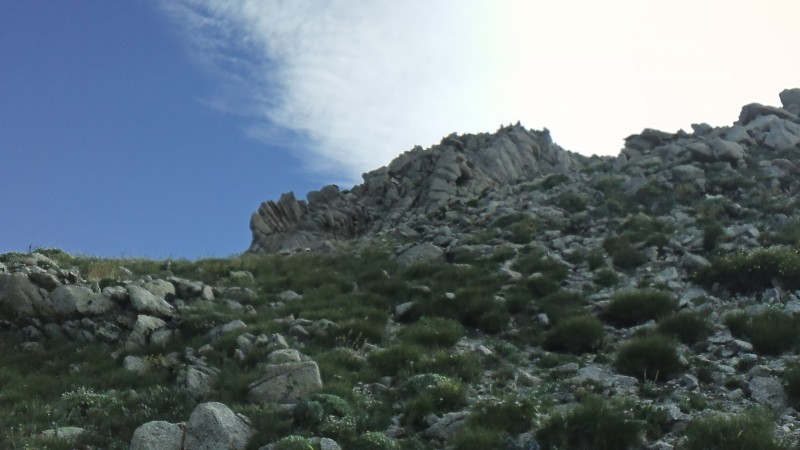
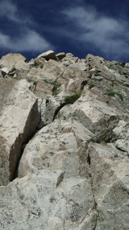
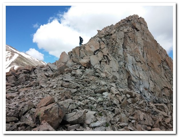
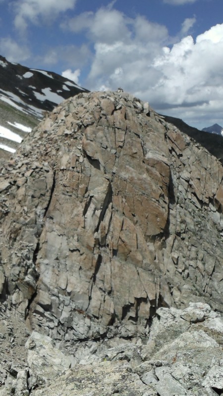
hate to have to bail into the basin if anything changed. A preview of our intended descent - the East Ridge. Some unique rocks along the ridge. Typical scrambling terrain up one of the ridge points. We downclimbed into a snow patch on the backside of this bump.
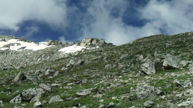
We could see other hikers along both the East Ridge & upper Southwest Slopes routes as we worked our way up.
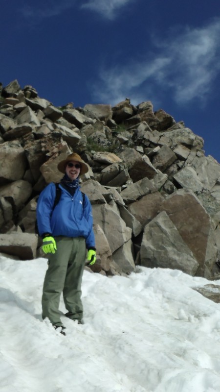
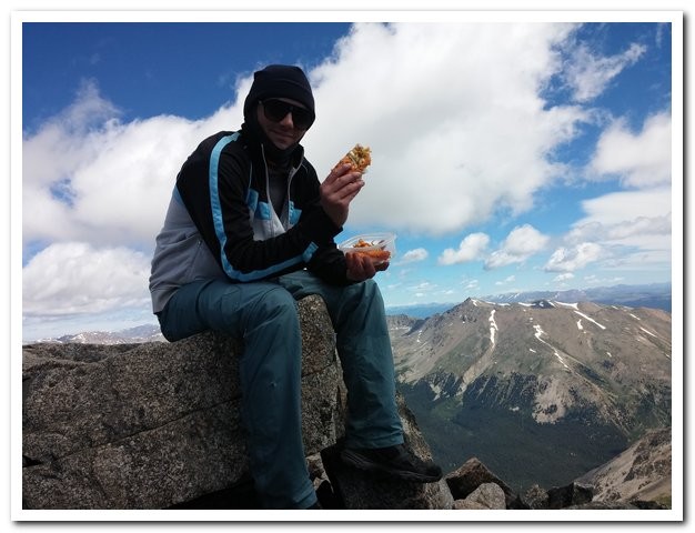
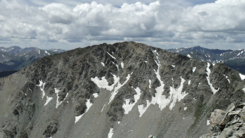
A little above 13k - every vertical foot became a personal high for Will - this was his 1st 14er after all! Looking back on much of the ridge. Almost to the final ridge section from the standard route. We aimed just right of the large rock in the center of this pictu My favorite part of the Yale standard: the fun ridge options! Summit pizza from Taster's in Snowmass. Yummy!
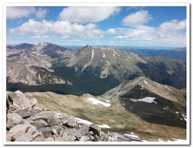
On the summit were at least a dozen people (this was a Sunday after all). We spoke with a few groups; inquiring
about the conditions on the East Ridge. After a couple strikeouts we found the group whom we'd seen on our
way up. They (& their dogs) were headed back the same route in a few moments and were happy to have us join
them. Some of them were from the Summit County area - Lauren, Kayla, Jeff, & Stu. Forgive me if I slightly
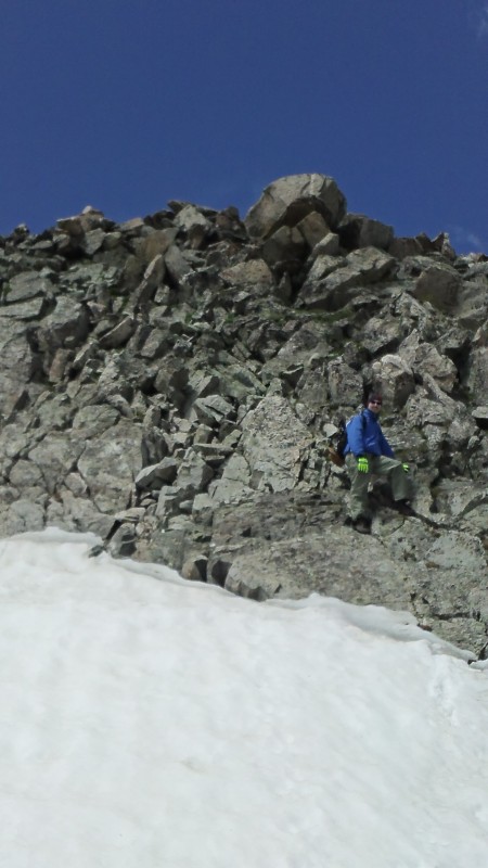
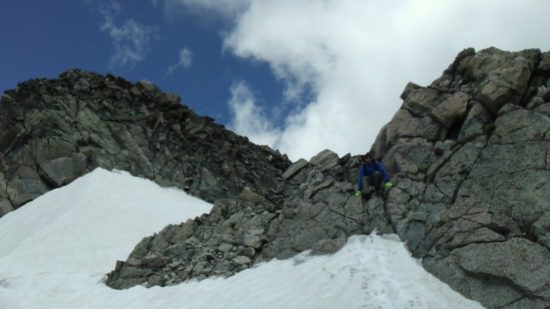
misspelled (or totally blew) getting your names right! Summit views and parts of our ascent route. Starting down the East Ridge. A little section of scrambling mixed with short snow patches. Playing with snow in the summer.
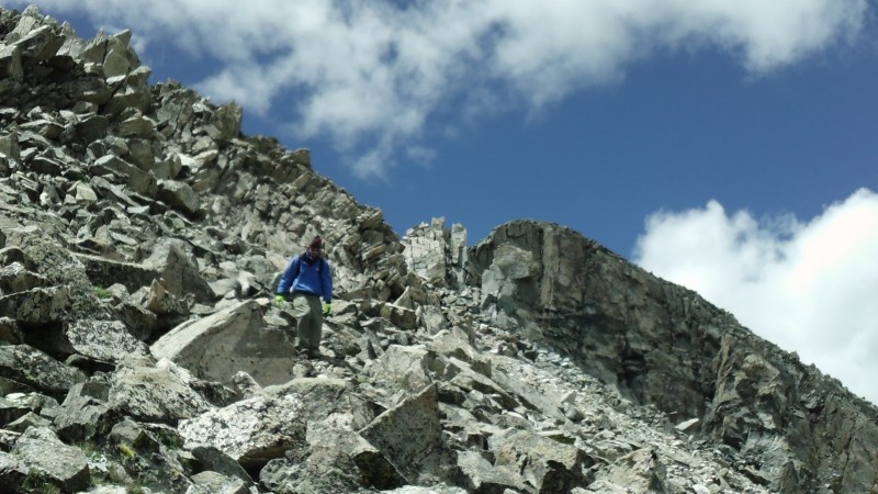
Plenty of optional scrambling kept this section fun. We were all very careful as we descended - a few spots had
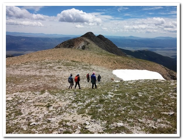
rocks that were loose. I chose to climb both 13,420' points - both definitely have good class 3 options. Our group headed for the 13,420' bumps. Descending the western bump. On the eastern bump - looking back at the western. We had originally toyed with the idea of adding Mascot Peak to our day. Ultimately we saw no easy way to hike it & still Will and the "white rock formation" from the East Ridge RD. Some of the last scrambling we found for the day.
We said our goodbyes at the junction of the Colorado Trail. The other group headed south as we returned north;
toward the Silver Creek TH. This is a rather nice section of the trail and we made good time to the creek. We
filtered some water, passed a few other hikers (one of whom was weeks into the entire CT route), and made our
way to the TH. We camped a few miles down the road, enjoyed breakfast Monday in BV, and drove back to
Snowmass Village as two happy hikers. A big thanks to Will for joining me on this loop & providing some of the
wonderful pictures in this report! Lets filter some of that snowmelt we were playing in earlier! *Not an actual GPS file... this approximation was created after the hike. The "U" is very easy to locate along the Notes on this route:
Expect 5500'+ vertical & 10+ miles to hike this route.
This route could be kept at difficult class 2 - with plenty of options for class 3 or harder available.
Bailing into the Silver Creek basin (due to weather, etc...) was very doable for most of this hike.
If you miss the turn past the "U" on the ascent you may find yourself in dense forest and/or cliffed out.
Route finding during the ascent above treeline is fairly obvious.
Route finding on the descent (having not ascended that route) will be needed (study the East Ridge RD).
If you choose to try this route - start early, stay safe, and have fun (we sure did!)!
Thumbnails for uploaded photos (click to open slideshow):
Way to get the summit using a unique and cool approach Brad. Looking forward to skiing some stuff next spring with you and your crew.
Enjoy the holidays.
Looking at Google Earth, it appears there are a lot of up and downs. Nevertheless, it looks like a day full of ridge fun.
Caution: The information contained in this report may not be accurate and should not be the only resource used in preparation for your climb. Failure to have the necessary experience, physical conditioning, supplies or equipment can result in injury or death. 14ers.com and the author(s) of this report provide no warranties, either express or implied, that the information provided is accurate or reliable. By using the information provided, you agree to indemnify and hold harmless 14ers.com and the report author(s) with respect to any claims and demands against them, including any attorney fees and expenses. Please read the 14ers.com Safety and Disclaimer pages for more information.
Please respect private property: 14ers.com supports the rights of private landowners to determine how and by whom their land will be used. In Colorado, it is your responsibility to determine if land is private and to obtain the appropriate permission before entering the property.