Download Agreement, Release, and Acknowledgement of Risk:
You (the person requesting this file download) fully understand mountain climbing ("Activity") involves risks and dangers of serious bodily injury, including permanent disability, paralysis, and death ("Risks") and you fully accept and assume all such risks and all responsibility for losses, costs, and damages you incur as a result of your participation in this Activity.
You acknowledge that information in the file you have chosen to download may not be accurate and may contain errors. You agree to assume all risks when using this information and agree to release and discharge 14ers.com, 14ers Inc. and the author(s) of such information (collectively, the "Released Parties").
You hereby discharge the Released Parties from all damages, actions, claims and liabilities of any nature, specifically including, but not limited to, damages, actions, claims and liabilities arising from or related to the negligence of the Released Parties. You further agree to indemnify, hold harmless and defend 14ers.com, 14ers Inc. and each of the other Released Parties from and against any loss, damage, liability and expense, including costs and attorney fees, incurred by 14ers.com, 14ers Inc. or any of the other Released Parties as a result of you using information provided on the 14ers.com or 14ers Inc. websites.
You have read this agreement, fully understand its terms and intend it to be a complete and unconditional release of all liability to the greatest extent allowed by law and agree that if any portion of this agreement is held to be invalid the balance, notwithstanding, shall continue in full force and effect.
By clicking "OK" you agree to these terms. If you DO NOT agree, click "Cancel"...
Five Peaks from Pine Creek with Perfect Solitude
(Mt Oxford, Mt Belford, Missouri Mt, Mt Harvard, and Mt Columbia)
Total Miles: 40.5 Total Elevation Gain: 13,820'
Read on if you are interested in climbing five Sawatch peaks in solitude on a single weekend.
I climbed these five peaks over a leisurely, extended, five-day, Labor Day weekend. As I write this, a friend of mine is attempting to do this same route with her father in two-and-a-half days!
The whole time I was in the Pine Creek valley, I only saw six other people. That's definitely considered solitude in Colorado. Thanks to offman and his 8/25/2009 trip report that served as the inspiration for putting my route together. B(3) (7/20/2008) and cbrobin (7/16/2015) also provided helpful information in their trip reports. As always, Gerry Roach's book, Colorado's Fourteeners From Hikes to Climbs, provided solid details!
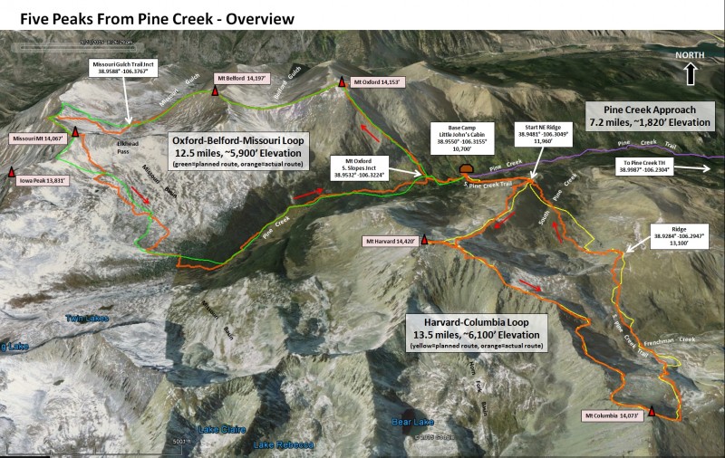
The first photo is an overview of my climb and lists key gps waypoints.
Overview of the Five Peaks Loops
Day 1 (Thursday, 3 Sep) - Drive to Pine Creek TH and Hike to Little John's Cabin (Base Camp)
I followed Roach's directions to the Pine Creek Trailhead (13T2) and easily made it to the TH in my Subaru Outback. The short, dirt road (CR 388) that you take off of HWY 24 to the trailhead is short, less than a mile, but has several intersections that can be confusing, take a second look at the directions/map or use the gps coordinates from the overview image. The last 200 yards are pretty rough and a high clearance vehicle is recommended. Parking is available before this section.
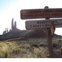
Pine Creek Trailhead
From the TH, I paid the small access fee, and followed a 4WD road across private land for about 2.2 miles to reach the start of the Pine Creek Trail (FT 1459).
Pay the Small Fee for Access
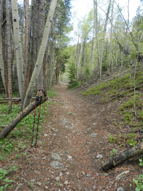
It was another five miles of gentle grades, beautiful scenery, and interesting rock formations to Little John's Cabin. Roach's description for climbing Mount Oxford - South Slopes (13R4) provides a good, concise description of the Pine Creek Trail approach.
Cool Rock Formations
Pine Creek Trail to Little John's Cabin
Nearing Base Camp on the Pine Creek Trail
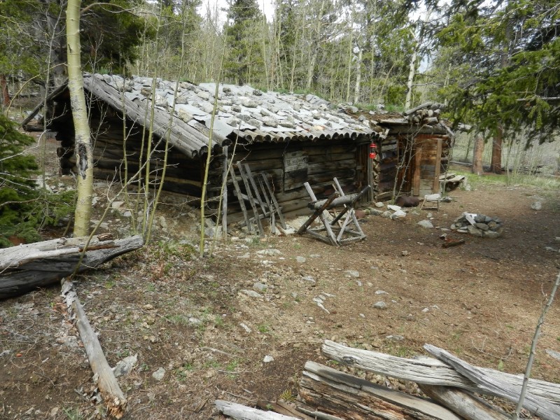
Little John's Cabin was fun to explore and is well located to serve as a base camp for climbing the five peaks.
Little John's Cabin - Camp Spots Behind
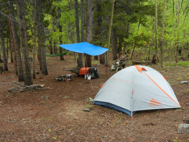
The aspen and pine forest directly behind the cabin provides several established camp spots.
I decided to climb these three peaks in a counterclockwise loop starting with Mt Oxford as shown in the overview photo. The main reason for this was I wanted to have a better chance at summiting Oxford and Belford should bad weather move in later in the day.
To gain Oxford's southern slopes, I continued west from Little John's Cabin another quarter-mile on the Pine Creek Trail until I reached point 38.9532° -106.3224°. This is where I left the trail and started hiking up slope (NW) towards Oxford's summit. Supposedly, there is a rock cairn that marks this departure spot, but I was unable to find it in the early morning darkness. There's no trail leading up the steep slopes and I bushwhacked through trees and thick undergrowth grabbing small aspen trees to pull myself up the slope. Rain pants and gaiters kept me from getting dew soaked in this section. If you try this route, stay west of the side stream. If you encounter a large rock outcropping, skirt this to climbers left. Going right will get you into more dangerous terrain.
I escaped the trees around 11,800' and was able to see the remainder of the route to Oxford's summit. Minimal rock scrambling was needed to reach the top.
This leg of the loop is 1.9 miles long and gains about 3,400' of elevation.
Approaching Mt Oxford's Summit
From Mt Oxford, I headed due west on the well defined trail towards Mt Belford. This is a very enjoyable traverse with excellent views on both sides.
The Trail Leading to Mt Belford from Mt Oxford
A Good Look at the Ridge to Mt Belford
The final summit block requires minimal rock scrambling.
Approaching Mt Belford's Summit
This leg of the loop is 1.4 miles long and includes about 720' of elevation gain from the Oxford-Belford saddle.
From Mt Belford it is possible to see Missouri's summit. Before leaving Belford's summit and dropping into Missouri Gulch, I took a good look at the weather. It was holding pretty well so I launch myself down Belford's NW, grassy ridge and saw a mountain goat along the way.
Goat!
There is no trail to follow as you head off the summit but the direction you need to go is obvious. You'll be doing the reverse route as described in Roach's (13R1 V1) Variation - West Shoulder route to summit Belford. Your goal is to connect up with the Missouri Gulch trail around point 38.9588° -106.3767°. Once on the Missouri Gulch trail, the path is well marked to the summit of Missouri Mountain. You will have to regain a somewhat demoralizing 1,700' of elevation to make it to the summit. The distance for this leg of the loop is about 2.7 miles. There's some moderate rock scrambling on the long ridge to Missouri's summit.
The Path to Missouri's Summit
From the summit of Missouri, my original plan was to hike towards Iowa Peak and then drop SE off the saddle into Missouri Basin to connect with the upper Pine Creek Trail. The weather was starting to turn bad so I decided to do a more direct departure from the summit by hiking slightly east on the ridge towards Elkhead pass and then dropping pretty much due south off the ridge. This was steep but manageable. Once again, the path back towards the upper Pine Creek Trail was laid out in front of me as I peered into the beautiful Missouri Basin. My course generally headed towards point 38.9303 -106.3558 where I intersected the upper Pine Creek Trail along the way. Once on the Pine Creek Trail, I enjoyed the all-downhill trek back to base camp at Little John's Cabin. The distance from the summit of Missouri Mountain back to Little John's Cabin is about 6.5 miles.
Day 3 (Saturday, Sep 5) - Rest and Scout the S. Pine Creek Trail
I planned for day three to be a rest day. Or, an alternate climbing day had the weather prevented me from climbing on Friday. I did a bit of resting and then decided to scout the S. Pine Creek Trail leading up to the beginning of Harvard's NE ridge route. I had read several accounts of hikers losing the minimal, steep trail. I figured a look during daylight would help me out when I had to hike the trail again in the dark next morning. I hiked the 1.2 miles (1,300' elevation) to the top of the ridge trying to memorize key landmarks along the way, imagining what they would look like by headlamp. The hike up to the ridge is very steep and I had some trouble at times finding the trail even in broad daylight. The knowledge gained from my scouting expedition really helped me out the next morning.
At the top of the ridge, I looked out across the S. Pine Creek valley at the terrain I'd be returning over the next day.
A Look Into South Pine Creek Valley
I also got a good look at the faint trail up Harvard's NE ridge that I'd be climbing tomorrow morning.
The Start of Harvard's NE Ridge
Something to note is there's one bar of Verizon cell coverage on the ridge if you had to make an emergency call.
Day 4 (Sunday, Sep 6) - Harvard - Columbia Climb
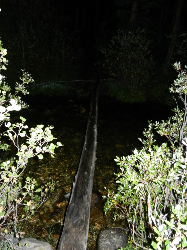
I was up early for this long day. Even though I'd be climbing only two peaks compared to the three on Friday, the Harvard-Columbia loop is longer and has more elevation gain. The S. Pine Creek trail splits from the main trail right at Little John's Cabin and takes off in a SE direction across the meadow, then crosses the creek on a skinny, bouncy, one-log bridge.
The Skinny One-Log Bridge Across Pine Creek
The log was so high above the water, my trekking poles weren't long enough to provide any help. If you do this route, each person in your party may want to be prepared with a long pole before attempting the crossing. On the other side of the creek, there's another old mining cabin with the outhouse up the slope a ways behind the cabin. The trail continues into the trees, directly past the left side of the outhouse. The hike up to the ridge seemed even steeper in the dark and I still had trouble staying on trail even after hiking it in the daylight. Two times, I had to use my gps to find my way back to the trail.
At the beginning of Harvard's NE ridge, the faint trail quickly disappears and the route becomes a nice mix of grass and rock. Early on, as you ascend the ridge, you'll encounter a boulder field. This can be a little tricky in the dark. Do not attempt to climb through this. Instead, you can easily skirt the boulder field to climber's right. I actually got lost in this boulder field during the darkness of early morning and had to sit tight for an hour waiting on the light of dawn before I could back out and find my way around it.
Once dawn arrives, you'll see the entire route to Harvard's summit ahead of you. This route is described in Roach's book for climbing Harvard (14R2 V) - Variation - Northeast Ridge.
Looking Up Harvard's Long NW Ridge
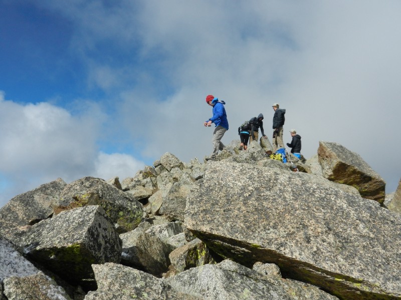
Near the top of the ridge it gets pretty steep and I cut left a bit to hit the ridge between Harvard and Columbia, then followed this ridge to Harvard's summit. I reached the ridge left of a bump which still held a snow field on its north slope. I found going left around this bump was the easiest. You'll be rock-hopping a fair amount on the final push to the summit. The rock was wet as I made my way up the summit block and I put on my microspikes for some added traction.
Approaching Harvard's Summit
Harvard's summit was a busy place!
The Crowds are Gathering on Harvard's Summit
This leg of the Harvard - Columbia loop was about 2.8 miles and had an elevation gain of 3,700'.
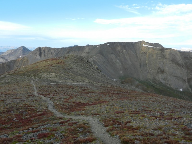
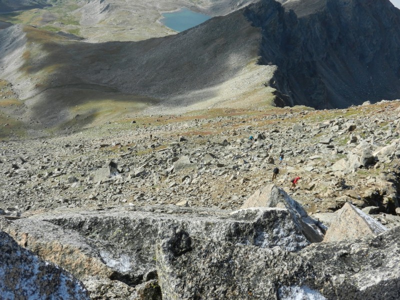
Four peaks down and just one more to go. All that was left was the dreaded Harvard-Columbia traverse. This route is covered pretty well on the 14ers.com website as Combo) Harvard and Columbia Traverse. It pays to really study this route carefully. There is rock fall hazard and a whole lot of hiking on talus. It's a long way from Harvard to Columbia. The second half of this route is a perfect place for wearing a helmet.
The first half of the route is not too bad.
The First Half of the Harvard-Columbia Traverse
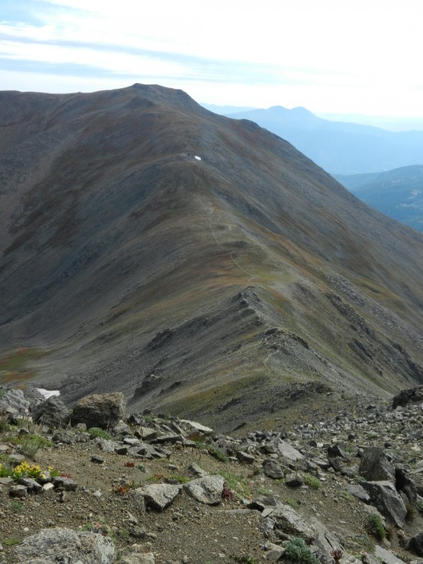
About half way through the traverse you drop off the left side of the ridge and start your trek-o-talus-from-hell.
The Second Half of the Harvard-Columbia Traverse
Follow the directions on the 14ers.com route description and try to maintain that 12,800' contour until you pass under the "Rabbit" feature on the ridge.
"The Rabbit" is Close By
Do you see the rabbit hiding behind the ridge?
Once past the rabbit, angle up towards the summit. As you approach the summit move off the ridge to your left and climb the east slope of the summit block to the top.
Approaching Columbia's Summit
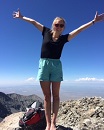
On Top of Peak Number Five - Columbia
It felt good to reach the top of peak number five but, I still had a long way to go to get back to base camp.
The Harvard-Columbia traverse is about 2.5 miles and requires approximately 1,300' of elevation gain.
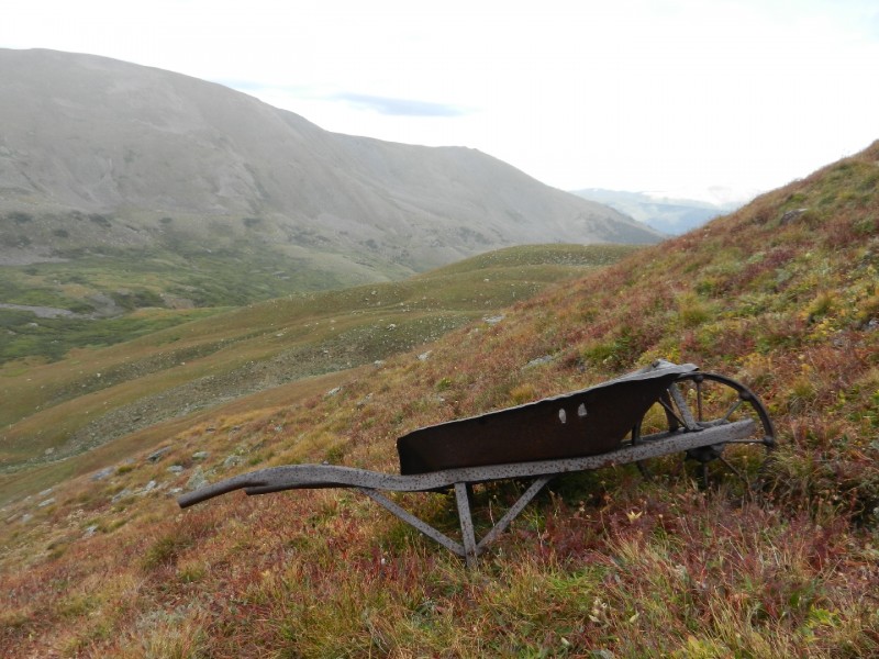
For the return to base camp, I dropped off of Columbia via the rocky East Ridge and then made my way down the grassy slopes towards Frenchman Creek and the South Pine Creek Trail. You'll know you're on track if you see the old wheelbarrow sitting out in the middle of nowhere.
The Old Wheelbarrow
The hike off Columbia and back to Little John's Cabin is loooong with a major ridge dividing Frenchman Creek and South Pine Creek that you must go over before climbing up a bit and descending back down into Pine Creek. It's a lot of work but the beautiful, open terrain and mountain scenery were distracting in a good way.
South Pine Creek
There is water in both basins if you need to refill. Both basins have willows to deal with but there are game trails that get you through without too much fighting. There's really no trail through these two valleys. There are a few cairns to help you find your way. The ridge between the two valleys requires 900' of elevation gain. It's your last major elevation gain before base camp. As you descend towards South Pine Creek, stay on a NW trajectory while you cross the valley. Look for a large boulder that marks the point where you can cut left through the willows and cross over the South Pine Creek.
Cut Left Through the Willows at the Boulder
Navigating this terrain in the dark would be difficult to say the least.
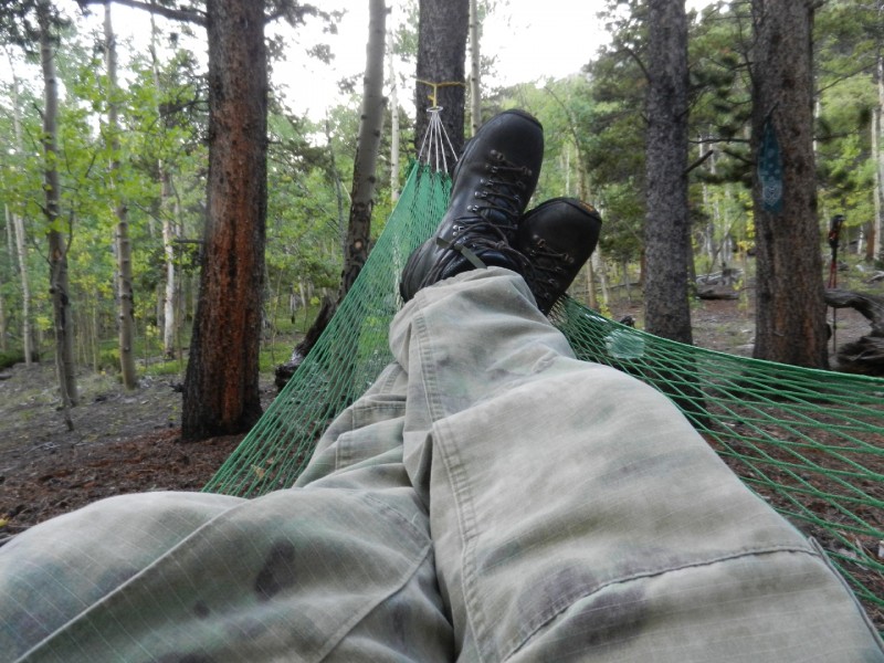
Once you cross S. Pine Creek, you'll start angling right up the slope, now with a trail under your feet. Head towards the point where you started up Harvard's NE ridge to close the loop. The final ridge is not as big a climb as it looks. You only have 200' of elevation to conquer. From the top of this ridge, all that's left is the 1.2 mile, steep descent back down the S. Pine Creek Trail to Little John's Cabin for some well deserved hammock time (if you brought one).
Hammock Heaven!
This last leg of the Harvard-Columbia loop ended up being about 7.2 miles with a total of 1,100' of elevation gain.
The two loops combined from Little John's Cabin were about 26 miles and approximately 12,000' of elevation gain. If you add the RT hike to Little John's Cabin, the total mileage was a little over 40 miles with a cumulative elevation gain of 13,820'.
Day 5 (Monday, Sep 7) - Pack Up Base Camp and Hike Out to the TH
The hike out was as beautiful as the hike in. Spreading this adventure over five days made it possible to soak in each day without hiking myself into the misery zone. The trip exceeded my expectations and I recommend the route for anyone looking for a five-peak weekend with solitude.
My GPS Tracks on Google Maps (made from a .GPX file upload):
This is the finest way to get those 14ers, yep the solitude can’t be beat! Such a beautiful valley with many ponds. We camped about a 1/4 mile east of Little John’s in the aspen. It was only Bel/Ox, but we went up a prominent slide zone straight to Belford, over to Oxford and down the southslopes straight to the cabin, that was one hellacous bushwhack too. We came down the eastside of that drainage, very steep with heavy brush and trees.
I am the friend with the father mentioned at the beginning of this trip report! I can say that we did climb all five peaks in just 2.5 days. I can also say that I’m not sure I’d recommend that schedule to anyone. My previous experience in Pine Creek, the author’s beta, and the 14ers.com description of the Harvard–Columbia traverse was about all we had going in. Besides schedule, the one big difference from what is described above was doing the Missouri–Oxford–Belford loop clockwise rather than counter–clockwise. I did this for two reason, I’ve climbed up to Elkhead Pass from Pine Creek before and knew that would be easy to navigate (as opposed to finding the proper ridge up Oxford in the dark), and the weather forecast was VERY stable, meaning there was less chance we’d need to bail.
In retrospect, going up Oxford is probably miserable, but I’m not sure it could be more miserable than going down. It might be nice to gain most of the elevation quickly, climbing the steepest terrain rather than descending it. Also, if there was anything but the best weather, I would suggest going counterclockwise due to the easy bail off point at Elkhead Pass (after Belford, before Missouri). If attempting Oxford first, take a GPS to determine where to leave the trail; I doubt it would have gone well if I had tried not having GPS with me.
The next day we did Harvard & Columbia largely as described. We crossed the single log bridge by scooting "au cheval", which proved reliable and safe. The S. Pine Creek trail is steep and not great, but we had no major difficulties staying on it. The boulder field(s) up Harvard were fairly extensive through the first section, but being low angle and stable, crossing them wasn’t much of an issue for us, even by headlamp. The summit of Harvard was lovely and we had it to ourselves on a Sunday morning.
The traverse to Columbia was awful. I am rather cautious on uncertain terrain, so I was slow leaving the Rabbit Ridge and slow ascending Columbia, then slow again descending into Frenchman Creek. Once there, we refilled water, lamented the lack of trail, and just tried to pick a good line up the headwall to get into S. Pine Creek. For both of these valleys it’s about descending steep, mostly trail–less terrain safely, then navigating willows efficiently, then picking your line to get out of the valley without expending more effort than necessary. The final bit is getting down the very steep S. Pine Creek trail back into Pine Creek.
Since I had to work on Monday morning, we headed to camp and after changing shoes and brushing teeth, packed up and hiked out as fast as our tired bodies would take us (just over 2.5 hours). We could not have done this trip without the phenomenal clear, calm weather we had. But, not being used to that many hours in the sun, I did get sunburned. Lots of food and water are critical, because this route requires so much effort (over 20 miles on our last day). Take care of your feet and be prepared for a lot boulders, talus, and scree (helmet, gaiters, shoes with ankle support, etc.) for many portions.
We saw no one in Pine Creek save two folks camping on the Colorado Trail where in crosses the valley. And, we had two of the five summits to ourselves despite it being a weekend! Great route if you have more than a weekend, like to navigate and bushwhack, are ready for a challenge, and want to avoid crowds.
Martha, that’s amazing speed on the route for you and your dad! Impressive. When approaching Missouri, did you climb the saddle between Iowa and Missouri, Elkhead pass, or did you climb more of a direct route towards the summit? Thanks for posting your clockwise perspective.
Kevin, on the way up Missouri we followed the Pine Creek trail until the sign for Elkhead Pass. We took a right at that trail junction and ascended out of the trees. You then cross a high, treeless section of the Missouri Basin with a full view of Emerald, Iowa, Missouri, Elkhead Pass, and Belford. We left the Elkhead Pass trail about halfway across this section and headed for the base of the south side of Missouri. We decided not to head directly to the summit, but instead to stay on the terrain that had some vegetation. This led us up climber’s left of the summit. There was certainly some scrambling, but not too difficult or sketchy. From there we gained the ridge between Missouri and Iowa, above the saddle on the Missouri side. We easily took that ridge to the summit!
is one of my favorite places. Thanks for the report, the pictures bring back many memories. We got goofed up heading to Columbia by the trail you took to Harvard (from the pass). We assumed it was the continuation of the South Pine Creek Trail. We ended up dropping down and circling the head of the basin to get to the other ridge. We never did get to Columbia that day. There used to be 2 logs at the river crossing. It was not to hard to cross even with backpacks. I used a hiking guide written by Bob Martin for Oxford. I liked his description, turn right pass the drainage, go up until you can’t go any further, than you are at the top.
It brings back great memories. And thanks for the shout - out. Like others here - this is one of my favorite spots. It looks like you and I sat around in the same scree slope on Harvard because we got started too early to see the best line. It made for great stargazing though. Pine Creek is good for a repeat when you go get Emerald and Iowa. On my second backpack there I saw 4 people total over 4 days - good times.
Happy Trails!
Great report. I wonder if you would answer some questions about difficulty. The peaks are all class 2. Would you say any of this route rises above a class 2 designation? Did you wear a helmet for the trip?
My group has not yet achieved a 14er and our peak elevation is about 13K. From you report the biggest hesitation I feel is the deviation from any visible trail. I do not mind if there are no markers or the trail does not show on a map. But I have not yet truly gone off trail.
How difficult would you think this trip would be for someone with moderate peak experience.
The portions of this route that may have exceeded Class 2 are the final 200 yards, or so, of Harvard. I most definitely used my hands. And, portions of the traverse from Harvard to Columbia. The second half of this traverse is one long talus slog. The rock will move a lot under your feet, no exposure to speak of but the potential for an injury is definitely there. Good route finding skills will help minimize the suffering. I actually took a fall in this area due to a very devious, rolling boulder. I was lucky and only ended up with a scrape on my leg. Yes, I was wearing a helmet. I always wear a helmet when I'm scrambling over rock to protect my head from bouncing on a rock should I fall awkwardly. There's also the potential for rock fall in a few places along this traverse. Helmets are good.
I really can't give you an estimate of difficulty as different aspects of the route (sustained talus, elevation gain, route finding, and route distance) will be difficult for some and not for others. The off trail travel portion of the route shouldn't be a problem since the terrain is open and you can generally see where you need to go. But, if weather moves in or you get caught by the darkness of night (for whatever reason) you should be comfortable using map/compass and/or gps.
Both loops require some sustained exposure to potential weather. You should feel comfortable with making weather decisions. For example, once you leave Belford for Missouri, you'll be on the north side of Elkhead Pass with your return to camp on the south side. You have to go over Missouri or the pass to get back. If weather moves in, you'll be stuck in the open.
It is a beautiful place to hike. For me, hiking across the basins was the highlight. Climbing the peaks was a bonus.
I hope this helps. Please let me know if you have other questions.
I just got back from doing this trip with a friend. It was amazing! I loved being off trail for most of the sections.The hike up the northwest ridge of Harvard was stunning so was the Frenchman's Creek basin -- as Kevin mentioned.. The basins are the highlight. If anyone is curious the old log across Pine Creek is still there and supported my 200 lb body just fine.
The only change I would make is the descent off Missouri -- it was pretty sketchy for me but I couldn't find your line... My friend and I had heard a lot of people complaining about the Harvard to Columbia traverse so we chose to descend off Harvard via the south trail and back up Columbia via the west trail. It was a lot longer but really only added 30 minutes to the time based on people who did the traverse that day.
All and all a worth while trip for anyone with the strength to do it. It was back to back exhausting 13 hour days for us..
Lang_daly, I hope you have a grand time! Let me know how it goes and good luck.
Caution: The information contained in this report may not be accurate and should not be the only resource used in preparation for your climb. Failure to have the necessary experience, physical conditioning, supplies or equipment can result in injury or death. 14ers.com and the author(s) of this report provide no warranties, either express or implied, that the information provided is accurate or reliable. By using the information provided, you agree to indemnify and hold harmless 14ers.com and the report author(s) with respect to any claims and demands against them, including any attorney fees and expenses. Please read the 14ers.com Safety and Disclaimer pages for more information.
Please respect private property: 14ers.com supports the rights of private landowners to determine how and by whom their land will be used. In Colorado, it is your responsibility to determine if land is private and to obtain the appropriate permission before entering the property.


 Overview of the Five Peaks Loops")
 Pine Creek Trailhead")
 Pay the Small Fee for Access")
 Cool Rock Formations")
 Pine Creek Trail to Little John's Cabin")
 Nearing Base Camp on the Pine Creek Trail")
 Little John's Cabin - Camp Spots Behind")
 My Base Camp Behind Little John's Cabin")
 Approaching Mt Oxford's Summit")
 The Trail Leading to Mt Belford from Mt Oxford")
 A Good Look at the Ridge to Mt Belford")
 Approaching Mt Belford's Summit")
 Goat!")
 The Path to Missouri's Summit")
 A Look Into South Pine Creek Valley")
 The Start of Harvard's NE Ridge")
 The Skinny One-Log Bridge Across Pine Creek")
 Looking Up Harvard's Long NW Ridge")
 Approaching Harvard's Summit")
 The Crowds are Gathering on Harvard's Summit")
 The First Half of the Harvard-Columbia Traverse")
 The Second Half of the Harvard-Columbia Traverse")
")
 Approaching Columbia's Summit")
 On Top of Peak Number Five - Columbia")
 The Old Wheelbarrow")
 South Pine Creek")
 Cut Left Through the Willows at the Boulder")
 Hammock Heaven!")