| Report Type | Full |
| Peak(s) |
La Plata Peak - 14,344 feet |
| Date Posted | 07/20/2015 |
| Date Climbed | 07/11/2015 |
| Author | HarknessHooligans |
| Additional Members | kc_hiking |
| Pick your Poison |
|---|
|
Northwest Ridge - Standard Route Start: 5:30am Summit 9:30am (stayed only 10min on top) Finish: 1:10pm Storms rolled in by 8am! This was my 30th 14er!! (not including repeats) YAY!!! I attempted La Plata 2 years ago via the non-standard route and never made it. So it was nice to have my comeback and actually make the summit this time. Plus, I am 9 months postpartum. I had two babies back to back the last two summers so I feel like my body is still in recovery. I have been doing what I can to prep for a 14er with local hikes and running, but with 3 little kids 5 and under, I'm limited to when I can get away. That being said, this 14er kicked my butt! I do feel my hikes helped train my quads because they weren't sore at all! But I was just so exhausted. It felt like my first 14er again...which makes sense when you have a 2 year gap with 2 pregnancies. So I am Very proud that I was able to hike this whole thing!!! It was tough on my body, but I think I did well considering my situation! I named this report "Pick your Poison" because I went back and forth on which route to do. Long, steep and possibly not as pretty but straitforward hike with a good trail vs shorter hike with steep loose scree but with beautiful scenery and less people - and did I mention it is shorter? Hmmmm. I really REALLY wanted to do the non-standard approach because this was what defeated me before. I also have heard that the scenery is amazing! Plus it is shorter and we like taking our Subaru on 4wd roads (ones she can handle) I have driven our vehicle up that road in the past so I knew that wouldn't be an issue. But what ended up making me switch my route was being worried that the willows would be really muddy and miserable with all the rain we had been receiving. I was also worried about the loose steep scree because I was trying new hiking shoes for the first time and didn't want to be on tough terrain if in fact they didn't work out. So I reluctantly agreed to hiking the Standard route and was pretty bummed out about it (especially having the added mileage) On to the hike..... We were shocked to see a full parking lot when we rolled up at 5am. I was hoping for bathrooms...But there were none. We brought headlamps but they were not needed. I could see how the first section before the log bridge would be difficult to follow in the dark. As you are walking up the road keep an eye out for the trailhead sign on your left....It is not super obvious and no where does it say La Plata. But this is the trailhead.  We followed directions and turned right after that great pedestrian bridge. The trail has steps going up that will help you know you made the "right" choice but then it curves back left. The best advice I read from another trip report was that you parallel the river/hwy for longer than you would think before hitting the log bridge. Even though I had read this, we still doubted we were on the right path because it felt so weird. Not much gain and it was not heading toward the mountain. We did turn back to the ped bridge to make sure we did in fact turn right (which we had done) - then I trusted the previous comment about paralleling the road for a bit and just kept going. So when this part feels a little weird, know you are doing it right! Once we hit the log bridge there were no more areas that we questioned.  We made our way through the forest, up the steps, and up the switchbacks. Nothing worth noting other than being surprised at how cold it was! 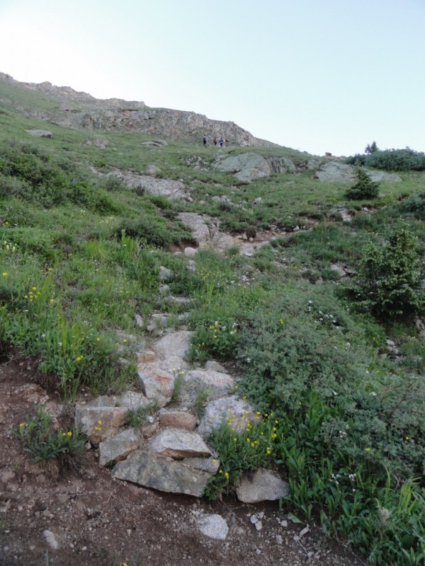 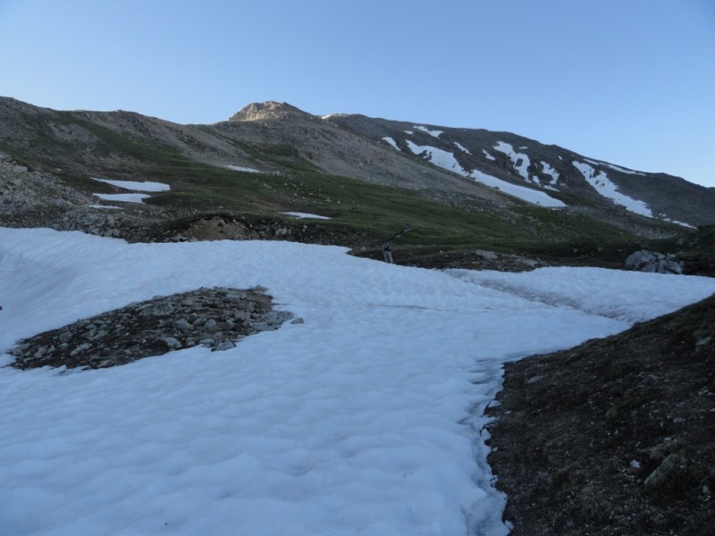  We wanted an early start because the weather has been unpredictable and many have mentioned storms rolling in sooner than usual. I was quite surprised after hitting the ridge, because there were dark threatening clouds forming and the wind was blowing it quickly toward us. This happened at 8am! I have been caught in an electrical storm before and it is not something I care to repeat. I was ready to turn around and was completely content not summiting if this was the case. But as I had my serious thoughts, my sweet husband suggested to drop my pack to help me make it up quicker. He had enough water in his bladder for both of us and I threw an extra Gatorade and some of my food items in his pack. What a sweetheart! So I left my pack under the rocks right when you hit the ridge....But there is still quite a ways to go at this point. We also would constantly be monitoring the weather from here on out. The rocks to the left of me in the pic below is where I stashed my bag 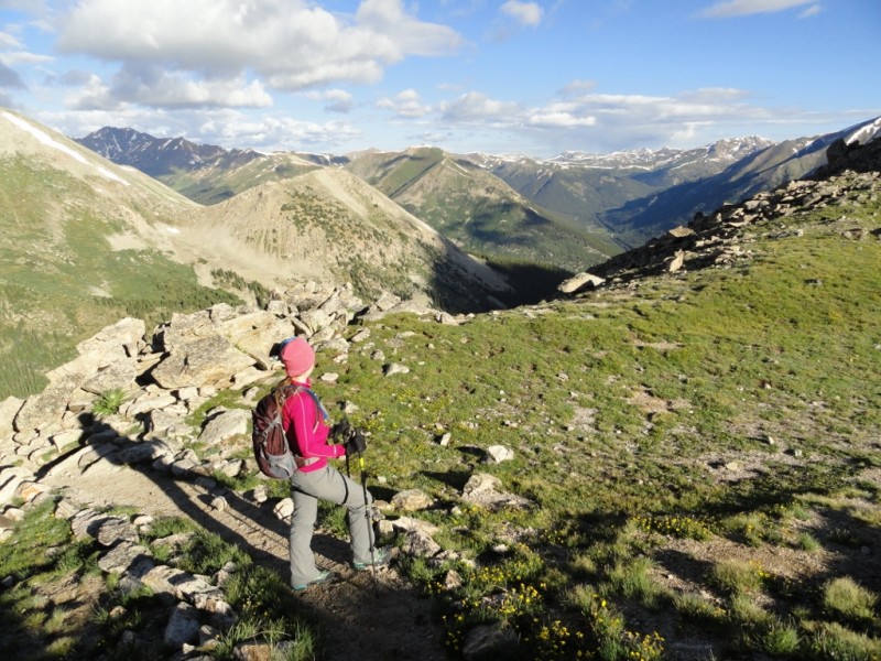    There is still quite a bit of snow but it is all avoidable by going to the right on the rocks (as shown in the pic above). I was losing energy fast at this point and the weather kept freaking me out (even though the weather in the last pic doesn't look threatening). I just had worse case scenarios running through my head. It started sleeting for a bit and was very cold. The group above us actually decided to turn around at this point. Our entire summit was either in the shade or under dark stormy clouds, so we had no sun to help warm us up. Wasn't prepared for that. My little fingers were freezing. But they do tend to lose circulation faster when Im using trekking poles anyways...but that combined with the cold weather caused them to go numb. When we were about 20 minutes from the summit we ran into our friends. We drove up together but honestly didn't hike at all together. After the log bridge, they were gone. Their pace is quicker than ours and they just booked it. So the only time we saw them was when they passed us on their descent after summiting! Ha! Our only group photo...and notice the weather has changed again! Looking better than it was and giving us a window of opportunity to press forward knowing we were about 20 mintues from the top  Knowing our friends would be arriving to the car about an hour before us, it was motivation to move as quickly as we could (even though they were totally fine with us doing whatever pace worked best). We finally hit "a" summit and I was so relieved to be on top....but then realized it wasn't the "actual" summit. We still had to hike another 5 minutes over to the other one. I know this sounds silly, but I was so exhausted that I seriously considered not going to the actual summit. I was completely content to let this be my summit because the clouds were so sketchy and I was so tired I just wanted to get off the mountain. But, that hike was a long ways to go to stop short by 5 minutes. Although I was annoyed, I pushed through and we made it to the actual summit! 9:30am 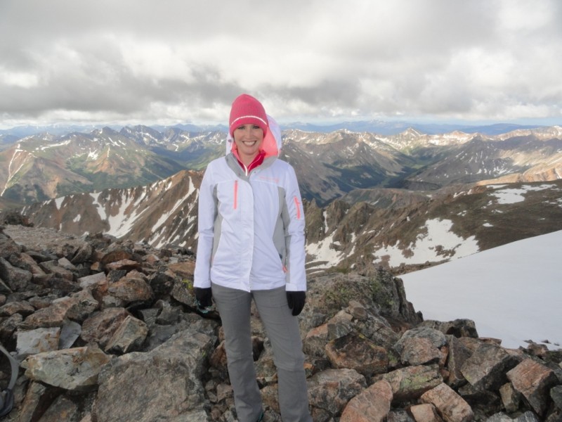  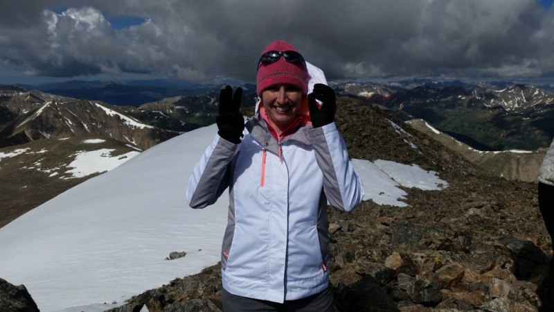  The weather made me so nervous, so we only stayed 10 minutes on top....only enough to take pictures and help some strangers out by taking their picture. I didn't even want to eat. I just want to get down as quick as we could knowing that you are on the ridge for such a long time. I was so flustered I don't even really remember the summit! It was kinda sad; I didn't really look around or take the time to see Ellingwood Ridge (which really made me bummed out cuz I brought binoculars to see if we could spot anyone on that route) My priority once summiting was getting off the mountain. The wind picked up and we booked it out of there. All our pictures really dont show well what the weather was doing...but trust me, it was unpredictable and constantly changing. It was hard to tell what would hit us and what wouldn't. The wind pushed many clouds our way but also broke some of them up. There was no telling what their plans were and I sure didn't want to stick around to find out. 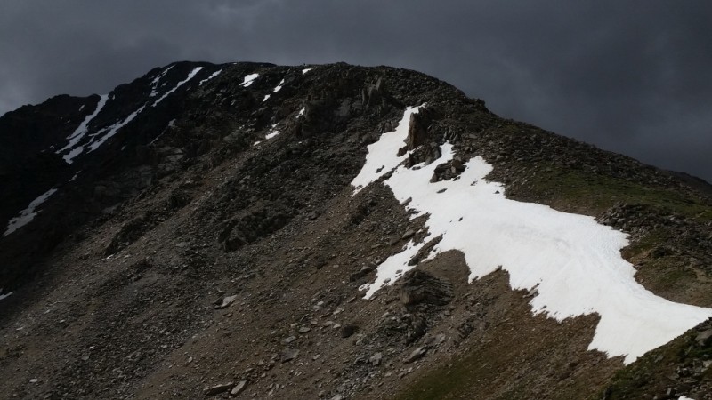 For perspective on the picture of La Plata above, you can actually see a tiny little person on top in the middle of the flat section (right above a tiny little snow patch) Once we got back to the large snow patch on the ridge, we were happy to feel like we were close to being out of harms way.     I grabbed my pack on the way down and it was at this point that it began to rain a little. The weather was so annoying because it was bipolar. It was the most indecisive weather I have hiked in. Sun, sleet, grapple, sun, clouds, sun, rain, sun. Just figure it out already! This 180 panorama shows perfectly what we were dealing with. We were hiking into the storm, but if you turned to see where you came from, it was back to beautiful blue skies. Rawr! Why couldn't we have had that pretty weather on top? Stinkin Colorado weather - You are so moody!  Anyways, We thought we were going to hike right into a rain storm...But it blew away like everything else. So actually by the time we hit the switchbacks, the sun and blue skies appeared again and stayed for the rest of our descent! The warmth was much appreciated!   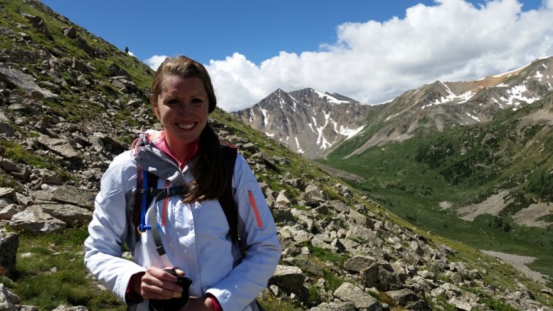 The flowers were in full bloom! And the forest going down was beautiful! I didn't notice how gorgeous it was in the early morning. My feet were tired and I was ready for the car. Most of our pictures were taken on the descent. We passed so many people who started much later than us and I was a little jealous that they got the better weather. I dont regret starting early because afternoon storms are more common, but in this case, the weather ended up being better for all those late comers! Why do they get to be rewarded for a late start?? The weather is so unpredictable here. Even though it kinda backfired on us, I still would advise to start 14er hikes early. But, as shown in our case, that doesn't always guarantee a safe summit free from storms! I do have to say that we never heard any thunder our entire hike, but you just never know what the weather will do or when it will turn on you. My last several pictures are from our descent through the forest. The scenery was gorgeous! I had no idea it was this pretty and it would have made my decision to hike La Plata's standard route a little easier. I dont think many trip reports make much mention of this section because the trail is very straightforward...but I think it is definitely worth noting! If you are going to be hiking up long, steep trail, at least it is pretty to hike!   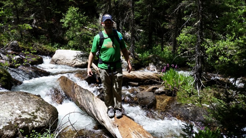 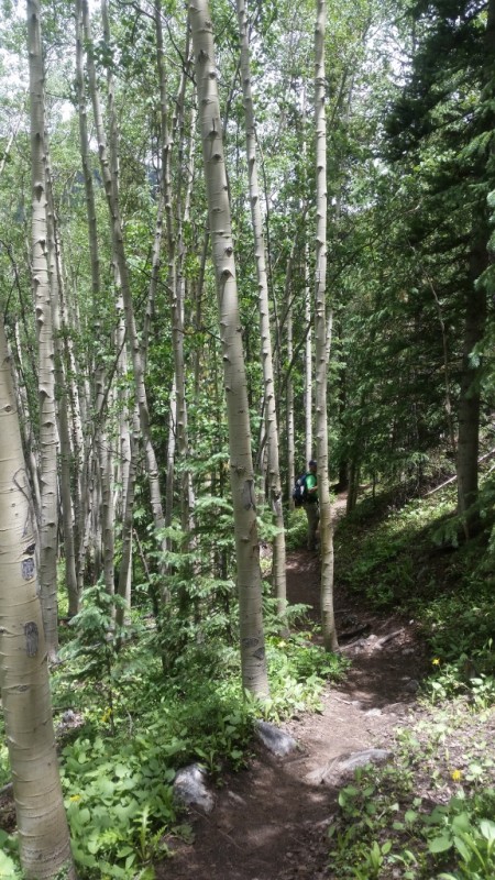   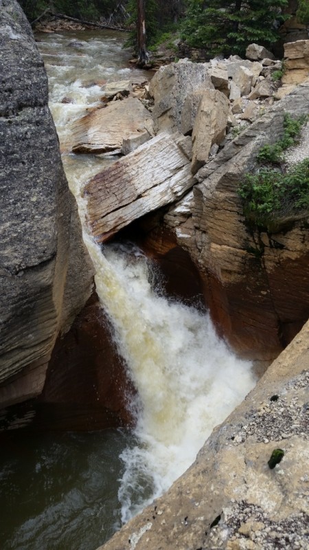 All in all, La Plata was a great hike even though it worked me over! And my advice is: the best way to prep for a 14er is to do a 14er! Thumbnails for uploaded photos (click to open slideshow):  Early start")
 Log bridge")
 Looking up at the switchbacks")
 The only snow crossing")
 Berg on the ridge")
 checking out the views (aka: the cookiehiker pose) :)")
 La Plata - so close but yet so far")
 Me on the ridge")
 Last of the snow")
 Group shot")
 Summit!")
")
 #30!")
 Dark storm clouds....Let's get out of here!!")
")
")
 looking back at Gloomy La Plata")
 Woo hoo!")
 180 panorama of bipolar weather")
 Me on the ridge")
 Sayers Benchmark")
")
")
")
")
")
")
")
 Aspen forest")
 Pedestrian bridge")
 raging (muddy) water")
 moody La Plata")
 Dark clouds")
|
| Comments or Questions | |||||||||||||||
|---|---|---|---|---|---|---|---|---|---|---|---|---|---|---|---|
|
Caution: The information contained in this report may not be accurate and should not be the only resource used in preparation for your climb. Failure to have the necessary experience, physical conditioning, supplies or equipment can result in injury or death. 14ers.com and the author(s) of this report provide no warranties, either express or implied, that the information provided is accurate or reliable. By using the information provided, you agree to indemnify and hold harmless 14ers.com and the report author(s) with respect to any claims and demands against them, including any attorney fees and expenses. Please read the 14ers.com Safety and Disclaimer pages for more information.
Please respect private property: 14ers.com supports the rights of private landowners to determine how and by whom their land will be used. In Colorado, it is your responsibility to determine if land is private and to obtain the appropriate permission before entering the property.


