| Report Type | Full |
| Peak(s) |
La Plata Peak - 14,344 feet |
| Date Posted | 07/19/2015 |
| Date Climbed | 07/03/2015 |
| Author | buckeyejes |
| Additional Members | AdDoBe |
| Dog days of snowmer |
|---|
|
La Plata Peak Route - NW Ridge Start - 6:04 AM Summit - 10:45 AM Left Summit - 11:30 AM Back to car - 2:15 PM We left Colorado Springs at 3am for the La Plata Peak trailhead. Our golden retriever, Grady, is retired from 14ers (you can read my previous Shavano trip report if you want to know why...), but we decided we would bring our other dog, Peyton along for the trip. We made it to an already crowded trailhead at 5:45am, and ended up parking just on the other side of the bridge. We got ready and left the car just after 6am. There were 2 bridge crossings. The first was a wooden bridge and easy to cross. Be sure to go right immediately after crossing. There were some folks milling about at this point wondering which way to go. 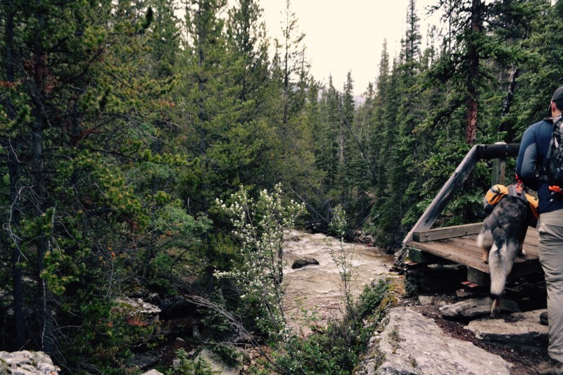 The second bridge was a log bridge over a creek that was already moving pretty fast. The crossing takes some balance, but was possible and surprisingly, Peyton went across pretty easily the first time. Adam went first, I unhooked Peyton, Adam called her, and she went across. Then, I went across. Success! Unfortunately, no pictures on this bridge....I put the camera away for this crossing. The trail was well defined, and the steps were in fantastic shape that was the first steep section. 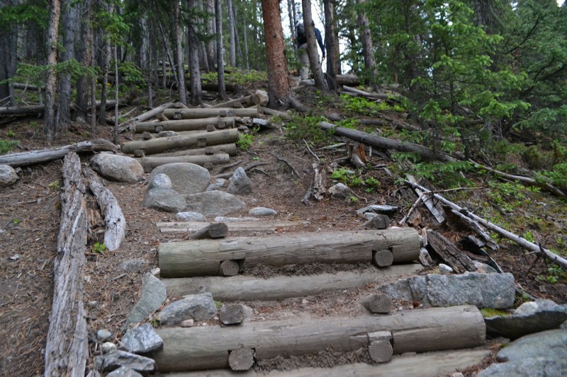 Just about the time we were walking next to the gulch and were a little out of the trees, we started to get rained on. We donned some rain jackets and didn't see lightning, so decided to press on. This was an enjoyable section of hiking.   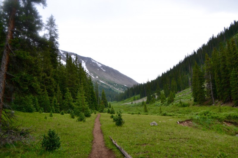  Pretty quickly it stopped raining, and we slowly started making our way up the steep gully. 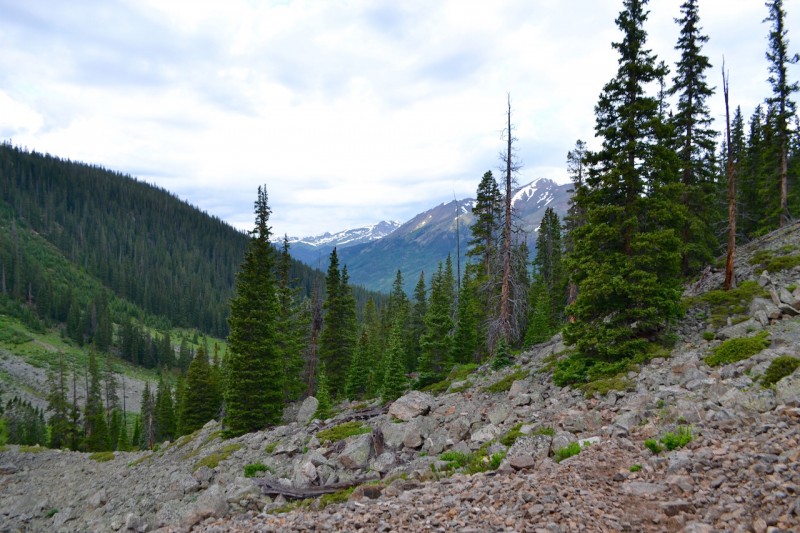 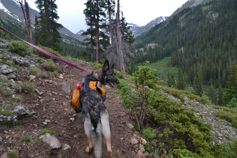  It was at this point that the bugs seemed to be the worst, so we had to stop to use bug spray at this point. After getting up the gully, we walked a bit to the very obvious square boulder. This was a very exciting landmark for Peyton, because this was the first snow patch we came across. All those promised snowcones started to become a reality for her.    We continued on the steep trail up to the ridge. Before heading to the Buttress, we took a quick break while Peyton had her fill of snow. We then continued toward the buttress, and the trip became increasingly difficult with the steepness. This climb felt long, but we cheated a little by being pulled up by a machine.    Once we were past the buttress, we actually opted to climb up the snow in microspikes instead of the talus to the right. The snow could easily be avoided if you wanted, but we wanted the more direct route, and Peyton really loves snow (if you didn't pick that up from earlier in the trip report). 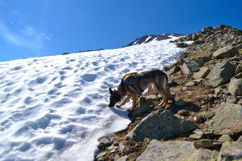   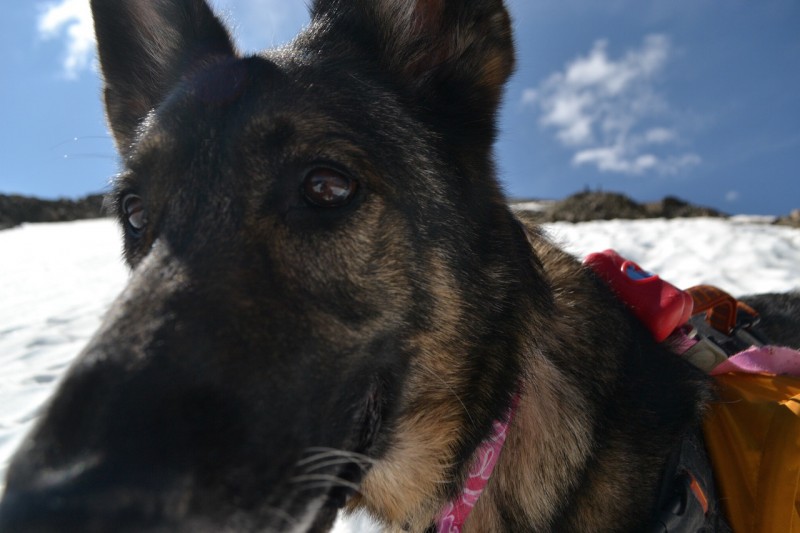  Once done with the snow field, the summit was still more than 500' of climbing to go. Once turning the corner, the summit was only a short slick walk to the summit. 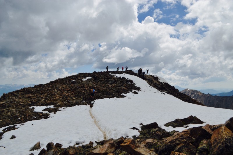 We certainly weren't alone on the summit, but we did enjoy some time on the summit. Adam napped for a bit, while I took some pics and chatted with some of the other people at the summit.   After Adam woke up and we got our usual family shot (minus the one furbaby still at home), we decided we had already pushed our luck with the weather, and we got ready to head down. 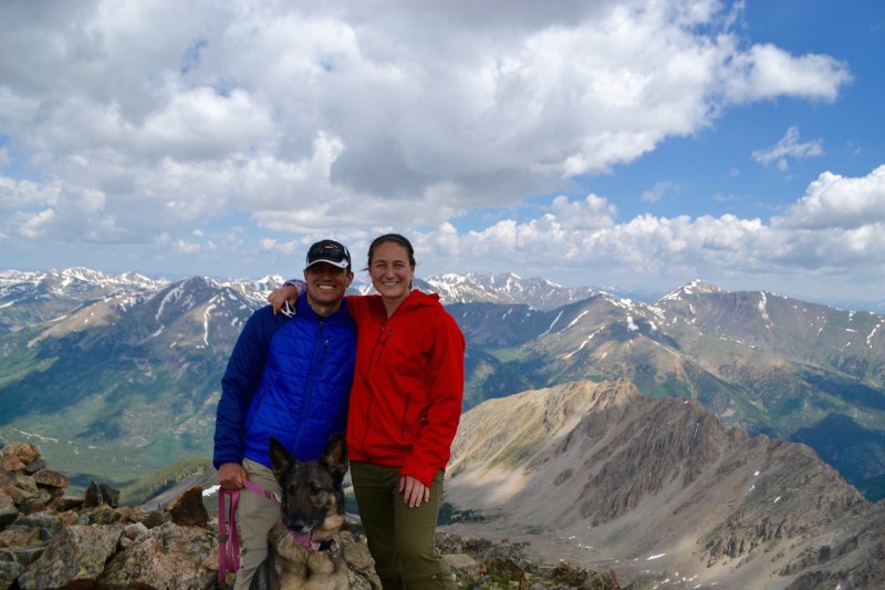 We made it back to the snowfield pretty quickly and found a great spot to get ourselves ready for a glissade. Since we carried the ice axes all the way up, we decided it was time to use them!! The glissades were a little short so we could scooch when we got a little too close to the edge and stay closer to the rock trail (and away from the fall line). We did save time, compared to those hiking down on the rock trail, and of course saved some energy! Peyton was confused, but enjoyed chasing us down, but there was a lab that came from the trail to sprint and chase Adam that was clearly having the most fun. Pure joy!!! The only issue was making sure the lab didn't get in the way of the ice axe.   We came to a slow stop (maybe not the best glissading, but still fun nonetheless...) and sadly resumed hiking when we realized the fun was over. We got back to the spot where we would start heading back down off the ridge, and we doffed the rain gear because we were starting to overheat, even though rain was imminent. Once we began this part of the descent, it was steep, but went relatively quickly. We kept moving at a fairly fast pace to try and beat the weather coming in and get back below treeline. Once we got back to treeline, the weather began rolling in, but at least we had a little protection. The trail through treeline was much longer than we remembered, but a nice gradual grade, so it wasn't too taxing. We were happy to see the steps, which was our sign that we were very close. We thought every corner after that was our log bridge that mean the car is very close! The rain picked up during this time, and we hustled until we finally reached the bridge. Once at the bridge, we tried to use the same technique, although we knew this was not going to be as easy with slippery logs as it was in the morning. We let Peyton go across after Adam made it. She slipped a few times, where I had to pick her up from her pack (glad she had that on!) and eventually she got across safely, and then I was able to get across. It continued to rain, but the car wasn't too far from that point. Once we hit the last bridge, we were homefree, even in the rain (and a tad bit of thunder). The car was a welcome site, and we packed up for a celebratory burger and beer at Eddyline. 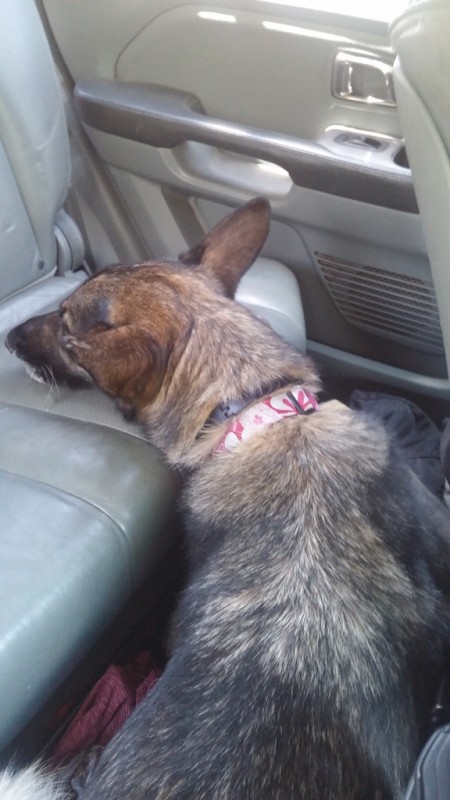 We were all so tired, but the hike was beautiful, and we were glad to use our day off to spend some time in the mountains. Thumbnails for uploaded photos (click to open slideshow):  First bridge crossing")
 Nice stairs!")
 The raging creek...")
 Where are the snowcones you promised, mom?!?!")
")
")
 Looking back as we started the steeper part")
 Peyton enjoying some views (or wondering why we aren't going faster...)")
 Getting even higher")
")
")
 Finally!! Snowcones!!")
")
 The evil marmot that scared our baby girl...")
")
 Can't. get. enough. snow.")
 Getting there....")
")
")
 Looking back down....")
 So close to the summit!")
 Peyton enjoying the summit")
 Oh sorry...were you trying to sleep??")
 The family shot (minus Grady)")
 We knew we brought though axes for a reason...")
 Peyton and Adam")
 On the way to Buena Vista...So tired after a long day, she couldn't even lay on the seat....had to be the floor with the")
|
| Comments or Questions |
|---|
|
|
Caution: The information contained in this report may not be accurate and should not be the only resource used in preparation for your climb. Failure to have the necessary experience, physical conditioning, supplies or equipment can result in injury or death. 14ers.com and the author(s) of this report provide no warranties, either express or implied, that the information provided is accurate or reliable. By using the information provided, you agree to indemnify and hold harmless 14ers.com and the report author(s) with respect to any claims and demands against them, including any attorney fees and expenses. Please read the 14ers.com Safety and Disclaimer pages for more information.
Please respect private property: 14ers.com supports the rights of private landowners to determine how and by whom their land will be used. In Colorado, it is your responsibility to determine if land is private and to obtain the appropriate permission before entering the property.

