| Report Type | Full |
| Peak(s) |
Castle Peak - 14,274 feet Conundrum Peak - 14,037 feet Snowmass Mountain - 14,105 feet |
| Date Posted | 05/12/2015 |
| Date Climbed | 05/26/2006 |
| Author | SchralpTheGnar |
| Elk Ski Extravanganza 2006 |
|---|
|
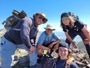
This is an old TR that I pulled off of TGR because all the images were broken and posted here because it's awesome and should be shared. Memorial Day Weekend Trip 2006 Elk Range Ski Extravaganza Peaks: Castle, Condundrum, and Snowmass Stats: 34 miles traveled, 11,500 vertical feet gained, 7,500 vertical feet skied. Team: Mike, me, Marcel, Cab, Gabe, and Hetzel. For the past 6 years, Memorial Day Weekend has been the weekend to get out and ski and camp. Over the past six years some things have changed, some things have stayed the same, some things have appeared to change but really have not, while others have appeared to stay the same but in reality have changed. One thing that has remained the constant arrow through the sand of time is that there are few things better than immersing oneself in the incomprehensible beauty of the mountains while enjoying the camradarie of life long friends. Day 1: We left Denver around 5:30pm and made the drive up over Independence Pass with Gabe and Hetzel right around sunset time. 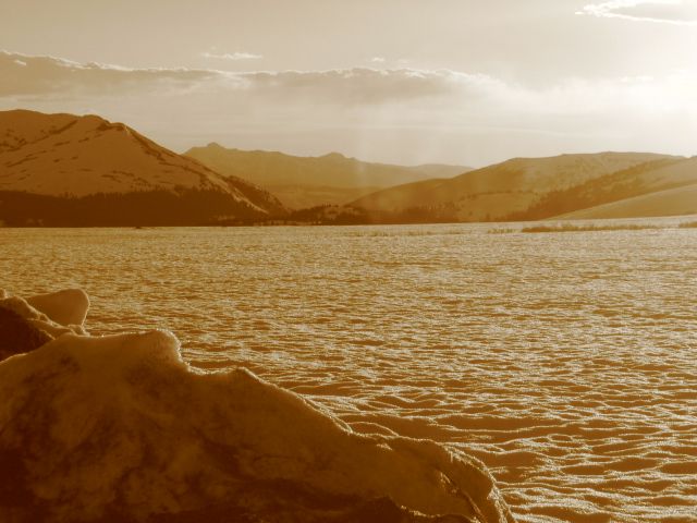 The rest of the team had found a campsite on the Castle Creek road right before the first bridge crossing around 9,700 feet. Here's a shot of climb2ski streching out the night before Castle, while the cycloptic Cab looks on, he recently had his right eye replaced with a Petzel headlamp. Due to this operation he decided he wouldn't be joining us on the next days ski, so it was just climb2ski and Irlts going for Castle and Conundrum. The plan was to climb and ski the Castle Couloir, then book over to Conundrum Peak and ski the Conundrum Couloir. 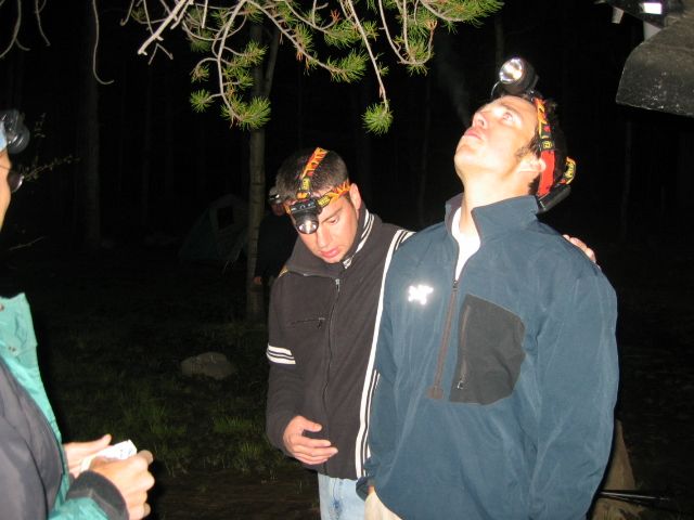 Day 2: After an hour or two of sleep, at 1am we began the hike into Montezuma Basin, about 4 miles and 3,000 feet of vertical from our camp. Around 4am I started to get very angry at the dark so the morning sun was met with a welcoming fit for a soldier returning home. The views began to unfold in dramatic fashion, here climb2ski crests the lower headwall into Montezuma basin. 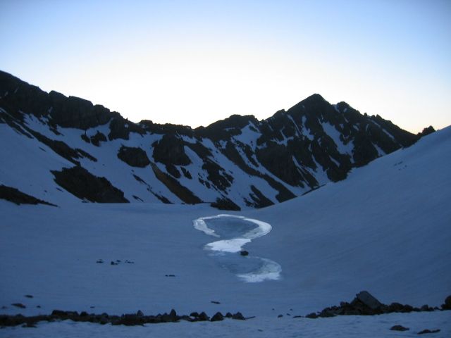 A lone apparition appears sillouhetted against the shadows, glancing up the couloir. 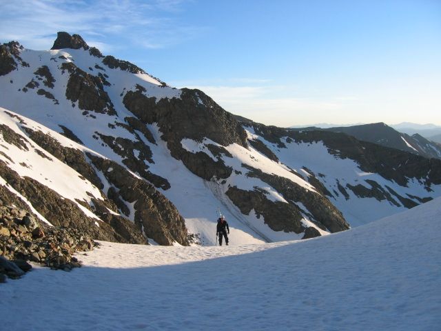 We made our way up the Castle Couloir with , crampon points and firm snow equals crazy delicious. climb2ski looming above it all on the summit of Castle. 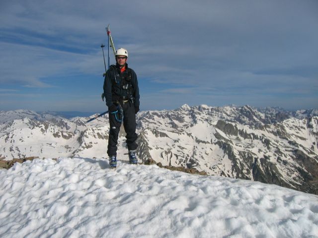 The 2ski bros on the summit of Castle 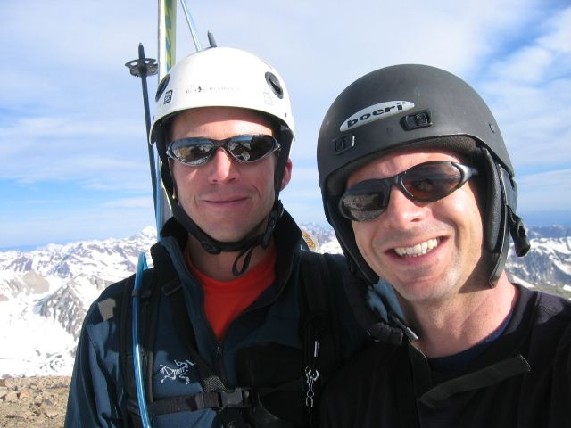 We got a nice view of our next goal while descending Castle. 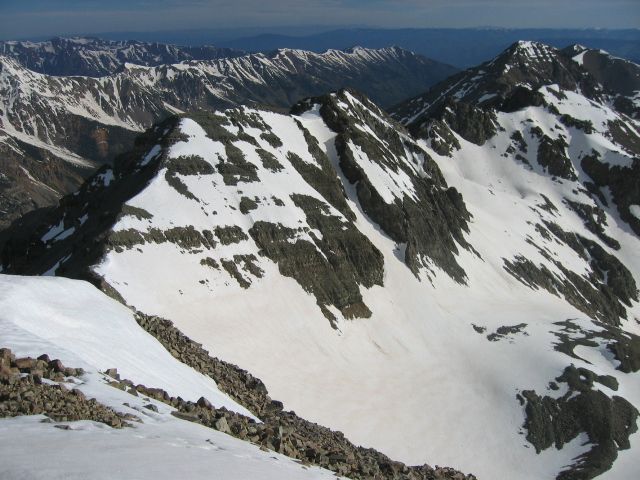 Mike in good form descending Castle  That was fun, let's do it again 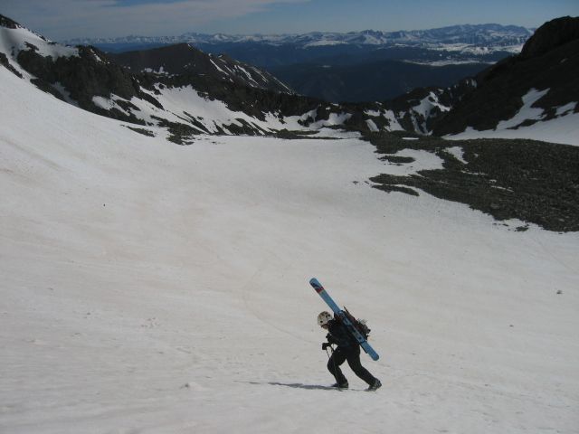 That was quick, we're back on the summit, Conundrum this time 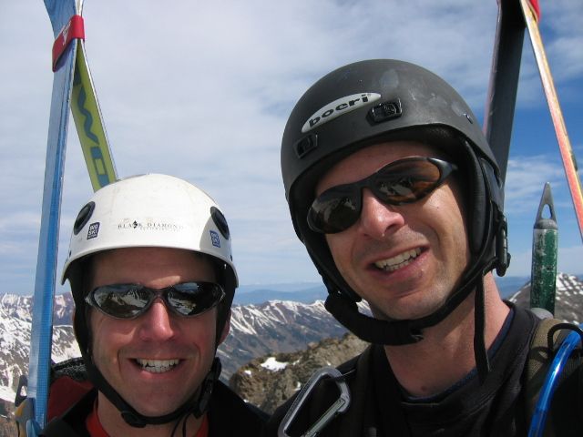 Aye, he's taller than Castle and shoots lightning out his arse 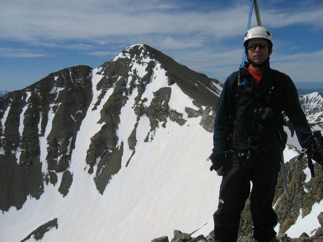 Mike dropping into the conundrum couloir. 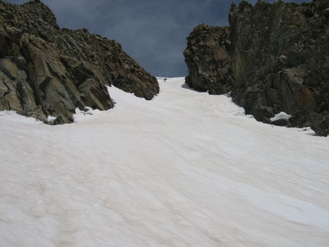 Hiking it back to camp in good style 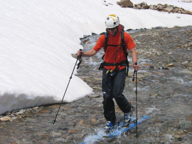 12 miles, 5,500 vertical feet, and 12 hours later we arrived back in camp, and met up with the rest of the team. Marcel keeping himself occupied with a variety of beverages. His rule of camp is always keep at least three types of drink within arms reach at all times. 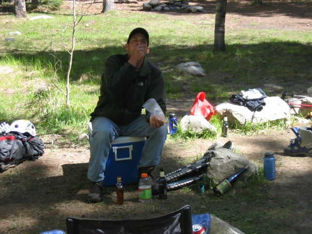 We packed up camp and headed back down the valley and over to the West Snowmass Creek trailhead. It was a nice place to camp filled with colorful characters questioning the whereabouts of barbecue sauce at 3am, and an inquisitive elderly German couple from Nebraska. Are you worried about people breaking into your car? Not really. Do you lock your cars? Yes. Do you have any sort of alarm system on the car that we should know about? No. So you're going to leave your cars here in the morning and won't be back for 36 hours, OK, got it. Day 3 A nice leisurely hike up to Snowmass Lake is a great way to spend a day; it's about 8 miles and 2,700 vertical feet up to the Lake and quite scenic. The hike starts low in the valley around 8,500 feet and ascends a long, beautiful valley for the first 6 miles. 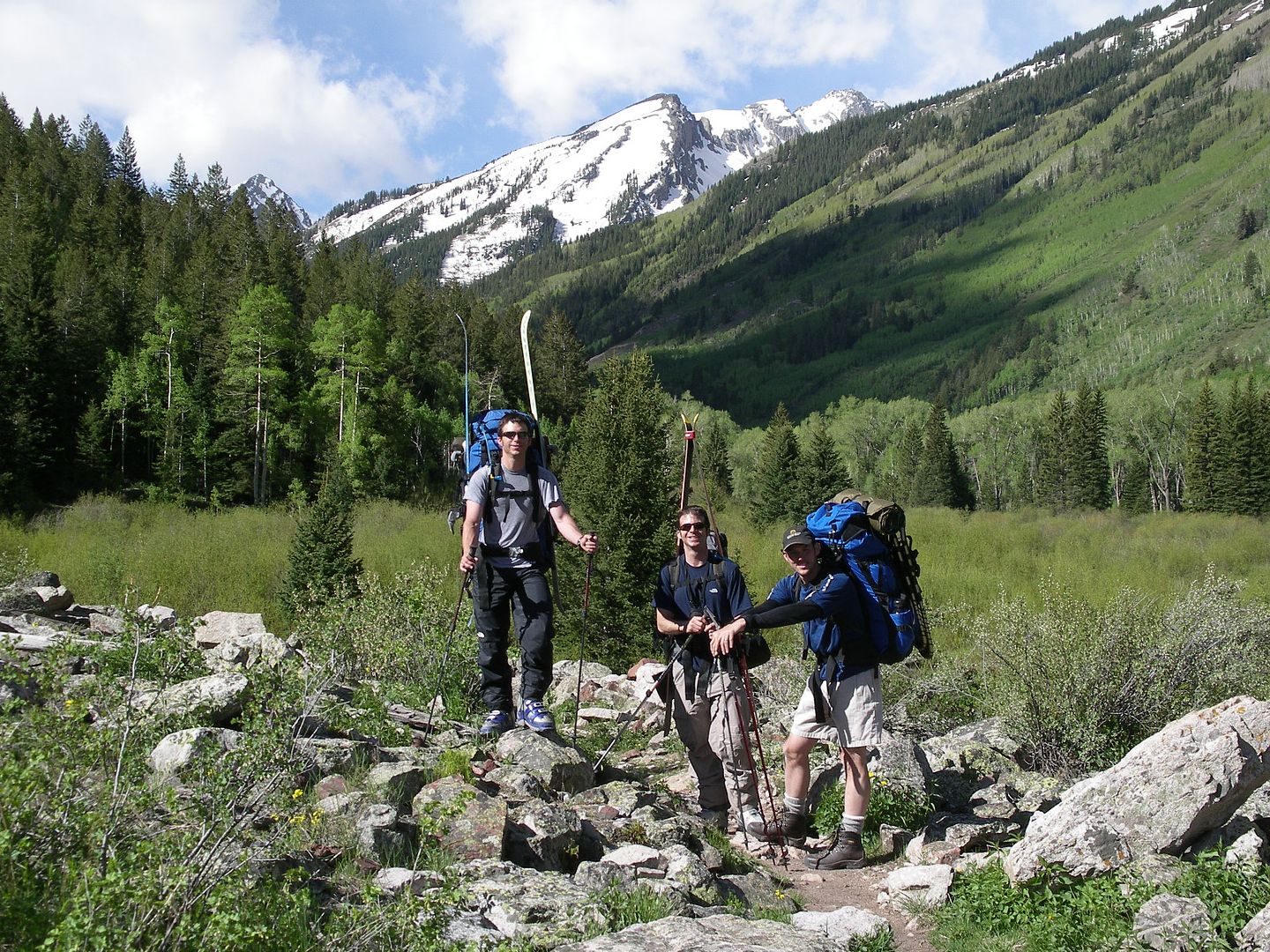 Gabe heading up the valley 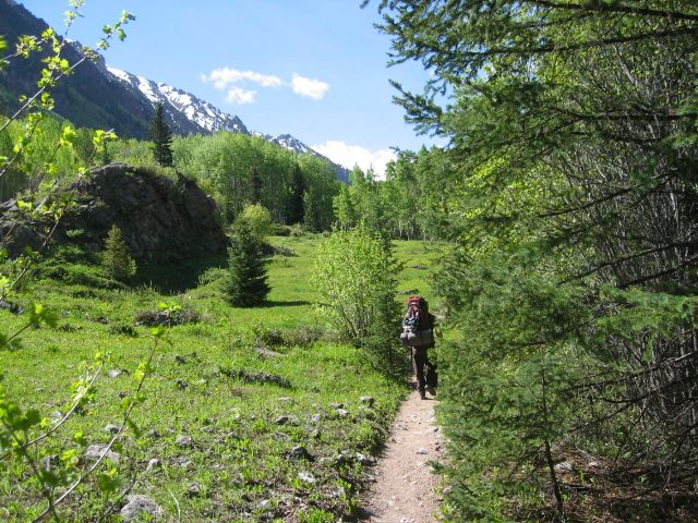 Mike, Marcel and Hetzel strolling through a dewy meadow 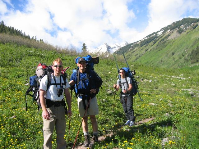 After 4 miles you get a nice view of some mountain, possibly Clark Peak, maybe Snowmass, or it could be Mount Toll, no one knows. Gabe was thoroughly confused by the whole lot of it. 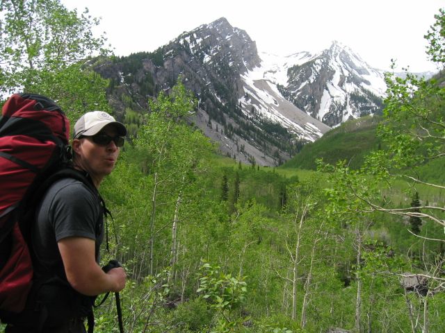 After 6 miles you have to cross Snowmass Creek to begin the climb up from Oxbow Lake up to Snowmass Lake. You can either do the log jam or wade the river, the choice is up to you. Climb2ski chose wisely, or poorly depending on how you look at it. 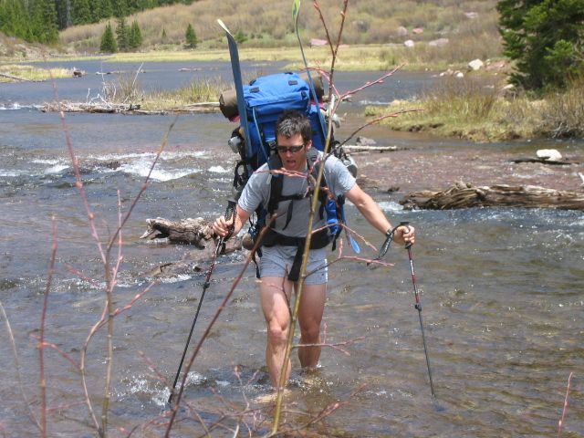 2 miles after the stream crossing we reached our destination, finding a foggy Snowmass Lake. 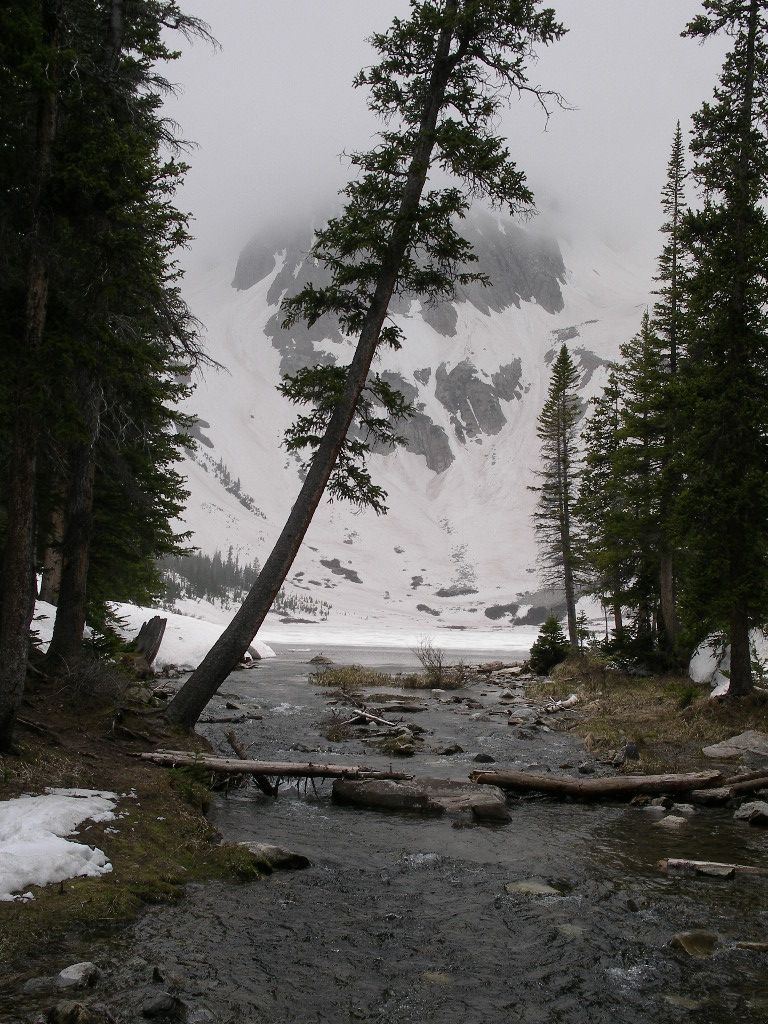 Within 30 minutes, a raging blizzard began raging. It snowed pretty heavily for about 3 hours. Some sought shelter in tents, others sought shelter in a bivy sack, while others still sought shelter in a bottle of wine and a song and dance rendition of the movies Ray and Help by Gabe. He's a solid entertainer with a wide range of vocal stylings. The tent people were entertained and warm, smart people. 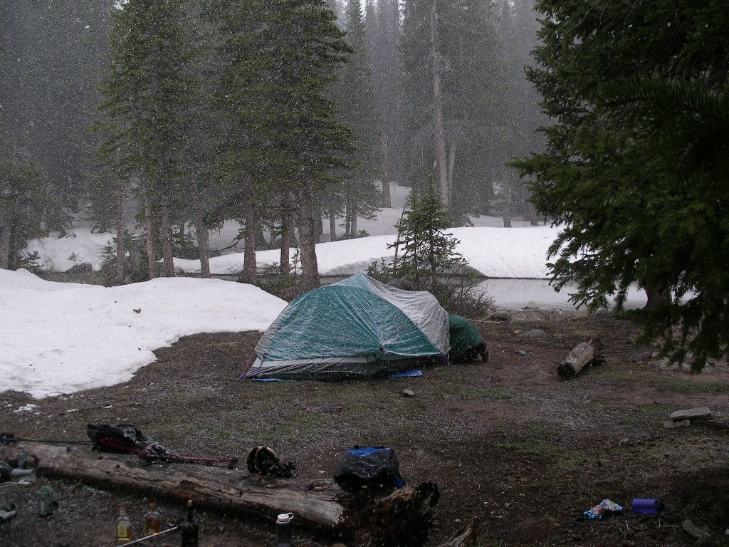 Day 4: Up at 5am, Mike and I were ready to get Snowmass done. The next 6 hours are to be woven with a canvas of words as I virtually forgot my camera on this leg of the trip. I always keep my camera in the top of my pack, but for some reason the night before I put it into the bottom of my pack. It was carried to the top of Snowmass completely unbeknownst to me. This is going to be tough to visualize for the multimedia generation. The traverse around the lake started off smoothly, as we skinned and were making good time. Splash!! My right leg is in the lake, this is no good. Fortunately I have lots of falling through ice experience, so after emptying the water out of my boot we pushed on up the lower headwall, with my right foot frozen and feeling a good 5 pounds heavier than my left. We crested the headwall as the sun began to bath the slopes of Snowmass in a gentle pinkish hue. With a fresh coating of snow, the view of Snowmas from here is simply stunning. The sheer scale of this mass of snow is incomprehensible, certainly one of, if not the most beautiful places I've ever been. The word on the street is that you can climb to the summit on steep snow during a good snow year, so we eyed a chute that reached about 50 feet below the summit and set our skins in that direction. We reached high in the basin, around 13,500 feet and threw the skis our back, the snow was soft enough that crampons weren't necessary, but also so soft that it would involve some significant step kicking. We took turns breaking the trail up the slope and it was getting steep, very steep, very quick. Several times we were almost thwarted, unable to ascend due to the steepness and the softness of the snow. However, a small traverse 5 to 10 feet to the left or right would find climbable snow, and we crested the ridge just below the summit. We reached the summit and found a chute leading directly down of the summit, it too was very steep, but since we hadn't climbed it and the snow conditions were questionable we decided to just ski the line we had climbed and just tell everyone that we skied directly off the summit. With the skis on my feet I began the side slip down the chute, the first 100 feet were the steepest, we measured it around 63 degrees on the inclinometer, to top it all off there were several jagged rocks sticking out of the snow directly below me. Fun!! While on the ascent of this you would break through the top crust and post hole, with the skis on you floated on top and got that nice reassuring sound of skis scratching on frozen snow. The sideslip ended and I traversed left and down to the bottom of the slope in order keep a good eye on my brother as he began the descent. He made it down in good form, nice and in control. He used his ice axe for balance on the upper steep section, then traded it in for his poles and some turns. With the hardest part behind us, we now had about 3 miles and 2,500 vertical feet of skiing with 4 inches of fresh snow below us. Just enough to make it my most favorite ski descent to this date, the run just seemed to last forever, we farmed turns, made 8's, straighpointed the flats, and happily glissed our way back to camp. Back in camp Hetzel was able to snap a few pictures of us on our descent. Can you see us? 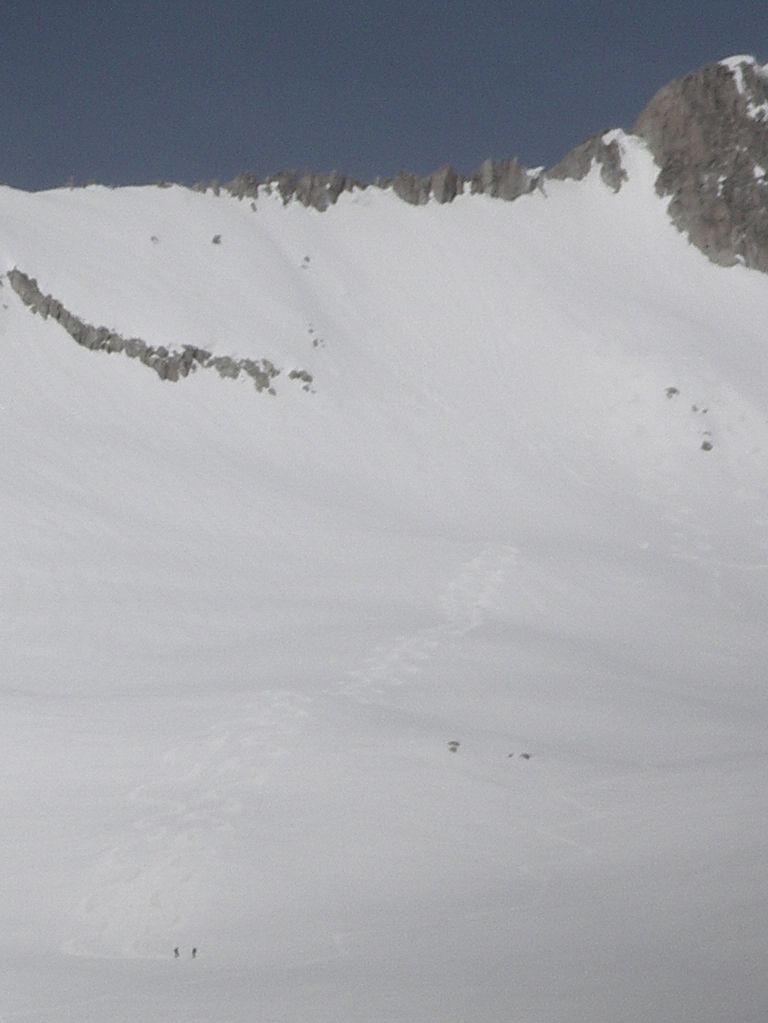 Skirting the Lake on our way back. 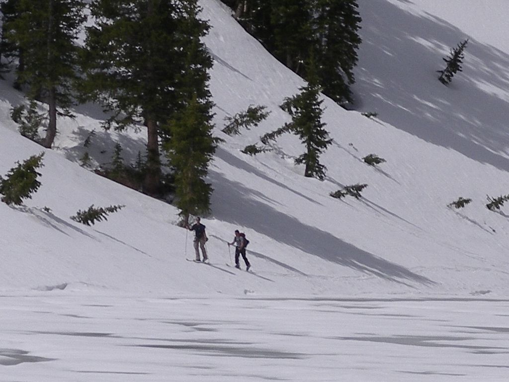 We arrived back in camp greeted by a hero's welcome, with stoves boiling water for food, and scotch to celebrate the descent. It's always nice to sit and relax and look up at 3,000 feet of snow. Snowmass Lake with Snowmass Peak in the distance. 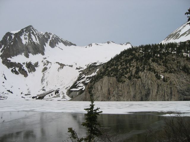 Appropriately named Snowmass 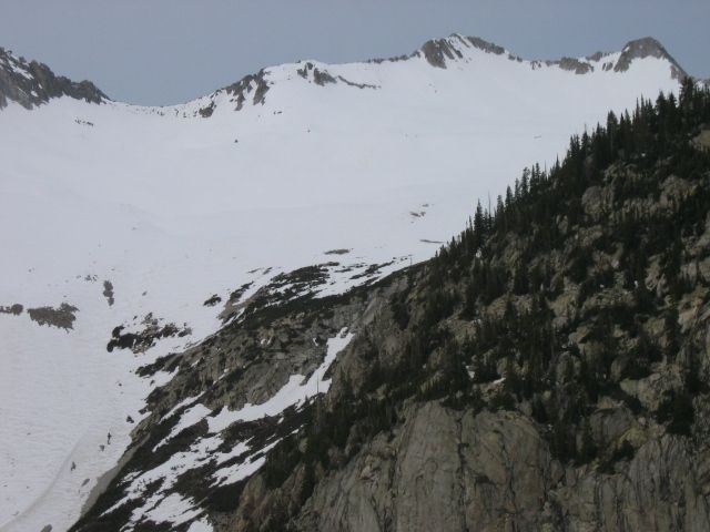 After relaxing and refueling for an hour we started the 8 mile hike back to the trailhead, fortunate happy clouds kept the hike out pleasant and cool. We opted for the log crossing on the way back. 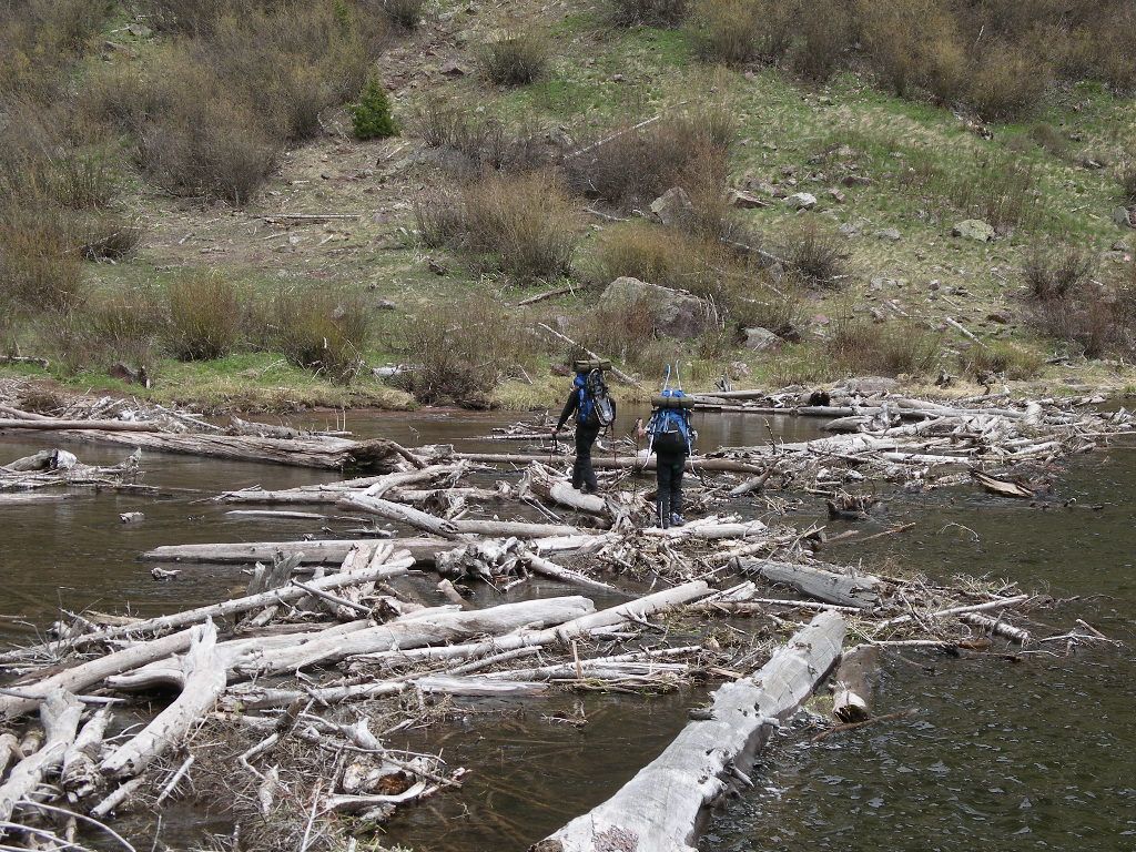 The team that all helped make this the best Memorial Day Weekend trip ever.  Back at the trailhead we had a toast to all those that gave their lives defending this country, especially our Uncle Leo Robert, so that we can enjoy freedoms such as these. We are forever in your debt and truly grateful. |
| Comments or Questions | |||||||||
|---|---|---|---|---|---|---|---|---|---|
|
Caution: The information contained in this report may not be accurate and should not be the only resource used in preparation for your climb. Failure to have the necessary experience, physical conditioning, supplies or equipment can result in injury or death. 14ers.com and the author(s) of this report provide no warranties, either express or implied, that the information provided is accurate or reliable. By using the information provided, you agree to indemnify and hold harmless 14ers.com and the report author(s) with respect to any claims and demands against them, including any attorney fees and expenses. Please read the 14ers.com Safety and Disclaimer pages for more information.
Please respect private property: 14ers.com supports the rights of private landowners to determine how and by whom their land will be used. In Colorado, it is your responsibility to determine if land is private and to obtain the appropriate permission before entering the property.