| Report Type | Full |
| Peak(s) |
La Plata Peak - 14,344 feet |
| Date Posted | 07/28/2014 |
| Date Climbed | 07/26/2014 |
| Author | OutbackDobbs |
| La Plata's Northwest Ridge Again Open to Hikers |
|---|
Basic Info
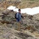
Topographic Map of the Route  I hiked up the 14,433 foot Mt. Elbert via its Southeast Ridge I had some great views of the fellow 14er La Plata Peak which rises adjacent to Mt. Elbert. La Plata is 14,336 feet in elevation which makes it the fifth highest mountain in the Rocky Mountains. However, visually La Plata just looks so much more impressive than many other peaks in the Sawatch Range, especially because of its famed Ellingwood Ridge:  This ridgeline is considered one of the great mountaineering challenges of Colorado. This long ridgeline is named after one of the most famous mountaineers in Colorado history Albert Ellingwood who first completed the two-mile long traverse of this ridge back in 1921. This is pretty impressive considering the peak was first climbed in 1873 by members of the Hayden Survey who gave it its name La Plata which is Spanish for silver in honor of all the mines in the area. So for nearly 50 years no one had been able to successfully complete this traverse until Ellingwood did it. Even more impressive is that a successful winter traverse of this ridge did not happen until 1974. According to the book "A Climbing Guide to Colorado's Fourteeners: Twentieth Anniversary Edition", on January 12, 1974, Craig Koontz, Gary Kocsis, Chuck Tolton, and John Lafferty began a traverse of the ridge. What they planned to be a two day traverse turned into a four day marathon which they completed on the afternoon of January 15, 1974. Pretty amazing perseverance by the four of them to continue on with this traverse despite the conditions that were slowing them down. Knowing I am no Albert Ellingwood I decided to stick to the standard Northwest Ridge for my hike up La Plata Peak. I left Colorado Springs at 1:00 AM in the morning and arrived at the trailhead at 3:50 AM. The trailhead was packed with cars. The standard trail had just recently reopened after being closed for weeks due to a bridge repair. It appeared that a lot of people were taking advantage of the weekend to hike this peak due to its recent reopening. Here is a picture from later in the day of the parking situation at the trailhead:  I was able to find a place to squeeze in and was heading down the trail by 4:00AM. I wanted to get an early start on this trail because of the thunderstorms that were forecasted to begin around 11:00 AM that day. Here is a picture from later in the day of what the new bridge looks like:  After crossing the bridge I had to follow a dirt road through private property for about a quarter mile before seeing the official trailhead signs on the left side of the road. Once again here is a picture from later in the day:  From here I began to follow the trail through a dark forest that had a few social trails that could be confusing at times but reflective tape on the trees helped keep me on the main trail. I then crossed over the below bridge, with once again the picture being from later in the day:  Due to the darkness I could not see the creek below, but I could sure hear it roaring. Later in the day I would see there was actually a small waterfall near the bridge. After the bridge I made a sharp right to stay on the main trail and continued to ascend through the dark forest. A short distance later I had to do another creek crossing but this time there was no bridge. Instead I had to cross a few small logs put across the creek:  My trekking poles were helpful in keeping my balance as I crossed the creek without incident. As I continued up the trail I was impressed with whoever has been doing maintenance on the trail because it is in good shape to include the installation of a number of wooden steps to help with the ascent through the forest:  I did continue to have issues with the social trails though. I nearly went off the main trail by ascending a hillside that was marked with reflective tape. I consulted my 14ers.com app and could see the route description did not match the direction the social trail was going. So I went back to the creek and continued to follow the creek. The trusty 14ers.com app saved the day again for me! I would find out later it is much easier to avoid social trails during the daylight hours. Anyway as I walked through the dark forest I had my bear repellant system on which is otherwise known as playing the AC/DC Live album on my iPhone. It seems to work because I have never had any wildlife encounters when I have hiked in the dark on these remote forest trails. As I walked through the darkness though I was a bit surprised when I saw a light suddenly appear in front me. It ended up being a tent. I quickly turned down my bear repellant system hoping I didn't wake them up with it. After a couple of hours of hiking I found myself rising above treeline and also had enough daylight to begin taking some pictures. Here is a picture of the valley below me that I had just ascended:  A good switchbacking trail then ascends a gully that leads to a ridgeline that would take me to the summit:  There are some nice steps constructed on this section of the trail to help with gaining the ridgeline:  Here is the view I had once I reached the ridgeline of the route leading to the summit as well of the famed Ellingwood Ridge:  From the ridgeline I could also see the 13,500 foot Red Mountain B in the distance:  Does anyone know what caused the red color on this mountain? Volcanism perhaps? It definitely stands out among the green and gray colors of the surrounding mountains. After taking in the views I continued my hike up the now rocky ridgeline leading to the summit. This section of the trail gets rockier, but there is still a good trail in place to help with the ascent:  There was a lot of talus rock to deal with, but for the most part there was a trail to follow though social trails did get me off course a few times, but I quickly regained the main trail:  I then came to a less steep section that led to the final summit approach:  There were a few snow fields remaining on this section of the mountain, but they were all easily avoided. I followed a good trail up the steep section of rock until I saw the false summit in front me:  I hiked up to the top of the false summit and could see the real summit in front of me:  I reached the summit of La Plata Peak at 7:50 AM making this a 3 hour and 50 minute climb. Considering the route finding challenges in the dark I was happy with my time. The weather was just terrific on the summit with hardly any wind. The sky was a little bit overcast due to the impending storm that was supposed to sweep through the mountains around 11:00 AM. Here is the view looking North where the 14,433 foot Mt. Elbert could be seen on the far right and in the distance the 14,421 foot Mt. Massive could be seen as well as the Ellingwood Ridge down below:  To the Southeast I could see every 14er in the central Sawatch Range except Mt. Columbia which was obscured by Mt. Harvard:  Even further in the distance I could see every 14er in the southern Sawatch Range:  To the South I could see the beautiful 14,003 foot Huron Peak which is my favorite mountain in the Sawatch Range:  Here is a panorama picture I took looking towards the South from the summit of La Plata:  Here is a panorama of the view looking towards the West:  The two 14ers, the 14,092 foot Snowmass Mountain and the 14,130 foot Capitol Peak were the most impressive looking mountains looking towards the West:  I ended spending an hour on the summit of La Plata because of how perfect the weather was. I also spent time talking to some of the people that began to trickle up to the summit. A lot of really cool people hiked up La Plata on Saturday. For example there was a group of trail runners that came up about 30 minutes after I reached the summit and one of them ended up being Brandon Stapanowich who recently ran up the Manitou Incline 22 times in 24 hours. You do not even have to have ran the Incline before to be impressed by this when you consider that he gained nearly 44,000 feet of elevation during those 22 ascents. Very cool to have ran into the guy on the summit of La Plata. I could have stayed up on the summit longer, but wanted to get back to the trailhead before the projected thunderstorm rolled in. I started down from the summit at about 8:50 AM. It was an uneventful walk down until I met another really nice couple who found my Oakley sunglasses on the trail that I had accidentally dropped in the darkness earlier in the morning. That was really cool of them to return my glasses and just goes to show what awesome people can be found hiking up 14ers. Also on the way down I enjoyed seeing all the wildflowers in bloom:  For anyone looking to view wildflowers while hiking up a 14er, I highly recommend checking out La Plata because its upper slopes just above treeline are covered with flowers to include many columbines:   At about 11:00 AM I could begin to feel some raindrops come down as I was now walking through the woods and nearing the trailhead. I arrived back at the trailhead at 11:20 and could see that La Plata had a lot of dark clouds forming around it:  In total it took my 7.5 hours to do the round-trip hike up La Plata. 3 hours and 50 minutes going up, 1 hour on the summit and 2 hours and 40 minutes for the descent. The weather was great until the forecasted thunderstorm rolled in. There was a lot of people up on the mountain on Saturday that hopefully did not have their day ruined due to the rain. Overall though I liked La Plata quite a bit; a nice mountain, with a good trail, beautiful views, some interesting history, and plenty of great people to meet hiking up it. |
| Comments or Questions | ||||||
|---|---|---|---|---|---|---|
|
Caution: The information contained in this report may not be accurate and should not be the only resource used in preparation for your climb. Failure to have the necessary experience, physical conditioning, supplies or equipment can result in injury or death. 14ers.com and the author(s) of this report provide no warranties, either express or implied, that the information provided is accurate or reliable. By using the information provided, you agree to indemnify and hold harmless 14ers.com and the report author(s) with respect to any claims and demands against them, including any attorney fees and expenses. Please read the 14ers.com Safety and Disclaimer pages for more information.
Please respect private property: 14ers.com supports the rights of private landowners to determine how and by whom their land will be used. In Colorado, it is your responsibility to determine if land is private and to obtain the appropriate permission before entering the property.