| Report Type | Full |
| Peak(s) |
Mt. Yale - 14,200 feet |
| Date Posted | 06/26/2014 |
| Date Climbed | 06/23/2014 |
| Author | Lville |
| Mt Yale - possible superhuman encounter |
|---|
|
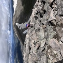
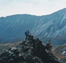
Summary This is a trip report of Mt Yale in which, in addition to hopefully providing some useful beta (OMG did I just use that word?), the author offers advice on camping gear, exercise tips, some self-psychoanalysis, gentle scolding of those who pronounce it "Byoonuh" Vista, reviews of CD's, restaurants and campgrounds, meets a blue dog, and possibly encounters a superhuman mountaineering celebrity. Or, you can just look at the pictures. My trip report follows, but first the "superhuman" part for those interested. I think I exchanged greetings with 14er phenom Andrew Hamilton around 7 AM or so on his way down the mountain in his current quest to summit all 58 14ers in a record-breaking ten days. The thought that it could be Bad Dad entered into my mind only briefly (who would be coming *down* the mountain that early?) but that possibility seemed very unlikely. I was curious enough to check the forum thread (only the longest thread since "Frapping" became a part of the climbing lexicon) and, sure enough, the timing was about right. No entourage though as I might have expected. Just a serious looking hiker on his own with a beekeeper-like headdress and just time enough to say hello as he passed. Not really running, but all business. If that was Andrew, what an honor and a coincidence to share the mountain with the man! My mind can't even grasp the difficulty of doing what he does. Go Andrew Go! Back to the rest of my story ... Stats Trailhead: 5:45 AM. Denny Creek. SW approach. Top: 10:00 AM (lost 20 mins getting lost) Depart 10:30 AM Trailhead: 2:15 PM (lost 30 mins at top getting off route again, damn. Plus lots of pix, conversations, rests) Roundtrip minus off trail and sightseeing at top: 7 hrs 15 mins Temps: mid to high 30's at start with a few innocent clouds. 70 at finish, dark clouds, some rain in the vicinity, but not on Yale. Elevation: 9900 to 14,196 Distance: 9.5 miles RT Intro In some ways, this 14er hike - my first of 2014 and 11th total - started in August of last year. I've lived near Boulder for 20 years, but it was never a priority to hike/climb 14ers and it never occurred to me to actually count them, as I just hiked here and there very sporadically for various reasons - none of them having to do with a list. But that was before I climbed Longs Peak last summer. After Longs, things changed. Whereas I had previously imagined that I *might* climb a small handful of 14ers (and why would you, it's so exhausting, painful, and a little dangerous!), it suddenly dawned on me that I *could* climb 40-45 or more of them and the idea of doing so became very alluring. Then strange things began to happen. I started reading forum threads going back to 2007 or so to hear debates about everything from comparisons of various Class 3 and 4 climbs, to the relative merits of sneakers vs boots. I read dozens of trip reports to the point that I think I can contribute fairly intelligently to a conversation about every 14er in CO. I studied up on my Colorado geology. I purchased a physiographic map of CO and some colored push pins. I joined the Colorado Mountain Club and took Basic Rock School to learn about technical climbing with a goal to become more comfortable with some of the more difficult 14er routes (and I liked it). And I bought lots more gear, much of it ultralight, in the hope of eventually backpacking in to the mountains that require it. But some good things happened too! Mostly, I continued to exercise and eat better. And I waited ... and waited for the summer 14er season to arrive which for me is July/Aug/early Sept when the snow is melted off. Except that as I kept a watchful eye on the "conditions" reports, I realized that there were a few routes available to me in June. No time to lose! Having either climbed or read up on each of CO's mountain ranges - the vibrant volcanic San Juans, the crumbling and fearsome Elks, the juggy sedimentary Crestones and the forbidding Little Bear hourglass in the Sangres, I tended to look down my nose at the Sawatch mountains. A relatively featureless pile of Class 1 and 2 rocks. Booorrrrinnnggg! But of course that is a shortsighted viewpoint. Mt Yale was wonderful! On my short resume, it was maybe the best hike up to treeline of any of my 'teeners through aspen groves and fragrant pine deadfall with the opportunity to walk along and across a captivating stream. The part above treeline wasn't too shabby either. And I remembered the awe that I felt years ago when I first came down hwy 285 and stopped at the overlook to take in the imposing Mt Princeton and its associated institutions of higher climbing. Since that first visit, I've traveled this route many times, and I never fail to stop at the overlook to re-read the nicely descriptive signs at the picnic shelter while gazing across the wide, flat, faulted valley and feeling the power of this majestic range. 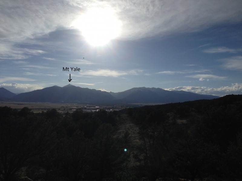 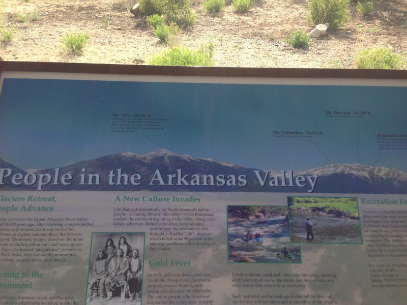 Prep In addition to the CMC activities and the stairmaster, treadmill, and stationary bike, I took relatively short hikes up Mt Sanitas and Green Mountain near Boulder. I had planned a couple more longer hikes before heading southwest into the heart of the Rockies, but I decided to skip that step since the big mountains were waiting and the season is short. My original plan up until the day of departure for Buena Vista was to get a twofer with Belford/Oxford, but I wisely realized that one of two things would likely happen. Either I would get to the top of Belford and be too tired for the extra down and up to Oxford and back again, or I would summit Belford and push forward dangerously to Oxford under threatening skies. If you're trying to touch 'em all, you don't want to do Belford and not get Oxford. So I went back through the conditions reports and realized that Yale would fit the bill perfectly for an early season summit attempt. I printed out the topo map and the entirety of the route description complete with color pictures, packed up my truck, and headed out on a pleasant Sunday afternoon for my first Sawatch 14er - Mt Yale. Part of the fun of my Yale experience was trying out my new 2 lb 1-person tent (2-person actually, but you can't fit two people comfortably in those things), along w/ my new ultra-light sleeping bag and pad. I had already set up my rig earlier in the week in my living room to test it out for a night like a 14 year old. Since I pitched my tent next to my truck at the campground on Sunday night, weight wasn't a concern in this instance, so I enjoyed the luxury of two large comfortable pillows and extra blanket - but didn't need the blanket. I can recommend the "Collegiate Peaks" campground about a mile east of the Yale trailhead. $17 with outhouses and only half full in late June on a Sunday night. And there's another one about a mile to the east towards Buena Vista. Part of the attraction of Yale is that it is so accessible - paved road right up to the nice parking lot at the trailhead, basic facilities provided. No debating whether to rent a jeep or not. The Quincy steakhouse in Buena Vista gets a thumbs up. Big hiking meal for a decent price as long as you want an OK steak, potato, and salad - I don't think they served anything else other than dessert. I wished that I'd had my wife and/or sons with me or the company of another hiker, but I enjoyed the freedom that attends going solo. The hike I set the alarm for 4:30 AM and slept fairly soundly up until then. The comforting white noise of a nearby stream in the campground masked the sound of the bears and mountain lions circling hungrily about my tent. My plan was to meet another 14ers.com member at the trailhead at five, but I ran a bit late in the dark. The other party was at the trailhead, but I encouraged him to go on ahead as I was afraid of slowing him down further, and as I saw a few others at the trailhead I became less concerned about flying solo. I'm guessing I saw maybe 25 people in all over the course of the day on the trail on this Monday and I was getting started earlier than most of them. I popped my three Advil and I was finally ready to set off along the obvious trail at 5:45 AM. 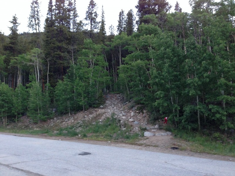 The memory plays tricks, and there is an easy temptation over the winter to reduce the difficulty of 14er hikes to a series of balloons on a map. How hard could it be? Despite being in perhaps the best shape I've ever been at the start of a 14er jaunt, the realities quickly set in as my heart rate increased and breathing became more labored, but I moved along at a decent pace up through the woods, happy to be on my way. One of the dangers of hiking alone is that a mindsong is likely to find its way in. This morning it was "Let's Hear It for the Boy" from the Disco era. Don't ask me why. Maybe I had heard something like it on the radio the night before. Maybe it was just self-congratulatory or a symptom of age regression. I guess I was hoping for something even more triumphant like "Eye of the Tiger". In any event, there was nothing I could do about it as it accompanied me for the next two hours all the way to treeline. Now, it is almost impossible to get off-route on this well-defined trail in snow-free daylight, but I managed to anyway. I *did* see this sign to go right about a mile up .... 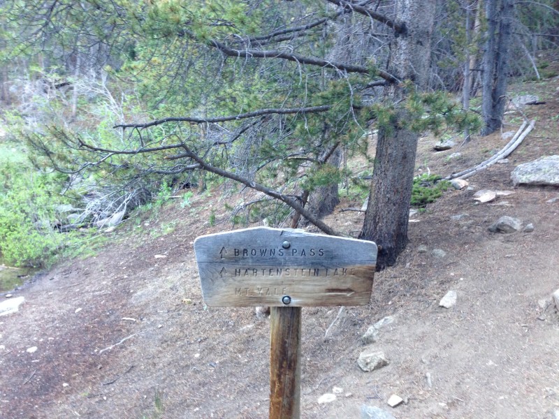 ... but then a bit farther on, I encountered this little head fake that leads you to the stream.  The correct route zig zags back and up to the left, but enough people and/or animals went straight to the stream, leaving a decent looking path. With my mindsong playing as a distraction, I took the little path to the stream and stopped to contemplate. A very large tree lies across the stream but it seemed too far above the water to be the correct course, so I headed upstream, looking for the place to cross. It wasn't entirely my fault as a few other misguided individuals had clearly gone before. I searched upstream for several minutes to no avail, and then back down to the tree. After convincing myself that the route description would have shown a picture of this tree, I retraced my path back upstream and found a decent place to cross. Still no path. So back downstream I went, along the steep bank, sliding a few feet downhill at one point, mindsong temporarily suspended, until I got back to the big tree. I looked up and saw another hiker back where I was supposed to be, so I re-crossed the stream, found my obvious error, and caught up with a couple from Michigan. Just look around you and you won't make this dumb mistake. I was a bit peeved at myself because I was making decent time and had just lost 20 minutes and felt foolish. The mental jukebox sprang to life once again. "Let's hear it for the boy, dah, dah ... let's give the boy a haaaa-aa-aaa-a-a-a-annnnd ..." 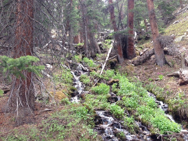 Shortly thereafter (or shortly before - can't be certain) I saw whom I now assume was Andrew Hamilton come down the trail, pursuing the 14er time record. He nodded, said hello, and moved on. I almost stopped him but he seemed to be on a mission - which I guess he was. I'd feel awful if I had detained him to comment on the weather and kept him from breaking the record ... 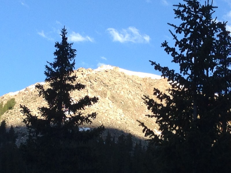 This mountain up to the left was very interesting, but kind of demoralizing as it looked *much* higher than where I was currently, one hour or so into the hike. My topo map suggested that it was at 12,325 ft. With Yale not yet in sight, it was hard to fathom that I had to get even with the top of this mountain, and then go an additional 2K! I also kept noticing the unusual "O" on the mountainside to the southwest.  The rest of the trip up was largely uneventful other than the usual awe-inspiring views and I guess the fact that at some point "Let's Hear It for the Boys" was mercifully replaced by Anders Osborne's "47", the origins of which were less of a mystery to me.  I didn't feel much of a chill in a synthetic tee and fleece vest as long as I was moving, but gloves were handy both for the cold and for the trekking poles. Don't forget the poles. Mandatory over 40 if your knees are like mine and highly recommended for everyone else. Treeline seems rather high at 12,200 here, but I finally welcomed the unobstructed view of Yale's false summit up to the right which, at just above 14K or so, is not far from the actual summit. I felt some doubt creep in at 12,500, but I pushed it aside with some more water and a second throat-choking power bar, and forged ahead. As the route summary explains, there is a rather steep series of switchbacks from 13,200 to the saddle at 14,000, but it went quickly as I used my GPS to track my progress in terms of elevation. As long as you can keep moving, the good news about steep is that you gain elevation quickly and I would often be surprised to find that I had just ascended 300 feet when I guessed 200. There was a small snowfield up towards the saddle, but no big deal to either walk through or around. The final push to the top contained more scrambling than I was expecting but there were small cairns here and there to guide me along the right side of the ridge and it added some more variety to the hike. I had to use my hands a bit for balance, but still Class 2. I couldn't find a register at the top so I walked along the ridge a little more to make sure I had my bases covered. There was some wind, but not too bad and my little compass thermometer read 70 degrees or so (which seems high). Clouds were plentiful, but not yet too threatening at 10 AM. I texted my wife and sons (cell service was available at the top, but not so much below), surveyed my surroundings, and the Michigan couple soon arrived so I had someone to take my peak shot.  It's fun to look around and try to identify other 14ers and other geographical features. I get better at it with each hike, but I have to spend some time researching it through all the info available on the site and elsewhere. My ultimate goal is to get it all figured out, and then learn how to use my "Photoshop elements 12" that I received for Christmas and label some of the features. I guess I finally succeeded on my first picture of this report, but it's time consuming and I'll have to work more on it later. But I think I can identify a few features:  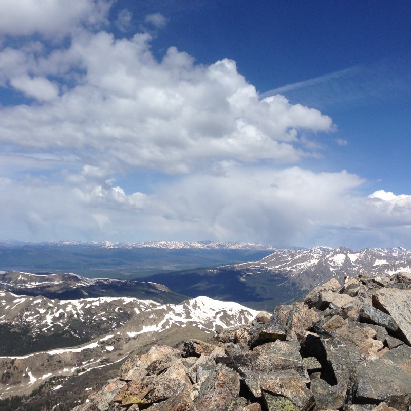 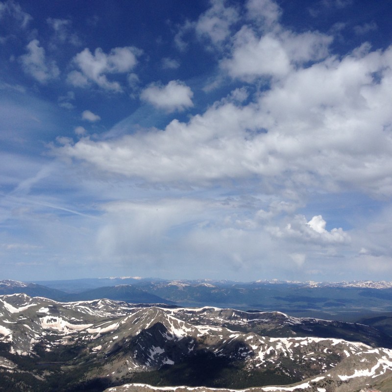 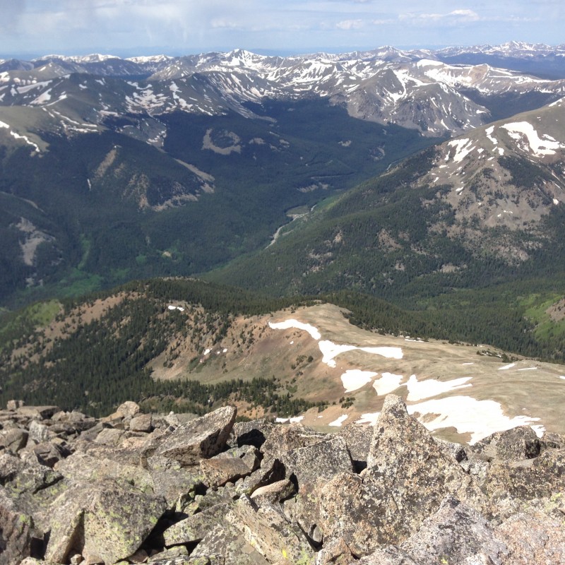 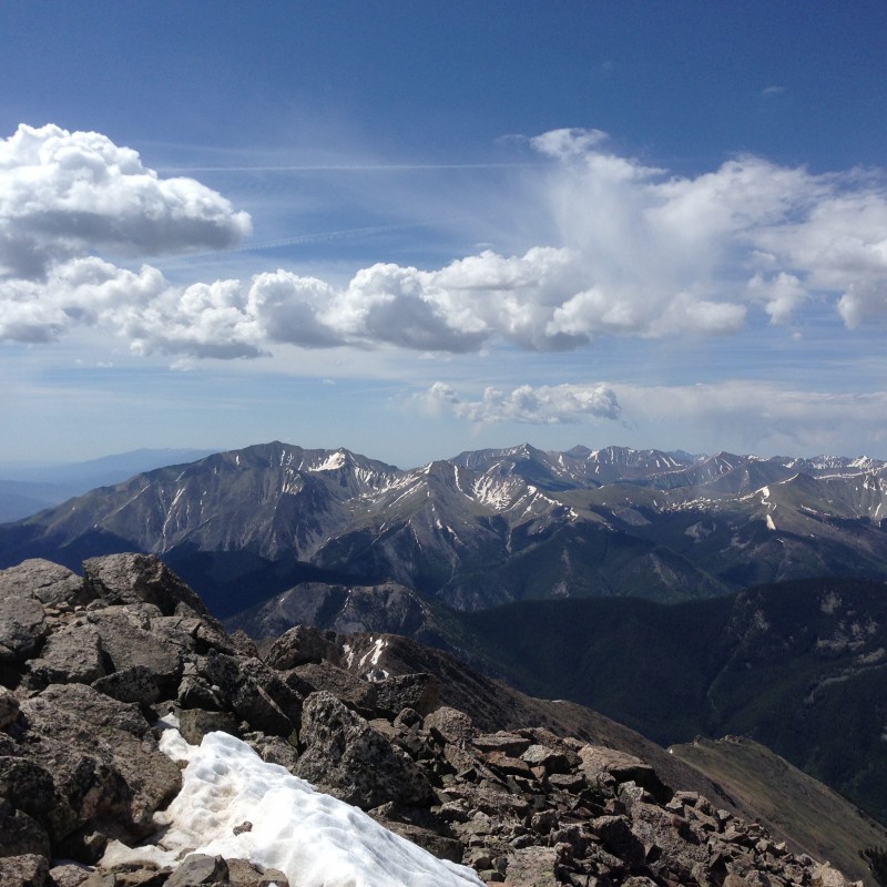 After a half-hour of rest, exploration, and the first of my PBJ's, I donned my windbreaker and it was time to ski down. 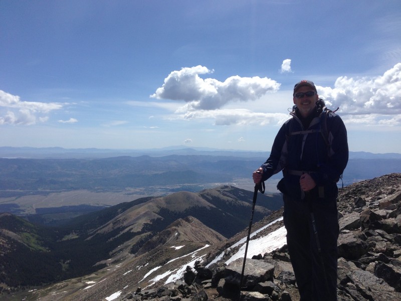 Nah, not really. Those are just my trekking poles and that's just how the picture turned out. By the way, since I've evidently got your attention, it's "Bwainuh" Vista, not "Byoonuh" Vista. You already know this. You don't have to know Spanish. We've all said "Bwainoh" at some point when asked how we're doing. It's just not a big stretch to get from "Bueno" to "Buena". C'mon, get with the program. Just kidding. I don't care how you say it. But don't even get me started on the spelling of "noob" for "newbie". I'll explore that one another day. It was here that I made my second dumb mistake. I knew that I had followed cairns to the right of the ridge coming up, so I started back down to the left looking for the cairns. No cairns were to be found, but just when I was ready to climb back up, I would see a little sandy path that had clearly been visited by humans, and I would climb down a bit further, expecting a better trail. I continued in this manner until I became a bit concerned. No cairns, no sign of the four or five people who had arrived after me. I was convinced that I had to be too low, so I began traversing over to the saddle rather than going straight back up to the ridge, but encountered some tougher going and a couple of small gullies. On a nice blue sky morning, this would have been fine because I knew I wasn't that far from getting back up to the ridge, and I could clearly see the path near the saddle below, but the wind started kicking up and shadows would pass over me as some of the clouds thickened. I'm strictly a standard-route kind of guy and really didn't want to be exploring new territory - especially if a storm moved in or a rock decided to fall while I was out of earshot and eyesight of another hiker. So there were a few tension-filled moments as I cliffed out at one point and found myself under some rocks that looked solid, but had a higher degree of difficulty than the ridge and required just a little bit of climbing. After flailing around a bit, I emerged back up on the trail, just as the Michigan couple was coming down. At this point, they must have figured that I was chronically Class 1/2 trail-challenged. I scolded myself again for being so stupid. This is *not* an easy mountain to get lost on as you can see everything from just about everywhere. I would just recommend staying on or very close to the top of the ridge on the way down as it's maybe harder to see the cairns looking down than it is coming up. The ridge is simply not that far before you're back in the saddle. And of course, better yet, climb with a partner. 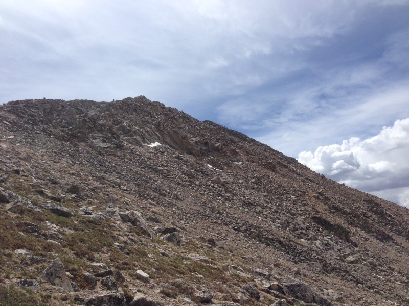 Crisis averted, I was happily back on the trail, pleased that I had summited another beautiful 14er and feeling pretty good about my chances of getting back down to treeline before any serious storms could hit - which they never did on this day, though you could see dark clouds and rain in various places in the distance. I took my time getting down, stopping to chat with folks coming up, taking lots of pictures, and attempting to identify the surrounding features.  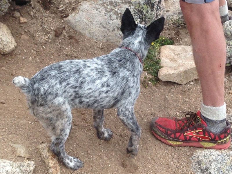 I met this blue dog, a puppy, on the way down and was amazed to see him friction climb about five feet up a rock to his owner's shoulder. We figured it was about a 5.7 pitch. Much steeper than the Flatirons. I have a great picture of the couple holding the dog but won't post it here as I forgot to obtain permission. They might have stolen the rare climbing blue dog and made their escape to Mt Yale. You just don't know. Oh well, if the owner of the red shoe sees this and would like the picture officially entered into the record, just let me know. It's a very presentable picture and the blue dog is adorable. Soon, "47" was replaced by Ray LaMontagne's "Julia" which was mostly disappointing as is most of the new CD, but there's evidently some catchy stuff there. Still a big Ray fan. As is often the case once the pressures of time and exertion are alleviated, I spent more time noticing and appreciating my surroundings on the way back down through the woods. I spotted this petrified bird of some sort that I recognized from maybe a Harry Potter movie or similar while I stopped to enjoy a gatorade. I think it was around 11,700 or so up to your left near a cut tree on the way up if you're into such things. 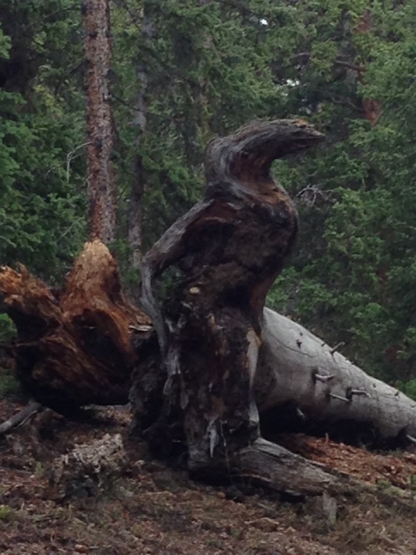 Then a little further down, I knew my mind wasn't right as I spied this dinosaur up on the rock with a companion in the background. Just so you know, while this rock emerged at the earths surface much more recently, its formation likely predates the dinosaurs by about 1.5 billion years give or take. 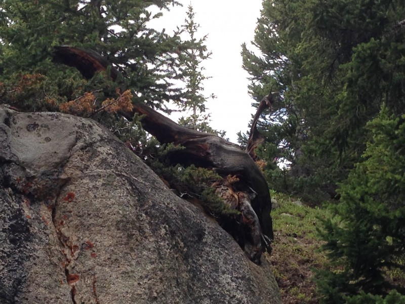 The clouds were much darker now at 1 PM. No obvious lightning/thunder or rain, but folks were still heading up which surprised me. I issue a bit of a warning if it's solicited and wish everyone well. They'll probably be fine (and were this day) but this kind of stuff scares me this high up. It sounds like preaching I know, but if you don't get started before 8 AM at the *very* latest, just don't do it. No reason not to enjoy a hike in the woods though.  My Iphone is great, but it's time for a camera that can take closeups and do that thing where you make the entire picture black and white except for one selected object - often a flower. Or maybe I just need to learn how to use Photoshop. Simply a beautiful hike through the woods near the end of my journey. Check it out:   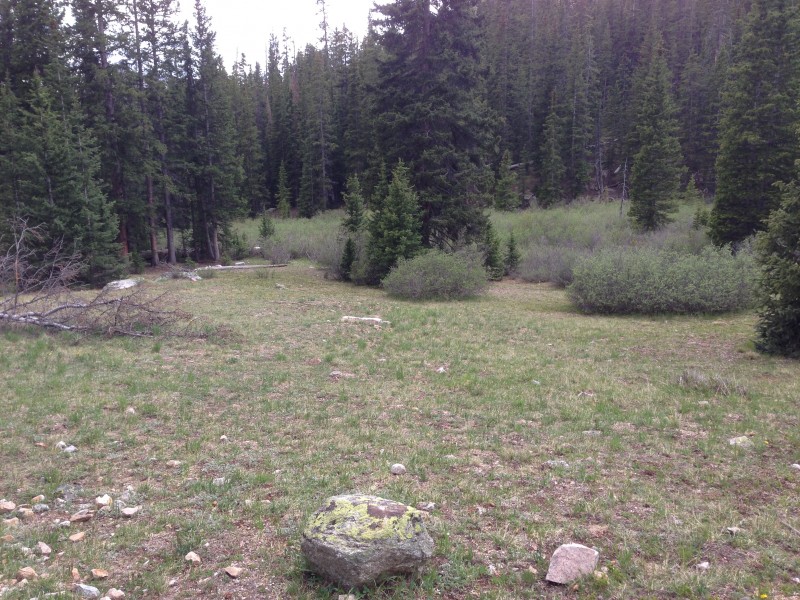 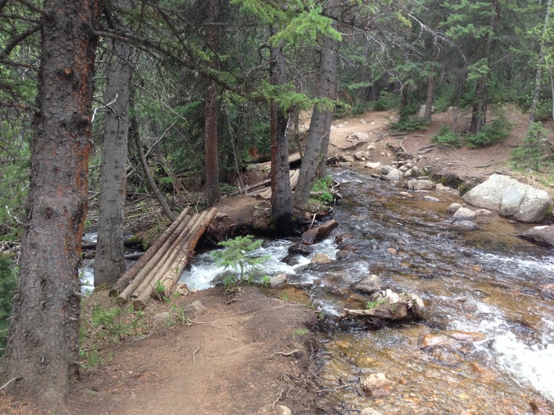 Soon enough, the parking lot was back in sight, and I pulled out a chair and peeled off my boots and socks while enjoying a wheat beer. I hate to ruin a perfectly good trip report by making you look up close at an old guy. Selfies just seem so self-indulgent (or selfie-indulgent I guess). They distort everything. You can see up people's noses and such and it just doesn't seem polite. But I *love* the colorful picture on the beer bottle - looks like the little balloons on the 14er map - and I was just so pleased with myself. I'll probably enjoy it later. Please allow it. My first Sawatch peak was checked off, and it was a great day! Mt Yale will not disappoint. I hope Mr Hamilton is still on track for the record.   Afterword I'm happy to report two days after my hike that I think I could have done another 'teener the next day - which would be a first for me. I'm usually spent and unable to even consider another hike on day 2, but I think the extra work has paid off. It certainly would be more efficient to capture multiple peaks on a single drive into the mountains. I don't know how people from places like Georgia and Ohio come out here and nab multiple peaks in a few days. Maybe it's because you have to. But you have my respect and it's always fun to run into you on the mountainside. I'm afraid to say it out loud but I hope I can get maybe 8-10 more peaks this summer! I find the Needle and Wetterhorn very appealing. How does someone get 8-10 in one day? Keep on truckin' Andrew! Say, would it be too much trouble to take a few minutes at the top of each peak to fill out a conditions report? I'm trying to decide which one to do next ... Thumbnails for uploaded photos (click to open slideshow):
 The road less traveled from above.")
|
| Comments or Questions | |||||||||||||||||||||||||||
|---|---|---|---|---|---|---|---|---|---|---|---|---|---|---|---|---|---|---|---|---|---|---|---|---|---|---|---|
|
Caution: The information contained in this report may not be accurate and should not be the only resource used in preparation for your climb. Failure to have the necessary experience, physical conditioning, supplies or equipment can result in injury or death. 14ers.com and the author(s) of this report provide no warranties, either express or implied, that the information provided is accurate or reliable. By using the information provided, you agree to indemnify and hold harmless 14ers.com and the report author(s) with respect to any claims and demands against them, including any attorney fees and expenses. Please read the 14ers.com Safety and Disclaimer pages for more information.
Please respect private property: 14ers.com supports the rights of private landowners to determine how and by whom their land will be used. In Colorado, it is your responsibility to determine if land is private and to obtain the appropriate permission before entering the property.