Download Agreement, Release, and Acknowledgement of Risk:
You (the person requesting this file download) fully understand mountain climbing ("Activity") involves risks and dangers of serious bodily injury, including permanent disability, paralysis, and death ("Risks") and you fully accept and assume all such risks and all responsibility for losses, costs, and damages you incur as a result of your participation in this Activity.
You acknowledge that information in the file you have chosen to download may not be accurate and may contain errors. You agree to assume all risks when using this information and agree to release and discharge 14ers.com, 14ers Inc. and the author(s) of such information (collectively, the "Released Parties").
You hereby discharge the Released Parties from all damages, actions, claims and liabilities of any nature, specifically including, but not limited to, damages, actions, claims and liabilities arising from or related to the negligence of the Released Parties. You further agree to indemnify, hold harmless and defend 14ers.com, 14ers Inc. and each of the other Released Parties from and against any loss, damage, liability and expense, including costs and attorney fees, incurred by 14ers.com, 14ers Inc. or any of the other Released Parties as a result of you using information provided on the 14ers.com or 14ers Inc. websites.
You have read this agreement, fully understand its terms and intend it to be a complete and unconditional release of all liability to the greatest extent allowed by law and agree that if any portion of this agreement is held to be invalid the balance, notwithstanding, shall continue in full force and effect.
By clicking "OK" you agree to these terms. If you DO NOT agree, click "Cancel"...
Route: Mt Harvard East Ridge via Frenchman Creek
~ 16miles, 6000'
Mickeys Grenade (Jeff), Yikes (Jim) Date: Dec 27-28, 2013
I had a week off of work and was hoping to hike a few more Winter 14ers. Jeff sent me an email and asked if I was interested in joining him on Harvard. I was already tentatively planning on Mt Massive, but decided to change my plans since it seems like there are less frequent opportunities to join up with others on Harvard. It is a little less popular with a lengthy approach and hefty elevation gain.
Jeff had already pre-trenched the route up to the Colorado Trail junction with Chris a few days prior. The lack of recent snow meant we could take advantage of the trench to make the approach day somewhat easier.
After a solid 4 hrs of sleep Thursday night, I met Jeff at Jan's Restaurant in BV at 6am. I normally don't load up on breakfast prior to a hike, but the French Toast and coffee hit the spot. After breakfast, we started driving up to the trailhead, when I started noticing the beautiful red and blue lights of the sunri... Wait, that's not the sunrise, that the lights from a cop car. Dang. Let's think... "I wasn't speeding", "I didn't run a stop light", "My registration is up to date",... Turns out I didn't turn on my headlights (didn't want to blind the customers in Jan's when I pulled out) and the cop reminded me it wasn't a good idea to drive in the dark without headlights. "Yes sir, thank you". Just a warning.
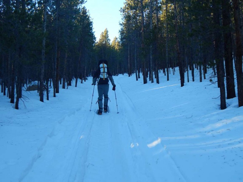
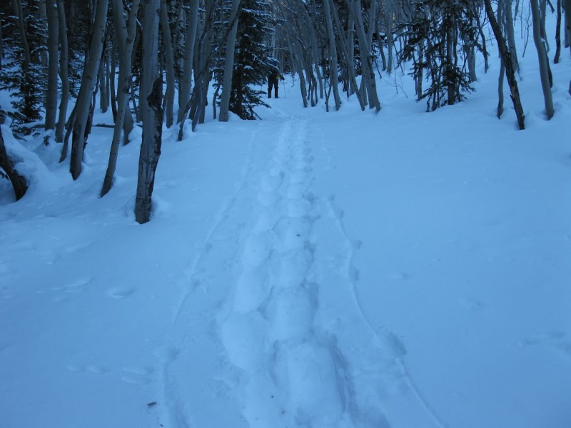
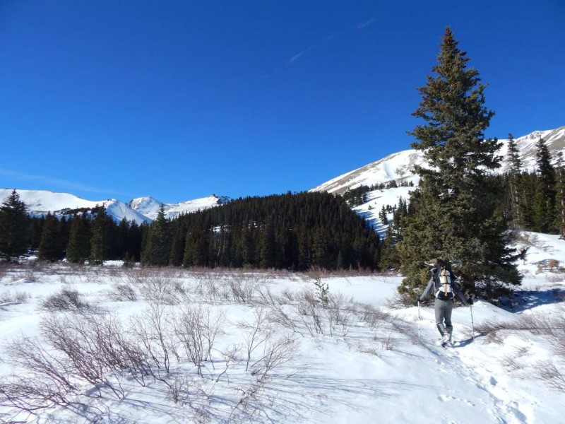
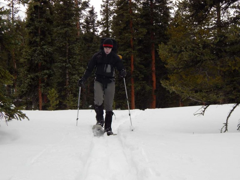
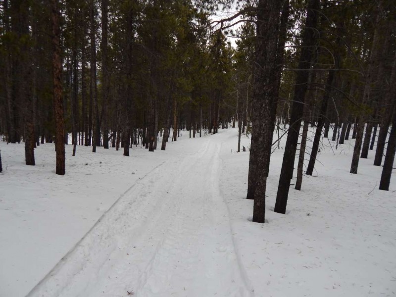
The TH starts at the beginning of FR 386. One vehicle left tracks in the snow, but they stopped after only 50 feet. The 1.3m hike up to the fork was pretty packed down. At the fork we became fortunate and found that a snowmobile had driven the additional 2.2m up FR 386 to the wilderness boundary. The hardpack made it a bit easier.
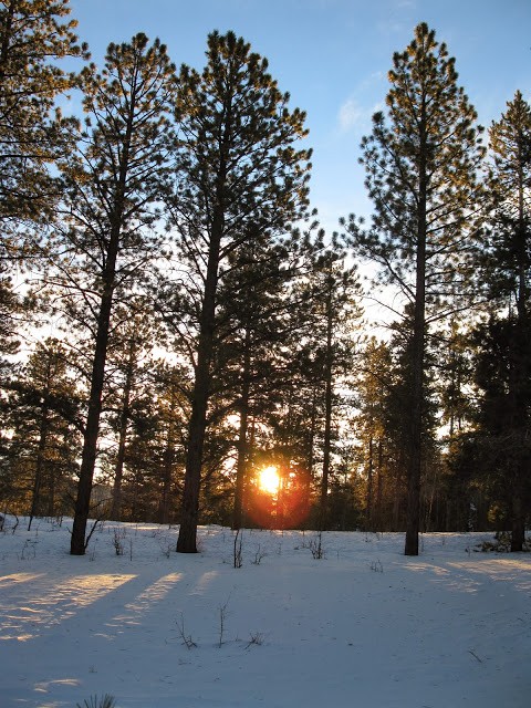
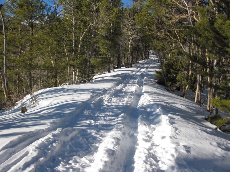
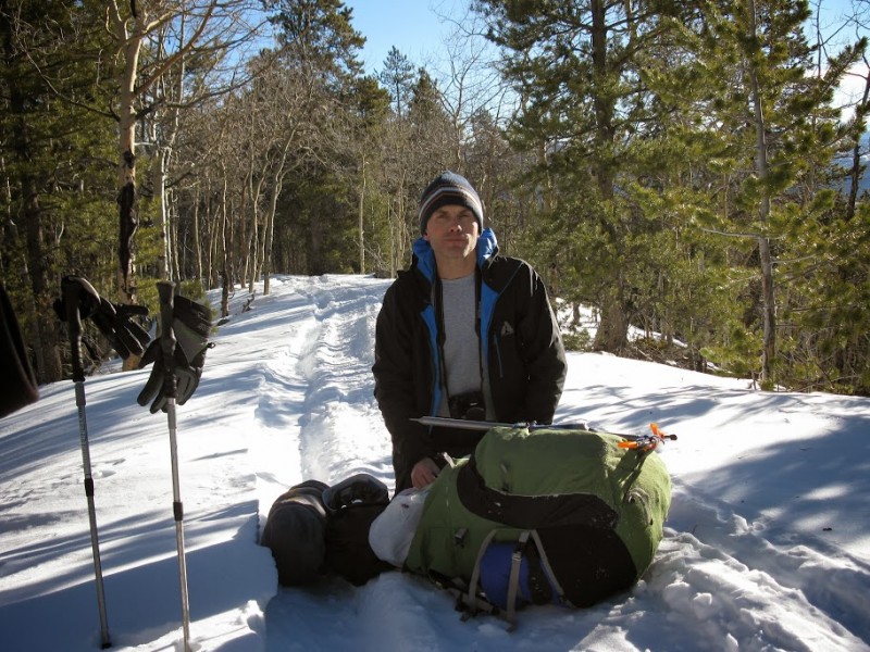
Sunrise from Jeff and Chris's trip Hiking up the 4wd road Nearing the end of the 4wd road Time for some calories
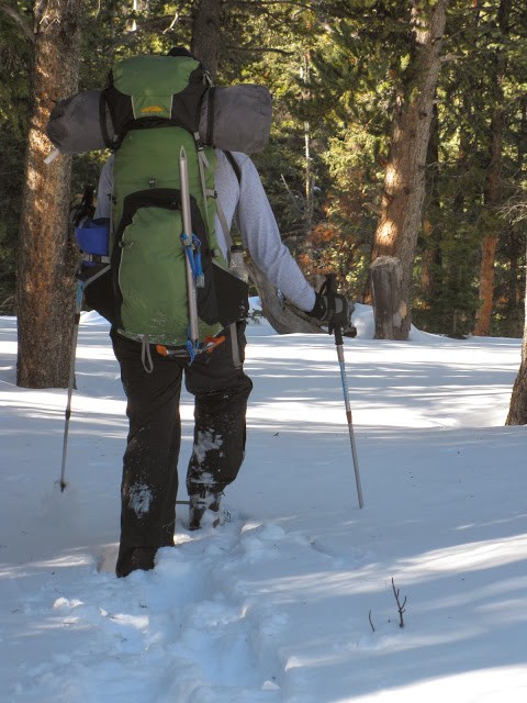
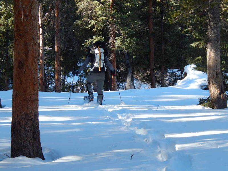
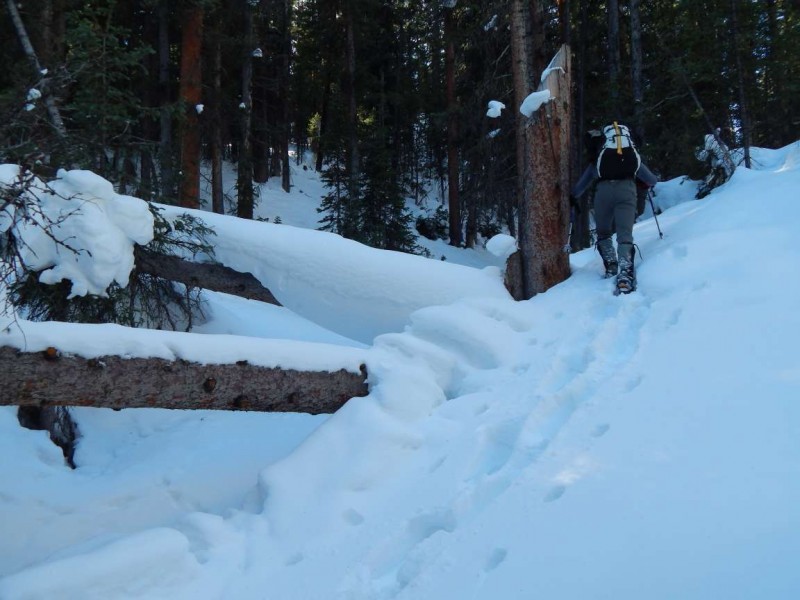
At the wilderness boundary, we jumped into the snowshoe trench previously made by Jeff and Chris. The route is fairly straightforward except for having to cross the creek on a somewhat hidden bridge. Once at the CT junction, we had to break trail up to treeline. The snow was deep enough to make it a bit of a struggle, especially in the steeper sections. No help from snowmobiles in the Wilderness Stupid heavy pack. Stupid deep snow. New trench work above the CT junction A few detours around deadfall Large meadow around 11,500. Camp site in trees.
We set up camp around 11,500 in the trees right after the large meadow. It took a bit of stomping around in the sugar snow to make platforms for the two tents. After we setup camp, we trenched up to the upper basin so the pre-dawn hike would be straightforward. Standing around camp around 4:30, my feet started freezing. I normally don't have a problem, so was going to chalk it up to getting older. Once in the tent discovered that the socks were soaked. With all of the hardpack lower on the trail, I neglected to put on my gaiters. I forgot to put them on once the trenching began and the deep snow filled up my boots. Fortunately I always bring spares.
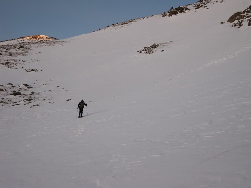
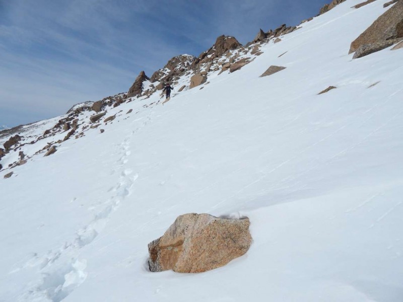
Typical winter camping - not much sleep, lots of tossing and turning. To add to my shopping list - a longer, thicker sleeping pad. Alarms at 5, left the camp around 6am. A quick hike to the upper basin and 2400' to go. I choose a large steep snowfield to gain the upper plateau. An alternative would have been a less steep talus slope up to "the saddle", but I usually prefer traveling over snow than rock.
Harvard in the back Jeff at the beginning of the upper basin. Up the steep snow slope at the back of the basin. Jeff resting above the steep snow slope.
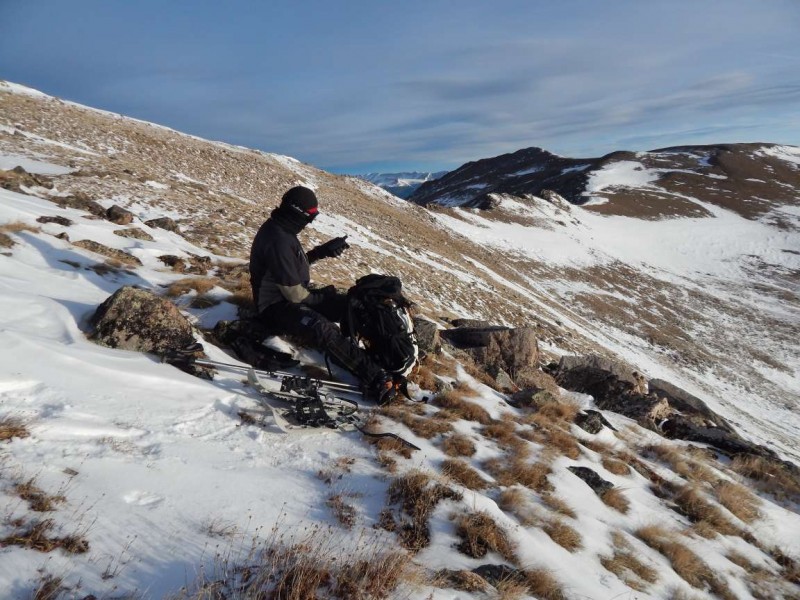
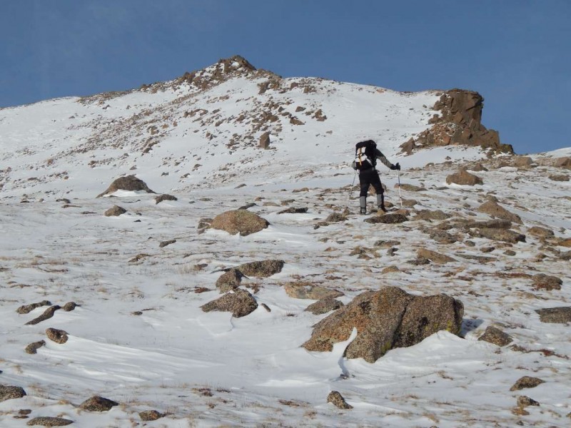
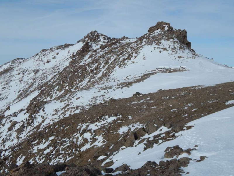
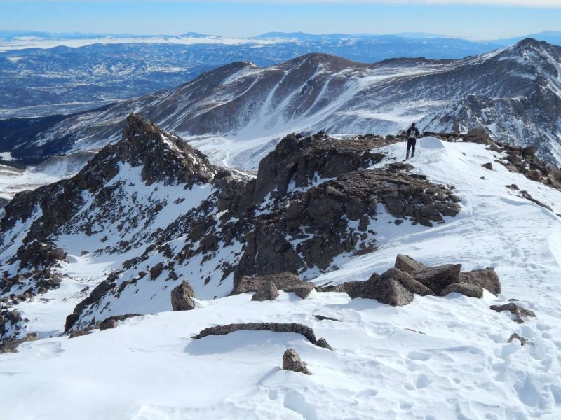
A giant rock pyramid guarded the final summit ridge. From afar it looks a little intimidating, but it pretty mellow up close. On the ascent we went up and over, later deciding it wasn't the best choice. The ridge is long, but pretty straightforward; lots of rock hopping to avoid the sugar snow.
Jeff approaching the Rock Pyramid Final ridge to summit Staring at the summit
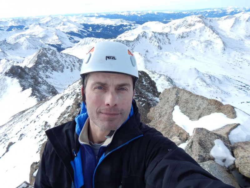
Happy to be on the summit at last (around 10:30 I think). A few minutes to snap some pictures and time to head down.
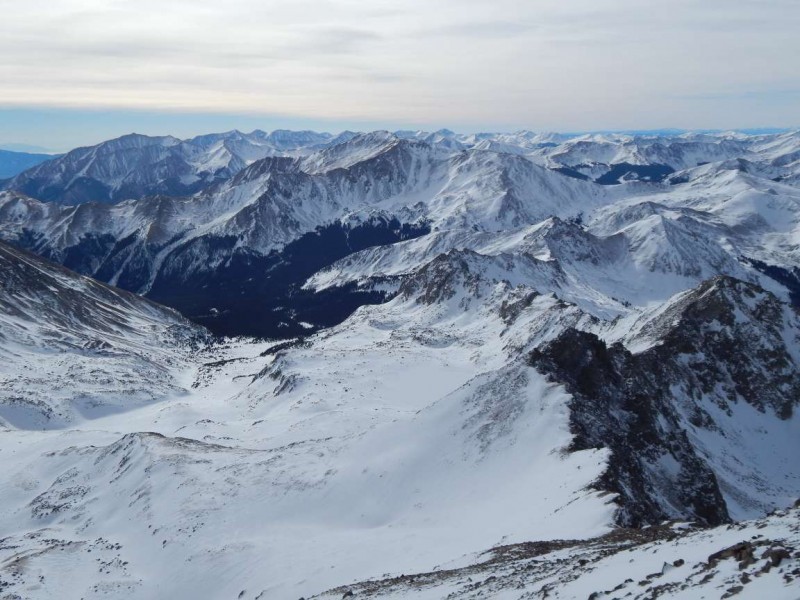
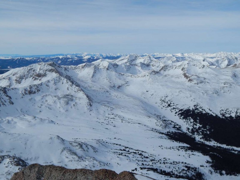
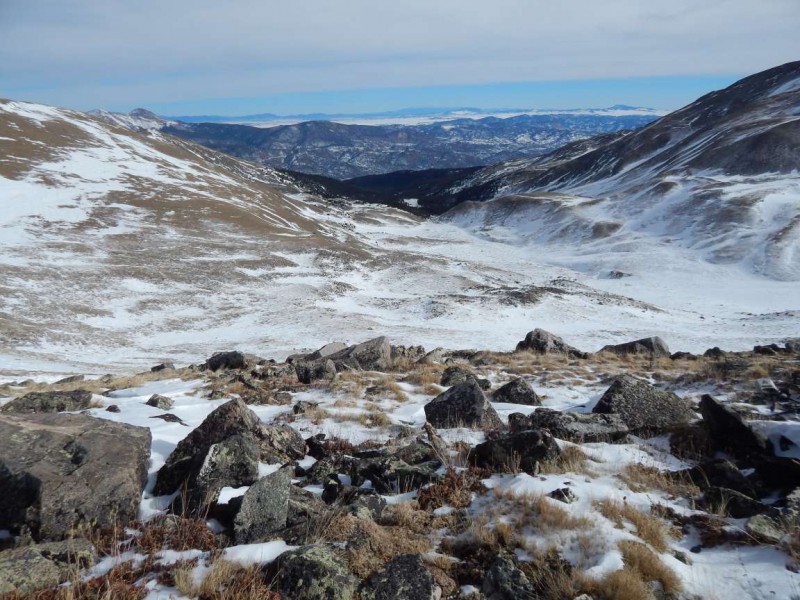
Looking down into Horn Fork Basin Views to the west. This is why I expend the effort Jim on the summit
On the way down, I chose to avoid the rock pyramid and cut around the south side descending across a snowfield. The upper plateau was the start of easier travel. However, the steep snow slope we ascending earlier in the day had not softened up and was a little tricky walking back down. Might have made for a nice glissade.
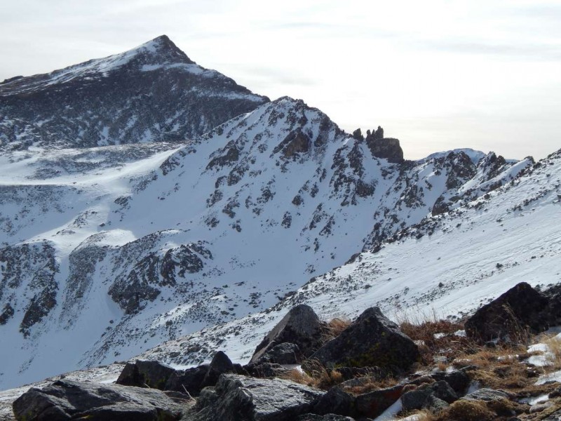
Jeff starting down the ridge Alternate bypassing rock pyramid Looking down the route Columbia and the rabbit ears Got to love the old trees
Got back to camp around 1:30 (I think). Jeff had a backup option of a second night camping, but we both decided that a warm/dry bed was more desirable. We quickly packed up and started down the trail.
Jeff appreciated the help of gravity on the descent 4wd road
The road down was seemingly endless and we finally got to the cars right at dusk. A couple of Prime Ribs at Quincys provided needed calories. Jeff drove back to the Front Range and I made the short drive to Salida where I fell asleep at 8pm.
Thumbnails for uploaded photos (click to open slideshow):
Sawatch Trench Buster and Grenade.
That's a big day. Beautiful pics!
Thanks for your offers to put in Sawatch trenches last week - very awesome of you. I was in a family holiday trench (a good thing) and unable to participate - but kept yearning to take you up on your offer!
Thanks!
Happy New Year and many Happy Trails! :D
Harvard is a difficult and rewarding winter peak
Very impressive. That's 3 attempts for Jeff...what determination!! Glad you guys got out together. Hope to see you guys out there this season.
Great TR Yikes. Looks to be considerably warmer than Jeff's previous attempt on that one (temps were in the negative ridiculous range). I know how it is when the thoughts of a warm bed trump the prospect of a second nite out. Nice job.
Caution: The information contained in this report may not be accurate and should not be the only resource used in preparation for your climb. Failure to have the necessary experience, physical conditioning, supplies or equipment can result in injury or death. 14ers.com and the author(s) of this report provide no warranties, either express or implied, that the information provided is accurate or reliable. By using the information provided, you agree to indemnify and hold harmless 14ers.com and the report author(s) with respect to any claims and demands against them, including any attorney fees and expenses. Please read the 14ers.com Safety and Disclaimer pages for more information.
Please respect private property: 14ers.com supports the rights of private landowners to determine how and by whom their land will be used. In Colorado, it is your responsibility to determine if land is private and to obtain the appropriate permission before entering the property.