Download Agreement, Release, and Acknowledgement of Risk:
You (the person requesting this file download) fully understand mountain climbing ("Activity") involves risks and dangers of serious bodily injury, including permanent disability, paralysis, and death ("Risks") and you fully accept and assume all such risks and all responsibility for losses, costs, and damages you incur as a result of your participation in this Activity.
You acknowledge that information in the file you have chosen to download may not be accurate and may contain errors. You agree to assume all risks when using this information and agree to release and discharge 14ers.com, 14ers Inc. and the author(s) of such information (collectively, the "Released Parties").
You hereby discharge the Released Parties from all damages, actions, claims and liabilities of any nature, specifically including, but not limited to, damages, actions, claims and liabilities arising from or related to the negligence of the Released Parties. You further agree to indemnify, hold harmless and defend 14ers.com, 14ers Inc. and each of the other Released Parties from and against any loss, damage, liability and expense, including costs and attorney fees, incurred by 14ers.com, 14ers Inc. or any of the other Released Parties as a result of you using information provided on the 14ers.com or 14ers Inc. websites.
You have read this agreement, fully understand its terms and intend it to be a complete and unconditional release of all liability to the greatest extent allowed by law and agree that if any portion of this agreement is held to be invalid the balance, notwithstanding, shall continue in full force and effect.
By clicking "OK" you agree to these terms. If you DO NOT agree, click "Cancel"...
No, I didn't eat meatloaf on this trip. No, I didn't climb with Marvin Lee Aday. No, I did not film a "2013 14ers Dance-off Challenge" submission to "I'd Do Anything for Love (But I Won't Do That)" (that would be totally awesome though!). However, with initial hopes of bagging all three 14ers in the Maroon Group and leaving with only two, I must find solace in Meatloaf's immortal words of wisdom:
"Now don't be sad . . .
'cause two out of three ain't bad."
So please turn up the volume on your speakers and play this while browsing through the rest of this trip report:
After a week of poor weather, I was really ready to get some hiking in. The Maroon Group (Pyramid Peak and the "Maroon Bells" of Maroon Peak and North Maroon Peak) seemed like my best option. My plan was to attempt Pyramid on the 14th, Maroon Peak on the 15th, and North Maroon Peak on the 16th. So on Tuesday afternoon I drove to Aspen, hiked up to Crater Lake, and snagged a nice campsite.
The iconic Colorado photo: Maroon Peak and North Maroon Peak from Maroon Lake.
I woke up at 4 a.m. on Wednesday morning and started hiking soon thereafter. I probably should have slept an extra hour. Although I found the cairn marking the turn-off from the main trail to the Pyramid trail, I somehow got off route in the dark and ending up bushwhacking for nearly 45 minutes before I found the trail again. Things become much easier after that point! The trail up into the Pyramid basin is top-notch . . . nice work Colorado Fourteeners Initiative! Before long I had gained the northeast ridge and was greeted by the Pyramid Welcoming Committee.
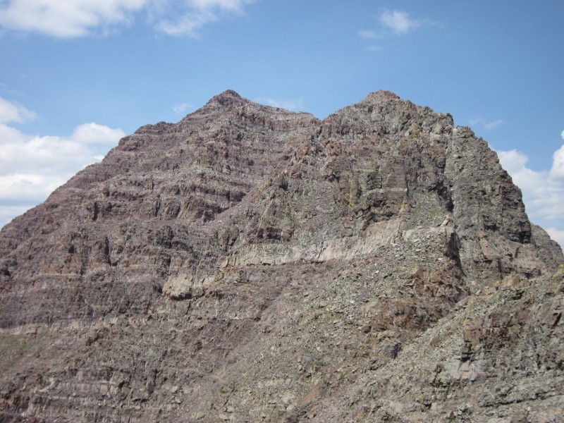
The north face of Pyramid.
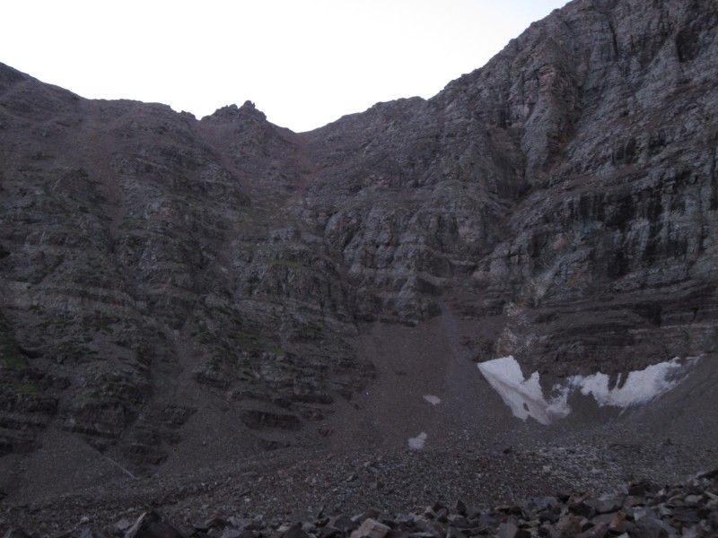
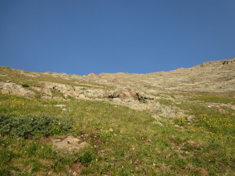
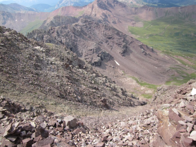
This slope climbs to Pyramid's northeast ridge and the start of more technical terrain.
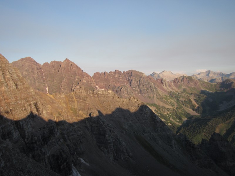
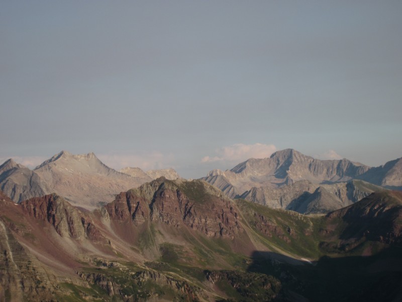
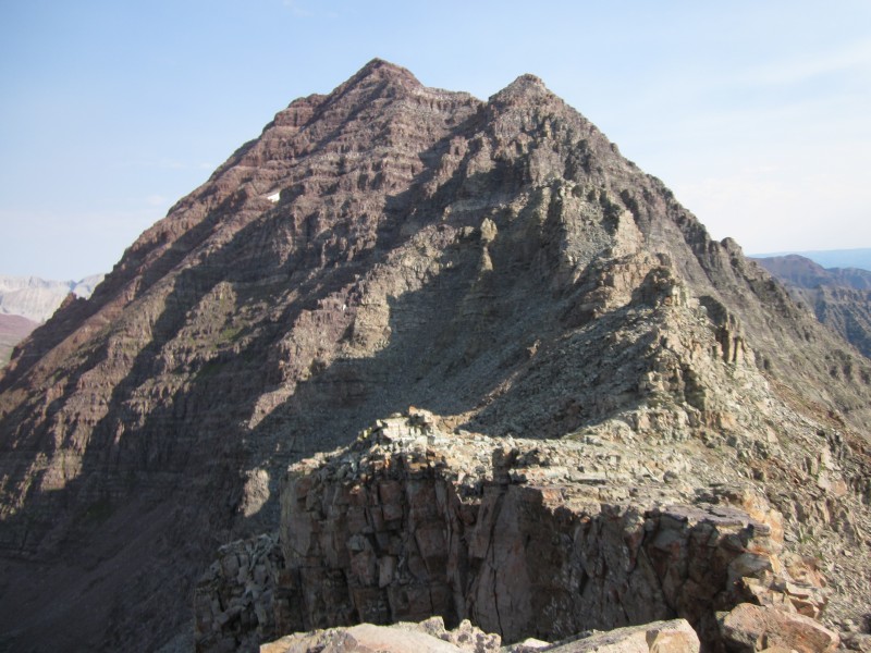
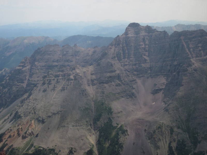
On the northeast ridge of Pyramid, with a great view of 4 other 14ers: Maroon, North Maroon, Snowmass, and Capitol.
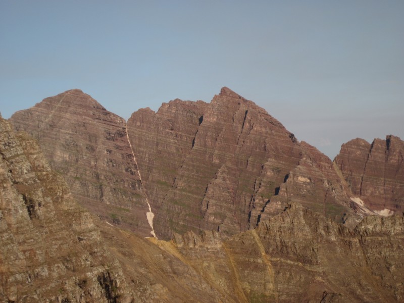
A closer view of Maroon and North Maroon.
A closer view of Snowmass and Capitol.
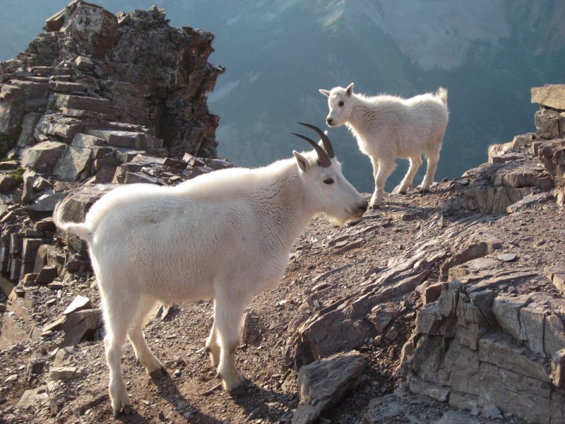
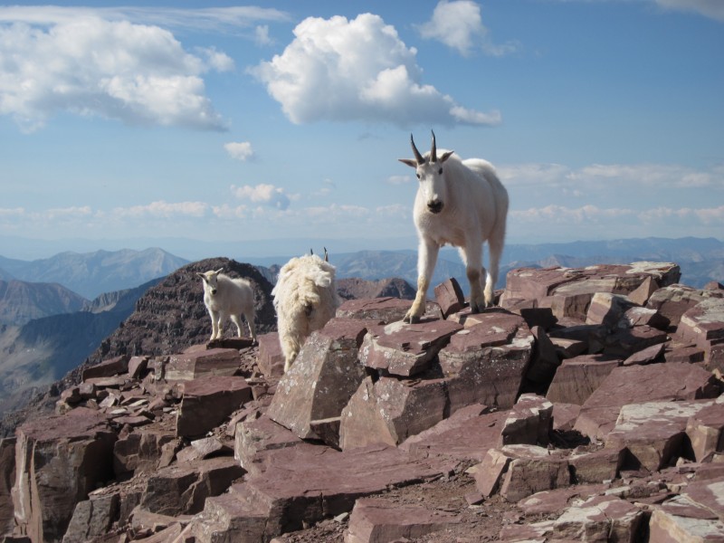
A friendly welcome to the northeast ridge of Pyramid.
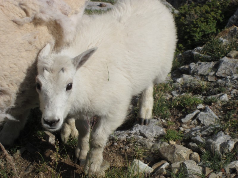
I really wanted to take the baby goat home for my youngest niece.
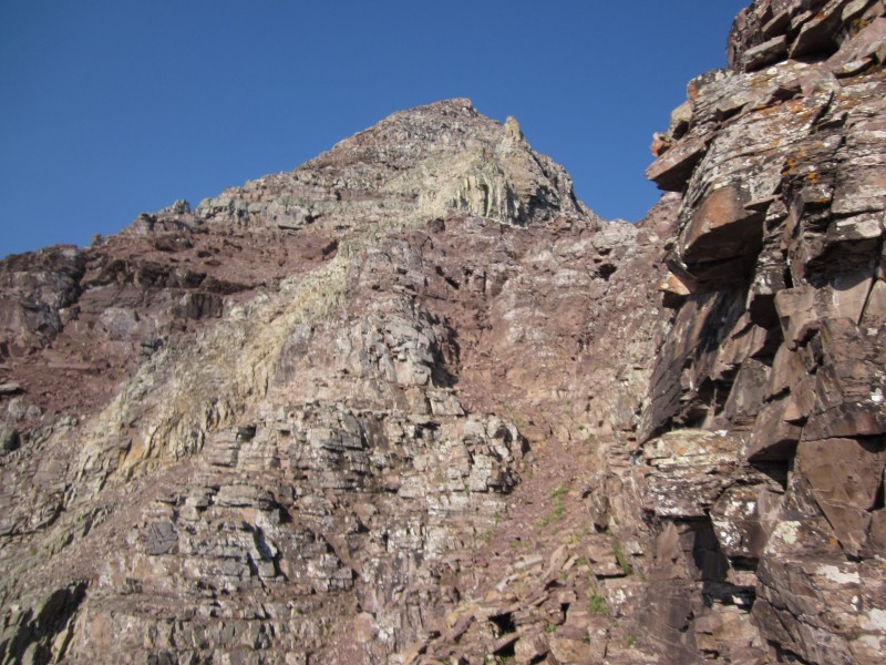
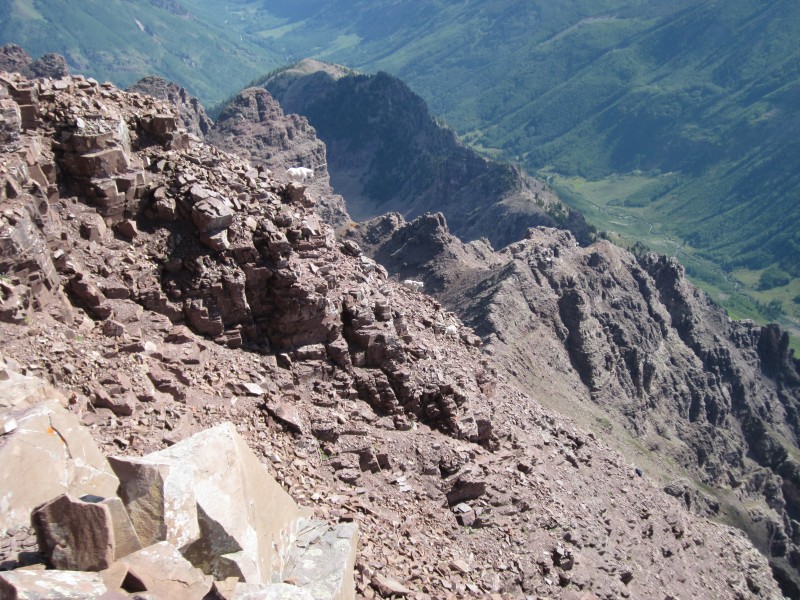
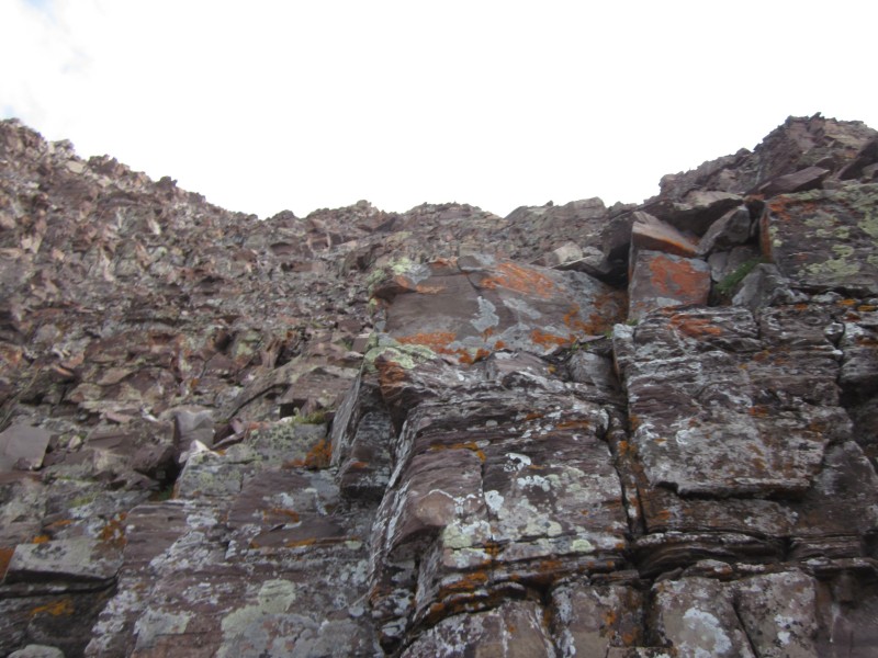
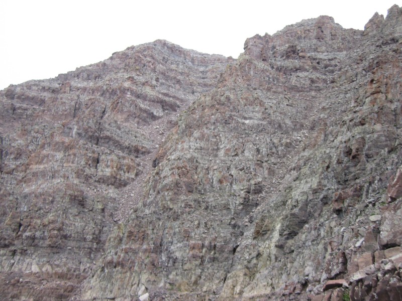
A good example of much of the route along the ridge.
The route up the northeast ridge had several Class 3 sections, but there was not as much exposure as I expected. I also found the rock surprisingly solid for the Elk Range. The infamous "cliff traverse" turned out to be yawnable--nearly as over-hyped as Kit Carson Avenue. Most of the fun climbing was in the "green rock" section and above. The route is well-cairned, although I still got slightly off-route in a few spots. There were much fewer Class 4 moves than I expected, and in general the ascent was easier than I had anticipated. Before too long I was on the summit, quickly joined by some fellow climbers and then by some mountain goats (who would follow us up and down the mountain!).
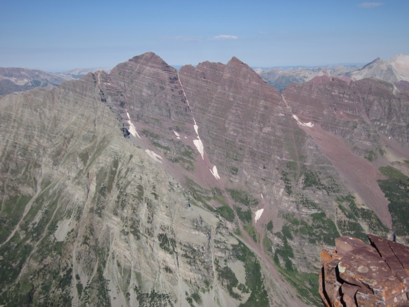
From the summit of Pyramid, viewing the Maroon Bells.
Peak-bagging mountain goat-style (you can actually see the summit marker on the rock on the right).
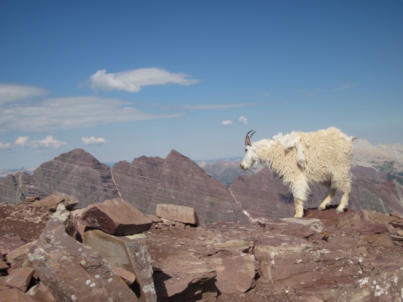
Looking back down the ridge and at more goats.
Pure Colorado.
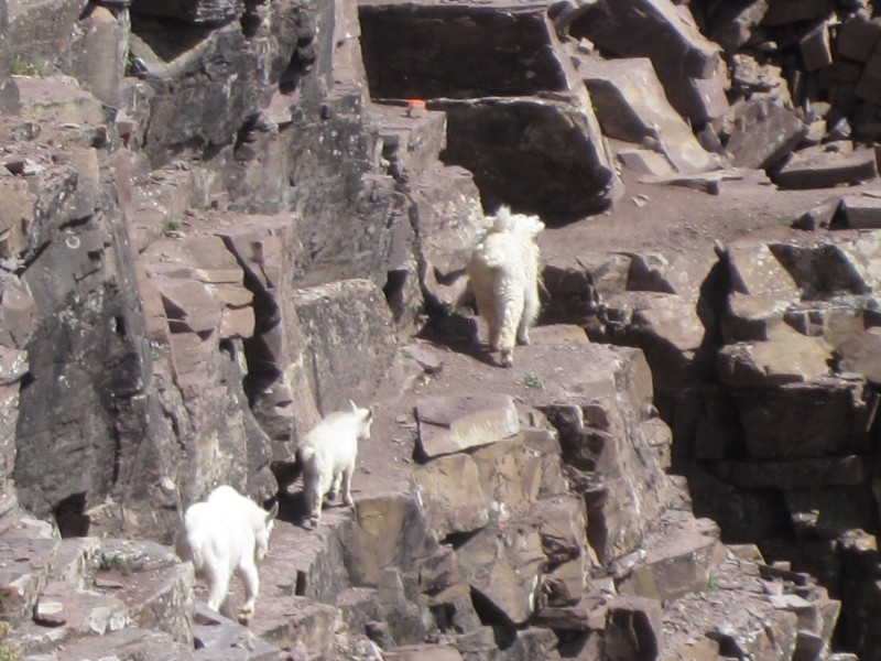
Yes, even goats use the Pyramid "cliff traverse."
There were several steep sections on the ascent which made me worried about the descent. Up-climbing Class 4 is one thing . . . down-climbing it another. Yet again, I was pleasantly surprised. The cairns were even easier to spot going down, and the rock was solid enough and hand- and foot-holds plentiful enough that I was able to face out on the entire descent--never had to face in a single time. The goats escorted me all the way back down the ridge. The slope back down from the ridge to the basin had some loose dirt and scree sections, but nothing serious. Slogging back across the basin along the rock glacier was probably the worst part of the day because of the rocking boulders and uneven terrain, but once back at the CFI trail it was a piece of cake to get back down to Crater Lake.
All in all, Pyramid was great. It's quite possibly my new favorite 14er. The rock was fairly solid, the technical sections were fun, the exposure was less than anticipated, and the route was well-cairned. Plus, the views from the summit are quite possibly the best on any 14er. It certainly needs to be approached with respect, but the climb was not nearly as daunting as I expected it to be.
Which made me nervous about Maroon Peak. Was I going to have to pay the price for having it easy on Pyramid?
The next morning (Thursday the 15th) I left my campsite at around 5:15 a.m. My legs were pretty sore from the previous day, which made the slog up Maroon's east slopes a chore. That may be the worst approach hike in the state, and it's even worse going down (more on that later). It is tedious, yet steep, and predominantly loose dirt and scree. I was very happy to gain the south ridge of Maroon and start on more technical terrain.
Slogging up the east slope of Maroon Peak.
On the south ridge, looking at the remainder of the route.
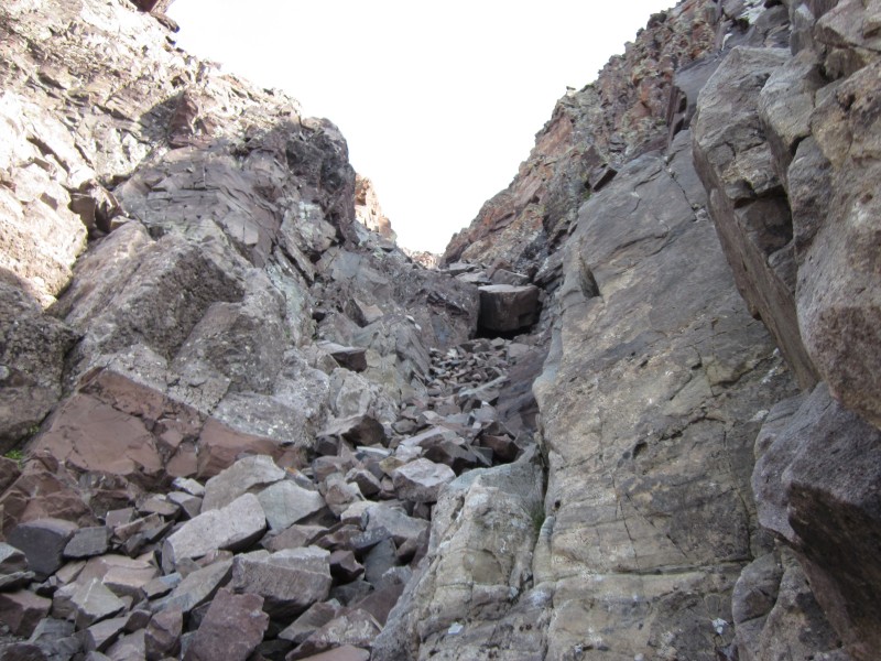
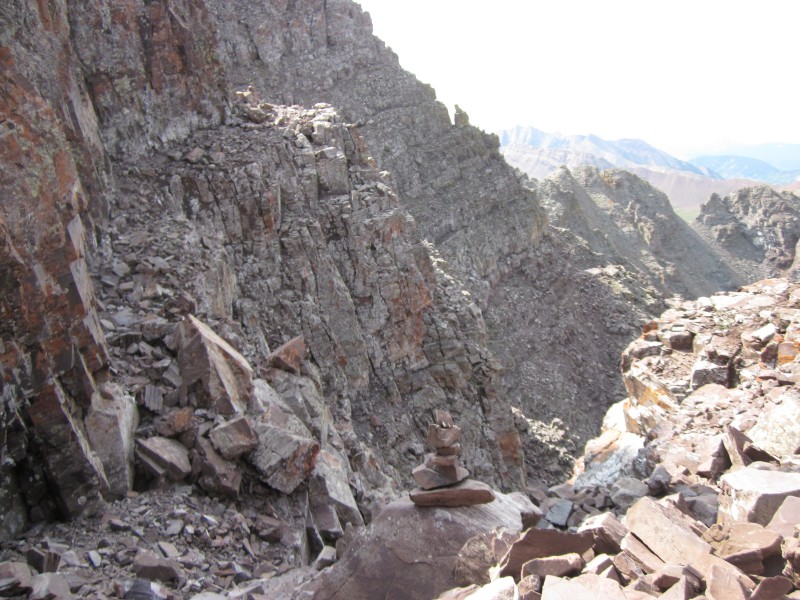
A few weeks prior to this trip I had hiked the Four Pass Loop around the Maroon Bells, and on that entire hike I kept staring at Maroon Peak and thinking: "How the hell do you climb that?" Well, I found out. You can kind of boil the route down to this: hike along the ridge, find a gully, climb up the gully to a ledge, cross the ledge to the next gully, repeat this process several times until at the notch at around 13,750 ft., then enjoy sustained Class 3 moves up to the summit. The route-finding was time-consuming and mentally draining, and it seemed like the vast majority of my time was spent searching for cairns. And there are a lot of cairns. There must be 20 cairned paths to the summit! So the trick is not just finding the next cairn, but finding the right next cairn. However, the rock was once again much more stable than I thought it would be. It was a bit looser than the rock on Pyramid Peak, but still not too bad. The exposure wasn't terrible either: "airy" but not "scary." I found the last 250 vertical feet or so (roughly from the notch to the summit), the most technically challenging and difficult. In some sections there are about 500 damned cairns, then you'll climb a tiny bit to look up and not be able to find a single one! I ended up just ignoring the cairns and trusting my own judgment. It took me about 2.5 hours from the top of the south ridge to the summit. It had been a lot of fun, but, once again, I felt a bit anxious about the down-climb.
How does one climb Maroon Peak? Climb up a gully . . .
. . . then across a ledge. Repeat as necessary.
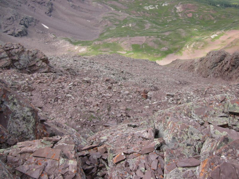
Looking down the "large gully."
This is a good example of the terrain on the last 250 vertical feet of the climb.
One of the "airier" sections.
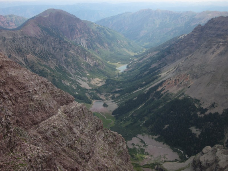
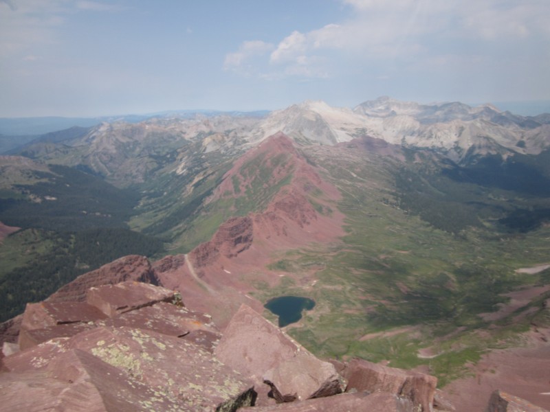
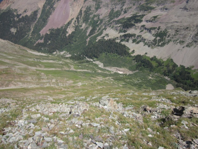
Looking down on Crater and Maroon Lakes.
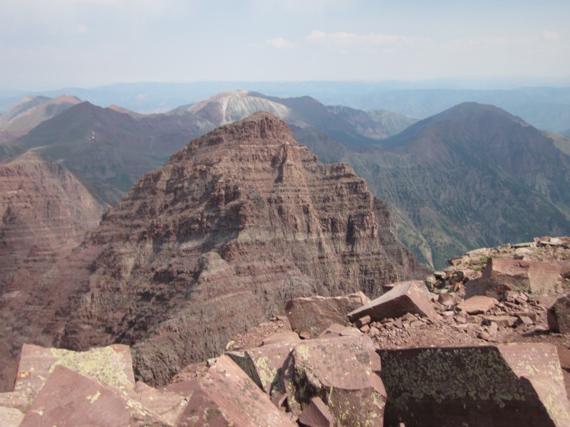
Looking across to Pyramic Peak.
Looking west to Snowmass and Capitol.
North Maroon.
Well, this time my anxiety about the down-climb was a bit more warranted. Finding cairns on the descent proved to be a bit harder than finding them on the ascent (the opposite of my experience on Pyramid). Plus, the rock in the gullies was just loose enough to ratchet up the stress level a bit. Unlike Pyramid, there were several spots where I needed to face in on the descent. I also kept getting nervous in the gullies that I would descend too far and miss the next exit ledge. This was responsible for me leaving the north gully in the "two gullies" section too early and having to climb over to the next gully on an exposed rib. There is an established path that goes between these gullies on the rib, but I crossed the rib below that on a non-established route that wasn't cairned. It ended up working out nicely; a bit exposed, but plenty of solid hand-holds. I should have put up some cairns to add even more confusion on Maroon Peak!
However, the absolute worst part of my Maroon Peak experience was descending back down the east slope. The steepness and loose dirt and scree that had been annoying on the ascent was downright dangerous on the descent. The tedium of the slog makes things even worse, since you find your mind wandering rather than staying focused on where to step next. My feet slipped out from under me and I fell on my ass twice heading down the "non-technical" east slope of Maroon, and I am totally amazed there aren't more serious injuries that happen there. It is perfect terrain for ankle and knee injuries, and there are even a few spots where a slip could easily be fatal. Laugh if you will, but I felt the most frightened on Maroon Peak when I was going down that east slope! The only enjoyable part was bumping into a few more mountain goats about half-way down.
The "two gullies" section.
Looking back on the route.
A grueling descent down the east slope.
How cute is this?
I thought Maroon Peak was a bit harder than Pyramid. The route-finding was trickier and more time consuming, the rock was a touch looser, and the descent was more challenging (especially down the east slope). That being said, I still found the rock more solid than I thought it would be and the exposure much less. The route isn't technically that difficult either (there are harder moves on Longs Peak, even though there is more sustained Class 3 on Maroon). I think the real trick to Maroon is having the time to route-find and be deliberate about each and every move. You can either do this by being a speedy climber in general, or by having a full day of great weather, but time is definitely the crucial factor.
When I got back to camp on Thursday afternoon, my feet, ankles, knees, and quads were shot. Pyramid had given my legs a good, solid workout; the descent down the east slope of Maroon had pummeled them. I read through my route description of North Maroon Peak and realized I would be adding another factor into an already dangerous climb if I attempted it while fatigued and sore. Sure, my camera battery was dead and I was nearly out of snacks for the climb, but the real reason I decided not to attempt North Maroon Peak was that I simply didn't have the leg for it after two tough days of climbing. It was a very hard decision to make while staring up at North Maroon--so close I could taste it. But I think I made the right decision. After all, this just gives me another excuse to go back to one of the most beautiful places in America.
And two out of three ain't bad.
North Maroon, I hope to see you soon!
Thumbnails for uploaded photos (click to open slideshow):
From one exiled Michigander to another, congratulations on two great summits and thanks for sharing the experience. Hoping to summit Pyramid the first week of September, so I really appreciate your account.
Great goat photos too. I typically just skip them in TRs, but you have some dandies there.
Very nice, Ex! I don't think you should be disappointed with getting only 2. That was quite an accomplishment in itself. The last thing you want to do is push yourself to your absolute limits especially on such loose and rotten rock. That's how accidents happen, so good call!
Like you said, they will be there again next year and it gives you a good excuse to go back again! Climb on and climb safe!
Nice pics, and the goats are outstanding! Thanks for your post! :D
Yep, loved the shots of the goats. Nice work on those routes. Good to hear that Pyramid is a bit of a better climb/descent vs. Maroon's slip sliding the east slope.
I am curious about the goats. It seems like they followed you up Pyramid and back down. Was there ever a concern that they were getting too close or really wanted some food or salt or did they just seem friendly and unafraid? I remember once walking back down the trail from Grays and Torres that a goat planted himself in the middle of the trail and was not about to move. We left the trail on class 2 terrain so it was no big deal. But if that had happened on Pyramid I suppose it would have been a different story
Caution: The information contained in this report may not be accurate and should not be the only resource used in preparation for your climb. Failure to have the necessary experience, physical conditioning, supplies or equipment can result in injury or death. 14ers.com and the author(s) of this report provide no warranties, either express or implied, that the information provided is accurate or reliable. By using the information provided, you agree to indemnify and hold harmless 14ers.com and the report author(s) with respect to any claims and demands against them, including any attorney fees and expenses. Please read the 14ers.com Safety and Disclaimer pages for more information.
Please respect private property: 14ers.com supports the rights of private landowners to determine how and by whom their land will be used. In Colorado, it is your responsibility to determine if land is private and to obtain the appropriate permission before entering the property.
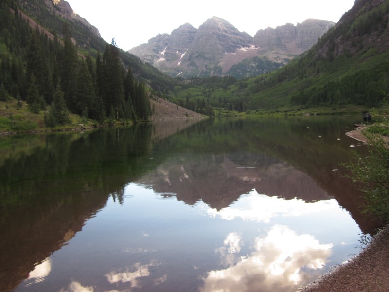


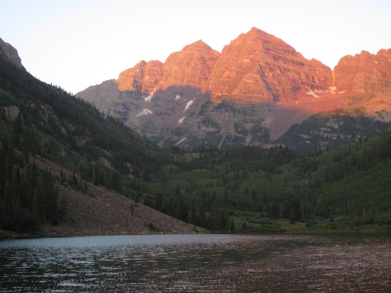
 The iconic Colorado photo: Maroon Peak and North Maroon Peak from Maroon Lake.")
 The north face of Pyramid.")
 This slope climbs to Pyramid's northeast ridge and the start of more technical terrain.")
 On the northeast ridge of Pyramid, with a great view of 4 other 14ers: Maroon, North Maroon, Snowmass, and Capitol.")
 A closer view of Maroon and North Maroon.")
 A closer view of Snowmass and Capitol.")
 A friendly welcome to the northeast ridge of Pyramid.")
 I really wanted to take the baby goat home for my youngest niece.")
 A good example of much of the route along the ridge.")
 From the summit of Pyramid, viewing the Maroon Bells.")
 Peak-bagging mountain goat-style (you can actually see the summit marker on the rock on the right).")
 Looking back down the ridge and at more goats.")
 Pure Colorado.")
 Yes, even goats use the Pyramid")
 Slogging up the east slope of Maroon Peak.")
 On the south ridge, looking at the remainder of the route.")
 How does one climb Maroon Peak? Climb up a gully . . .")
 . . . then across a ledge. Repeat as necessary.")
 Looking down the")
 This is a good example of the terrain on the last 250 vertical feet of the climb.")
 One of the")
 Looking down on Crater and Maroon Lakes.")
 Looking across to Pyramic Peak.")
 Looking west to Snowmass and Capitol.")
 North Maroon.")
 The")
 Looking back on the route.")
 A grueling descent down the east slope.")
 How cute is this?")
 North Maroon, I hope to see you soon!")


