Download Agreement, Release, and Acknowledgement of Risk:
You (the person requesting this file download) fully understand mountain climbing ("Activity") involves risks and dangers of serious bodily injury, including permanent disability, paralysis, and death ("Risks") and you fully accept and assume all such risks and all responsibility for losses, costs, and damages you incur as a result of your participation in this Activity.
You acknowledge that information in the file you have chosen to download may not be accurate and may contain errors. You agree to assume all risks when using this information and agree to release and discharge 14ers.com, 14ers Inc. and the author(s) of such information (collectively, the "Released Parties").
You hereby discharge the Released Parties from all damages, actions, claims and liabilities of any nature, specifically including, but not limited to, damages, actions, claims and liabilities arising from or related to the negligence of the Released Parties. You further agree to indemnify, hold harmless and defend 14ers.com, 14ers Inc. and each of the other Released Parties from and against any loss, damage, liability and expense, including costs and attorney fees, incurred by 14ers.com, 14ers Inc. or any of the other Released Parties as a result of you using information provided on the 14ers.com or 14ers Inc. websites.
You have read this agreement, fully understand its terms and intend it to be a complete and unconditional release of all liability to the greatest extent allowed by law and agree that if any portion of this agreement is held to be invalid the balance, notwithstanding, shall continue in full force and effect.
By clicking "OK" you agree to these terms. If you DO NOT agree, click "Cancel"...
Trailhead: Maroon Lake (elev. 9,580 ft), Summit: 14,018 ft, RT Distance: 8.0 miles
Climbers: Pete (Wish I Lived in CO), Mark (Roald)
Mark and I had intended to summit Pyramid Peak the first day. Our slow start and the weather that moved in altered our plans accordingly. By the time we had reached halfway up the scree gulley, I was pretty sure the clouds moving in would not allow a summit. However, we now proceeded up to the saddle more as an acclimation hike and a scouting mission for next time. At the saddle, the weather did look not quite so terrible so we ventured a little further to the base of the green wall. We climbed about 40 feet or so of the wall just to get an idea of what we'd face next time in (hopefully) better weather. It's always demoralizing to have to turn back, especially only 700 ft. below the summit, but we wisely agreed the steep green wall was no place to be in wet conditions, so down we went. It did in fact rain a little later once we were again below the saddle.
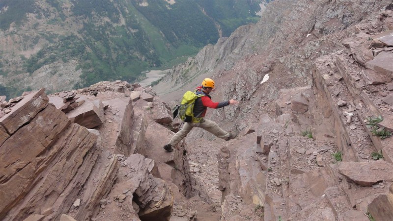
In terms of our "scouting mission", our impression was that the ledge crossing and leap of faith make for impressive and dramatic pictures (as 14ers.com members have seen a million times), but really are not at very hard (so long as you respect it anyway). The lower 40 foot of the green wall that we sampled was steep, and more concerning is there are lots of small loose rocks. Maybe the climbing is better a bit better higher? We'll find out next time........
Once back at the ampitheatre entrance, the weather of course cleared up.... Anyway still a fun day. Some pics of the day's forays:
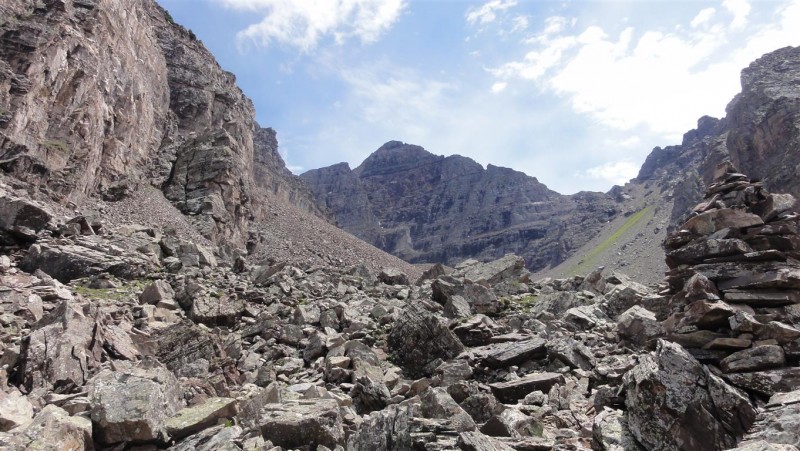
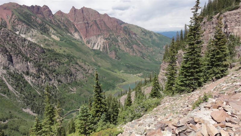
Pyramid Peak from the Ampitheatre Entrance (taken on descent)
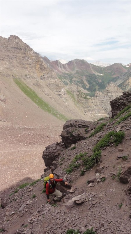
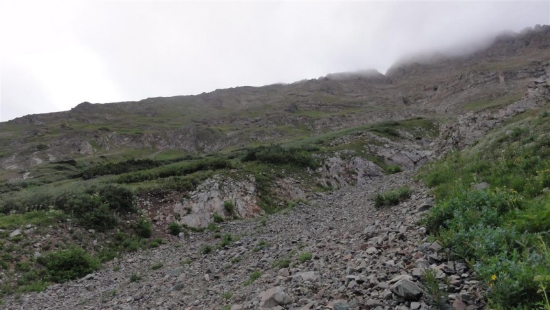
Mark Heading up the Not-So-Awesome Scree Gulley
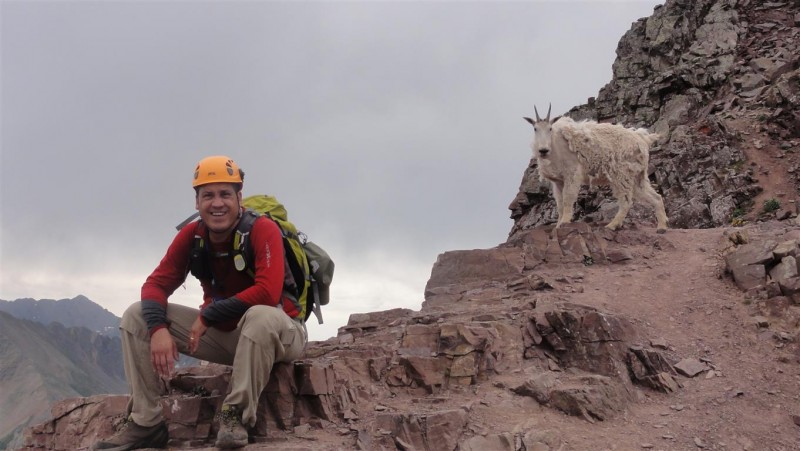
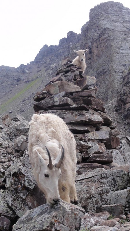
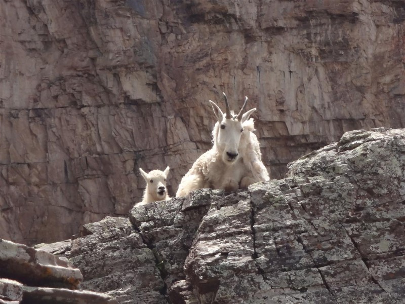
At the Saddle - Mark and Goat
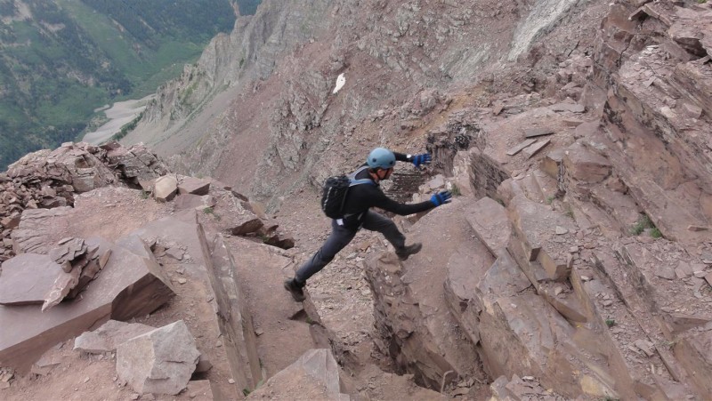
Mark on the Leap of Faith
Pete on the Leap of Faith
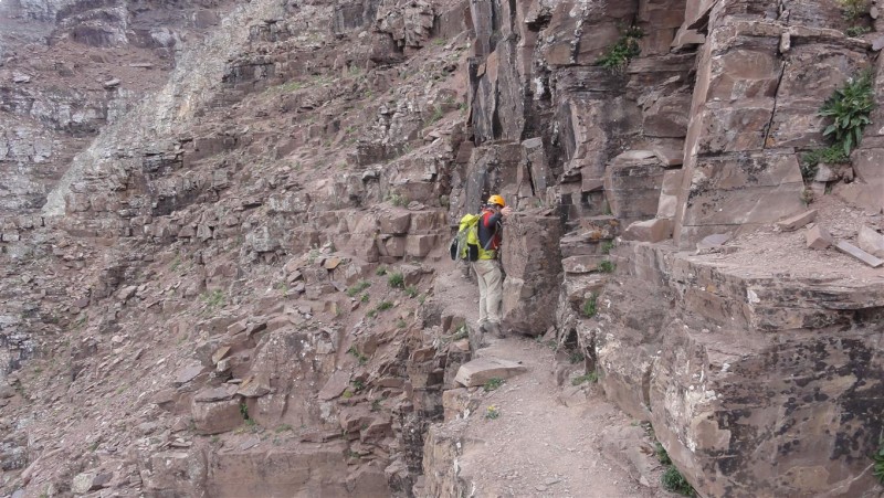
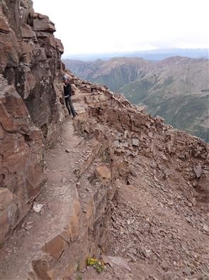
Mark on the Ledge
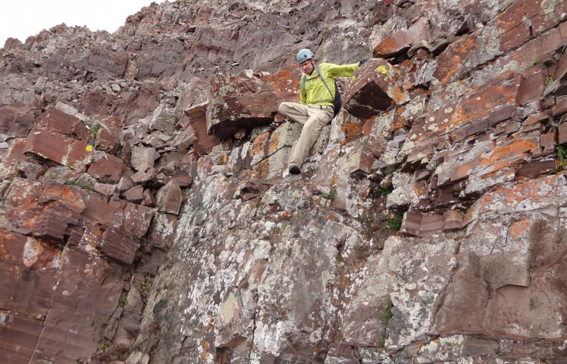
My Turn on the Ledge
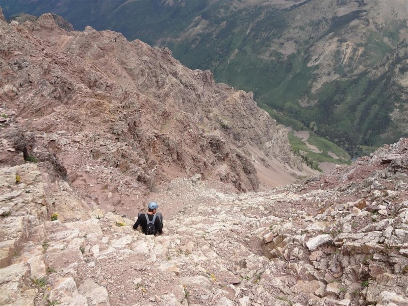
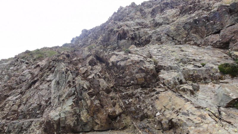
The Green Wall
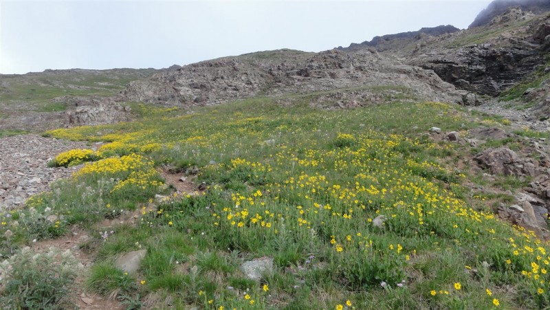
Goats at the Ampitheatre Entrance
Goats
Crater Lake Below
MAROON PEAK
THURS. JULY 25, 2013
Depart: Crater Lake (elev. 10,076 ft), Summit: 14,156 ft, RT Distance: 8.0 miles
Climbers: Pete (Wish I Lived in CO), Mark (Roald)
Mark and I broke camp at Crater Lake just before 5 am. The 2 mile hike under head lamp paralell to the Maroon Creek would normally be relaxing, but was very anxious as the misty and overcast start to our day threatened another failure to summit. Upon reaching the "bent tree" just below where the trail splits off to an abrupt start of the vertical climbing, our spirits were not yet improved.
Living out of state, typically only one trip per year to Colorado's amazing high country is feasible. One tends to get invested into such a trip as sometimes months of logistic planning and route research, weeks of physical conditioning, getting the wife's permission, buying more gear, coughing up the cash and vacation time, packing and traveling, and finally the emotional investment from the anticipation all tend to work to raise the stakes a bit and put pressure one's self to summit if at all possible. Overall, I do a pretty good job when things don't go well by convincing myself of old sayings like "a bad in the mountains is better than a good day at work", or "I made a good decision to turn back", or "The mountain will be there tomorrow". Still, one starts to wonder at 6 am under the clouds and mist.
After a break at the bent tree, we decided something like "Well, the clouds don't look like the lightning type, it's early, let's just try it." Enter the 2,800 foot slog in the fog: Starting Up the 2,800 ft Slog
As I would discover later in the climb, Maroon peak with it's beautiful setting, lakes, neighboring 14ers, and fun scrambling up high could easily be my favorite 14er so far. Except that is for a certain 2,800 foot relentless uphill slog between the creek and the ridge takes away a bit from the overall experience. Oh well, put the head down and head up, up, up ......
Most of the slope is on a trail, so that helps. About half way up the slope we encountered a relatively short class 3 section to climb. Was not comparitively difficult, but did not expect it. We picked up the trail before and after so it seemed part of the route; though on the way down Mark said he found a way around it. Class 3 Section on the Slog
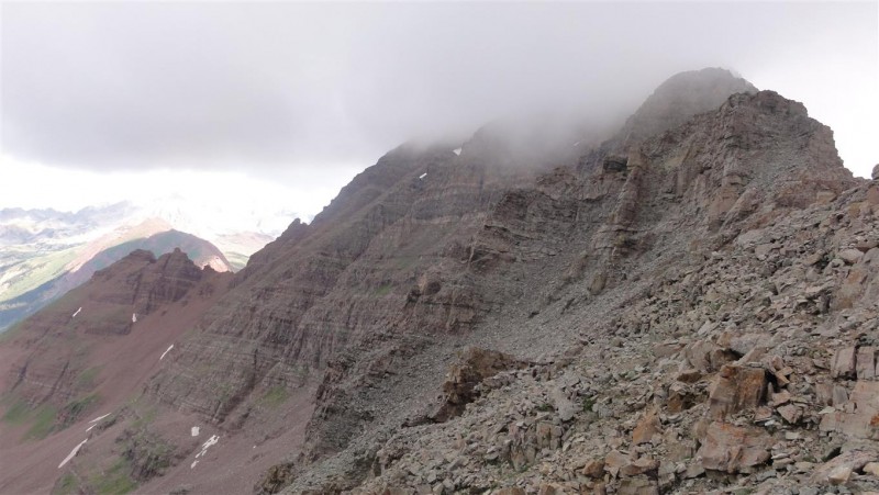
Finally at the ridge, the weather seemed to be improving, though the summit was still in the clouds. It would lift by the time we summited, only to lightly rain again for a short bit (and graupel) some distance after / below the summit. S. Maroon in the Clouds
Maroon peak has a reputation as one of the more difficult peaks in terms of route finding. Technically the class 3 terrain was most enjoyable and not so difficult, but I did not want to stray from the standard route as things can typically get bad fast. Turns out that if you've done your homework, the route is intuitive and very well cairned. The terrain just below the top is a bit complicated, but with a little trial and error it is easy enough to find your way to the top. Mark Coming Down the Chimney
The twin gulleys: Of all the trip reports I read, most people seemed to take the second gulley. An additional advantage that made the choice easy of which to take was that the snowfield in the following photo is just above the exit point for the second gulley. I discovered from someone's report the week before it was still there and matched a photo from Bill's route description (and corresponding to the exit point). The Twin Gulleys
Taking Care on a Ledge
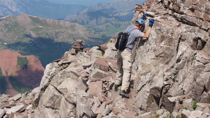
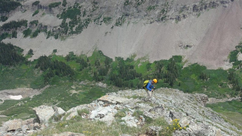
Despite the look on my face, I really am having a lot of fun at this point: Scrambling Up High
Summit Shot with N. Maroon Peak and Maroon Lake
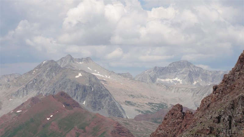
Snowmass (L) and Capitol (R) in the Distance
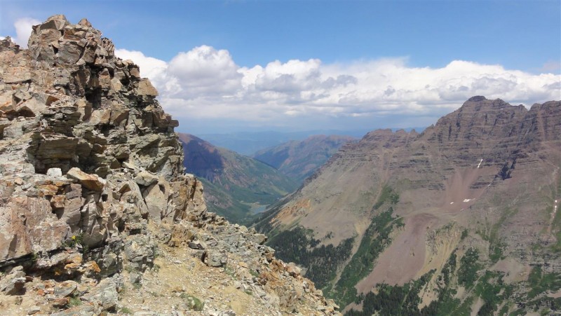
Maroon Lake with Pyramid (R) from Near the Saddle
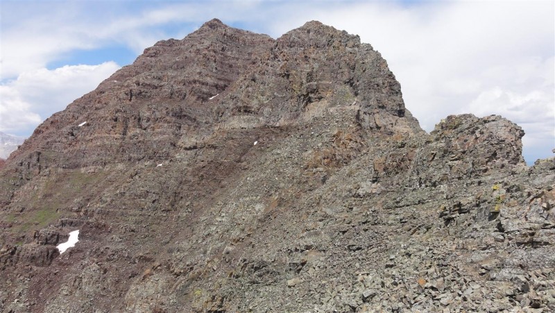
Classic View of S. Maroon from the Saddle
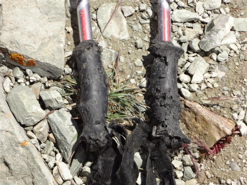
Mark said he's always had good luck with the marmots not attacking his trekking poles when left unattended for technical portions. His luck ran out this trip: Marmot Attack !
The Down-Slog
Almost Back to Camp at Crater Lake
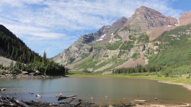
The Maroon Bells from Crater Lake (Maroon Peak (L), N. Maroon Peak (R))
Well despite the early "slog and the fog", Maroon peak turned out to be a pretty fun day after all !
As always, praise to God for another safe journey !
Thumbnails for uploaded photos (click to open slideshow):
Stupid marmot cost me $100 for a new set of poles. ”A 2800 ft slog in the fog” is a perfect description of that morning. Great climbing these with you, and I'm confident Pyramid is going down next year.
Great shots of the goats - and great TR!
Sorry you missed Pyramid. 2nd time is the charm - it'll go even better next time, since you've done a recon mission.
Caution: The information contained in this report may not be accurate and should not be the only resource used in preparation for your climb. Failure to have the necessary experience, physical conditioning, supplies or equipment can result in injury or death. 14ers.com and the author(s) of this report provide no warranties, either express or implied, that the information provided is accurate or reliable. By using the information provided, you agree to indemnify and hold harmless 14ers.com and the report author(s) with respect to any claims and demands against them, including any attorney fees and expenses. Please read the 14ers.com Safety and Disclaimer pages for more information.
Please respect private property: 14ers.com supports the rights of private landowners to determine how and by whom their land will be used. In Colorado, it is your responsibility to determine if land is private and to obtain the appropriate permission before entering the property.