| Report Type | Full |
| Peak(s) |
Mt. Yale - 14,200 feet |
| Date Posted | 07/29/2013 |
| Modified | 09/17/2016 |
| Date Climbed | 07/20/2013 |
| Author | huffy13 |
| Gorgeous Day with Clear Skies on Mt. Yale |
|---|
|
After two summers of successful hikes with my son and his cross country team, I decided we would try a third annual hike with the team. The original plan was to take all the kids to the east side of the Mosquito Range and bag Horseshoe and Peerless Mountains and then, if everyone was feeling up to and the weather was clear, continue on to Mt. Sheridan and Mt. Sherman and on from there if conditions were still good. Well, lots of things were causing the kids to have to back out...work, family vacations, sports, etc...., most of the kids were not able to go. It turned out to be my son and three of his teammates...all this next year's senior boys runners! We decided the day before we left for Colorado from Texas that we would go ahead and take a shot at Mt. Yale since the trailhead at Denny Creek was easily accessible, all of our boys that were going have been to the top of Pikes Peak two years ago and Mt. Ouray last August, so experience was fairly good and Mt. Yale looked like a great hike with a little fun bouldering and scrambling near the top. So Yale became our goal!!! I booked us some tent sites at Chalk Creek Campground in Nathrop. These are great tent sites, have a laundry and shower facility and several restroom sites and Chalk Creek runs right alongside the tent sites for a great place to soak the legs after a long day in the mountains! We turned in Friday night at 9 pm so we could try to get a good sleep in before an alpine start the next morning. We woke up at about 4 am and got our packs together, made sure we were not forgetting anything and left the campground at 4:40 am. It took us right at 25 minutes to drive from the camp site to Denny Creek TH. We arrived at the trailhead a few minutes after 5 am, had a quick breakfast at the parking area and everyone took a quick break at the restroom facilities at the trailhead. We hit the trail at 5:25.  The trail is extremely well kept, very clear and easy to follow. You get to cross the creek and several smaller feeder streams along the way, several places that are relatively flat and some up and down roller coaster type stretches along the way. There is a point where the trail forks and you can either go right to Mt. Yale or left to Brown's Pass and Hartenstein Lake. The next several pics are of trail conditions we enjoyed up to treeline. 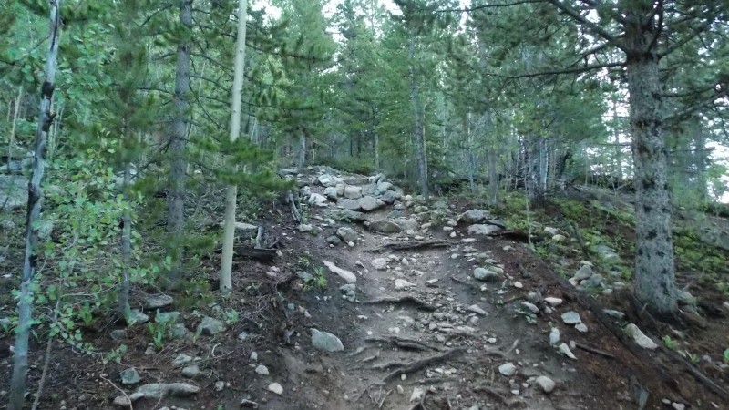 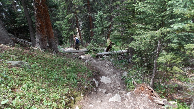 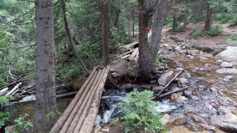 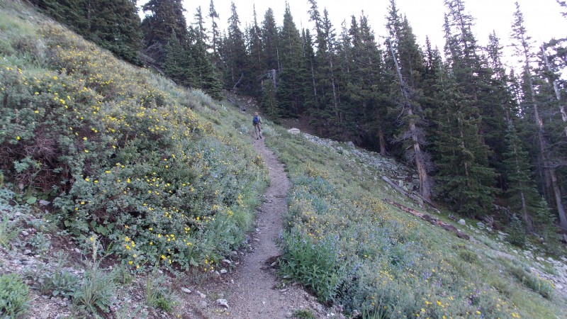 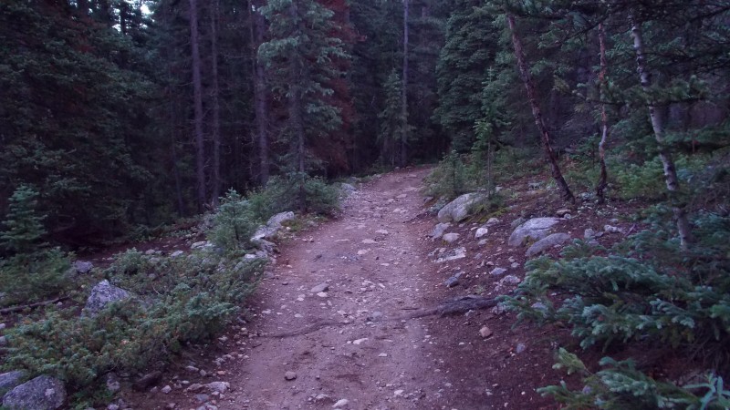 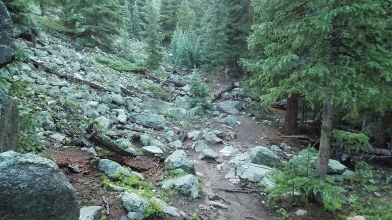 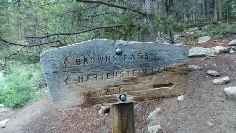 We even had a curious visitor checking us out while we took a hydration/food break at about 11,000 ft. 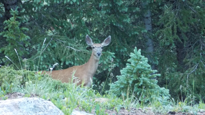 Once at treeline the views really open up. Great views of the Sawatch peaks to the south and west and views down into the valley towards Cottonwood Pass. 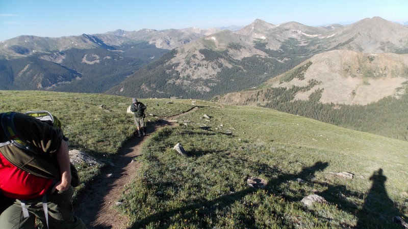  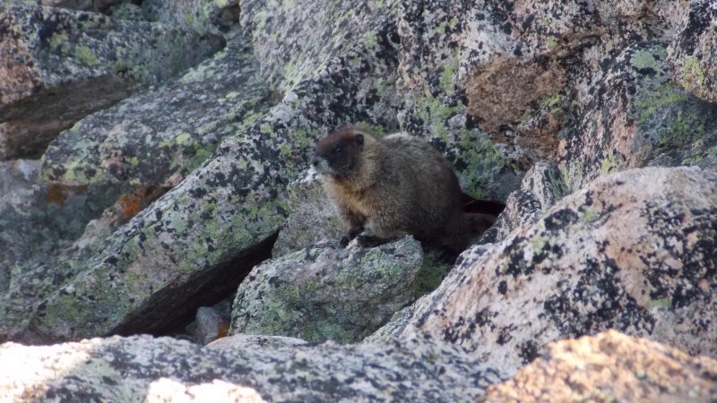 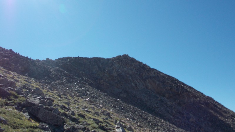 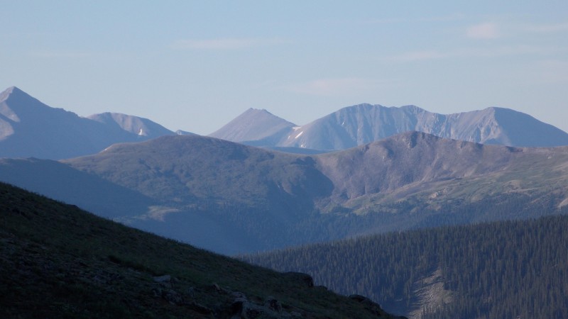 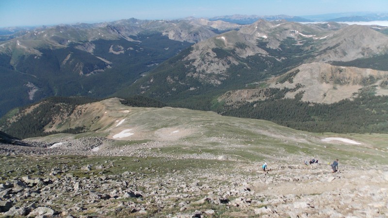 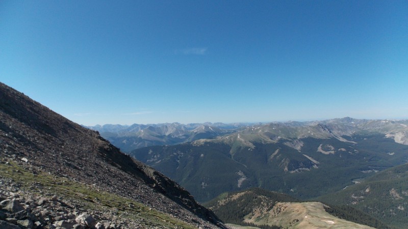 The last part of the ascent is what I consider to be the best part of the entire hike. Once you ascend the rocky slopes above treeline you arrive at the SW ridge. There really isn't a trail, but there are cairns here and there that keep you somewhat along the path up. You really just need to pick a line and go with it...you can keep this at a solid to easy class 2 or you can spice it up a little with some fun scrambling along the highest points of the ridge...which is what I did quite a bit of the time while the boys stayed along the cairns. Very good class 2 experience for the boys and the really enjoyed it. Here are several pics of the ridge, some on the ascent and some on the descent. 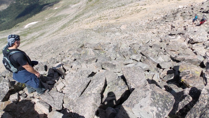  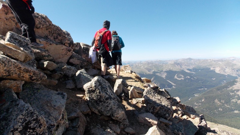 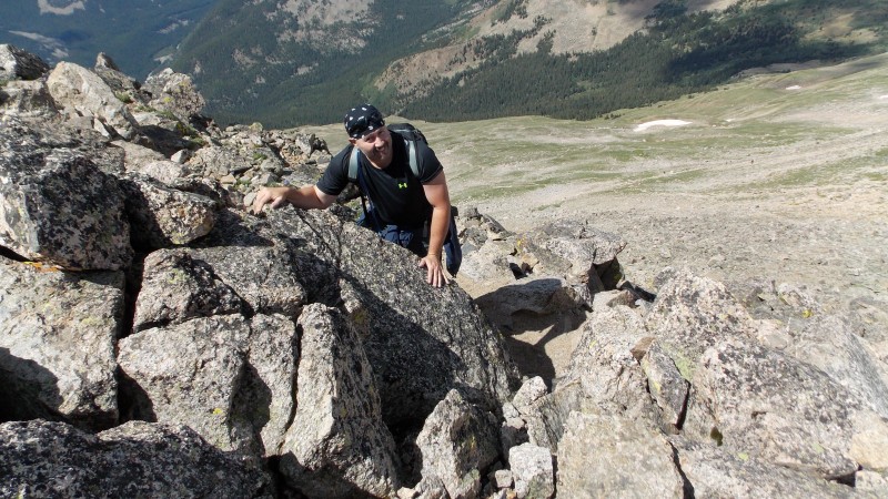 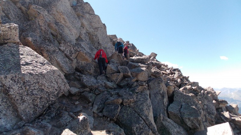 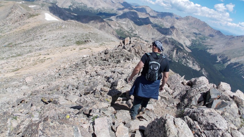  After just a couple hundred feet of gain you reach the last short, flat stretch to the true summit. We reached the summit at 10:15 am, just under 5 hours on the ascent. 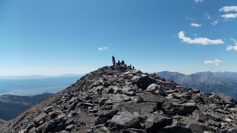 Summit was awesome and the skies were clearer than I have seen them in a couple years. We could easily see most of the Sawatch range, the Elks were easily discernible to the west, Pikes Peak was visible on the far east horizon and we could even see the northern end of the Sangres, including the Crestones and Humboldt. Incredible views on a perfect day.  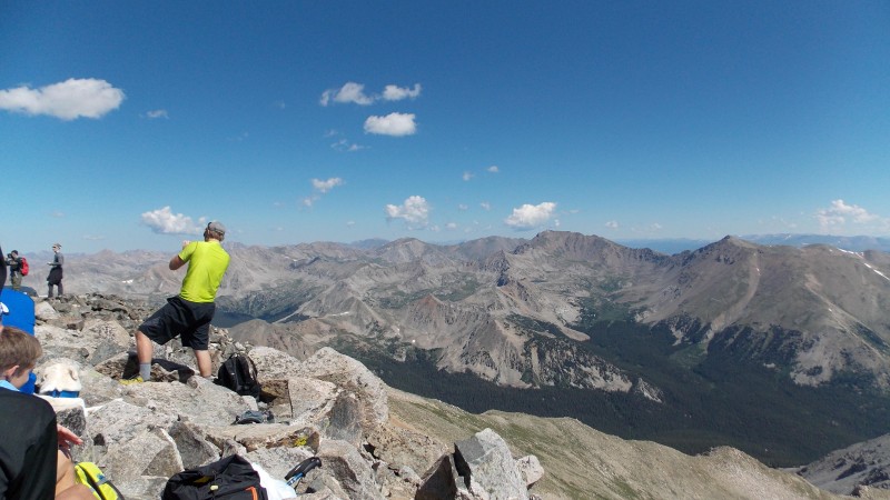 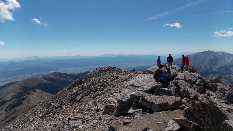 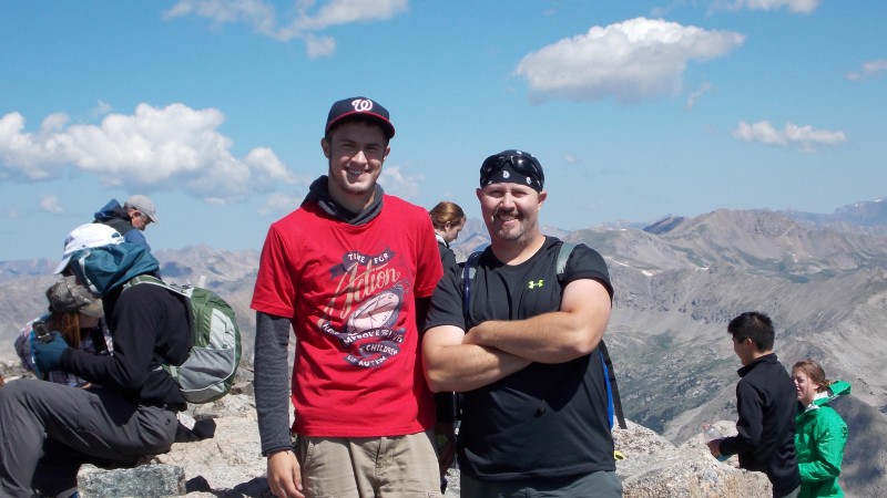 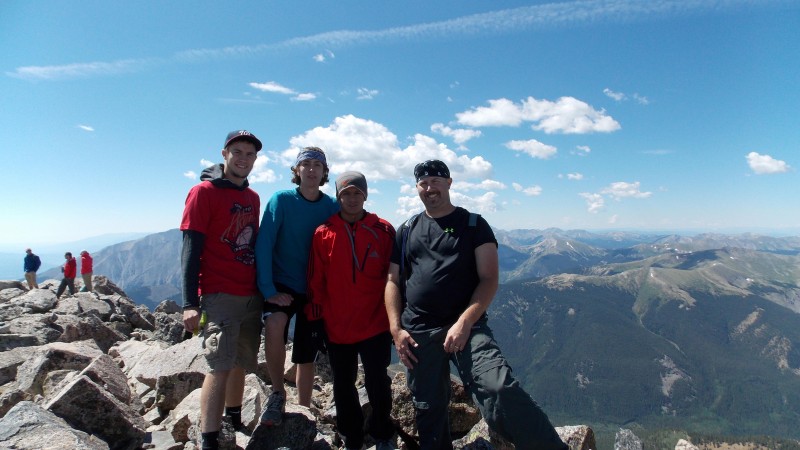 We spent almost a full hour on the summit since the temps were great, the skies were clear and there was no sign of bad weather anywhere. We then headed down back to the trailhead. I actually got to see something that I have never seen before on any of my hikes....a mountain hiking feline!!!! 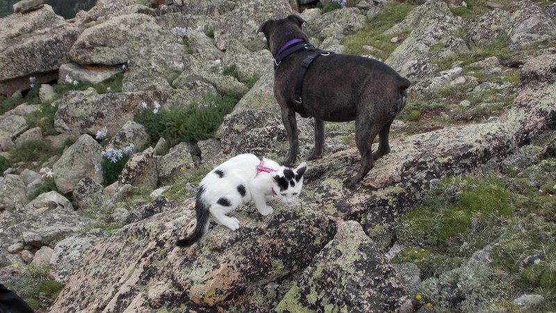 We reached the trailhead at about 1:30 pm, just over 2 hours total on the descent, for a total hike time, including the summit time, of just at 8 hours. Not bad for a bunch of flatlanders! Great times for a third year in a row....now what do we dare attempt next year? 8) And now, as I have been doing on most all my reports, here are my observations, opinions and pointers for anyone that may be thinking about this great hike: First off, as always, start early. It is not a terribly long hike, but the last 2 miles up are a lot slower than the first 3 miles up. The trail is always easy to follow and straightforward until you hit the ridge. The ridge is not intense for those who like some minor exposure, but for those such as my son, that do not like any exposure, it can be a little intimidating. I thought the ridge was extremely fun...just pick a line and look for the frequent cairns, they will guide you along and there is never a place on the ridge that you can't keep at an easy class 2 scramble. Views are awesome from the summit...I really think this peak is underrated. Overall, it was not something I would take a brand new hiker on, but anyone with any kind of experience will enjoy Mt. Yale. There is water along the first half of the hike, but I would recommend some type of purification method as it is all below treeline and you would not want to flirt with the funky crud you could catch from drinking it untreated. I usually go through my entire 2.5 liter camelbak bladder on every hike, I did not quite get through all of it on this hike due to it not being but about 10 miles total. Again, I highly recommend this hike...you will thoroughly enjoy it. Thumbnails for uploaded photos (click to open slideshow):
|
| Comments or Questions |
|---|
|
|
Caution: The information contained in this report may not be accurate and should not be the only resource used in preparation for your climb. Failure to have the necessary experience, physical conditioning, supplies or equipment can result in injury or death. 14ers.com and the author(s) of this report provide no warranties, either express or implied, that the information provided is accurate or reliable. By using the information provided, you agree to indemnify and hold harmless 14ers.com and the report author(s) with respect to any claims and demands against them, including any attorney fees and expenses. Please read the 14ers.com Safety and Disclaimer pages for more information.
Please respect private property: 14ers.com supports the rights of private landowners to determine how and by whom their land will be used. In Colorado, it is your responsibility to determine if land is private and to obtain the appropriate permission before entering the property.

