| Report Type | Full |
| Peak(s) |
Mt. Blue Sky - 14,268 feet |
| Date Posted | 07/27/2013 |
| Date Climbed | 07/20/2013 |
| Author | bigredmachine |
| Evans from Guanella Pass using Gomers Gully |
|---|
|
Who: Myself, my close friend Travis, and his dog Moxey. When: Saturday, July 20th 2013 Where: Mt Evans from Guanella pass I actually went into this trip relatively unprepared for a couple of reasons. First off, I had some other plans for Saturday that fell through and so my trip was last minute. Second, the original plan was to do a much shorter hike from Summit Lake and be back in Denver before noon. Little did I know, the Mt. Evans road was closed due to a bike race. So instead of getting a good night sleep in preparation of a long day of hiking, I was at Old Chicago's until midnight (I know...probably a bad idea anytime you set your alarm for 3:45AM, but due to overwhelming excitement I rarely sleep well the night before a hike). To the hike....My alarm went off at 3:45AM, I jumped out of bed, brewed a pot of coffee and pulled up to Travis' house at our planned meetup time of 4:15. At about 5AM I exited I-70 in Idaho Springs, drove about a half mile and saw the CDOT sign notifying me of the road closure. I had attempted climbing Evans from Guanella Pass last November but turned back mostly because I didn't feel comfortable doing the route solo. It definitely wasn't on my list of routes to do anytime soon. However, since then, but not recently I had read a few trip reports and felt prepared enough to make the last minute change. Travis had no idea what I was getting him into. We got back on I 70, made our way towards Georgetown and by 5:30 pulled into parking lot at the top of Guanella Pass. In retrospect, you can break this particular route into 3 sections: The Willows (or as we referred to "The Muck"), Gomer's Gully, and the West Ridge traverse towards the summit. It was beautiful out, the temperature was 42 degrees, there was no wind and we hit the trailhead at 6AM. The first mile or so is on the very defined, well marked Mt Bierstadt trail. The trail leads you down from the parking lot (you lose a couple hundred feet immediately) and across an open meadow that could easily be described as a high mountain swamp. The Mt. Bierstadt trail has numerous boardwalks that allow hikers to cross the mucky, willow filled meadow with little effort. Since I had attempted this route last year I knew all to well about the willows; I knew the trailhead (if that's what you want to call it) for Mt. Evans was just after you cross Scott Gomer Creek. But I had also read on a couple of trip reports, that you could by bypass or minimize bushwhacking through the willows if you headed north (or left) from the Mt Bierstadt trail prior to the first lake. This was about the only detail I remembered from the trip report so we opted to stick to the normal route described in Roach's 14er guidebook. After about 15 or 20 minutes of hiking along the Mt Bierstadt trail we crossed the creek and found the Mt Evans trail head within 100 yards. 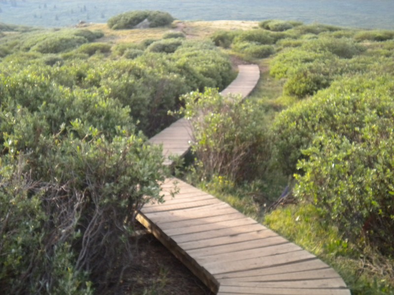 From here forward there really is no set trail for quite some time, when you think you're on a trail you suddenly find yourself deep in a giant willow that is 4 ft taller than you. You find a trail and lose a trail. The willows are an absolute pain in the ass. Laugh and enjoy it for what its worth. It had rained the night before so not only was the ground wet but the willows were wet as well. Within 10 minutes we were essentially soaked, we had not even stepped in muck yet. We decided to set mini goals. Our first goal was to get past the big open meadow and get around the hill into the valley that goes towards the Sawtooth. We got along the edge of the meadow on the far east side closer to the trees, it was better, but the willows are everywhere, and you basically get forced back into the muck. After a full hour, we finally got around the hill and into the valley. At this point you can either cross the creek and climb up a smaller gully towards the west side of Mt Spaulding or go east along the creek towards the Sawtooth and take Gomer's gully up towads the ridge between Mt Spaulding and the Sawtooth. 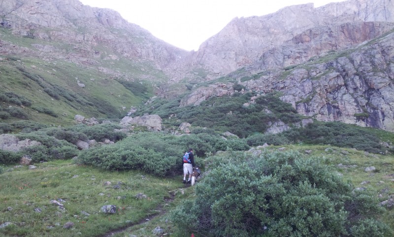 We chose to go east towards Gomer's gully (Either way you still have to go through more muck.) We did find a defined trail going towards the Sawtooth, we lost it a couple times trying to go around more muck but found it pretty easily. As you approach Gomer's gully the scenery gets better and better. We followed the trail to the end of the valley below the Sawtooth, crossed the creek and stood at the base of Gomer's Gully. It was 8AM, we were soaked and the sun had not peaked over the sawtooth yet so we were rather cold as well. We took a quick break and removed whatever wet layers we could. We ate a couple granola bars and headed up the Gully. The Gully looks much worse from a distance than it really is. It is steep, but for the most part fairly soild. However with that being said If I had brought my helmet I would have worn it here. There is absolutely some loose scree to be careful with. I would be extra cautious with anyone above you. 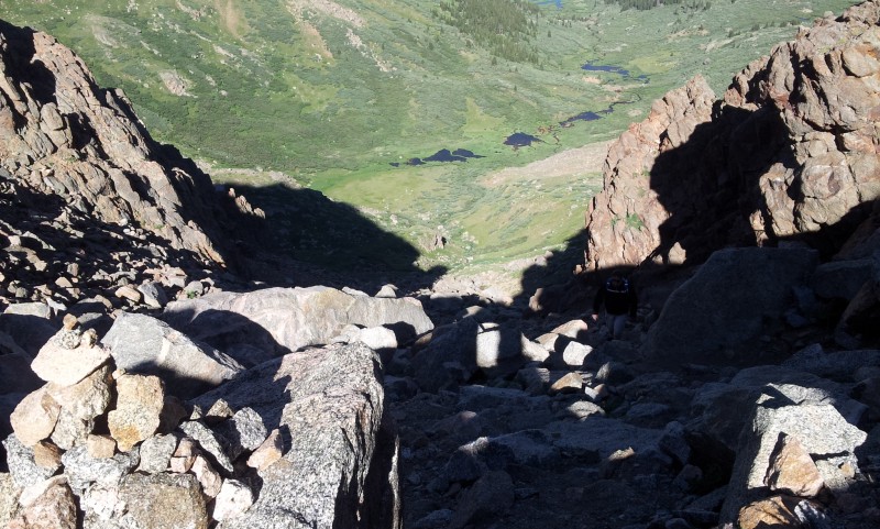 Overall, the gulley is beautiful, with a fast running creek, lots of wildflowers and a close up of the Sawtooth not commonly seen. 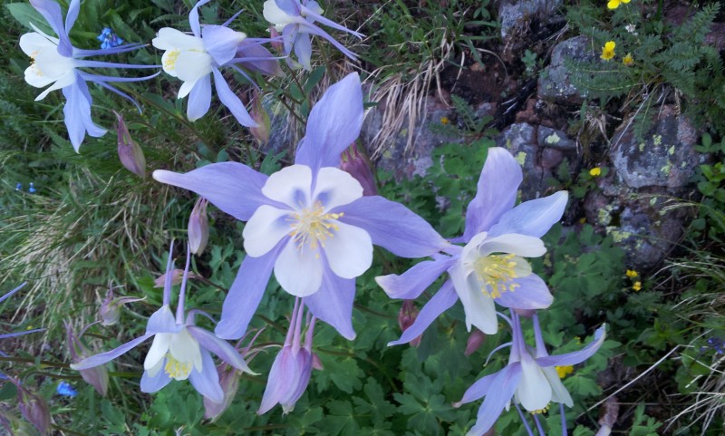 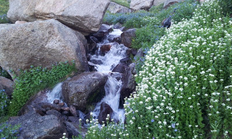 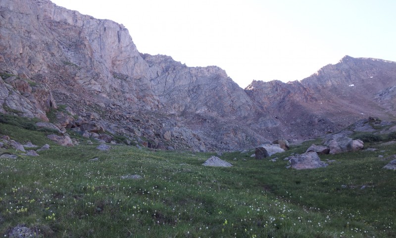 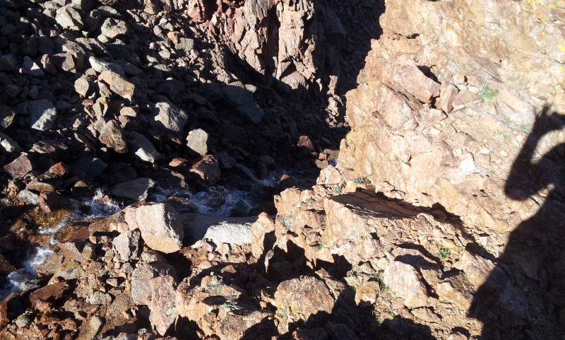 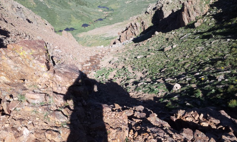 You end up gaining nearly 1500 feet from the bottom of the gully to top. This was probably our favorite part of the hike Once on top of gulley, everything opens up 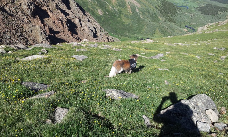 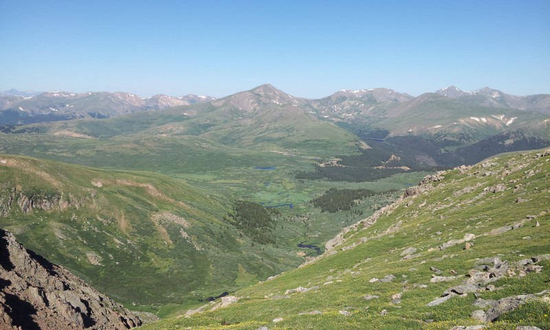 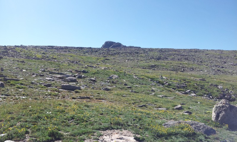 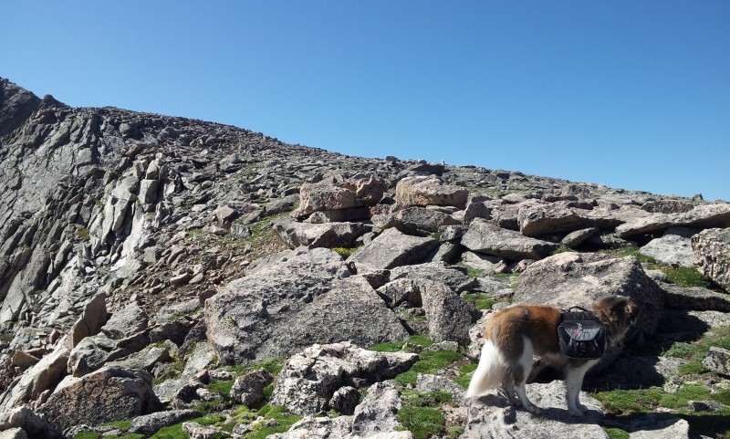 The view on top of the ridge is fantastic in every direction.  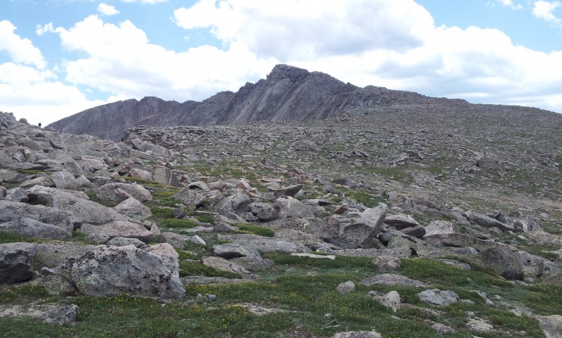 From here, we headed south as the terrain changed from soft tundra to quite a bit of rock and then eventually all rock. We contemplated doing west Evans, but felt it might have been a little bit much with Moxey.  We continued below the ridge on a somewhat defined trail which eventually rounded and headed east where eventually the summit facilities come into view.  Once near the summit facilities we ran into the tourist trail from the summit parking lot to the actual summit. 2 or 3 switchbacks and we made it to the summit at 11AM (5 hours). The summit was pretty nice, the road was closed so the only people up there were hikers and bicyclists. The weather was still pretty good, but it was 11:30 and we still had a lot of hiking above tree line ahead of us. We ate some snacks, took some pictures and headed back down. The Decent...I love ascending mountains and hate descending mountains. I have a torn ACL and meniscus in my right knee (soon to be repaired), so I not only go slower, but I have to be extremely cautious where I put my foot on each and every step. I made it back down off the ridge and to the tundra when my right hamstring began to cramp. I've learned over the years that in addition to lots of water, I need to drink Gatorade to keep me from getting cramps (I didn't bring any Gatorade). I did have salty sunflower seeds which helped, but I had to deal with cramping most of the way down (Not much you can do at that point though). In hopes of avoiding the willows, we opted to descend Mt Spaulding's west ridge all the way down rather than descend the gully. >10> 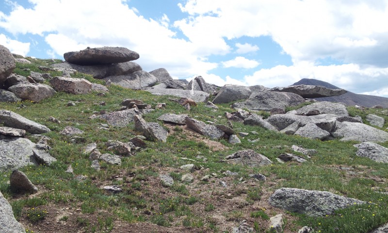 Although we still hit some willows at the bottom, this was a good choice; the descent was more gradual and easier on my knee and also very picturesque. You can basically follow the ridge all the way down. You do have to cross the other gully previously mentioned, but its not a big deal at all. Once we crossed the gully we kept heading mostly west and a little south down towards the trees. It was near here that we found a trail that lead us down below a small cliff band through some willows and into the trees, it wasn't swampy at all here. We hiked at least a mile on a good trail willows and trees. Everything was good until probably the last ¾ mile ( ½ mile north and ¼ west of the big lake below the parking lot) in which we found ourselves standing in about a foot and half of muddy water. At this point we were hungry, tired and now wet and chose to go straight ahead rather than zig zag through the willows. We got back to the parking lot at 3pm, muddy and wet (8.5 hours total, not including time on the summit). Things to consider...(This is my first trip report...hope it can be of some help) -This is great route as long as you understand the willows suck (or find that magical way around them). -There is not many people on the route until you meet up with the other routes -Other than the gully, it is not a steep route -The views of the Sawtooth are incredible -Although it's only listed at 8.5 miles RT, its felt more like 10 miles with all the bobbing and weaving through the willows. Things I learned -The Willows suck- I know I've said this a few times, but if you go into this expecting this, you will enjoy the route We did not have gaitors or trekking poles, both would have been nice. -Cramps suck...I'd like to think that I'm normally well prepared, I was not. Electrolytes are important, I need to remember that I can't just drink water. Thumbnails for uploaded photos (click to open slideshow):
 Taken from November (General Direction past willows)")
 The Sawtooth from the west slopes of Spaulding")
 Sawtooth from Spaulding west slopes")
|
| Comments or Questions | |||
|---|---|---|---|
|
Caution: The information contained in this report may not be accurate and should not be the only resource used in preparation for your climb. Failure to have the necessary experience, physical conditioning, supplies or equipment can result in injury or death. 14ers.com and the author(s) of this report provide no warranties, either express or implied, that the information provided is accurate or reliable. By using the information provided, you agree to indemnify and hold harmless 14ers.com and the report author(s) with respect to any claims and demands against them, including any attorney fees and expenses. Please read the 14ers.com Safety and Disclaimer pages for more information.
Please respect private property: 14ers.com supports the rights of private landowners to determine how and by whom their land will be used. In Colorado, it is your responsibility to determine if land is private and to obtain the appropriate permission before entering the property.

