Download Agreement, Release, and Acknowledgement of Risk:
You (the person requesting this file download) fully understand mountain climbing ("Activity") involves risks and dangers of serious bodily injury, including permanent disability, paralysis, and death ("Risks") and you fully accept and assume all such risks and all responsibility for losses, costs, and damages you incur as a result of your participation in this Activity.
You acknowledge that information in the file you have chosen to download may not be accurate and may contain errors. You agree to assume all risks when using this information and agree to release and discharge 14ers.com, 14ers Inc. and the author(s) of such information (collectively, the "Released Parties").
You hereby discharge the Released Parties from all damages, actions, claims and liabilities of any nature, specifically including, but not limited to, damages, actions, claims and liabilities arising from or related to the negligence of the Released Parties. You further agree to indemnify, hold harmless and defend 14ers.com, 14ers Inc. and each of the other Released Parties from and against any loss, damage, liability and expense, including costs and attorney fees, incurred by 14ers.com, 14ers Inc. or any of the other Released Parties as a result of you using information provided on the 14ers.com or 14ers Inc. websites.
You have read this agreement, fully understand its terms and intend it to be a complete and unconditional release of all liability to the greatest extent allowed by law and agree that if any portion of this agreement is held to be invalid the balance, notwithstanding, shall continue in full force and effect.
By clicking "OK" you agree to these terms. If you DO NOT agree, click "Cancel"...
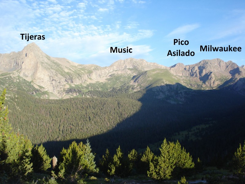
Tijeras Peak(north face) and Music Mountain(south ridge ascent, east ridge descent)
Date Climbed: 7/23/2013 Mileage: 11.4 miles per Garmin Elevation: 4,805' per Garmin
A few years back, I ventured over to Milwaukee Peak on a long day that originated in the South Colony basin. I really enjoyed that day, and had been ready to come back to the Sand Lake drainage to climb Milwaukee's neighbors for quite some time. Things worked out, and I found myself ready for a loop around the basin.
My hope was to circle the basin clockwise and climb until either I got tired or weather threatened. In a perfect world, I wondered if I could go Tijeras, Music, Milwaukee, Pico Asilado, back to Milwaukee, Marble. Realistically, that plan was shot from the get-go with a 6:30 start.
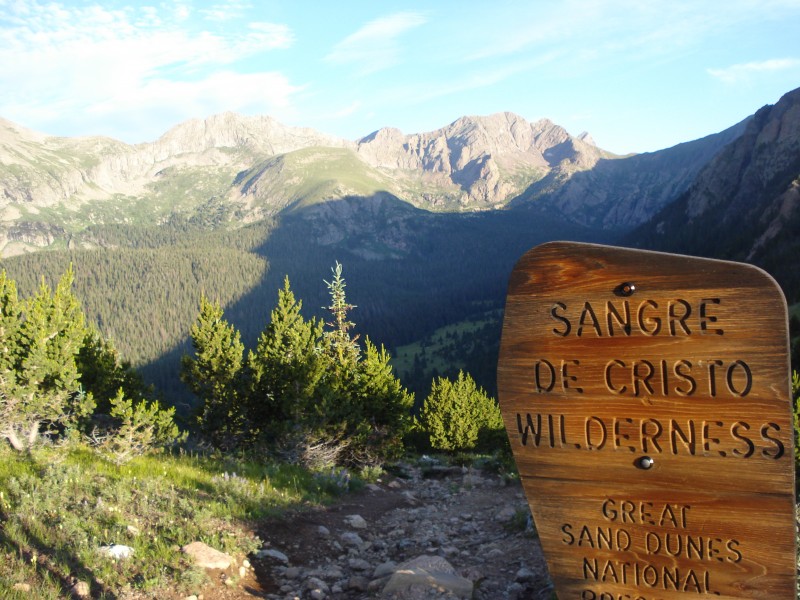
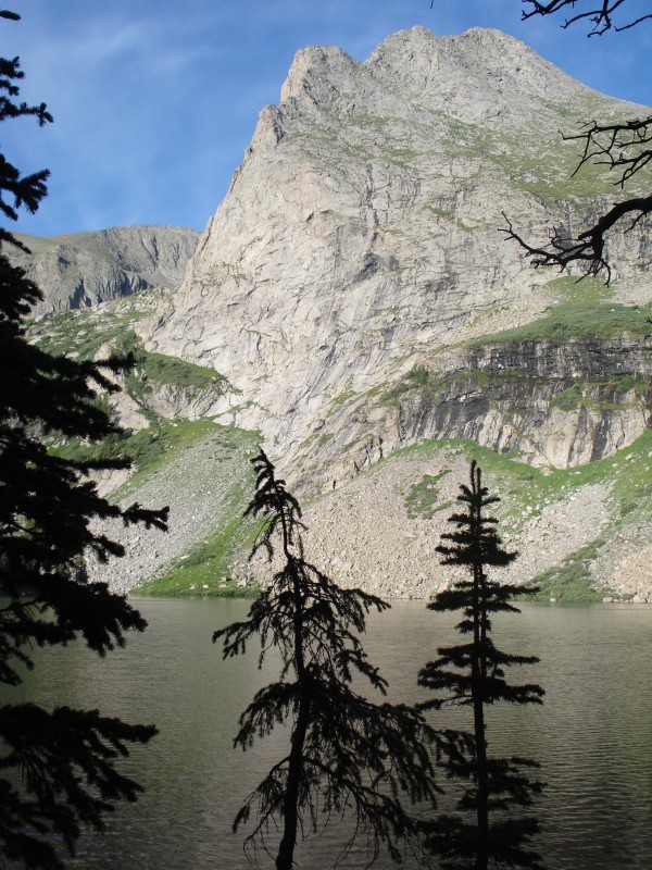
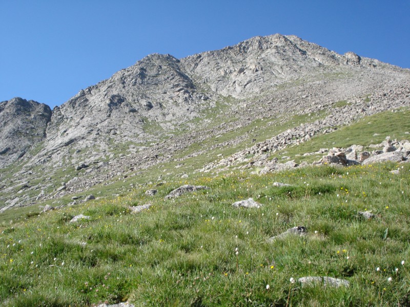
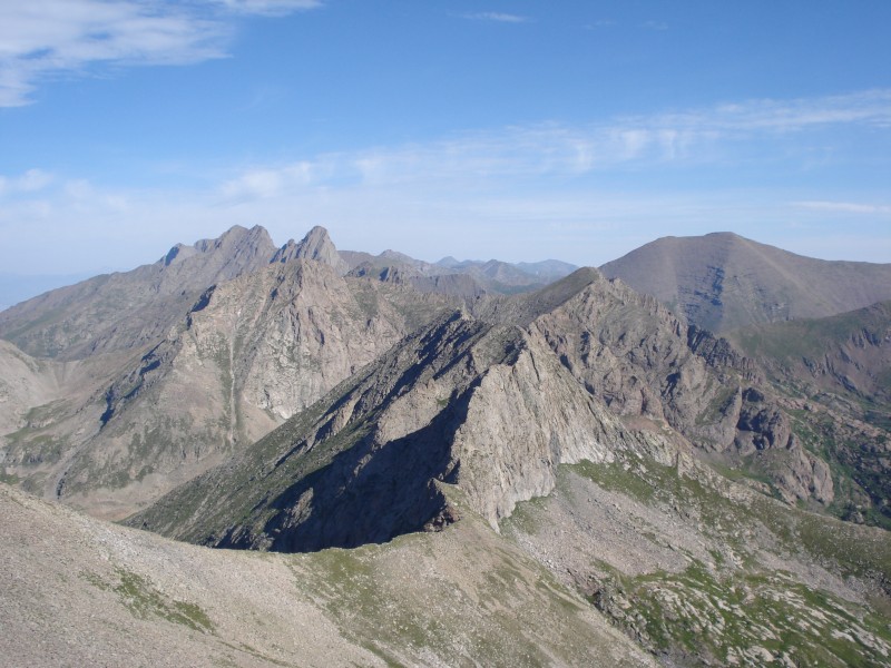
Crestones' southerly neighbors
Music Pass, ridge of Marble Mountain in the background
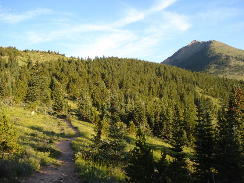
The climb up Music Pass was somewhat runnable. It may have been moreso, but I brought my bigger pack, which I do when I'm expecting to be out more than 6 hours on technical routes.
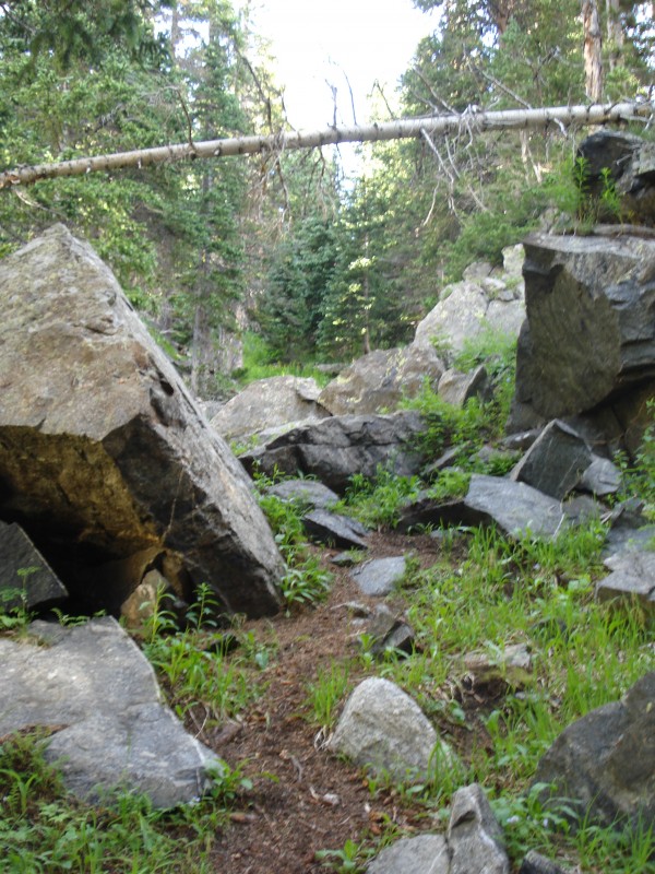
Beautiful trail
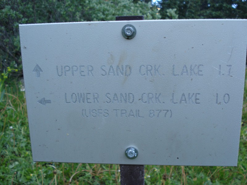
Cooper describes the approach to Tijeras from Upper Sand Lake. I chose to apprach via Lower Sand Lake. I believe his reasoning is that most folks will set up camp and do Music Milwaukee etc over the course of a weekend, so a camp at the Upper Lake is centrally located. After today, I'm convinced that neither option is head and shoulders better than the other. Going to the Upper Lake may add distance, but it appeared to me that you could avoid a good amount of willow-bashing (summer postholing) and other bushwhacking by going around to the Upper Lake. One more thing - Upper and Lower are kind of a misnomer. The Upper lake does not feed the Lower lake, and is in fact only a couple hundred feet higher.
Left to lower, straight to upper, right to ? Milwaukee Pass?
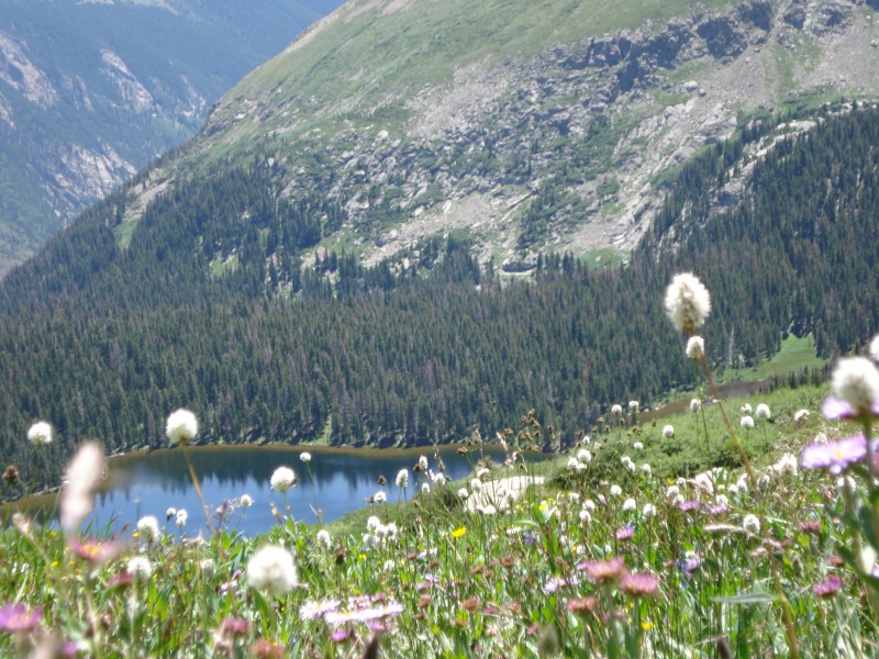
The trail continued to be very mellow and switchbacky, making it possible to wog much of it. I got to Lower Sand Lake just as many of the campers were beginning to stir. Beautiful place!!!
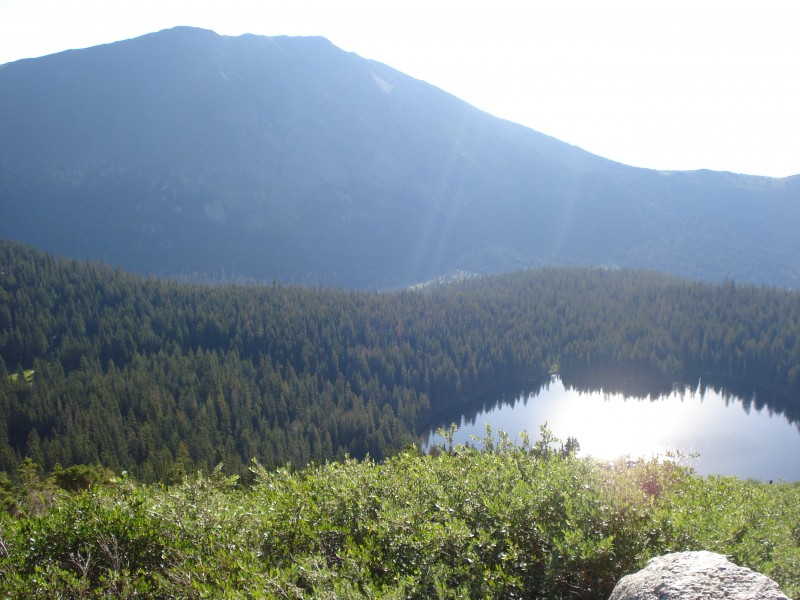
Lower Sand Lake
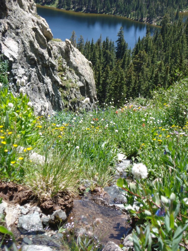
I located a weak climber's trail at the far (northwest) corner of the lake and took it until it dumped me out in a bunch of willows. Thanks.
Climber's trail at NW edge of Lower Sand Lake
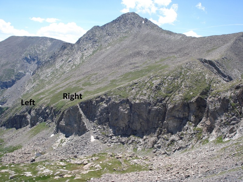
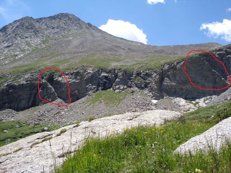
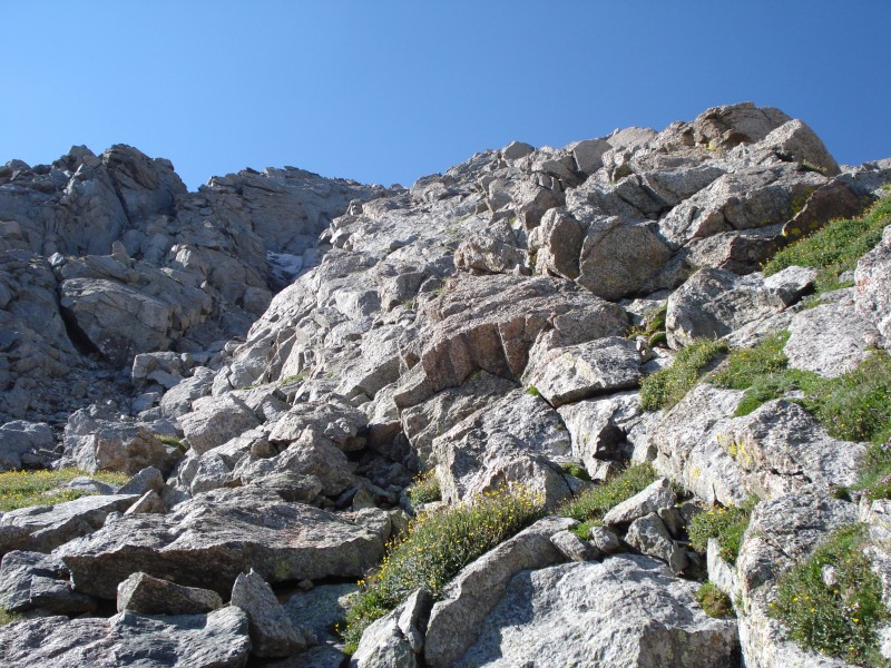
In lordhelmut's TR from a few years back, he refers to Tijeras as a puzzle. No doubt, it attempts to confound you early. Before the infamous "ramps", you have to persevere through a good amount of willowage. My shins weren't happy. A couple hundred feet of gruntwork, though, and I was face-to-face with the cliff. I was a little too far south of both ramps, and since both open to the north, they were hidden to me. A couple minutes of traversing north uncovered the left ramp, which by now had completely melted out.
Willows, clifflets and such
Horns!
View of the two ramps
Another angle
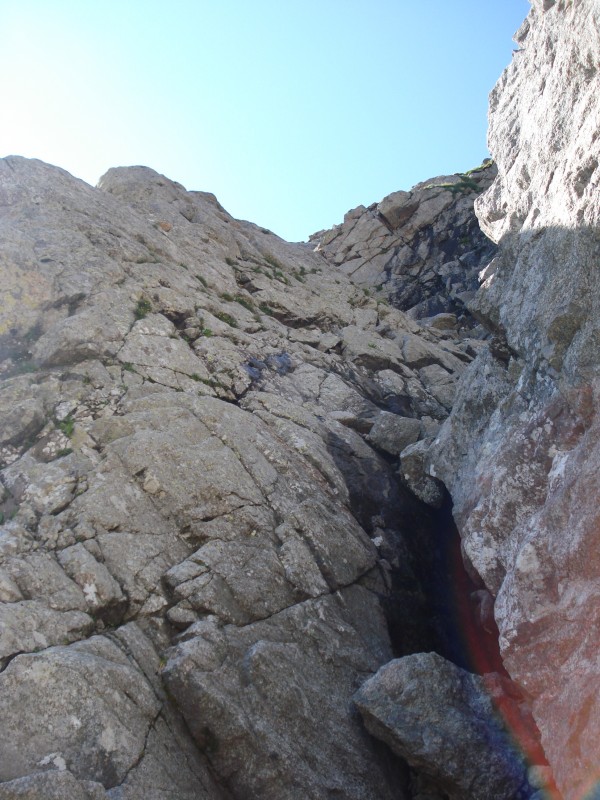
Looking up the left ramp
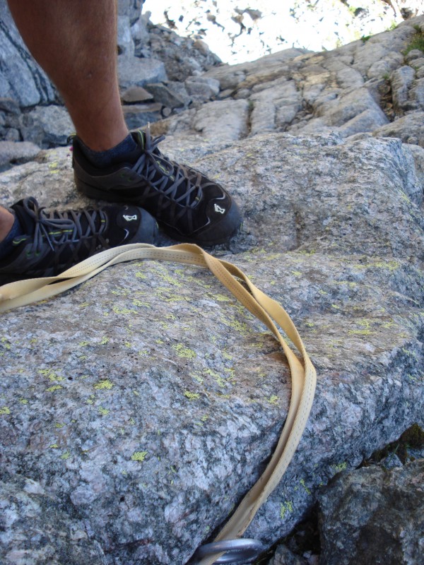
Navigating through the cliff's weakness was the first class 3 of the day, and I came across a sling. Assumedly used in sketchier conditions.
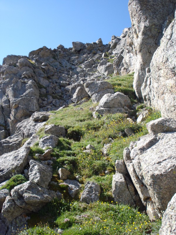
For all of it's majesty when viewed at every other angle, Tijeras sure wasn't a looker from the base of its north face. I think I could see a double chin. After a bit of talus-hopping, I opted to aim for a shallow couloir on the north face. If you're a fan of garbage, then I highly recommend this route.
Shallow couloir
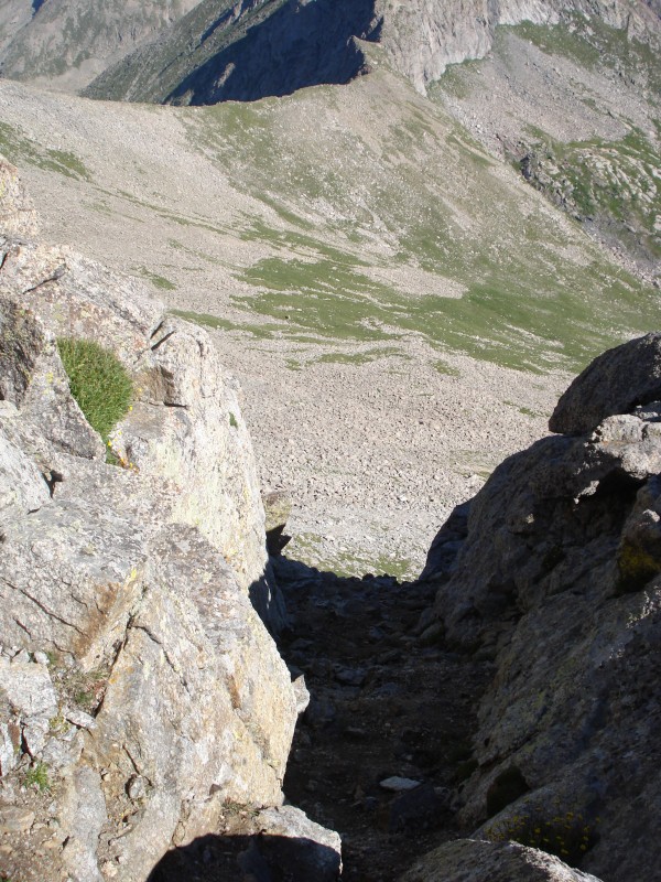
Looking down
near the summit of Tijeras
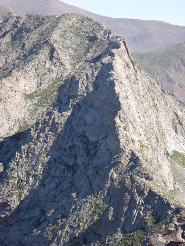
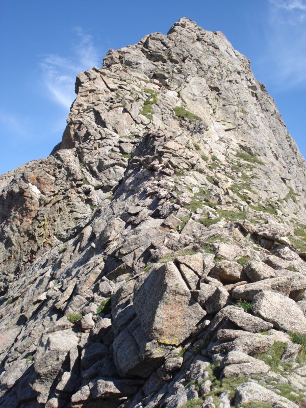
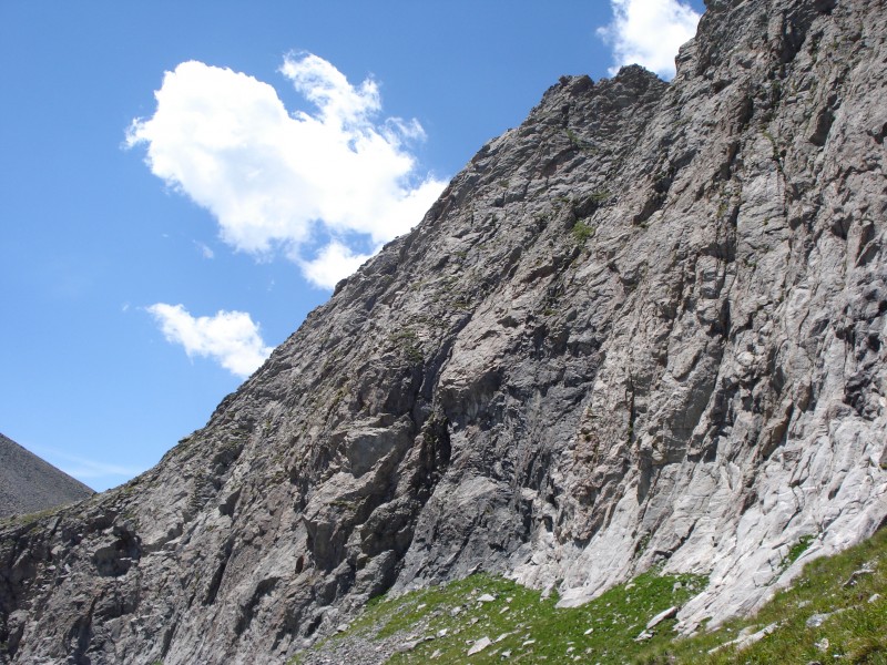
From atop Tijeras, I looked north at the rich set of "scrambler's mountains" before me. That south ridge of Music didn't actually go, did it? Cooper's book said it looked better the closer he got. I believe the words he uses to describe it are "a superb airy scramble on solid rock. Sustained class 4 or lower-class 5 scrambling that may require a rope for some sections." Furthermore's TR from June seemed to downplay the difficulties, saying that it was mostly class 3 interspersed with an occasional class 4. By this point, I was intrigued. Terrified. But intrigued. So down the ridge I went to get a closer look.
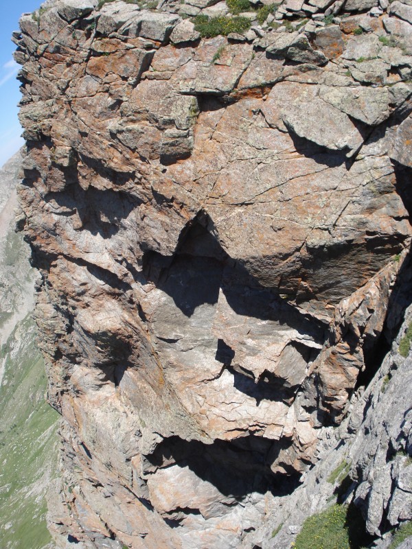
Looks pretty finny to me. Maybe if I get closer.
Hmmmm. Still looks pretty thin. Maybe I'm not close enough.
Shit.
I sat at the base of the ridge for a few minutes, contemplating my future. I follow a simple rule: I don't go up something I can't go down. That eventually was the push I needed.
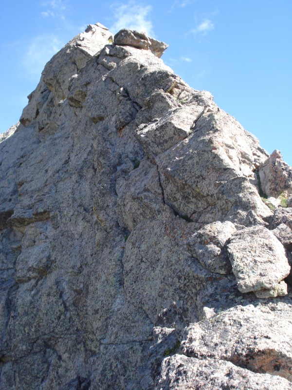
Right away, I found myself thinking, "Man, I would be screwed if not for that hold right there." I must have repeated that thought a good ten times as I ascended the ridge. Every time I looked up and convinced myself there was no possible way up or over or around a problem, *poof* the perfect rock would just be there! I definitely felt much of the initial climb was solidly in class 4 terrain, but as I said, the holds were bomber and the rock was solid! There were a couple of airy sections that caused my testicles to lodge in my throat, but......nah, there were a LOT of those airy sections. I found it to be quite intense, and by the time I gained the north summit, I was happy to be on a wider berth.
Images are rockier than they appear
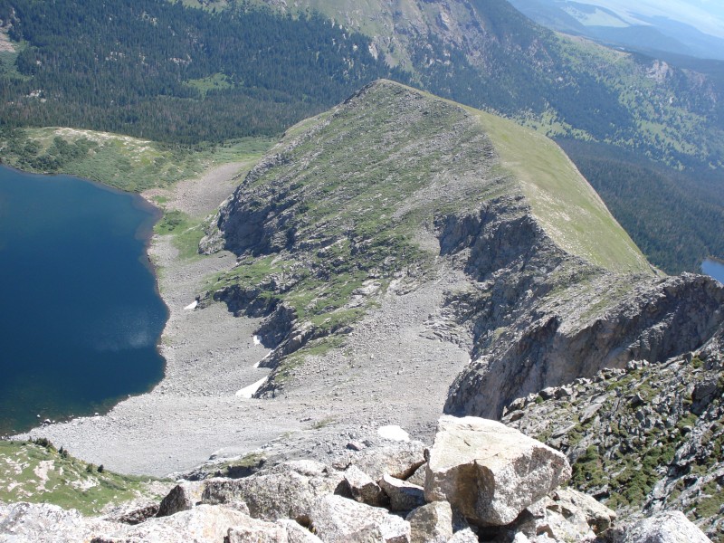
I'm not gonna lie. The ascent of Music's south ridge rattled me a bit. When combined with the time, I found it easy to decide not to continue on down Music's north ridge to Milwaukee. Instead, I punted and began the journey back to the car via the much more tame east ridge.
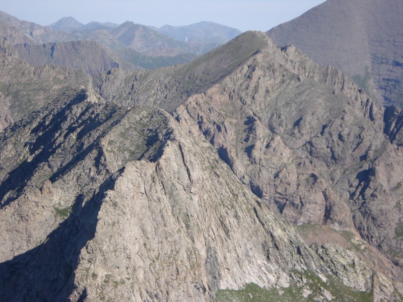
The two sand lakes split by Music's east ridge
South ridge looks harmless from here, right?
I wasn't a fan of the east ridge. Seemed to be a lot of grassy steepness without much scrambling.
The further down I went, the more exhilarated I became over the ascent that I had just completed. I had underestimated Music, and it on more than one occasion nearly offered me a laxative effect. Kind of like when you're a kid and your older brother jumps out of the closet when you least expect it and scares the living #@$@# out of you...it sucks when it happens, but something about that rush makes you smile when you look back.
Splits
Car to Music Pass: 0:20
Music Pass to Lower Sand Lake: 0:36(0:56)
Lower Sand Lake to Tijeras summit: 1:39(2:35)
Tijeras summit: 0:15(2:50)
Tijeras summit to Music Summit 1:45(4:35)
Music summit: 0:15(4:50)
Music summit to Lower Sand Lake: 1:22(6:12)
Lower Sand Lake to Music Pass: 0:32(6:44)
Music Pass to Car 0:14(6:58)
Thanks to those of you who provided previous excellent TRs, especially lordhelmut and furthermore. Appreciate it, guys.
My GPS Tracks on Google Maps (made from a .GPX file upload):
Musics South Ridge was the first time I turned around simply because of fear, not weather, conditions, choss, or danger...just plain fear. Not that my resume is thick, but the class 3 and 4 I have done to date, didnt seem to compare to it at all. I will go back another day, and see if my courage can be more steadfast :) Nice report.
I enjoyed both this report and your report of the traverse from Crestones to Broken Hand to Milwaukee. The south ridge is sweet - one of the scrambles in Cooper's book that lives up to the hype.
Not a bad time too. I'm sort of mixed on the ridge. We stayed about as direct as it goes. For the most part, I think I'd go with exposed 3rd class but the 3-4 sections of airy 4th with maybe a single move of bomber-hold 5.0 are certainly attention grabbing. I do think Cooper exaggerates the difficulty a bit, considering his likely audience.
There's a notch downclimb on Music's N. Ridge headed over towards Milwaukee. I'd be curious to know how it goes.
The peaks in this area are on my short list this year. Don't know if I'll get there in 2013, but I'll definitely be checking out your report again when I do go.
Two years ago I had envisioned doing some back country camping with the kids near one of the Sand Creek lakes, but pulled the plug because I thought they were too young (4 and 6 at the time). However, we did make it to the top of Music Pass for a glance over the other side, and boy- them's pretty mountains. I remember thinking that they looked like an awesome time, but a bit too gnarly for me given my current experience/confidence. Tijeras might be a go, but I'm one of those fellows who's a bit self-conscious of the way my voice sounds when the old gonads get up near my throat....
Anyway, a great story!
cheers,
tbg
Caution: The information contained in this report may not be accurate and should not be the only resource used in preparation for your climb. Failure to have the necessary experience, physical conditioning, supplies or equipment can result in injury or death. 14ers.com and the author(s) of this report provide no warranties, either express or implied, that the information provided is accurate or reliable. By using the information provided, you agree to indemnify and hold harmless 14ers.com and the report author(s) with respect to any claims and demands against them, including any attorney fees and expenses. Please read the 14ers.com Safety and Disclaimer pages for more information.
Please respect private property: 14ers.com supports the rights of private landowners to determine how and by whom their land will be used. In Colorado, it is your responsibility to determine if land is private and to obtain the appropriate permission before entering the property.