Download Agreement, Release, and Acknowledgement of Risk:
You (the person requesting this file download) fully understand mountain climbing ("Activity") involves risks and dangers of serious bodily injury, including permanent disability, paralysis, and death ("Risks") and you fully accept and assume all such risks and all responsibility for losses, costs, and damages you incur as a result of your participation in this Activity.
You acknowledge that information in the file you have chosen to download may not be accurate and may contain errors. You agree to assume all risks when using this information and agree to release and discharge 14ers.com, 14ers Inc. and the author(s) of such information (collectively, the "Released Parties").
You hereby discharge the Released Parties from all damages, actions, claims and liabilities of any nature, specifically including, but not limited to, damages, actions, claims and liabilities arising from or related to the negligence of the Released Parties. You further agree to indemnify, hold harmless and defend 14ers.com, 14ers Inc. and each of the other Released Parties from and against any loss, damage, liability and expense, including costs and attorney fees, incurred by 14ers.com, 14ers Inc. or any of the other Released Parties as a result of you using information provided on the 14ers.com or 14ers Inc. websites.
You have read this agreement, fully understand its terms and intend it to be a complete and unconditional release of all liability to the greatest extent allowed by law and agree that if any portion of this agreement is held to be invalid the balance, notwithstanding, shall continue in full force and effect.
By clicking "OK" you agree to these terms. If you DO NOT agree, click "Cancel"...
Day 1 of 3
June 28, 2013
~7.2 Miles, ~4,200 Gain
TH: Music Pass TH (High Clearance Recommended)
Max difficulty: Class 4
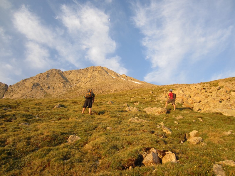
I was the first to arrive at the Music Pass trailhead Thursday afternoon while Ryan and Steve staggered in later. Due to the increasing consistency of afternoon thunderstorms, an early start was mandatory. With some last minute gathering, we hit the trail for Music Pass Friday morning at 3:35 AM. A good trail led us over the pass and we quickly hit the junction for Lower Sand Lake. Joining us on the approach was Mad Mike. Mike was planning on day tripping the Cleveland Group. It was nice to meet you.
Smoky sunrise.
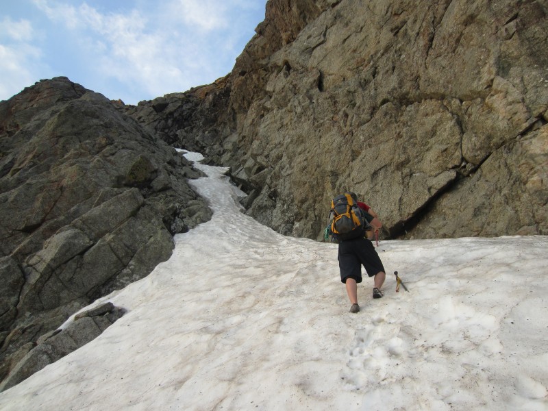
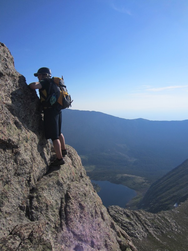
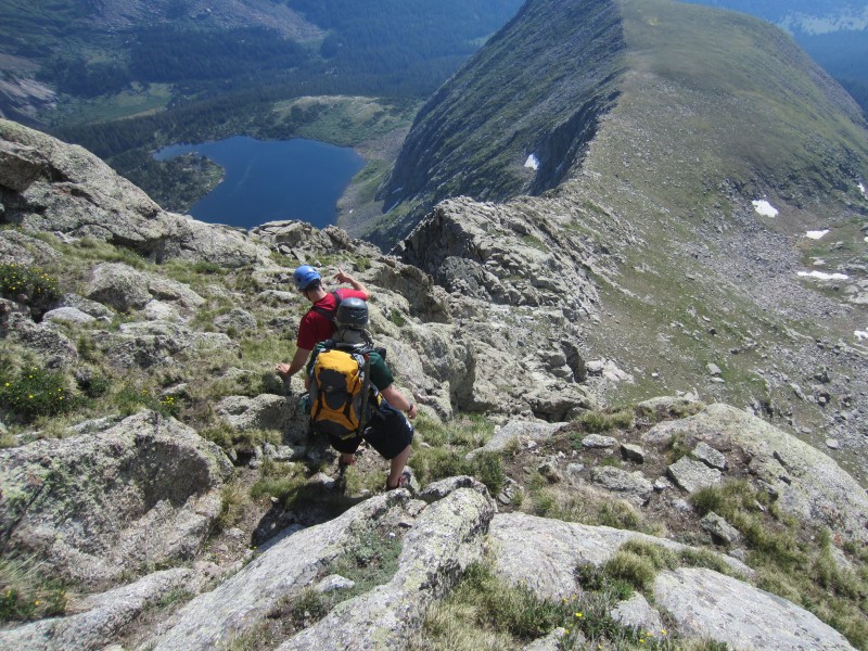
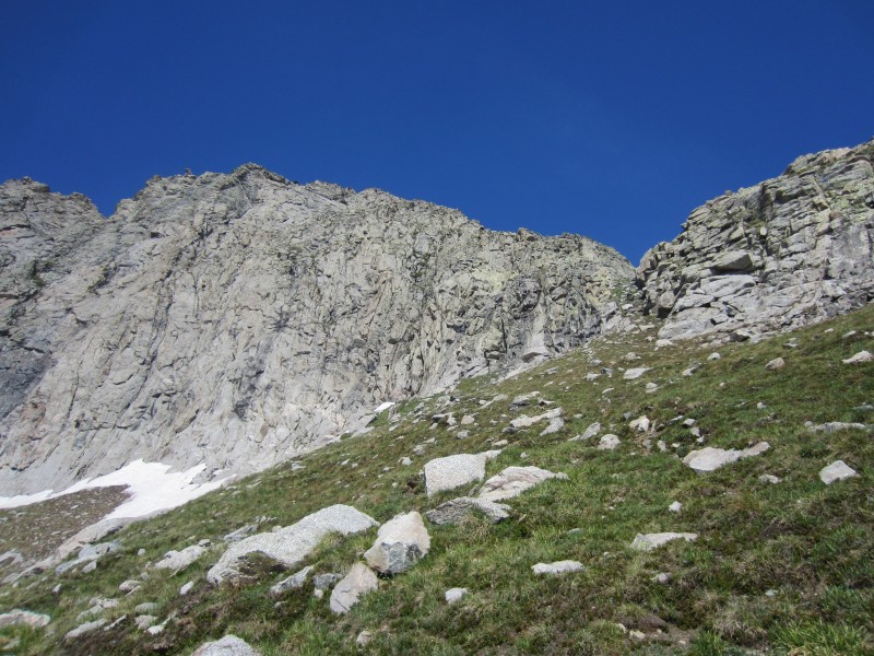
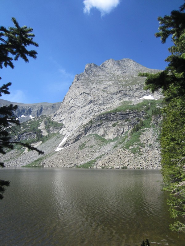
Following a good trail to Lower Sand Lake, we ditched our camping gear before starting up Tijeras. From Lower Sand Lake, we hiked around to the northwest side of the lake before starting a quick bushwhack towards the Music-Tijeras saddle. Staying south, we found the first of two obvious weaknesses in the cliff that would lead us to Tijeras's north slopes. A short snow climb later, we were through the cliff band.
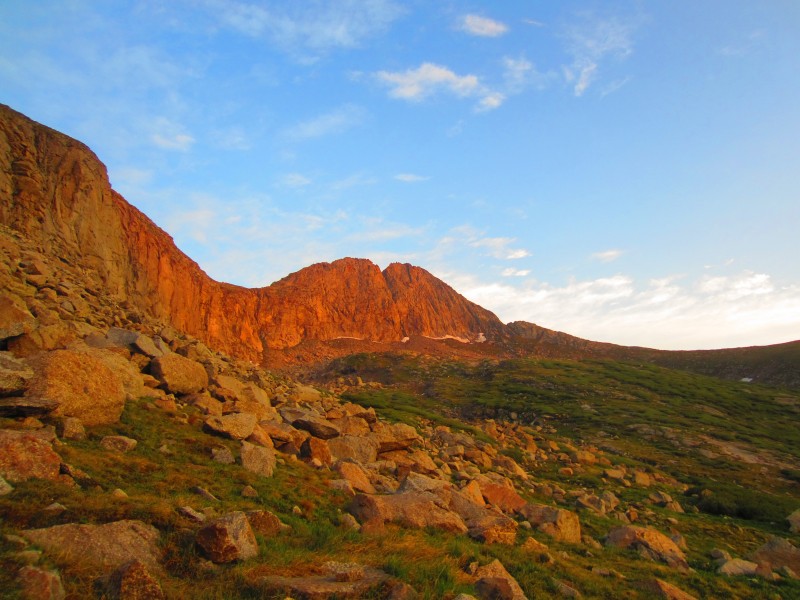
Morning light on Music Mountain.
Starting up the short snow climb through the cliff band.
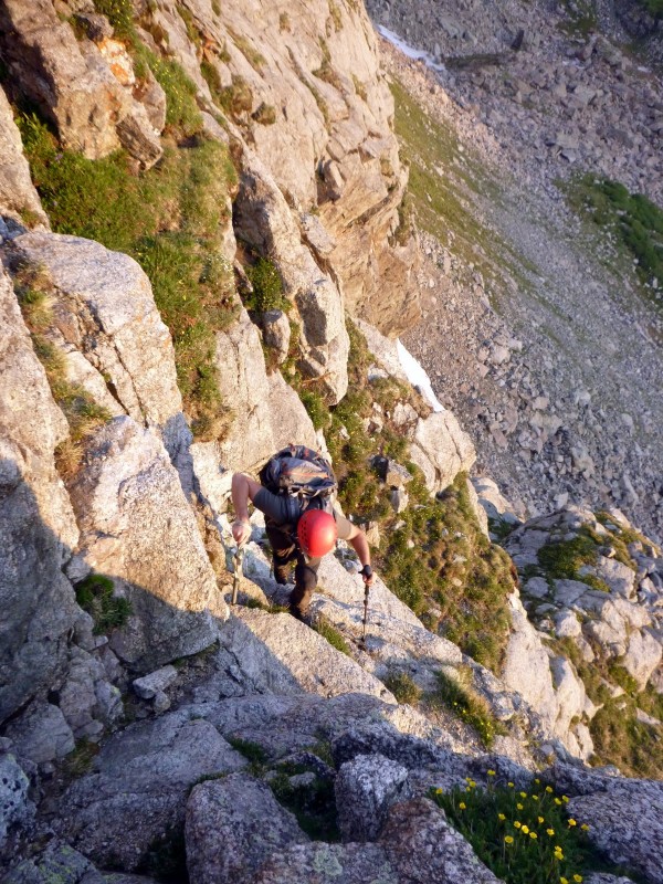
Climbing up after the snow climb (Photo by Ryan)
A little class 3 after the snow climb.
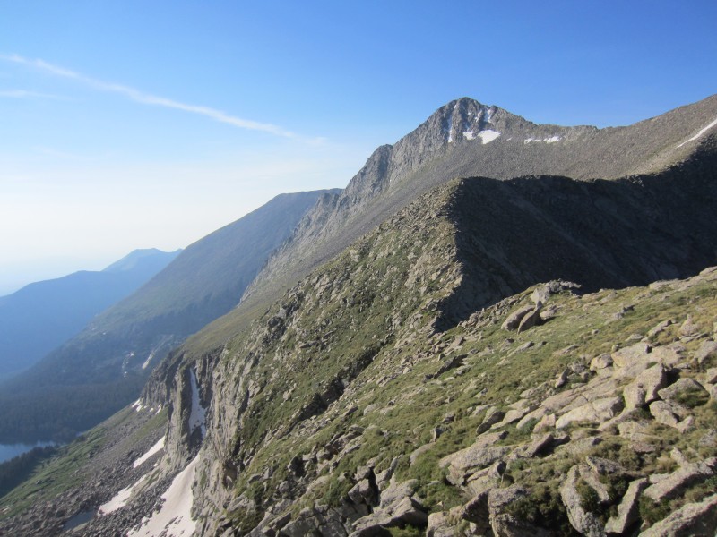
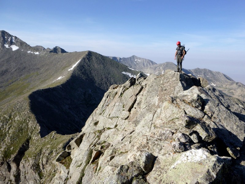
Avoiding talus as long as we could, we veered west towards Tijeras's northwest ridge and when the talus was inevitable, we started up Tijeras's north slopes. Staying on harder terrain for more enjoyable scrambling, we enjoyed sections of relatively solid class 3 scrambling until we reached the summit of Tijeras at 7:00 AM.
North slopes of Tijeras.
Scrambling on Tijeras. (Photo by Ryan)
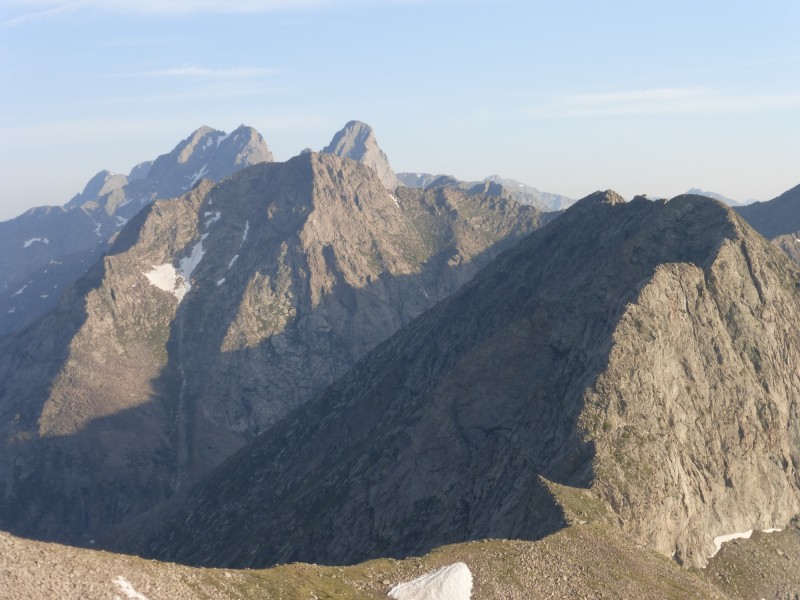
Crestones from the summit of Tijeras (Photo by Steve)
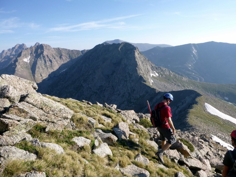
We made excellent time from the trailhead and from Lower Sand Lake to the summit. Descending Tijeras's northwest ridge went quickly and we hiked directly to the Music-Tijeras saddle. I was surprised at the lack of scrambling on Tijeras's northwest ridge.
Steve descending Tijeras. (Photo by Ryan)
Ryan starting his way to Music's south ridge.
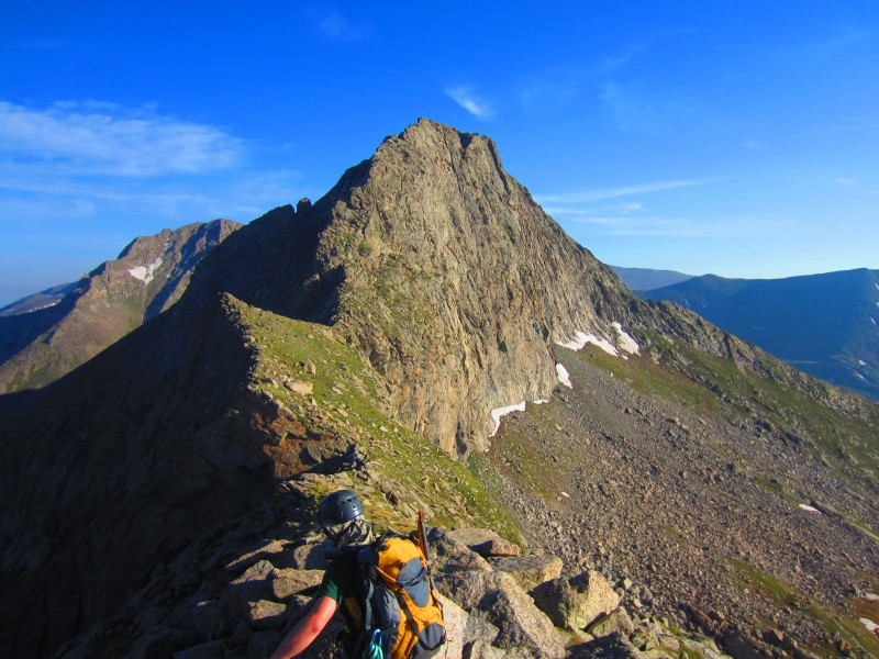
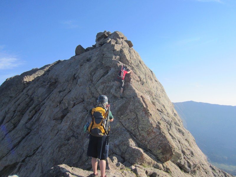
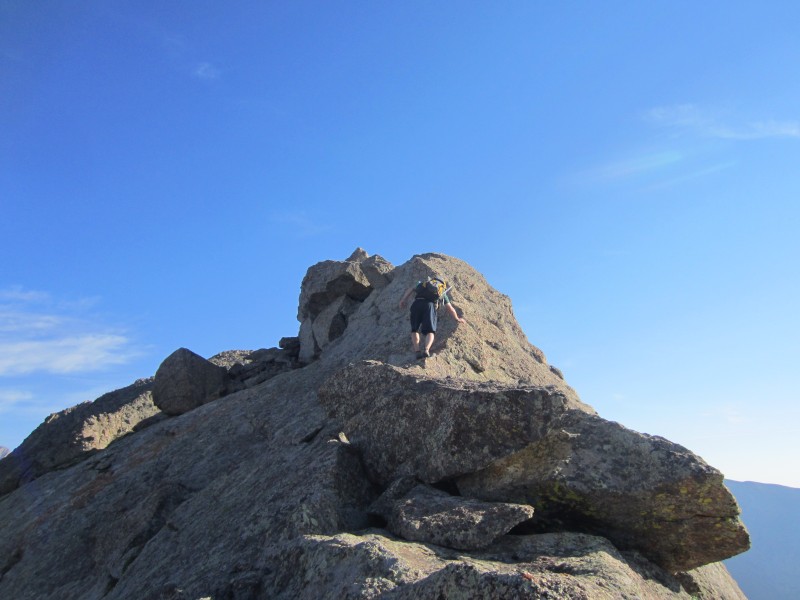
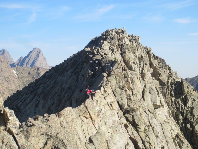
Climbing up the south ridge of Music was really enjoyable which in my opinion, is one of the better scrambles around. Solid rock, exposure, and fun scrambling led us upwards. While most of the scrambling was 3rd class, there were some occasional sections of 4th class scrambling.
South ridge of Music Mountain.
Tijeras and the cliff band.
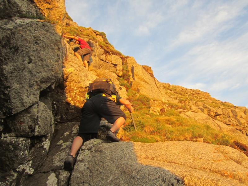
Steve starting a short class 4 section.
Solid rock.
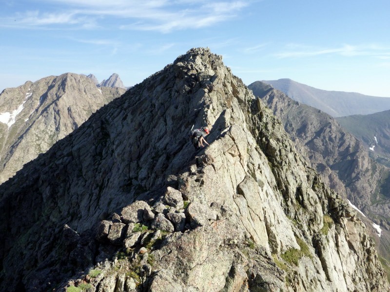
Good climbing on Music's south ridge. (Photo by Ryan)
Music's south ridge (Photo by Ryan)
Ryan making an exposed move on Music's south ridge.
Ryan scrambling on Music's south ridge.
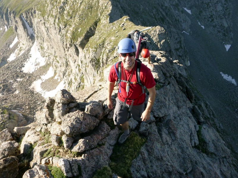
Steve nearing the south false summit of Music.
It was a real shame the scrambling wasn't longer on Music's south ridge. We arrived on the summit of Music at 8:10 AM. The weather was holding and we spent some time relaxing and enjoying the views of the Crestones and our other objectives for the following two days.
Finishing on Music's south ridge. (Photo by Ryan)
Returning to the false southern summit on Music, we headed down Music's class 3 east ridge. Mostly solid rock guided us downwards. The weather appeared to be holding so Ryan and Steve decided to give Marble Mountain a try. Since I have already climbed Marble, I decided to head back to Lower Sand Lake and set up camp.
East ridge descent off of Music.
Class 3 on Music's east ridge.
Looking back at Music's east ridge.
I was tired from the early wake-up call and I took a nap as soon I finished setting up camp. Around 11:00 AM, the thunderstorms rolled in and Steve and Ryan returned to camp unsuccessful on their Marble Mountain attempt. It's always amazing how fast thunderstorms build in the Sangres.
The rest of the day included naps and listening to rain on our tents. Later that evening, Al found our camp and was joined us for our next two adventurous days.
Tijeras from Lower Sand Lake.
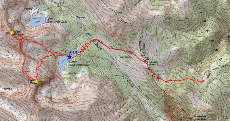
Route Map.
Thumbnails for uploaded photos (click to open slideshow):
... and am considering this route. A couple of questions:
1. Are the exposed 4th class section(s) north or south of Music's East Ridge? Or both?
2. On your descent it appears you didn't follow the East Ridge for long, but made a beeline for LSCL. How was the going? Loose? Cliffs? Willows?
Thanks in advance, and very nice pictures and report!
1) The 4th class exposed sections were on the south ridge. I'm not sure how the north ridge on Music would go. If I were to guess, I would estimate class 4 with exposure.
2) Once past the scrambling section on the east ridge, it was a pretty easy grass hike to Lower Sand Lake without many willows. If you were to venture too far south, you could end up in some minor cliff bands.
Caution: The information contained in this report may not be accurate and should not be the only resource used in preparation for your climb. Failure to have the necessary experience, physical conditioning, supplies or equipment can result in injury or death. 14ers.com and the author(s) of this report provide no warranties, either express or implied, that the information provided is accurate or reliable. By using the information provided, you agree to indemnify and hold harmless 14ers.com and the report author(s) with respect to any claims and demands against them, including any attorney fees and expenses. Please read the 14ers.com Safety and Disclaimer pages for more information.
Please respect private property: 14ers.com supports the rights of private landowners to determine how and by whom their land will be used. In Colorado, it is your responsibility to determine if land is private and to obtain the appropriate permission before entering the property.