Download Agreement, Release, and Acknowledgement of Risk:
You (the person requesting this file download) fully understand mountain climbing ("Activity") involves risks and dangers of serious bodily injury, including permanent disability, paralysis, and death ("Risks") and you fully accept and assume all such risks and all responsibility for losses, costs, and damages you incur as a result of your participation in this Activity.
You acknowledge that information in the file you have chosen to download may not be accurate and may contain errors. You agree to assume all risks when using this information and agree to release and discharge 14ers.com, 14ers Inc. and the author(s) of such information (collectively, the "Released Parties").
You hereby discharge the Released Parties from all damages, actions, claims and liabilities of any nature, specifically including, but not limited to, damages, actions, claims and liabilities arising from or related to the negligence of the Released Parties. You further agree to indemnify, hold harmless and defend 14ers.com, 14ers Inc. and each of the other Released Parties from and against any loss, damage, liability and expense, including costs and attorney fees, incurred by 14ers.com, 14ers Inc. or any of the other Released Parties as a result of you using information provided on the 14ers.com or 14ers Inc. websites.
You have read this agreement, fully understand its terms and intend it to be a complete and unconditional release of all liability to the greatest extent allowed by law and agree that if any portion of this agreement is held to be invalid the balance, notwithstanding, shall continue in full force and effect.
By clicking "OK" you agree to these terms. If you DO NOT agree, click "Cancel"...
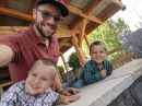
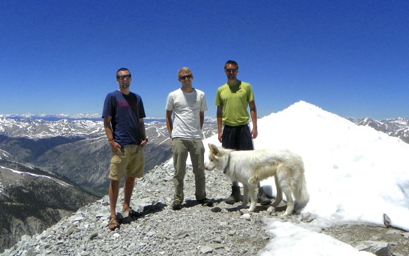
Party: Colby (zephyr_pelicante), Eric (emohr), Hank, and Takota Route: West Slopes Via Baldwin Gulch
Miles: 15
Elevation Gain: 5,200'
Ascent Time: 3.75 Hours
Descent Time: 2.75 Hours
Summit Time: 1 Hour
Good Times Had: Yes
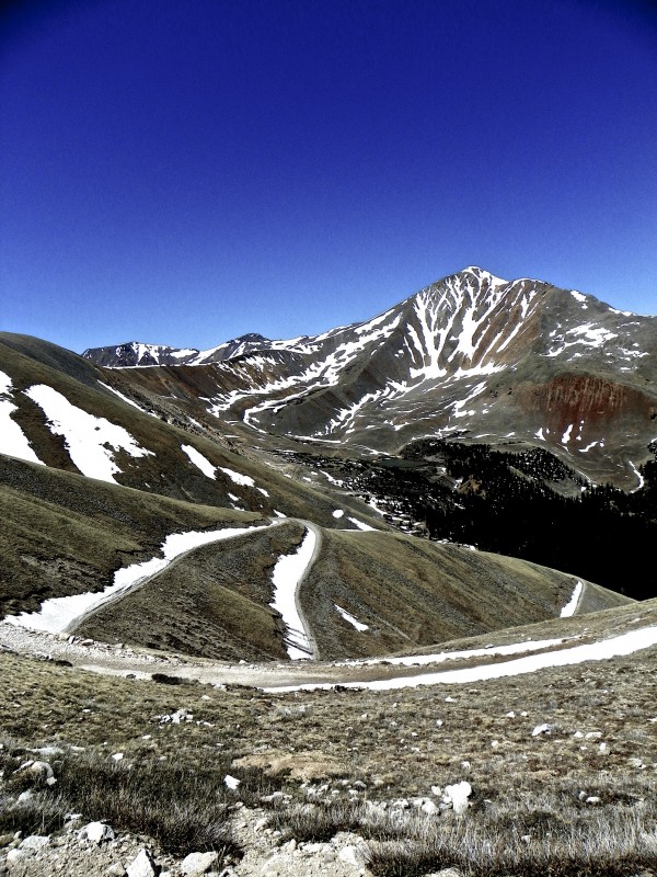
Descending down the lonnggggg, winding road
___________________________________________________________________________________________________________________________
It's been over 6 months since someone has written a trip report about Antero. To put that into perspective, Culebra has a more up-to-date trip report selection than Antero. So, here is the freshest report on Antero you might get for some time folks
Another weekend, another perfect forecast for Buena Vista and The Sawatch. My Sawatch checklist is getting shorter and shorter, and this week I chose on giving Mt. Antero a go. Antero is probably one of the least talked about peaks among the 14ers. You can drive up to about 13,800', and reach the summit within a mile from there. Not necessarily the most epic mountain that one will climb in their career, so I was just expecting an easy hike up a road to the top of my 29th 14er where I could celebrate with some beer. Luckily, Antero gave us a more entertaining day
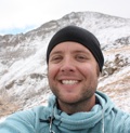
I had been talking about Little Bear with Colby Renfro (zephyr_pelicante) on Saturday, and mentioned that some buddies of mine were going to attempt Antero on Sunday. He said that he was planning on doing it Monday, but just ended up joining our group for a Sunday Summit. Colby and I have been going to Mines for 3 years together and have probably climbed 100 14ers between us in that time, but we had never actually hiked together. I was excited for one of my first hikes with another 14ers.com nerd
We left Golden at about 5:15 and made it to the Chalk Creek Road by about 7:15. I wanted to start hiking by 8, so we were well ahead of schedule. I was hoping to make it to the Baldwin Creek Crossing to make the hike about 9 Miles, and less than 4,000' of elevation gain
Then came the real start of the day.
I had read trip reports about The Baldwin Gulch Road and wasn't too skeptical about bringing a 2012 Outback up there. People had told me we could handle it. Unfortunately, we couldn't.
We scraped the crap out of the bottom of Hanks car for about half a mile on the rocky, eroded road for about 1.5 miles until my bladder full of coffee and water couldn't take it much longer. When we stopped to take a leak, Colby utters the two foulest words you can concoct on a 14er road: "Flat tire". Sure enough, we blew Hank's right rear tire. At this point, the 14er wasn't really the focus anymore. We backed up the Outback about .25 miles till we could find a turnaround point, then slowly made our way back down, making sure to touch every single rock on the road with the bottom of the car. The clearance was just shot with a flat tire. We finally made it back to the Antero "Parking Lot" at the bottom to begin the tire changin
"How many engineers does it take to change a tire..." - Takota
After some friendly folks at the trailhead offered us a handy tire iron, we began the switch. It was about 9, and I knew if we started from here it would be one of the longest days in the Sawatch I've ever had. Harvard-Columbia was 14 miles and 6,300' gain; Antero was looking like 15 Miles and 5,300'. Which at first sounded like a masochistic journey, but soon sounded like a hike I had dreamt about all winter the more I thought about it. 0% forecasted rain, decent elevation gain, and decent mileage; the perfect remedy for not only a good ass kicking, but for a day to simply be enjoyed in the wonderful mountains of Colorado. I started the day off with excitement, enthusiasm, and most importantly, a Dale's Pale Ale that Colby brought along
Cruising up the road along the Creek
Walking up the road was surprisingly quick. We made it the 3 miles from the bottom to Baldwin Creek in just under an hour. I kept my mind occupied making dumb calculations for hike times and taking pictures of the roaring creek
Baldwin Creek Crossing
Right when I was about to cross the creek, I saw Jeep Wrangler pull up to the creek. I could see the woman in the car asked the guy a question, the guy nodded his head with a huge grin, then pinned that gas pedal to the floor like his foot instantly turned to lead. They flew through the creek with no problem whatsoever. Jeeps are too much fun. My second favorite mode of transportation in the mountains.
That Jeep and some other 4x4 cars were able to make it to treeline, but there are some impassable snow fields right at it that prevent you from being able to drive any further.
Making our way up the road was a breeze; it is perfectly sloped for endless hiking without fatigue. More distance, but much more casual than say the Switchbacks going up Belford.
My favorite 14er shoe
Hank and Takota looking towards Mt. Cronin
Cronin
Some of the Cronin
Making our way up along the road, we kept looking up the gulleys that went straight to the top of the road. Colby actually opted to take this more direct route than the road. Hank and I just walked the road, and met up with him in only about 15 or 20 minutes. Walking up the road is very quick
Colby's Shortcut
Looking back on what we had already traveled
First of the season... surely not the last
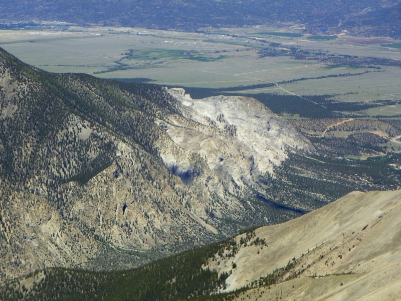
At about 13,000', the road comes to a plateau on the South Side of Antero which I thought was pretty cool. There really aren't too many wide open spaces like this on any of the other Sawatch Peaks I've done
Making our way across the plateau with the Summit in sight
Gazing South Towards Shavano and Tabaguache
West Towards Pikes
End of the Road
Once we got to this point, the road ended and the "climbing" part kinda started. The ridge up to the summit was really fun. It reminded me of the final ridge to Massive or Columbia; tons of different routes with the option to do some Class 2 scrambling if you desire. The snow wasn't bad, but believe me, I wish I would have had microspikes here. Unfortunately, they don't work well with Chacos. But for the next week or 2, I would recommend bringing the spikes if you have them
Final Ridge
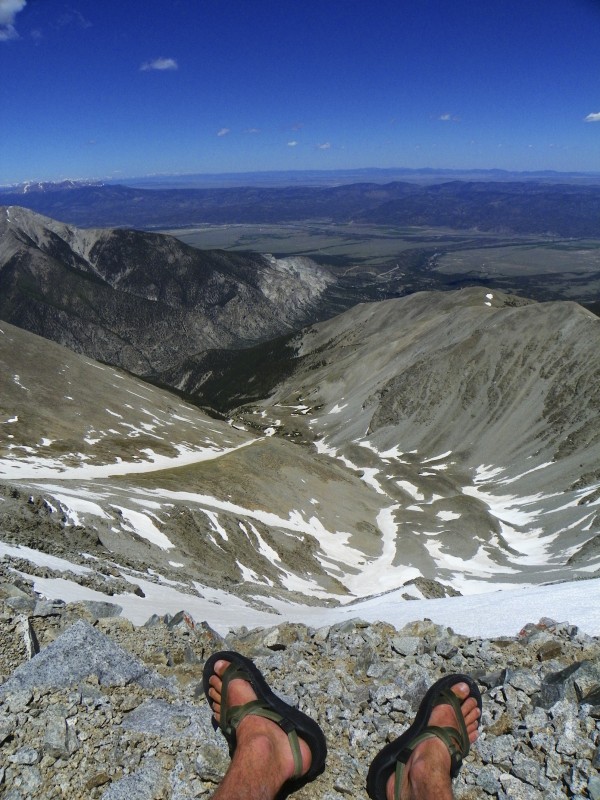
Window to the Rockies
The final ridge was pretty slow going, and had similar steepness/rock to the final push on Quandary. Luckily we made it up without a problem just missing the 2MPH ascent pace by 5 minutes. The summit was shared with 3 or 4 groups that were enjoying the windless 60 degree summit. I was pretty shocked we got an even better summit than on Yale last weekend. The Sawatch is just a great place to be right now
Our Summit Party
We enjoyed the summit with some Dale's Pale Ale that Colby brought. Some of us enjoyed more than others
What's a summit without a beer?.... or 6?
After an hour on top, we made our way back down the 7.5 mile trail to get back to the car. We were able to make it to the car just before 5, so it ended up being a 2MPH+ day. Very reassuring compared to our 1MPHish pace on Yale
Chalk Cliffs by Mt. Princeton
14er Traffic Jam
Mt. Antero marked the Halfway Point in my 14er Journey, and what I'm expecting to be the start of great next half. I'm just about done with The Sawatch, so it's just about time for me to start making my way over to those Lovely Elks in the next couple of weeks. I'm hoping to do the Sawtooth, Longs, then Kelso Ridge over the next few weekends to get more comfortable with the class 3 climbing. From the excitement that people show on this site for the more difficult peaks like the Crestones, Maroon Bells, etc, I have become very excited in completing this next half of the 14ers. The more people that I can hike with over the next 29 14ers the better, so hopefully I'll be hiking with you soon! Happy Hiking, and go climb a mountain!!
Thumbnails for uploaded photos (click to open slideshow):
Good report! I believe I actually made the last report of Antero form Fall Break last Oct haha. We should all join up on a hike or two this summer. Colby and I are heading up tomorrow to the Crestones.
Thanks for the updated report on this, I am thinking of knocking out Antero and Shavano/Tab this weekend. Congrats on your halfway point! I hope to be a little more than half way by the end of this summer. Also looking to do the Sawtooth soon, perhaps I'll see you there. Would love to meet some more folks from here.
...you posting new trip reports again, Eric! Always fun reads. Best of luck to you during the rest of the summer!
Caution: The information contained in this report may not be accurate and should not be the only resource used in preparation for your climb. Failure to have the necessary experience, physical conditioning, supplies or equipment can result in injury or death. 14ers.com and the author(s) of this report provide no warranties, either express or implied, that the information provided is accurate or reliable. By using the information provided, you agree to indemnify and hold harmless 14ers.com and the report author(s) with respect to any claims and demands against them, including any attorney fees and expenses. Please read the 14ers.com Safety and Disclaimer pages for more information.
Please respect private property: 14ers.com supports the rights of private landowners to determine how and by whom their land will be used. In Colorado, it is your responsibility to determine if land is private and to obtain the appropriate permission before entering the property.


")
 Cruising up the road along the Creek")
")
 Baldwin Creek Crossing")
 My favorite 14er shoe")
 Hank and Takota looking towards Mt. Cronin")
 Cronin")
 Some of the Cronin")
 Colby's Shortcut")
 Looking back on what we had already traveled")
 First of the season... surely not the last")
 Making our way across the plateau with the Summit in sight")
 Gazing South Towards Shavano and Tabaguache")
 West Towards Pikes")
")
 End of the Road")
 Final Ridge")
 Window to the Rockies")
 Mt. Princeton lookin snow-free and gorgeous")
 Our Summit Party")
 Chalk Cliffs by Mt. Princeton")
 What's a summit without a beer?.... or 6?")
 14er Traffic Jam")
 Descending down the lonnggggg, winding road")
 What's a summit without a beer?.... or 6?")
 14er Traffic Jam")
 Descending down the lonnggggg, winding road")