Download Agreement, Release, and Acknowledgement of Risk:
You (the person requesting this file download) fully understand mountain climbing ("Activity") involves risks and dangers of serious bodily injury, including permanent disability, paralysis, and death ("Risks") and you fully accept and assume all such risks and all responsibility for losses, costs, and damages you incur as a result of your participation in this Activity.
You acknowledge that information in the file you have chosen to download may not be accurate and may contain errors. You agree to assume all risks when using this information and agree to release and discharge 14ers.com, 14ers Inc. and the author(s) of such information (collectively, the "Released Parties").
You hereby discharge the Released Parties from all damages, actions, claims and liabilities of any nature, specifically including, but not limited to, damages, actions, claims and liabilities arising from or related to the negligence of the Released Parties. You further agree to indemnify, hold harmless and defend 14ers.com, 14ers Inc. and each of the other Released Parties from and against any loss, damage, liability and expense, including costs and attorney fees, incurred by 14ers.com, 14ers Inc. or any of the other Released Parties as a result of you using information provided on the 14ers.com or 14ers Inc. websites.
You have read this agreement, fully understand its terms and intend it to be a complete and unconditional release of all liability to the greatest extent allowed by law and agree that if any portion of this agreement is held to be invalid the balance, notwithstanding, shall continue in full force and effect.
By clicking "OK" you agree to these terms. If you DO NOT agree, click "Cancel"...
Summary
============== Start: 6:45 AM Mt Antero Summit: 11:47 AM Time To Summit: 5h 2m Time On Summit: 1h (Sensational Weather!) Back at car: 3:42 PM Descent Time: 2h 55m Total Time: 8h 57m Total Distance: 8.60 miles Total Elevation Gain: 4,780' Partners: The voices in my head ==============
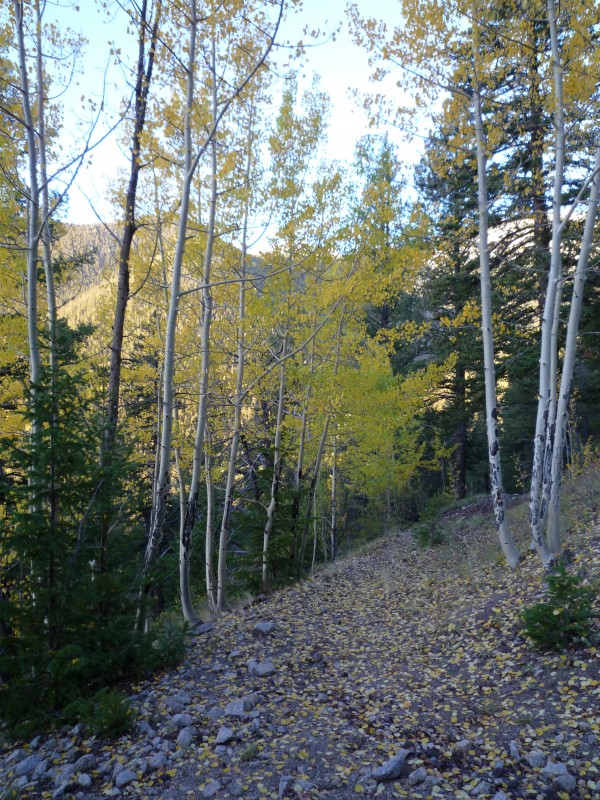
I never hiked Mt Antero via the standard Baldwin Gulch Route, but hiking up a 4WD road coupled with the noise of all-terrain vehicles made me happy to hear about this MUCH LESS traveled route via Raspberry Gulch. I highly recommend the route to everyone although your knees will be sore when all is said and done as there are some steep slopes to contend with while hiking off-trail.
I don't know if there would be much appeal to camping out for a hike like this considering its close proximity to nearby towns so not really out in the middle of nowhere, but I suppose if you wanted to camp (not in your car) there are a couple sites that could work for you just outside the perimeter of the "round-about" TH parking area. If you wanted to camp in the first ¼ mile or so of the trail, I would definitely recommend finding a clearing to set up in as there were lots of downed pine trees that would give me concern for future "widow makers". No camping options once the trail jogs northerly to start up to the saddle. I suppose you would have one option right off-trail around 10,130' at the sharp switchback. After that you will have to wait till you hit the clearings in the saddle starting around 10,440'.
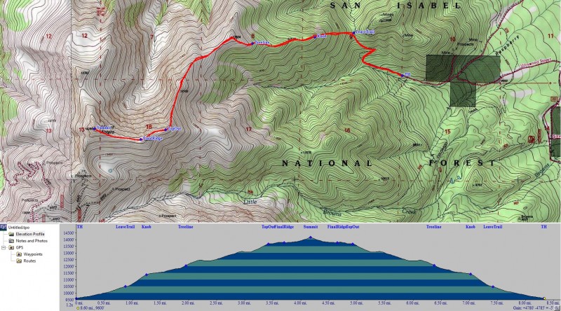
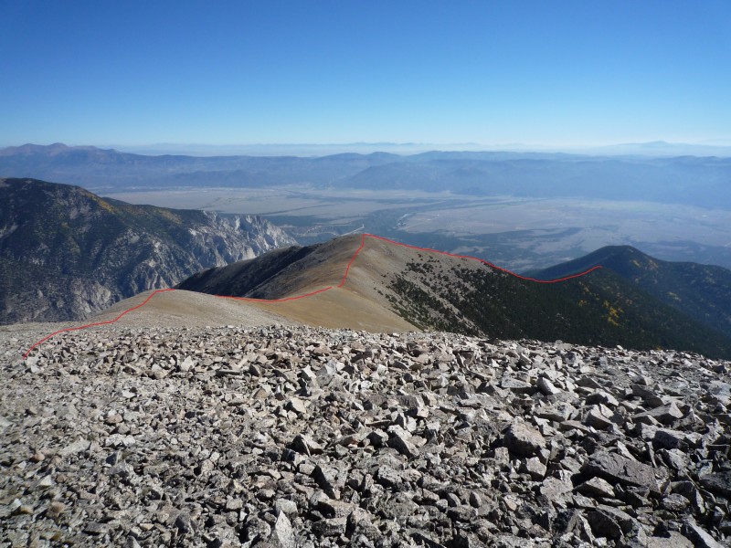
Here is a snapshot of the entire route along with elevation profile:
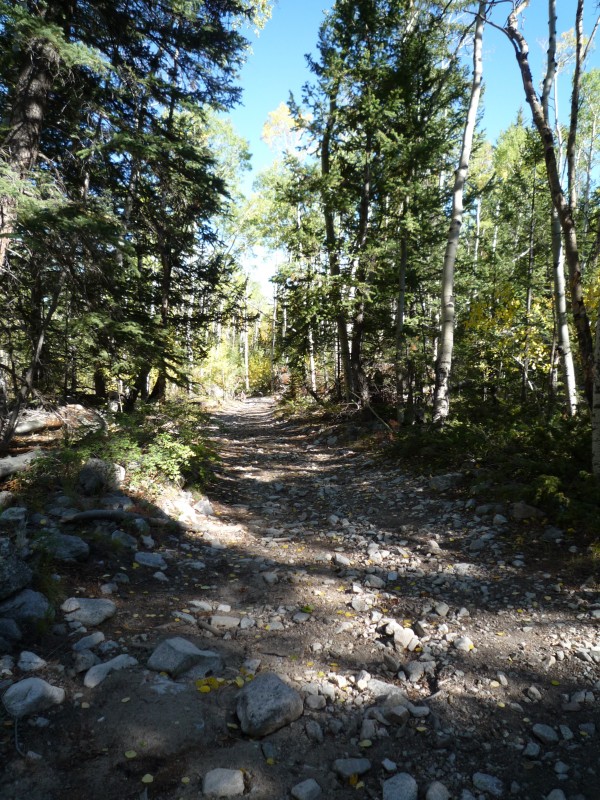
Image below was taken on my way out, but shows a sample of what the road looks like leading to the TH. I thought the road was actually very good until around 9,300' when it started getting narrow to the point where cars passing would not be possible. After that the road became more rutted with larger rocks. That said, I still think a 2WD car with good clearance would be fine. I'd say Stevens Gulch Road heading up to Grays/Torreys TH is much worse and yet I see 2WD cars up there all the time.
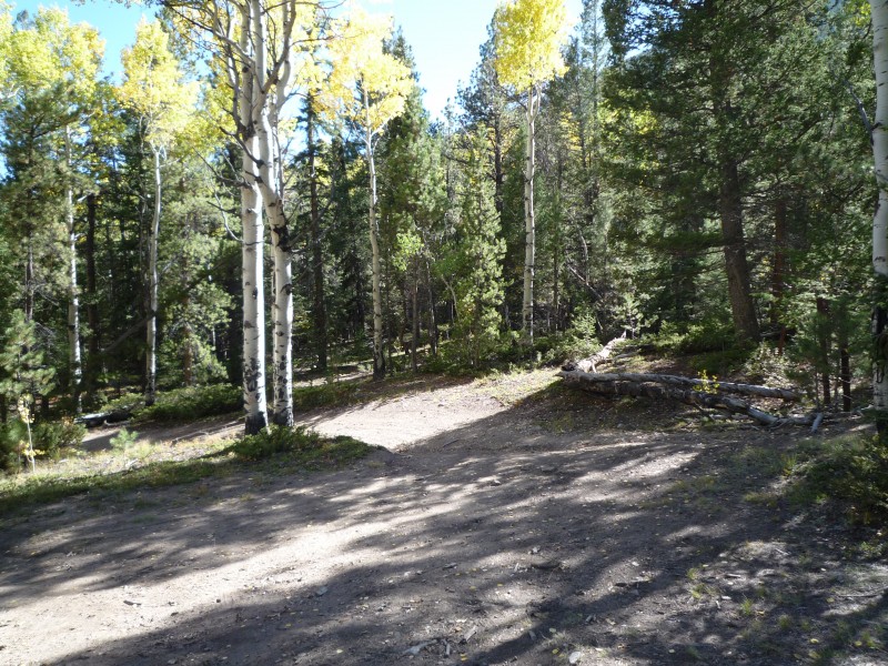
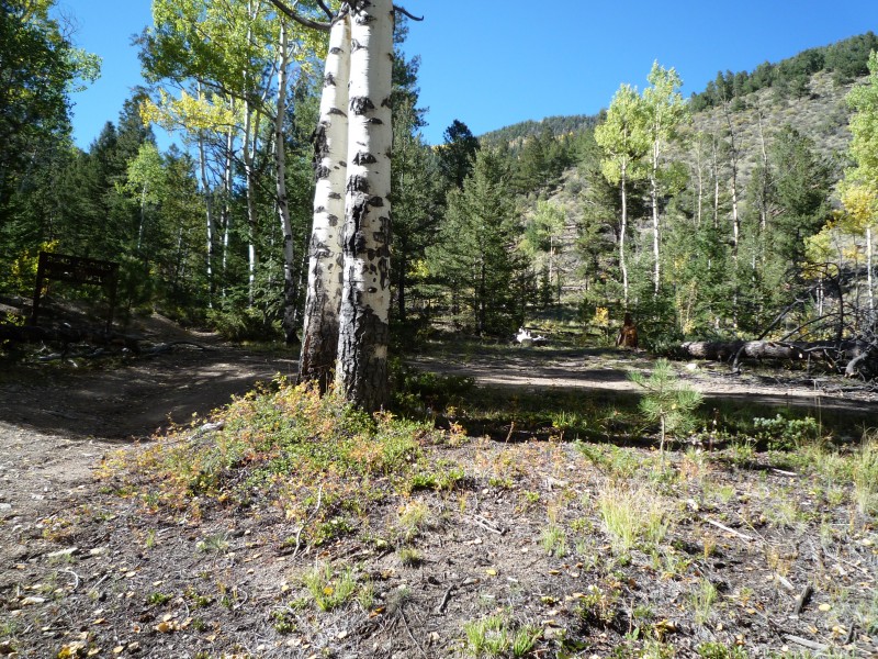
The next two shots show the "round-about" TH parking area and the 3rd is the TH itself:
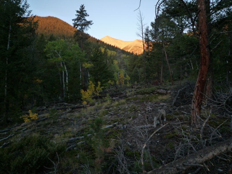
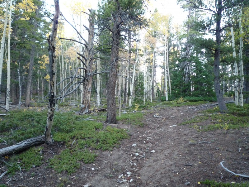
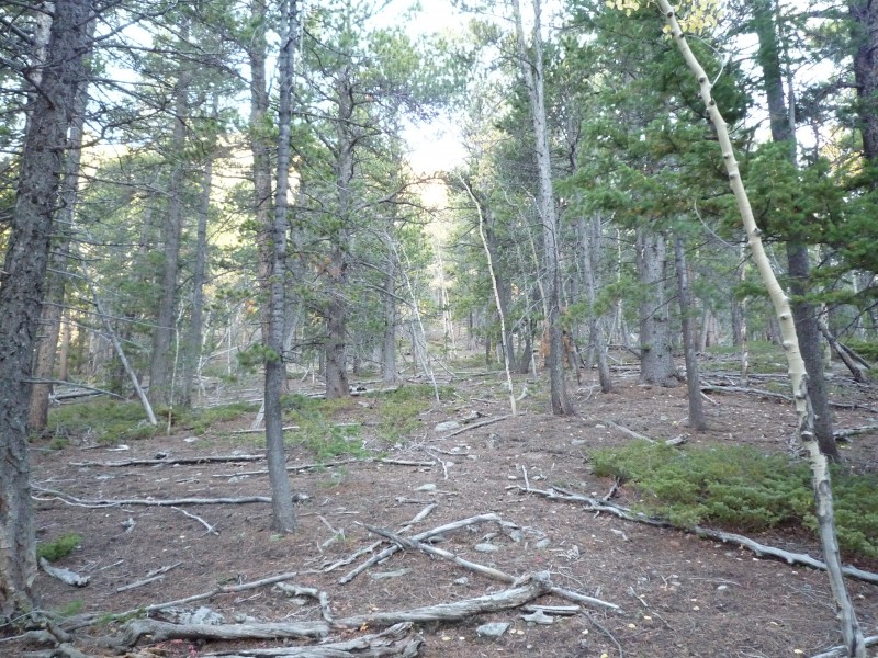
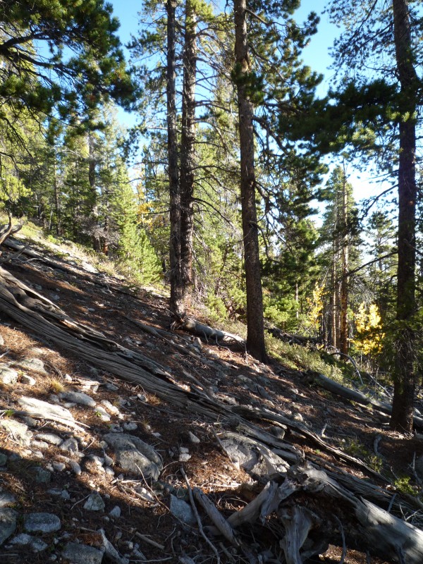
Here is a view from early in on the trail looking towards Pt 13,105' and "TopOut" that you see shown in the route image earlier. You can see a lot of fallen trees. This was the case quite a bit along the early trail including several on the trail itself. Judging by the age of some of the trees as well as some of the new trail spurs that have cropped up going around tree fall, I get the impression this trail is not "maintained" by the forest service on anything like a regular basis.
Approx 10,130' looking back down back the way I came from sharp switchback on the trail
Say goodbye to the trail around 10,460' in the saddle and pick your path off to the left to start your forest excursion!
Here is a sample of the forest hike shortly after leaving the trail in the saddle
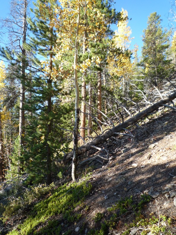
Here is my attempt to give you an idea of the slope you see around 10,680'.
Here are a couple more a little further up from before where the slope increases a bit. From this point up to the "knob" around 11,420' the slop runs around 25-30 degrees.
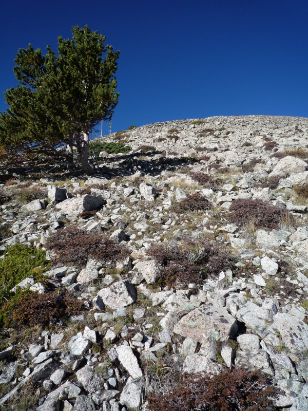
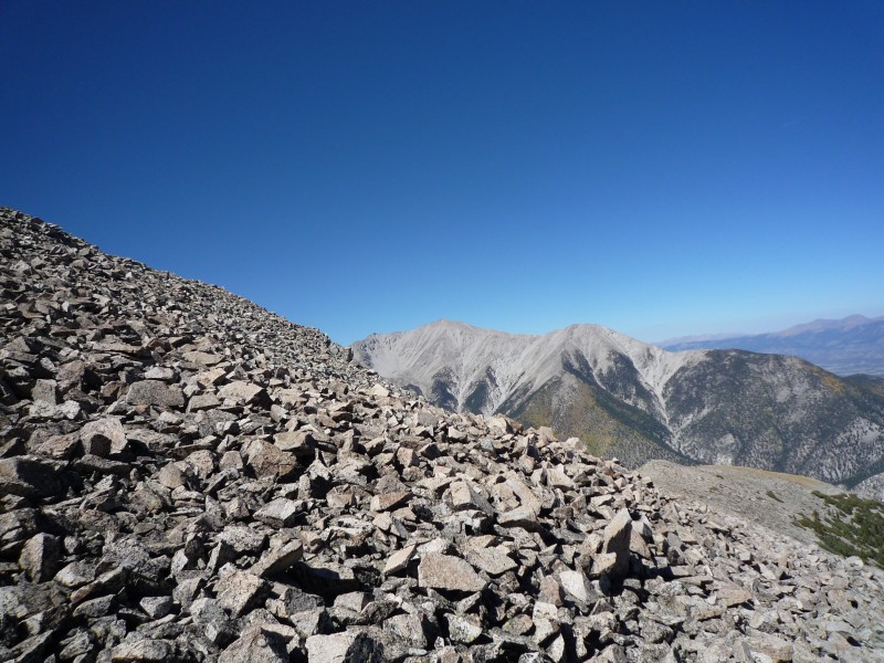
The slope finally relents around 11,420' at the "knob" where the forest also thins up in places opening these kinds of views of the Princeton "chalk cliffs" and Mt Princeton itself.
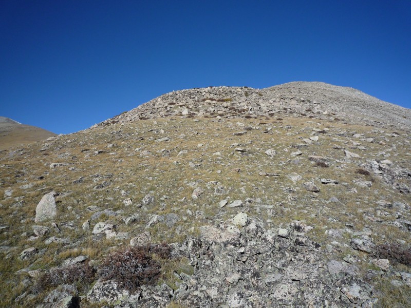
Following the route I took you will hit tree line around 12,120'.
Here we have a shot looking to your next goal of Pt 12,504'. The going here is a bit easier than the talus slope earlier on after you popped out of tree line.
Here we have a shot a couple hundred vertical feet below Pt 12,504' looking towards the saddle to the southwest from that point. If I were going to skip hitting Pt 12,504', this is the path I would choose where you traverse across its southern slope to reach the saddle across the way. I say this because later you will see a different trail which leads me to believe folks may curl around this point's northern slope to get to that saddle and that rock is a mess. Not for me.
From the broad saddle past that point looking back you can see the path I would pick to the right if I chose to skip out on Pt 12,504'. On the left side you can see an obvious trail and I am not sure where it goes to, but I would skip it if its purpose is to avoid the point by curling around its north side since it just seems further and more hassle than it is worth. Plus the north side of the point looks like the mess you see in the next picture. Again...not sure where that left-side trail goes to, but it didn't show up on any topo maps I looked at.
The mess on the north slopes of Pt 12,504' Mt Princeton as seen from Pt 12,504'
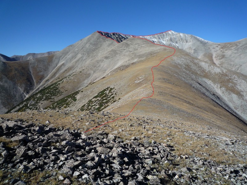
Here is the view looking back the way I came as seen from Pt 12,504'. The red highlight ends at the "knob" where you drop back down into the saddle to meet up with the trail.
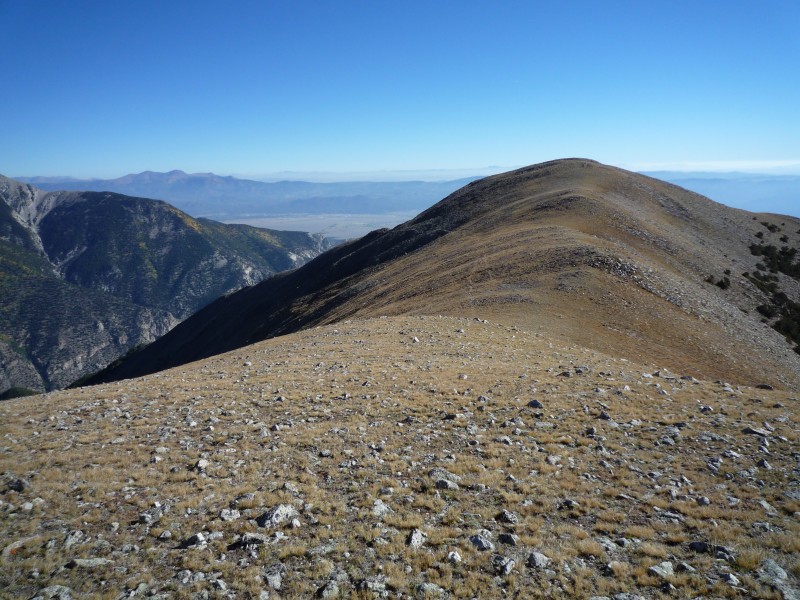
You can see pretty much your entire remaining route here from Pt 12,504'. Also shown are some faint trails on either side of the ridgeline. I stuck to the ridgeline the entire way which seemed a bit easier being on top of everything rather than traversing on a slope below the ridge where rocks underfoot may tend to slide downhill under you. Plus you get a better view.
Standing at around 13,000' looking back down ridge. Pt 12,504' centered with descent from there off to right into tree line a
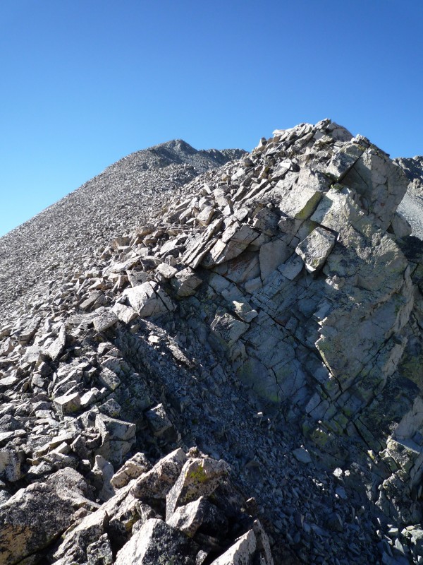
Pt 13,105' looking up towards remaining ridge line. Traversing anything more than a short distance off the ridge appeared to be a slippery mess. Just stick to the ridge the entire time for easiest passage, better views and some chances to have a little more fun if desired as shown in the subsequent 3 shots. All of those are easy enough to avoid.
This is the "TopOut" point around 13,700' looking back down the ridge to Pts 13,105' and 12,504'.
Pano shot of the Raspberry Gulch area from the "TopOut" spot.
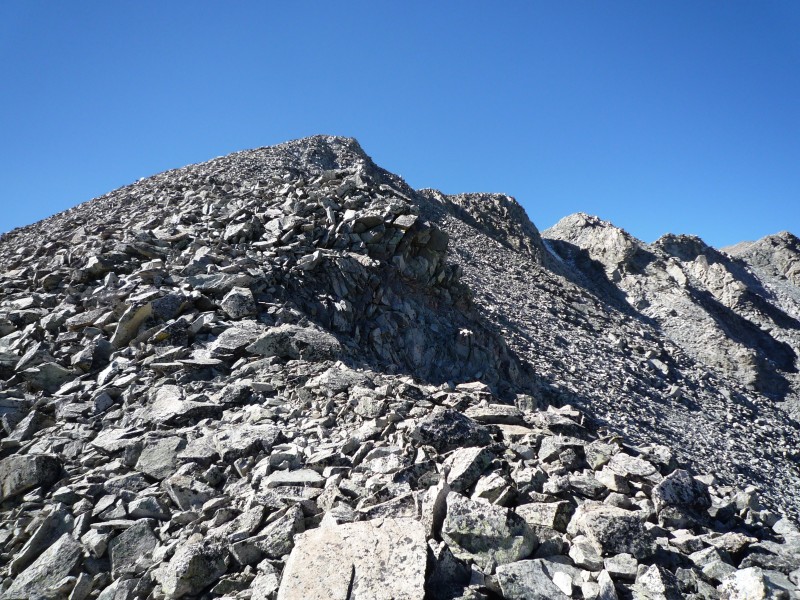
Next goal...the ridge-line leading to Pt 13,888' from "TopOut" spot. Again the best route to take is to stick to the ridge.
About midway across ridge-line shown in shot above...view looking back down to "TopOut" and then up to Pt 13,888'.
Atop Pt 13,888' looking at the final ridge to Antero's summit. It was only shortly before this point when I started to hear dirt bikes and ATVs. I also didn't see another soul on the entire trip until about 60' below Antero's summit. Definitely a solitude route!
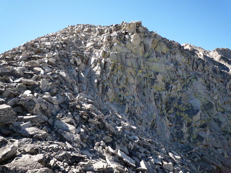
Here is another example of one of the many "bumps in the road" you can see all along the ridge that you can either have fun on or easily skirt around the side.
The summit at last with next week's hopefuls (Mt Shavano, Tabeguache Peak, Pt 13,712' and Jones Peak) behind me.
3 of the 4 other folks that were also enjoying the wonderful weather on the summit.
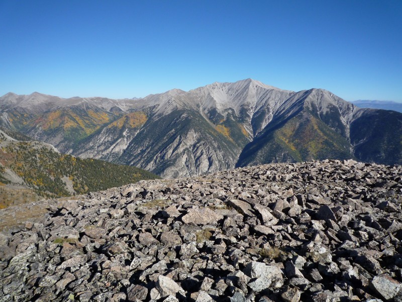
Antero summit looking westward on Baldwin Gulch and then up valley towards St Elmo.
Taken on the way down, winds must get pretty bad up here at times as shown by the recent untimely demise of these trees. Just something to be aware of should anyone wish to camp along the relatively mellow area between "knob" and "treeline" around 11,700'.
This really was an enjoyable route. No crowds, no 4WD roads, etc. Saw the same small group of big horn sheep above Pt 12,504' on the way up and below that same point on the way back down, but they were too skittish to let me get close enough for pics. I also had a "weird" animal encounter on that broad saddle just to the southwest of Pt 12,504'. I stopped for a moment to get in a shot of Mt Princeton and knelt down. While lining up the shot, a small bird flew up in between my arms while holding the camera and landed on my arm! I was hoping to get a pic, but as quick as it started...it ended...little guy took off. Couldn't believe how bold that little guy was.
Other than the downed tree issues for potential campers, the only other warnings I'd throw out there are the "knees issue" and "teeter-totter" talus. Trekking poles can be handy for those 25-30 degree slopes between the saddle where you leave the trail and the "knob". I guess I should also warn about rock fall in that area as well. You wouldn't think it looking at those pics (at least I didn't when I was in that area), but kicking loose a rock can be a really bad thing if there are folks below you. I knocked one loose on my way up and again on my way down and was amazed how much speed they picked up and how far they went down even with trees and shrubs in the way. They would definitely put a hurt on someone if they got hit. Even though I was pretty sure there were no other people around, I couldn't help but yell out "rock" on my way back down to the saddle after the "knob" because one decent sized rock picked up so much steam, bounced right off a tree and kept right on going! So...if you are hiking in a group, it may be wise to hike spread out across rather than above/below. Also be wary of the talus on the ridge anywhere between Antero's summit and Pt 13,105'...particularly on the descent. I found many of them that appeared to be large and stable to teeter quite a bit.
PM me with any questions you may have on this route. Enjoy!
Thumbnails for uploaded photos (click to open slideshow):
I'm really interested in giving this route a shot and what you've got here is excellent. You ought to combine this with the previous post about this trail and make a new route for it!
This TR is awesome and will be really helpful when I eventually try it. Such amazing views, especially after you top out on 12504. I'm glad you had a great trip. I did Antero from Baldwin the 15th and the slog up the road, gem seekers, ATVers, and hunters detracted from the experience as anticipated. Felt like I needed to be wearing blaze orange just to be safe!
Hey - is this route easier than the one via Browns Creek? and great job on the hike on Shavano/Tabeguache. You really left us in the wind. We took quite a few breaks and enjoyed both summits, and didn't get back down until close to 6pm.
Hey Stella. Glad you all had a good time on Shav/Tab. My route across the ridge from Pt 13712' to Jones Peak took longer than I thought so I didn't get back to the TH till after you all. I stopped and signed out in that book and noticed a group had signed out at 6PM so it most likely was you all. Mine was the last car left in the parking area just behind you all at 6:15PM.
Anyway, I can't say for sure if Browns Creek is easier than Raspberry Gulch route or not since I've never done the Browns Creek route. That said, just going by the numbers it appears easier. Total mileage only 6.5 compared to my 8.6 on Raspberry and elevation gain 2785' compared to mine at 4780'. If you haven't already, you can read the Browns Creek route description here: http://www.14ers.com/routemain.php?route=ante2&peak=Mt.+Antero
Again it was nice meeting the 4 of you. Don't let ”Dad” be the only one that uses 14ers.com. You guys will find a lot of good stuff here as well!
-Mike
Caution: The information contained in this report may not be accurate and should not be the only resource used in preparation for your climb. Failure to have the necessary experience, physical conditioning, supplies or equipment can result in injury or death. 14ers.com and the author(s) of this report provide no warranties, either express or implied, that the information provided is accurate or reliable. By using the information provided, you agree to indemnify and hold harmless 14ers.com and the report author(s) with respect to any claims and demands against them, including any attorney fees and expenses. Please read the 14ers.com Safety and Disclaimer pages for more information.
Please respect private property: 14ers.com supports the rights of private landowners to determine how and by whom their land will be used. In Colorado, it is your responsibility to determine if land is private and to obtain the appropriate permission before entering the property.