Download Agreement, Release, and Acknowledgement of Risk:
You (the person requesting this file download) fully understand mountain climbing ("Activity") involves risks and dangers of serious bodily injury, including permanent disability, paralysis, and death ("Risks") and you fully accept and assume all such risks and all responsibility for losses, costs, and damages you incur as a result of your participation in this Activity.
You acknowledge that information in the file you have chosen to download may not be accurate and may contain errors. You agree to assume all risks when using this information and agree to release and discharge 14ers.com, 14ers Inc. and the author(s) of such information (collectively, the "Released Parties").
You hereby discharge the Released Parties from all damages, actions, claims and liabilities of any nature, specifically including, but not limited to, damages, actions, claims and liabilities arising from or related to the negligence of the Released Parties. You further agree to indemnify, hold harmless and defend 14ers.com, 14ers Inc. and each of the other Released Parties from and against any loss, damage, liability and expense, including costs and attorney fees, incurred by 14ers.com, 14ers Inc. or any of the other Released Parties as a result of you using information provided on the 14ers.com or 14ers Inc. websites.
You have read this agreement, fully understand its terms and intend it to be a complete and unconditional release of all liability to the greatest extent allowed by law and agree that if any portion of this agreement is held to be invalid the balance, notwithstanding, shall continue in full force and effect.
By clicking "OK" you agree to these terms. If you DO NOT agree, click "Cancel"...
Mountain and Route: S. Maroon peak via South Ridge (Standard Route)
Date: 09/08/12
RT Mileage: 11.8 mi
Vertical Gain: 5200 ft
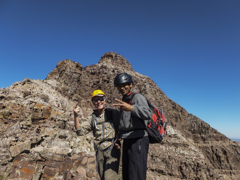
Party: Abhishek and Karthik (theotherindian)
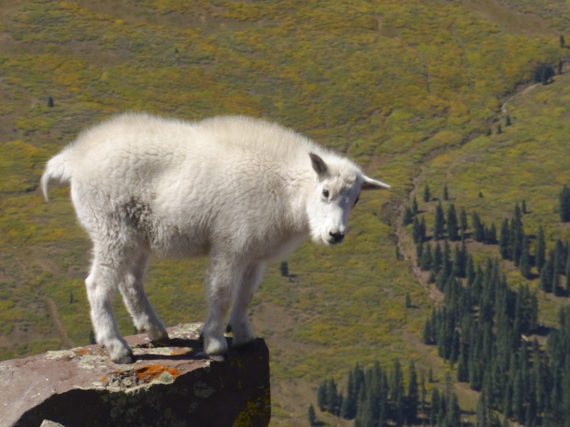
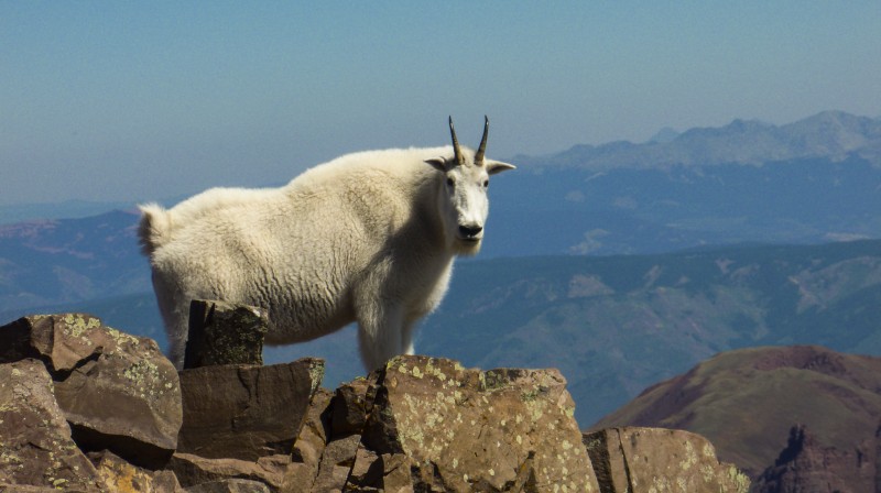
Wildlife: Deer, pika, Mountain goats, small birds, horses (okay not wild ones)
Note: Not much route info here. 14ers.com route description covers it all and I'm too scared to take pictures when I'm holding on to dear life.
2800 feet of scree is not that bad right? How much worse can it be?
The previous weekend, I'd been turned around at the ridge due to weather moving in. I'd taken a direct line up the face to reach the ridge by remaining true to the GPS tracks on 14ers.com. A few others in my hiking party and I realized the hard way that sometimes it better to stick to actual trail on the ground rather than the trail on the GPS. If you do take a direct line up, be prepared to encounter wobbly rocks, unstable ground, falling projectiles and considerable route finding.
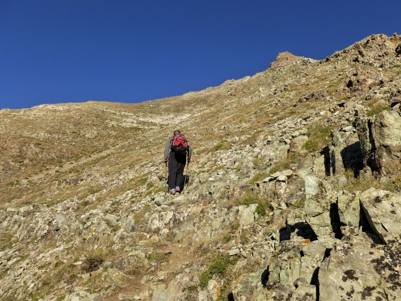
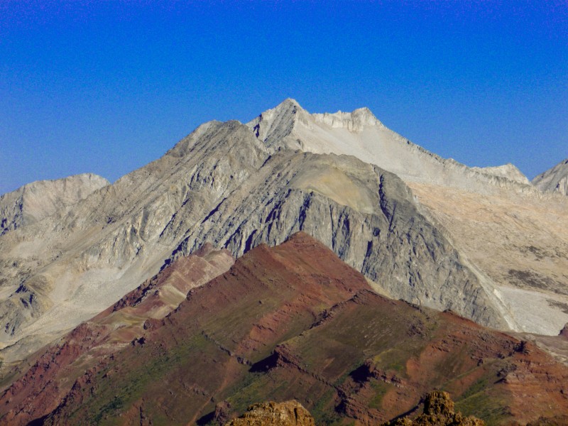
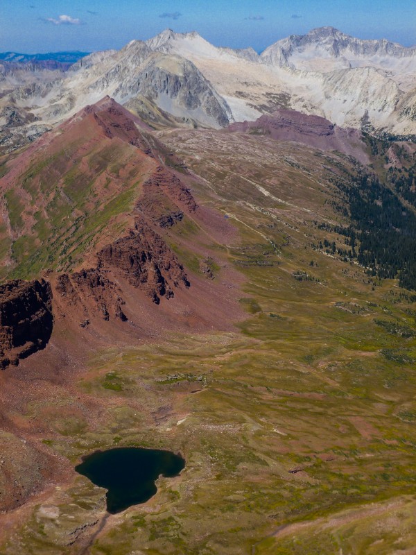
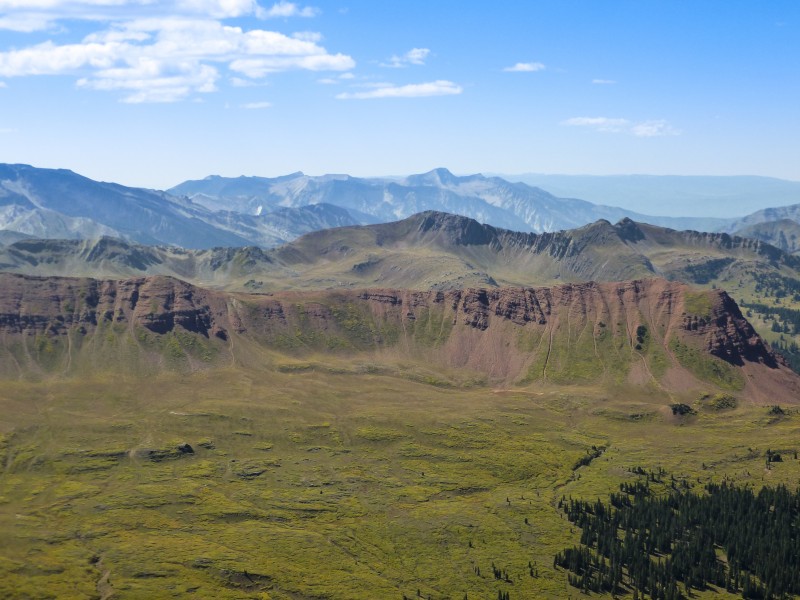
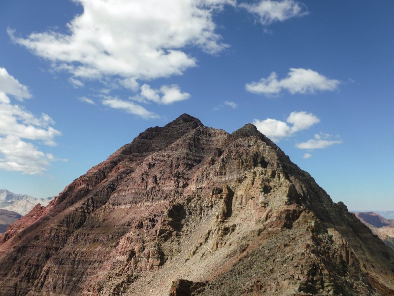
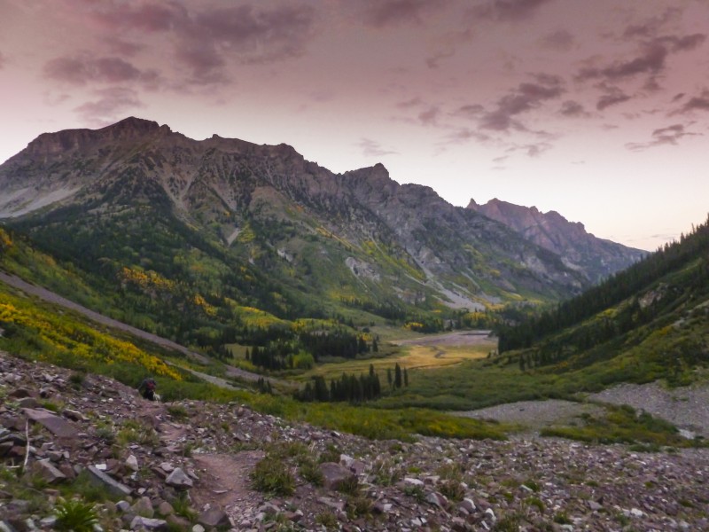
I decided to give Maroon another go while the pain of that ascent and descent is fresh in mind. My friend Abhishek decided to join in and we car camped along the Maroon Creek road. After a delayed start at 3:45am, we made good time and covered the 4 miles from the TH to the base of Maroon's east face passing an almost dry Crater lake in the process. The hike up was gruelling and relentless as expected and the sun rose when we were halfway up there. There is not much to describe about this part of the hike. The only saving grace is being able to look back every once in a while and be greeted by the monstrous Pyramid and the colorful valley beneath.
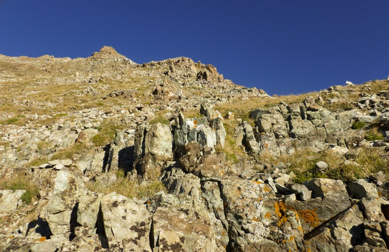
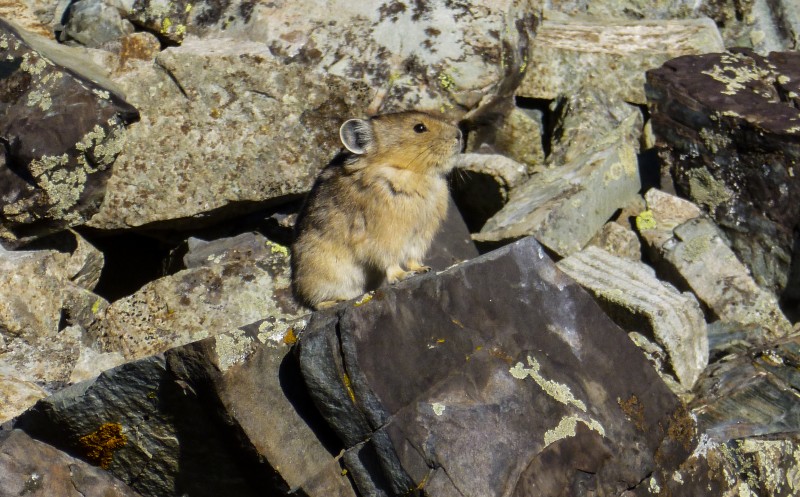
Going up the steep face Beautifully ugly Views from the ridge Proud pika starring in and as 'The Lion King'
After a longish break at the ridge for breakfast, we stashed our poles and some water on the ridge and began the hike up the last mile to the summit. The initial part skirted along the mountain and went quickly. We then came across two chimneys which provided for fairly easy Class 3 with solid holds.
Snowmass, surprised how white these mountains look!
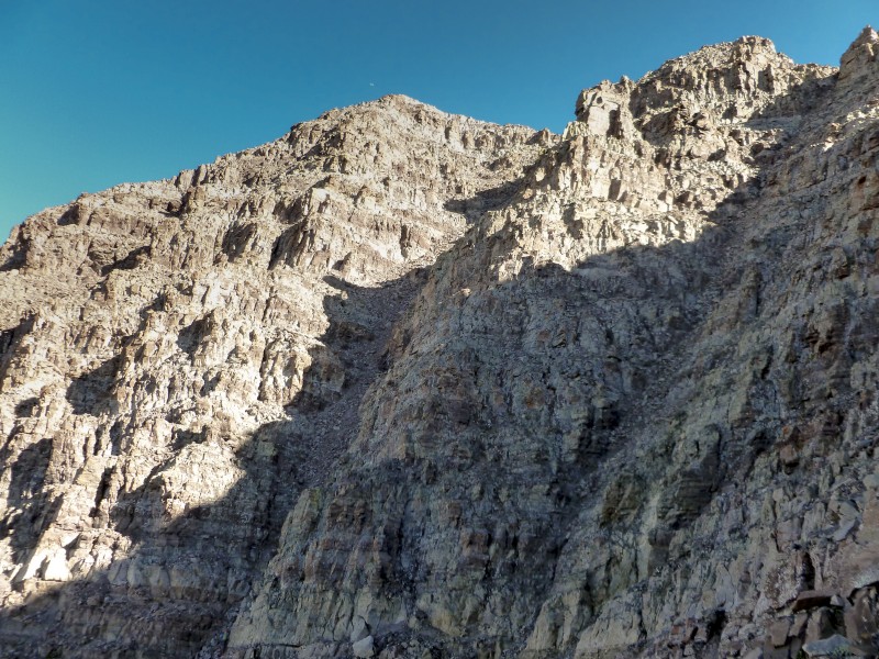
When the gullies came into full view, I was a bit intimidated by their steepness and knowing how lose the general area was. Anton passed us at this point and while I was still wondering how/if I'm going to be able to go up and more importantly go down these gullies, we saw Anton and his partner had already finished ascending them in a couple of minutes. That was the last we saw of 'that shirtless dude'. I was still contemplating whether to go up the first or the second gully. The first one looked more narrow while the second looked wider with a slight curve along the way. I was leaning towards the second gully. Abhishek thought the first one offered more solid holds. Two other hikers passed us and took the second gully and a few other downclimbing ones were inching towards the second gully. This made our decision easier and we stuck to the first gully. The gully was loose in places and lot of rocks had the potential to fall but we eventually made it up halfway through it. I realized the ascent in the gully was much shorter with a small gain than what I was dreading.
The twin gullies
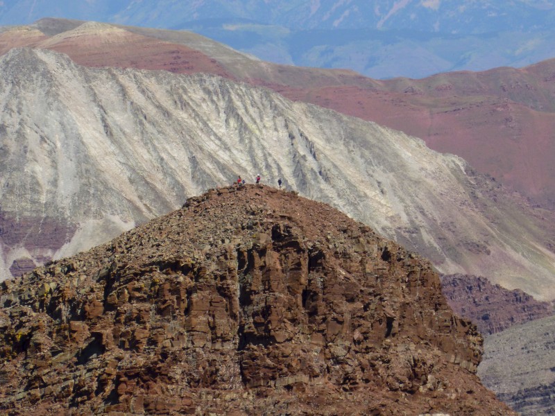
We found some cairns for exiting this gully and made a high traverse being careful not to knock down any rocks on people below. When we reached the second gully near the high traverse, we mistook the notch on top of this gully for the notch in the route description and started ascending it. Another group by either coincidence or having followed us came up the same route. We ascended pretty close to what we wanted to believe was the notch and when we couldn't find any exposed ledge that goes around the rib, we decided to go up high to the ridge. We had infact ascended Pt 13753 - which I did not know until I saw my GPS tracks. Once at the top, the other group found a faint trail along the side of Pt. 13753 and rejoining the standard route on some pretty loose scree and we followed them meekly. The CMC members were making their way up here and just went past us as we were negotiating the loose gravel to rejoin the standard route. Around this area, I had my first and thankfully the only big scare of the day when a handhold simply crumbled while I was facing in and negotiating a small ledge. Luckily my friend was close and supported my backpack and helped me regain balance.
At this junction, we also met Jerry, a fine gentleman of 71 years who was sprinting up the mountain like a 17 year old. He had ascended Pt 13753 like us and took a different route to get down and was ruing losing half an hour doing so. He also told us he had done the traverse when he was 'younger' at 61. Jerry stuck with us for the rest of the climb and back to the ridge.
Rocking on ....
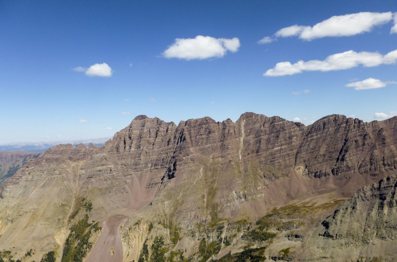
Abhishek led the route finding and I preferred taking some harder scrambling on solid rocks to the loose scree in many places. We eventually summitted and noticed that the CMC members were having a jolly good time at the peak. In the distance Paula's group were cherishing their summit of N. Maroon. A mountain goat and his/her kid played gracious hosts at the summit and posed generously for the tourists' pictures. We lounged around on the summit for close to an hour and started heading back.
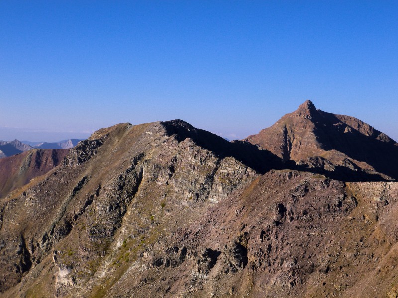
North Maroon, summit loungers Is this exposure, mom? Views of the elks Summit views Pyramid in its glory
The descent was much better than the ascent as the cairns were easily visible and route finding was not much of an issue except in a couple of places. On the descent, we more of less kept to the standard route. Instead of going down one of the two gullies, we stayed high and then rejoined the standard route via a couple of loose descents and very narrow steep chimneys and found ourselves at the ridge in a short time.
We were just there ...
The descent back on the east face was torturous as expected with the loose scree and moving rocks when we tried to avoid the scree. Somewhere on our descent we heard a loud gunshot that echoed through the mountains. A short while later, Abhishek found the hunter preparing a dead mountain goat for transport. Even though I was angry at the goats for knocking down rocks in the gullies on the east face, I wasn't terribly happy seeing a dead goat crumpled on a man's backpack, more so after seeing the gracious family at the top.
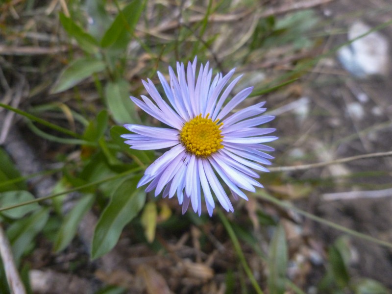
Flora Hiking out
The rest of the hike went smooth and even though the hike out is on flat land, it is about 4 miles from the valley to the car and takes considerable time. In conclusion, we couldn't have asked for a better weather day to get Maroon with the fall colors. Now, how do I go about ringing the other bell? ....
My GPS Tracks on Google Maps (made from a .GPX file upload):
I checked to see if I was in that picture, but I was wearing a shirt that could be seen from space so it doesn't look like it. I was hoping to see you in the parking lot post-climb too, but alas, no luck. Fine climb Karthik! North Maroon ain't much harder, you've got this.
Nice to meet you! I was surprised that your recognized me from my trip reports when we ran into you. I'm afraid I didn't make much sense, I blame it on being tired. But good job on S. Maroon Peak, it's a great climb. Good pictures.
We also ran into the hunter with the dead goat. There was a pretty significant blood trail up the slope on S. Maroon.
For a moment I couldn't figure out how you knew who I was last Sat on Maroon! Anyway, good job! Not sure where we passed you on the way down, but we did somewhere.
So the hunter did get a goat? He asked us where they were. We weren't sure if hunting season had started, I hope it had.
Glad to see you got back there and made the summit--and on a much nicer day than we did! You're gonna love N Maroon--it's S Maroon's slightly tougher and much more fun cousin :D
Jeff, Ryan: We were bit late both at the summit and the parking lot. There wasnt any reason to hurry :)
Chris, Jason: Yes, now I dont have to go up that steep sucky part in my life anymore. I'm done :)
wooderson, lemurtech: He told us he waited 12 years to get that goat license and that only a handful are given each year in the entire aspen-snowmass area. I think it was hunting season. He didnt appear to be doing anything illegal.
I am contemplating whether to do the Cord in June or wait until later to climb a route like this one. I appreciate the good text and photos. Vort.
Caution: The information contained in this report may not be accurate and should not be the only resource used in preparation for your climb. Failure to have the necessary experience, physical conditioning, supplies or equipment can result in injury or death. 14ers.com and the author(s) of this report provide no warranties, either express or implied, that the information provided is accurate or reliable. By using the information provided, you agree to indemnify and hold harmless 14ers.com and the report author(s) with respect to any claims and demands against them, including any attorney fees and expenses. Please read the 14ers.com Safety and Disclaimer pages for more information.
Please respect private property: 14ers.com supports the rights of private landowners to determine how and by whom their land will be used. In Colorado, it is your responsibility to determine if land is private and to obtain the appropriate permission before entering the property.