Download Agreement, Release, and Acknowledgement of Risk:
You (the person requesting this file download) fully understand mountain climbing ("Activity") involves risks and dangers of serious bodily injury, including permanent disability, paralysis, and death ("Risks") and you fully accept and assume all such risks and all responsibility for losses, costs, and damages you incur as a result of your participation in this Activity.
You acknowledge that information in the file you have chosen to download may not be accurate and may contain errors. You agree to assume all risks when using this information and agree to release and discharge 14ers.com, 14ers Inc. and the author(s) of such information (collectively, the "Released Parties").
You hereby discharge the Released Parties from all damages, actions, claims and liabilities of any nature, specifically including, but not limited to, damages, actions, claims and liabilities arising from or related to the negligence of the Released Parties. You further agree to indemnify, hold harmless and defend 14ers.com, 14ers Inc. and each of the other Released Parties from and against any loss, damage, liability and expense, including costs and attorney fees, incurred by 14ers.com, 14ers Inc. or any of the other Released Parties as a result of you using information provided on the 14ers.com or 14ers Inc. websites.
You have read this agreement, fully understand its terms and intend it to be a complete and unconditional release of all liability to the greatest extent allowed by law and agree that if any portion of this agreement is held to be invalid the balance, notwithstanding, shall continue in full force and effect.
By clicking "OK" you agree to these terms. If you DO NOT agree, click "Cancel"...
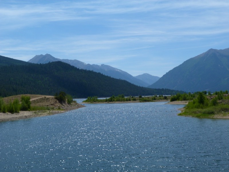
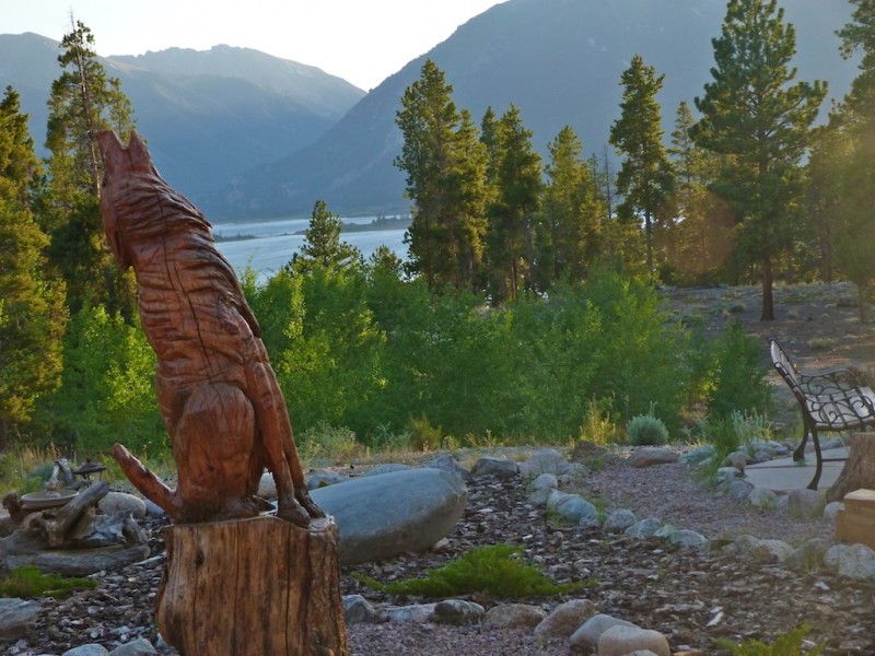
The trailhead for La Plata is three hours from our house in Castle Rock. I happen to be a fan of actually sleeping the night before a climb, so we decided to spend the night in Twin Lakes. Friday morning we enjoyed pancakes (pineapple upside down, and blueberry structural) for breakfast at Snooze, and then headed to Twin Lakes. We spent the day riding our mountain bikes on the Colorado Trail around the lake, and fishing. We then checked into Wolfsden B&B for the evening. We enjoyed a relaxing evening with a nice view. Liz and James are great hosts I would highly recommend.
Twin Lakes Chipmonk enjoying water at the B&B The view from a wolfs den
The Hike
We had a 15 minute drive to the trailhead so we slept in until 4:45. We were kind of slow getting going, so we didn't get to the trailhead until 5:45. We took the last parking space at the small parking area off highway 82.
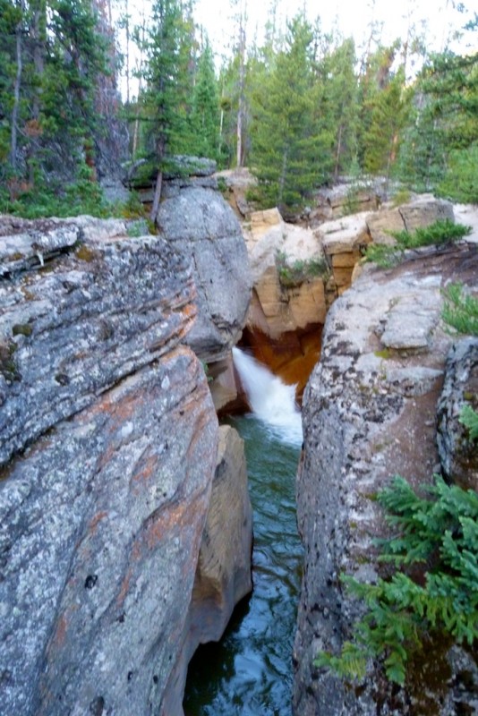
The trail starts off with a couple of creek crossings on good bridges. The second crossing has a really cool waterfall!! The first creek crossing Waterfall at second creek crossing Another view of the falls. (Looked mighty inviting on the return trip)
After crossing the second bridge we accidentally turned left on the small trail instead of following the main trail. To avoid this make sure you continue straight (not left) after crossing the second bridge. We did not realize our error until we reached a creek with no aid for crossing. We checked a map and gps and decided to bushwhack upstream to the main trail. This turned out to be much easier than backtracking I would recommend to anyone who makes the same error. If you simply follow the trail upstream you will reach this crossing.
Camping
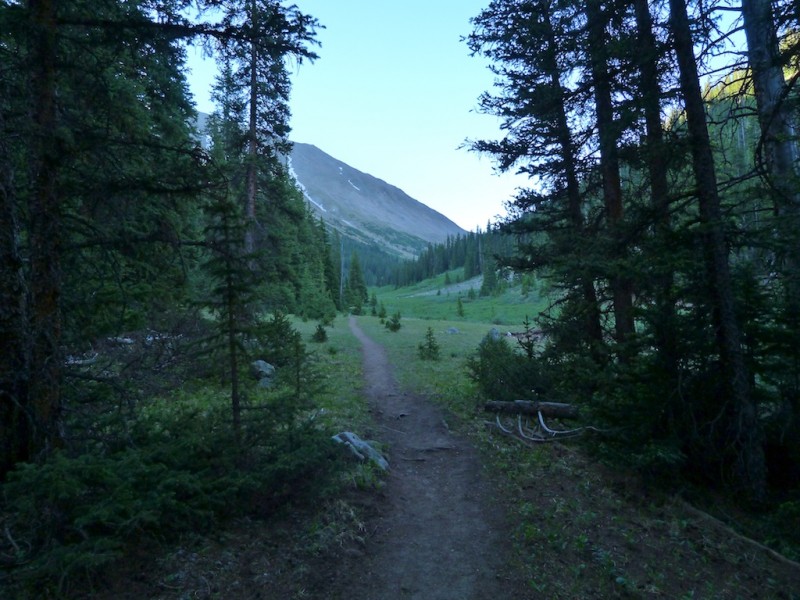
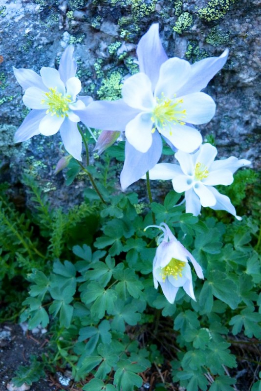
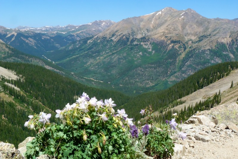
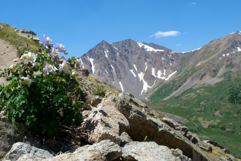
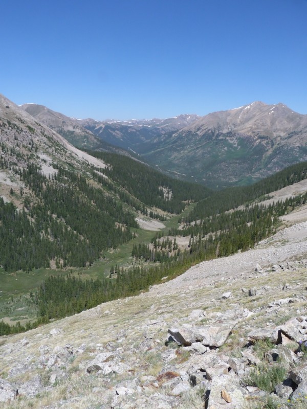
Last year I was considering doing this trip as an overnight backpack. There was a couple of nice camp sites approximately an hour in. They were directly on the main trail with little privacy. There was no fire rings, so I would not recommend a fire here. Also at the start of the trail there was a warning about not drinking the water in the area. It is contaminated with heavy metals / minerals from mining. I don't know if the upper creek has this issue, but it would be worth investigating before camping here. I have seen in other trip reports that the Southwest ridge has some decent camping as well. Nice meadow near timberline. this is the area where you could camp Colombine were everywhere on this hike tight switchbacks up the valley
WIND!!!
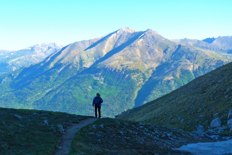
We knew from the forecast that we were likely to encounter bad winds. We reached the switchbacks (11,300') at around 7:15. Partway up these switchbacks the wind really picked up. For me strong wind is super annoying, and it really saps my motivation. It seems there is a point in many climbs where a seed of doubt creeps into your mind (Am I really going to stand on top today?). A couple of parties passed us on the way down, reporting they turned around at the ridgeline due to extreme winds. As we struggled to stand in the gusts I was thinking if I would write a trip report for a failed attempt. It was very annoying, but not yet dangerous so we persevered. By 9AM the wind had subsided to a manageable level. Angela Crossing the ridgline Angela posing with her frend Karen (cairn) Sunlight bathing Sayres Benchmark
Loose Trail
I had read a recent thread on how "loose" the La Plata trail was. I would have to agree that the area between 12K and 13K was exceptionally loose. It was dirt, and small gravel. This caused some wasted effort from slipping backward on the trip up. It was annoying on the return, but didn't pose much of a hazard. When descending this stuff I find it easiest to not fight gravity. I move pretty quickly and just accept that I am going to slide. It is kind of half plunge stepping half skiing motion, seems to work well for me. It is sort of like sliding on ice. If you bend your knees, keep your center of gravity low, an expect your feet to move in any direction you are fine. I you try to fight it and stop from sliding you are going to have a bad time.
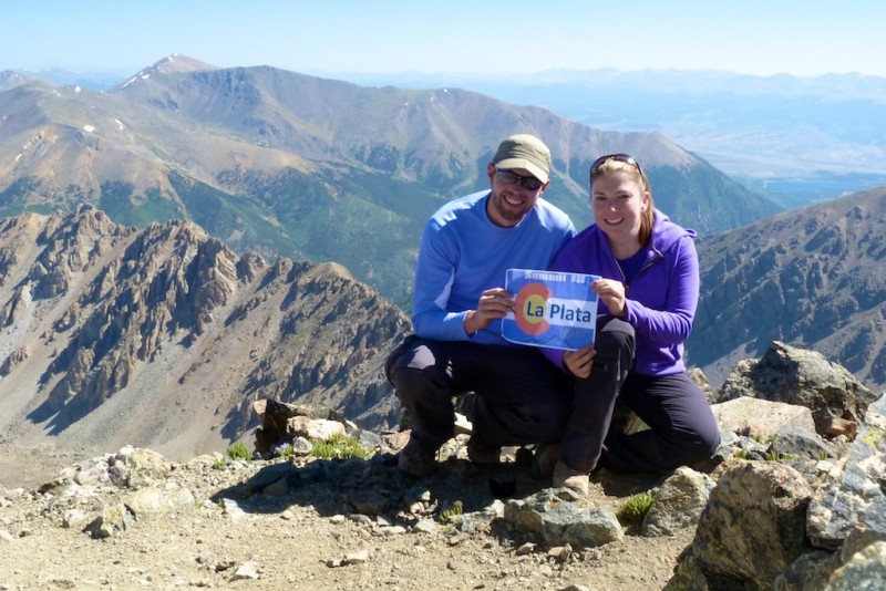
Summit
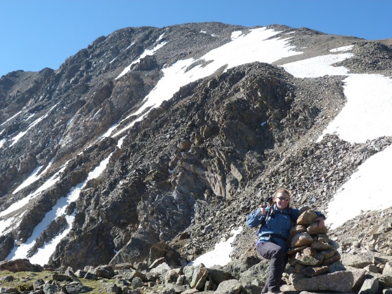
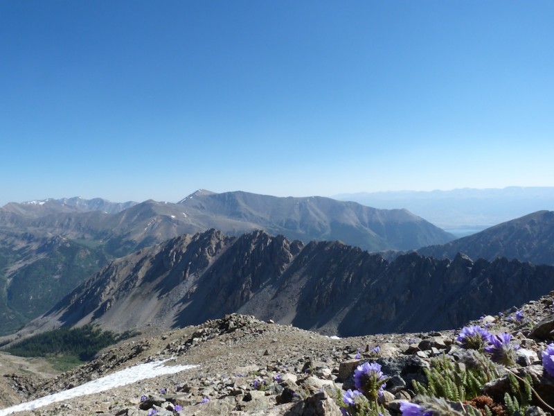
After 13K the trail fades, and you climb a large heap of talus. I found this section to be a lot of fun. There is 40 minutes of sustained class two stuff here. After the talus hopping the trail picks back up, and continues most of the way to the summit. We made the summit at 9:45 (3:45 minutes climbing time). It had turned out to be a beautiful day. There was no sign of incoming storms, and the temperature was pleasant. The well-constructed shelters on the summit provided protection from the remaining wind. We spent 30 minutes enjoying the stunning views. One of the groups sharing the summit was enjoying a sushi lunch. Elingwood ridge from the summit SUMMIT!
Descent
The descent was uneventful, but LONG. I expected to be down in two hours or so, it ended up taking more than three hours to get down. As we lost altitude the temperature rose, at 10,500 it was 85 degrees! I stopped and dipped my shirt, and hat in the stream which provided some welcome relief. My feet were quite sore and tired, which made the last two miles really drag. I wanted nothing more than to be done hiking, I knew the only way to make it stop was to keep putting one foot in front of the other.
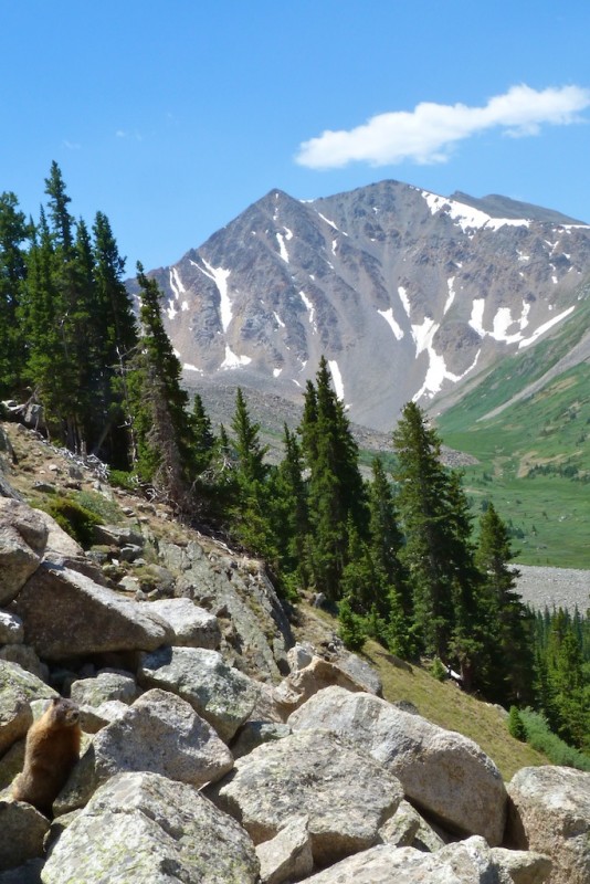
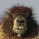
Another view of Sayres Benchmark. This peak was my favorite view of the day We encountered a couple marmots (bottom left) which was the only wildlife we saw all day
At 1:40 we reached the parking lot. We cranked up the air conditioning, and removed our hiking boots; both felt AMAZING. We met some friends who were camping at Twin Lakes. At the campsite we cooked up some wygyo beef hot dogs ($10 for 4), which were delicious!!
Overall La Plata was a long, beautiful, and fun hike. My favorite so far in the sawatch range.
Thumbnails for uploaded photos (click to open slideshow):
Awesome pictures and report, looks like you had a great time! I'm planning to climb the Ellingwood ridge pretty soon and was wondering if it's clear - the picture looks good but I'm wondering if you noticed any snow up there.
I looked pretty closely with my zoom lens and saw zero snow. There were only two small snow fields on the entire mountain. Good luck! the ridge looks fun!
Thanks! Yeah man the wind was really bad until shortly after the saddle, then it dropped to a strong breeze. I am quite tempted to give summit sushi a shot.
Nice pictures, I'm glad I wasn't the only one who thought the trail was loose. Maybe I will try controlled sliding instead of fighting the loose terrain. :)
Between you and emohr, I'm beginning to think about making this my plan A in a couple weeks, instead of either Quandary or DeCaLiBron, even if the Leadville fire is contained. Thanks a lot, guys!
Craig. Fie of no fire la plata is a more fun route than quandary or DECALIBRON. It was more physically challenging than either of those routes as well.
Nice report. Flying out tomorrow to stay at Wolf's Den. Nice to hear your recommendation. Flying in with my 13-yr old daughter for her first 14er - La Plata.
Caution: The information contained in this report may not be accurate and should not be the only resource used in preparation for your climb. Failure to have the necessary experience, physical conditioning, supplies or equipment can result in injury or death. 14ers.com and the author(s) of this report provide no warranties, either express or implied, that the information provided is accurate or reliable. By using the information provided, you agree to indemnify and hold harmless 14ers.com and the report author(s) with respect to any claims and demands against them, including any attorney fees and expenses. Please read the 14ers.com Safety and Disclaimer pages for more information.
Please respect private property: 14ers.com supports the rights of private landowners to determine how and by whom their land will be used. In Colorado, it is your responsibility to determine if land is private and to obtain the appropriate permission before entering the property.