Download Agreement, Release, and Acknowledgement of Risk:
You (the person requesting this file download) fully understand mountain climbing ("Activity") involves risks and dangers of serious bodily injury, including permanent disability, paralysis, and death ("Risks") and you fully accept and assume all such risks and all responsibility for losses, costs, and damages you incur as a result of your participation in this Activity.
You acknowledge that information in the file you have chosen to download may not be accurate and may contain errors. You agree to assume all risks when using this information and agree to release and discharge 14ers.com, 14ers Inc. and the author(s) of such information (collectively, the "Released Parties").
You hereby discharge the Released Parties from all damages, actions, claims and liabilities of any nature, specifically including, but not limited to, damages, actions, claims and liabilities arising from or related to the negligence of the Released Parties. You further agree to indemnify, hold harmless and defend 14ers.com, 14ers Inc. and each of the other Released Parties from and against any loss, damage, liability and expense, including costs and attorney fees, incurred by 14ers.com, 14ers Inc. or any of the other Released Parties as a result of you using information provided on the 14ers.com or 14ers Inc. websites.
You have read this agreement, fully understand its terms and intend it to be a complete and unconditional release of all liability to the greatest extent allowed by law and agree that if any portion of this agreement is held to be invalid the balance, notwithstanding, shall continue in full force and effect.
By clicking "OK" you agree to these terms. If you DO NOT agree, click "Cancel"...
Shuffling the Seasons on La Plata - A Winter First
A ten day holiday vacation at sea level left me congested not only with excess oxygen, but excess options. A spring or even summer like forecast, and so many choices for a climb! Yale, Antero, Lindsey, Castle and Conundrum, La Plata, maybe even an attempt at LB's west ridge??? I spent the majority of the time around New Years debating which peak to attempt over the holiday weekend.
Eventually, Dillon (dillonsarnelli) and I settled on La Plata. Niether of us had been up the peak in the past, and it would be his second winter climb while I would no longer be a virgin to the toughest climbing season. With the forecast looking beautiful, I was excited to say the least.
I picked Dillon up at 5:15am in Denver and we made our way to the La Plata trailhead. What a treat to drive straight up to a paved, plowed trailhead in winter! We geared up and were on the trail just a few minutes after 8am, both of us a bit colder than we had initially anticipated.
The trail starts out down a road before veering left into the woods at a sign. There are a large number of smaller trenches that deviate from the La Plata trail, but if you stay on the most beaten path, and have a sense of where the route goes (very little elevation gain the first half mile), you will end up following the main trench.
(All photos with date and time stamps taken by dillonsarnelli).
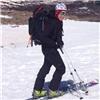
At the TH (photo by Benfromtheeast)
The route follows a good trench steeply through the trees
Before I lead people astray from what I believe is the proper winter route, I'll come out and say it. The well-beaten trench that climbs through the woods will deposit you at the lower end of the ridgeline that you'll use for the summit push. While this was both Dillon and my first time on La Plata, I am almost positive that you will exit the trees too high / too far left if you follow this trench. (If you look at photo #1 in the route description on the site, the trench exits the trees at lower left).
Upon exiting the trees, the relatively intimidating headwall at the bottom of the ridge rises in front of you, and tracks spread out and go left, right and straight. Knowing that the winter route deviates a bit from the summer trail, but still goes right of this initial rise in the ridge, we opted to traverse around on frozen scree to try and find an easier path to the ridge.
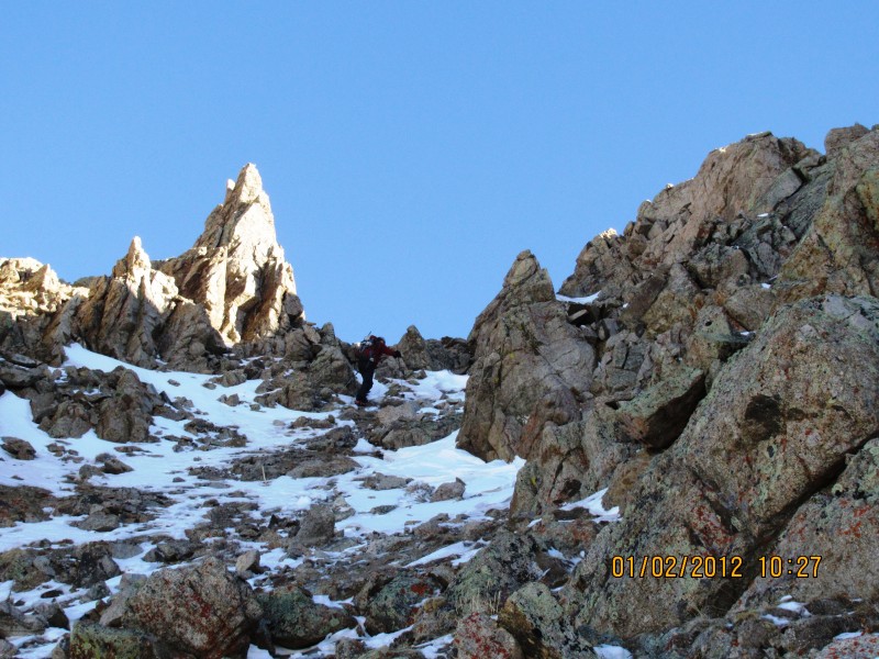
At treeline with the initial ridge rise ahead. See that big rock over my left shoulder? That's where the tracks go EVERYW
The traverse wasn't too bad in the morning as the scree was mostly solid, but it would be much more unpleasant in the afternoon.
Me beginning the sidehilling
Eventually we grew tired of the uneven terrain, and chose to climb a steep yet relatively solid gully for ~250 vertical feet so we could gain the ridge.
Looking up the gully
Upon gaining the ridge, we met forum members 2aron and JDip, who had stopped to take in the beautiful views. Guys, it was great meeting you both!
2aron and JDip on the ridge
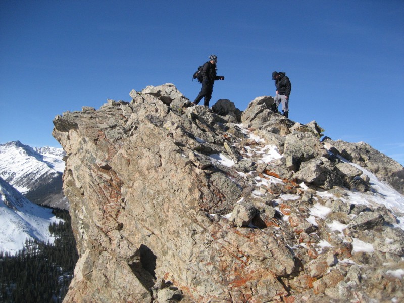
Once we gained the ridge, it was a relatively straightforward, "dry scree and talus / occasional knee deep posthole but snowshoes not necessary" grind up to the summit. We reached the top around 12:30pm, about 4 hours 15 minutes after starting.
Looking back at 2aron and JDip on the ridge
Dillon looking up at the ridge
Dillon traversing
Me climbing a steeper section of ridgeline
Dillon climbing high on the ridge
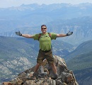
On the summit
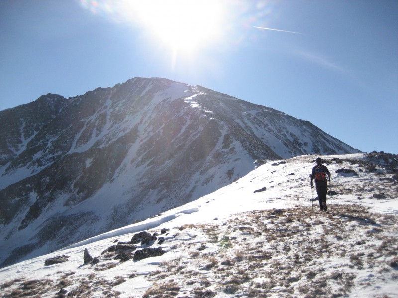
The views from any 14er are good, but these were particularly stunning. We easily picked out the Elk 14ers, and had fun trying to spot the various San Juans (with the exception of Uncompahgre, which was easy). I don't think we could see any Sangre 14ers from this point though, just a little too far north in the Sawatch
The views were insane
Ellingwood Ridge with Elbert
Heel-stepping the snowfields on the descent
As we started the descent down the ridge, we took advantage of the friendly snowfields and plunge-stepped our way down pretty quickly. We discussed the various options for getting off of the ridge proper, and both agreed we didn't want to descend the steep gully we had ascended. Instead, we opted to look for a dry gully (hopefully less steep than the one we ascended), that would lead us off the west side of the ridge, thereby allowing us to contour around to the trench that would take us into the trees.
Dillon contemplating the descent
Dillon descending off of the ridgeline
Dillon descending below the ridge, near the suspect snowfields
In a route-finding mistake that we realized too late, we followed the still visible summer trail off of the ridge and switchbacked our way down toward the drainage on the west side of the peak. We didn't descend all the way to the drainage though, as Dillon had stashed snowshoes along the main trail in the trees that we needed to retrieve. Instead, once we had lost considerable elevation, we contoured descenders right (north) toward the lower toe of the ridge where the trail had emerged from the trees (photo #3). This put us in an uncomfortable position, as we were forced to alternate between walking sideways on downsloping, now unfrozen scree, and snowfields. The gravity of the situation become more apparent when, upon crossing a crust-covered snowfield, I caused a rather large "whoompf" to occur. The snow didn't collapse, but there were some small shooting cracks that were generated. Needless to say we high-tailed it back to treeline while avoiding the snow whenever possible. Once back at the treeline we both breathed a large sigh of relief.
We crossed the remaining snowfields very carefully, and stuck to the rocks when possible. The trees and trench grew tantalizingly close and after lots of scree slips and off-balance steps, we reached level ground.
One of the slopes we crossed that had mixed snow and vegetation
Me with an idea of the sidehilling we went through
Finally reaching the trees and trench.
We were mighty glad to get to this spot on the descent
We were mighty glad to get to this spot on the descent
Of course, the last 50 yards before the trench provided the most unpleasant postholing (2 inches of concrete over quad-deep powder) that we experienced all day.
One last difficulty before the trench into the trees
Once we hit the trench, we put it in cruise control and quickly descended through the woods to the snowshoe stash. Not having snowshoes, I postholed maybe 8-10 inches a decent amount on the way down, which combined with my already fatigued state from the 10 previous days at sea level made me feel, well, very tired indeed. I imagine Dillon was quite exhausted too, having logged nearly 10,000' of vertical in 2 days.
The only real exposed move in the trees
If you have any questions on the route or current conditions, feel free to let me know. Thanks for reading!
Robert
Thumbnails for uploaded photos (click to open slideshow):
The micros held up pretty well, quite a bit of abuse on the scree though. I think snowshoes would be useful in the trees and then not needed above; I didn't mind not having a pair. Micros were very useful though, would bring them along if you plan on attempting, especially because the trail in the trees is steep.
Very little wind, maybe 20 mph on the summit but it was so warm it wasn't much of an issue.
I'll be pretty happy if I never hear that sound again EVER! My Class 5 move in that last picture was pretty incredible. Great trip Rob and excellent report. You detailed it to the tee. I think we kicked some a#s on the ascent and the views on the summit were awesome. La Plata... check - Lets not go back there anytime soon!
I wore Montrail Torre GTX's, and Dillon had the La Sportiva Trangos I believe. As long as they're waterproof and you have good gaiters, this route in present condition shouldn't be a big issue, (unless of course it gets much colder).
Thanks for the TR, Rob! In case it's helpful, check out the link below with Garmin info from my partner Paige. We were just a bit slow (both getting out of cozy sleeping bags and on the trail) to keep up with Rob and Dillon, those studs! Anyway, zoom in on the loop made by our deviation in return path from ascent route, click on satellite imagery, and you'll see how we tackled the pesky section. Look at Rob's picture of the end of the trench at treeline. You can see two high points on the ridgeline. The higher is just left of the sun and obvious. The lower is closer to the camera and not as distinct. On the way up, we took a fairly direct route just to climber's right of the lower high point. On descent, we failed to descend the ridge far enough and dropped off (descender's left) before the higher of the two. The descent was awful, no fun, similar to what Rob described. But that was mostly in the traverse once we had descended the steep section. So the take home message would be to climb just to the right of the first, smaller, high point that's visible on the ridge. There is a lot of scree, but some solid rock if you pick the right line. Then be sure not to bail left too early on the way down. It's still steep and has lots of scree, but it's a fairly short section. Also, we found snowshoes very helpful up to treeline, and microspikes for many sections after that.
Hey guys! Great meeting you that day. Thanks for the shout-out! I agree, that day was a wonderful day on the mountain.
Tried to make it to the Denver Gathering, but have been swamped with work :( . We actually followed your tracks back down, except in the snowfields that had big ol' cracks already spreading across them. I'm sure that won't be the last time we run into eachother! Cheers!
Caution: The information contained in this report may not be accurate and should not be the only resource used in preparation for your climb. Failure to have the necessary experience, physical conditioning, supplies or equipment can result in injury or death. 14ers.com and the author(s) of this report provide no warranties, either express or implied, that the information provided is accurate or reliable. By using the information provided, you agree to indemnify and hold harmless 14ers.com and the report author(s) with respect to any claims and demands against them, including any attorney fees and expenses. Please read the 14ers.com Safety and Disclaimer pages for more information.
Please respect private property: 14ers.com supports the rights of private landowners to determine how and by whom their land will be used. In Colorado, it is your responsibility to determine if land is private and to obtain the appropriate permission before entering the property.