Download Agreement, Release, and Acknowledgement of Risk:
You (the person requesting this file download) fully understand mountain climbing ("Activity") involves risks and dangers of serious bodily injury, including permanent disability, paralysis, and death ("Risks") and you fully accept and assume all such risks and all responsibility for losses, costs, and damages you incur as a result of your participation in this Activity.
You acknowledge that information in the file you have chosen to download may not be accurate and may contain errors. You agree to assume all risks when using this information and agree to release and discharge 14ers.com, 14ers Inc. and the author(s) of such information (collectively, the "Released Parties").
You hereby discharge the Released Parties from all damages, actions, claims and liabilities of any nature, specifically including, but not limited to, damages, actions, claims and liabilities arising from or related to the negligence of the Released Parties. You further agree to indemnify, hold harmless and defend 14ers.com, 14ers Inc. and each of the other Released Parties from and against any loss, damage, liability and expense, including costs and attorney fees, incurred by 14ers.com, 14ers Inc. or any of the other Released Parties as a result of you using information provided on the 14ers.com or 14ers Inc. websites.
You have read this agreement, fully understand its terms and intend it to be a complete and unconditional release of all liability to the greatest extent allowed by law and agree that if any portion of this agreement is held to be invalid the balance, notwithstanding, shall continue in full force and effect.
By clicking "OK" you agree to these terms. If you DO NOT agree, click "Cancel"...
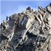
| S ridge |
This was my first 14er so sorry if my trip report is not up to par. Myselft and 3 other 14ers.com members set off for this summit.
First off on the road there when you turn from marble/crystal city turn off go 1.9miles to the unmarked turn twoards lead king basin. Follow that road for a wile sorry i didnt get millage from this point. But to explain follow it you will start dropping down the back side. Once you cross a small stream with 2 signs on trees both sides of you the trail head is just ahead. There is a decent sized parking area and if you continue down the hill just a little more there is some campsites on the left side down the hill.
Once you get on the trail (we started at 4:45) make sure you have some rain pants or something as you will get wet from the due off the bushes. Treck up the trail to geneva lake. At camp site 3 there is a tree blocking the trail climb over the tree and continue on. Once at little gen we were told there was no real trailhead to sridge so try to cross over with out ruining any of the wildlife.
Here is where you start your assent up Snowmass there are 2 gullies you can go up. The left is the one we chose. When we reached the gully there was a class 4 climb on the right side of the gully that myself and Fortmyers-b climbed as Wisco14er and sky climbed the gully. We found that we had an easier time climbing up the class 4 rather then the scramble up the gully. Continue the top of the gully up to the ridge line.
ON the ridge line you will pass the pinnacle and continue to a small rock face. Here you can either climb it and stay on ridge or go around thru a small portion of the gully below and come back up around the rock face. I climbed the face and found it solid and fairly nice to climb. From this point your almost up to the summit.
Once you summit and on your way down if you are climbing back down the s ridge which most people say to do make sure you stay on the ridge as you can get turned off down other ridge gullys and stuff on the way down. At the 2 gullys you can enter on the beging make sure you look and go down the gully you came up. We ended up coming up left gully and missed it on way down and came down the first gully (right one). Which was a little bit looser but all went well.
I hope this helped you out with some knowledge on what to do. Gl! WOOOOHOOOOO #1 is down!!!!!!
Thumbnails for uploaded photos (click to open slideshow):
 Looking at the s ridge and 2 gullies")
 Comin up to the gullies")
 Some wildlife")
 The boys.")
 Gully with class 4 on the right side.")
 Wisco14er and sky in gully")
 Fortmyers-b climbing the Class 4 right side of gully")
 Looking up at the pinnacle")
")
 YAYYY #1")
|
Caution: The information contained in this report may not be accurate and should not be the only resource used in preparation for your climb. Failure to have the necessary experience, physical conditioning, supplies or equipment can result in injury or death. 14ers.com and the author(s) of this report provide no warranties, either express or implied, that the information provided is accurate or reliable. By using the information provided, you agree to indemnify and hold harmless 14ers.com and the report author(s) with respect to any claims and demands against them, including any attorney fees and expenses. Please read the 14ers.com Safety and Disclaimer pages for more information.
Please respect private property: 14ers.com supports the rights of private landowners to determine how and by whom their land will be used. In Colorado, it is your responsibility to determine if land is private and to obtain the appropriate permission before entering the property.
 Looking at the s ridge and 2 gullies")
 Comin up to the gullies")
 Some wildlife")
 The boys.")
 Gully with class 4 on the right side.")
 Wisco14er and sky in gully")
 Fortmyers-b climbing the Class 4 right side of gully")
 Looking up at the pinnacle")
")
 YAYYY #1")