| Report Type | Full |
| Peak(s) |
La Plata Peak - 14,344 feet |
| Date Posted | 08/21/2011 |
| Date Climbed | 08/17/2011 |
| Author | JROSKA |
| La Plata, SW Ridge |
|---|
|
Heading into my second 14er season, La Plata ranked high up on this summer's "to do" list. On August 17, I set out to try to summit Colorado's 5th highest mountain. Solo hikes are great, but as I have gained more experience in the 14er universe, it has become apparent that teamwork reduces risk. A nice guy named Dave had answered my "climbing connection" post, and we met up that morning. We had earlier decided on the Southwest Ridge route, so we began the journey down to Winfield. We were able to make it to within a couple hundred yards of the trailhead, and set out at 8:05 AM. The hike starts out nice and easy, but the real workout occurs quickly, as the trail elevates through the forest. 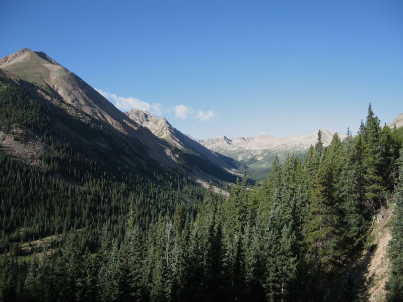 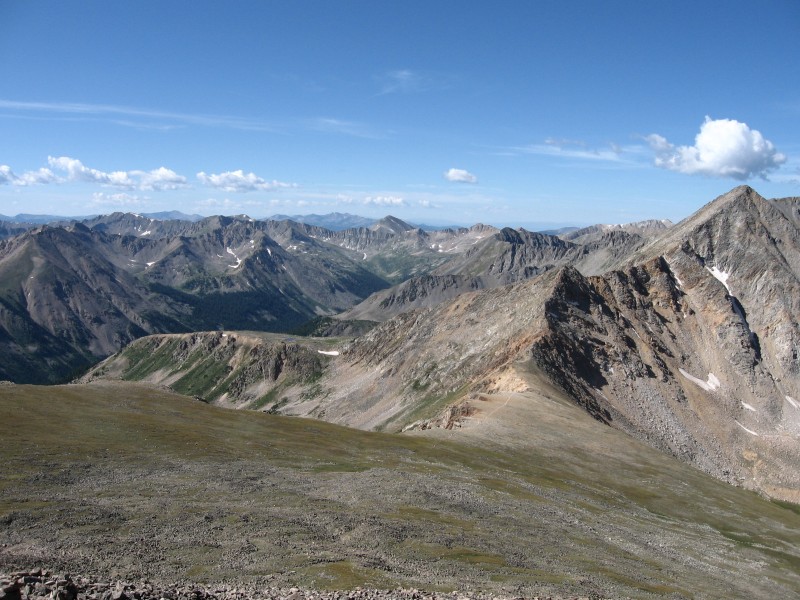 At least, we thought we were quickly gaining the summit. This was actually the first of three false summits on this route. 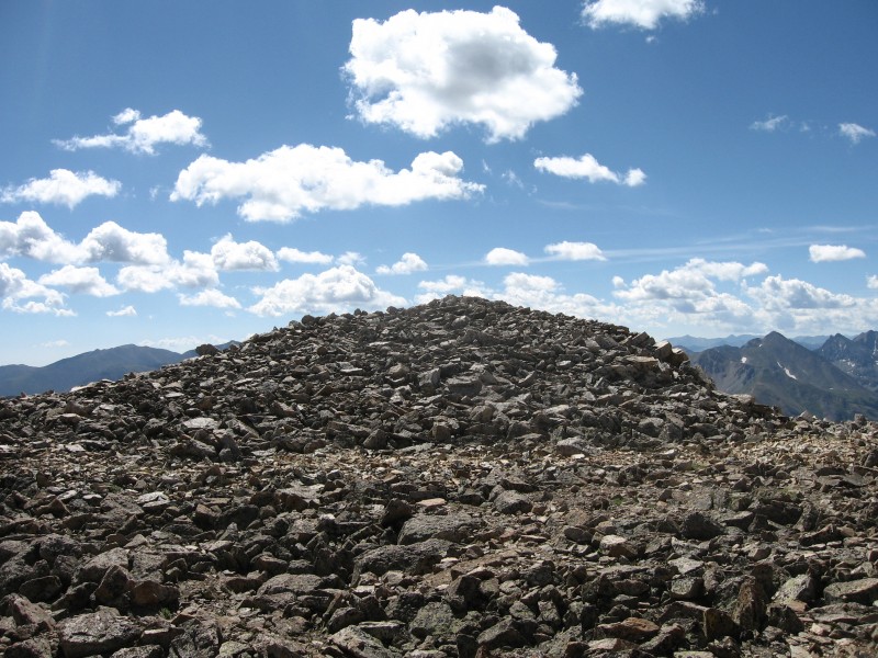  We finally reached the true summit at 11:15. This was my third fourteener of the summer, but it was the first one in which I didn't have to race off the summit to beat the clock, with bad weather looming. The views were immaculate. Here is a look to the west - from left to right, Castle, Maroon Bells, Pyramid (in front of the Bells but you can see the right side of it), Snowmass, and Capitol. 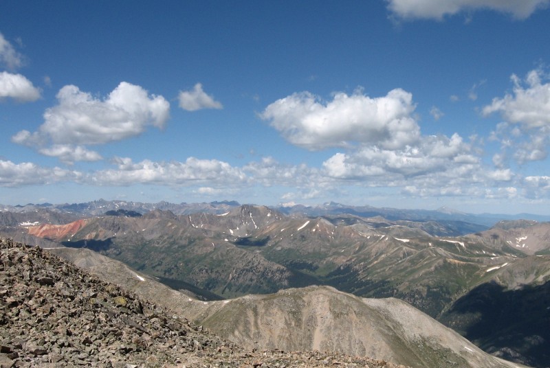 Mount Harvard in the center, flanked by Missouri Mountain on the right, and Mt. Belford and Oxford on the left. 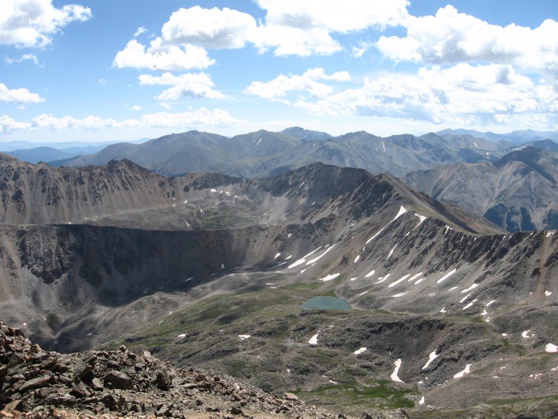 Mount Elbert on the far right in the sunlight, foreshadowing the Mt. Massive Group.  The struggle for the summit is a small price to pay when sights like these await. After relaxing up there for almost an hour, it was time to begin the (mis) adventure of the descent. After dealing with the irritating false summits on the ascent, we attempted to loop around one, rather than climb over it. This initially worked, but eventually resulted in Dave reaching a cliff, and me traversing this. 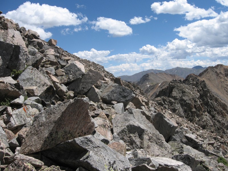  The rest of the descent was uneventful, although we both cursed a bit at the stretch immediately below the ridge. So steep and loose, major scrambling was required to stay upright, and avoid sliding. Often, there was little or nothing to grab onto. We were somewhat confused, because nothing on 14ers.com, or Gerry Roach's book, made any mention of this aspect. Being back in the sea of willows was quite a relief, and here is one last view of Mt. Huron before we re-entered the forest. 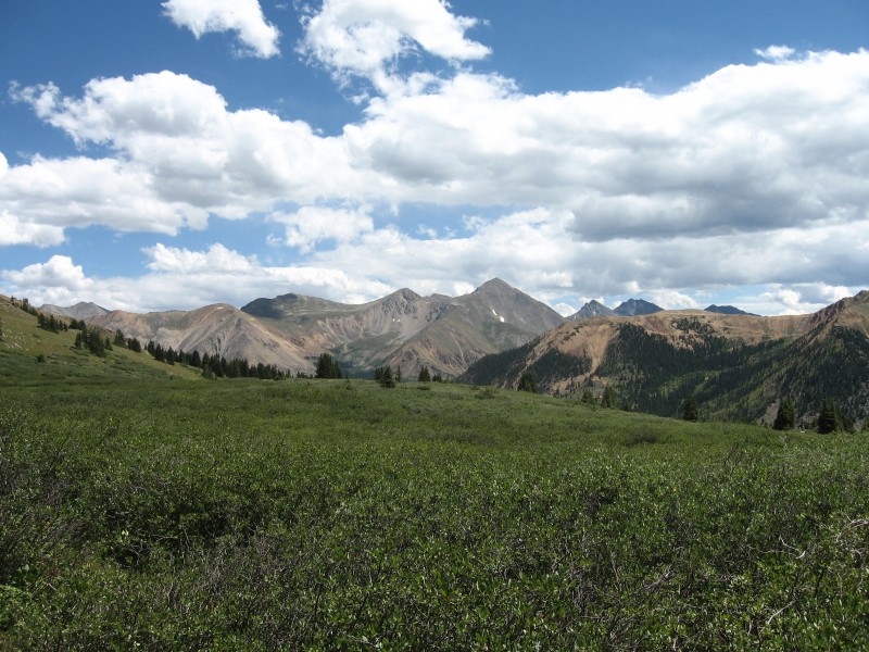 I really enjoyed the Southwest Ridge route. It is advertised as a more secluded, and scenic alternative to the standard route, and it did not disappoint on either front. I do recommend this route; just understand that the trail just below the ridge pushed the limits of what can be considered a Class 2 climb, and on the descent, maybe even pushes into Class 3 territory. However, it's always fun and interesting to attempt a route that differs from the standard one, and the challenge is worthwhile and quite fulfilling. Thumbnails for uploaded photos (click to open slideshow):
|
| Comments or Questions |
|---|
|
|
Caution: The information contained in this report may not be accurate and should not be the only resource used in preparation for your climb. Failure to have the necessary experience, physical conditioning, supplies or equipment can result in injury or death. 14ers.com and the author(s) of this report provide no warranties, either express or implied, that the information provided is accurate or reliable. By using the information provided, you agree to indemnify and hold harmless 14ers.com and the report author(s) with respect to any claims and demands against them, including any attorney fees and expenses. Please read the 14ers.com Safety and Disclaimer pages for more information.
Please respect private property: 14ers.com supports the rights of private landowners to determine how and by whom their land will be used. In Colorado, it is your responsibility to determine if land is private and to obtain the appropriate permission before entering the property.


