Download Agreement, Release, and Acknowledgement of Risk:
You (the person requesting this file download) fully understand mountain climbing ("Activity") involves risks and dangers of serious bodily injury, including permanent disability, paralysis, and death ("Risks") and you fully accept and assume all such risks and all responsibility for losses, costs, and damages you incur as a result of your participation in this Activity.
You acknowledge that information in the file you have chosen to download may not be accurate and may contain errors. You agree to assume all risks when using this information and agree to release and discharge 14ers.com, 14ers Inc. and the author(s) of such information (collectively, the "Released Parties").
You hereby discharge the Released Parties from all damages, actions, claims and liabilities of any nature, specifically including, but not limited to, damages, actions, claims and liabilities arising from or related to the negligence of the Released Parties. You further agree to indemnify, hold harmless and defend 14ers.com, 14ers Inc. and each of the other Released Parties from and against any loss, damage, liability and expense, including costs and attorney fees, incurred by 14ers.com, 14ers Inc. or any of the other Released Parties as a result of you using information provided on the 14ers.com or 14ers Inc. websites.
You have read this agreement, fully understand its terms and intend it to be a complete and unconditional release of all liability to the greatest extent allowed by law and agree that if any portion of this agreement is held to be invalid the balance, notwithstanding, shall continue in full force and effect.
By clicking "OK" you agree to these terms. If you DO NOT agree, click "Cancel"...
Having only ten days back at home in Monument, I was eager to get to the mountains. Given the proximity of the Sawatch Range, I decided on Mt. Antero. I had read the recent reports indicating a lot of snow, so I was just hoping for solid snow, or some additional melt. I saw some of this, but not completely...
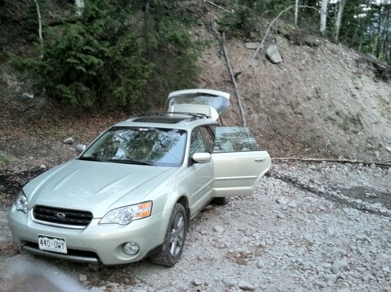
I left Monument Sunday night to camp at the Baldwin Gulch TH. I got there around 2230 and went right to bed. My Subaru was able to go about a third of a mile up the 4WD road, but I was going as fast as I could walk, so I just parked the car .
I hit the trail by 0600 and made good time on the remaining 2.5 mile or so road. Only one snow crossing which was not a big deal at all. By the loud roar of the creek, however, I could sense that crossing it was going to be a bit tricky. Sure enough, as I arrived at the crossing, the amount of water flow was staggering. There was no way around it, my feet were to get soaked. They did. I got over it. Then, I arrived at another creek. Same story, but not quite as deep.
After crossing the creek, I finally felt like I was starting to make some altitude. For the most part, I was able to avoid the large snow fields prior to the switchbacks. But after about a mile or so, I had no choice but to walk on the snow. So, I donned my MicroSpikes and retrieved my ice axe. The snow was pretty solid at about 0745 as the sun hat not hit it yet (at least where I was at).
Once I reached the switchbacks, I noticed that there was a valley (not quite steep enough to constitute a couloir) filled with snow. This offered a direct route almost all the way to the south ridge at 13,089ft. I had maybe two or three more switchbacks once I left the valley of snow.
At about about 0830 or so, I reached the south ridge.
From here you can avoid snow for the remainder of the 4WD road (to about 13,700ft). From here, I spent a lot of time route finding to avoid snow (it was post-hole time of day by now) and turning back to find better routes. The most important thing to do is stay high on the ridge. This is the best way to avoid steep snow fields. I spent a lot of time rock-hoping to avoid the slushy snow and I cam real close to giving up.
After crossing the ridge and reaching the final summit push, I was able to stay on dry rock the rest of the way. I reached the summit at a late 1100. I really do not like being this high, this late in the day. I took a few photos and headed back down.
Heading down, I took the road and post-holed at the snow-field crossings. I was getting very frustrated as anyone does with postholing, but I made it back to the car, with soaked feet, at around 1500. Long day, but I was really glad to get another in this early in the season!
Thumbnails for uploaded photos (click to open slideshow):
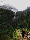
Right after the creek crossing and right before the switchbacks. It was only about a half of a mile.
Caution: The information contained in this report may not be accurate and should not be the only resource used in preparation for your climb. Failure to have the necessary experience, physical conditioning, supplies or equipment can result in injury or death. 14ers.com and the author(s) of this report provide no warranties, either express or implied, that the information provided is accurate or reliable. By using the information provided, you agree to indemnify and hold harmless 14ers.com and the report author(s) with respect to any claims and demands against them, including any attorney fees and expenses. Please read the 14ers.com Safety and Disclaimer pages for more information.
Please respect private property: 14ers.com supports the rights of private landowners to determine how and by whom their land will be used. In Colorado, it is your responsibility to determine if land is private and to obtain the appropriate permission before entering the property.


")
")
")
")