| Report Type | Full |
| Peak(s) |
Argentine Peak - 13,743 feet McClellan Mountain - 13,594 feet Mt. Edwards - 13,860 feet Grays Peak - 14,275 feet |
| Date Posted | 07/27/2020 |
| Date Climbed | 07/09/2020 |
| Author | HikesInGeologicTime |
| Additional Members | TallGrass |
| Grays (again) for the Gullible |
|---|
|
"You're gonna hate me for this," TallGrass responded when I asked him what time I should set my alarm. Just for this? I managed to not say out loud, or at least I think I managed to not say out loud. My muscles were still semi-gelatinous from pushing my bike literally all the way up Evans the other day, plus Teakettle and an attempt of Dallas on separate days the weekend before. I find that in such a state, civility doesn't stick around long. He suggested a start time of 3 a.m., and while I did look him in the eye and solemnly vow that I would be cursing his soul to the bottommost crevices of the pits of damnation (which would likely have meant more, were I not a Jewish atheist) as soon as I could get my Broca's area up and running the next day (it may already have been the next day by that point in the previous day), I couldn't in good conscience suggest a more respectable hour. I was, after all, no stranger to multi-peak days involving the crown jewel(s) of the Continental Divide, albeit via a different route. A hiking buddy from prior years had planted the idea of doing a shuttle route from Loveland Pass to Bakerville (or, at the time we were discussing it, Grays' summer TH) and tagging "Cupid," approximately 5,437 or so bumps by my later soft estimate, Grizzly D, Torreys, and Grays in one single stretch. A solo October 2019 trip to Grizzly made the rest seem viable enough that when fellow forum member daway8 wrote a trip report about his winter attempt to do all four plus Sniktau but could only force himself to do the thirteeners before the never-faltering wind got to him, I sent him a message that boiled down to, "Hey, you sound like you're my kind of crazy!" 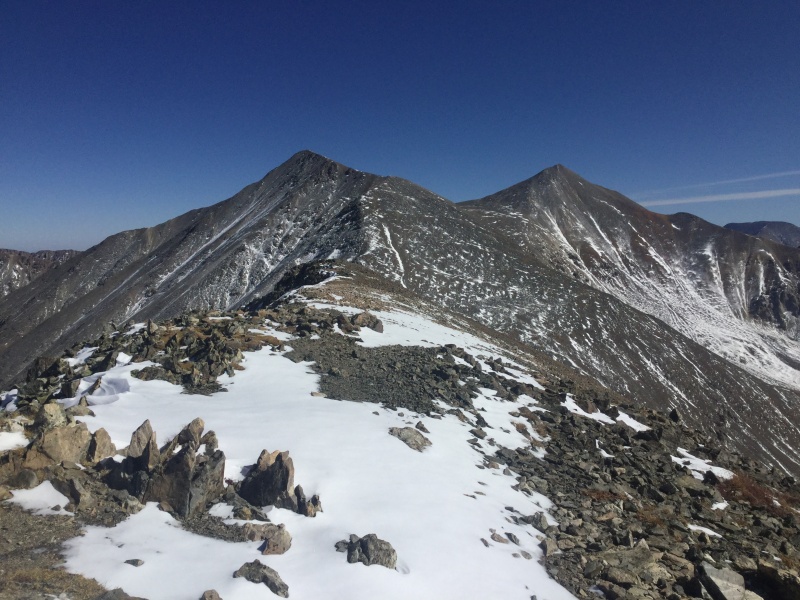
While that stretch from Grizzly's saddle to Torreys turned out to be more of a godawful suckfest of epic proportions (as I wheezed to the first of a pair of hikers who passed us, reached Torreys, then went back to Loveland Pass despite our offer of a ride out of Bakerville that would help them avoid the 7 bajillion ups and downs between Grizzly and "Cupid"!) than my autumn survey made it seem, we earned ourselves four snowflakes in a single day, and I earned the highest number of peaks I have done in a single day - nope, not even the DeCaLiBr, as I'd gotten chased back from Bross by incoming storms on my first outing. To say it took all day would be an underexaggeration, however, as we started before dawn and finished after dusk. 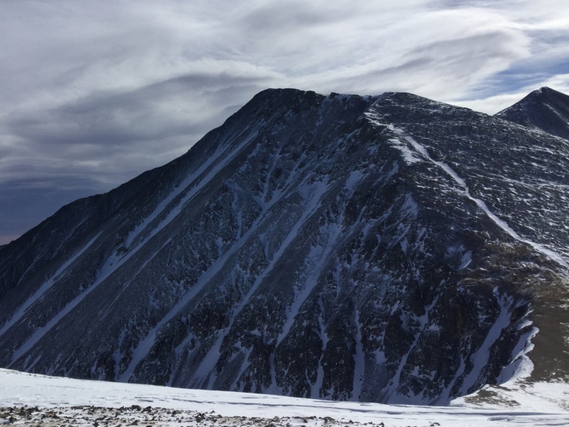
The summer outing would have an added logistical complication: daway8 and I both had cars, so leaving one at either endpoint was no problem. TallGrass and I have two vehicles between the two of us, only one of which is a car, and even he evidently recognized how unenthusiastic I was likely to be about going down Stevens Gulch on the back of a motorcycle. But we did have those cycles of the non-motorized variety still all sprightly after Evans... I decided it was just as well that I couldn't see exactly which tree off Stevens Gulch my partner was locking our bikes to. It would mean that if we were arrested and interrogated for disturbing what I felt pretty sure was private property - we were still a mile or so below the G/T trailhead - I could lend some legitimacy to my protests of innocence. This'll make a good story, I reminded myself as we then bounced back down those two miles of worse-than-one-would-expect-for-this-close-to-the-highway road in the car, headed back east on I-70 to Georgetown, and up the first two miles and change of Guanella Pass Road to the start of Leavenworth Creek Road, where a quick survey on TallGrass' part revealed that he had no doubt I would personally hand-deliver him to Satan's gaping maw if he made me subject my poor Booger to that flavor of a non-diabetic-coma-inducing rocky road so early in the morning. 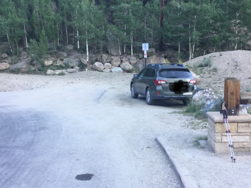
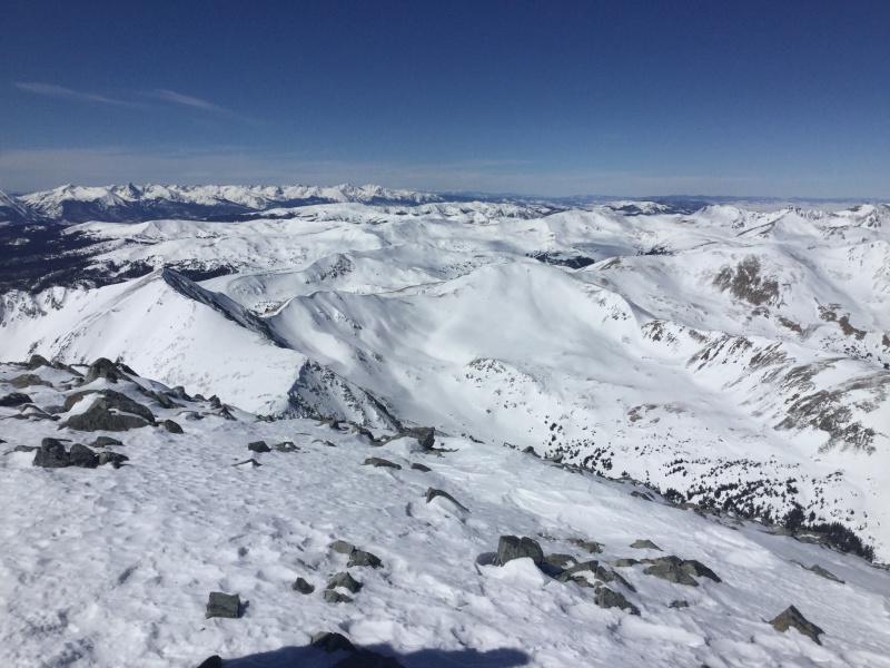
Not that I was that thrilled with walking it. We'd left the car around 9600', well below where even my 3000-Foot Rule adherent* of a partner insisted on starting to make sure he earned his stats for Edwards, the Centennial 13er we planned to summit after Argentine and McClellan, and while the road wasn't particularly steep, it was going to pack on the miles. Even he perked up when we heard the Jeep coming up behind us nearly 2 miles in and became fully animated when they let us clamber in the open bed that I don't seem to recall having been an option on Jeeps when I was a kid but which I now think is a fantastic addition. TallGrass did hop out at the Waldorf Mine so he could make absolutely sure to start below 10,800', but I was content to ride with the Jeepers as far as they'd let me. We discussed our previous exploits in the area until the road went above the trees, where I hopped out to take a doze and wait for my partner to catch up. I felt the tap of a trekking pole against my boot all too soon, though aside from a detour too close to what seemed more a pond than a lake to avoid a particularly deep puddle in the road ("What's a Front Range hike without a little willow-bashing?" I commented as my feet likely got just as wet on our shortcut), the rest of the route to Argentine Pass was unremarkable. And while I'm pretty sure there were more bumps on the way to Argentine Peak than there'd appeared to be from the saddle ("What's a Front Range hike without a false summit or several dozen?"), it had nothing on certain other adventures of mine along the onetime Continental Divide Trail, and our early rise paid off with one whole summit under our belts by noon! 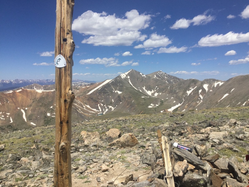
The Class 2-at-most ridgewalk past the Pass and up to where we contoured around Edwards to meet its saddle with McClellan (TallGrass had figured exactly one summit push to Edwards would be more than enough, and I had more than agreed) would have been a no-brainer if it hadn't been for my blood sugar reacting to the aerobic torture I'd subjected it to for 5 out of the 7 previous days with a full-on temper tantrum. I stopped to fix it while my partner filtered water from one of the lingering snowfields we needed to cross, and I'm sure the cause of my abnormal readings contributed to my grouchiness when I snarled of our latest conquest's unranked status that, "False peaks should not be allowed to have false summits!" once we finally reached the last of a couple options for McClellan's apex. 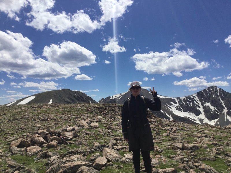
"You're looking better," he commented as I passed him going up to Edwards, and since I was, I generously stopped to wait for him a few feet below the Centennial's summit so we could tap the high point simultaneously with our poles. I spent enough time staring at the ridge connecting our location to our next destination to have a quasi-mid-life crisis. I understood rationally why it made sense for us to end up at the standard G/T route's trailhead rather than making that our start - much better to ride down the I-70 frontage road than up it, especially if you (...okay, Royal You) can't pedal up anything higher than a 2% grade - but it was hard to use even that to get my inner child to shut up about being SOOOOOOOOOOOOOOOOOOOO TIIIIIIIIIIIIIIIIIIIIIIIIIIIIRRRRRRRRRRRRRRRRRRED. If only we'd done a modified shuttle, where I dropped my buddy off at his vaunted 10.8k on Stevens Gulch Road, driven myself up to the TH, tagged Grays and Torreys, accompanied him to Edwards, and then gone back up and over (or contoured around) Grays so my car and I could meet him where Leavenworth Creek Road intersected Guanella Pass...! 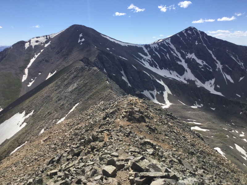
Then again, I soon reflected, it was just as well I'd only have to do this ridge once. I now had enough Class 3, enhanced with a little 4 and even low 5, under my boots that I could see we weren't going to run across anything out of my purview, but the path was tight enough in places and loose enough in others that this was no time to go on autopilot, and downclimbing the bulges along the way (you couldn't call them towers, or at least a semanticist with my level of prescriptivist tendencies couldn't) did require a low Class 3 move or two at the tops of each. 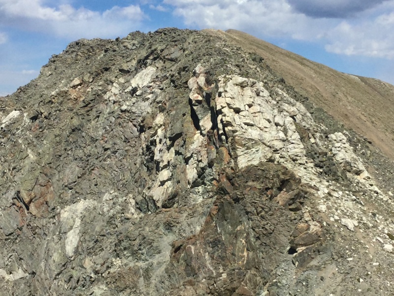
I had yet to make up my mind as to whether the stretch from Edwards to Grays would be more or less of a godawful suckfest than the stretch from Grizzly to Torreys when we reached the former's saddle. Yet despite that former's saddle being a good 500' higher than that between the latter, meaning less elevation to re-gain, and that higher saddle being followed by a decent trail that doesn't exceed Class 1 in my reckoning, I'd somehow still had enough mojo left after sucking wind all the way up to Torreys in February to push for one more summit - and succeed. 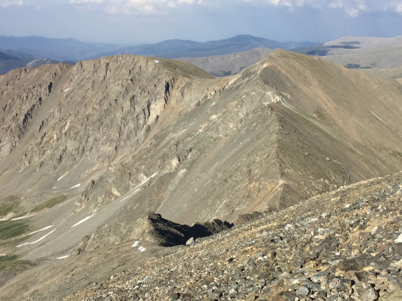
"Grays is going to be my last peak of the day," I notified my partner after roughly the hundredth out of the thousand or so times I had to gag for air during my push to the top from the other side four and a half months later. But I was too invested now not to make that, at least, and while a just-shy-of-6 p.m. summit time is hardly recommended by the experts, I knew I'd have a few minutes to rest and photograph the baby mountain goat accompanying its mom on a taste test of the hardiest urine to flow into two separate oceans that day. 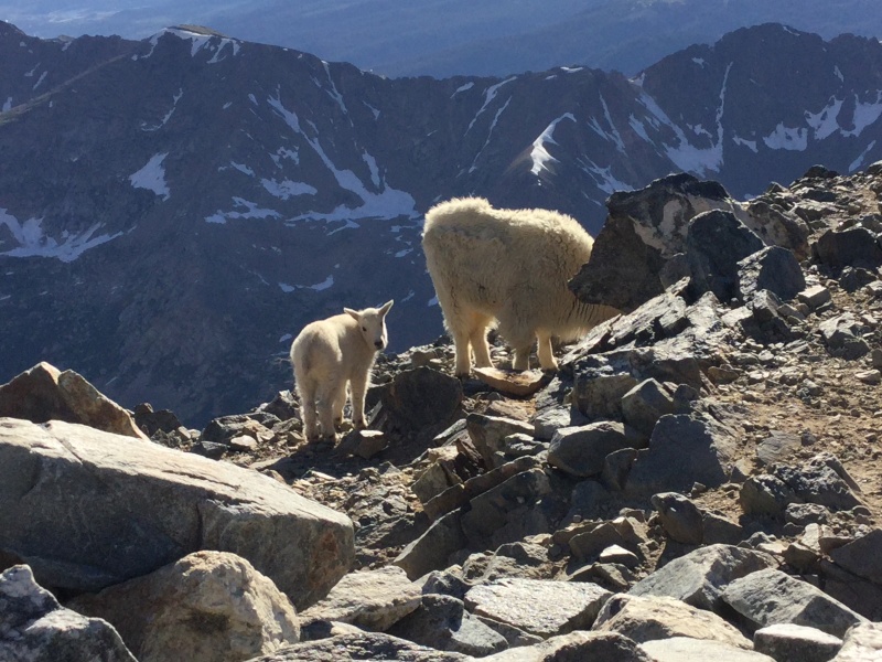
"Come on," TallGrass urged me as he prepped for his own final summit push. "Keep me company. Make it a five-peak day. Think of what your Instagram followers will say if you bag five peaks instead of just four!" "A lot of my followers aren't from this state. They think it's mindblowing if I summit the Capitol. As in, the building with the specially marked step at 5280', not the peak." "It's just another 500 feet of elevation gain," he insisted. 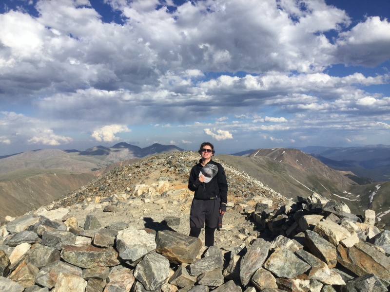
My civility hadn't quite been tossed out to save pack weight yet, so I found a less crass way of telling him where he could shove his last 500'. I lingered to take more baby mountain goat pictures after he started down toward the G/T saddle, then shuffled my own battered feet down the main trail. I have nothing but kind things to say about the work CFI's done on that trail. It was marvelous back in February and more marvelous still when you can stay on it the whole way down instead of taking a detour through one of the lesser circles of hell that is filled with snowy willows in order to circumnavigate Kelso's infamous avalanche slopes. My only complaint is that the going is SO easy that it allowed my fatigued mind to engage in what I can only describe as mini-out-of-body-experiences with every other step. It seemed prudent to find a minimally-rocky patch of ground at the TH and rest my head against my pack for a catnap. Alas, the mosquitos cared little that I still had literal miles to go before anything resembling real sleep, and even with that added 500' of elevation gain - after 500' of descent - plus a snow crossing at the saddle, my annoyingly long-legged and still-energetic partner cruised to the USFS information sign less than thirty minutes after I did. We hustled down the road to our bikes in the last of last light, where I declared that there was no way in the hell I'd somehow condemned myself to that I would be riding my bike down to Bakerville. He started to say something, but I'm sure it was just as much the civility I'd ditched once and for all between Grays' summit and our location as it was my logic - "I can barely ride a bike on flat pavement in broad daylight. Forget about a road that demands AWD on a currently moonless night!" that encouraged him to keep his thoughts to himself. I'll admit to being a wee bit disappointed that there wasn't a cavalcade of Clear Creek County cops awaiting us where we'd stashed the bikes; I would have taken any motorized ride back into town at that point. Disappointment turned to wistful nostalgia as I remembered my last trip down this stretch of road on foot...that time, while daway8 and I had both been well beyond tuckered out, we'd been joined at the summer trailhead by an attractive Scottish physicist who'd been in town for a conference that had succumbed to an early COVID shutdown, and he'd decided to go summit a fourteener in winter instead. How I wished it had been him instead of my bike that I was stumbling over rocks with on this outing! I had doubts about my ability to bike down even the pavement once I reached it; my haste in the absence of decent light had tenderized the knee that's been an on-and-off aggravation throughout almost all of my fourteener journeys. I had even greater doubts as, not long after we turned onto the frontage road, the road started going uphill - this was not what I had signed up for, though at least my string of invective against that road's mother, father, and third cousins once removed apparently kept my partner amused. The frontage road does eventually quit its rebellious nonsense and start going down the way it's supposed to, and for a few miles, even I, frayed and frazzled as I was, could appreciate the almost eerie beauty in being so close to what some would call the pinnacle, others the nadir, of human innovation and yet far enough away that an overactive imagination could fancy itself having been pulled by the rising moon into a fairyland whose inhabitants were mischievous but not malignant. Back in the human realm, one of the problems with our species' ingenuity is that it eventually butts up against our mindlessness. We coasted into Silver Plume, where I relied on my memories from the Slacker Half Marathon in 2019 that had followed much of our route, to direct us under the highway, then looked around frantically for the updated route that had to exist, because the rest of the path into Georgetown the year before had us running too close to the highway's shoulder for my comfort. 
Alas, the route was the same in 2020, and in addition to the distraction of sedans and eighteen-wheelers alike zooming by at speeds that sure sounded like they exceeded the limit by a good ten or twenty miles per hour, I also had the joy of trying to dodge headlights from westbound traffic grinding up the hill. With little way to distinguish the edge of the bikepath from the grass on either side, and one side's grass quickly giving way to the gorge below without so much as a how-d'y-do, I once again found myself walking my bike, this round of curses buried in the noise of the traffic whipping past mere feet to my left. Happily, it wasn't too long before we dropped below the shoulder and onto a series of switchbacks leading down to a parallel path with the railroad...though with the continued lack of ambient lighting, I found myself walking the bike for those as well. I was able to bike the straightaway back into town, where I figured I could be most useful to my partner's efforts in finding a ride back up to the car by standing behind him, keeping my mouth shut lest any residual...feelings...emerge, and generally looking as pathetic as I felt while he explained the situation to the fingerful of people who were still awake at 11 p.m. Emergent feelings or no, everyone we came across was either unable or unwilling, so we stopped at the gas station just off the highway, where I sagged into the firewood on prominent display out front and gratefully agreed to keep watch over my bike and the packs while he biked the 4 miles back up the road at such a time of night to fetch Booger. I reunited my bike with Booger's trunk sometime around 12:45, and we returned to Denver around 2, making it 23 hours between solid sessions of shuteye, but what splendid shuteye it was when I sank into it at last. And I did get three new thirteeners, including a Centennial, out of it, plus another story to frighten my non-Coloradan friends with, so I suppose I can't really begrudge my partner for that 3 a.m. alarm. At least, not too much. 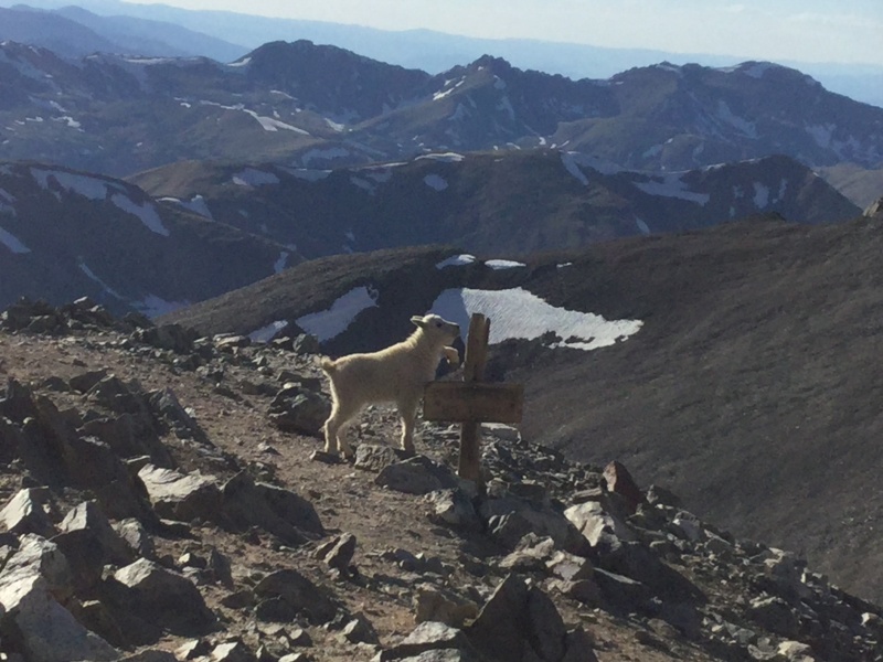
*The phrase I actually used when we stopped about a mile and a half up to adjust layers and I gave him a sample of the 800-page-long rant I planned to include in my eventual fourteener memoir re: the 3000-Foot Rule and its devotees was much less civil. Thumbnails for uploaded photos (click to open slideshow): ")
")
")
")
")
")
")
")
")
")
")
")
")
|
| Comments or Questions |
|---|
|
|
Caution: The information contained in this report may not be accurate and should not be the only resource used in preparation for your climb. Failure to have the necessary experience, physical conditioning, supplies or equipment can result in injury or death. 14ers.com and the author(s) of this report provide no warranties, either express or implied, that the information provided is accurate or reliable. By using the information provided, you agree to indemnify and hold harmless 14ers.com and the report author(s) with respect to any claims and demands against them, including any attorney fees and expenses. Please read the 14ers.com Safety and Disclaimer pages for more information.
Please respect private property: 14ers.com supports the rights of private landowners to determine how and by whom their land will be used. In Colorado, it is your responsibility to determine if land is private and to obtain the appropriate permission before entering the property.

