| Report Type | Full |
| Peak(s) |
Mt. Spalding - 13,863 feet "West Evans" - 14,257 feet Mt. Blue Sky - 14,268 feet The Sawtooth - 13,780 feet |
| Date Posted | 03/18/2020 |
| Date Climbed | 03/16/2020 |
| Author | daway8 |
| 4 Peak Evans Ridge Route at end of winter |
|---|
|
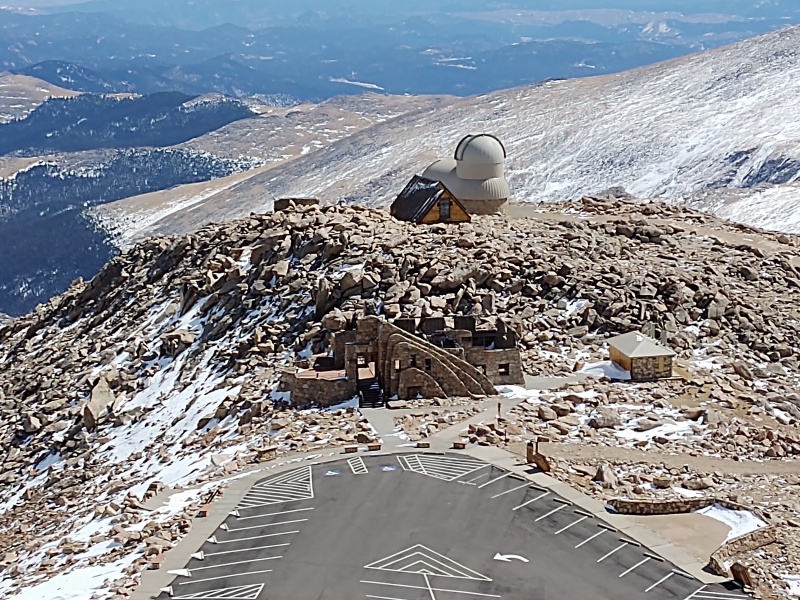
This route was my best and most unexpected surprise of the season - early on I thought Evans would be a somewhat ho-hum way to get an easy snowflake. Then my interest grew when I noted how easy it would be to tag a couple 13ers in calendar winter (Spalding and Sawtooth) and also realized I could get a 14er sub-summit (West Evans) on the way. That last one, the ShadowFlake as I call it (the snowflake for a sub-summit doesn't show up in your overall snowflake count - only visible if you expand your list out) turned out to be the real jewel of the trip - or rather the process of getting there did. Since there was some uncertainty as to precisely where West Evans is at, I took a suggestion I saw on here and just hiked the entire ridge, going up on virtually every prominent point along the entire ridge over to Mt. Evans. That was the most fun I had all winter - 100x better than just strolling the summer trail down below the ridge! With all the new closures, restrictions and ever growing craziness popping up related to coronavirus, even in the couple days since I did this hike, it looks like I might be getting stuck home for a while so I'm glad I squeezed this hike in when I could. Included in this report will be:
The Approach My initial concept for the approach came from the gpx tracks that SnowAlien posted several years back (thanks!) showing a way to do Evans with basically no avy danger even under loaded conditions (other than the first switchback in the road which has been highlighted by many folks). So I downloaded those tracks and at times somewhat followed them, and at other times just followed wherever a trench was and then still other times made my own trench/tracks wherever the ones in front of me seemed to go somewhere other than what I had in mind. 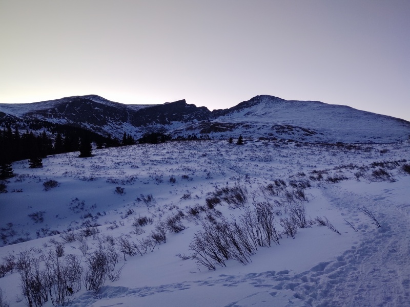
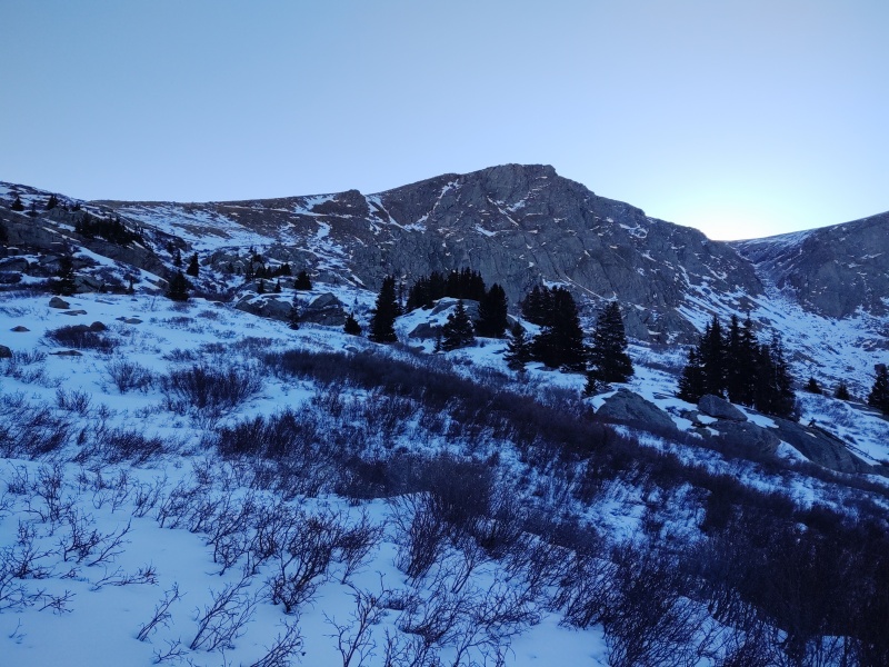
There were multiple different paths veering around through the willows - everyone trying to find an easy way through them. I'm pretty sure everyone failed... If you find a beaten path you probably might as well use it at least until your turnoff point (cut left to go the gentle, avy free climb or go straight on to the very steep looking gully if you prefer to tackle your altitude in one big chunk - just beware that gully might possibly slide if it's not blown clean by the wind). 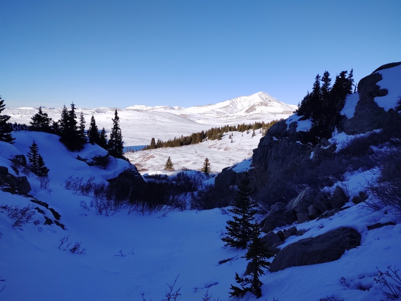
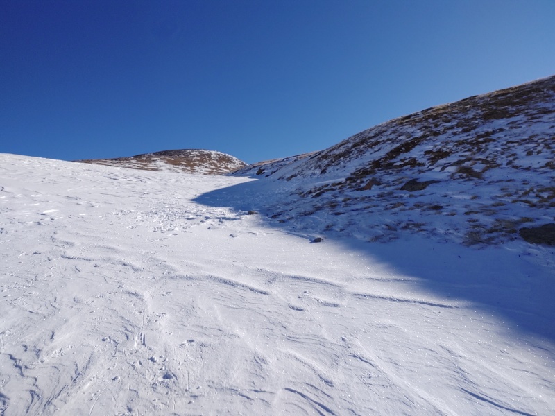
There are also multiple variations of exactly where to go up the more gentle slopes - my gpx tracks show a couple options. The return route (far right in photo below) was perhaps a little better than coming up the gully where at one point I heard running water below my feet. 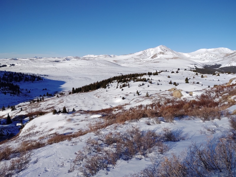
As you come to the top of the climb and have to cut over to the slopes going up to Spalding you can either cut soon and give up some altitude in the process or walk a little bit further to where you can cut over without losing any altitude. Whether you're going for Evans, Spalding, the Sawtooth or whatever, this point in the hike (right before a prolonged incline) isn't really the spot where you want to surrender any altitude, in my opinion, even though it wouldn't take too much of a drop to cut over right away. 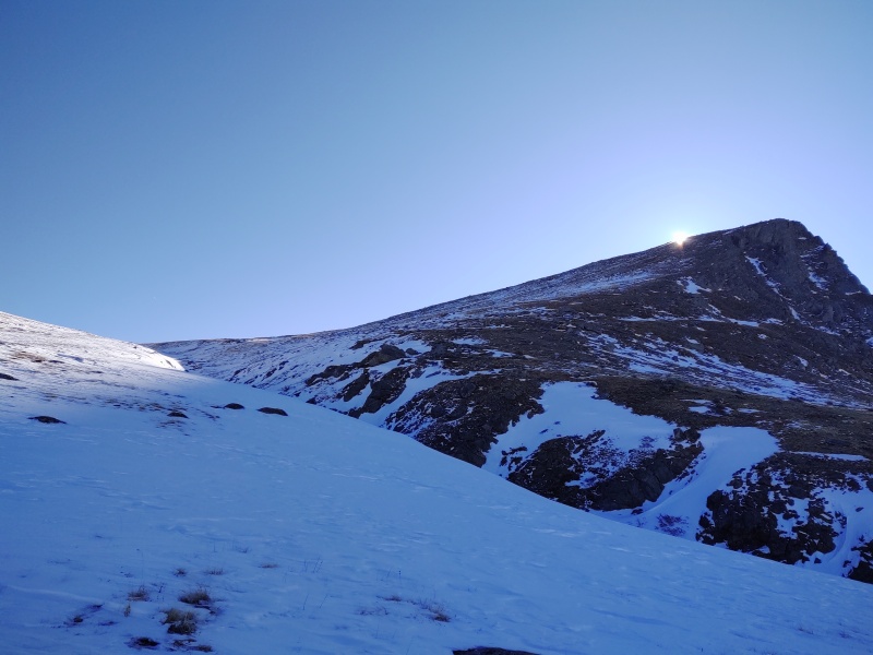
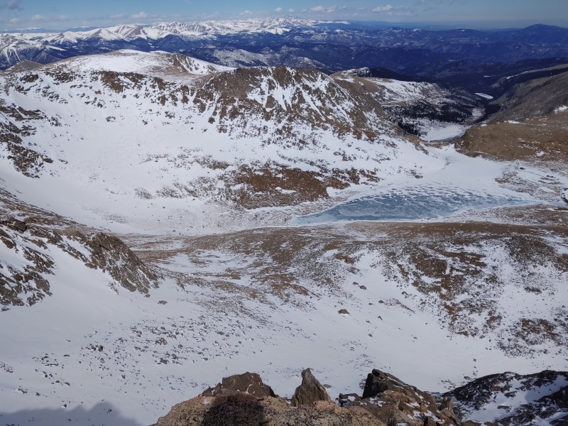
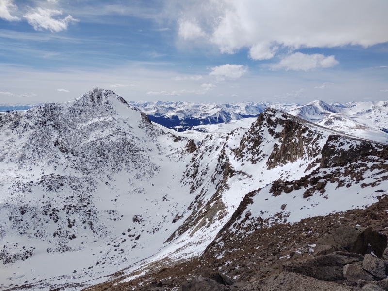
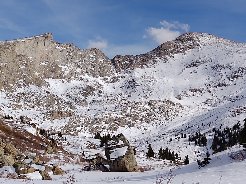
Once you get high enough along boring relentless terrain you're finally rewarded with views of Bierstadt and the Sawtooth and that oh so interesting looking ridge between them. 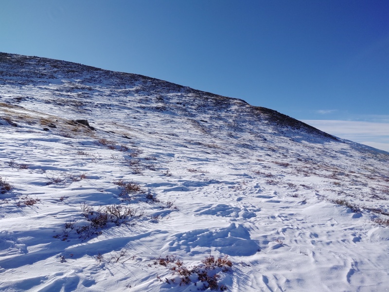
I ended up leaving my snowshoes on until just before the summit of Spalding but I really could have probably taken them off shortly after crossing the gully at the base of the climb up Spalding. 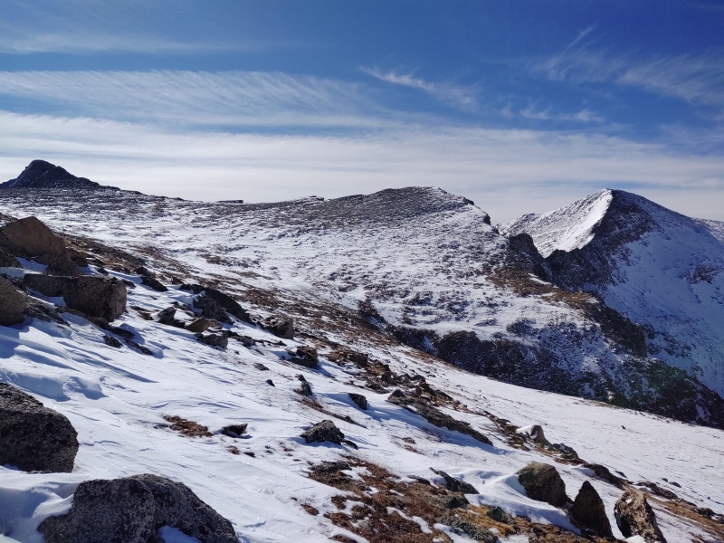
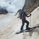
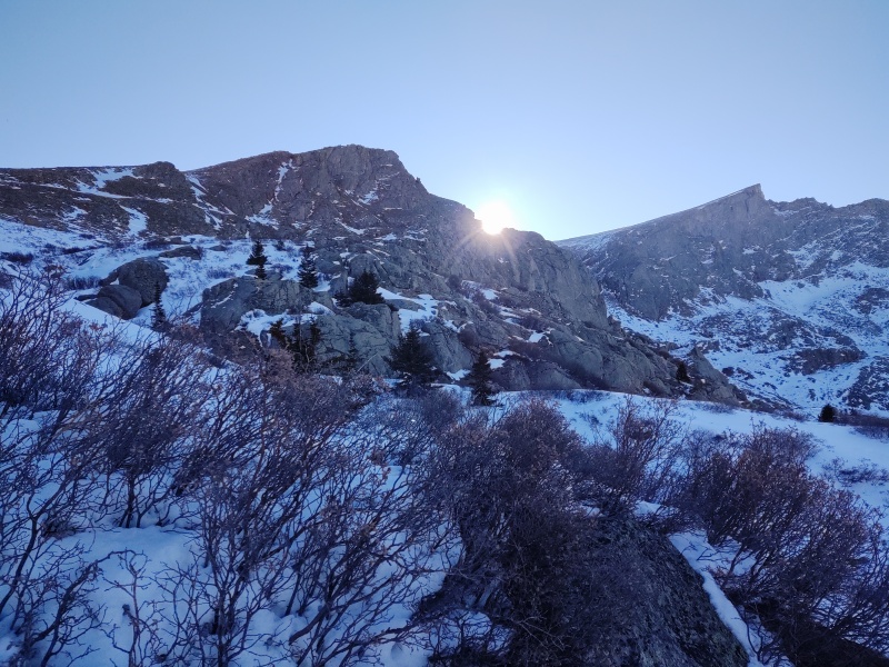
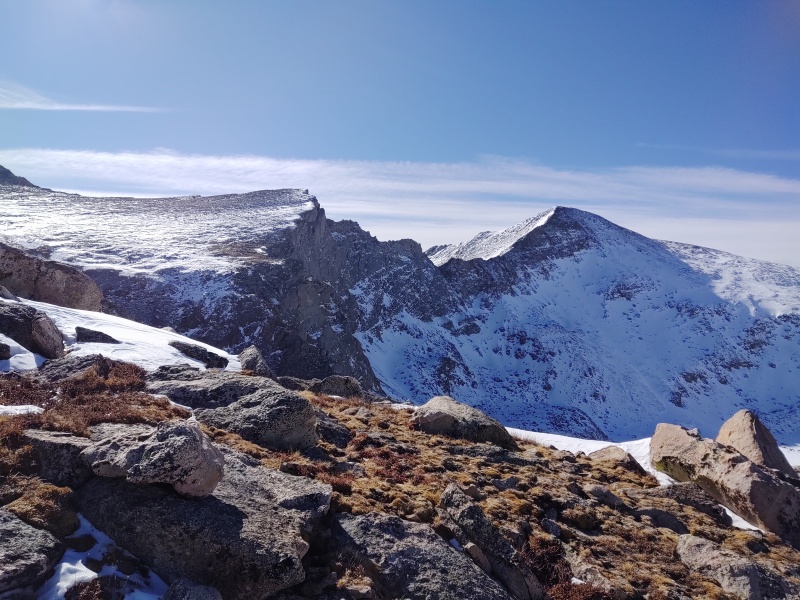
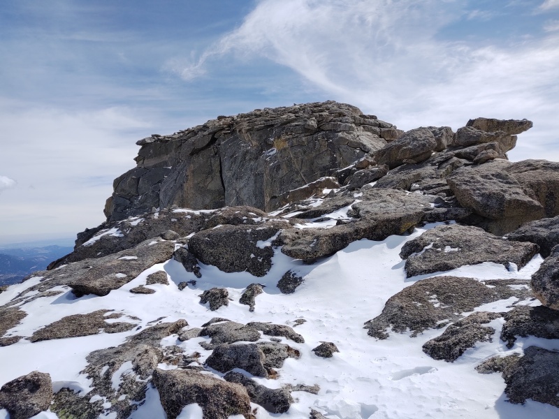
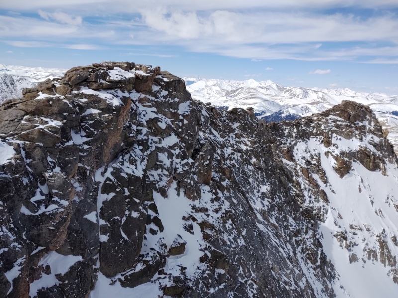
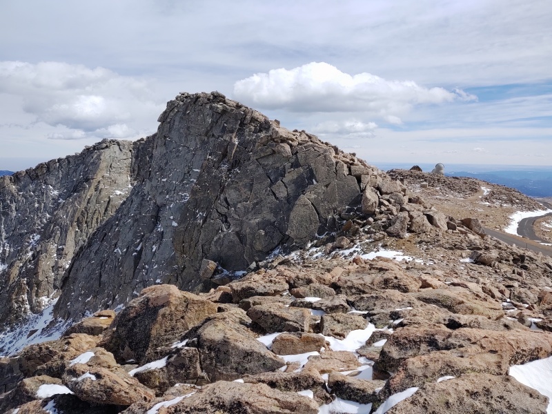
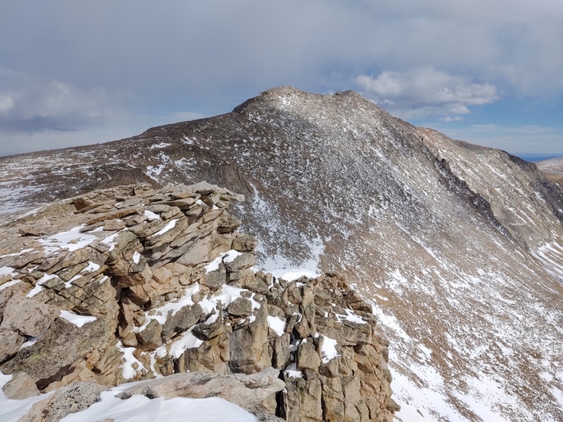
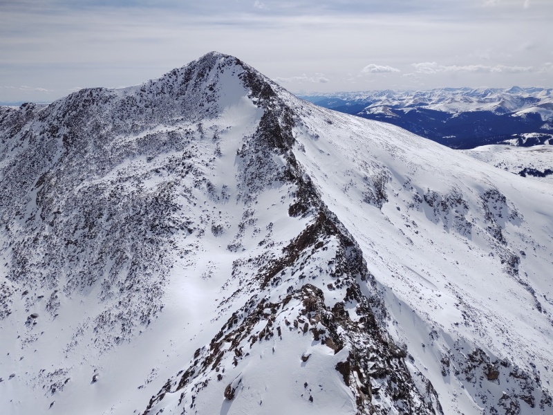
The Ridgeline to West Evans and Mt Evans This was the unexpected delight of the trip. I've always liked the view of the ridgline going up to Evans but on my two previous summits of this peak never tried to follow the ridgeline (I was with less ambitious hikers both times). At first I wasn't sure if I'd really stick to the ridge the whole way or not but the longer I went along the more addicted I became. The entire ridge top can be done staying at class 2 most of the way with a little class 3 action here and there if you tackle the more interesting features (a couple isolated moves maybe in the class 3+ range purely by choice). 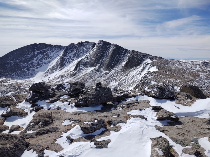
The summer trail takes you close to the ridgeline and follows along down to the right of it but is deathly boring by comparison to the top of the ridgeline. 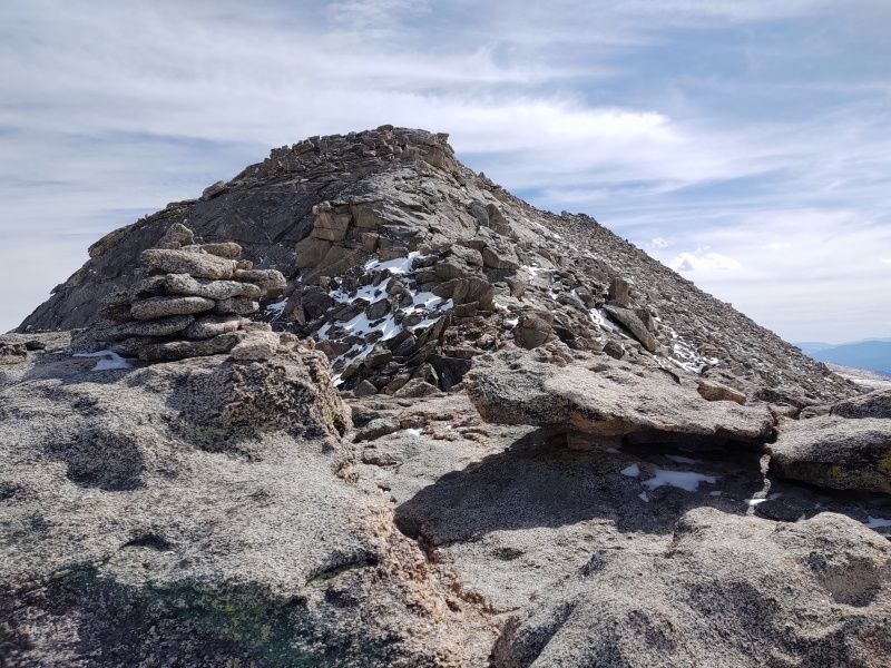
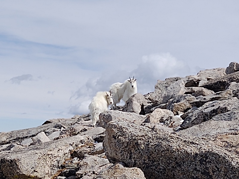
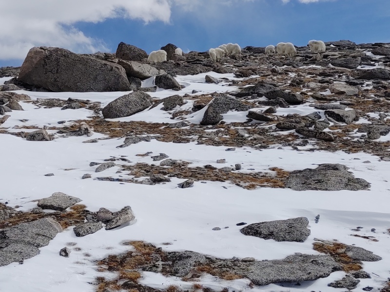
At first the ridgeline doesn't look like anything special (unless you encounter some mountain goats as I did) but keep going to get to the good stuff. 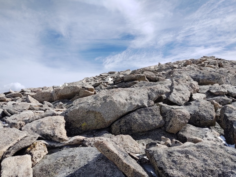
Once you get to the top of the first rise you quickly begin to see the potential for some very enjoyable ridgeline hiking. 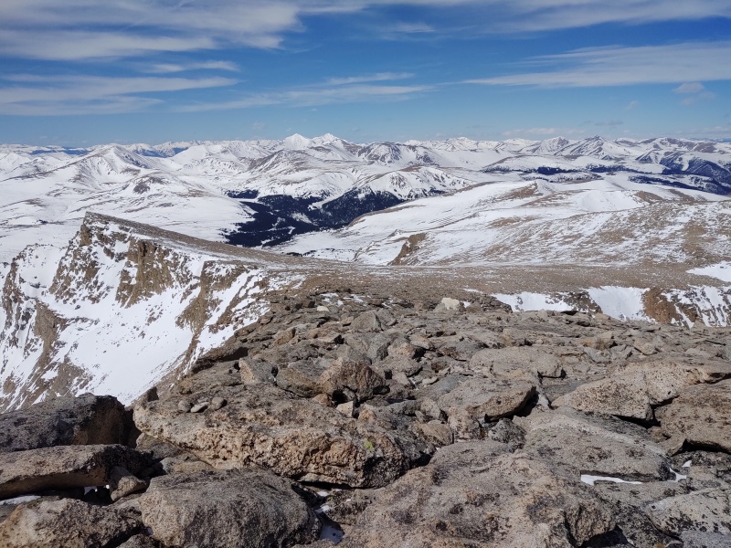
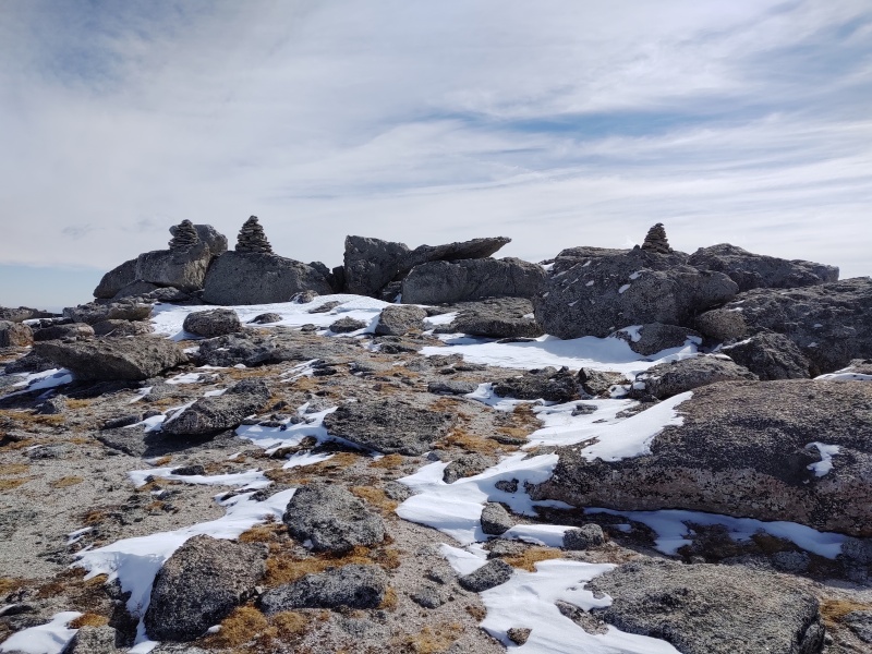
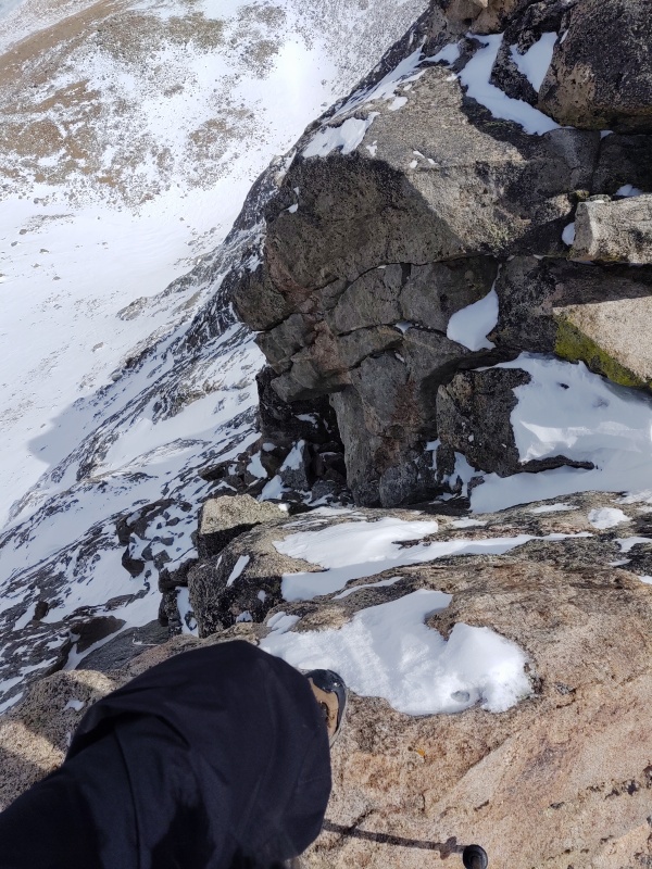
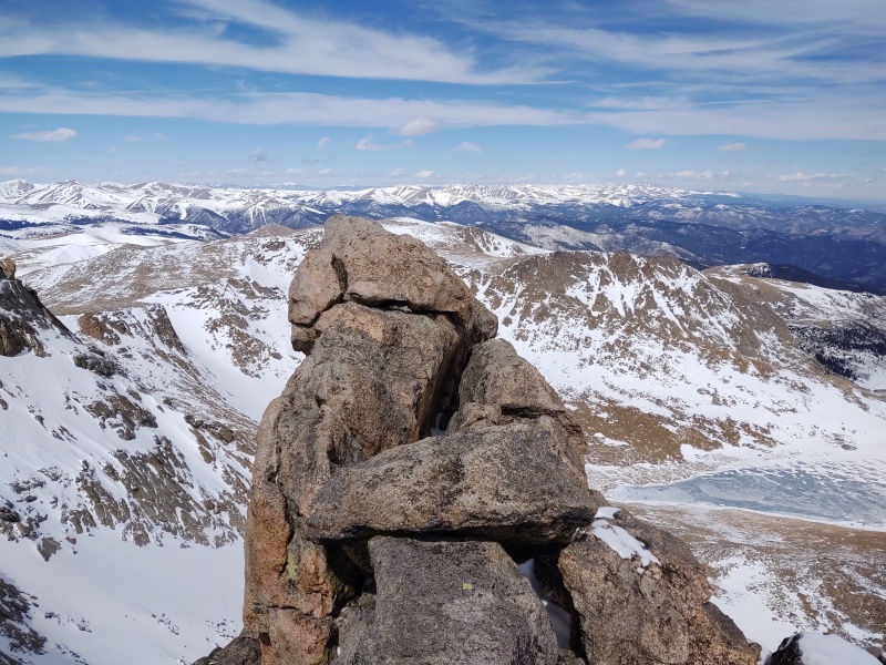
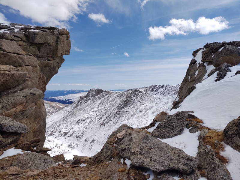
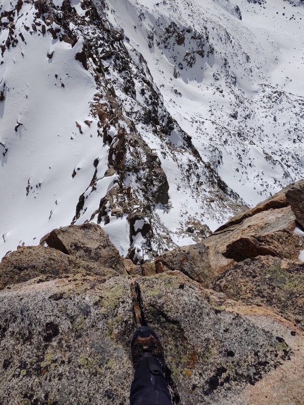
There are at least a couple mind blowing rock formations along the ridge like this one below which looks like one of the crazy rock stacks you see people setting up next to streams. But this one is probably a good 10 feet or so high as I recall and way too massive to have been man made while at the same time seeming way too bizarre to be natural. It was with a little trepidation that I climbed up and stood on top - half expecting it to give way underneath me, but it seemed very solid. 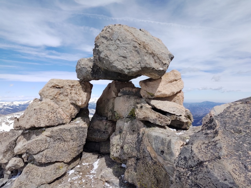
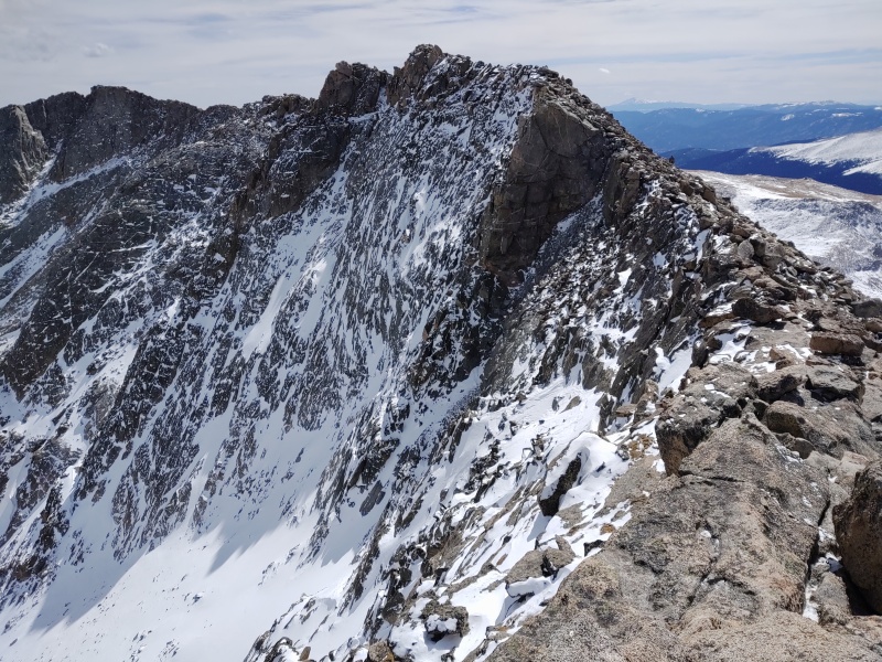
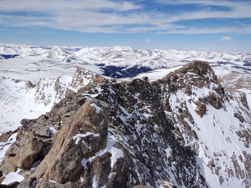
At times the ridge proper becomes very narrow with some fairly epic drops off to the left (N/NE). This is perhaps some of the most heart pounding class 2 terrain you'll find out there. You could always move down to the right if you weren't up for the exposure but if you're going to do that you might as well just stick to the summer trail... 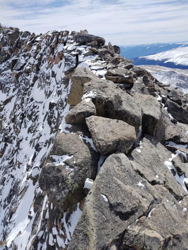
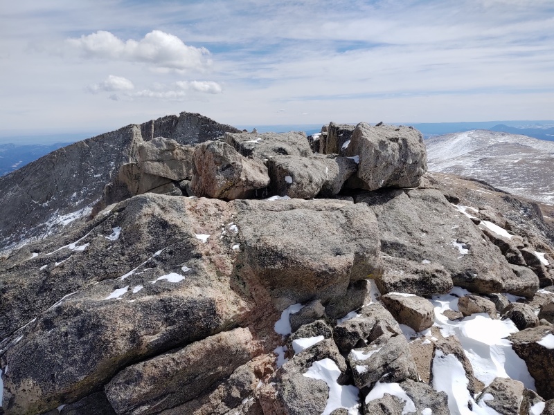
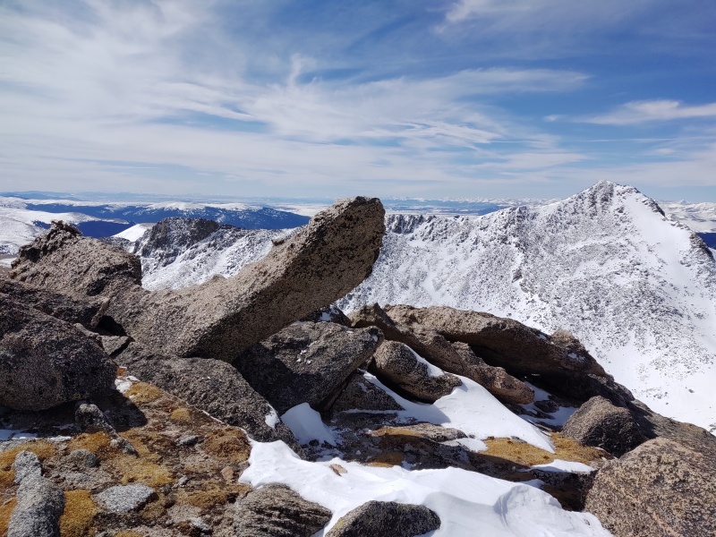
There's lot of variety to be had if you stay on the ridge proper - several little mini leaps of faith in spots, lots of epic exposure if you choose to stay continually on the highest point, and some really fun, unique spots like The Pinnacle below. 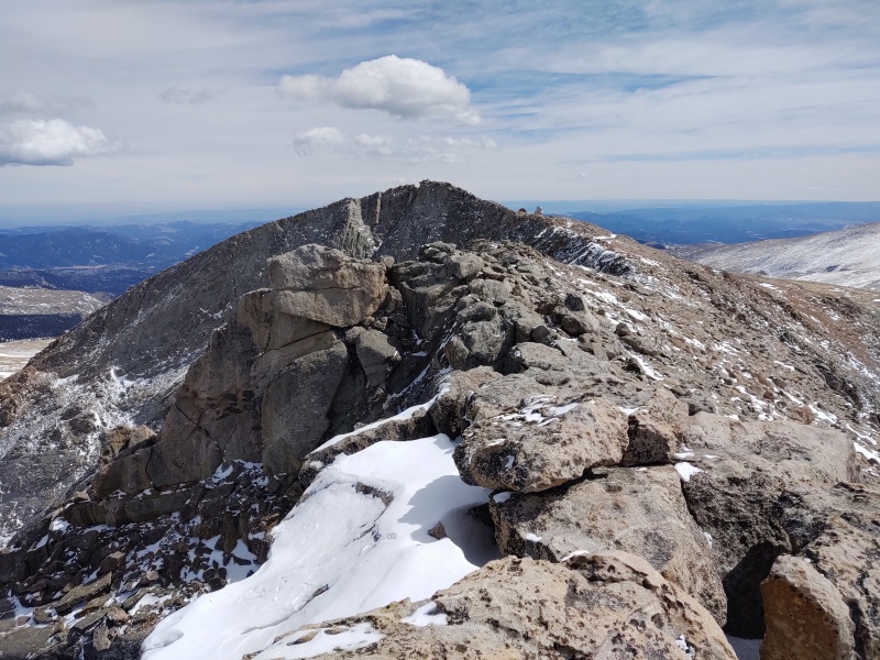
By the time I made it over to the summit I was glad I had waited for a good weather day and had literally all day to complete the hike since sticking to the ridge proper the whole way like that was slow (but fun) going. 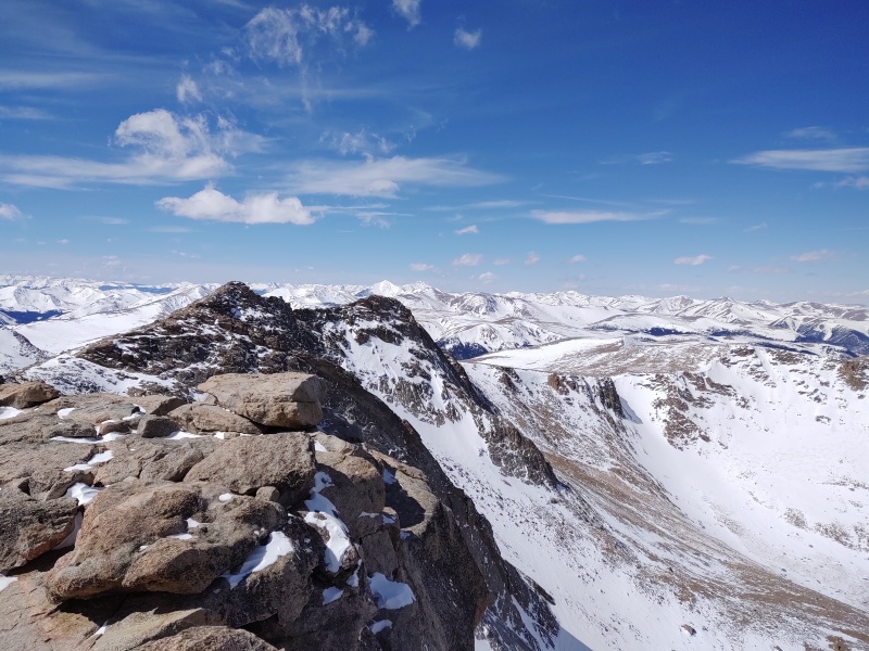
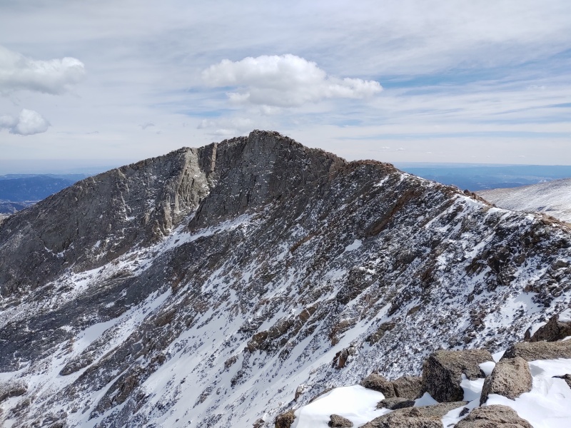
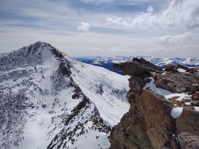
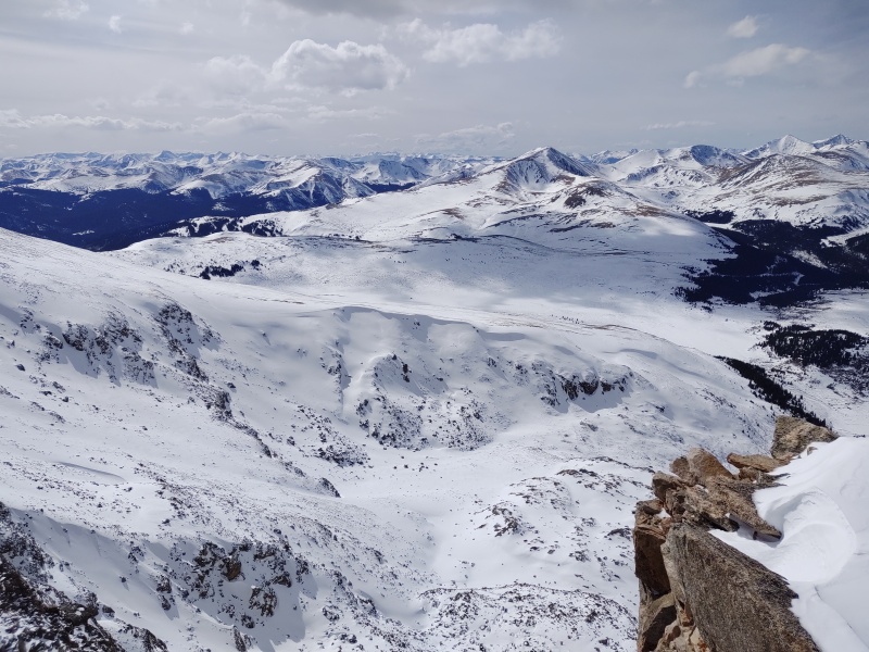
Bierstadt-Sawtooth For the return journey I stuck to the summer trail which just had intermittent patches of snow along it. You can get some excellent views of the ridge between Bierstadt and Sawtooth from here (this is on my to-do list for the summer but first I have to research how on earth you're supposed to get up onto the Sawtooth from the ridge?!?!). 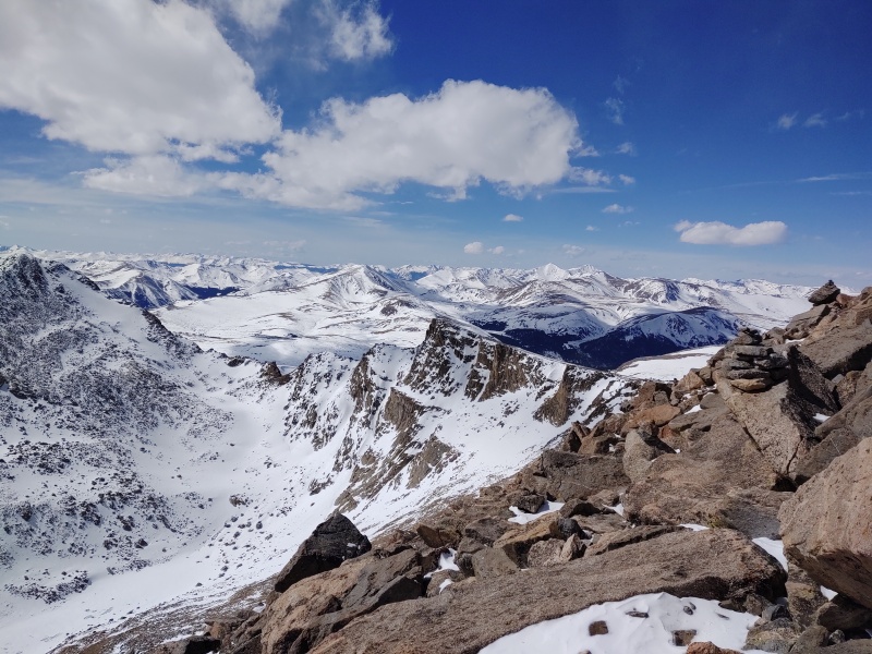
I encountered another larger group of mountain goats on the way to Sawtooth. 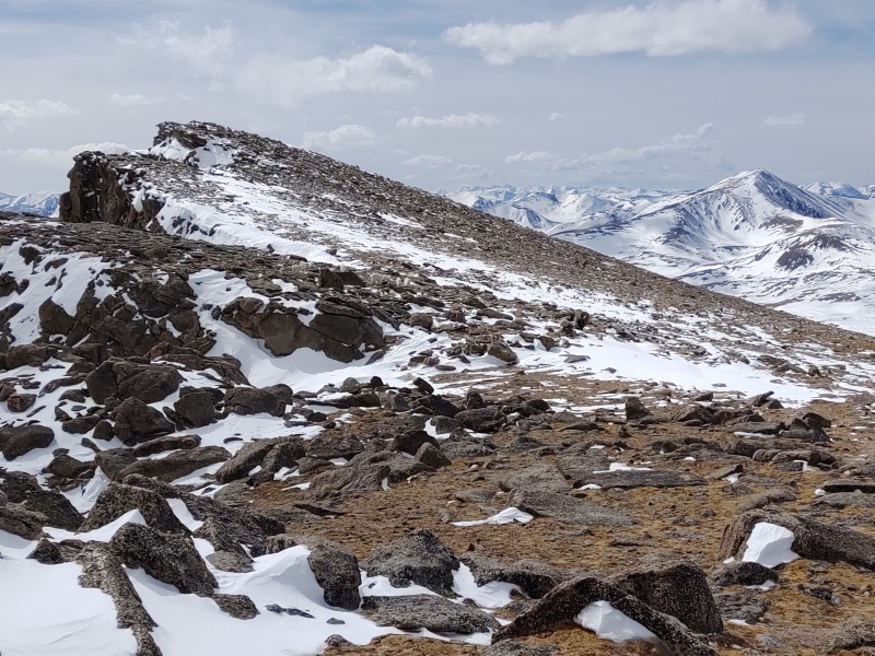
The more I see of the ridge from Bierstadt the more I want to come back and do that one. 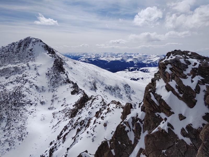
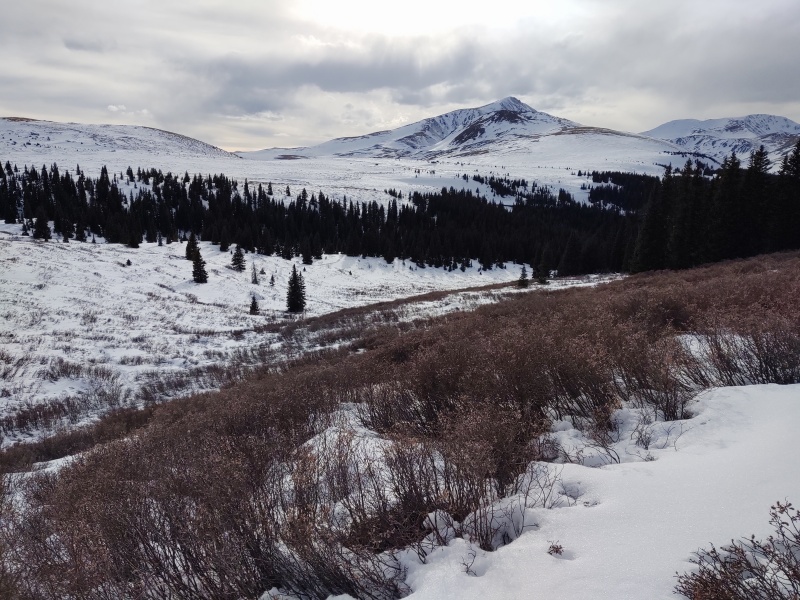
The Return At this point it's mostly a long, dreary trudge back but with some nice views along the way. I swept a wide arc around the bowl between the Sawtooth and Spalding, only slowly dropping in altitude to make sure I didn't accidentally drop too low and have to regain altitude (I was ready to be done with uphill at this point in the day). I met my previous tracks at about the point where it was time to drop back to the gully at the base of the slopes coming off Spalding. At that point I put my snowshoes on again and left them on till I got back to the Jeep (they were VERY useful fighting through the willows - even though I mostly followed other tracks going back). 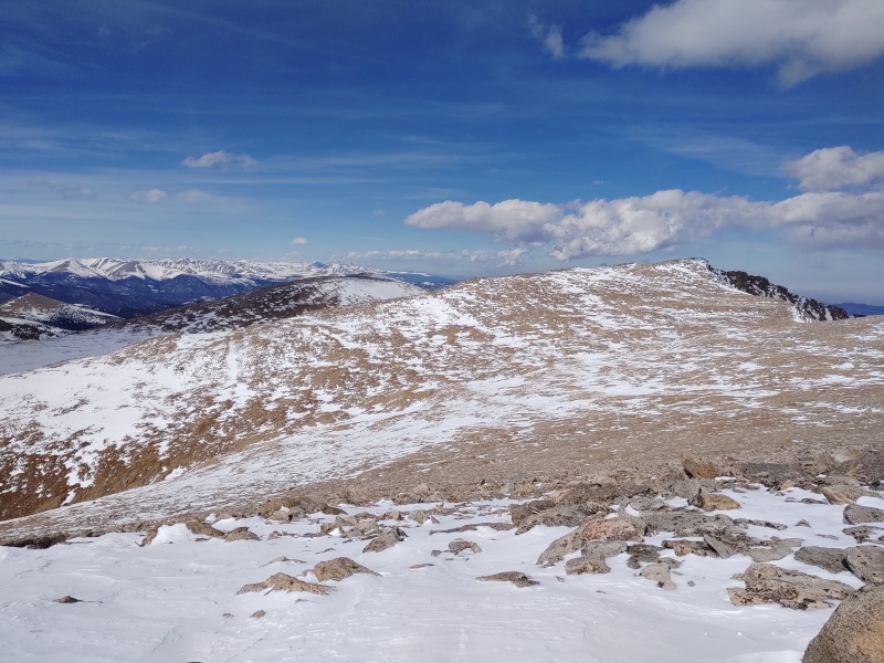
Instead of following my solo tracks through the willows or trying to bust a new trail under the warming conditions, I made use of some good tracks laid down by others (thank you whoever you were!). These were a good ways out to the right (on the descent) compared to where I forged my trail up. At least one unfortunate soul did that route in just boots and periodically sank in pretty deep. Even with snowshoes on and on a packed trail I still sank in a little ways here and there but not as bad as when I trail-blazed up. 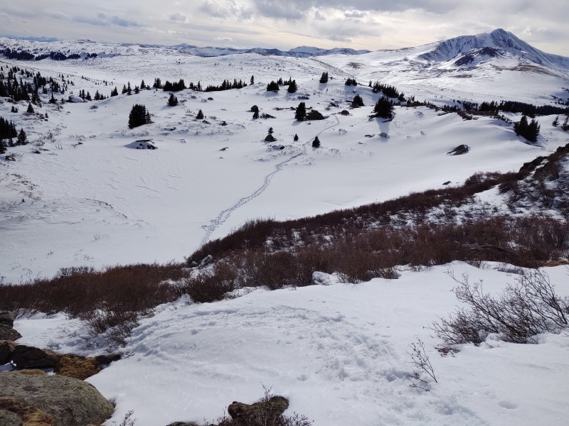
There doesn't seem to really be a way to avoid the willows regardless of what variation you take - but maybe someone has found some magic path... 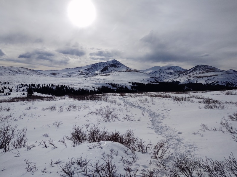
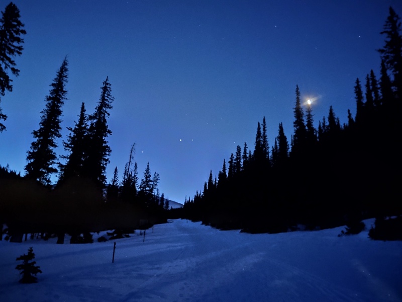
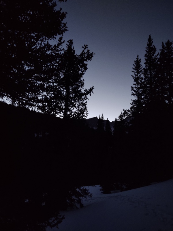
My Stats/Times Since this was such a custom and randomized trek I'm just recording the numbers that my GAIA tracks show, even though I've known them to be off a good bit at times - but this was just too much of a custom/crazy course to confirm gains and such manually. Total Mileage: ~12.5 miles Total time: 12h 14min (moving time = 9h 50min) Total Elevation gain: ~3,500ft? 6:13am start from winter parking area (~1.8mi shy of Guanella Pass). 6:19am went ahead and put snowshoes on since snow on road was soft (even though it was 21F at the winter parking). 6:44am back on the road after taking the bypass to skip the first switchback (which can be avy prone). 7:15am no more trench poaching - start making my own tracks after following the wrong set. Snow in the meadows starts off very firm. 5 seconds later: sink almost to my waist even with snowshoes on. Continues to be intermittent very hard/very soft snow. 7:29am briefly spotted remnants of old tracks then lost them. 7:50am found some more old tracks. 8:05am left tracks to veer up into gully. 8:10am found some ski tracks to follow up. 8:15am left ski tracks since seemed to veer too far away from my goal. 8:32am hear running water under my feet (lots of it!). Quickly divert uphill out of the gully. 9:14am find more human tracks again. 10:49am stop just below Spalding to strap snowshoes back onto pack (could have done so well before then). 11:03am Spalding summit 11:16am saddle 11:44am finally stop to add layers just before the first hump on the Evans ridge since now getting a steady breeze. 12:11pm top of first main hump on Evans ridge. 12:40pm West Evans 12:57pm top of last main high point on Evans ridge. 1:20pm Evans summit 1:47pm return 2:54pm encounter mountain goats near Evans/Sawtooth saddle. 3:21pm far end of the Sawtooth. 4:11pm rest above the gully at the base of the Spalding incline and scan ahead to plot return course. 4:30pm put snowshoes on and continue down. 6pm rejoin my trail from the morning. 6:04pm back on the road going to the winter parking (so happy to be out of the willows!!!) 6:15pm at the turnoff for the shortcut past the first switchback (I just stuck on the switchback on the way back). 6:27pm at the Jeep!!! Thumbnails for uploaded photos (click to open slideshow): ")
")
")
")
")
")
")
")
")
")
")
")
")
")
")
")
")
")
")
")
")
")
")
")
")
")
")
")
")
")
")
")
")
")
")
")
")
")
")
")
")
")
")
")
")
")
")
")
")
")
|
| Comments or Questions | ||||||
|---|---|---|---|---|---|---|
|
Caution: The information contained in this report may not be accurate and should not be the only resource used in preparation for your climb. Failure to have the necessary experience, physical conditioning, supplies or equipment can result in injury or death. 14ers.com and the author(s) of this report provide no warranties, either express or implied, that the information provided is accurate or reliable. By using the information provided, you agree to indemnify and hold harmless 14ers.com and the report author(s) with respect to any claims and demands against them, including any attorney fees and expenses. Please read the 14ers.com Safety and Disclaimer pages for more information.
Please respect private property: 14ers.com supports the rights of private landowners to determine how and by whom their land will be used. In Colorado, it is your responsibility to determine if land is private and to obtain the appropriate permission before entering the property.