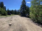
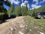
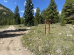
5/31/2025 Posted On: 5/31/2025 By: Ryan987 Info: Open and dry all the way | 2 |
|||
10/11/2024 Posted On: 10/11/2024 By: drewskiclimbs Info: Surprised with how good the 4x4 road was -- definitely a bumpy ride, but no huge holes. I was glad to have a truck, but someone was up there in a Rav4. Not as much clearance needed as I expected, a crossover class vehicle can make it all the way, albeit slowly | ||||
9/15/2024 Posted On: 9/16/2024 By: Brighteyes1 Info: 9/14/2024 Long 12 mile drive from 24. Last two miles pretty bumpy, dippy, narrow, etc. High clearance or high skills off road with stiff suspension. Signs that indicate no further access for motorized vehicles below trailhead maybe 300 yards shy. Plenty of parking!!! (No doubt because north trailhead is so easy to get to off 82. When we summited folks up top said parking was handling over 50 cars, mostly on 82.) Dry, a few streambeds no issue. No snow. | ||||
7/30/2024 Posted On: 7/30/2024 By: wolfgangstiller Info: Road is bit rougher than I remember. There are two spots in the last 3/4 mile where I would not like driving my Rav4 awd. I would not drive anything with less than 8 inches of clearance and 4wd. | ||||
6/27/2024 Posted On: 6/28/2024 By: Ptglhs Info: Road is well marked as 3/6. A Subaru was able to handle it with only a couple of rough spots. Clearance is probably more important than AWD, but I'm glad we had both. 2 Creek crossings, one is pretty high right now. | ||||
5/25/2024 Posted On: 5/25/2024 By: daway8 Info: For the route going to North Fork/South La Plata, the road is dry up to Winfield then there's a small patch of snow just past the Winfield houses but it contains an imposing ice shelf - need either exceptional clearance or very careful tire placement to get over it at the moment until it melts down further. After that, intermittent dry ground, muddy patches and chucks of hardened snow that become increasingly difficult to pass the further you go. Got to the 10,600 Ervin/Bluarock creek crossing when I almost got stuck in snow drift. Someone parked nearby came over and said he had to pull someone out of that drift and that it gets much worse ahead. I could see the creek crossing looked really dicey so turned back. | 3 |
3 |
||
1/4/2024 Posted On: 1/5/2024 By: madmattd Info: I'd highly recommend AWD/4WD and actual snow tires (or AT) to get to Winfield right now - the road is drive-able but nearing Missouri Gulch it starts getting a little deeper and softer between and along the tire tracks, and worse beyond. Many places where people have clearly gotten stuck with inadequate traction/driving ability. The 4WD road past Winfield to the S. La Plata TH has only been traveled by snowmobiles and skiers - and there's a lengthy, nasty stretch of ice starting mere feet past the road split at Winfield. Don't even try driving it until it melts out. | ||||
11/4/2023 Posted On: 11/4/2023 By: kyrawhitworth Info: We were able to drive to just before the marked point (taco and subie) but there was snow and ice past Winfield. Getting to Winfield was just fine with minimal snow spots. Will likely change soon! | 1 |
|||
9/23/2023 Posted On: 9/24/2023 By: chicagostylehotdog Info: No problems getting up in a standard Jeep Patriot. Didn't scrape. A few small chunky sections that need clearance, and a few steep rolls that could cause a scrape if you have a long wheelbase. Figure most SUVs can make it up without incident. | ||||
7/28/2023 Posted On: 7/29/2023 By: minnesotanclimber Info: I drove to the South La Plata trailhead Friday night in preparation for a Saturday climb of La Plata via the Southwest Ridge route. I started on the 4WD section of the trail around 8:15PM after spending 30m or so on County 390. The moderate 2WD road ends at Winfield and the 4WD section starts immediately once you take a right turn, in front of a rustic cabin. This road is NOT for low clearance/2WD vehicles, in case the description isn't clear enough. I drive a '22 stock Forester and was able to make it without any scratches or grinding, though you need to take your time. I counted two true water crossings, though they were only 5-6" deep at most and weren't a problem. Arriving at the trailhead itself, there are some spots for dispersed camping (one of which I took) and room for 10 cars or so at the trailhead lot. Don't worry about missing the area in the dark, the GPS link to Google Maps in the description here was dead on. A fun and challenging drive! | ||||
7/16/2023 Posted On: 7/17/2023 By: haileyraskovic Info: There is some washboard stretched on the county road 390 up to the trailhead but nothing major just a bit corrugated. Then once you head down the road past Winfield (my gps says 390A but the .com doesn't) there is some rocky-ness, but nothing major (if you off-road then this road just feels like a regular dirt road almost). Depending on the clearance of your vehicle it may be challenging, especially near the stream crossings because they really dip down. However, the streams water levels were really low and easy to cross; I don't think the water level even made it passed my tire to my rims. For reference, I drive a 4runner sr5 with a 3" lift on 33's. We got there really late Saturday night (around 1130/12) and still saw plenty of open sites. We camped right around the point our gps said the trailhead was just a bit further as we were worried about missing the "administrative use only" sign in the dark, however we were further away from the trailhead then we realized so we drove up the rest of the way in the morning (gps dropped us off ~1mile away from trailhead give or take). | ||||
6/24/2023 Posted On: 6/28/2023 By: cfoster Info: Drove up to the trail head Saturday 6/24 in a stock Subaru Outback (with BFG Trail Terrains), slow going and bumpy with several spots that you sort of have to pick your line (with a Subaru) over a few rocks and a root, there was one spot where the front bumper almost touched (thanks ridiculous Outback approach angle.) The creeks were fine, about 8 inches deep currently, almost touching bottom of the Outback. Anything with much less clearance than an Outback isn't going to safely get over the rocks and dips without touching or possible damage. It is a one lane road with intermittent areas to pass. | 2 |
3 |
||
8/28/2022 Posted On: 3/6/2023 By: BillMiddlebrook Info: After recently hiking La Plata's SW Ridge, I just updated this trailhead to all of the latest information and photos. AND all 14er trailheads now include elevations! | 1 |
2 |
||
7/17/2022 Posted On: 7/17/2022 By: davebelin Info: Made it to the junction for the South La Plata TH in a stock Subaru Outback, no problem with either of the water crossings. You can no longer drive the "last few hundred yards" to the actual signed trailhead because it is closed for "Administrative Access Only." There is also an updated sign from what is shown on Photo01 in the route description for La Plata Southwest Ridge. | ||||
7/5/2022 Posted On: 7/8/2022 By: mountain_guy Info: I have limited 4wd experience and this road was not difficult at all in a stock Jeep Wrangler. A Subaru Forester and Crosstrek both made it as well. The lower creek crossing was running up to 1ft deep due to recent rains, upper crossing was much more shallow. Road is blocked less than a hundred yards after the right turn towards La Plata. There are a dozen or more dispersed campsites between the cemetery and the trailhead, and more further past the trailhead. |


