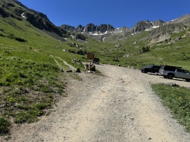
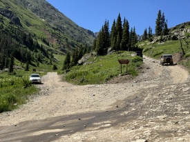
6/24/2019 Posted On: 7/2/2019 By: hikebikeboardrocks Info: This was closed as of 6/24/19. I saw CFI and other crews at the Silver Creek / Grizzly Gulch trailhead and they didn't seem like they had any plans at all for opening the trailhead. It's covered in avalanche debris. | 1 |
|||
11/14/2018 Posted On: 11/16/2018 By: Squirrellysquirrel Info: On Cinnamon Pass after the Grizzly TH, just past a gate, there's a drainage that was frozen over. I was following tire tracks across the ice and, with 17F temps, assumed it was an easy traverse. Not so. Broke ice on the distal side, my back end fought for traction on a gravel-like base with a surprising current; found a grip after a few attempts. Turned around after that with higher speed to recross drainage, which was fine. Probably okay with a beefy, high clearance 4x4; I was in a Crosstrek. Heard from locals that the gate might not be open much longer past hunting season. | ||||
10/13/2018 Posted On: 10/15/2018 By: Reg0928 Info: Made it up to the 11,300 split in my Tacoma on Saturday. Good bit of ice on the road, but no deep snow on the road up until the split. Big snow expected on Sunday (10/14) probably changed that though. | ||||
8/30/2018 Posted On: 9/12/2018 By: Strider29 Info: The road gets rougher past the Silvercreek / Grizzly Gulch TH, but nothing a high-clearance 2WD can't handle. The stream crossing is very easy. The last 1/4 mile or so gets very, very rough and rocky and probably isn't worth the trouble. | ||||
8/28/2018 Posted On: 9/1/2018 By: jennincolorado Info: This road is in much rougher shape than in years past. After passing the SC/GG trail head, the road progressively gets bumpier and a high clearance vehicle is needed. The last .3 miles or so to the final parking lot at the basin requires high clearance 4wd and may be tricky. Tacomas, jeeps & a large ford truck were up there, thats it. We drove a Tacoma trd & all was fine, but yikes some of those rocks were sharp. Heard of some flats happening in the area. | ||||
8/15/2018 Posted On: 8/15/2018 By: scottf Info: The "Road Difficulty" section is correct, but the "Driving Directions" led me to think that a 2WD vehicle could make it to the American Basin turnoff. Don't make the same mistake we did--the road is *definitely* 4WD after the Grizzly Gulch Trailhead. If you're driving a normal 2WD vehicle, take a good look at the Silver Creek/Grizzly Gulch Trailhead info--the road is quite rough for 2WD even to that point. | 3 |
|||
7/6/2018 Posted On: 7/12/2018 By: Terry_S Info: When planning for this trip, one of my main concerns was that Google Maps kept wanting me to take CR 20 around to the TH, but instructions on this forum said to take CR 30. Google Maps even showed a break in the road in one part on CR 30 (see photo). It is, however, passable; it's just a stream crossing. I was able to get all the way to the TH in a stock Forester. | 10 |
|||
7/5/2018 Posted On: 7/9/2018 By: madmattd Info: The last 1-2 miles of the road before the junction is pretty rough, high clearance recommended (4WD not necessary). The last hill before the TH is quite rocky and rough. We made it up and over fine in a stock Ranger. A stock Outback was parked atop this hill, basically past the worst of it. So it is possible to get an Outback to the TH, but it will take some care to not shred your oil pan, probably not worth it to save the short extra walking distance. | ||||
7/1/2018 Posted On: 7/2/2018 By: wmbii Info: Drove in 6/30/18 to hike Handies on 7/1/18. Tons of traffic for the upcoming 4th of July, especially on the way out on 7/1/18. Last 0.3 miles rough and not worth getting all the way to the trailhead. Agree with others that parking just beyond the last creek is probably ideal. That said, I made it to the trailhead and found a FLAT perch for my Tacoma on right 30 yards before trailhead. Level enough for good sleep in back of truck. | ||||
6/25/2018 Posted On: 6/27/2018 By: Ptglhs Info: Got my '18 Elantra, 2wd, 5.3" of clearance, to just before the 2nd stream crossing. The stream was too deep and the rocks on the other side made the road impassable to anything but a high clearance 4wd. There are some pretty sketchy parts to be sure: pick a line and try to get a tire on each side of the washed out portions. I did stop and look at the rocks to check my clearance a couple of times. It's doable, just be cautious. | ||||
6/11/2018 Posted On: 6/11/2018 By: shizupple Info: Made it to the upper TH in a stock '15 Outback without damage or any issues. Stream crossing is no big deal but there are some bigger rocks to be careful of on the upper parts of the road. | ||||
5/29/2018 Posted On: 5/29/2018 By: vswrman Info: Road is open and clear all the way to the trailhead. All parking areas are clear of snow. | 2 |
|||
5/24/2018 Posted On: 5/25/2018 By: jennincolorado Info: | ||||
11/29/2017 Posted On: 12/2/2017 By: RWSchaffer Info: Cinnamon Pass Road is closed for the winter about 7 miles below the American Basin trailhead, at the intersection with the road to the Sherman town site. | ||||
10/8/2017 Posted On: 10/9/2017 By: Trotter Info: Road is still dry and snow free. Stream is not an issue. There is one especially rough spot about half a mile up past the stream, on a small rise, that requires some careful maneuvering in a 4x4 to not bottom out. Otherwise plenty of SUVs at upper 4wd trailhead. |


