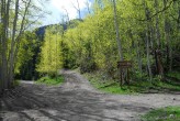
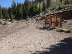
5/26/2019 Posted On: 5/26/2019 By: Jesse40 Info: Henson Creek Rd is closed about 1/4 mile above the Uncompahgre turn (or about 6 miles below the Matterhorn TH) due to multiple large avalanches blocking the road. These are being actively cleared. However, the side road covering the last two miles to the trailhead is also blocked by multiple avalanches and I'd bet it will take a while for that to be addressed. | ||||
10/21/2018 Posted On: 10/25/2018 By: antoniohconte Info: Road is completely clear of snow and ice. It appears that winter has hit every part of the San Juans except this valley. The trail was clear of all snow up to the ridge of Wetterhorn. | ||||
9/23/2018 Posted On: 9/24/2018 By: kayleenann8 Info: Road is dry and clear to lower TH. Didn't attempt the last .7 because the risk didn't seem worth the reward. | ||||
9/22/2018 Posted On: 9/26/2018 By: shane14ers Info: Took the Prius up, Im surprised its not broken. Lower part of the 2WD road requires 4WD or speed, so you cant go careful if you have a 2WD car. Thus I ended up bottoming out a bunch. I dont expect a car with lower clearence to make it. | ||||
9/15/2018 Posted On: 9/16/2018 By: Danger_D Info: The road to the 2WD trailhead is a little rougher than some years, but should be doable in about any vehicle. I took my RAV-4 to the upper trailhead, but it was a pretty hairy experience. If I use this trailhead again I will be leaving my RAV-4 at the bottom and hike up to the 4WD trailhead | ||||
9/8/2018 Posted On: 9/8/2018 By: ma1919 Info: The road from Capitol City to the 2WD trailhead is a little more challenging than normal due to water on the road from all the recent rain (mostly makes it difficult to judge the best line - the lower your clearance, the bigger the problem). There was a mix of sedans, minivans and crossovers at the 2WD TH, so its still doable in just about any car. Only 4Runners, Jeeps, pickups and similar at the 4WD TH though. I didnt attempt the Matterhorn Creek Road in my Outback. It might be Subaruable, but you would have to be perfect. It took me 20 minutes to walk up from the 2WD TH, maybe 15 minutes down, and that was with stopping to take pictures of the aspens turning. | 1 |
|||
9/6/2018 Posted On: 2/25/2021 By: bigDmulc009 Info: Any car should be able to make it to the 2WD TH, but our 2017 Outback started to bottom as soon as we tried to make it to the 4WD. Decided it wasn't worth the .7mi and met a pair who wrecked their front bumper going for it in an older Outback. Otherwise it didn't seem too bad if you can get over the first approach. Some good camping spots at the 2WD though | ||||
9/4/2018 Posted On: 9/17/2018 By: Strider29 Info: We drove the Mt. Princeton, Nellie Creek, American Basin, Willow Creek, and Matterhorn Creek roads on a recent trip. This one was definitely the roughest of that group. The first 1/4 to 1/3 mile is very rocky and blurs the line a bit between "road" and "trail". However, if you make it past that section it eases up the rest of the way to the TH. | ||||
8/30/2018 Posted On: 9/1/2018 By: TravelingMatt Info: Here are pics of what I consider the crux, or at least the first one, about an eighth of a mile from the start of the Matterhorn Creek road. Backpack for scale; it's a small day pack. There is no place to stay relatively level here, and smaller SUVs will be tested. Easiest way through is probably to the far right. Turning around or backing down from here is a BITCH. If you park at the start of the road it's only an extra 20-25 minutes uphill and 15-20 downhill to the upper TH. | 5 |
|||
8/20/2018 Posted On: 8/20/2018 By: bosnian2014 Info: I would say any vehicle can make it to the junction between county road and forrest service road (2.6 miles from upper TH). There are a few potholes with water that require weaving if low clearace vehicle is used. Some sedans were parked there. From there, we made to lower TH in 2wd Nissan Rogue but it took some driving skill by our driver. I did not see any sedans there yesterday. On the way down, one person had to step out and navigate a few times to help the driver. I agree that the last 0.6 miles to the upper TH are doable in an Outback or similar vehicle but you have to be perfect. I do not think it is worth the risk for 500 ft of gain. | ||||
8/14/2018 Posted On: 8/19/2018 By: Elijah_Bankhead Info: Ignoring the warnings I had received, I took my 09 Outback all the way to the upper trailhead. No scrapes, no bumps, no damage, no nothing. This road in an Outback demands perfect line choice, though. Lots of weaving and patience will do the trick. There's 1 spot in the last few hundred yards immediately after a pull-off that could be problematic - small boulder on the right side forcing you to go over a good sized rock on the left. Had to place a small rock just below the bigger one and made it just fine. I've got sport tires that I aired down a little and didn't really have any traction problems anywhere. 09 Outback has 8.4 inches of clearance and a fairly long wheelbase. | 2 |
|||
7/8/2018 Posted On: 7/9/2018 By: madmattd Info: North Henson Road is pretty rough and rocky, decent clearance recommended. The 0.7 mile road to the 4WD trailhead is narrow and quite rocky, 4WD and good clearance recommended. Go left just below the lot to avoid a really rocky spot. Ford Ranger made it up with patience. Plenty of room to park near the start of the road if one opts to walk up. Small trailhead lot, but room to park just below if the main lot is full. | ||||
6/24/2018 Posted On: 6/25/2018 By: alpinenut Info: Upper 4wd road is clear of trees. Road open to upper TH. | ||||
5/25/2018 Posted On: 5/25/2018 By: illusion7il Info: OPEN dry and clear to easy 4wd TH, the last 1/2 mile to the upper TH is blocked by down trees. | ||||
4/3/2018 Posted On: 4/4/2018 By: jaquetcj Info: Henson creek road still closed at winter closure gate just past Nellie creek. Hinsdale Road and Bridge started plowing Monday, but the road is still closed to vehicle traffic just beyond Nellie creek TH ~mike 5. Henson creek road is passable via Mtn bike to capital city. (Not a bad way to start a ski mountaineering trip!) N fork Henson creek road and all points above still snowbound. Matterhorn 4wd road from N fork Henson totally snowed in. |


