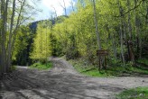
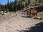
6/22/2025 Posted On: 6/22/2025 By: 5ClimbingCooneys Info: The road to the turnoff for Matterhorn Creek is a bit rough, but should be drivable by most vehicles with good clearance and 4-wheel drive. There are a few spots here and there where bigger rocks are starting to become uncovered and present more of a challenge, but not so much that cars like Subarus should have much problem. Low-range 4x4 is definitely preferable, as several spots are just steep and loose and the low range means you don't have to rely on momentum to make it up (further destroying the road). Getting up to the Matterhorn turnoff the night before, we walked up the road a bit to preview it. I opted not to drive my Nissan Xterra up that portion. The vehicle would have been capable, but there's a few spots you need to be spot-on with your wheel placement going over tall rocks to avoid damage, and for the extra 0.65 miles, I just didn't seem worth it to risk a daily driver style SUV. Jeeps and such shouldn't have much trouble. | ||||
6/13/2025 Posted On: 6/13/2025 By: HokieTom Info: Hey everyone. I posted a trailhead update yesterday about how a 4WD is not needed the first one or two miles. I drove it this morning at 3:30, and it scared the heck out of me. Although, I made it to the middle trailhead parking lot, I would not drive the road again, unless I had a beefy 4WD. I am sorry for posting the report before I actually drove it. | ||||
5/17/2025 Posted On: 5/19/2025 By: Jcinco Info: Rough but clear to the 2wd TH. One of the rougher “2wd” roads around. The 4wd section to the upper TH has one significant snow back that probably needs a week or two to melt. A dirt bike did make it to the upper TH while I was on Wetterhorn, however. | ||||
2/11/2025 Posted On: 3/31/2025 By: jacolc Info: Henson Creek Road (CR-20) is gated 0.3m behind the Nellie Creek TH, ca 5.3miles from LakeC. It is dry in 99%. Looks like behind gate, well packed by snowmobiles. | ||||
10/16/2024 Posted On: 10/16/2024 By: indyjmatt33 Info: I took a stock 4Runner to the lower 4WD Trailhead (0.7mi from TH). The 30min of hiking in the yellow aspens vs white knuckling on that terrible road for 30min was an easy choice. There were spots for 3-4 cars in this area. The upper lot had a 1 car--a very lifted F-150, with room for 5-6 cars to park. | ||||
9/14/2024 Posted On: 9/16/2024 By: ColoNativeGal Info: Lower 4w you could take your Subaru up, but I honestly would want more clearance to be safe. If you're skilled then go for it carefully picking your lines. Upper 4w need good clearance. Road is narrow, so I would not recommend for full size trucks. Saw a Tacoma at the upper 4w TH, and saw 4Runners along the 0.7 miles to upper TH. We made it no issue in a Jeep Gladiator with 4" lift to the upper TH. | ||||
9/3/2024 Posted On: 9/3/2024 By: sccm Info: Agree with previous users that the "lower 4wd trailhead" (0.7 miles from the upper trailhead) is Subaru-able. Having hiked the remaining 0.7 miles, I was glad I parked my Crosstrek at the lower 4wd trailhead. Travel time from Lake City was 1 hr 15 min. | ||||
8/22/2024 Posted On: 8/22/2024 By: Linusmallett Info: The section up from Engineer to the lower TH is definitely Subaru-able, but has a few spicy sections and takes some line-finding. The 4x4 road is gnarly and tight, I would not plan on making it up that unless you drive a HIGH clearance vehicle or dont care about your it. | ||||
8/15/2024 Posted On: 8/23/2024 By: mountainero Info: Drove a 2DR JK Rubicon on metric 33's to the upper TH. Definitely manageable, but had we known how tight it would be, we would have stopped at the turn off. For only half a mile, I'd rather walk it. Not to mention there's better camping below the turn off. I honestly found the upper road worse than Nellie Creek. | 1 |
|||
8/12/2024 Posted On: 8/19/2024 By: masonzastrow Info: When the road splits 2.7 miles from the 4WD trailhead, the road gets considerably worse. There's a sign there that only 4x4 vehicles should proceed. If you're in a low clearance vehicle, I'd plan on walking from here. With some skill, effort, and unavoidable scraping risk, you could get within .7 miles of the 4WD trailhead, but why chance it? From .7 miles, only high clearance 4x4s should proceed, road is very rough and narrow in places. Saw a Tahoe about halfway up the last stretch of road. | ||||
7/7/2024 Posted On: 7/9/2024 By: dgriff Info: The trailhead definitely has three sections to it: All the way up till 2.7mi from the true trailhead you can certainly get to in a 2WD / no real clearance. A nice dirt+gravel road that has a few bumps in it. At the end of this section is a nice parking area where you could certainly sleep in your car, not a lot of space to spread out for tent camping. Continuing up till 0.7mi from the trailhead, 4WD is important and clearance is helpful - we made it up slowly but without too much concern in a crosstrek but having previous experience on rougher roads was helpful. Nothing too serious but you do need to be able to pick a line. This is where we ended up stopping and there is plenty of room / room to set up a tent if you'd like. You could certainly make it up all the way to the trailhead if you'd like with clearance and 4WD but make sure you have som off-roading experience - looking at it on the hike you'll need to be able to pick and execute a line well. | ||||
7/6/2024 Posted On: 7/9/2024 By: thebeave7 Info: Several rough spots with a few bigger rocks and one set of muddy rutted potholes after you turn off onto North Henson Creek. A carefully driven Crossover (my Rav4, but also Subarus) can make the Lower Matterhorn Creek TH/turnoff, but it definitely takes some navigation and careful driving not to scrape. Took a 4Runner to the upper TH without much issue, definitely wouldn't take anything with less clearance to the upper TH. | 1 |
|||
6/15/2024 Posted On: 6/16/2024 By: FlipFlap55 Info: Road is open and clear to the trailhead. The upper portion after leaving North Henson is quite rough and narrow requiring good clearance and 4WD. I was able to reach the upper TH fine in a Jeep. I would strongly recommend crossovers and SUVs park at the lower TH. An ambitious driver with a spotter might be able to get there, but it would be at walking speed with a high likelihood of scraping. | ||||
9/16/2023 Posted On: 9/18/2023 By: MaryinColorado Info: Both North Henson and especially the road to the Wetterhorn TH are both WAY worse than I remember. Good clearance is mandatory on both. Henson has some decent stretches where you're not dealing with obstacles, but Matterhorn Creek is an adventure all the way to the trailhead and a lot more consistently rutted out, rocky, and obstacle-y than I remember. Do not even try without great clearance - and power and gearing to match. We were in a Jeep. | 1 |
|||
8/26/2023 Posted On: 8/26/2023 By: Burazin19 Info: Made the 4WD trailhead in a stock 4Runner, and can say I wouldnt be stoked to have to do the upper 4WD again. Was up this way a month and a half ago and the road was considerably worse this go round. Very rutted out in places and some substantial sized rocks jutting out throughout the 4WD section. Need to pick very solid lines in some pretty narrow sections. | 1 |
2 |


